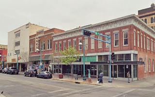
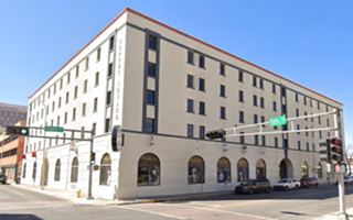
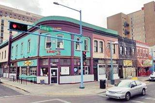
Route 66 in Downtown Albuquerque NM
Albuquerque's Attractions along US 66
A List of Stops and Landmarks
We will use the ❌ symbol to mark those that have been torn down.
1. Eastern Albuquerque
- Paradise Club ❌
- Little Beaver Town ❌
- Original 1930s Roadbed
- Holiday Inn East
- Bar-B-Q Inn
- Phillips 66 Gull Wing service station
- Tropicana Lodge, later Nendel's ❌
- Caravan Nightclub neon sign
- Iceberg Cafe in East ABQ ❌
- Rodeo Court ❌
- Steer on a pole
- Eldorado Court later Roma Motel ❌
- Zuni Motor Lodge ❌
- Muffler Man
- Fair Grounds Motel ❌
- Carrico Modern Court ❌
- Sundowner Motel & Bill Gates
- Former Denny's Diner
- Leonard's ❌
- Tracy's Modern Court ❌
- Trade Winds ❌ / Replica Neon Sign
- Honey Dew Drive Inn ❌
- Nod-A-While Motor Lodge / Silver Spur ❌
- American Car Wash
- Cooksey Court, later New Mexico Motel ❌
- Bimbo's Drive In ❌
- Anchor Inn / Bar-X Motel& ❌
- New Chinatown Restaurant neon sign
- Ambassador Lodge ❌
- Coronado Court ❌
- El Sombrero ❌
- American Motor Inn
- La Puerta Motor Lodge
- Luna Lodge
- Piñon Motel
- Lo-La-Mi Lodge ❌
- Bow & Arrow Lodge
- Chevron Gas Station
- Phillips 66 Gull Wing Gas Station
- Loma Verde Motel
- Pioneer Motel
- Texaco Station
- Ace Cafe
- Tewa Lodge
- La Vela Lodge
- Desert Sands Motel Neon Sign
- Hiland Theater
- Zia Motor Lodge
2. Nob Hill
- De Anza Motor Lodge
- Circle K Motor Court
- Bel Air Motel
- Goody's Restaurant
- Martens Tourist Court and Trailer Park ❌
- Comfort Lodge
- Town House Restaurant
- Aztec Court ❌
- Two Gas stations, one gone, Mobil survived
- One of the First KFC in ABQ
- Kurt's Camera Corral ❌
- Original Iceberg cafe ❌
- Rainbow Cafe
- Hiway House Motel
- Pipp's Texaco
- Triangle Cafe ❌
- Tonnie Pegue's Standard Oil Service Station ❌
- Lobo Joe's ❌
- El Oriente Auto Court
- Premiere Motel
- TraveLodge Motel
- The Toddle House
- Nob Hill Motel
- Nob Hill Conoco
- Johnson Standard Station
- Nob Hill Business Center
- Jones Motor Company & Texaco
- Valentine Diner Police Substation
3. Downtown (This Page)
- Pig and Calf
- 66 Diner
- A Phillips Petroleum Gull Wing
- Cottage Bakery
- Zia Oil Station
- Park Lane Hotel ❌
- Lorlodge Motel
- Central Ave. Underpass
- Hiway House #1 ❌
- Railway Depot
- Glorieta Sation Neon Park
- Yrissari Building: Maisel's first store
- Franciscan Hotel ❌
- Sears
- Hospital
- Little House Cafe ❌
- Crossroads Motel
- Hyatt Chalet Motel
- Whole Hog Cafe
- Imperial 400 Motel
- TraveLodge Downtown
- Hilton Hotel
- El Fidel Hotel
- Kimo Theater
- Lindy's Coffee Shop
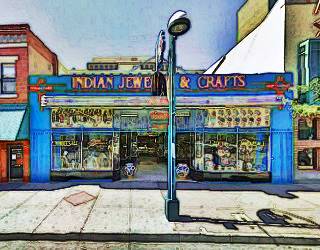
- Maisel's Indian Trading Post
- Holocaust & Intolerance Museum of New Mexico
- El Rey Theater
- Firestone Tires
- Downtowner Motor Inn
- Skinner Grocery
4. Old Town & Western Albuquerque
- Chevron ❌
- Lorlodge West
- Bell Indian Trading Post
- World Court ❌
- Desert Inn ❌
- Arrowhead Lodge ❌
- Texas Ann Court ❌
- Moon Motel and Café ❌
- White Way Court ❌
- Katson's Drive Inn ❌
- Country Club Court ❌
- Pueblo Bonito Court ❌
- Casa Grande Complex ❌
- Tingley Beach and Beach Motel ❌
- Rio Grande Bridge
- The Volcanoes
- El Nido Motel ❌
- Rainbow Court
- Sandia Motel ❌
- Duke's Court ❌
- Stop In Court ❌
- Auto-Tel Court ❌
- Miller's Court ❌
- Silver King's Auto Court ❌
- Blue Bell Court ❌
- Hill Top Court ❌
- Arrow Court and Hill Cafe ❌
- Navajo Court
- Dutch Motel ❌
- California Court ❌
- Hill Crest Motel ❌
- Sky Court ❌
- Mile Hi complex
- Covered Wagon Court
- Hubbell Motel ❌
- Oasis Lodge ❌
- Phillips 66 Gull Wing ❌
- Jerry Unser ❌
- Route 66 Conoco
- Route 66 Travel Center
- Capri Motor Hotel
- Horn Oil Co. Motor Lodge
- Sandia Theatre
- Old Town of Albuquerque
- San Felipe de Neri Church
- Tower Court
- El Don Motel
- Monterey Motel
- Country Club Court
- El Vado Auto Court Motel
- Relict Motel Signs: Cibola and Super 6
- El Campo Tourist Court
- La Hacienda Camp
- Siesta Court
- Americana
- Western View Diner and Steak
- Adobe Manor
- Westward Ho Motel
- French Quarter Motel
- Grandview Motel
5. Fourth St. Route 66
- Cavalier Court ❌
- Crossroads of Route 66
- Ruffin's Texaco #1
- Horn Oil North 4th St.
- Ruffin's Texaco #2 ❌
- El Camino Motor Hotel
- King's Rest Court ❌
- Court John ❌
- Madonna of the Trail
- Monkbridge Manor ❌
- Luke Apartments
- Clyde Miller Tire & Service Station
- Texaco Gas Station
- Scott's New Motel ❌
- Barelas-South Fourth Street Historic District
- Hudson Auto Sales
- B. Rupee Drugs
- Tasty Freeze Drive In
- Durand Motor Company
- Hi-Way Service Station - Horn Oil
- Sinclair Service Station
- Magnolia Service Station
- Navajo Super Service Station
- Red Ball Cafe
- Fito's Cafe

Sponsored Content:
Some exciting Tours
Downtown Albuquerque attractions
Along Route 66 into Downtown ABQ
In this page we describe the classic Route 66 sights from east to west, starting at the intersection of Girard and Central Avenue on the 2900 block, on Nob Hill's western tip, and westwards from there into Downtown, and across it.
We will use the ❌ symbol to mark those that have been torn down.
Downtown Albuquerque's History
In 1880 the Atchison, Topeka and Santa Fe Railroad reached the area of Albuquerque and built its depot and station 2 miles east of the Old Colonial Town Center, the influx of Anglo merchants and settlers chose this location to establish themselves and a New Town sprung up around the depot. The community of "New Albuquerque" incorporated as a town in 1885 and as a city in 1891. In 1920 absorbed the Old Town. In 1921, the railroad built a Hospital close to the depot on Central Ave.
Two Route 66 alignments cross it, the first one (1926-37) from Santa Fe along 4th St., and in 1937 it was realigned along Central Ave.
Route 66 in Downtown Albuqurque
Your Route 66 Road Trip through Albuquerque
At Girard Blvd. and Central Avenue (2900 block) you leave Nob Hill; you will drive west into the Downtown district of Albuquerque crossing the Midtown-University district.
University of New Mexico
The Territorial Assembly created the University of New Mexico (UNM) on February 28, 1889, to be located in Albuquerque. Its first building, Hodgin Hall was completed in 1892.
Some Gas stations ❌
The Sanborn Insurance Map of 1942 shows the UNM golf course on the north side of Central west of Girard and several stores, auto dealers and buildings along the south side.
The first relevant Route 66 buildings were located on the intersection with Harvard Dr. with two gas stations. To the west at 2300 Central was Kitchen's Conoco with two canopies, one facing Central, the other facing Harvard, behind it was a garage. Now there is a Satellite Coffee shop on that corner. Click on the image to see an advertisement from 1962 and how it figured in the 1942 Sanborn map.
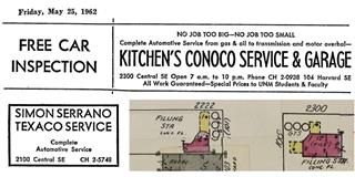
Some gas stations on US 66 by the UNM. A. Whittall Source.
Click to enlarge
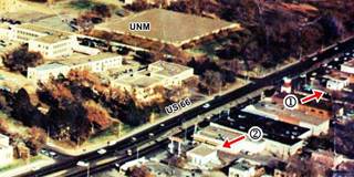
Aerial view 1960s with gas stations on US 66 by the UNM. Source.
Click to enlarge
Opposite Kitchen's at 2222 (SW corner with Harvard) was another gas station in 1942, but by 1955 it had been torn down (1955 aerial photo.)
There was yet another gas station on the next corner, with Yale (SE corner, at 2200 Central) where the McDonalds is now located. and you can see it in the aerial photo above (click on it to enlarge), marked with number (1), we don't know what brand it sold... Sinclair? Shamrock?
Further west, on the SE corner with Buenavista Ave (2100 Central) was another filling station, this one was Serrano's Texaco, marked with a (2) in the aerial photo.
Simon Serrano Jr. (1918-2011) when he was a young man worked on the family ranch in Santa Rosa, was a truck driver, motel operator and, in 1953 moved his family to Albuquerque where he worked as a mechanic. He soon became the owner of "Simon's Texaco" and worked it for many years. Further up is his advertisement in the Daily Lobo from May 15, 1962 offering "Complete automotive service." The box-shaped building is still standing, though very modified, and you can see it in this Street view.
Pig and Calf
Listed in the National Register of Historic Places
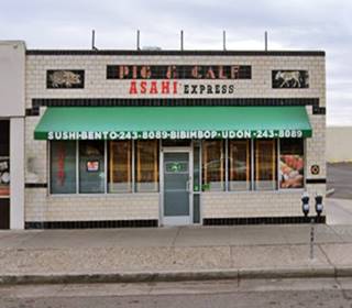
On the left side of Serrano's Texaco, at 2106 Central Ave SE, Albuquerque was the classic Pig and Calf with a black and white ceramic facade with the words "Pig and Calf " written on it; at each end of the parapet is a mosaic of a pig and a calf. It opened in 1924 as Charley's "Pig Stand" Cafe owned by Charlie Ellis. It evolved into a barbecue restaurant and acquired its present appearance in 1935. During the 1950s it was the University Café and it reopened in 2006 as the Pita Pit and since the pandemic it has been a Sushi restaurant. The building is still stsanding and in very good shape as you can see in the "Then and Now" sequence below:

Pig and Calf 1930s postcard. Source. Click on image to enlarge
Cottage Bakery
Listed in the National Register of Historic Places
On the next corner (Buena Vista St.), to your left at 2000 Central Ave SE. This cottage-styled bakery opened here in 1937. It was owned by Herbert Weis and his brother-in-law, Prince Schroeder, they had already owned a bakery in Winslow AZ and moved to Albuquerque in 1931 with their first Cottage Pure Food Shop in 1931.
They shared the shop front with Spot Ice Cream Co. and sold their goods to locals and travelers. The Spot went out of business and a succession of other businesses occupied the western side of the cottage. The bakery lasted until 1960 on the eatern side.
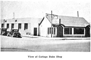
Cottage Bakery in Aug. 1937 Source. Click on image to enlarge
The Sanborn Map shows the bakery, and across Terrace, where the tattoo shop is now, at 1924 Central, there was a filling station. Then came some stores, dry-cleaners, a laundry shop.
On the SW corner of University Blvd. and Central Ave. was the now gone Oklahoma Joe; operated by Joe Valdez it had a "Genuine Pit Bar-B-Que" and sold beer and liquour to UNM students. By 1942 it had gone. At one time its postcard proclaimed "Ladies and Men's Rest Rooms," we have come a long way since then!
Park Lane Hotel ❌
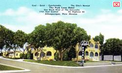
Park Lane Hotel (gone) c.1940s. by the UNM ABQ Route 66. Source
Click to enlarge
Across the highway, on the NE corner of Pine and Central, right, there is a parking lot nowadays on the site of The Park Lane Hotel "Cool - Quiet - Comfortable - The City's Newst," at 1701 East Central. The Sanborn map shows it as the Memorial at the Methodist Sanatorium in 1942; by 1970 it had been torn down. Opposite, on the SE corner with Pine St. at 1700 Central was the Zia Oil Co. Skelly service station.
Zia Oil Station
Adjacent to Oklahoma Joe, it sold Skelly gasoline and was owned by the Zia Oil Co. it included a tire store and a warehouse. W. T. Davis was the manager back in Jan. 1941 when it opened. Still standing tough the canopy has gone.
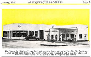
Zia Oil Co. in Jan. 1941. Source. Click on image to enlarge
On the NW corner of Central and N. Ash there was a Sinclair gas station ❌ (1515 Central), pictured below.
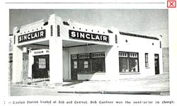
Sinclair on Ash and Central, Dec. 1939. Source
Click to enlarge
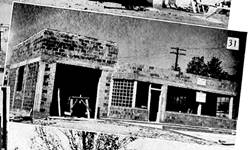
Sam's Service being built, June 1946. Source
Click to enlarge
66 Diner formerly Sam's Service
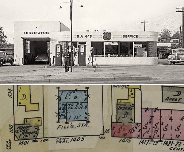
On the next block, to your right, at at 1405 Central, this was J. H. Samuelson's Phillips 66 Service Station, it was built in June 1946 by Roach & Rutherford, contractors,
with a single service bay to the left and an office with glass brick windows on its two curved corners on the right side. It was known as Sam's Service.
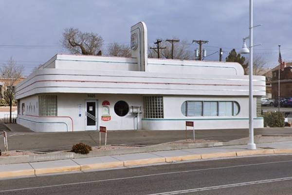
In 1987 the building was vacant and converted into a restaurant, 66 Diner. After a fire it was rebuilt. It has been modified but with an Art Moderne style and you can enjoy a meal in this retro-dinner with jukebox and soda fountain.
1940s photo (top) and Sanborn Map, 1942 (bottom)
Current view of Sam's as 66 Diner
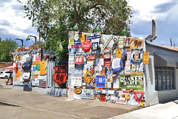
Don't miss the wall on the eastern side of the property, with vintage enamel signs,
West of this point there aren't any remaining structures from Route 66's golden days. There were apartments, and between Mulberry and Oak was the Presbyterian Sanatorium to the left. Across from it was a now gone landmark, a gull wing Phillips 66.
#3 Phillips Petroleum Gull Wing ❌
It was located in what is now a parking lot, at 1023 central Ave NE.
Its was the third out of four Gull Wing gas station in Albuquerque; two others are on the Eastern side of town: #1 Gull Wing and #2 Gull Wing and the fourth (gone) was in Western Albuquerque: Phillips 66 Gull Wing ❌. This one was razed in 2018. Another Route 66 icon that has been lost to progress.
It appeared in the 1942 Sanborn map.
> > Learn more about Phillips 66 Gull Wing stations on Route 66
West of the Hospital came a vacant block which is now cut by I-25, and then came the A.T and Santa Fe Railway Hospital. You can see the empty block and the hospital in the following picture taken in Feb. 1943 by John Collier.
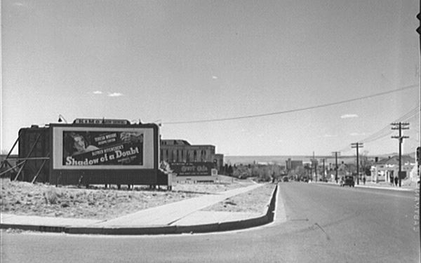
Gas stations on Central from Oak to High Streets
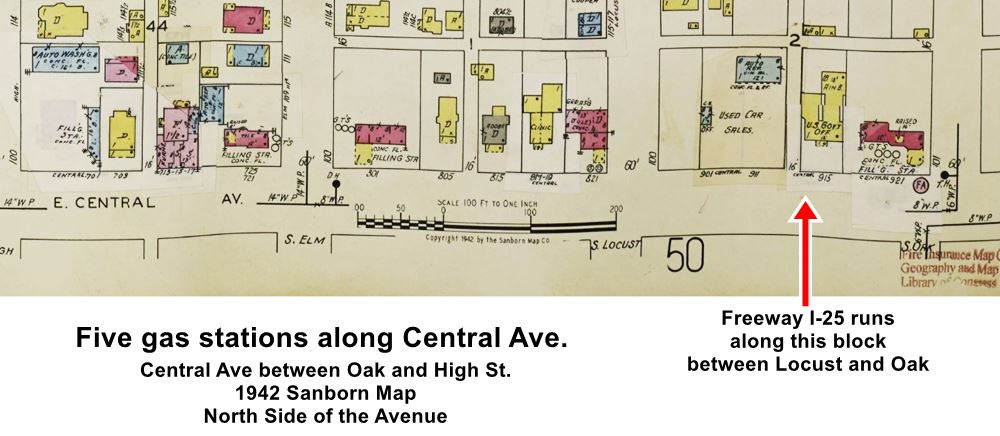
Route 66 gas stations along Central and I-25, 1942 map. Source
Click to enlarge
The image above shows a gas station on the right at 921 Central Ave. It was torn down to make way for the freeway in the 1960s. Actually there were several gas stations here where Central is cut by I-25, all of them long gone. Click on the thumbnail map image to see the 1942 Sanborn map of this area, we marked where I-25 is located.
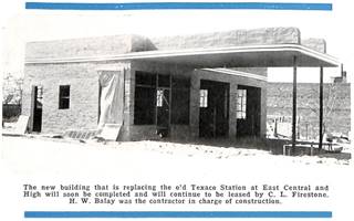
Texaco on High and Central, Mar. 1942. Source
Click to enlarge
There was the one at 921 mentioned above, one on the NW corner of Locust (821 Central) that was an Enco, one on the NE corner of Elm (801 Central), one across Elm on its NW corner (725 Central) and the last one on the NE corner with High (701 Central), this one was a Texaco, maybe from the 1930s that was modernized and rebuilt in March 1942 and leased by C. L. Firestone -pictured.
There was another gas station on the SW corner of High and Central, a Texaco (Sanborn map view - 1942.)
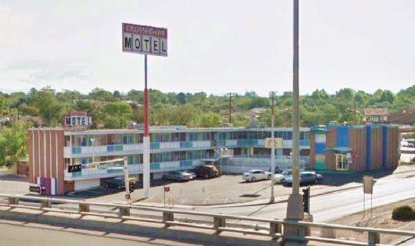
Crossroads Motel
On the eastern side of the freeway crossing, to your right, at 1001 Central Ave NE, Albuquerque
The Crossroads Motel got its name because it was built next to the main crossroads in Albuquerque: U.S. 66 and U.S. 85. During the late 1950s and early 1960s, I-25 replaced US-85 through the city.
It appears in Breaking Bad; it is where Hank takes Walter Jr. to warn him about the evils of drugs. Below are a "Then and Now" set of pictures of the motel that offered "Color TV... In Room Dialing... Free sauna bath."
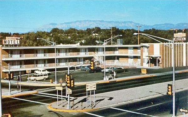
The motel has added a tall sign to lure visitors from the Freeway, but otherwise it has not changed:
The Huning Highlands district of Albuquerque
Listed in the National Register of Historic Places
Huning Castle Source
Click to enlarge
Head west, passing I-25. Here, on the western side of the freeway, you enter the historic Huning Highlands district. It lies on both sides of Central Ave (originally known as Railroad Avenue), from the railroad tracks in the east, to Locust St. in the west.
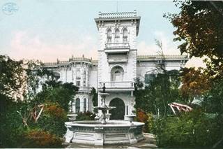
It is named after Franz Huning (1828-1905), a German merchant who settled in New Mexico, reaching ABQ in the 1860s. In 1880 he sold part of his land to the AT & SF, for one dollar, prompting them to establish their regional headquarters in Albuquerque; this helped develop the city that sprung up beside the depot. He also platted a neighborhood west of the tracks on his property, known as Huning Highlands subdivision. The first residential area of the city, where the traders, bankers, lawyers and doctors built their homes (1). Huning built his 14-room Italiante mansion known as Huning's Castle on Central and 15th St., it was torn down in 1955.
At Locust, the motel strip from the 1960s begins but there is also a classic building to your left, on the south side of Central, the former Atchison, Topeka & Santa Fe Railway Hospital:
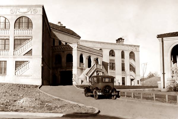
Former Atchison Topeka and Santa Fe Railroad Hospital
Listed in the National Register of Historic Places
The hospital opened in 1921 and provided medical treatment to the company's employees. In the 1980s it became a mental health institution, the "Memorial Hospital" that closed in 2007. Now, completely restored and upgraded it is the Hotel Parq Central.
It was built in Italianate style, that was popular in the early 1900s and was used in mansions or public buildings to give them an elegant look; it was inspired in the Renaissance architecture and included an elaborate balustrade.
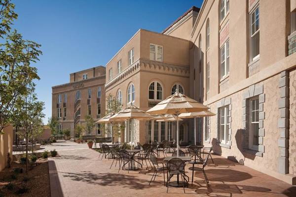
> > You can book your room in the Parq Central Hotel
Central Ave. seen from the freeway in the 1960s.
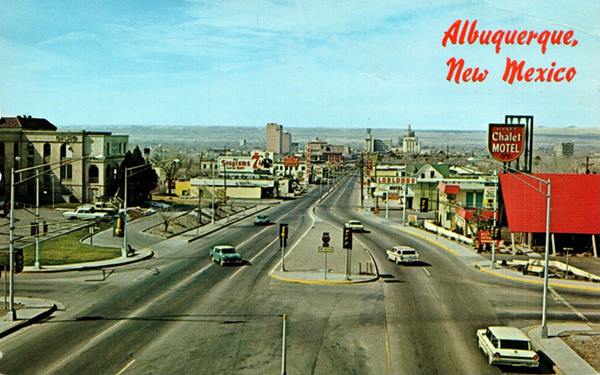
The image above, from the early 1960s, looks west along Huning Highlands District towards the railroad and Downtown Albuquerque; to the left is the Santa Fe hospital, to the right is the Chalet Motel, followed by two motels that we describe below; to the left beyond the Seagram's sign is Frank's Pizza restaurant and a Texaco sign.
So, opposite the Parq Central, to your right, on the north side of Central, at 817, is a 1960s classic Route 66 motel:
Hyatt Chalet Motel
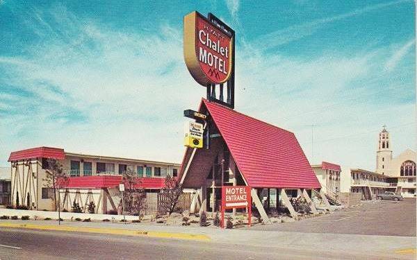
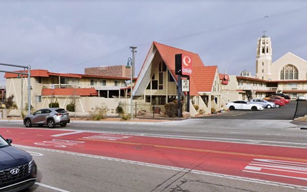
The Hyatt Chalet Motel is still open as a motel but under another name; now it is the Econo Lodge Downtown. At one time it was the Pan Am Motel owned by W. L. McCoy (after I-25 which is also known as the Pan-America Freeway. This chalet-style with a steep gable roof is a design that dates back to 1960 when Hyatt planned to build some 200 similar motels by 1966. They were part of Hyatt Lodges, a new division within the company. This one has very "sixtyish" colored glass panes on the facade. There are other surviving motels of the Hyatt Lodges division along Route 66: the Needles Inn (Needles CA), and the Swiss Lodge (Pasadena CA).
Hyatt Chalet Motel in a vintage 1960s postcard
Nowadays, an intersecting hip has been added to the gabled roof, but it is basically the same building:
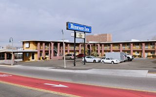
Lorlodge East Motel
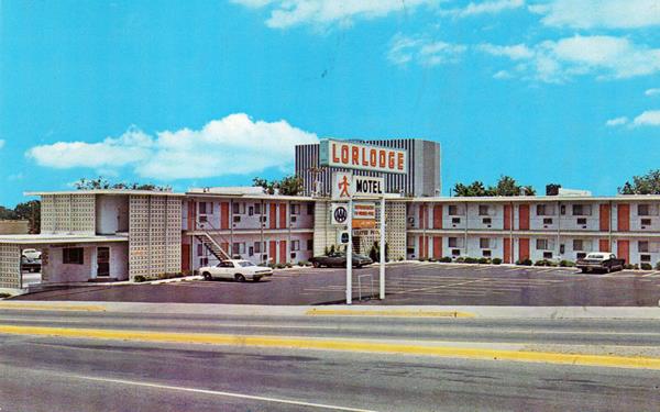
Adjacent to the Chalet, at 801 Central NE was the Lorlodge East Motel, it was named like that because theree was a second motel in Western ABQ. It had a heated swimming pool and was located at "Intersection U.S. 66 at Interstate 25;" it offered "Thrifty Rates."
It had some hollow brick walls to decorate it a style favored in the 1960s.
It is still open as a motel, though now it is the Rodeway Inn; fortunately those hollow brick details have been replaced. It still has a swimming pool, and the neon sign structure is the same!
> > You can book your room in the Rodeway Inn
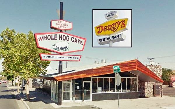
Whole Hog Cafe - former Denny's
Across from the Rodeway, on the NW corner of Elm and Central (725 Central Ave NE) is the former Denny's restaurant, now known as the Whole Hog Cafe. It is a BBQ chain store in a building which was once part of Denny's, a chain which opened in California in 1953 as Danny's Donuts.
It was renamed Denny's in 1959. They adopted a modern space age boomerang roof design in the 1960s, it was created by Armet & Davis, and they displayed a hexagonal shaped sign which
can be seen in the image below.
There are more of these Denny's on Route 66; we mention a few: the Barstow CA Denny's Diner, the Denny's in Kingman AZ, the Denny’s Diner in Needles CA, the Denny’s Tucumcari Diner and the one in Gallup NM.
The Whole Hog formerly a Denny's as it looks today. The original Denny's sign is there, but with different words:

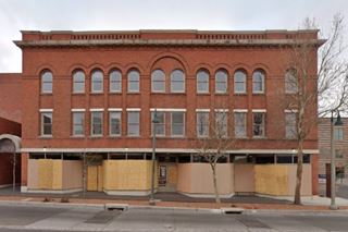
Imperial 400 Motel
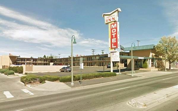
On the corner, at 701 Central Ave NE was the 1960s Imperial 400 Motel that until recently was the Imperial Inn; but in 2021 the city began a redevelopment project that will cost $7.6 Million; it will include 52 guest rooms and 16 residential suites, along with space for a dozen businesses including retail and restaurants.
The classic motel announced on its postcard that it was "A pleasant place to stay for rest, relaxation, or to make a headquarters for your business trip into the heart of the city."
Imperial 400 was a motel chain founded in 1959 and its buildings had a characteristic "Gull Wing shaped roof" (like this motel has). It went broke in the mid 1960s and sold out to new owners. There are plenty of them on Route 66; for instance the Imperial Winslow AZ and Vagabond Inn Pasadena CA; the Imperial Motor Inn in Needles CA and the Imperial 400 in Barstow CA.
Imperial 400 Motel in a vintage 1950s postcard
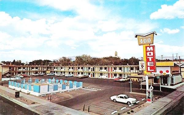
A view of it before its redevelopment project began; it kept its original appearance and its original neon sign with a gull-wing shape too:
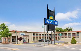
TraveLodge Downtown
Opposite the Imperial, on the NW corner of High and Central (615 Central Ave NE) is the former Travelodge
The TraveLodge Downtown is still open as a motel, though now it is the Days Inn. It has remained relatively unchanged and its original neon sign has been kept and given a second life. It is pictured below in a "Then and Now" sequence, Its postcard read "40 Units... Color TV, Guest Dial Phones, Heated Pool, Coffee Shop Next door...".
>> You can Book a Room in the Days Inn.
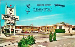
TraveLodge Downtown, old postcard. Source. Click to enlarge
Hiway House #1 ❌
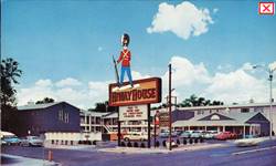
1950s Hiway House #1 Source
Click to enlarge
Adjacent to the Travelodge, on the NE corner, at 601 Central, it was the Hiway House #1; the other Hiway House Motel #2 was in Nob Hill. It had "Weather conditioned for your comfort, 24 hour telephone service, television in all rooms..." Now it is a vacant lot.
Head west, there are several vacant lots. On the SE corner with Edith, there was a gas station in the 1940s. On the next corner, Central and Arno there were two gas stations in 1942. Only one has survived. The first was was one on the NE corner (401 Central) with two rectangular canopies, one facing Arno, the other Central; a garage was located in a separate unit to the east. The second was on the SW corner and is still standing.
Carothers & Mauldin Station
To your left, at 320 Central Ave, SE. This Texaco station opened in March 1938 shortly after the brand new Route 66 was aligned along Central through downtown Albuquerque. It was built by Estella and Fred Luthy, and operated by Carothers and Mauldin, who also owned a station on Fourth and Copper (the original Santa Fe Loop US 66). Now it has been refurbished it was a diner and now is the "Range Cafe".
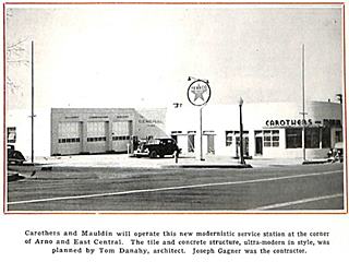
March 1938 view of Carothers Texaco Source. Click to enlarge
Highland Hotel
Listed in the National Register of Historic Places
To your left at 200 Central, at Union Square, corner with John St. this three story red-brick commercial building dates back to 1903 and is an example of the Chicago School of commercial architecture; it had a hotel that remained open until the 1970s.
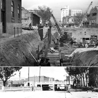
Central Ave. Underpass
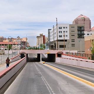
Central Avenue was born as Railroad Ave. with the New Albuqerque in the 1880s. It was renamed Central Ave. in 1912 and crossed the A.T. & Santa Fe tracks here, next to the depot. Traffic grew over the years, and when Route 66 was aligned along Central in 1937 a safer alternative to the grade crossing became necessary.
The New Deal's Works Progress Administration (WPA) funded the construction of an underpass. Below are a Then and Now set of pictures, the 1937 ones show the underpass being built, and when it was finished.
Alvarado Hotel ❌
Occupying the first block of East Central, between the tracks and 1st St. was the magnificent Alvarado Hotel, followed on its south side by Albuquerque's Depot.
It was the largest of the railroad's Harvey Houses operated by Fred Harvey Co. but owned by the AT & SF railroad.
It was built in 1901 in the Mission Revival Style and had 120 rooms and Rittenhouse mentioned it in 1946. It was named after Hernando de Alarado, a member of the
1540 Coronado Expedition. It was torn down in 1970. Below is a view of the hotel in the 1950s, and further down the sprawling hotel and depot complex.
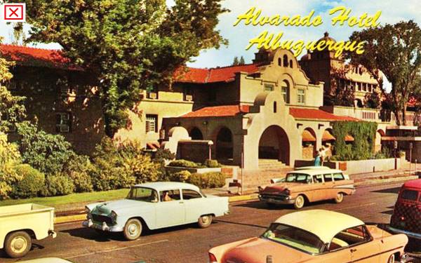
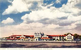
Alvarado and Depot c.1920s. Source. Click to enlarge
Railway Depot
The Downtown Albuquerque Rail Runner station at 100 1st Street SW, Albuquerque has replaced the old one built in 1880 that burned down in 1993. Nowadays the Alvarado Transportation Center, built in 2002, occupies the spot where the Alvarado and old depot stood. It is pictured above. Its Spanish Revival style is similar to the original complex.
Take the Rail Runner To Santa Fe
Buy your ticket online or onboard. Fares, ticketing at the Train's website
A high-speed rail link that gets you to Santa Fe in 80 minutes. Named after the "Roadrunner", the state bird, it gives you some views of the Sandia, San Felipe, Santo Domingo, and Cochiti pueblos.
Day Tour to Santa Fe
The Railrunned takes you to Santa Fe with is the historic Santa Fe Depot close to the 400-year-old Plaza. There are plenty of sights and attractions for a full day walking tour in historic Santa Fe.
Into Downtown Albuquerque
Also on 1st Street, facing the Alvarado was the Sturges Hotel ❌, it was the town's oldest, having opened as Hope's European Hotel in 1880. It stood across 1st St from the Alvarado, at 100 West Central and was torn down in 1956. Rittenhouse mentioned it in 1946, and also the Savoy Hotel ❌ facing the depot, at 219 South 1st. It was built by Oreste Bachechi in 1905; he was the architect that designed the 1927 the Kimo Theater.
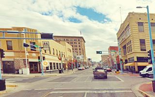
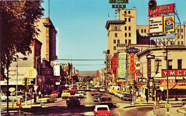
Below is a view along West Central in the 1950s from the overpass. To the left is the Alvarado Hotel sign, further down the Sunshine Theater. To the right was the YMCA, Liberty Cafe, and Kings Hotel, formerly the Combs mentioned by Rittenhouse in 1946, at 119 W Central; all of them gone; ❌. This is the Same view nowadays; I miss the bustling, lively and colorful look of the 1950s.
Glorieta Sation Neon Park
Listed in the National Register of Historic Places
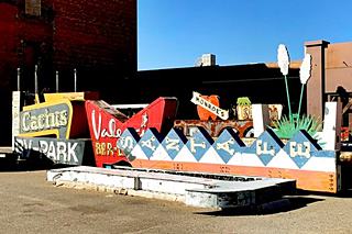
Old Route 66 neon signs in the "Neon Park". Source
Less than one mile north of the underpass and railroad depot, on the southeast side of Lomas Blvd. and the railroad tracks; See this Map with directions from Central and the ABQ Depot. The old Glorieta SW Brewery & Ice Company Building between Lomas, it was listed in the National Register of Historic Places in the 1970s, and currently is being restored and reconverted into a "Neon Park" by local devleopers, the García family.
The eight acre complex has been named Glorieta Station and will include the old red-brick brewery, retail space and restaurants. There will also be a place for the neon signs recovered from Route 66 in Albuquerque. You can see some of them in the yard at the site which is partly finished and still under construction after delays due to the pandemic. More signs can be seen from Spur St. NE. (Street view)

Walking Tour in Downtown Albuquerque
The best way to get the feel of the city is to walk. There is a large parking area ahead, between 2nd and 3rd Streets to your left; here on the corner once stood Payless Drugs and the Chief Cafe. You can park your car here and go on a self-guided walking tour. It is a 1.2 mile round trip and this is the Walking Tour map.
Across Central, on the NW corner with Central was the "Grand Central Hotel," and on the SE corner of Central and 2nd is the Sunshine Building.
Old Hilton Hotel
Listed in the National and State Register of Historic Places
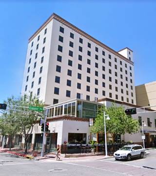
Head north from Central and at the end of the block, to your left on the SE corner with Copper at 125 2nd St NW is the old Hilton Hotel. It was built in 1939 and Rittehnouse mentions it in his Guidebook to Route 66. According to the postcard, it was "New Mexico's newest and finest hotel... Duncan Hines approved, Refrigerated air conditioning and heat individually controlled throughout. Convenient drive-in entrance...". It is still in operation as a hotel, the Hotel Andaluz Albuquerque, Curio Collection By Hilton.

Old Hilton postcard. Source
> > You can book your room in the Hotel Andaluz Albuquerque, Curio Collection By Hilton
Retrace your steps back to Central, turn right and walk westwards; on the following block to 4th and Central, where two alignments of Route 66 cross each other.
Crossroads of Route 66
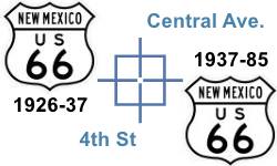
Fourth Street and Central is one of the few places along Route 66 where two alignments cross each other.
The original 1926 alignment ran along 4th Street across Albuquerque with a North to South course, from Santa Fe towards Isleta. It was the main highway and throughfare. However, in 1937 Route 66 was realigned along Central Ave, with an East to West course, from Santa Rosa through ABQ and onwards towards Laguna. U.S. 85 was aligned along 4th.
In a separate section we describe U.S. 66 and its attractions along the 4th Street 1926-37 alignment:
>> Learn all about The sights along 4th St
Woolworths
On the NE corner, to your right at 325 Central there had been a hotel in the 1930s; it was replaced in the 1940s by Woolworth's whose building is still standing, as Bourbon & Boots; pictured below (on the left side of both images):

Woolworths building 1940s, Albuquerque. Source. Click to enlarge
Yrisarri Building: Maisel's first store
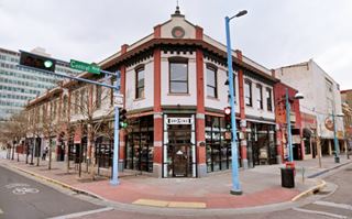
Kitty corner from Woolworths, on the "Crossroads of Route 66," at 400 Central is a classic brick building with a bracketed cornice and arched windows was built in 1909, it housed the first store operated by Maisel with his Maisel's Trading Post (he later moved two blocks west to Maisel's Indian Trading Post at its current location.)
Jacobo Yrisarri (1866-1925) belonged to a wealthy New Mexican family of Basque origin. He was a merchant and land owner he married Manuela Armijo, joining the elite of New Mexican society. He built the Yrisarri building, also known as Yrisarri Block.

Yrisarri Bldg. and Maisel's first store 1920s. Source. Click to enlarge
400s block of West Central
On the south side (left) of the block between 4th and 5th streets, there was a J.C. Penney's since 1915 in the two-story red brick Melini building in the middle of the block at 410 Central. It was replaced in 1949 by a box-shaped three story building, it followed by the H.S Kress Co's Five and Dime department store that opened in 1925 and is Listed in the National and State Register of Historic Places (4). And the Gas and Electric Co. (Public Service Co). All three buildings are still standing as you can see in the following "Then and Now" images from left to right.
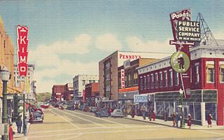
Penney's, Kress, on Central Ave. Source. Click to enlarge
Nothing remains of the stores that lined the north side of the block: Meyer & Meyer opposite Woolworths, Betty Gay, Levine's DepartmentStore that later became Franklins, and Berland's Shoe Store. On the NE corner, Kimo Theater is still standing:
Kimo Theater
Listed in the National Register of Historic Places
On the NE corner of Central and 5th at 423 Central Ave. NW, Albuquerque, NM.
The Kimo Theater is an amazing fusion of Pueblo and Art Deco style theater which opened in 1927.
This is a street view and below are two pictures I took back in 2016:
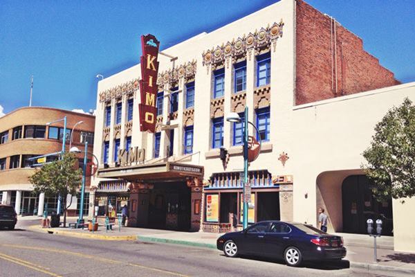
Historic Kimo Theater
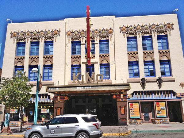
Kimo Trivia
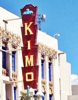
Kimo Theater neon sign, A. Whittall
The swastika was a Navajo symbol for life, happiness and freedom long before it was desecrated by its abominable use in Nazi Germany.
Urban myth has it that the ghost of a six-year old boy haunts the theater, he was killed when a heater exploded in the lobby in 1951.
The name "Kimo", in local Pueblo Isleta language, means "King of its kind". It was built for Oreste Bachechi, who had also built the Savoy Hotel next to the railroad depot. It cost $ 150,000 in 1927. The three-story building has a steel frame and brick walls with ornamental glzaed tile decoration. The marquee and entrance were refurbished in the 1950s. Its decoration includes native designs in chandeliers, staircases and murals.
It closed in 1968, was almost demolished but saved on time it was restored in the 1990s and currently the offers performances and films. Self guided tours daily from 9 AM to 4 PM. Closed Sun, Mon. View their coming events or purchase tickets at ABQtickets.com.
El Fidel Hotel
To your right, one block north along 5th, on the SW corner of 5th and Cooper St. is a classic hotel, the El Fidel Hotel was mentioned by Rittenhouse in his Route 66 Guide. The five-story building opened in the 1920s and was doubled in size in 1934. In 1981 it was converted to offices and completely redone in 2014 as the Cooper Center.

Postcard of El Fidel, 1940s. Source. Click to enlarge
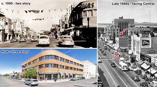
Sears
Turn around and head back to Kimo on Central Avenue. Across 5th from Kimo, on the NW corner at 505 W Central was Sears Roebuck and Co. The original building dates back to 1937; it was built by Dr. Lovelace (2) as a two story building with a full basement facing Central in Streamline Moderne lines. In 1948 Carl's lounge was torn down, and an addition was built on the corner and along 5th (3) with a modern curved facade, a third story was added after a fire in 1952. It is still standing. Click on the thumbnail image to see the building through each of these stages: facing Central in the 1940s, two story on the corner, late 50s and nowadays.
Opposite, on the SW corner is a former cafe and hotel:
Lindy's Coffee Shop
On the SW corner with 5th at 500 Central Ave SW. Queen Anne-style Bliss building was erected in 1906. Coney Island Cafe opened on the ground floor in 1929. It became Lindy's Diner in 1960. The second floor was the 22-room Elgin hotel until 1976. In the same building, at 504 Central was "Lobo Curios. Below is a "Then and Now" set of pictures; to the right is Halls and Maisel's Indian Trading Post:
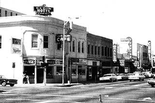
Elgin Hotel and Coney Island Cafe, 1970s. Source. Click to enlarge
Maisel's Indian Trading Post
Listed in the National Register of Historic Places
On the south side of Central Ave., to your right, opposite the former Sears store at 510 Central Ave. SW, Albuquerque, NM.
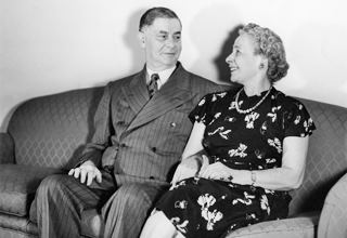
Maurice Maisel and his wife Cyma. Source. Click to enlarge
Built in Indian Pueblo sytle in 1939, it was owned and operated by Maurice Maisel a Jewish emigrant from Austria. It was still open selling Southwest souvenirs to tourists and Route 66 travelers until 2019.
Maisel moved here from the Yrisarri Building, and commissioned architect John Gaw Meem to build his new store. Its windows have pigmented glass and are topped with murals depicting Southwestern Indians painted by native artists. The terracotta flooring are also decorated with native designs.
Maisel born in the 1880s in Austria, ran his store until his death in the 1960s when it closed. His grandson Skip reopened it as Skip Maisel's Indian Jewelry and Crafts in the 1980s but it closed in 2019.
On the same block but on the NE corner with 6th where Suchi Hana is now located, once stood Fred P. Higgins Auto Service and garage, with gas pumps on the sidewalk in the 1930s, later in the 1940s it became Cook Sporting Goods (523 Central) on its eastern side, at 519 there was a Hotel on the second floor. Keep on walking west, on the next block (600s) there are two more stops:
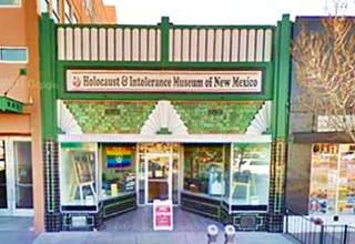
Holocaust & Intolerance Museum of New Mexico
At 612 Central Ave SW. It was founded in 2001 by Holocaust survivor Werner Gellert and his wife Frances. This museum promotes understanding and teaches about many genocides besides the Shoah. After visiting this museum it became clear how important it is to remind people that these mass atrocities happened (Holocaust deniers, you are wrong), and are still happening. They should matter to everyone, everywhere. Discrimination, hate and intolerance are unacceptable and we should all actively work towards a more tolerant society. This is the twenty-first century not the Middle Ages!
The building's green and white Art Deco facade is beautiful. It is pictured below.
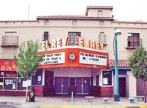
El Rey Theater. Source. Click for street view
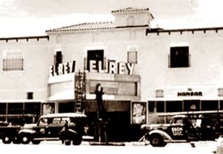
El Rey Theater 1940s. Source
El Rey Theater
Listed in the State Register of Historic Places
To your left, at 624 Central Ave SW. It was built during WWII, in 1941 in a Spanish Revival style with a classic marquee.
At one time it was an adult theater, but nowadays it hosts bands as a night club, a good example of a theater reborn on Route 66.
Franciscan Hotel ❌
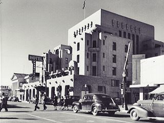
Franciscan Hotel in the 1940s. Source.
Click to enlarge
Across the street was a classic hotel that had been built in 1923 with a Pueblo revival style designed by Trost & Trost.
It closed in 1970 and was torn down in 1972 -at that time many of Albuquerque's landmarks were demolished one after the other, the Alvarado and the Franciscan Hotels are two of these lost buildings.
Its first owner was the local community, who had raised and donated the nearly $350,000 it had cost (roughly $8.8 Million in today's dollars). The Albuquerque Hotel Company was an organization formed by the local Chamber of Commerce and the idea behind the hotel was to promote the development of Albuquerque.
It was a six-story building with magnificent proportions. It stood on the corner of 6th St. and Central. Its postcard announced "The courtesy, thoughtfulness and helpfulness in catering to the comforts of guests make this hotel more homelike than hotel-like."
Across from El Rey, and next to the Franciscan, on the NE corner with 7th, was the Masonic Temple, it too was torn down. The image below looks north at the lodge; the Franciscan is to the right. This is the current st. view
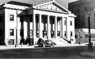
Masonic lodge Temple c. 1940s. Source.
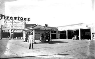
1930 view of the Firestone Service. Source
Click to enlarge
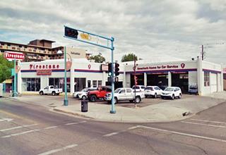
Firestone Tires Building
Across 7th, on the NW corner, at 701 Central Ave NW is a building dating back to 1929 or 1930. It was the first Firestone Tire Company store in town and it also included a Service Station with women attendants.
It had an "island" hip roof canopy with Spanish tiles over the gas pumps; at one time it sold Texaco gasoline. This was later removed. Its owner Bridgestone Tire closed the store in 2020 the signs have been removed. The image below was taken in 2019, and shows it with the signs still in place; they were later removed.
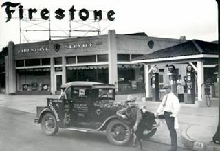
1931 view of the Firestone Service. Source
Click to enlarge
The photo above shows "Jules Allen, a popular cowboy singer who is a feature of the First American." with his Ford A, and a dog sitting on it! Allen (1883-1945) was a songwriter, singer and cowboy who performed on the Radio and in live shows.
The picture below shows a woman service station attendant pumping Texaco branded gas into a 1940 Chevrolet at the Firestone Service.
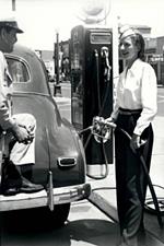
1940s female attendant
Firestone Service. Source
Click to enlarge
Conoco ❌
Opposite the Firestone, on the SW corner with 7th (700 Central) was a Conoco station, with dual canopies, one facing each street. It appears in the Sanborn insurance map of 1942. It is pictured above.
On the same block, to your left at 718 Central, the map marks the Downtown Hotel in a three story brick building that looks like a home and which is still standing (St. view).
Skinner Grocery
Listed in the National and State Register of Historic Places
Adjacent to the Downtown Hotel, on the corner at 724 Central Ave SW is an excellent example of Art Deco style. This was a grocery store belonging to J.A. Skinner, who commissioned A.W. Boehning, a local architect to build it in 1931. It is currently an Italian Restaurant. The balcony on the second floor has been a controversial modern addition but it does not touch the original structure.
Notice the decorative details: the white terra cotta tiles, the fluted corner towers, the stained glass, and above all the geometric patterns. Skinner owned more stores as you can see in the 1930s advertisement below depicting the facade of this store.
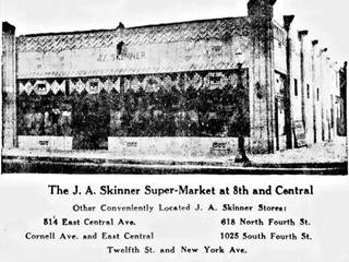
The Skinner Grocery advert c.1930s. Source. Click to enlarge
Downtowner Motor Inn
Across the street from Skinner's is another classic hotel at 717 Central Ave NW
The Downtowner Motor Inn (currently the Hotel Blue) opened in 1965 and changed names a few times (Downtown Inn, Quality Inn, Ramada Inn). Some of its 1960s style has survived the remodelations. The 1974 postcard pictured below announced: "In the heart of downtown... Free TV - Hi-Fi (in those days there was no WiFi, only Hi Fidelity) reasonable rates.." It is currently closed and being revamped.

Quality Inn motel in a vintage postcard. Albuquerque NM. Source. Click to enlarge
Valentine Diner:
The "Little House Cafe" was located a 107 8th St. SW, across 8th St. from Skinner's, on the corner of Park and 8th, by what is now the Central Ave. roundabout (map marking the spot.)

Original Little House Diner, c.1990. Source
Click image to enlarge

Original Little House Diner, c.1950s. Source
Click image to enlarge
Joe and Della Hernandez ran it from 1947 until 1992. When they retired, they donated it to the Albuquerque Museum for its preservation. The Aristocrat model Valentine Diner was stored and around 1997 an agreement was reached with the Albuquerque Police to use the building as an APD substation in Nob Hill. It was restored and moved to the triangle there, in Nob Hill: read more at Valentine Diner Police Substation.
End of this leg of your Route 66 Road Trip
Here, at 8th Street you leave Downtown Albuiquerque; this point marks the end of this leg of your Road Trip across Downtown ABQ.
Continue West into the Old Town and Western Albuquerque
Continue your Road Trip heading west along Route 66 ⁄ Central Avenue into the Old Town and Western Albuquerque.
Read all about the Old Colonial Town and Western Albuquerque's Route 66 attractions in our Next Page.
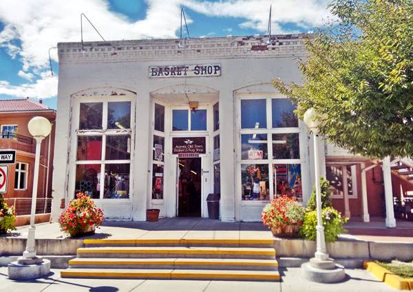
The Route 66 Attractions in Albuquerque
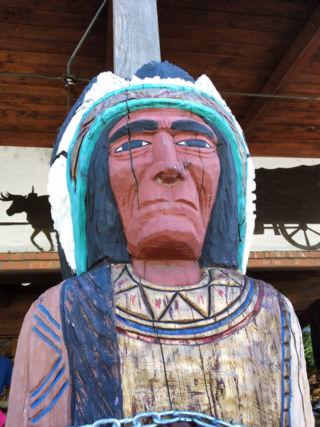
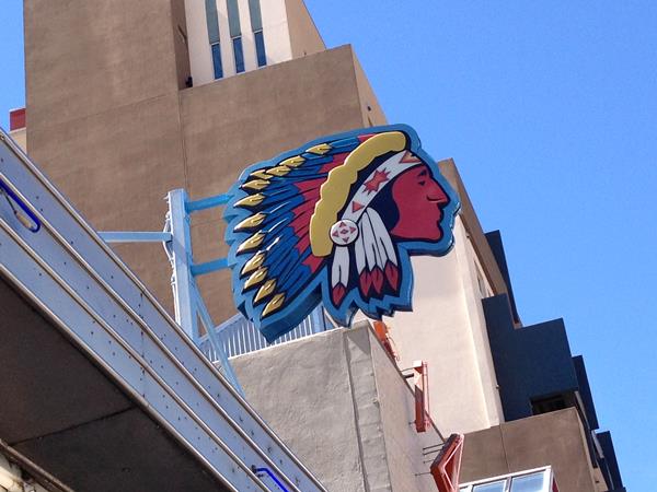
Indian Chief, Downtown Albuquerque. A. Whittall
Albuquerque is, after St. Louis and Oklahoma City, the third largest city between its two endpoint megacities, Chicago and Los Angeles. However, it has preserved far more classic landmarks along Route 66 than any of the other cities.
We have split this segment of your Route 66 road trip across Albuquerque into six separate webpages, to be able to mention all of them. They are, from east to west, the following:
- Main Page: Albuquerqe overview, hotels, history, maps
- Page 1. Eastern Albuquerque
- Page 2. Nob Hill
- Page 3. Downtown
- Page 4. Colonial Town & Western Albuquerque
- Page 5. 4th St. Route 66 - 1926-37 Sights
Continue your Road Trip westwards beyond Albuquerque
After covering eacho of our four webpages you will have reached western Albuquerque, the endpoint of your Route 66 acreoss the city. You can continue your Route 66 road trip by heading west into the next town, Suwanee NM on the 1937-85 alignment or Isleta on the 1926-37 alignment.

Sponsored Content
>> Book your Hotel in Albuquerque


Credits
Banner image: Hackberry General Store, Hackberry, Arizona by Perla Eichenblat
Jack DeVere Rittenhouse, (1946). A Guide Book to Highway 66.
Sources of the Sears images: Source 1, Source 2, back to Sears


