Route 66 in Albuquerque NM
Index to this page
- About Albuquerque
- Weather
- Hotels
- Map of US 66 through Albuquerque
- All the Classic Route 66 sights and landmarks
- Best Top 5 Things to See and Do in ABQ

TheRoute-66.com is reader-supported. When you buy through links on our site, we may earn an affiliate commission at no additional cost to you.
About Albuquerque, New Mexico
Facts, Trivia and useful information
Elevation: 5,312 ft (1.619 m). Population: 942,000 (2022) - metro area.
Time zone: Mountain (MST): UTC minus 7 hours. Summer (DST) MDT (UTC-6).
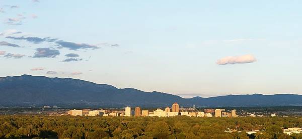
Albuquerque is the most populated and the fastest growing city in New Mexico, and it ranks 32 among the largest cities in the U.S.; its Metro area has 903,000 inhabitants. It is the seat of Bernalillo County, NM. straddles the Rio Grande, between West Mesa and the western slope of the Sandia Mountains
It is nown as "Duke City" and "Burque".
Tewa Lodge Route 66 motel
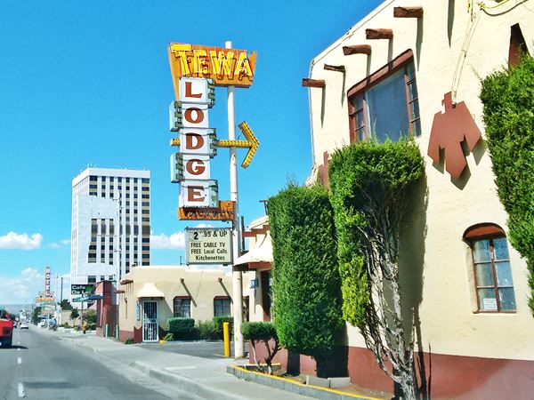
It is nicknamed ABQ, The Duke City and Burque. Its inhabitants are "Albuquerqueans" (or Burqueños).
History
People have lived in this area for over 10,000 years (the site at Sandia Cave is proof of this). Later the Pueblo people settled in the valleys of the rivers that flowed into the Rio Grande.
Seeking the "Cities of Gold", the Spanish explored the area, and in 1540 Francisco Vásquez de Coronado named the native people "Pueblo", after the Spanish word for "village".
The Spanish settled in Santa Fe in the early 1600s and converted the natives to Catholicism but opression led to a rebellion in 1680 which destroyed the colonial towns. The Spanish returned in 1692 and resettled the area, founding Albuquerque in 1706 as a key stopover on the Camino Real (Royal Road).
Origin of the name Albuquerque
The name Albuquerque comes from Extremadura, Spain. The first part of the word "Al-bury" is arabic for "the tower", remember that the Arabs occupied spain between 711 and 1492 A.D. The second part is pre-Roman, "Karkar" a local hill. Both form: Al-bury-Karkar or "Alburquerque", with an "R".
Another version says the name derives from the latin words for "white oak" (Albus quercus).
The local nobles were the Dukes of Alburquerque and one of them, Francisco was viceroy of New Spain (which comprised Mexico and all of the Southwestern USA) from 1653 to 1660.
The governor of Nueva Mejico named the town after the Duke of Alburquerque. Common usage led to the dropping of the first "R" and the town became known under its present name of Albuquerque.
After its independence from Spain, Nueva Mexico passed on to Mexico but it was ceded to the U.S. who won the Mexican - American War (1846-48). Confederate troops occupied the town during the Civil War and the Battle of albuquerque took place there on April 8, 1862.
Trivia: Altitude
Albuquerque is one of the highest major cities in the United States, ranging from 4,900 feet (1.490 m) in the Valley to over 6,700 feet (1.950 m) in the Sandia Mountain foothills.
In 1880 the Atchison, Topeka and Santa Fe Railroad reached the town and built its depot and station 2 miles east of the Old Town Center, creating the New Town or downtown area, which incorporated in 1891 and in 1920 absorbed the Old Town.
Route 66 was aligned through the town along the old Santa Fe - Las Vegas loop. It soon brought new business to the central part of town. In 1937 it was realigned when the Santa Fe cut-off shortened the road which took an east-west course to Santa Rosa through Moriarty and to the west, the "Laguna cut-off" shortened the road towards Gallup.
The atomic age became part of Albuquerque with the Sandia National Laboratories (1949). But Route 66 and its chain of motels, diner and filling stations would be bypassed by I-40 when the Interstate looped around the north part of town in the 1960s.
List of all Route 66 Attractions in Albuquerque East to West:
Check out our pages that cover the sights and attractions in Albuquerque:
- Page 1 Eastern Albuquerque
- Page 2 Nob Hill
- Page 3 Downtown
- Page 4 Colonial Town & Western Albuquerque
- Page 5 4th St. Route 66 - 1926-37 Sights
- Albuquerque Top 5 Things to See and Do & city overview (This page)
A List of Stops and Landmarks
We will use the ❌ symbol to mark those that have been torn down.
1. Eastern Albuquerque
- Paradise Club ❌
- Little Beaver Town ❌
- Original 1930s Roadbed
- Holiday Inn East
- Bar-B-Q Inn
- Phillips 66 Gull Wing service station
- Tropicana Lodge, later Nendel's ❌
- Caravan Nightclub neon sign
- Iceberg Cafe in East ABQ ❌
- Rodeo Court ❌
- Steer on a pole
- Eldorado Court later Roma Motel ❌
- Zuni Motor Lodge ❌
- Muffler Man
- Fair Grounds Motel ❌
- Carrico Modern Court ❌
- Sundowner Motel & Bill Gates
- Former Denny's Diner
- Leonard's ❌
- Tracy's Modern Court ❌
- Trade Winds ❌ / Replica Neon Sign
- Honey Dew Drive Inn ❌
- Nod-A-While Motor Lodge / Silver Spur ❌
- American Car Wash
- Cooksey Court, later New Mexico Motel ❌
- Bimbo's Drive In ❌
- Anchor Inn / Bar-X Motel& ❌
- New Chinatown Restaurant neon sign
- Ambassador Lodge ❌
- Coronado Court ❌
- El Sombrero ❌
- American Motor Inn
- La Puerta Motor Lodge
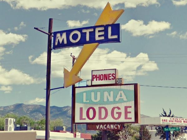
- Luna Lodge
- Piñon Motel
- Lo-La-Mi Lodge ❌
- Bow & Arrow Lodge
- Chevron Gas Station
- Phillips 66 Gull Wing Gas Station
- Loma Verde Motel
- Pioneer Motel
- Texaco Station
- Ace Cafe
- Tewa Lodge
- La Vela Lodge
- Desert Sands Motel Neon Sign
- Hiland Theater
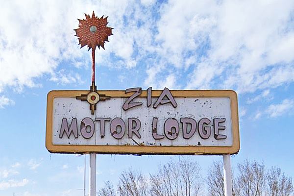
- Zia Motor Lodge
2. Nob Hill
- De Anza Motor Lodge
- Circle K Motor Court
- Bel Air Motel
- Goody's Restaurant
- Martens Tourist Court and Trailer Park ❌
- Comfort Lodge
- Town House Restaurant
- Aztec Court ❌
- Two Gas stations, one gone, Mobil survived
- One of the First KFC in ABQ
- Kurt's Camera Corral ❌
- Original Iceberg cafe ❌
- Rainbow Cafe
- Hiway House Motel
- Pipp's Texaco
- Triangle Cafe ❌
- Tonnie Pegue's Standard Oil Service Station ❌
- Lobo Joe's ❌
- El Oriente Auto Court
- Premiere Motel
- TraveLodge Motel
- The Toddle House
- Nob Hill Motel
- Nob Hill Conoco
- Johnson Standard Station
- Nob Hill Business Center
- Jones Motor Company & Texaco
- Valentine Diner Police Substation
3. Downtown
- Pig and Calf
- 66 Diner
- A Phillips Petroleum Gull Wing
- Cottage Bakery
- Zia Oil Station
- Park Lane Hotel ❌
- Lorlodge Motel
- Central Ave. Underpass
- Hiway House #1 ❌
- Railway Depot
- Glorieta Sation Neon Park
- Yrissari Building: Maisel's first store
- Franciscan Hotel ❌
- Sears
- Hospital
- Little House Cafe ❌
- Crossroads Motel
- Hyatt Chalet Motel
- Whole Hog Cafe
- Imperial 400 Motel
- TraveLodge Downtown
- Hilton Hotel
- El Fidel Hotel
- Kimo Theater
- Lindy's Coffee Shop
- Maisel's Indian Trading Post
- Holocaust & Intolerance Museum of New Mexico
- El Rey Theater
- Firestone Tires
- Downtowner Motor Inn
- Skinner Grocery
4. Old Town & Western Albuquerque
- Chevron ❌
- Lorlodge West
- Bell Indian Trading Post
- World Court ❌
- Desert Inn ❌
- Arrowhead Lodge ❌
- Texas Ann Court ❌
- Moon Motel and Café ❌
- White Way Court ❌
- Katson's Drive Inn ❌
- Country Club Court ❌
- Pueblo Bonito Court ❌
- Casa Grande Complex ❌
- Tingley Beach and Beach Motel ❌
- Rio Grande Bridge
- The Volcanoes
- El Nido Motel ❌
- Rainbow Court
- Sandia Motel ❌
- Duke's Court ❌
- Stop In Court ❌
- Auto-Tel Court ❌
- Miller's Court ❌
- Silver King's Auto Court ❌
- Blue Bell Court ❌
- Hill Top Court ❌
- Arrow Court and Hill Cafe ❌
- Navajo Court
- Dutch Motel ❌
- California Court ❌
- Hill Crest Motel ❌
- Sky Court ❌
- Mile Hi complex
- Covered Wagon Court
- Hubbell Motel ❌
- Oasis Lodge ❌
- Phillips 66 Gull Wing ❌
- Jerry Unser ❌
- Route 66 Conoco
- Route 66 Travel Center
- Capri Motor Hotel
- Horn Oil Co. Motor Lodge
- Sandia Theatre
- Old Town of Albuquerque
- San Felipe de Neri Church
- Tower Court
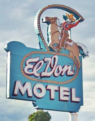
- El Don Motel
- Monterey Motel
- Country Club Court
- El Vado Auto Court Motel
- Relict Motel Signs: Cibola and Super 6
- El Campo Tourist Court
- La Hacienda Camp
- Siesta Court
- Americana
- Western View Diner and Steak
- Adobe Manor
- Westward Ho Motel
- French Quarter Motel
- Grandview Motel
5. Fourth St. Route 66
- Cavalier Court ❌
- Crossroads of Route 66
- Ruffin's Texaco #1
- Horn Oil North 4th St.
- Ruffin's Texaco #2 ❌
- El Camino Motor Hotel
- King's Rest Court ❌
- Court John ❌
- Madonna of the Trail
- Monkbridge Manor ❌
- Luke Apartments
- Clyde Miller Tire & Service Station
- Texaco Gas Station
- Scott's New Motel ❌
- Barelas-South Fourth Street Historic District
- Hudson Auto Sales
- B. Rupee Drugs
- Tasty Freeze Drive In
- Durand Motor Company
- Hi-Way Service Station - Horn Oil
- Sinclair Service Station
- Magnolia Service Station
- Navajo Super Service Station
- Red Ball Cafe
- Fito's Cafe

Find your accommodation in Albuquerque
There are plenty of lodging options in the city and its suburbs; you can find your room in in Albuquerque with our affiliate link:
>> Book your Hotel in Albuquerque
Lodging Near Albuquerque along Route 66
Below is a list some of the towns along Route 66 east and west of Albuquerque, click on any of the links to find your hotel in each of these towns.
Heading West in NM and AZ
- 16 mi. Isleta
- 25 mi. Los Lunas
- 60 mi. Acoma Pueblo
- 78 mi. Grants
- 139 mi. Gallup
- 188 mi. Chambers
- 235 mi. Holbrook
- 268 mi. Winslow
- 300 mi. Twin Arrows
- 336 mi. Flagstaff
Heading East
- 39 mi. Moriarty
- 116 mi. Santa Rosa
- 176 mi. Tucumcari
- 258 mi. Vega, TX
- 291 mi. Amarillo, TX
- 387 mi. Shamrock, TX
- 425 mi. Sayre, OK
- 442 mi. Elk City, OK
The Santa Fe Route 66 segment
- 65 mi. Santa Fe
- 124 mi. Las Vegas NM
Find your room in Albuquerque
Booking.com>> There are RV campgrounds in Albuquerque.
Weather in Albuquerque
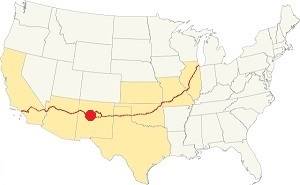
Location of Albuquerque on Route 66
Know the weather to plan your Rte 66 road trip: Albuquerque is located in the Rio Grande Valley on the western slope of the Sandia Mountains. The climate is dry, sunny (278 sunny days per year) and the relative humidity is low. Altitude and dryness causes large swings between day and night temperatures, even in summer.
Average High ⁄ Low Temperatures in summer (Jul.) are: 92 ⁄ and 65 °F (33 ⁄ 18 °C) respectively. The average in winter (Jan), are: 47 ⁄ and 24 °F (8 ⁄ -4 °C)
Summers are hot and winters are cold. Rainfall tends to fall during the summer monsoon season (July through September), and adds up to about 11 in. per year (279 mm). Shielded by mountains, snowfall is quite low: around 10 inches (25 cm) per year.
Tornado risk
The tornado risk in Albuquerque is nil: Bernalillo County has no Tornado watches. There have only been thirteen tornados here since 1883, and most of them have been F0 grade. The worst, in 1974 killed one and injured eight, running for 2 miles with an F2 force.
Tornado Risk: read more about Tornado Risk along Route66.
Map U.S. 66 in Albuquerque New Mexico
There have been several alignments of Route 66 across Albuquerque since the highway was created in 1926 when it was aligned along the original highways in this area: the "Ozark Trail", the "Santa Fe Trail" and the "National Old Trails".
These highways were known as "Auto Trails" and part of a public demand for "better roads": a movement that lobbied for good highways that could be used by motor vehicles, and also signs to mark them and help drivers to find their destination. New Mexico authorities improved the original Ozark Trail in 1914 and designated it as New Mexico State Highway 3. The thumbnail map (Click to see large size map), shows some of the "Auto Trails" that could be used by cars in 1912 in the area close to Albuquerque; the trails are marked with red lines.

1912 Road map, western NM
Click on image to enlarge.
Credits

1925 Road map, western NM
Click on image to enlarge.
Credits
The second thumbnail map above (from 1925) -click on it to see the full sized map- shows the roads that existed one year before Route 66 was created.
Those marked "22" (National Old Trails Rd., coming from Los Angeles) and "32" (New Santa Fe Rd.) with white letters in a black box, went from Gallup to Albuquerque through Santa Fe. Highway "50" (Ozark Trails) had two forks, one from Albuquerque to Moriarty and then south through Clovis into Texas, and another from Albuquerque to Dilia.
The only paved sections (full black line) was between Albuquerque Bernalillo, and Albuquerque and Tijeras. The highway from Bernalillo to Santa Fe, and beyond Isleta was "improved" (dashed line), the rest were either graded or dirt roads.
The 1926 Route 66 alignment

Detail of a 1927 Map of Route 66 in NM.
Click on image to enlarge.
Credits
The Santa Fe Loop (1926 - 1937)
This was the first alignment of Route 66, from Santa Rosa to Albuquerque via Pecos and Santa Fe.
We describe this segment in our Santa Fe Loop page, a dedicated webpage, with the full alignment, from Santa Rosa, through Dillia, Pecos, Santa Fe, Santo Domingo, and Bernalillo all the way to Albuquerque.
This original highway continued beyond Albuquerque to Isleta, Peralta and Mesita.
The 1926 -1937 into Albuquerque from Bernalillo
South of Bernalillo, starting at I-25's Exit 248 continue along Camino Real Pan American Central Hwy or NM 313, and follow it south all the way into Albuquerque. At Sandia Pueblo the highway merges with NM-556 at a roundabout. Head south along NM 556, it becomes 4th St. NW. At Marquette Ave., 4th St. changes direction so you can't drive along it into downtown Albuquerque, for those driving, you must follow 5th until meeting the 1937-85 alignment of US 66 on Central Ave.
This is the Map of the driveable part from Bernalillo to Lomas Blvd., and this is the yellow line shows the course of the old '66 that can't be driven across the Civic Plaza, and southwards to Barelas district as 4th St. runs from south to north.
Albuquerque to Suwanee along the 1926 - 37 Route 66
The highway crossed the Rio Grande in Barelas and then along what is now NM 314, headed south along the western bank of the river going through the villages of Isleta, Peralta, and Los Lunas. There it turned west.
This section is now NM 6 higway. It flanked the Cerro de los Lunas mountain (5,957 ft) and then crossed the Puerco River. It ran close to the railroad and both skirted a 6,500 ft. high volcanic plateau (Mesa Carriza, Mesa Lucero) as shown in this Map to Suwanee, where it continued west towards Mesita. Later this is where it would meet the alignment via 9-mile-hill.
1937 Realignment of Route 66
A political dispute between New Mexico Governor A. T. Hannett and local politicians led to the realignment of Route 66 in 1937.
Hannett blamed the local party bosses when he lost his 1927 bid to re-election. He decided to punish them, and their backers (the business men in Santa Fe) so he quickly had state highway #6 built, in 1927, to link Moriarty with Albuquerque. This highway bypassed the capital city, and was 90 miles shorter for those driving from the east to Albuquerque.
In 1937, the Federal roadbuilders decided to realign Route 66 using Hannett's road, and paved it. It was a straighter highway, and only had a short mountain segment across the Sandia Mountains between Sedillo, Tijeras and Carnuel.
South of Albuquerque, the "Laguna Cut-Off" (named after the Laguna Mission Village west of ABQ and Los Lunas) eliminated the southern section of the 1920s alignment: in 1937 the whole highway was moved north. It used the new bridges and climbed out of Albuquerque westwards and took a straight course towards Suwanee and Laguna. Both Isleta and Los Lunas had been cutoff.
Route 66 across Albuquerque (1937 - 85)
The highway descended the western slope of the Sandia Mountains along Tijeras Canyon from Carnuel.
1937-50s two lane highway
The original Route 66 had two lanes and had a winding course along the north slope of in this section of the Canyon.
The highway followed the alignment marked with a bue line in our custom map.
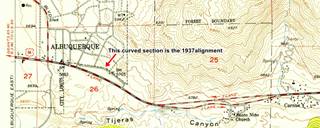
Finally, when the highway reached the level area at the foot of the mountains it curved (green line in our map) to the north and met Central Ave. at Tramway Blvd.
This quarter mile long, curved segment has survived and you can walk along it. It is pictured below:
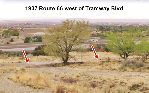

1937 roadbed nowadays Credits
1950s Four Lane US66
As traffic grew, a safer and straighter highway was needed so the old roadway became the eastbound lanes and a new set of straighter lanes were added north of them, for the westbound traffic. We marked them with a red line in our custom map.
The image below looks west along the four lane alignment where Exit 167 offramp begins.
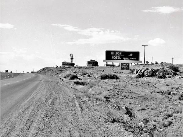
This four-lane alignment was buried by I-40 and the same spot where the picture shown above was taken is now under the freeway's westbound lanes (same spot as it is nowadays). So a new extension to Central Ave was built east to carry I-40s frontage Rd., NM 333.
Central Avenue
This area at Tramway and Central Ave. was empty space. There were motels along Route 66 west of this point. The first signs of an urban area appeared at Wyoming Blvd. three miles west.
Route 66 followed Central Ave all the way into downtown Albuquerque and then through the Old Town and onwards until it crossed the Rio Grande.
It did so from 1937 until it was decertified in 1985. This is the map of Route 66 across Albuquerque.
The original 1937 Route 66 ran along the westbound lanes of Central Avenue from the Rio Grande bridge all the way along 9-Mile Hill (Map of the first 6 miles) a second set of eastbound lanes were added in the mid 1950s. At what is now Exit 149, the highway followed the alignment shown with a violet line (0.8 mile gap in the alignment) and ended up as the North Frontage Rd. The eastbound lanes were buried by I-40s WB lanes in 1970. This 1951 aerial photo shows what Exit 149 looked like before I-40 was built.
The highway headed west for another 7.7 mi. (map to Exit 140) where Exit 140 disturbed its alignment at the Rio Puerco rivier. The gap is marked with a green line here.
It crossed the river along the historic Rio Puerco Bridge Listed in the National Register of Historic Places. The bridge was built in 1933 on NM State highway 6 and it was part of the plan to shorten the transcontinental route and became part of Route 66 in 1937 when the "Laguna Cut Off" was implemented, bypassing Isleta and Los Lunas.
The bridge's deck is 25 feet wide and was remodeled in 1957. When I-40 absorbed the traffic of Route 66, it became its Frontage Road until 1999 when the NM Transportation Department replaced it. It is open to pedestrian traffic.
Rio Puerco Bridge, historic landmark
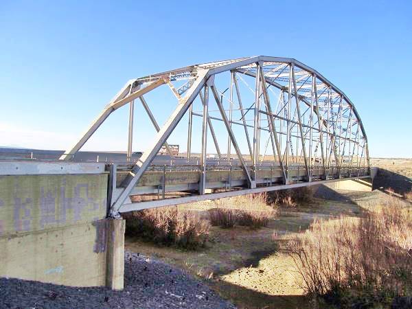
The highway continued west along what is now the N Frontage Rd. for 2.1 mi. (map), and then it turned and runs under I.40s EB lanes as marked with a red line in our custom map, all the way to Suwanee. Here as I-40 curves north, the original highway continued with a SW course into Suwanee, where it meets the 1926-37 alignment.
Route 66 Alignment near Albuquerque
With maps and full information of the old roadway.
- Albuquerque to Lupton (next)
- Santa Rosa to Albuquerque (previous)
The Santa Fe Loop (1926 - 1937)
Our Santa Fe Loop page describes the complete 1926 to 1937 alignment of Route 66 from Santa Rosa to Albuquerque through Pecos, Santa Fe and Bernalillo.
Albuquerque, New Mexico: Attractions & Sights
Things to Do and See
Sponsored Content:
Some exciting Tours
Albuquerque's Attractions
Where Route 66 crosses itself

Route 66 sign on Central Ave. Albuquerque. A. Whittall
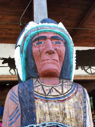
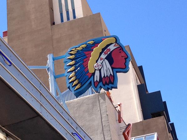
Indian Chief, Old Town Albuquerque. A. Whittall
Albuquerque has many attractions, landmarks, and sights: from volcanos to Native American pueblos; from the historic Colonial Old Town to Classic Route 66
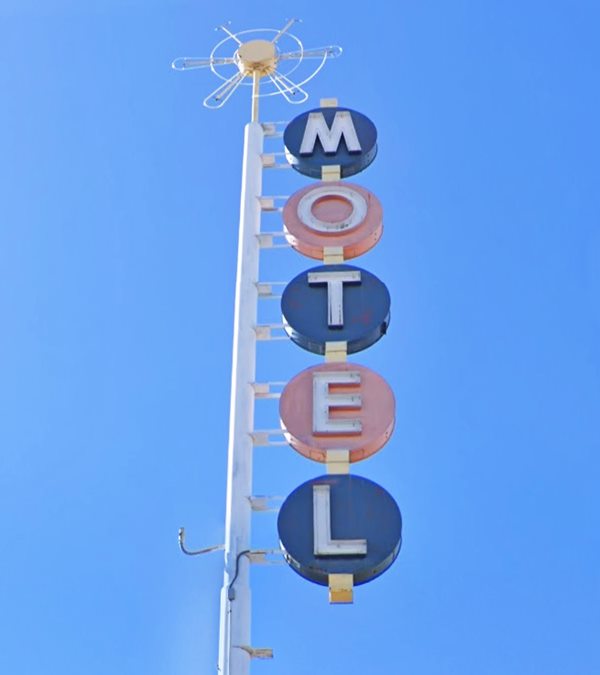
motels (Tewa, el Vado, De Anza, and more), diners, theaters, and trading posts.
It has awesome outdoor activities in the Sandia Mountains and ancient Southwestern roots.
Route 66 attractions in Albuquerque
A Driving Route 66 Tour along Central Avenue in Albuquerque
The Mother Road crosses the town along two alignments that meet downtown. The original 1926-37 runs north-to-south, and the 1937-85 runs east-to-west.
Most of the classic Route 66 sights are located on the latter alignment starting at the point where Central Avenue splits off from I-44 at Exit 167 in Eastern Albuquerque, and ending in Western Albuquerque on the Nine Mile Hill.
We have written five separate pages covering the all US 66 sights and attractions in Albuquerque:
- Page 1. Eastern Albuquerque
- Page 2. Nob Hill
- Page 3. Downtown
- Page 4. Colonial Town & Western Albuquerque
- Page 5. 4th St. Route 66 - 1926-37 Sights

The Top Five Best things to do in Albuquerque
Besides sighting Route 66 landmarks, Albuquerque offers many cultural, historic and outdoor activities allowing you to enjoy and explore the city; below we list five of them:
- Hot Air Ballooning
- Aerial Tramway to Sandia Peak
- Historic Old Town of Albuquerque
- Indian Pueblo Cultural Center
- Petroglyph National Monument (volcanos!)
1. Balooning
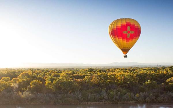
Albuquerque is known as the "Hot Air Ballooning Capital of the World" because it has optimal weather conditions for hot air ballooning year-round: predictable wind patterns and air temperature conditions that make for better balloon handling and rides. The landscape offers plenty of space for balloons taking off, landing and flotating with the stunning views of New Mexico's landscape.
Albuquerque is the venue of the World's Largest Hot Air Balloon Festival: the Albuquerque International Balloon Fiesta.
> >Book your hot air balloon half day tour
2. Aerial Tramway to Sandia Peak
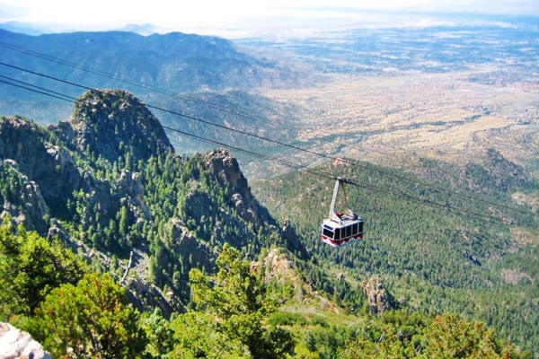
Located on the steep western slope of Sandia Mountains it is the world's third longest single span aerial tramway
It links Albuquerque with the crest of Sandia Mountains.
It was built in 1966 and is the longest aerial tram in the Americas measuring 2.7 miles (4.3 km) long. It was upgraded in 1986, 2009 and in 2016 new tram cars were installed.
It makes 10,500 trips each year climbing 3,819 vertical feet (1,164 m) from Albuquerque (6,559 ft - 1,999 m elevation) to a peak at 10,378 ft (3,163 m) iin roughly 15 minutes.
Threr is a restaurant by the top tram terminal, with great scenic views westwards across Albuquerque and the Rio Grande. There is wintertime skiing and trekking, and nature hikes during summer.
More details at: www.sandiapeak.com. The tramway station is at 30 Tramway Rd. NE Albuquerque. Phone: (505) 856 1532
Sandia Crest Aerial Tramway
3. Historic Old Town of Albuquerque
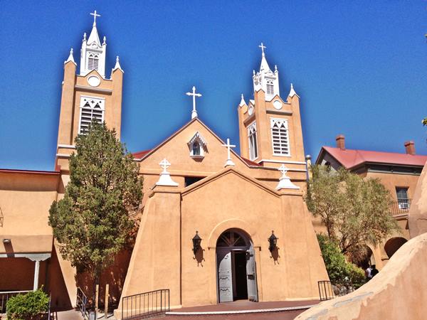
At Rio Grande Blvd NW and Central Ave. NW. The Old Town of Albuquerque is the original site where the Spanish founded the town in 1706. It spans about 10 blocks around the central Plaza that was the heart of the Spanish colonial town. The San Felipe de Neri historic church built in 1793 is located on its northern side.
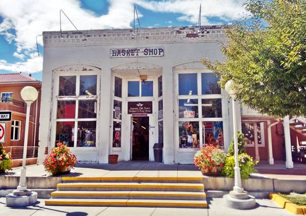
This part of the city still looks like it did in the 1700s, with Pueblo-Spanish styled adobe buildings that have been converted into souvenir shops and restaurants. Enjoy its brick paths, hidden patios, and adobe benches known as "bancos;" buy some souvenirs, enjoy the scene and the history.
More information at the www.albuquerqueoldtown.com
4. Indian Pueblo Cultural Center

Indian dancers at Indian Pueblo Cultural Center. Credits
2401 12th St. N.W. Albuquerque. This Map shows where it is located.
Discover the Pueblo Indian culture. See the traditional native dances, buy handicrafts and turquoise jewels at the arts store, visit the museum and taste the local food at the café.
More information at the official website: www.indianpueblo.org and (505) 843-7270
5. Petroglyph National Monument
About 8 mi. northwest of Albuquerque. Access from Exit 154 of I-40, head north along Unser Blvd. for 3 mi. to Western Trail, gateway to the National Monument. Below is a view of one of Albuquerque's volcanoes.
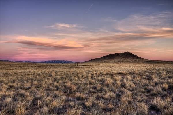
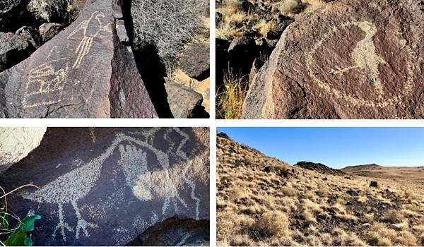
This volcanic area with the black volcanic rocks were sacred for the Pueblo people, who engraved their "petroglyphs" or rock art on them.
The National Monument is a day-use park that closes at 5 PM. Take your time (average hiking time through the park is from 1/2 to 4 hours). Stop at the visitor center is (at Unser Blvd. NW and Western Trail) for current park information, maps and brochures. Open 8 AM - 5 PM.
- Boca Negra Canyon. See some 100 petroglyphs along a paved trail guided with signs. Paid parking, drinking fountain and restrooms.
- Rinconada Canyon. A 2.2 mile round trip trail (no water) with 300 petroglyphs; 1.5 to 2 hour trek.
- Piedras Marcadas Canyon. A 1.5 mile rount trip trail (no water) with 500 petroglyphs; 1.5 hours.
The Volcanoes
The "Three Sisters" or Albuquerque volcanoes, and the West Mesa area formed simultaneously 150,000 years ago when the Earth's crust cracked and allowed magma to rise through it along a 5 mi. (8 km) fissure like a curtain of fire.
The Rio Grande Valley is actually a "rift", where the Earth's crust is thinner allowing lava to flow upwards, the valley to sink and the lateral areas to rise, like the Sandia Mountains to the east. There are several trails from 0.8 to 2 miles long, from easy to moderately strenuous, which allow you to view the volcanoes by hiking around the cinder cones. Great views of the Rio Grande Valley and the Sandia Mountains. Take water with you. Parking lot is located at Atrisco Vista Blvd. NW (former Paseo del Volcan), about 4.8 miles north of I-40. (see Street View).
More information at the National Parks website
Albuquerque Museums
Albuquerque has many museums, below is just a small sample of them, and both are close to the Old City:
American International Rattlesnake Museum

Rattlesnake Museum. Source
202 San Felipe St. N.W. Albuquerque
Fun little museum with plenty of snakes and snake "memorabilia". You will learn that a group of rattlesnakes is called a "rhumba".
An exciting and educational experience for kids and adults. It houses the largest collection of different species of live rattlesnakes in the whole world.
Visit their website rattlesnakes.com for more information.
Albuquerque Museum

Route 66 highway sign c.1940-50s. Albuquerque Museum. Source
At 2000 Mountain NW, Albuquerque.
Experience Albuquerque's art and history at the museum its collection includes around thirty-five thousand artifacts, cultural arts, maps, photographs, and even an original Route 66 shield (pictured).
Check open hours and admission information at: (505) 243-7255 or the museum's website
The Route 66 Attractions in Albuquerque
Albuquerque is, after St. Louis and Oklahoma City, the third largest city between its two endpoint megacities, Chicago and Los Angeles. However, it has preserved far more classic landmarks along Route 66 than any of the other cities.
We have split this segment of your Route 66 road trip across Albuquerque into five separate webpages, to be able to mention all of them. They are, from east to west, the following:
- Page 1. Eastern Albuquerque
- Page 2. Nob Hill
- Page 3. Downtown
- Page 4. Colonial Town & Western Albuquerque
- Page 5. 4th St. Route 66 - 1926-37 Sights
Continue your Road Trip westwards
After covering eacho of our five webpages you will have reached western Albuquerque, the endpoint of your Route 66 acreoss the city. You can continue your Route 66 road trip by heading west into the next town, Suwanee NM on the 1937-85 alignment or Isleta on the 1926-37 alignment.

Sponsored Content
>> Book your Hotel in Albuquerque


Credits
Banner image: Hackberry General Store, Hackberry, Arizona by Perla Eichenblat
Jack DeVere Rittenhouse, (1946). A Guide Book to Highway 66.


