Tiny hamlet on US66
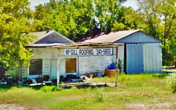
Old garage (gas station?) in Bushyhead, Route 66

Index to this page

TheRoute-66.com is reader-supported. When you buy through links on our site, we may earn an affiliate commission at no additional cost to you.
About Bushyhead, Oklahoma
Facts, Trivia and useful information
Elevation: 764 ft. (233 m). Population: 1,314 (2010 census).
Time zone: Central (CST): UTC minus 6 hours. Summer (DST) CDT (UTC-5).
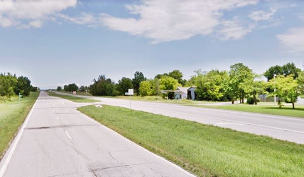
A very small town just southwest of Chelsea, in northeastern Oklahoma. Route 66 crosses the community with a notheast to southwest course.
Bushyhead's History
See Chelsea, History for full information on the region's history.
Bushyhead is a small rural community. The St. Louis-San Francisco Railway built a stop here, six miles south of Chelsea and 13 miles north of Catoosa.
The post office opened in April 1898, and remained operational until 1955.
Today it is an unincorporated community and census-designated place (CDP) in Rogers County.

Chief Dennis Wolfe Bushyhead, credits
The Peculiar name: Bushyhead
A Scotsman, Capt. John Stuart settled in the Colony of South Carolina in 1733 and enlisted in the British army. As a soldier he was captured at Fort Loudon, Georgia in 1760, but the Cherokee spared his life.
He then became the British Indian Agent for the tribes located to the south of the Ohio River. It was there that he met and married Susannah Emory, a Cherokee.
The Cherokees called him "Oo-na-du-to", which meant "Bushyhead" because of his thick blonde hair.
His only son was also known Oo-na-du-to or Bushyhead; he married Nancy Foreman, who was a half-blood Cherokee.
Nancy would later migrate during the "Removal" of the Cherokees to the west of the Mississippi River, led by her son, the Reverend Jesse Bushyhead, in 1839. This forced relocation of the Native Americans by the U.S. government is known as "Trail of Tears": 4,000 out of the 15,000 evicted Cherokees died due to hunger and disease during the march.
Jesse's eldest son, Dennis Wolfe Bushyhead (1826 - 1898) also took part of that march, as he was a teenager.
Dennis would play an important role in the life of the Cherokee Nation: he was elected chief of the Cherokees on October 4, 1879 for a four year term, and reelected again in 1883, serving for a total eight years.
He retired to is home in Tahlequah, where he passed away and is now buried.
The town is named Bushyhead in his honor.
Chelsea just north, and Claremore to the south drew population during the depression and although Route 66 passed through the town, it had little impact in its economy.

Getting to Bushyhead
The town is 6 miles southwest of Chelsea.
Hotels: Where to Stay
There are several hotels in neighboring Vinita and Claremore north and south of Bushyhead. Below we list some towns with hotels along Route 66 close to Bushyhead in Oklahoma.
> > Book your hotel in Vinita
Lodging Near Bushyhead
>> There are three RV campgrounds near Chelsea - Bushyhead.
Weather in Bushyhead

Location of Bushyhead on Route 66
Check the Weather and climate of Chelsea for historical weather information.
Tornado Risk: Bushyhead lies within the "Tornado Alley in Oklahoma and experiences about 8 Tornado watches every year.
Read more about: Tornadoes on Route66.
Map of Route 66 through Bushyhead

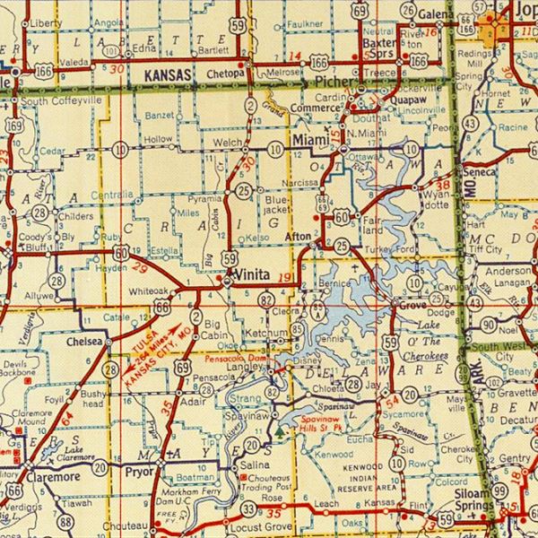
1948 Shell Roadmap northeast Oklahoma
Click on map to enlarge
Credits
The thumbnail map (click it to enlarge) was published in 1948. It is a Shell Highway Map and it shows northeastern Oklahoma and SE Kansas. You can follow Route 66 from the upper right (Galena KS) to Claremore OK on the lower left. Bushyhead is on the lower left side.
See this map with US 66 alignment in Bushyhead
Route 66 Alignment near Bushyhead
Visit our pages with old maps and plenty of information of the old US 66 roadway.
- Tulsa to Chandler (next)
- Vinita to Tulsa (Bushyhead's)
- KS-OK state line to Vinita (previous)
Route 66 landmarks & attractions
Small Town Attractions
Rittenhouse in his "Guidebook to Route 66" published in 1946 mentioned that it Bushyhead had "gas and grocery on US 66; no other facilities..." he added that there was "An old indian lookout west of here".
The town is an open rural community with no major landmarks.
Old Garage - Filling Station?
The photo at the top of the page shows what seems to be a former garage or even gas station -perhaps the one mentioned by Rittenhouse. It has a canopy that hints at a filling station and it is located at E 385 Rd. and old Route 66.
Bushy Head Rodeo
This event which included Pasture Roping and Barrel Race had been a long standing event on Route 66 (since the 1980s). In 2010 it moved to Bristow, Okla. leaving its Route 66 venue after the death of its creator and promoter Clem McSpadden.

Some sponsored content
> > Book your Hotel in Vinita


Credits
Banner image: Hackberry General Store, Hackberry, Arizona by Perla Eichenblat
Jack DeVere Rittenhouse, (1946). A Guide Book to Highway 66
George H. Shirk, Oklahoma Place Names, pp. 167


