"America's Maple Leaf City"
Index to this page
About Carthage on Route 66
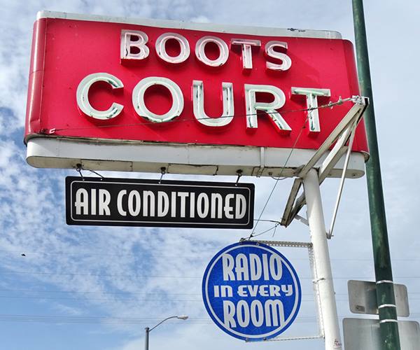
Neon sign of Boots Court
Facts, Trivia and useful information
Elevation: 1,004 ft (306 m). Population 15,482 (2023).
Time zone: Central (CST): UTC minus 6 hours. Summer (DST) CDT (UTC-5).
Carthage is the county seat of Jasper County, in southwestern Missouri.
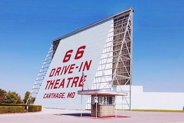
66 Drive-In Theatre, Route 66, Carthage, Missouri
Carthage's history
Southwestern Missouri has been inhabited since the last Ice Age, some 10,000 years ago; more recently ca. 700 BC the native Osage migrated here from their homeland on the Ohio and Mississippi rivers. They had been expelled by the bellicose Iroquois.
In 1682, French explorers coming from Canada claimed the region, naming it after their king Louis XIV: Louisiana. In 1803, during his wars with Britain, Napoleon sold it to the U.S. government who formed the Missouri Territory in 1812. Missouri became a state of the Union in 1821.
The Osage people in the meantime lost their territory, ceding it in a series of treaties signed in 1808, 1818 and 1825. They stood their ground but in 1837 they were forced from Carthage by the state militia (See the historic marker at the SW corner of the Courthouse Square on 4th St). They ended up in a Reservation in Oklahoma.
In 1841 Jasper County was organized and the flat area above the Spring River was chosen for a town which was founded in 1842 and named Carthage.
The name: Carthage
The stone bluffs along the river were of a pale color that reminded the founders of the fabled stone quarries at the North African city of Carthage.
The name Carthage comes from Latin Carthago, which in turn came from Greek Karkhedon. The original Phoenician words meant "New City" in Punic language. The town was a "New Tyre", founded in what is now Tunisia. Rome and Carthage waged several wars (Punic Wars) and Rome prevailed, razing the city.
The town with 500 residents entered the American Civil War on the side of the Confederates, the county favored slavery. The First official battle of the American Civil War was the Battle of Carthage, which took place on July 5, 1861 between 1,000 Union soldiers and 6,000 "Rebels" (Confederate troops). There are markers along US 571 marking the 8 mile-long route followed by the troops during the battle which ended at Carter Park.
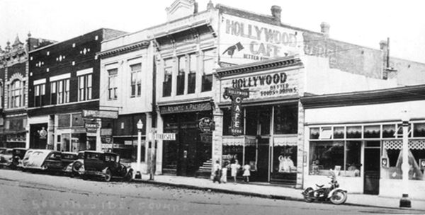
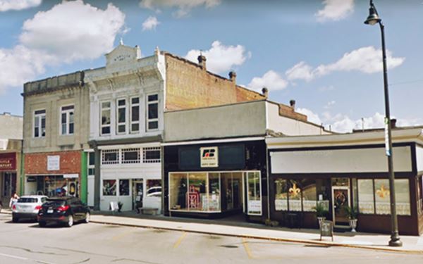
There was a "Second Battle of Carthage" during Oct. 1863. The town was burned by Rebel irregulars in 1864.
Rebuilt in 1866, it incorporated in 1868 and grew quickly. In 1872 the Missouri Western Railroad reached the town and the post office which had opened in 1840 as Jasper adopted the name of Carthage. The lead mines and limestone & gray marble quarries brought wealth to the town and the Historic Carthage South District with Victorian and Queen Anne homes was built during this period.
The advent of automobiles in the early 1900s led to the building of the Jefferson Highway and the Ozark Trail.
Jefferson Highway
This "auto trail" linked New Orleans in Louisiana, USA with Winnipeg in Manitoba, Canada (hence its name "palm to pine highway". It was built in the 1910s, and is contemporary of the Ozark Trail and the National Old Trails (which in part became U.S. 66). In 1926 it became U.S. Highway 71 ("Broadway of America").
Route 66, America's Main Street meets the Jefferson Highway in Carthage at the intersection of Central and Garrison Avenues.
U.S. 66 on the other hand was aligned along a highway organized by the Ozark Trails Association, which was the brain-child of William Hope "Coin" Harvey 1851-1936), an entrepreneur, teacher and active promoter of tourism; he established the Association in 1913.
The Ozark Trail soon spanned Missouri, Oklahoma, Texas and eastern New Mexico. When Route 66 was created, it was aligned along the Ozark Trail from St. Louis MO to Romeroville NM.
Route 66 had several alignments in Carthage, but was bypassed by I-44 which opened in 1958 from Oklahoma City to Joplin and then headed east along US-166, south of Carthage, towards Springfield. However Route 66 survived in Missouri until its decertification in 1985.

Find your Motel in Carthage Missouri
Lodging in Carthage: there are plenty of accommodation options in town.
> > Book your hotel in Carthage
More Lodging near Carthage along Route 66
Find your room in any of the Motels and Hotels along Route 66, close to Carthage. Below are some of the towns with hotels on the Mother Road.
Westwards in Missouri, Kansas and Oklahoma
Heading East in Missouri, more accommodation
- 67 mi. Springfield
- 82 mi. Strafford
- 93 mi. Marshfield
- 124 mi. Lebanon
- 160 mi. Saint Robert.
- 187 mi. Rolla
- 197 mi. Saint James.
- 211 mi. Cuba.
Book your hotel in Carthage
Booking.com>> Check out the RV campgrounds in Carthage
Weather in Carthage
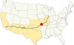
Location of Carthage on Route 66
Carthage has a wet & subtropical climate with dry and cold winters and very wet summers (the rainy season spans from April to July, with thunderstorms). Averages rainfall is 46.5 in (1.180 mm) yearly plus some 11.9 in. of snow (30 cm) in winter.
The winter (Jan) the average high is 44.9°F (7.2°C) and the average low is below freezing, with 25.0°F (-3.9deg;C). The summer (Jul) average high is 90.6°F (32.6°C) and the average low is 69.° (21.1°).
Tornado risk
Carthage is located within the infamous "Tornado Alley" and Japer County has an average of 6 tornado strikes per year. Tornado Risk: read more about Tornado Risk along Route66.
Map of Route 66 in Carthage, MO
In the early 1900s there were some roads that could be driven by cars (in fair weather). The map below, published in 1900, shows (marked with red arrows) the course of one of these roads which would become the Auto Trail #2 (Jefferson Trail or old Jefferson Highway) through Carthage (1915-1926), and it was paved and designated as Missouri State Highway #1 after 1921. In 1926 it became U.S. 66. Now cut by I-49, you can still drive it, check out these maps: map #1 east of town, map #2 up to I-49, map #3 west of I-49, Actually the road is cut three times by I-49, once at Iowa Lane heading west, to become Index Rd. Our map #3 avoids criss-crossing I-49 to the south, and kept north, on Index Rd. again at Leggett Rd heading south, and again on the later Route 66 heading west.
The other map above is a USGS map published in 1936, it shows the 1926 alignment ("old US66") after the 1954 upgrade ("US66"). Both meet at Kellogg Lake. But the original 1926 alignment followed Jiminy Ln. and crossed Spring River on a bridge built in the 1920s and removed in 1954, only the abutments remain.
In 1934 a viaduct was built across the railroad avoiding the grade crossing on the River St. - Central Ave. dogleg route.
You can see the Alt 66 alignment (built in 1933) along the north side of the city.
Rittenhouse in his 1946 guidebook tells us that Route 66 forked on the eastern side of Carthage: "City 66 turns left, main US 66 goes straight ahead", the city route which was shorter had light traffic which did not slow you down.
>> Read about the full alignment with interactive custom maps in our entry on Route 66 in Carthage .
US 66, I-44 and the final days of the Mother Road
Route 66 and Interstate 44 lived along together for many years (like many U.S. Higwhays do today), From Springfield west, to Halltown, they overlapped and at this point US 66 went northwards to Spencer and west to Carthage along its original alignment (now MO-96) while I-44 turned southwest and then west to Oklahoma. They coexisted until the federal government moved the eastern terminus of US 66 to Scotland, near Joplin, in the 1970s.
Route 66 Alignment near Carthage
Visit our pages, with old maps and plenty of information about US 66's alignments.
- Route 66 in Kansas (next)
- Springfield to Joplin (Carthage's)
- Rolla to Springfield (previous)
Route 66 Sights in Carthage
Landmarks and Places to See along Route 66
- Route 66 City tour in Carthage (read on below)
- Tours & Itineraries
Thinking about visitingt Branson?
Some tours and sightseeing
Sponsored
Historic context, the classic Route 66 in Carthage
Jack DeVere Rittenhouse book "A Guide Book to Highway 66" written in 1946 gives us an insight into the "classic days" of Route 66. He mentions the following lodging in Carthage: "Hotels: Drake, Crane and Arlington. Baird garage; few cabins: Dazy and Parkview; all accommodations" he also mentioned the 1870-80's woman bandit, Belle Star (Myra Belle Shirley who married Sam Starr) who ended up shot by another bandit. He described both the City and the Alternate U.S. 66 routes through the town.
Tour the route 66 landmarks in Carthage
We will begin our tour on the east side of town, where the 1926-56 Route 66 forks from the later alignment in Maxville. Take a left along Old 66 Blvd and head west. It is marked as a "Historic Byway", after one mile, to your left is a historic building.

Route 66 Byway sign in Carthage Mo.
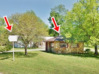
Old Sunset Drive-In building
According to the 1993 Historic Survey of Route 66 in Missouri, this two-room building with "giraffe" style slab rock walls and multi-lite windows, was built back in 1935 part of the Sunset Cabins (?). Later it served as a store and restaurant for the adjacent "Sunset Drive-In Theater" (12600 Old 66 Boulevard) don't get mixed up, Carthage had two drive-in theaters, this one on the eastern side of town, and the now more famous 66 drive-in theater on the western side.
It opened in August 1949 and was ran by Clyde Leeson. It closed around 1974 and was torn down. All that remains is this building and the neon sign (red arrows in the image above). There was a bar and grocery store across the street, both torn down.
Continue straight. To your right is an old motel.
White's Court, later Rock Castle Cabins
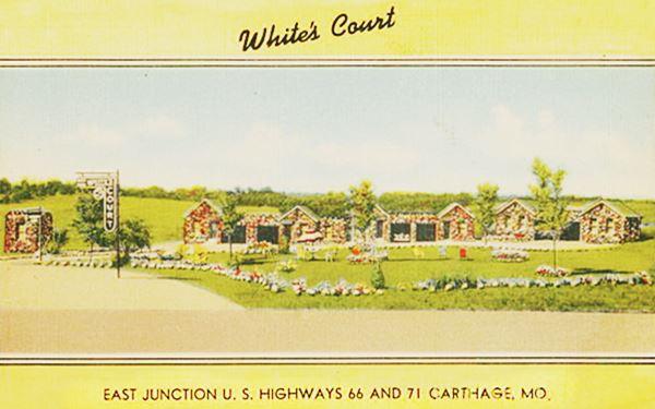
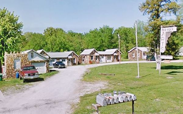
12937 Old 66 Blvd. "White's Court" motel began as a service station and café in 1927, the year after Route 66 was created. It later became the Old Rock Castle Cabins and now is the Red Rock Apartments. As you can see, the original sign has survived until now! and the gabled stone faced cottages on the north side of the property are still there but their garages have been enclosed.
The back of the postcard says "Modern Cottages. Cafe in Connection. We service your car. Phone, Mail, and Telegraph sevice".
A 1930s postcard showing White’s Court
The former White’s Court is now the Red Rocks Apartments
Buster Brown Inn
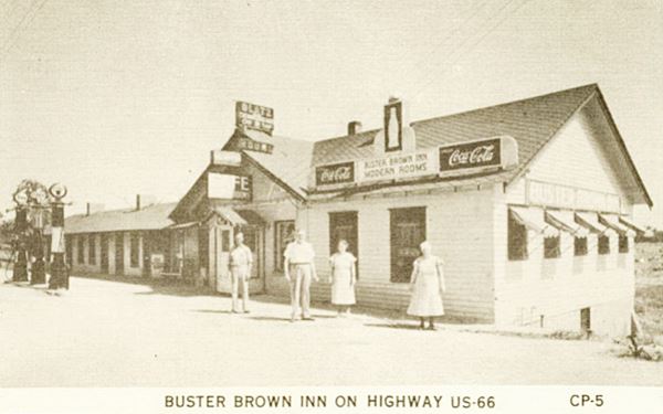
Across the street, at 12932 Old 66 Blvd., facing the old motel is the former inn.
The building dates back to 1935, when it was owned by E. J. Brown. Now it is a private home. The vintage postcard below shows the old gas pumps to the left.
Its matchboxes stated "Modern Rooms. Best Places to Eat Home and Here. Dining Room and Grill. 2 miles East of Carthage MO. On Highway 66".
A 1940s postcard showing Buster Brown Inn
A view today of what was the Buster Brown Inn and is now a private home.
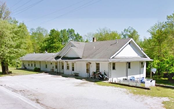
US 66 1926-53 alignment into Carthage
The road forks ahead. To the right is the Alt US66 and 1953 US66 alignments, to the left is the original 1926 alignment along Esterly Dr., marked with the Historic Byway signs. It runs along the eastern side of Kellogg Lake and the north bank of Spring River. It ends in a dead end where the now demolished bridge carried it across the river into Carthage along N. River St. You can drive up to the river, where the bridge's abutments are still standing.
The image shows the site, looking north as seen from the new bridge that carries Route 66 into Carthage (original bridge built in 1953 was replaced in 2017).
1953-85 Route 66 and Alt 66
Taking the right fork on Old 66 Blvd, you will drive along the north shore of Lake Kellogg and Park (it used to be known as Kel-Lake Park). The lake was formed as a borrow pit, when 28 acres of land were dug up and the earth used on Route 66's new 1953 alignment. The land belonged to the Kellogg Farm and its owners deeded it to a local wildlife and conservation organization as the site of a lake for fishing and recreation. Fed by water pumped from Spring River, it opened in 1954.
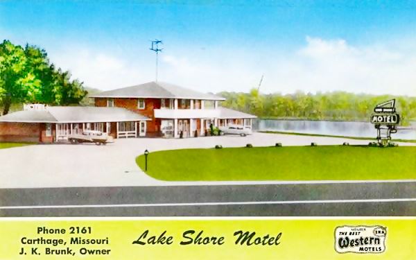
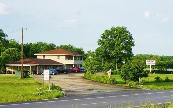
Just ahead, to your right, on the intersection with the 1953 US 66 running north to south, you will see the old "Lake Shore Motel".
Lake Shore Motel - Now Best Budget Inn
13008 State Highway 96. J. K. Bunk built it next to the shores of Lake Kellogg and advertised the great fishing the lake offered. Its motto was "Wonderful Rest in Cleanliness". It is still operating as a motel (Best Budget Inn).
You can Book a Room in the Best Budget Inn
A 1950s postcard showing Lake Shore Motel, Route 66 in the foreground, the lake behind.
The old Lake Shore Motel - now the Best Budget Inn, nowadays
Crap Duster
On the NW corner of the intersection, facing the motel, at the Conoco gas station you will spot a sculpture of a weird flying machine. It is the "Crap Duster" created by Lowell Davis, the "Norman Rockwell of Rural Art". It is based on a manure spreader built by John Deere around 1910-1930. Davis turned it into a biplane with pilot and all, like a crop duster but spreading manure, hence its name.

"Crap Duster" Route 66 Carthage Mo. Source. Click for St. view

John Deere manure spreader. Source

Classic Kel-Lake Motel sign, credits
The road that intersects US 66' 1953 alignment is Alt US66. On its south side, facing the "Crap Duster" is another motel, the former Kel-Lake Motel.
Kel Lake Motel
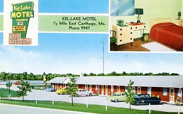
13071 State Highway 96. This is a 1950s motel built on the SW corner of the intersection of former US 66 and US 66 Alt.
As you can see in the "Then and Now" sequence, it has hardly changed. The trees have grown, but the building is the same, and the sign to the east of the building is also the same, but now painted red instead of green, see postcard below and picture of the neon sign.
The postcard described it as "New, Refrigerated Air-Conditioning, Steam Heat, Tile Bath. Free Radios, TV. Commercial & Family Rates."
A 1950s postcard showing Kel Lake Motel
Still open, it now offers weekly rentals.
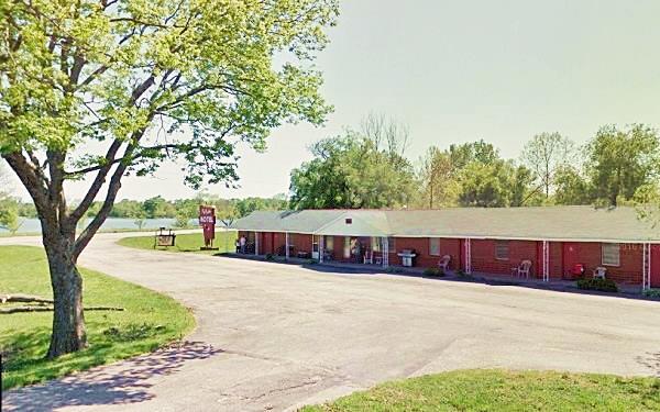
Along Alt US 66
Alternate US 66
The American Association of State Highway and Transportation Officials (AASHTO) created the "Alternate" designation in 1959. Its purpose was to designate a route that branches off from the main highway, passes through given towns or cities and then connects again with the main numbered route. The idea is to accommodate a high traffic demand. When the Alternate and Main highways followed a similar course, the shorter and better built highway would be marked as main and the other as alternate.
There are only six places along Route 66 where an Alternate 66 alignment existed: From East to West they were the one into Chicago, this one in Carthage MO, the one in Joplin MO, Oklahoma City, Alt 66 in San Bernardino, California, and the one leading into Los Angeles CA.
You can drive (Map) 1.1 mi. along former Alt US66 towards the west and visit three vintage gas stations.
Phillips 66? Station
Kendricktown is the community located at Alt 66's junction with Old US 71 (now N. Garrison Ave). To your left you will see a small wood siding cottage-style gas station. It has a steeply pitched cross-gabled roof. The pump island is clearly visible in front of the small building. This style was favored by several gasoline companies in the 1920s: Cities Service, Conoco, Enco, Phillips 66, and Texaco.
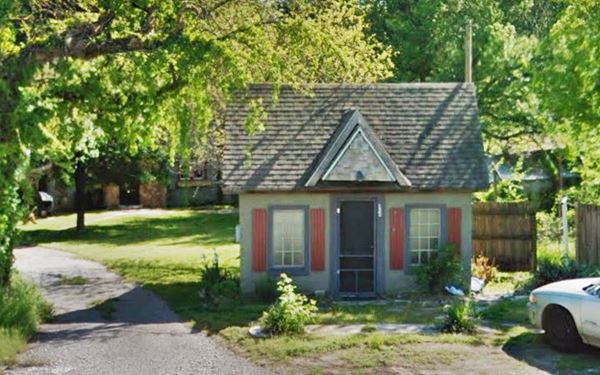
Ahead E Jazz St. forks to the SW (this was the original Alt 66 junction with old US 71, towards Carthage). To your right is the oldest house in the district.
Kendrick Place
131 E Northwoods St. A two-story brick house built in 1849 by William Hendrick on his 570 acre plot of land. It survived the Civil War, when it was used as a hospital and headquarters by both sides. It served as temporary courthouse when the original one burned in 1863.
You can tour it (Kendrick House Facebook), and learn about the ghost of a slave woman that haunts it. (Street View).
To your left are the remains of a Texaco filling station and Café, but first head along the north fork of the intersection, to old US 71 and 50 yards north along the highway, to your right is the old "Rock Station".
Rock Station (Mobil or Humble)
Built on the old US 71 alignment, long before Alt 66 was even conceived, this low-pitched hipped roof gas station could be either a Humble from the 1910-27 period or a Magnolia-Mobil station from 1918-1920. Both used this design. It has a canopy projecting over the pump island from the main building as continuous extension of the roof.
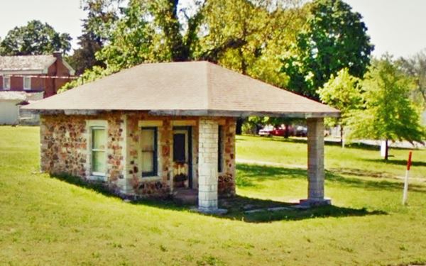
Turn around and head south, back to where former U.S. 66 Alt & old U.S. 71, meet, to see an old Texaco station and Café.
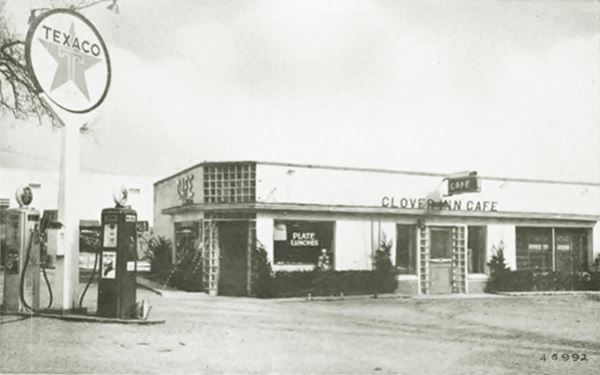
Clover Inn Cafe & Texaco
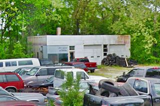
Former truck stop, Texaco service station, and Clover Inn Cafe. The building is still standing, but mostly in ruins.
The glass brick surrounding the entance door on the angled corner facing old US 71 is still visible. Comparing the black and white postcard with the
current view (see the "Then and Now" pictures below), you can see that the original garage bays on the eastern side of the property behind the Texaco sign in the postcard (1) are standing, and that a new shed with a gabled roof and a masonry room with the "Best Budget Inn" sign painted on it (2) -red rectangle- were added to the original building's north facade.
The original entrance (3) is there, and the pump island is located at (4).
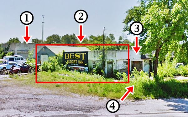
There is an L-shaped motel on the southern side of the cafe, probably an adjoining motel, but we haven't found any references about it. And just south of it a "Cottage-style" building, very altered, but with a steep pitched roof with a cross gable that makes me believe it was a gas station at some time (St. View).
Into Carthage
You can drive into Carthage by heading south along Old US71. Or retrace your steps to Lake Kellog and head south into the city. Both will take you into town. We will head back to the lake, and turn right along US 66.
A new viaduct takes you across Spring Creek into the city, ahead, to your right N River St. splits off -this was the original Route 66 alignment into the city. There is another Lowell Davis artwork here, a sculpture titled Jasper County, it includes a XIX century road grader and two buzzards, and a US66 shield (street view).
Take the "old" road, it meets the newer ahaed, on Central Ave. The 1926 Route 66 has a grade crossing and then turns 90° right, onto E Central Ave., it crosses another railroad and, to your right is a classic gas station.
1940s Gas station
This oblong box building witn a white porcelain enamel panel exterior, no canopy, an office with large pane glass windows and a two-bay garage looks like the 1940s-50s design used by Phillips66, Gulf, and Texaco. The viaduct over the railroad, to its left was built in 1934.
Fox Fire Farm sculpture
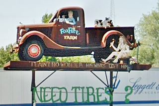
At the junction of both US66 alignments head straight west. On the following corner, to your left is another sculpture by Davis a jalopy upon poles with the words
"FoxFire Farm" -he owned it- and on the base "It aint no wonder his wives left him" (a woman is fixing a flat tire while the husband is sitting on the driver's seat).
Two blocks ahead, to your right you will see the "Guest House Motel".
Guest House Motel
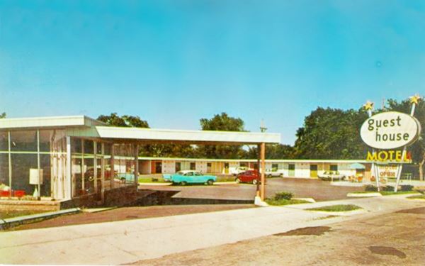
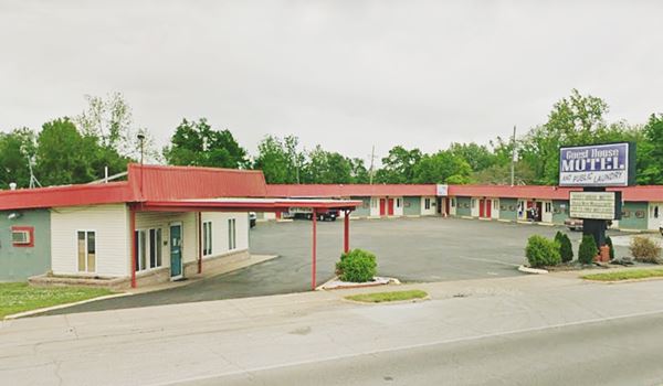
417 East Central Ave. Carthage. This motel is still open under the same name. The layout and building are unchanged, though it is a pity that the sixtyish-style neon sign has been replaced by a duller contemporary sign.
You can Book a Room in the Guest House Motel
A 1950s postcard of the Guest House Motel
A current view of the Guest House Motel
Two blocks west, to your right on the corner of Central and N. Main St. is "Chet Campbell's Gulf Service Station".
Chet Campbell's Gulf Service Station
101 E Central Ave. Chet Campbell's Gulf Service Station is a one-floor red brick building that has survived the ravages of time. In the postcard (1930s?) you can see the gas pumps facing Central Ave. Now it is Woodys Glass shop. Below is a "Then and Now" picture sequence.
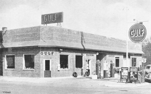
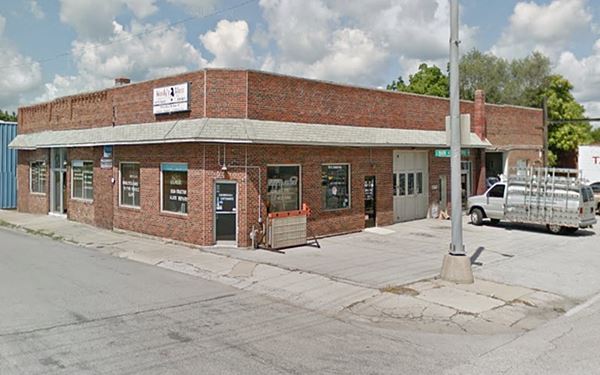
Just ahead, at N. Garrison Ave. where old US71 (and later Alt US 66) met US66, take a right and to your left is the old "Dazy Courts" (Motel).
Dazy Motel
119 N. Garrison Ave. Still standing, this motel was mentioned by Rittenhouse in 1946. It had individual cabins laid out in a "U" shape around a central courtyard. The neon sign on Garrison is still there, fading away (with the words "Dazy Apartments and Sleeping Rooms"), and also the motel's office.
This was the Dazy Courts Motel
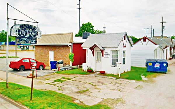
Continue north for two blocks, and to your right, on the corner of W. Vine is the burger restaurant:
Whisler's Drive-Up
This Hamburger Restaurant is a classic which has been serving hamburgers since it opened in 1953. Now it is painted red and has a newer neon sign.
Whisler’s Burger restaurant
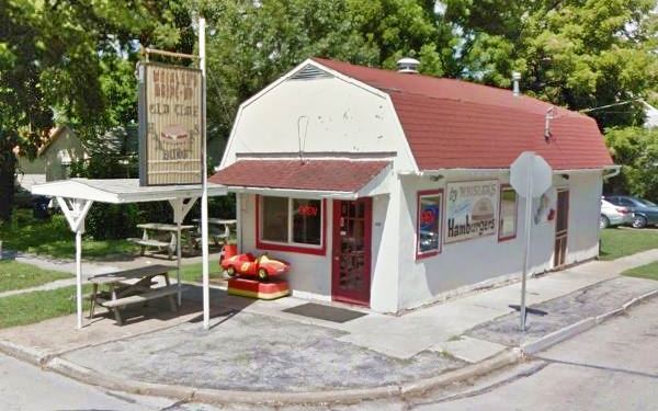
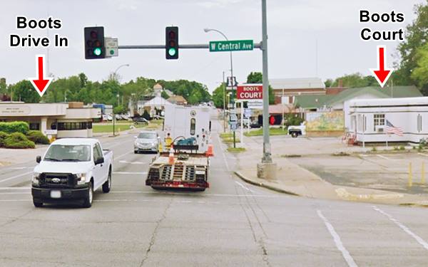
Turn around and drive back to Central Ave. and head south along S. Garrison. Here on the corner once stood a Standard Oil (SE corner), a Phillips66 (SW corner). Then, to your right is the former "Boots Court Motel". Below is a photo of the spot in the mid 1950s, at that time US 66 ran west along Central Ave.
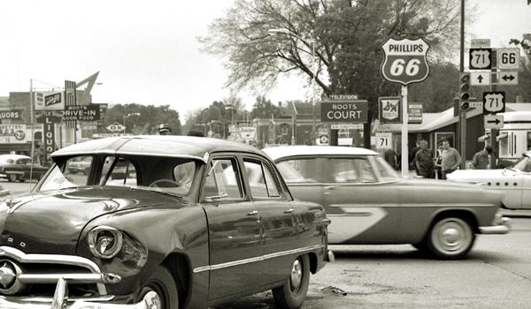
Boots Court Motel
107 S. Garrison Avenue, Carthage. he "Boots Court" opened in 1939, with 8 rooms and "a radio in every room". It was strategically located on the "Crossroads of America" where The "Jefferson Highway" (U.S. 71) crossed Route 66. It belonged to Arthur and Ilda Boots, who ran it.
Boots Court Motel in Carthage, Route 66
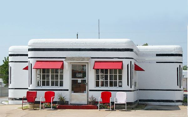
Its style combines Streamline Moderne with Art Deco. It had a filling station that later became the office. The Neely's bought it in 1942 and added five rooms to it in 1946. Clark Gable stayed here twice. By the 1950s it had added TV, phones and airconditioning.
After 1990 a period of decline set in, it was almost demolished but saved by public activisim. In 2011 restoration and preservatin began after it was purchased by the Bledsaw sisters. The Motel is now open and receiving guests again.
Boots Drive In
At 120 S Garrison Ave, across the street from the motel. You can see it in the 1955 photo further up, with a great neon sign that included an arrow pointing at it.
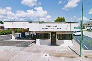
The Boots opened a drive-in across the street with a soda fountain in the mid-1940s. After I-44 bypassed Route 66 patrons dwindled and the place closed in 1971. Now it has been restored and is the Great Plains FCU. It has a "Streamline Moderne" style.
Art Moderne
Also called Streamline Moderne, was popular in the 1930s and evolved from Art Deco. Its main features are: curved shapes with rounded edges, horizontal lines or grooves in walls, flat roofs, smooth wall surfaces (plaster) and pale beige or off-white colors with contrasting dark trims.
Downtown Carthage
Turn right on 3rd St. to visit the downtown district with the historical County Courthouse and the late 1800s buildings and the hotel that surround it (map).
Jasper County Courthouse
Listed in the National Register of Historic Places
Between 3rd, 4th, Main and Grant Streets., built in 1894 with a Richardsonian Romanesque style. The former Courthouse was razed in 1863 during the Civil War. it was built with "Carthage stone". There is a mural inside the courthouse depicting the history of Jasper County.

The Jasper County Courthouse, Carthage. Source. Click for street view

"Big Dreams Grow in Carthage" mural. Source
Big Dreams Grow in Carthage mural
This mural 28 by 44 feet is the work of Andy Thomas, a local artist. It depicts the Carthage Drive In, a forme astronaut, the first elected female office-holder in Missouri and more!
On the eastern wall of McBride's Antiques, on the SW corner of Grants and E 4th St. (map).
Head east along E 4th for one block to visit a hotel mentioned by Rittenhouse in 1946, the Drake.
Drake Hotel
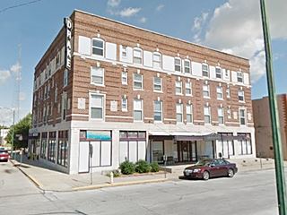
The Drake Hotel was built in 1922, it was named after A. M. Drake, a shareholder in the project. The neon sign it now sports on the corner does not appear in the postcard, and probably dates back to the 1950s, it was restored in 2006. Below is a Then (1920s) and now (2020) sequence.

1920s postcard Drake Hotel, Carthage MO. Source
West along the 1926-1954 Route 66
Head back west to S. Garrison and head west along Oak Street, the old and original 1926 Route 66 alignment.
G & E Tire Co.
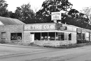
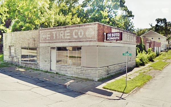
500 Oak St. SW corner of Oak and McGregor. The G & E Tire Co. has the famous DeSoto-Plymouth Sign. It was built in 1935 and by 1947 was listed as Joy's Garage and Filling Station run Joy L. Ortloff. By 1950 it was Joy Motor Co. selling Plymouth and DeSoto cars.
Towards the mid 1950s it became John Graue Motor Co. and in 1962, a recapping shop named Downey Auto Repair. Finally in the 1970s it was G&E Tire Company (recapping).
The DeSoto (also written De Soto) was a brand of automobiles manufactured by Chrysler's DeSoto division between 1928 and 1961.
G and E Tire Co. on US66, Carthage Mo.
Oak Street Bridge "Whee Brige"
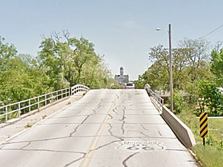
Continue west and just ahead, between S. Orner St. and Fall St. you will cross the famous timber bridge built in the 1920s. It carries Oak Street (Route 66) across the Union Pacific Railroad. It is 56 ft. long and 27 ft. wide. It has been slated for replacement but it has managed to survive (who know for how much longer). Its peaked shape gives those who speed across it a tickled tummy feeling, hence its name, the "whee" bridge.
Murrell Tourist Rooms and Cabins
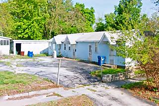
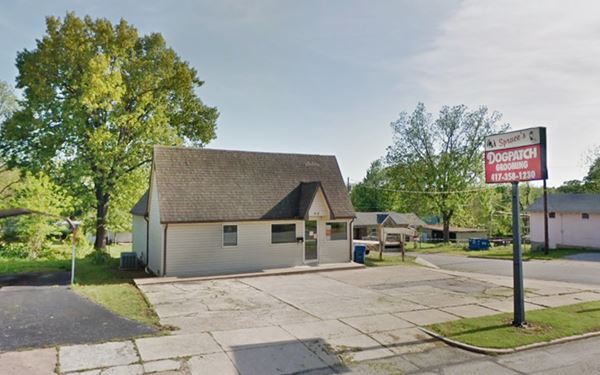
Two blocks west, on the SE corner of Sophia St., at 830 Oak St. is a former "Court". It was opened by M. S. Murrell and L. E. Newman in 1947; they rented rooms in the house facing Route 66 and the five cabins. It was later named by Noah Murrel "Murrel's Court Motel". In the 1970s the cabins became apartments for rent. Nowadays you can still see the blue cabins in the rear part of the lot (you can get a good view of them from Sohpia St.

1970s view Murrell's Cabins. Source
Neatherry Station
916 Oak St. S.E. corner of S. Francis St. This service station opened in 1935 and after 1947 it became the Wiliam C. Neatherry Filling Station, Christman's Service station (1950), Pop's Service Station (1957). Later it was known as Earle's Service Station and by the late 60s it was D B Discount Station. Finally it sold gas as the Flying W station. Now it no longer sells gasoline.
The building has a very steep roof with a side gable and was designed to fit in with the surrounding residential area, using the "cottage style" of that period.
G and E Tire Co. on US66, Carthage Mo.
Moxley's Grocery and Filling Station
1002 Oak St. SW corner of S. Francis St. On the corner facing Neatherry Station; opened by Eli P. Moxley in 1947. This is its street view.
Former Powers Museum (Closed 2021)
1621 Oak St. just after you cross I-49, to your right. Its endowment ran out and it closed for good in 2021. The collections have been distributed among other museums in the area.
This was the site of "Taylor Tourist Park" that opened in 1927 ran by Dr. C. Taylor and after 1931 by H. Scoville. Re-named Parkview Motor Court and Café because it faced the Municipal Park built during the Great Depression. It was acquired by the Museum in 1988. No trace remains of the old Motor Court or of the Parkview Trailer Court next to it. The 1916 Standard Oil Filling Station that stood here until the 1980s was later moved to Avilla and recently relocated at Red Oak II.
One quarter of a mile west, to your right is "West Old 66 Blvd", the former 1954 alignment of Route 66 that came from W Central Ave with US 71. Now it is cut off from the original roadway (Street view). Just ahead Route 66's 1930s and later alignments split towards the left with a NE-SW course, away from the original US66 that continues straight along W Oak.
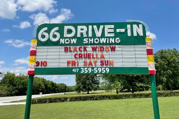
66 Drive-in Theater
Drive along the 1930s alignment for 1.4 miles and you will reach the famous Drive In theater.
Listed in the National Register of Historic Places
17231 Old 66 Blvd., Carthage, Missouri. The historic Drive-in is located on the north side Route 66, it was one of two drive in theaters in Carthge.
It dates back to 1949. Its screen was widened in the early 1950s. Finally, overtaken by home videos, it closed in 1985. However, it reopened in 1998 and shows films every weekend.
The Ticket Booth is built in an Art Deco - Streamline Moderne style and it has a great neon sign (pictured below).
The movies Cruella and Black Widow announced on Carthage's 66 Drive-In Theater neon sign
Your Route 66 city tour of Carthage ends here. Continue your road trip by heading west into Carterville.
Tours & Itineraries
Red Oak II
12306 Kafir Rd. Carthage. This recreation of Red Oak, is located about 4 miles to the northeast of Carthage (Map).
It is the work of Lowell Davis.
Lowell Davis (1937-2020) was famous for his detailed porcelain sculptures of animals, his art also included Red Oak II, which recreated "Red Oak", a rural small village that is 20 miles east of Carthage, where he was born and raised.
Visiting it is like traveling back in time, it also has several buildings and a gas station formerly on Route 66 which Davis saved.
An old truck atop a post by Davis, at US 66 and Co. Ln. 130 marks the entrance road (Street View). More information at www.redoakiimissouri.com.
The 1916 Standard Oil Filling Station from Carthage is located here. And also the Phillips 66 taken from Route 66 in Avilla. Both are pictured below. Read their full story in our Avilla page.

1916 Carthage Std. Oil station. Source

Avilla's Phillips 66. Source
Event: Maple Leaf Festival
Held since 1966, during October, (Festival's website) it is a week-long festival celebrating the coming of fall with the bright yellow, red and orange colors of the maple trees. It includes a parade, booths around the the town square and more.

Some sponsored content
> > Book your Hotel in Rolla.

Credits
Banner image: Hackberry General Store, Hackberry, California by Perla Eichenblat
Jack DeVere Rittenhouse, (1946). A Guide Book to Highway 66.
Route 66 Maps. Missouri D.O.T.
Historic US 66 Bridge Database 1926-1985, Jim Ross. 2015
Architectural - Historic Survey of Route 66 in Missouri, Maura Johnson. 1993.


