Route 66 in Hodge CA
Index to this page

TheRoute-66.com is reader-supported. When you buy through links on our site, we may earn an affiliate commission at no additional cost to you.
About Hodge California
Facts, Trivia and useful information
Elevation 2,283 ft (696 m). Population 431 (2020).
Time zone: Pacific (MST): UTC minus 8 hours. Summer (DST) PDT (UTC-7).
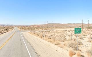
Hodge is a small unincorporated community located on Route 66, in south western San Bernardino County in the south of California.
The History of Hodge, California
Visit our Barstow web page to learn more about the early history of this area.
The Mojave Trail was opened in 1780, linking California with Arizona, New Mexico, and Utah. It crossed the Mojave desert north of the modern I-40 and US 66, following the Mojave River.
Mojave Trail or Mojave Road
The Natives used a trail from Cajon Pass, a gap between the San Bernardino and San Gabriel Mountains in the south, that reached to the Colorado River in the east along the Mojave River and a series of water holes across the Mojave Desert.
Father Garces used the trail during his mission to the Hopi Indians in Arizona in 1776.
Jedediah Smith was the first American to use it westwards, from Utah in 1826, a few years after Mexico became independent from Spain (1821) and California became part of the new nation.
By the late 1820s "The Old Spanish Trail" had been opened by Mexican traders in New Mexico and it linked with the Mojave Trail at Soda Lake, the drainage point of the Mojave River.
The US defeated Mexico in the 1846-48 war and California became a state of the Union in 1848.
The Mormons expanded west settling along the "Mormon Corridor" between 1850 to 1890 and they purchased the San Bernardino ranch in 1851, founding a town they named after the ranch. San Bernardino County was formed in 1853.
Several way stations operated along the Mojave River in the 1870s, one was located at Oro Grande, another near Helendale (Point of Rocks) and it was ran by the Saunders. The next one was Cottonwood (present Hodge), ran by the Lightfoots.
The Railroad in Hodge
The Southern Pacific Railroad (SP) extended its line from Bakersfield east after silver was found near present Barstow, they continued it all the way to Needles, meeting their rival the Atlantic & Pacific Railroad (A & P) there. By the way it was later absorbed by the Atchison Topeka & Santa Fe Railroad.
A&P had built their tracks across Kansas, New Mexico, and Arizona, reaching Needles in 1883. In 1884 they threatened to build a line parallel to the SP line and thus forced their competitor to sell them the line from Needles to Barstow.
A&P extended its line south to San Bernardino through Cajon Pass in 1885 and followed the Mojave River along the Mojave Trail. They built a station at Hodge and called it Cottonwood.
Hodge, the name
The railway renamed the siding "Hicks" but in 1926, it switched to Hodge after two important ranchers of the Mojave, who homesteaded here in 1911, Gilbert and Robert Hodge. The Hodge were from Buffalo, NY.
The surname "Hodge" is a pet form of "Roger" brought by the Normans to England and derived from Germanic "Ro(d)ger" ("hrod" = renown and "geri" = spear). The English replaced the initial "R" for an "H" as they could not pronounce the French (Norman) "R" sound.
National Old Trails Highway (N.O.T.)
In the early 1900s, the use of the automobile began to grow and better roads became necessary. The National Old Trails (N.O.T.) planned a road from Los Angeles to New York, and they aligned it next to the AT & Santa Fe railroad tracks from Cajon Pass to Needles. The road passed through Hodge.
In 1926, the N.O.T. highway became part of the US highway network and the section west of New Mexico became US 66. Nevertheless Route 66 was known as the "National Old Trails Road" for many years in California.
After World War II, traffic grew and peaked in 1960 with over 1.1 million travellers passed through Hodge that year. A new safer road was needed and it was finally built: I-15 and I-40 interstate highways replaced both US 66 and US 91 in this area, bypassing Hodge.
The town vanished.

Accommodation in Hodge: Where to Stay
There is no lodging in Hodge; check out the hotels and motels in neighboring Barstow or Victorville to find your room.
> > Book your Hotel in Barstow or in Victorville
More Lodging Near Hodge along Route 66
Below you will find a list some of the towns along Route 66 east and west of Hodge; click on any of the links to find your hotel in these towns.
Heading West
- 10 mi. Helendale
- 25 mi. Victorville
- 34 mi. Hesperia
- 46 mi. Cajon Junction
- 63 mi. Fontana
- 63 mi. San Bernardino
- 73 mi. Rancho Cucamonga
- 85 mi. Pomona
- 99 mi. Arcadia
- 106 mi. Pasadena
- 117 mi. Los Angeles
- 123 mi. Hollywood
- 132 mi. Santa Monica
Heading East
- 11 mi. Barstow
- 172 mi. Needles
- 236 mi. Kingman
- 288 mi. Peach Springs
- 322 mi. Seligman
- 349 mi. Ash Fork
- 366 mi. Williams
- 387 mi. Bellemont
- 398 mi. Flagstaff
You are so close to Las Vegas!
Book your hotel in Victorville
Booking.com>> Check out RV campground nearby in Barstow and Victorville
The Weather in Hodge

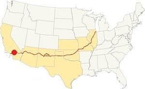
Location of Hodge on Route 66
Hodge has a desert climate, winters are cool and summers are very hot.
Rain is scarce and averages 6.3 in. per year (161 mm) with the driest months being May to Sep (less than 0.2 in monthly - 5 mm).
The average temperatures (high) are, in summer (Jul) 99°F (37°C) and in winter (Jan) 60°F (16°C).The average Low is, during summer (Jul) 62°F (17°C) and in (Jan) winter: 32°F (0°C). Snow seldom falls.
Tornado risk
Hodge is located well to the west of the Rocky Montains, so there is no risk of tornados in this part of California.
Tornado Risk: read more about Tornado Risk along Route 66.
Map of Route 66 in Hodge
From the N.O.T. Highway to U.S. 66

1927 Road map, SW CA
Click on image to enlarge.
Credits

1956 Shell Roadmap, SW CA
Click on image to enlarge.
Credits
National Old Trails Highway (N.O.T.)
The Automobile Club of Southern California's map of 1912 from Barstow to Victorville shows no sign of Lenwood and only mentions Todd, 8 miles south of Barstow followed by Cottonwood (current Hodge) another 8 miles away.
The next town was Oro Grande 17 miles to the south, followed by Victorville (5 mi.), which had "Gasoline."
There was another road, through Stoddard Well that would later be the route adopted by I-15.
Shortly after, Oro Grande offered "Gasoline - Oil", and Helen Station (modern Helendale) had appeared 10 mi. north of Oro Grande. Hicks (present Hodge) now appeared on the map replacing the name of Cottonwood.
By 1915 Victorville offered "Meals - Lodgings, Gasoline - Oil. Garage Repairs." That year, the road linking San Bernardino with Barstow through Cajon Pass became California highway LRN 31, neverthelss San Bernardino County upkept it until the mid-1920s.
The N.O.T. guidebook published in the 1920s does not even mention Hodge, it only mentions Barstow and Oro Grande.
Route 66 through Hodge
The dirt surfaced N.O.T. Hwy became Route 66 in 1926, and it shared the alignment with U.S. 91. It was paved in the 1930s and runs. The highway remaind aligned along this roadway until it moved to the freeway (I-15) in the mid 1960s. And in 1973 the highway's Western Terminus was moved to Needles. The era of Route 66 ended in SW California with this change.
It is an easy 12 mile drive from Barstow to Hodge (going through Lenwood) along Old Route 66. This is Map with Directions.
Route 66 Alignment near Hodge
With maps and full information on the Mother Road.
- Pasadena to Santa Monica (Next)
- Barstow to Pasadena (Hodge's)
- Topock to Barstow (Previous)
Getting to Hodge
You can reach Hodge along old Route 66 which here is named "Old National Trails Highway". Also from I-40 in the northeast or from I-15 (north, east and south).

Sights and Attractions in Hodge
Route 66 in the Mojave Valley
Historic Context
In his 1946 Guidebook to Route 66, Jack Rittenhouse mentioned Hodge as follows:
The only business establishment is a gas station with café and a few cabins. Railroad maintenance Rittenhouse (1946)
None of these buildings have survived.
In 1939, a "Guide to the Golden State" written by the WPA described the area as follows:
...South of BARSTOW, US 66 runs through billowing desert country; only the cottonwoods and willows on the banks of the Mojave River (R) relieve the tedium of rolling sandscape. HODGE, 11.7 m. (2,150 alt., 102 pop.), is a supply center. Its brick grammar school, perched on a slight rise (L) serves the far-flung desert district between Barstow and Oro Grande... The Mojave River nears the highway in Hodge. Screwbean mesquite and green desert willows grow abundantly along its banks. Distantly, the harsh, jagged mass of IRON MOUNTAIN protrudes (R) islandlike from the sand and gravel wastes... WPA (1939)
This is a very poetic description to say the least. The school is gone but the scenery remains more or less the same.
Road Trip leg in Hodge
Driving westwards from Lenwood towards Victorville the highway follows a straight and level alignment close to the railroad and the Mojave River. At Johnston's Corner it reaches the northwestern foothills of the Ord Mountains (Mt. Ord with 6,300 ft is its highest point 14 miles east of Hodge), the range continues on the western side of the Mojave river as the Iron Mountains.
Hinkley Road Turnoff
At Jonhston's Corner, 1.3 mi. north of Hodge, to your right left. Map showing the spot.
Hinkley Road linked Route 66 with the town of Hinkley, located 5 miles to the north on the western side of the Mojave.
The town became famous because of the 2000 film Erin Brokovich starred by Julia Roberts who won the Best Actress Academy Award for her role.
The movie directed by Steven Soderbergh depicts a true story where Erin Brockovich took the Pacific Gas and Electric Company (PG&E) to court over its negligence in the Hinkley groundwater contamination incident.
PG&E of California operated a natural gas pipeline linking a Texas gas field with San Francisco. The company owned a compressor station in Hinkley where hexavalent chromium was used to fight corrosion in the cooling tower. This toxic chemical product was stored in unlined open-air ponds and it percolated through the soil tainting the community's underground drinking water supply. Chromium is highly toxic. The case was finally settled in 1996 for $333 million making it the largest settlement ever paid in a direct-action lawsuit in the US. The water is still being monitored to this day.
On the northwestern corner of the junction, are the foundations of a now razed service station whose light post stood until quite recently.
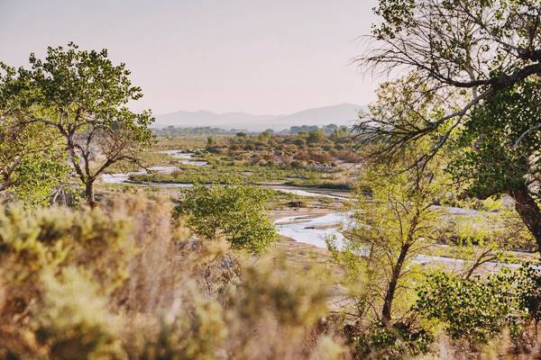
The Mojave River is just 0.7 miles west along Hinkley Rd. it is dry most of the time, but you can get to see it from the bridge.
Mojave River
The Mojave river is located roughly half a mile west of Hodge. It is an itermitent river that flows in a closed basin with an area of 4,580 sq. mi. (11.862 km2), its source is in the San Bernardino Mountains at almost 3,000 ft. altitude (900 m) and it discharges into Soda Lake, in the Mojave Desert.
It is a source of water used by the desert animals and plants, and also by those crossing the Mojave since prehistoric times.
110 mi long (177 km), its discharge varies from nil to a maximum of 70,600 cu. ft. (2.0000 m3). Most of its water flow is underground as the river bed is dry most of the year.

Father Garces named it Arroyo de los Mártires (Martyrs' Creek) in 1776. When Jedediah Smith followed it westwards into California in 1826 he named it "Inconstant River".
The underwater course of the Mohave River was marked by vegetation growing next to it, and therefore was in sight of Route 66 and the SF Railroad all the way from Newberry to Victorville.
Hodge
Continue westwards for one mile, the tracks approach the highway. Here was the old railroad depot. The "town" consists of a few scattered houses and some trees, greenery in the arid Mojave.
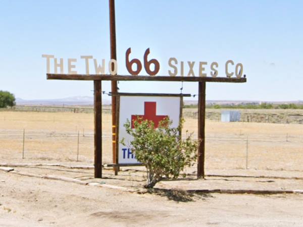
The Two Sixes sign
1.3 mi. south of Hodge, to your right (Map with directions).
The sign says "Two Sixes Co."
Two sixes sign in Hodge, California

Continue your Road Trip
Your journey through Hodge ends here. Continue your "Route 66 Road Trip" by heading west towards the next stop along the highway: Helendale.

Sponsored Content
>> Book your Hotel in Victorville


Credits
Banner image: Hackberry General Store, Hackberry, Arizona by Perla Eichenblat
A Guide to the Golden State, by the Federal Writers' Project of the Works Progress Administration, Hastings House, New York, 1939.
Jack DeVere Rittenhouse, (1946). A Guide Book to Highway 66.


