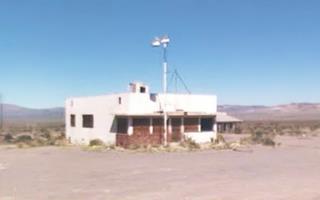
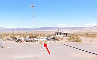
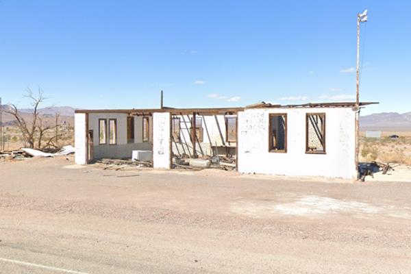
The remains of the Ludlow Post Office on Route 66
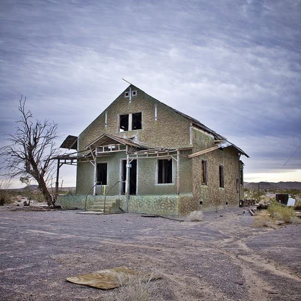
Route 66 in Ludlow CA
Index to this page

TheRoute-66.com is reader-supported. When you buy through links on our site, we may earn an affiliate commission at no additional cost to you.
About Ludlow California
Facts, Trivia and useful information
Elevation 1,778 ft (542 m). Population 10 (2020).
Time zone: Pacific (MST): UTC minus 8 hours. Summer (DST) PDT (UTC-7).
Ludlow is a very small town on Route 66, west of Amboy and east of Barstow, in central San Bernardino County in the southeast of California. Where I-40 and old Route 66 meet again, west of Needles.
The History of Ludlow, California
Visit our Barstow web page to learn more about the early history of this area.
The Mojave Trail was the main route used by traders and pioneers on their way in and out of southwestern California. It was opened in the late 1700s when California was a Spanish Colony, part of their Viceroyalty of New Spain (Mexico), but became well used after 1850. It crossed the Mojave to the north of what is now Ludlow.
However a better link was needed and the railroad to California
was surveyed in the 1850s and finally completed in 1883.
Railroad in Ludlow
The Atlantic & Pacific Railroad -A & P (which was absorbed by the Atchison Topeka and Santa Fe Railroad in 1897) built its way across New Mexico and Arizona, crossing the Colorado River at Needles in 1883. There it linked with its competitor, the Huntington and the Southern Pacific (SP) railway who had built a line from Barstow to Needles with the purpose of block the entry of A&P into California.
Both companies built an interchange at Needles to transfer cargo between lines. However the A &P pushed west with a line parallel to the tracks of its rival forcing them to sell out (1884). The following year Atlantic and Pacific linked its main line through the Mojave with their line through Cajon Pass into San Bernardino and Los Angeles.
During this process, they established a station and siding at Ludlow, that later became the basis for the town.
Ludlow was not only a watering stop after the climb across the divide at Ash Hill (1,944 feet) east of Ludow, it was also a rail link to the local mines.
The Name, Ludlow
Ludlow was named after William B. Ludlow, master car repairer of the A&P Railroad.
The surname is a locational one, originating in Shropshire, England, near the Welsh border, at the town of Ludlow: "Ludelaue", meaning: "hill by a rapid", from Old English 7th century, "hlude": "hill" "hlaw": "loud" (noisy).
Mining Town boom and Railroads
Two railroad lines branched out of Ludlow station, one to the north: the Tonopah and Tidewater (T&T), another to the south, the Ludlow and Southern (L&S).
When theT&T was completed in 1907 it didn't link San Diego with Tonopah NV as planned. Instead, it ran for 169 mi. to Beatty Nevada to carry the borax mined there back to Ludlow and from there, it was shipped out using the AT & SF Railroad.
The L&S only ran for 10 miles southwards to the Bagdad Chase Mines where copper and gold had been found in 1898. This mine had been named after the nearby town of Bagdad and the Chase Bank of New York who bought it in 1900. The place was called Camp Rochester after the hometown of the bankers (in NY) but later changed to Stedman (name of one of the bankers).
The mine's general manager was a Mr. E. H. Stagg and the local post office beside Ludlow station was named after him in 1902. Copper ore was shipped via Ludlow to Barstow for milling.
Steadman was a "dry town" so the miners went to Ludlow for their booze. This led to the growth of Ludlow, and the Murphy Bros. Store though badly damaged nowadays is a reminder of the town's former glory.
L&S closed in 1916 and its tracks were lifted in 1935. The Borax mine to the north closed in 1927 and the Great Depression led to the closure of T&T. Its rails were torn up but the sleepers were left in the desert and can still be seen.
The loss of the railway lines led to a decline in the town's fortunes and it became a ghost town. But, as we will see below, Route 66 which had been aligned through the town in 1926 gave it a second wind.
US 66 was created in 1926
The original dirt trail from Los Angeles to New York passed through Ludlow and it became Route 66 in 1926. The travel guides of that time reported that Ludlow had "Hotel - gas - oil," clearly the town was switching from an economy based on the mines and the railroad to one based on catering to travelers moving along U.S. 66.
Over the next few years, the highway was improved, straightened out, widened and better bridges built. It was also paved by the early 1930s.
After World War II, diesel engines replaced the old steam locomotives. Water stops were no longer necessary. So the railroad became even less important to Ludlow. business focused on US 66 and did so for the next 25 years until I-40 opened in 1973 and bypassing Route 66 between Ludlow and Needles. Ludlow declined rapidly.
Most of the shops, service stations and cafes located far from I-40's Exit 50 went out of business.

Where to Stay near Ludlow
There is a motel in Ludlow. But there is also lodging close to Ludlow in neighboring Barstow:
> > Book your Hotel in Barstow
More Lodging Near Ludlow along Route 66
Below you will find a list some of the towns along Route 66 east and west of Ludlow; click on any of the links to find your hotel in these towns.
Heading West
- 53 mi. Barstow
- 76 mi. Helendale
- 90 mi. Victorville
- 98 mi. Hesperia
- 111 mi. Cajon Junction
- 128 mi. Fontana
- 128 mi. San Bernardino
- 138 mi. Rancho Cucamonga
- 150 mi. Pomona
- 164 mi. Arcadia
- 171 mi. Pasadena
- 182 mi. Los Angeles
- 188 mi. Hollywood
- 197 mi. Santa Monica
Heading East
- 108 mi. Needles
- 171 mi. Kingman
- 221 mi. Peach Springs
- 258 mi. Seligman
- 285 mi. Ash Fork
- 301 mi. Williams
- 322 mi. Bellemont
- 334 mi. Flagstaff
You are so close to Las Vegas!
Book your hotel in Barstow
Booking.com>> Check out RV campground near Ludlow
The Weather in Ludlow
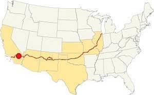
Location of Ludlow on Route 66
Ludlow is located in the Mojave Desert and has a "mild desert climate" with very dry and hot weather.
Winter average temperatures (Jan) are low: high 60.7°F (16°C) and the low is quite cold: 36°F (2.2°C). The summer (Jul), high is a searing: 104.2°F (40.1°C) and the average low is a pleasant 73.3°F (22.3°C).
Ludlow's rainfall is 4.1 in. year (145 mm) during 30 rainy days every year (there are 281 sunny days per year). Snow never falls in Ludlow. The dry months are April, May and June with less than 0.15 in. per month (3.8 mm), more rainfall takes place during July and Nov. through March with 0.4 to 0.6 in. per month (10 - 15 mm.). Expect thunderstorms during summer.
Extreme Heat and Dehydration Warning
During summer make sure you stay hydrated. The hot and dry desert climate can dehydrate you quickly. Drink plenty of water and dress for the heat.
Read more how to keep healthy in hot temperatures.
Tornado risk
Ludlow is located well to the west of the Rocky Montains, so there is no risk of any tornados in this area.
Tornado Risk: read more about Tornado Risk along Route66.
Map of Route 66 in Ludlow, CA
The first alignment of Route 66 in 1926
The first highway was an Auto trails one, built in the 1910s, a dirt track. You can see its alignment in the thumbnail map and the map below.
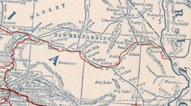
1927 Road map, western CA
Click on image to enlarge.
Credits
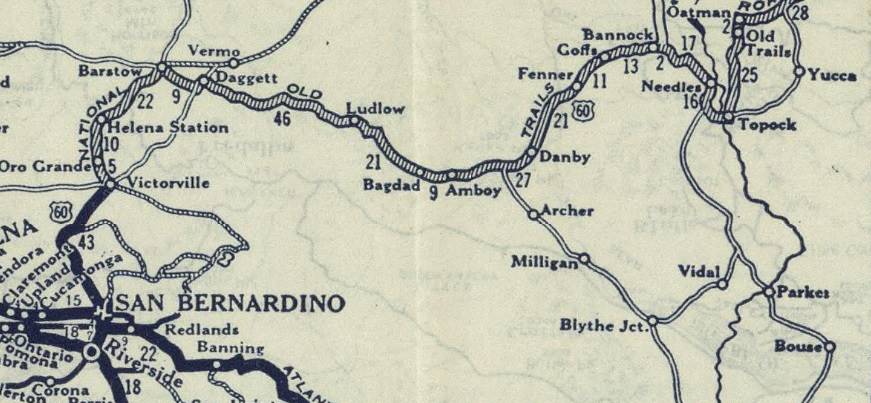
1926 Road map, western CA
Click on image to enlarge.
Credits
The map above (from 1926) -click on thumbnail to see large size map- shows the Highway as U.S. 60! Read why Route 66 was almost named Route 60.
This map is the first to show the alignment of a U.S. highway in Western California.
National Old Trails Highway
In the early 1910s the National Old Trails (N.O.T.) built a highway for automobiles, from Barstow to Needles, as part of the Los Angeles to New York road. This road followed the course of the Santa Fe railroad and went right through Ludlow.
The Automobile Club of Southern California (ACSC) map of 1912 shows "numerous cross washes" between Bagdad and Siberia in the east, followed by a winding course through "Very Heavy Sand" past Klondike station, which was not on the highway, and Ash Hill station that was also, to the north of the N.O.T. alignment.
The N.O.T. road reached Ludlow and crossed the Santa Fe Railroad to its north side. The town had "gasoline, oil, meals and lodging." East of Ludlow the road climbed a 15% Grade towards the station of Argos (5 mi.) and then encountered "Sand - Hard Pulling" into Lavic (9 miles west of Ludlow). It Crossed to the south side of the Santa Fe tracks and climbed a 10% Grade of Heavy Sand, crossing a dry lake well to the south of the black lava beds that the SF RR crossed. It passed far to the south of the station named Hector and after going through another Dry Lake 29 miles west of Ludow at Troy, it reached a "Fine Spring" next to the "alkali marsh" at Newberry, that in those days offered no services for the traveller (37 mi.)
The Arizona Good Roads Association guide of 1913 showed many cross gutters and light sand up to Siberia followed by "Heavy sandwash" to Ash Hill "summit". The road must have been a nightmare.
By 1915 some improvements had taken place. but a sandy wash still stood east of Kloindike station. The road now crossed the tracks into Ludlow further east than before. At that time Ludlow offered "meals, lodgings, Gasoline and Garage-repairs" plus "club signs". The town had 255 inhabitants but it lacked fresh water (its wells were briny), water was brought in via tanker wagons from Newberry Springs.
In 1922 the ASCS map showed more stations than shown in the previous maps: Haynes, Siberia (7 mil from Bagdad), Klondike (2.5 mi. west) and Ash Hill (3 more miles), all to the north of the road. The road now crossed the tracks 4 miles west of Ash Hill and 3 before Ludlow.
The original highway ran along Main St. through Ludlow from the N.O.T. days and as U.S.66 from 1926 to 1931; this is the map of this original roadway.
The 1931 alignment of Route 66
Initially U.S. 66 was aligned along the N.O.T. roadway but in the early 1930s it was straightened, shortened and paved. West of what is now the razed ghost town of Siberia the Santa Fe railway curved away from the road in a climb out of the basin where Bagdad and Siberia are located, heading for Klondike while the highway turned slightly to the north-northwest, to curve around a mountain range located to the left (west) of its course and again, curving towards the northwest close to the tracks, after Klondike.
From here it ran in a straight line, while the railway went across the divide at Ash Hill further north.
Map of US 66 from Amboy to Ludlow.
Then it continued along the N.O.T. highway westwards, but now it is cut by the freeway, see the orange line in our custom map. To continue west, take Main to cross I-40 at Exit 50 and continue along the North Frontage Rd.
Route 66 Alignment near Ludlow
With maps and full information on the Mother Road.
- Barstow to Pasadena (Next)
- Topock to Barstow (Ludlow's)
- Kingman to Topock (Previous)
Getting to Ludlow
You can reach the ghost town driving along old Route 66 which here is named "Old National Trails Highway" westwards from Amboy or Chambless. Also from I-40 at Exit 50.

Sights and Attractions in Ludlow, California
Ludlow. A Vanishing Town with Route 66 attractions
Historic context, the classic Route 66 in Ludlow
In 1946 Jack DeVere Rittenhouse drove along Route 66 gathering information for his memorable "Guide Book to Highway 66", this was the heyday of the route, and he mentioned Ludlow in his self-published book:
...Although quite small, Ludlow appears to be a real town in comparison to the one establishment places on the way here form Needles... 170 residents, a garage, motels, a cafe, and a gas station Rittenhouse (1946)
The WPA's A Guide to the Golden State published in 1939 (1) tells that after passing Bagdad:
For 20 miles westward US 66 covers a desolate terrain almost as primitive as it was thousands of years ago. The railroad tracks are dotted with lonely stops without accommodations, which bear such curiously incongruous names as Siberia and Klondike.
In comparison with neighboring "towns," LUDLOW, 115.5 m. (1,782 alt., 150 pop.), is a metropolis. Here two narrow-gage railroads of the Tonopah & Tidewater connect with the Santa Fe.
The SLEEPING BEAUTY, a formation resembling a dormant, smiling human face is outlined by the crest of the CADY MOUNTAINS, northwestward. Directly north appears the yellowish blotch of LUDLOW DRY LAKE, where experiments have been made in processing the lake bed's fine "flour" gold... WPA (1939)
Ludlow Leg of your Route 66 Road Trip
We will tour the village driving westwards from Bagdad. About 2.5 mi east of Ludlow the highway that has been running more or less parallel to the railroad, curves north, crosses it with a grade crossing and then curves to head westwards straight into the town.
Post Office and Motel
To your left on the SE corner of Elliot St. and National Trails Hwy., you will see a two story gable roof building, vacant and falling apart. Many have wondered if this was a hotel, a filling station or a home, see its picture at the top of this page.

Post office and Motel, Ludlow c.1920s. Source
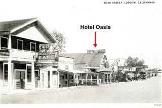
Hotel Oasis, Ludlow c.1920s. Source. Click to enlarge
According to this old black and white photograph from the 1920s it was a motel and post office, the thumbnail's caption reads "Post Office for Ludlow, Ca. The Motel (sign) is in the rear of th P.O." The motel sign, long gone, can be seen on the left side of the photo.
Below is a "Then and Now" view of the old motel and post office. The desert is unforgiving:
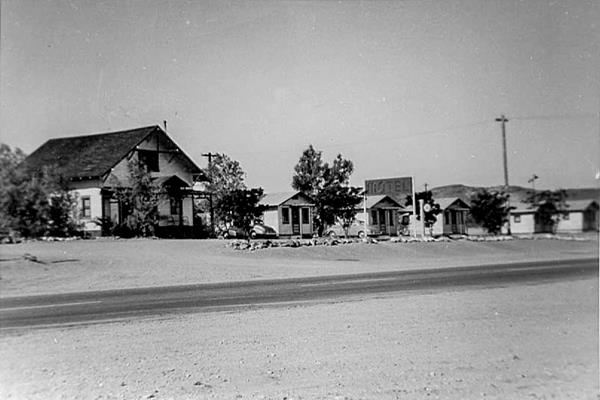
Same view nowadays, only one cabin has survived, in ruins, on the eastern side of the former motel.
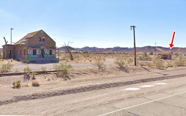
Henry Elmond "Penny" Pendergrast (c.1892-1967) and his wife Venus Elizabeth "Lucy" neé McNeil (1894-1989) bought the old building in 1939. It had previously been the Oasis Hotel since 1921 on Main Street (see picture further up=. They moved it to face Route 66 and renamed it "Ludlow Motel." It had separate cabin units of which only one has survived on the western side of the property.
Penny eventually became constable. The couple lived across the street (2) (3).
The Old Cafe at Ludlow ❌
Across the street, to your right is a group of old derelict buildings, the remains of the golden days of Route 66. On the north side of the road is the site of the old Ludlow Cafe (gone ❌).
Abandoned since the early 1970s, when I-40 bypassed it. Its signs have vanished long ago, and a fire burned its ineterior in 2008 the empty shell crumbled and nothing remains of it, just rubble on the ground.
It was built in "Streamline Moderne" style, with a simple box shaped building. Streamline Moderne or Art Moderne, was popular style in the 1930s. It evolved from Art Deco and its main features are: curved shapes with rounded edges, horizontal lines or grooves in walls, flat roofs, smooth wall surfaces (plaster) and pale beige or off-white colors with contrasting dark trims.
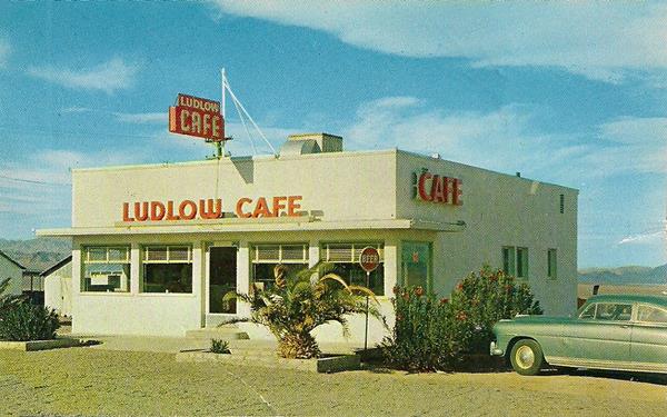
Earl W Warnix (1905-1968) and hiw wife Lillian L. Mitchell (1906-2002) ran the property for over twenty years and then retired. In the 1960s when he sold it to Cameron and Laurel Friend. ars by Earl and Lillian Warnix, it was sold in 1963 to Laurel "Lolly" and Cameron Friend (1926-2005) who owned other properties on the east side of Ludlow, including the next door 76 gas station. They spent the next 12 years building new businesses and and in 1975 they retired to the mountains east of Durango, Colorado where the spent the next 25 years ranching (4) (5).
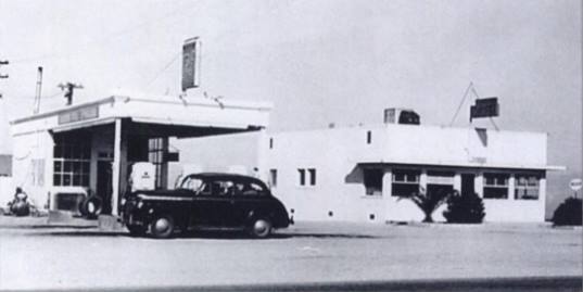
Ludlow Café and Union 76 in 1947, Ludlow Route 66. Source. Click to enlarge
Union 76 Filling Station
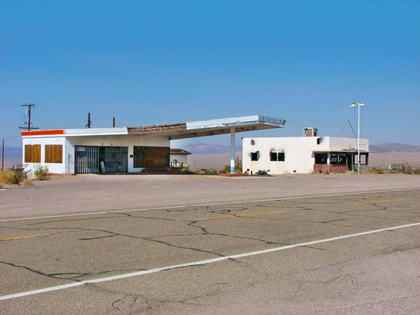
Next to the Café (to its left) is a gas station with an unusually shaped canopy: its a long trapezoid held up by a single column. This was a design used on the Union 76 stations; a Space Age Googie style typical of the late 1950s and early 1960s. Built at that time, it replaced an older icebox style station from the 1930s or 40s pictured above. The 1960s building is still standing, in poor shape. Below is a view of the Cafe (closed and burned out inside, but still standing) and the Union 76 when they were in better conditions back in 2009:
Ludlow Cafe (right) and Abandoned Union 76 gas station (left)
Ludlow Garage
Next to the Union 76, to your right is a shell of a former garage, the two service bays can still be made out, but the roofless building will surely disappear soon. Below is a view of it in 2021
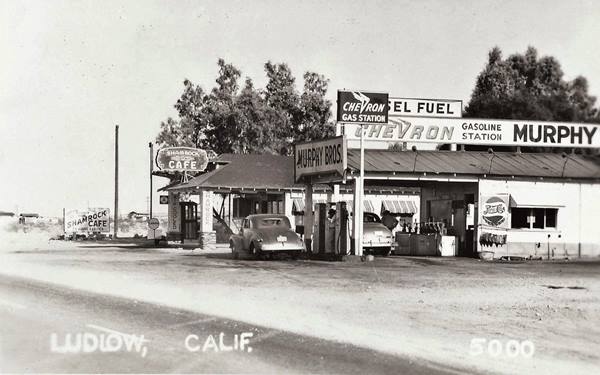
Shamrock Cafe & Cabins, Murphy Bros. Chevron Station ❌
The 1940s image below shows two businesses located on Route 66 both belonged to the town's virtual owners, the Murphy brothers (more on them further down when we describe their general store in downtown Ludlow). These two buildings have gone, they were the Chevron Gasoline Station and the Shamrock Cafe & Cabins. Murphy Bros. relocated to Route 66 when it was realigned along the current roadway in 1931. No exact address has been given, but we understand, based on the image below that it could have been located on the south side of the highway between the Motel & Post Office, and the site of the Modern Ludlow Cafe. This street view shows the foundations of a building, and to the left is one of the cabins of Pendergrast's Motel that also appears in the image below. The low hill in the vintage photograph coincides with the view towards the SE. If this is so, the image below was taken in the afternoon (light is coming from the west -right side of the image).
The old township
Just ahead is the "modern" Ludlow crossroads that Friend build up at the the freeway's Lupton Exit. The original town is one quarter mile to the south (left) along main street. The old railway depot was there and the stores, hotels and the first gas station on the N.O.T. highway were there too, Route 66 ran beside the tracks coming from Bagdad along Main St. and by the depot turned north along Main to continue eastwards towards Newberry Springs.
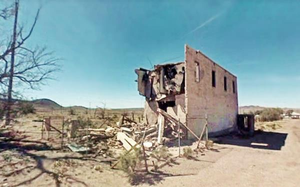
On the corner where Main St. turned north opposite the long gone ralroad depot are the ruins and a relic of Ludlow's past glory: Murphy Brothers Store.
Murphy Brothers General Store

Murphy Store in a 1913 photograph. Source
At Main St. and Railroad to your right, on the NW corner, you will see the remains of a concrete building, it has an interesting story.
Mary "Ma" Preston and her husband Tom who had opened a saloon and store very close to it in 1903 after they moved here to sell whisky to the miners. Then came a former miner, John Denair who built this two story building in 1908 next to their saloon, to compete with them. The Preston won the competition and ended up buying Denair's building by a foreclosure.

1923 ad, Murphy Bros. Source. Click to enlarge
It was during that boom period of mining in Ludlow in the early 1900s that the Murphy Brothers, Tom and Mike came to town and they they profited from it.
They soon grew their business and ended up owning a garage, general store, eating place, hotel, boarding house, and a saloon (for the thirsty miners). They competed with Mr. Lee, a Chinese and of course with "Ma" Preston. However when the Prestons returned to France after WWI, they sold their business and two story concrete building to the Murphys. The Arizona Good Roads Association published a guide back in 1913 showing their store, and the picture-advertisement shows their focus on tourists: "oil - gas- accomodations (sic) - information."
The ruins of the old Murphy Brothers Store in Ludlow
Below is a postcard showing the General Store in its better days ca. 1926 its facade read "Ludlow Mercantile Co. 1908".
A 1926 postcard of Murphy Brothers General Store
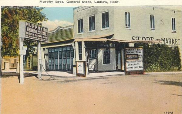
When business shifted from mining and railroad to Route 66, they provided travelers with their hotel, supplied them with their store and their garage was listed by AAA as a reliable place for repairs.
The 1920s guide of the N.O.T. road gave Ludlow a population of 350 and mentioned Murphy's: "Store, camp ground, hotel".
At that time they had rebuilt the store in reinforced concrete, a two story building. But in 1931, the road was routed north of the tracks, and Main St. stopped being the principal road through Ludlow. The focus had shifted to the north. The place began to languish.
After the opening of I-40 in 1973, the Exit by the Interstate became the only place for business. The store had closed long ago.
The Hector Mines Earthquake (7.1 magnitude) hit it in 1999 and the front of the building collapsed. Further damage came from the Chino Hills Earthquake in 2008. The place is fenced off for your safety.
Balloon Track Remains
The sleepers in the desert.

Route of the Balloon Track in Ludlow CA. A. Whittall
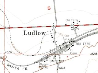
Map of Ludlow, USGS, 1954, the dashed line marks the T&&T's tracks
In 1933 the Tonopah and Tidewater Railroad (T&T) ceased operating, so its link at Ludlow with the Santa Fe Railroad was no longer necessary. When the flood of 1938 damaged the line, the owners decided to scrap it.
26 miles of steel track were removed beginning in 1942, working south from Beatty. This job was completed in 1946.
But the only thing that was removed were the steel tracks. Steel was a valuable resource. The sleepers were left behind and also the railroad bed, the bridge foundations, culverts, and drainage. You can still see them today.
As the image shows, the T&T tracks (marked with a red line) met the main Santa Fe RR line (shown in black) just a few yards east of Murphy's General Store at the old depot, and curved counter-clockwise from there in a wide circle, crossing Main St. just behind the Cafe and Motel (street view at this crossing point marked with a yellow circle on the right side of the image).
It then headed south before curving to the north again, crossing Route 66 and what is now I-40 (Yellow circles - St. view).
The yellow arrow marks one of the spots where the sleepers were left on the ground (Map with exact location, you can even make out the sleepers!).
Back to Route 66
Return to the main crossroads in town, at Main and Route 66 by the Freeway's exit. The buildings here went up when the Interstate was built to cater to those speeding past Ludlow along I-40. On the southwest corner there was a gas station (street view before it was torn down) with a flat canopy over two parallel pump islands and a single service bay, it offered towing services. It went during the Covid pandemic.
Ludlow Café
To your left, at 68315 National Trails Hwy, Ludlow, close to the SW corner of Ludlow Rd. and Main St., just to the south of Exit 50 on I-40 is the "Modern" Ludlow Cafe (that Friend built to replace the bypassed Old Ludlow Cafe).
The building has a high gabled roof and a modernistic style vitraux on the facade that faces the road. Back in the 1970s it was known as "Friend's Coffee Shop".
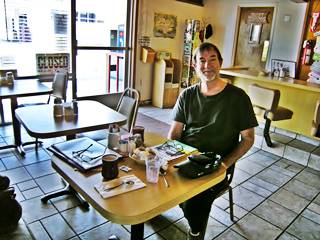
The author in Ludlow Cafe, Route 66. P. Eichenblat
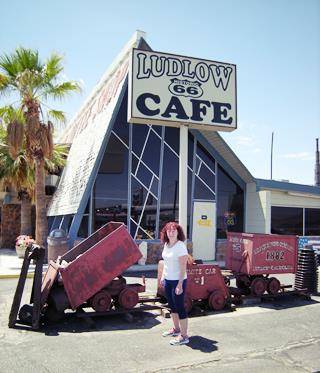
Author's wife Perla at Luldow Cafe. A. Whittall
There are some wagons used for carrying ore in a mine decorating the front of the Cafe and a small marker with two plaques on it.
The Carryall Project
Atomic Bombs to Build a straighter railroad and freeway
Marker and plaque in Ludlow
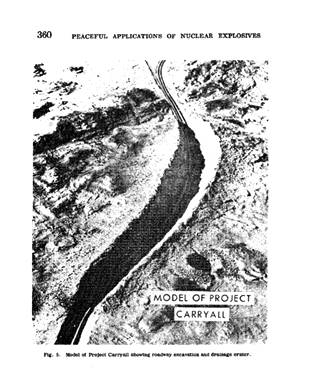
Carryall Project, model of the ditch. Source
Nuke a cutting across a mountain range!
In front of the Cafe at Ludlow there is a marker about the "CARRYALL Project" it was placed there by the Bureau of Land Management and the Billy Holcomb Chapter of the Ancient and Honorable Order of E Clampus Vitus in 2010.
The AT & SF Railroad planned a new line between Barstow and Needles with a shorter and straighter route, instead of curving south around the mountains via Amboy it would cut straight across them. It would also be more level to avoid climbing the mountain ranges along the route.
As conventional tunnel digging and excavation would be too expensive, the company got in touch with the US Atomic Energy Commission (AEC) in 1962, to explore the use of nuclear explosions to blast the new route across the mountain range.
Since 1957, the AEC had developed the "Plowshare" program, for the peaceful use of H-bombs with the idea of excavating harbors and canals using nukes.
As Route 66 was also needing a shorter alignment (the freeway would eventually be built as I-40) the California Department of Public Works (DPW) also joined the project.
The nuclear digging would employ 23 nuclear bombs with a total power of 1,830 kilotons to remove 68 million cubic yards of earth (52 million m3). This would create a trench across the mountains 2 miles long, 360 ft. deep, and around 900 ft. wide (3.3 km, 120 m, and 300 m respectively).
Scheduled to begin in 1967, the cut would carry the railroad and a four lane highway.
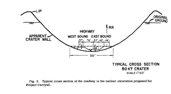
Based on the experience gained from the tests carried out at the Nevada Test Site, little radioactive fallout was expected. But in 1963 the US had signed a treaty that banned any tests that produced debris that crossed international borders (and in this case fallout may have reached Mexico).
DPW dropped out in 1966 and built the highway using conventional methods (6) (7).
Finishing our trip through Ludlow
T & T (Tonopah and Tidewater) Railroad Marker
Marker and plaque in Ludlow
There is a second marker in front of the Cafe at Ludlow beside the "CARRYALL Project" marker. The plaque tells the story of the Tonopah and Tidewater Railroad which contributed to the growth of Ludlow.
Former Richfield Service station
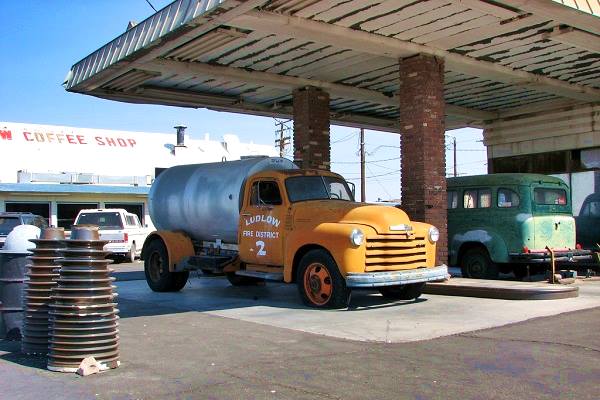
To the west of the Cafe. It has a flat canopy over two vintage trucks -one is a water tanker from "Ludlow Fire District" which has been there since the 1970s. The canopy is held up by two brick pillars. The box shaped building with brick veneer is a typical 1960s station design. It has two service bays and at one time it sported the yellow sign of "Richfield" gas, as shown in the postcard below from the early 1970s
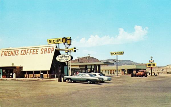
Trucks at the old Friend's Ritchfield filling station
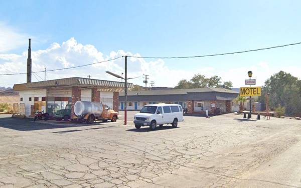
Ludlow Motel
Beside the gas station, on the western edge of Ludlow, to your left. The building has a mansard style roof with asphalt shingles. The Yellow sign with black letters says "Motel" and "Ludlow" written in red letters above. It has a linear layout, office in front and rooms behind.
The old Route 66 alignment continues westwards for another 1.3 miles but its course is cut by the freeway. It resurfaces on the north side of I-40. You will have to take the underpass here at Exit 50 to continue your journey.
Continue your Road Trip
Your journey through Bagdad ends here. Continue your road trip by heading west towards Newberry Springs.

Outdoors, National and State Parks
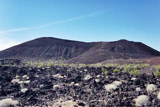
Pisgah volcano and lava field, Route 66. Source
Pisgah Crater in the Lavic Lake volcanic field
15.2 mi. west, on the south side of I-40 next to Route 66 in Pisgah. Map with directions.
It consists of a lava flow and a volcano, similar to the one at Amboy Crater.
Named after Mount Nebo, that in the biblical book of Deuteronomy is called "Pisgah". The crater is 2,545 ft. (776 m) high and stands over 350 ft. above the surrounding terrain (108 m). It is a cinder cone, of volcanic origin and caps a lava flow known as Lavic field.
It has been quarried (and lost some 100 ft. or 30 m in height in the process) to obtain ballast for the Santa Fe Railroad and therefore lost its former conical shape. Its base is around 1,600 ft (488 m) diameter, and the cone has several caves. The volcano has erupted several times, forming the Lavic Volcanic Field some 13,000 to 23,000 years ago. The cone resulted in its last eruptive event. The lava flows were quite extensive reaching 11 mi west and 5 mi south (11 and 8 km).
Mojave National Preserve
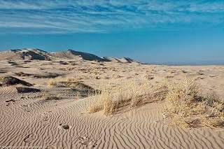
Kelso Dunes in Mohave Preserve CA. Credits
The Mojave National Preserve protects almost 1.6 million acres of desert habitat; it is a scenic National Park located just west of Needles, east of Barstow, between I-15 and I-40 and the California - Nevada state line.
Observe wildlife like the Desert Tortoise or Bighorn Sheep. Visit the "Hole in the Wall" area, the Cinder Cones, Cima Dome and Kelso Dunes (map to the dunes).
Read more at the National Parks website.

Sponsored Content
>> Book your Hotel in Needles


Credits
Banner image: Hackberry General Store, Hackberry, Arizona by Perla Eichenblat
A Guide to the Golden State, by the Federal Writers' Project of the Works Progress Administration, Hastings House, New York, 1939.
Jack DeVere Rittenhouse, (1946). A Guide Book to Highway 66.


