McLean The Heart of Old Route 66
Index to this page

TheRoute-66.com is reader-supported. When you buy through links on our site, we may earn an affiliate commission at no additional cost to you.
About McLean, Texas
Facts, Trivia and useful information
Elevation: 2,861 ft. (872 m). Population: 778 (2010 census).
Time zone: Central (CST): UTC minus 6 hours. Summer (DST) CDT (UTC-5).
McLean is located in Gray County, in the eastern region of the Texas Panhandle. The Texas Panhandle covers a rectangular section of northern Texas. New Mexico borders it to the west and Oklahoma to the east.
Most of it is flat (High Plains), and it is a relatively dry area averaging 20 inches of rain per year (500 mm); however the Ogallala Aquifer supplies water for irrigation of the loamy, clayey, and calcareous soils of the plains.
McLean's History
The Paleo-Indian ancestors of the Comanche and Kiowa Indians lived here over 10,000 years ago. Later Indians lived hunting the southern buffalo on the plains but after the US annexed Texas, a period of wars began. The natives lost and were displaced to reservations. This opened the land to pioneers. In 1901, the Rock Island Railway set up a switch in Gray County and it was around this switch that rancher Alfred Rowe donated 640 acres of land for a townsite that would become McLean.
He chose a spot which was next to the Chicago, Rock Island and Gulf Railway station where he shipped his longhorn cattle to the markets.
Rancher perished on the Titanic
Alfred Rowe (1853 - 1912). Born in Lima Peru was part of a wealthy English merchant family. He moved to the US in 1878 with 500 pounds and eventually settled on land he purchased in the Salt For of the Red River, in 1884. His RO Ranch covered 200,000 acres. He donated the land for establishing what would become the town of McLean next to the station where he shipped his longhorn cattle to the markets.
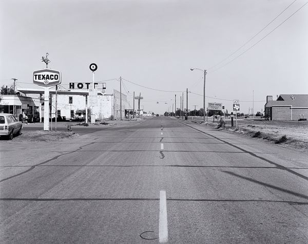
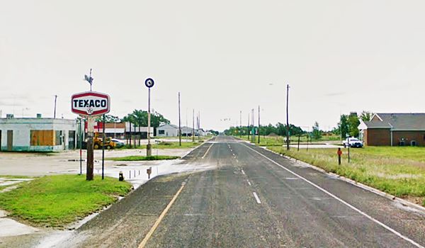
In 1901 he married Constance Ethel Kingsley and in 1910 he moved with his family back to England but returned twice a year to keep an eye on his ranch. On his April 1912 journey, he embarked on the HMS Titanic tragic maiden voyage. He refused to board a lifeboat and died of exposure. His body was recovered and buried in Liverpool.
Rowe and Kingsley Streets in McLean remember both his and his wife's names.
McLean, the town's name
The town was named after a Texan Civil War hero, Judge and representative in the State Legislature, William P. McLean (1836 - 1925) he was also secretary of the Texas Railroad Commission. Livestock and agriculture helped the town grow and it incorporated in 1909. C.S. Rice was its first mayor.
There are Two McLean's on Route 66
The one in Texas and another in Illinois: McLean IL
Oil in the mid 1920s and U.S. Highway 66 contributed to the town's prosperity during the Great Depression. By 1940 its population had reached 1,500 inhabitants.
A Prisoner of War Camp was built in 1942 to house German POWs, it closed in 1945.
Growth of Amarillo and Pampa led to a slow decline of McLean during the 1950s and 60s. Interstate 40 bypassed the town reducing the inflow of travelers.

Getting To McLean
McLean is the third town along I-40 and U.S. Route 66 after entering Texas from Oklahoma. It is 34 miles (55 km) west of the Texas-Oklahoma state line.
Heading west from McLean, it is 75 miles (119 km) to Amarillo and 150 miles (241 km) to the New Mexico state line. Shamrock is 19 miles (31 km) to the east.
Hotels in McLean
Besides the Cactus motel mentioned below, the closest town with a pick of places to stay is neighboring Shamrock, 19 miles (31 km) east of McLean.
>> Book your Hotel in Shamrock
Heading West
- 75 mi. Amarillo
- 84 mi. Vega
- 178 mi. Tucumcari
- 238 mi. Santa Rosa
- 356 mi. Albuqerque
Heading East
- 19 mi. Shamrock
- 63 mi. Sayre
- 81 mi. Elk City
- 124 mi. Weatherford
- 168 mi. El Reno
Book your hotel in neighboring Shamrock
Booking.com>> There are RV campgrounds close to McLean.
The Weather in McLean
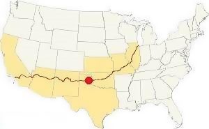
Location of McLean TX on Route 66
The area where McLean is located is quite dry and around 24 in (618 mm) of rain fall every year. It can be quite hot in summer with averages that range from 65°F (19°C) to values over 90°F (30°C). It cools at night.
Winters have averages that vary between 51°F (10°C) 26°F (-4°C), below freezing point. Snow: You may not associate snow with Texas, but they are linked: it snows in McLean starting around the first week of December. You may encounter snow between September and March. As it is a high area, snowfall is greater than in Oklahoma, and averages 18” per year (with maximum values of about 41”), that is: 43 to 103 cm.
Tornado Risk
Tornadoes in the Panhandle region: this part of Texas is located within the famous "Tornado Alley", yet it is highly unlikely that you may see one. Read more: Tornadoes on Route 66.
Map of Route 66 in McLean Texas
Check out McLean on our Route 66 Map of Texas, with the complete alignment and all the towns along it.
Route 66 began as a dirt road, but by the late 1930s had been paved. By 1956, Route 66 was already improved and had been upgraded to a four-lane divided highway all the way to Jericho, and the final part near Amarillo.
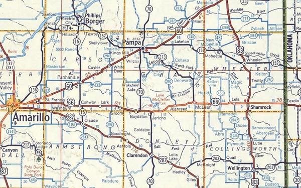
Coming from Lela to McLean, the original 1926-70s alignment ran along the South Frontage Rd. and at the eastern side of the city, took a SE-NW course into it. This approach is now cut off from the S. Frontage Rd. by I-40 (map from Lela to eastern McLean) so you can enter McLean just ahead at Exit 143, pass under I-40 and drive into the town along its 1st St.
Map with the alignment of Route 66 through McLean
US 66 alignment in McLean
The USGS map from 1963 shows that US66 was a divided four-lane highway at that time, and its eastbound lanes ran along Railroad St. while the westbound ones took 1st St.
The 1926-32 alignment, unpaved left McLean heading south along FM Rd 2695 and then west along a couse south of the railroad (roughly the one followed by BB Rd. nowadays) and entered Alanreed along its Main St. (map).
Route 66 Alignment near McLean
- Amarillo to Glenrio (next)
- Texola to Amarillo (McLean's)
- Clinton to Texola (previous)
McLean’s Route 66 Landmarks
What to see in town
We will tour McLean from east to west along Route 66. Starting at I-40's Exit 143 and heading west.
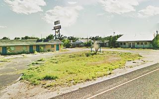
Texas Motel and Restaurant
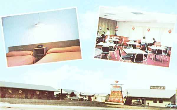
Facing both east and westbound lanes of Route 66, the Texas Motel & Restaurant opened in the 1960s as the "Dixie Motel".
It became the Texas in 1968. It is abandoned, but standing. You will see it on the 14000 block, to your left, at McCarty St.
The Dixie Motel had "23 units, some familiy units. Color TV... BankAmericard & Master Charge", at one time it was managed by Frank and Wilma Going.
After becoming the Texas, it replaced the sign for a large silhouette of the state of Texas but remained unchanged.
Watt Service Station and Motel
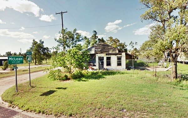
Facing the Texas motel, on the north side of 1st St., on its NE corner with McCarty, is what is left of Watt Service Station and Motel, also known as Watt Courts.
It opened in 1940 and is in poor shape, slowly falling apart. It had a linear lay out, facing the highway.
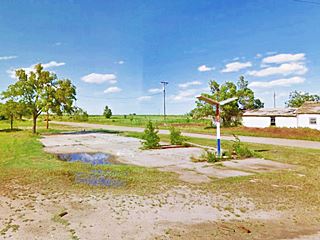
Gulf Station
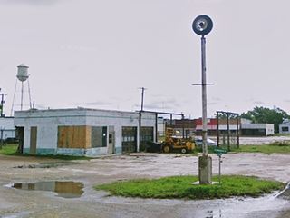
Across the street from Watt's, on the NW corner of McCarty and 1st, are the remains of a Gulf Service Station from 1940, concrete apron, pump island, and lights. The building was torn down. Below is a "Then and Now" set of pictures.

Gulf gas station McLean before demolition. Credits
Dorsey Service Station
On the south side of Texas Motel, on is another gas station, one that served eastbound drivers alonr E Railroad St.
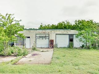
It opened in 1940, E. B. Dorsey's Service Station at 14012 Railroad St. is vacant and neglected.
Burma Shave signs
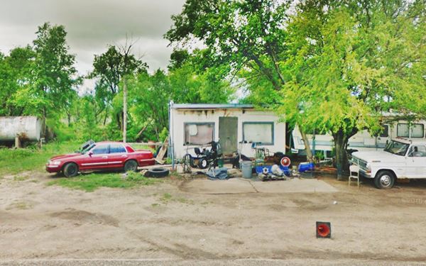
Continue west along First Street, ahead on the next block (700s) to your right is a park with some red signs with white letters that are designed to look like original Burma Shave advertising.
Burma-Vita was a company based in Minesota. Starting in 1926 with the creation of the U.S. highway system they began to advertise their "Burma Shave" shaving cream using these red signs. They spaced them some hudred feet apart, and each sign had a few words, that combined with the text on the other signs formed a rhyme.
Examples of Burma jingles: "Are your whiskers - When you wake - Tougher than - A two-bit steak? - Try - Burma-Shave" and "The bearded lady - Tried a jar - She's now - A famous - Movie star - Burma-Shave".
The signs in the park read "Going East - or Going - West - Route 66 - Does its Best - Burma-Shave." (Street view).
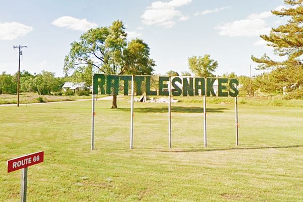
Rattlesnake sign
In the park you will also see the "Rattlesnake sign" salvaged from Lela's Snake Pit. It collapsed after a storm and was rescued and relocated here.
Devil's Rope and Route 66 Museums
Two blocks west, to your left, on the SW corner of Kingsley St. is the dual-purpose museum, "Barbed Wire Museum" and "Route 66 Museum" (100 Kingsley St.)
The brick building that houses the museum was once a bra manufacturing company!
Barbed Wire Museum
This is a unique museum exhibiting different varieties of barbed wire (did you know that there are over 2,000 types of barbed wire?) and also wiring tools.

Devil's Rope Museum. Credits. Click for St. view

Barbed Wire Hat at the museum
Until the invention of barbed wire, keeping cattle contained in a specific location required thorn hedges, stone walls or wood fences. In open terrain forks in rivers helped to retain errant cattle, but the open prairies of Western America needed something else, and that led to the invention of barbed wire. Patents were issued for steel wire fences after 1853. Michael Kelly from New York patented barbed wire in 1868. But the first practical wire as known nowadays was invented by Joseph F. Glidden of DeKalb, Illinois. He was granted Patent No. 157,124 on Nov. 24 1874.
A steel wire with steel barbs that were held in position by another strand of wire wrapped around the first. Strong and easy to manufacture, it was a success and earned its inventor the title of "Father of Barbed Wire". It was the most important factor in the economic conquest of the Great Plains.
Barbed Wire and Route 66 Trivia
Did you know that... Glidden established a ranch in Bushland next to what is now U.S. Route 66, to demonstrate that his barbed wire was effective?
He started fencing in 1881 and proved the advantages of barbed wire. The eastern fence line of his ranch is nowadays Western Street in Amarillo. Heirs of Glidden still manage the ranch.
Route 66 Museum
Housed in the dual-purpose museum. This Texas Route 66 Museum has over 700 Route 66 artifacts in its collection, from road signs to advertising and even some snakes pickled in formalin from Lela's snake pit, and souvenirs from the POW Camp.
Vintage Station (Conoco? Magnolia?)
At 220 1st St., on the SW corner, this gas station that opened in 1950 faces the castle-like two-story brick First Baptist Church built around 1925, located across the street (church street view). It is a typical oblong box station, with a flat canopy with curved corners, double service bays, single pump island and three horizontal bands across the upper part of the building. Both (curved corners on canopy and multiple bands) mean it could have been a Magnolia or a Conoco staton.
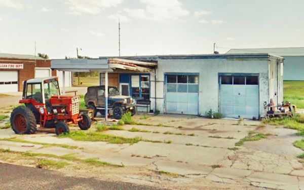
Another service station built in 1930 stood on the NE corner (street view) but was torn down and replaced by the storage facilities. All that remains is the concrete base of its sign (street view). Drive to the next corner. The Historic District starts there.
McLean Commercial Historic District
Listed in the National Register of Historic Places
The Historic District is defined by 2nd Street on the north, Railroad St. on the south and Rowe St. to the east and Gray St. to the West. The Route 66 corridor runs along 1st and Railroad Streets.
Uplift Capital of the World

A 1947 magazine ad, "Form-o-uth"
See it on page 163
At one time visitors arriving at McLean were welcomed by a colorful billboard that announced they had reached «The Uplift Capital of the World»
That was maybe a pun: travel and "road tripping" is fun and raises your spirits, but McLean also had a factory that made brassieres, which according to its advertising: «mold gently yet firmly to that graceful uplift that is youth's alone»
The Form-o-uth Brassiere Company of Gardena, California, opened a branch in the town in 1957. They closed in the 1970s and were a big employer in town.
During the economic boom years that followed World War II, in the late 1940s and 1950s, McLean greeted thousands of motorists who were crisscrossing the country vacationing.
During its heyday the town had 22 auto-related businesses and 17 of them were gasoline service stations. Other shops included tire repair and dealerships.
Bypassed by I-40, the town gradually froze in time in a state of arrested decay, a time capsule that is slowly being restored to its former glory. The town still retains its easygoing atmosphere of the mid-20th century, and its commercial district which was shaped by Route 66 and happy travelers.
Mantooth's Chevron

"Heart of Old Route 66" mural (gone) enlarge
Continue your tour. On the next block, at Rowe St. you will see two great vintage filling stations, Mantooth's Chevron and the Panhandle station.
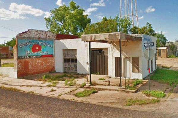
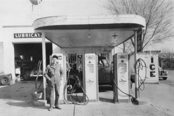
At 119 E 1st. To your right is Mantooth's Chevron (also known as Hotrod Haven), has murals painted on its walls. Built in 1945, it has two service bays with multi-light windows, a flat canopy over its single pump island. Which is an add on, the original was at a lower height and had rounded corners.
At one time the "McLean Heart of Old Route 66" with a 1950s Elvis Presley, rocking teens mural, graced the brick wall on the western side of the property. It has gone, replaced by a local boutique's billboard.
Panhandle Service Station
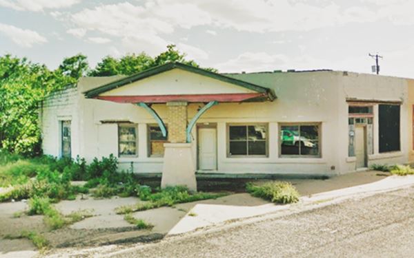
Facing Mantooth's, to your left, on the SW corner is the Craftsman-style Panhandle Service Station, built in 1925.
It was originally a garage and showroom for an auto dealership that in 1940 was repurposed as a Panhandle gas station. Panhandle Refining Co. was founded by Roy B. Jones in 1918 and operated until 1956, when it was acquired by Fina.
It has a single and centrally placed column that creates a sense of openness, gable roof canopy with wooden brackets. At one time the canopy had faux-Spanish tiles (tin tiles) and the yellow bricks were plastered with stucco to give the premises a more authentic Spanish apperance.

Brown Rexall Drugs neon sign. Click for St. view. credits
Main Street: Paved with red bricks and Rexall sign
On the next corner Route 66 meets Main Street, and it is paved with red bricks, as you can see in this street view.
On the SW corner is a great vintage neon sign "Brown Rexall Drugs". Rexall was a franchise chain of drugstores that operated from 1903 to 1977, that grew to have 12,000 stores across America. The 1933Sanborn Fire Insurance map shows a pharmacy on this corner.
One block north, on 2nd St. by the water tank is the tiny McLean Jail and some nice murals too!
> Read more about Brick paved sections of Route 66.
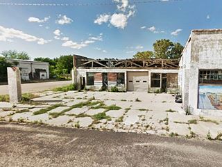
Texas Garage
Head west along Route 66. At 119 W 1st Street, on its NE corner, to your right, are the ruins and decaying remains of the vacant "Texas Service Station and garage", built in 1930. As you can see, the roof and facade facing the corner have been removed.
It was a Texaco owned by Emery Crocket who also owned the Crockett Texaco on Railroad St.

Texas gas station in 2006, credits
Across Route 66 (120 First St.), on the SE corner is an old auto dealership that opened in 1946 as the Dysart Motor Company, aFord Dealership. Later it became Ellison Motor Company, and finally Spalding Automotive.
Windom Auto Service
To your right, on the NW corner of Commerce St. (207 W 1st) is Windom Auto Supply, an Art Morderne building with a half-octagon facade facing Route 66. Next to it is the service and gas station section that has two garage bays, one on each side of the office, a flat canopy and single pump island.
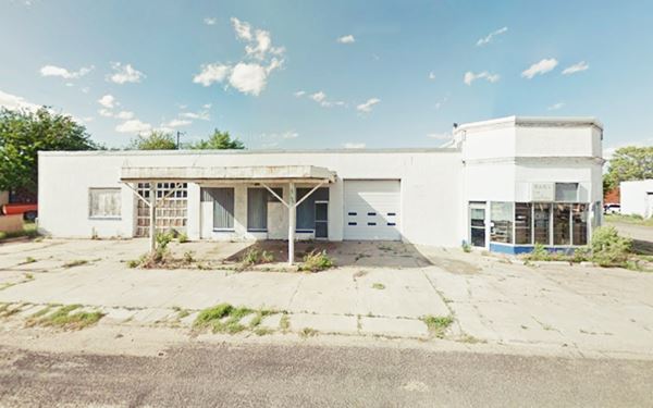
Oblong Box station
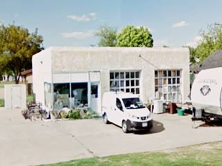
On the next corner (NE), to your right at 215 W 1st, is a Moderne styled one-story oblong box station, with two service bays and a corner office.
Built with concrete and stucco exterior it was built around 1950. Notice the bathroom ontrances on its wetestern facade.
To the left, across the street, is the famous Cottage Style Phillips 66 gas station.
Phillips 66 Service Station
218 West First St, on the southeast corner of Gray St. Route 66 reached McLean in 1926 and shortly after Phillips Petroleum Co. chose the town as the location of its
first gasoline station in Texas.
There is a plaque affixed the front of the Phillips 66 station that states that it was built in 1929, and the McLean Commercial Historic District Registration form
confirms the date and states that it was the first Phillips 66 in Texas, however other sources sya that it was not the first Phillips 66 service station built in Texas: that honor goes to the one built in Turkey, Texas, which opened for business one year earlier on July 27, 1928.
By the 1940s it was run by W.L. Copeland. It passed to Charles Weaver in 1959, who operated it until it closed for good in 1977. In 1991 the building was remodeled.
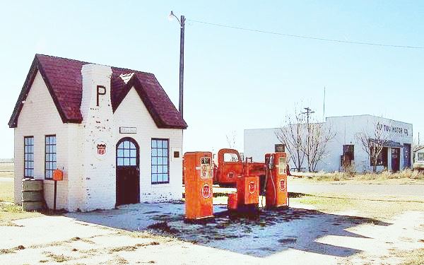
The building is surprisingly small for modern travelers (street view), it was built in Tudor Revival style (which imitated medieval English cottages with simple lines, steep pitched roofs, tall windows, brickwork walls and high chimneys).
Phillips 66
The Phillips brothers discovered oil in 1905 but their company (Phillips Petroleum Co.) did not open its first gasoline station until 1927, when it purchased a small Texan refinery. "Phill'er Up": Their first service stations opened in Wichita, Topeka, Salina (Kansas) and Bartlesville (Oklahoma) and were located close to the railway because gasoline was transported in tankcars. The gas stations were designed to blend in with the local neighborhoods, which were residential and that was the origin of the "cottage" look.
The company developed a high-octane gasoline in 1927 and ran a test drive along the brand new U.S. Highway 66. The car reached a cruising speed of 66 mph so inevitably the fuel was named "Phillips 66". The highway's shield shaped road sign inspired the company logo.
Guyton Motor Co - Gone
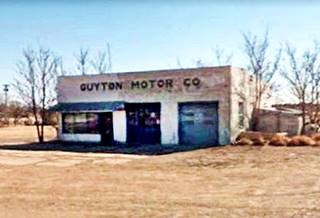
Guyton was torn down (vacant lot). It was located across the street from the Phillips gas station, it has a double bay garage and a wide concrete parking apron. Raymond Guyton ran it. He had a tow service and repair garage from 1950 to 1998.
Graham Hotel
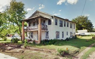
Across the street, to your left is an imposing two story building, at 313 W 1st. It is the Graham Hotel built in 1930. It has a roofed balcony above the front porch, held up by two solid brick pillars.
Cowboy Drive-In and Gas station
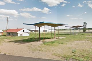
Head west, Route 66 curves to the SW away from 1st St. to meet the eastbound lanes. In the triangle-shaped area to your left, between the eastbound and westbound lanes, you can see a gable-roof building (red roof on the left side of the image). It was the Cowboy Drive-In ca.1940s.
On the same block, is a former gas station, on the corner with Walnut St.
Built in the 1950s its detached butterfly canopies are still standing over the empty pump islands.
Both Conoco and Enco adopted this kind of canopy from 1950 to 1970.

Cactus neon sign of West Wind motel. Credits
Cactus Inn Motel
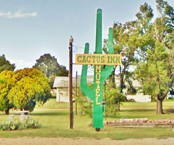
Ahead, to your right, on the corner of Pine (101 Pine St.) and Route 66 is the "Cactus Inn Motel".
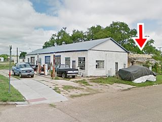
In case you are wondering, yes, the motel's neon sign is shaped like a cactus, at one time it was the West Wind Motel, and the cactus had that name written on it (red arrow in image).
It was built in 1956 and still has a definite 50's air to it. Cacti planted by the sign add to the ambiance.
Its postcard below reads "Located in the heart of cattle, oil and ranching area of Texas... E.J. and Grace Windom Owners and Managers."
It is relatively unchanged and still open and operating also as an RV campground.
Below is a "Then and Now" sequence of the classic motel.
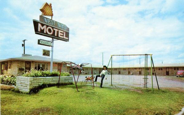
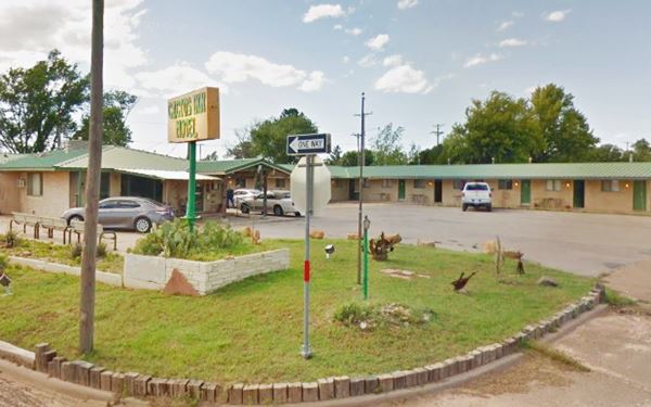
On the next block is the ranch-style "Red River Steak House", built in 1977, and on the following block, just past CR-273, to your right is Miller's Truck Stop.
Miller's Chevron
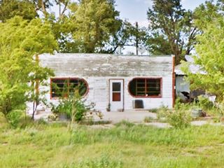
This building with rounded windows, was, according to the The Texas Historic Resources Survey Inventory a Chevron gas station that opened in 1935, Miller's Truck
Stop. Another source says that George Graham built it in 1936 as a Café with a clear Streamline Moderne style and that it was acquired by Edith Smith Bybee in 1957.
This is the end of your westward tour of McLean, just ahead, you can turn around and head east along the eastbound lanes of Route 66 into McLean to see the remaining sights in town.
Eastbound Route 66 through McLean
More US 66 classics
Wade's Overnite RV Park
As you drive east, you will once again pass by the butterfly canopies and Cowboy Drive-In; on the NE corner of Cedar St. you will see a neon sign. We believe that here was the site of the now defunct Wade's Overnite RV Park. A 1969 advert announced it as being "Inside west city limits of McLean between E.&W. lanes of US.66. 40 tent or trailer sites... Complete laundromat. Grocery, ice, cafe nearby. Pets on leash. Open all year." All that remains is the building to the right on Cedar St. and this sign.
Old Gas Station
Ahead, to your left, on the NE corner of Clarendon (319 Railroad St.) Is a 1940s service station. The one story, box shaped building has three service bays, and is in bad shape, overgrown.
Crockett Texaco
Continue eastwards and on the NW corner of Commerce St. at 201 Railroad, is Crockett's Texaco.
This classic gas station was owned by Emery Crockett. It is a one-story building, with a flat roof and a rectangular layout. It had its office on the corner, and two service bays which have kept
their original glazed wooden roll-up doors.
It dates back to 1952 and still has its original Texaco sign. You can see it below, and also in the 1995 picture further up, looking east along Route 66.
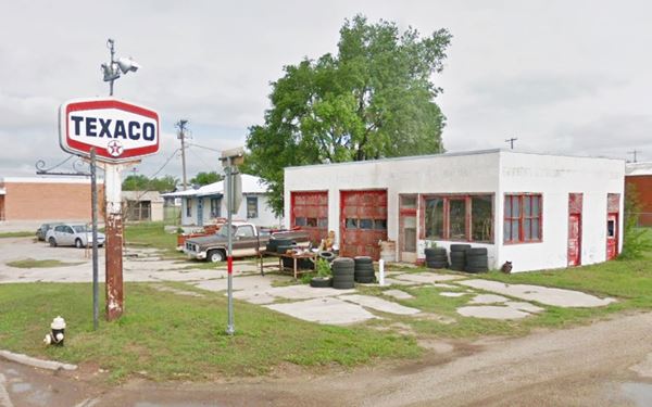
Tire gas station
Across the street from the Texaco, on the NE corner of Rowe and Railroad St. is a one-story gas station from 1952. It has a box-shape, corner office and the service bays have the original twenty-light glass and wood doors. Its butterfly canopy has been removed, but the steel posts remain and also the tall metal pole on the corner topped with a wheel and tire. Pictured below.
Continue east, on the now empty NW corner of Main and Railroad St. once stood a large hotel, known as the O'Dell (postcard) , and later as Hindman Hotel (postcard). See a street view before it was torn down.
Consumer's Supply Co. station
On the next corner at 119 E Railroad St ,is another ancient filling station. Consumer's Supply Company. It was built in 1955 and owned by Ted Glass and Arthur. They moved their store here from Main St. when the eastbound lanes of Route 66 were aligned along Railroad Street.
It was a gas station and also sold spare parts. The pumps are the original ones! Notice their light fixtures.
On the eastern side, on Rowe St. (red arrow in picture above) is the original grocery store, now boarded and falling apart.
This marks the end of your McLean City Tour.
Tours & Itineraries
World War II Prisoner of War Camp Site
Texas Historical Commission Marker
It is 4.5 miles NE of McLean (Map with directions). Take Exit 146 on I-40 2 miles east of McLean and go north along CR 5280 (county line road) for 1 mile. There is a historic marker on the NW corner of CR 5280 and Z Rd. (street view).
The camp was on the grounds of the current municipal airport. Some ruined remains of the buildings can be seen from the marker sign at the roadside.
The Prisoner Of War (POW) camp at McLean was formally known as a Permanent Alien Internment Camp, and it was set up during World War II. Construction began in September 1942 and the first German prisoners arrived in July 1943. The camp had almost 30 buildings which accommodated military and civilian personnel as well as three compounds for the POWs.
There were also other buildings: quarters for bachelor officers and nurses, hospital, barber shop, theatre, laundry, Post Exchange and fire department. The first prisoners had been captured in North Africa, and had fought in General Erwin Rommel's Afrika Korps. The camp housed over 3,000 prisoners by October 1944. After the war ended, the camp closed in July 1945.
Some sponsored content
> > Book your Hotel in Amarillo


Credits
Banner image: Hackberry General Store, Hackberry, Arizona by Perla Eichenblat
Jack DeVere Rittenhouse, (1946). A Guide Book to Highway 66.
Eloise Lane, White Deer Land Museum, Pampa, TX
H. Allen Anderson, "Rowe, Alfred", Handbook of Texas Online. Uploaded on June 15, 2010. Published by the Texas State Historical Association.
McLean Commercial Historic District, Texas Historical Commission


