Route 66 in Springfield IL
Index to this page
About Springfield Illinois
Facts, Trivia and useful information
Elevation: 558 ft (170 m). Population 113,273 (2022 est).
Time zone: Central (CST): UTC minus 6 hours. Summer (DST) CDT (UTC-5).
Springfield is the capital of the U.S. state of Illinois and the county seat of Sangamon County.
There are two Springfields on Route 66, the other is the city in Missouri: Springfield MO.
Route 66 also crosses two other capital cities: Santa Fe NM and Oklahoma City OK.
The History of Springfield
The central area of Illinois has been inhabited for over ten thousand years since the end of the last Ice Age.
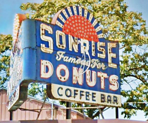
Sonrise Donuts Neon sign in Springfield, Illinois
The first Paleoindians evolved into the historic Kickapoo natives recorded by the first French explorers to reach area in the mid-1600s.
After American independence, the first white pioneers settled in Sangamon around 1810. During the 1812 War, the territorial Governor Ninian Edwards destroyed many Kickapoo villages leading to their surrender. They were forced to cede all their lands in Illinois (1819) and move west.
John Kelly built his cabin in what is now Springfield in 1820. At that time it was known as Calhoun.
Its good location made Calhoun the county seat of Sangamon County in 1821. The town changed its name and incoporated as Springfield in 1832.
Springfield's name
Calhoun was named after Senator John C. Calhoun of South Carolina. But when he fell out of favor, the local citizens changed it for Springfield, after the prosperous town in Massachusetts, that was named so by William Pyncheon in 1636 after his home town in Essex, England.
The town became the state's third capital in 1839 thanks to the efforts of an attorney named Abraham Lincoln (future U.S. President) and his colleagues.
It prospered during the Civil War (The war's first official death claimed the life of Col. Elmer E. Ellsworth, from Springfield).
An ancient native trail or "trace" was the first road in the region; it linked St. Louis with Springield and Peoria. Later a stagecoach line ran along the dirt trail. The Alton & Sangamon railroad (now the Chicago & Alton) reached linked Springfield with Alton on the Mississippi river in 1853.
With the advent of the automobile, a "hard road" was built from Chicago to St. Louis in the 1910s, it was called the "Pontiac Trail." A fully paved State Route 4 was built along it, in the early 1920s.
When Route 66 was created in 1926 its first alignment followed State Hwy. 4.
Route 66 was aligned through the capital city in 1926 and was realigned over the course of the years until its decertification in 1977.

Springfield, its Hotels and Motels
There are plenty of accommodation options on Route 66 in Springfield so you won't have difficulty to book your room in the city:
> > Book your Hotel in Springfield IL
More Lodging Near SpringfieldNeedles along Route 66
Below you will find a list some of the towns along Route 66 east and west of Springfield; click on any of the links to find your hotel in these towns.
Hotels to the West in IL
- 31 mi Raymond
- 60 mi Staunton
- 61 mi Williamson
- 69 mi Hamel
- 77 mi Edwardsville
- 83 mi Troy
- 85 mi Glen Carbon
- 87 mi Collinsvile
- 90 mi Pontoon Beach
- 94 mi Granite City
- 102 mi East St. Louis
Hotels to the East, Illinois
Hotels further west, in Missouri
- 104 mi St. Louis
- 101 mi Florissant
- 103 mi Hazelwood
- 107 mi Bridgeton (St. Louis airport)
- 118 mi Sunset Hills
- 120 mi Kirkwood
- 124 mi Fenton
- 131 mi Eureka
- 139 mi Pacific
- 157 mi Saint Clair
- 182 mi Sullivan
- 190 mi Cuba
- 198 mi Saint James
- 200 mi Rolla
- 238 mi St. Robert
- 239 mi Waynesville
- 273 mi Lebanon
Book your Hotel in Springfield
Booking.com>> Check out the RV campgrounds in Springfield, Lichtfield, and also in Raymond
Springfield's weather
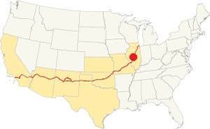
Location of Springfield on U.S. Hwy. 66, Illinois
Springfield's climate is a "humid continental type", its summers are humid, long and hot. Its winters are short, very cold, with a lot of snow and quite windy.
Its average yearly temperature is around 52.4 °F (11.3°C). The winter averages (Jan) are: low 21°F (-6°C) and high 35°F (1.7°C). The average summer (Jul) high is 86°F (30°C), and a low is 68°F (20°C).
Snow falls during more than 4 months with an average snowfall of 22 inches (56 cm) yearly. Precipitation is 35.3 in. (895 mm) per year.
Tornado risk
Sangamon county, where Springfield his hit by some 7 tornados per year.
Tornado Risk: learn more about the Tornado Risk on US 66.
Map with the alignment of Route 66 through Springfield
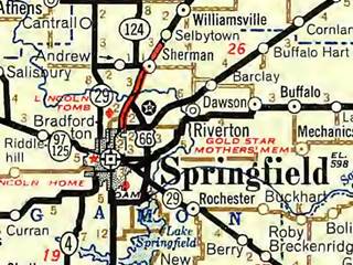
Roadmap of Springfield in 1946. Source
Click thumbnail map to enlarge
See this Interactive map of Route 66 alignments in Springfield.
It is color coded to show the years each alignment was used.
The thumbnail map (click on it to enlarge), shows Route 66 along the Bypass alignment west of the City alignment through the downtown, and in red, the four-lane highway from Springfield northwards towards Selbytown.
The Route 66 alignment in Springfield
Visit our pages with old maps and plenty of information about US 66's alignments.
- Route 66 Hamel IL to St. Louis MO (Next)
- Springfield to Staunton IL (1926-30 US66) south from Springfield
- Springfield to Hamel (after 1930) south from Springfield
- Pontiac to Springfield (previous)
Springfield's classic U.S. Hwy. 66 Sights
Landmarks and Attractions
Historic Context: The Village back in 1946
Jack D. Rittenhouse drove along Route 66 in 1946 and wrote his classic "Guidebook of Route 66." In it he mentions Springfield quite extensively. Coming from the north he writes that after crossing the Sangamon River you "begin to enter the outskirts" of the city. He added that those wishing to visit the city follow "the main route of US 66 [that] passes through the town, near the business district." He mentions the "Bypass 66" also as well as the Illinois State Fair Grounds "about 3 miles from the center of town."
Rittenhouse provides a detailed list of local sites:
garages: Uptown, Thomas, Motor Inn, Midtown... main hotels include: Abraham Lincoln, Leland, St. Nicholas, and Illinois. Courts include: Highway Hotel Ct., Bedini's Lakeview Cabins, Johnny & Janey Camp, Ahrenkiel Service Station Camp, Capitol Tourist Camp, Moderne CT., Poland's Modern Ctgs., and Sabattini's Cabins. A good cafe is Maldaner’s. Rittenhouse (1946)
Rittenhouse mentions the significance of Abraham Lincoln in Springfield, his home, and tomb.
On the south side of the city he mentions the junction with Bypass 66, the Lincoln Ordnance Depot, the bathing beaches at Lake Springfields and the Lincoln National Memorial Gardens.
Route 66 Road Trip: the Springfield Leg

1930 USGS Map of Route 66 roadbed (red line) and 1936 highway (dashed blue line)
To Drive Route 66 in Springfield. We will start our tour on the northern (east) tip of the city, coming from Sherman. After crossing the Sangamon River and passing through Riverside Park, the 1926 and later alignments of entered Springfield along Peoria Rd. At its junction with Sandhill Rd. the 1940s Bypass 66 forked towards the east to run around the city.
1926 Sandhill section: original Route 66
From 1926 to 1936 the highway took a sharp right here and then a sharp left to run along a very short section of Sandhill Rd., shown in the image and in this map with directions; also see the pink line in our custom interactive map. In 1936 it was eliminated by a straight segment (current Route 66 - dashed blue line in map).
Along the later alignment, there were three classic motels side by side.
Springfield Motel
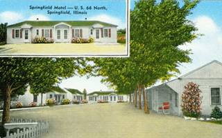
1950s Springfield Motel. Source.
Click on image to enlarge it
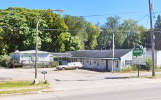
To your right, on the frontage road (4421 Peoria Rd); this is one of the few surviving motels and tourist courts out of the 34 businesses listed in the 1958 Springfield City Directory for US 66. Now housing a concrete business (Anders), the Springfield Motel's postcard announced: "Cleanliness - Comfort - Quiet - Modern ... Family Units Located on U.S. 66 North, just north of 66 BY-PASS." This is its current street view.
Little Chum's Lodge
One hundred yards south is the second motel: "A very friendly and fireproof motel... fifteen modern units comfortably furnished for the commercial man or the man with his family... Mr. and Mrs. R. F. Stine." Still standing. Below is a "Then and Now" set of pictures:
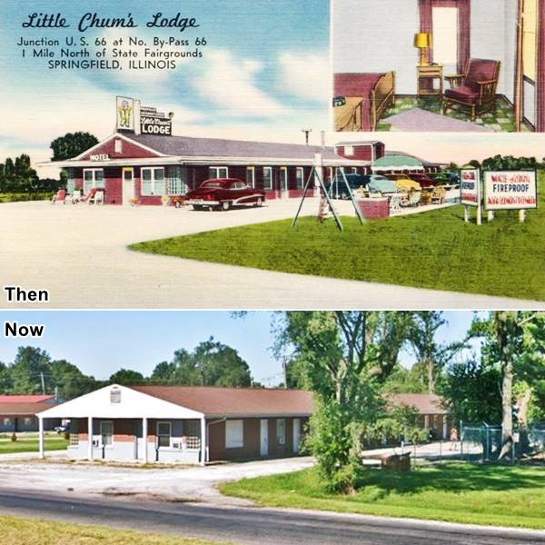
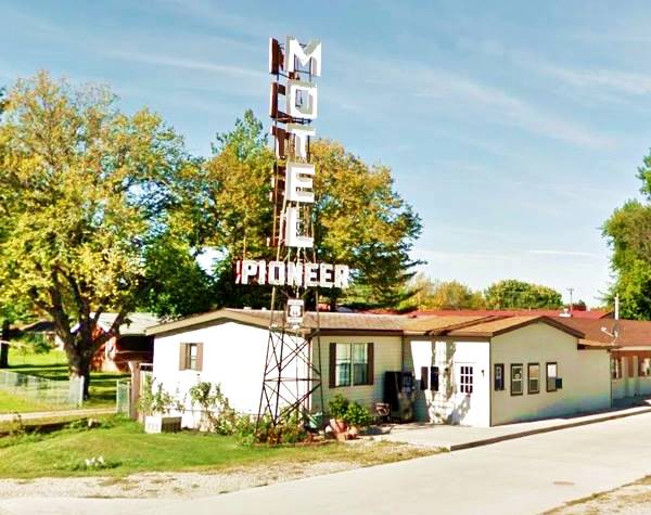
Pioneer Motel (still there)
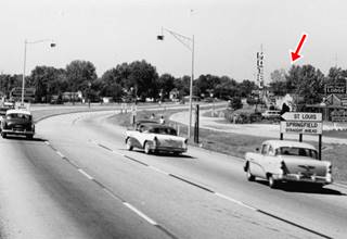
1950s view Pioneer Motel and Main US66. Source.
Click on image to enlarge it
Next to Little Chum's, to your right was The Pioneer Motel. Located at 4321 Peoria Rd. This motel dates back to 1951, it has the classic "L shaped" layout with gable roofs. Its main feature is its column-shaped neon sign. The black and white image (click to enlarge) shows the motel (red arrow), the adjacent Little Chum's lodge and cafe, as well as signs for the Bypass and City 66 alignments. There is also a sign for the Capitol Motel further down the road.
Few buildings have survived from the golden days of Route 66. We will describe the few that are still standing along City 66 and the Bypass 66; both meet on the south side of the city.
Attractions along Bypass 66
Route 66 around Springfield
The alignment is marked with a brown line in our custom map. Leave Peoria Rd. and City 66 by turning left along N. Dirksen Parkway to follow it. You will be meeting City 66 on the south side of Springfield.
When the Bypass 66 was built in the 1940s it crossed open fields and it ran through open countryside east and south of Springfield. That has changed over the years. The area has been built up and in the process most of the original Route 66 motels, gas stations and restaurants have been torn down.
Closer to the downtown area it was known as 31st Street but it was renamed Dirksen Parkway in 1974 after Everett McKinley Dirksen (1896-1969), representative and senator for Illiois.
Court Shamrock Motel
After driving 3.5 miles, to your left at 928 N Dirksen Pkwy is what originally was the Akers Motel. It has 7 units in a gable roofed single story building and it dates back to 1953. It offered television, air conditioning, carpet and telephones.
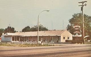
Court Shamrock Motel postcard, Springfield, Il. Source. Click image to enlarge
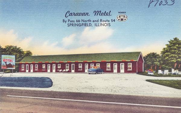
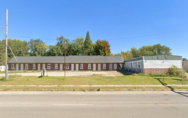
Caravan Motel
Next to the Shamrock at 900 N. Dirksen Parkway. The rectangular building with a gable roof now it serves as apartments and has an extra wing to the south. It had "All modern units, Fireproof, Tile Baths... Simmons Beauty Rest Matresses, Turk Furniture... Mr. and Mrs. Ira E. Tosh, Owner-Managers." Below is a "Then and Now" set of pictures:
Best Rest Inn
Two blocks ahead, to your left, at 700 N Dirksen Pkwy is the Best Rest Inn; the place was until recently the Dirksen Inn Motel.and during the 1950s and early 60s, Miler's Motor Court. It was built in 1953 and had 8 units in a rectangular building. This is its Street View.
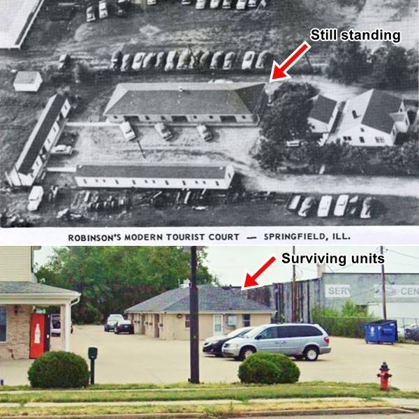
Robinson's Modern Tourist Court
Drive south for 0.2 miles; by E Linden Ave., to your left, at 304 N Dirksen Pkwy, is what now is the Lincoln Lodge, it used to be the Roginson's Modern Tourist Court with 22 All Modern Units. The hip roof building on the south side of the property can still be seen as marked with the red arrow in the "Then and Now" picture below.
Four hundred feet ahead, the red-brick two story Arrow Trailer Equipment building to your left has survived from the 1940s. At the crossroads with Clearlake Ave, to your right, was the long gone Parkview Motel (at 3121 Clearlake Ave.) opposite, to your left, where Freddy's is now located was a Phillips 66 gas station. Head south for 1⁄4 mile to Niccolls Rd., former U.S. 36.
Blakely's Standard Station
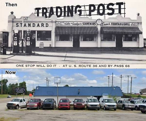
1940s view Blakely's station, Gift shop and Dinier (top) and same spot nowadays. Source, St. view.
Click on image to enlarge it
At the crossroads, to your left there is an old store, diner and gas station. The building has survived as the south wing of the current car dealership building on the NE corner of N Dirksen and Niccolls Rd. According to the postcard, it offered "friendly, dependable service" at the gas station and "Breakfast, Plate Lunches, Home-Made Pies at CRANE'S FOUNTAIN AND GRILL" plus souvenirs and gifts at Gorham's. Click image to enlarge.
Leonard's Modern Motel
Cook St. crosses Bypass 66 just 0.3 mi. south of Blakely's, here, to your right is another golden-age motel repurposed as apartments. It was located at 2224 E Cook St. "One mile west of By-pass 66" serving travelers along U.S. 36, 54 and 66 with its ten units. Below is its "Then and Now" view:
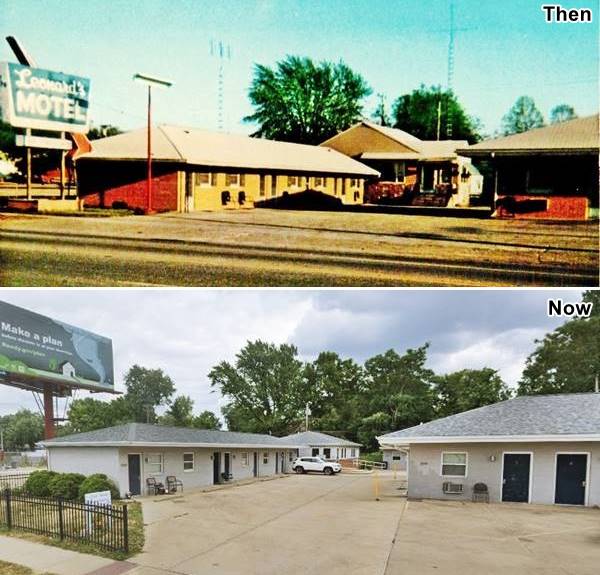
Continue south, and after another 2.5 miles. Where the Hilton Garden Inn is now located and in the field south of it was the modern Holiday Inn Hotel built in 1964. The original curve of Bypass 66 began here, but it has been altered by the construction of Exit 94 on I-55 ⁄ 72 and Dirksen meets A. Stevenson Dr. Turn right along it. This southern part of the Bypass 66 was originally known as Linn Street and was renamed Stevenson Drive in 1966 after Adlai Ewing Stevenson II (1900-1965), he had been governor of Illinois, presidential candidate (D) and the U.S. Ambassador to the United Nations.
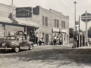
Lake Drive Market c.1950s Source. Click image to enlarge
After 1.3 mi. to your left is the former Evening Star Motel, that survives as part of the structure of the brick mall on the corner at 1405 Stevenson Dr.
Lake Drive Market & Hank's Cafe
Just ahead (0.3 mi) you will see another example of how the old scenery has changed is the now gone Lake Drive Market, with Hank's Cafe and a Standard Oil gas station (see picture - click to enlarge it); it was razed and now a Quik-n-EZ stands on the spot (St. view). Across Stevenson, was a Phillips 66, now a U-Haul. The building is still there, but you'd never know it had been a gas station.
Copp's Corner
A view of Copp's Corner
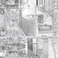
Aerial photo of Copp's Corner c.1940s Source. Click image to enlarge
One third of a mile west is the spot where City 66 Alignment heading south along 6th St. met the bypass 66. See the 1937-47 aerial photo (click on it to enlarge it). This spot was actually a corner (blue-dashed line in image) on Route 66 where it had a sharp 90° T-intersection on the old State Hwy 126. Then in 1930 with the new US 66 alignment to Staunton, a curved alignment was built to bypass the two sharp right-angle turns.
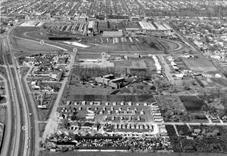
c1959-60 view of the south side of Springfield, Il. Click to enlarge. Source
The other aerial photograph taken around 1959 adds dimension, and looks north towards Springfield at Copp's Corner. The main landmarks are (1) South 6th St., (2) the "curve" on S 6th built on the 1930 alignment of Route 66. (3) Copp's Corner. (4) Bypass 66 along Stevenson Dr. North of it is the large Allis-Chalmers plant. (5) The Curve Inn. (6) The now gone Southern View motel. (7) Sunset Inn gas station and cabins. (8) the "new" four lane Route 66 alignment, now I-55 Bus.
Curve Inn
Illinois Route 66 Hall of Fame inductee
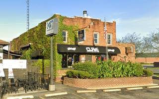
The place was named after Austrian-born Marion Joseph "Melio" Copp (1896-1982) and his wife Mary Ann who opened a bar (Copp's Corner) here in 1932. They also added a Shell Station here next to White's Auto Garage.
They ran it until 1945 when they sold it to Guido Manci who renamed it Curve Inn after the curve here. Neil McGillivray bought The Curve Inn in 1972. The current owners are Ray and Ami Merchant who purchased it in 2002. Located at 3219 S 6th St, it is the only surviving building from those days.
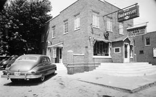
The Curve Bar, Route 66, c.1940s Source. Click image to enlarge
Next to it was the Southern View Motel (2007 Street view while it was vacant but still standing.) now there is a mall on the spot.
On the other side of I-55 Bus, opposite the mall, is the former East Springfield Holiday Inn built in the early 1960s, now the Route 66 Hotel and Conference Center (St. view.)
The 1930s U.S. 66 runs for a few more blocks to a dead end, cut by the modern I-55 Bus that replaced it. There is one final site on this section of S. 6th St.
Sunset Inn Cabins and gas station
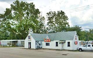
The old gas station building on the south side of the property has survived now it is a pub (3540 S 6th St) on the left side of the highway. The tiny cabins are gone. See the "Then and now" views with the old gas station to the right.
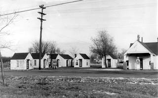
Vintage Sunset Inn & Cabins, Route 66, c.1940s Source. Click image to enlarge
This marks the end of this leg of Route 66. Follow the City 66 alignment across Springfield from north to south or continue south along the Final leg of Route 66 Southwards from Copp's Corner along modern I-55 Business spur.
City 66 Alignment
Route 66 Across Springfield
Starting on the north side of Springfield at the fork where Bypass 66 headed east, by the Pioneer Motel, continue south along Peoria Rd, the original 1926 Route 66 alignment across Springfield.
See it marked with a navy blue line in our custom map, and in this 1926-77 City 66 map from the Sangamon River to the business district.
There were two motels, a tourist camp and and two gas stations here, the motels have gone.; see them in this 1956 aerial photo.
Poland Modern Court ⁄ The Haven Motel
Located where Sandhill Rd. meets Peoria Rd., to your left. Now it is a trailer park and nothing remains of the old motel. It was built in the late 1930s by Roy and Alice Poland. They sold it in the 1960s to Darel and Marge Jones and it became the Haven Motel.
The image below (click on it to enlarge) shows it as seen from City 66; notice the original Sandhill alignment passing in front of the motel.
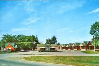
The Haven Motel Route 66, c.1960s Source
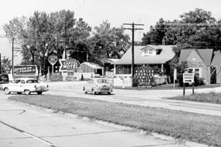
Capitol Motel Route 66, c.1950s Source
Capitol Motel
Located next to the Haven, on its southern side, it was ran by the Watts family, the image (click to enlarge) shows the junction of the old Sandhill alignment with City 66, to the right is the Haven, to the left is John Stuper's Sinclair station (Street view.)
Ahrenkiel Service Station Camp
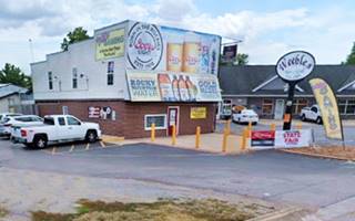
Mentioned by Rittenhouse in 1946 its postcard states: "Ahren Kiel's Tourist Court - U.S. 66, North". Nowadays it is Weebles bar. The old Standard Oil sign survived until now. Below is a "Then and Now" set of pictures.
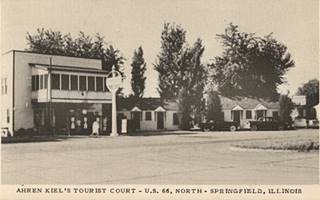
Ahren Kiel's Tourist Court and Standard station, c.1950s Source
Two Ghost Segments on City 66 & former Mo-Derne Court
Ahead was the now gone Mo-Derne Tourist Court owned by William Marsh and his wife; street view, now an open field.
As the highway approaches the railroad underpass ahead there is a section of the original U.S. 66 with the 1926 roadbed. The original road was upgraded in the 1940s to four lanes (as it is nowadays), and as it approaches the railroad underpass at Spring Creek, there are two old roadbed remains of past alignments:
1st: By the Campground. See the pale blue line in our custom map.
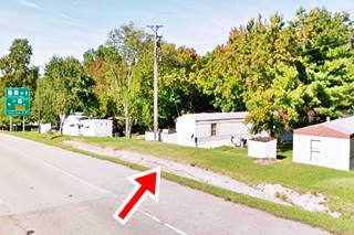
On the eastern side of the railraod, 1⁄4 mile from the railroad bridge, to your left, by the Campground, is a section of the original U.S. 66 with the 1926 roadbed (pictured). The strip of concrete serves as a side drain next to the shoulder, directing water downhill. You can see it in this satellite view (red marker) and in this 1946 aerial photo.

1940 USGS Map and 1926 roadbed (red arrow)
2nd: On the south side of the highway.
The eliminated segments at this point are marked with pale blue line in our custom map.
The surviving part of the second segment is shown in this map with directions.
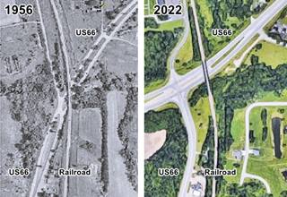
In the mid 1990s, the original alignment that curved as shown in our custom map, was modified when the Veterans Parkway was built: a "T" junction between North Peoria Rd and the parkway was built and the railroad underpass moved further north, the curve was eliminated. Click on the thumbnail aerial views that show the same spot in 1956 and nowadays. For more details check this 1956 photo and the 2022 view.
Northern Aire Motel
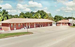
From the underpass, drive south for 0.4 miles to 2917 Peoria Rd. The motel is on the right: A rectangular hip roofed building facing Route 66, from the 1950s, with "16 Modern units" that was the Northern Aire Motel and now is the Countryside Inn. Still operating on Route 66.
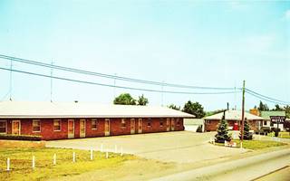
Northern Aire postcard, Springfield, Il. Source
Lazy A Motel
Listed in the National Register of Historic Places
Facing the Northern Aire, to your left at 2840 Peoria Rd.
It has a "U-shaped" layout, now it is an apartment complex. Its 13 Pueblo-styled units were built in 1948 in stuccoed concrete blocks. They had closed garages and the office and manager apartment was a two story building in the center of the complex.
The postcard pictured below says "...tile bath, locked garages, fireproof. On U.S. 66 (city route)..." It remains unchanged as you can see below:
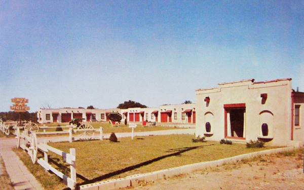
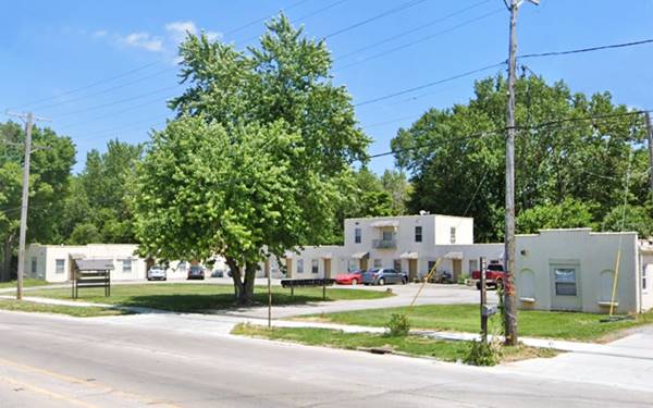
To your left is the State Fairgrounds. After 0.6 mi. at the next corner turn right along E. Sangamon Ave. To your left is the State Fairgrounds. Head to Gate No. 1 for an an example of Americana:
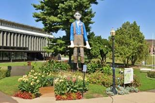
Rail Splitter: Skinny Abe Lincoln Statue
Americana and Kitsch
Located at the Illinois State Fair, Gate #1 801 E Sangamon Ave, Springfield. Right past the main Gate #1 is a 30-foot-tall statue depicting a clean-shaven "skinny" Abraham Lincoln holding an axe in his hands. It is also known as "The Rail Splitter" and it is the work of Carl Rinus, who made it in 1967.
Mahan’s Filling Station at Fulgenzi’s
Turn back along Sangamon Ave. and to your right, at 1168 Sangamon Ave, you will see a very Old Service Station.
The ancient Mahan’s Filling Station was moved here from former Shea's museum in Jan. 2016 and set up next to Fulgenzi’s Pizza and Pasta restaurant.
It is a gas station from the late 1910s. By the way Fulgenz's property is located on the site that once belonged to two Route 66 motels.
Ross Motel
Turn right along Peoria towards downtown Springfield, and just one block away, to your right at 2217 Peoria Rd. Springfield is an old former motel. Built in 1954 it is a long low building with an end gable roof, 8 units. The building survived though it no longer operates as a motel. Below is a "Then and Now" set of photos:

Ross Motel postcard, Springfield, Il. Source
Across Peoria Rd., to your left was the long gone Springfield Motel, now an open field (map marking the spot.)
Former Bill Shea’s Gas Station Museum
On the 2000 block to your right is the now closed Shea's Museum at 2075 Peoria Rd.
Shea's Route 66 Museum is closed and vacant. Two local residents Randy Pickett and Jake Niewold announced they'd convert it into a Route 66 themed auto-repair and maintenance shop (April 2017) but it didn't happen. In 2023, the City of Springfield accepted a $623,000 state grant to reopen the museum.
Route 66 Hall of Fame inductee William "Bill" C. Shea (1921-2013) owned and operated the site as a Texaco and Marathon Gas stationS from 1946 to 1982. He then built in 1995 a gas station museum on the spot. His collectibles were auctioned after his death.
One of its centerpieces was the vintage Mahan Filling Station rescued by Fulgenzi and moved nearby.
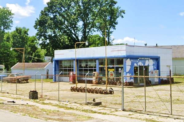
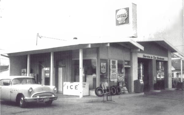
To your right at 1921 N Peoria is a former ranch style Shell station from the mid 1960s, with its sloping gable roofs over the office and service bays. Now a used car dealer (Street view), the column-like structure with the Shell sign has gone. Pictured below.
Drive south along 9th St. into Downtown Springfield. There are several spots to visit in this district, as well as three different Route 66 alignments. We will describe them in the next section.
Downtown Springfield
1926-30 Route 66
We show its alignment with an orange line in our custom map. It crossed the downtown along W Capitol Ave. and S 2nd St. and then west along S Grand Ave.
1930-32 Route 66
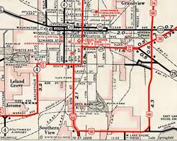
1957 roadmap of Springfield, Il. Click to enlarge. Source
Realigned along S 6th St. (red line in our map) which in those days carried traffic in both directions. Now it runs south to north.
After 1932
It ran in both directions along 9th St, S Grand Ave, and then along S 6th (see the blue and violet lines in our custom map.) The map published in 1957 shows this alignment. Only in the early 1960s was the traffic split between S 5th (southbound) and S 6th (northbound).
Sights in Downtown Springfield
Lincoln Depot
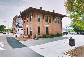
Drive 9th till you reach E. Monroe St., turn right by the tracks to your right, on the next corner, at 930 E. Monroe Street is a red-brick building that served as the Great Western Railway Depot, built in 1852 and from where Abraham Lincoln set off to Washington as President-Elect in 1861. He delivered a speech here aboard the special train that took him to the Capital.
Sonrise Donuts
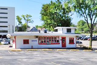
Continue south till 1101 S 9th St., to your left is the building of the old Sonrise donut shop; now a taco restaurant. Here stood the neon sign that dates back to 1956 and that in 2018 was auctioned and purchased by the city for $22,000. The two 6-by-8-foot porcelain neon sign panels were restored by Ace Sign Co., in 2019 and one is on display at Ace Sign Co Museum and the other at Route 66 Motorheads Bar and Grill.
The sign is pictured at the top of this page See image while it still stood at its original location.
On the 500s block of S 9th St was the 1960's three-story, L-shaped Travelodge (gone).
Ahead, take a right along S Grand. To your right on the corner is a box-shaped former gas station with three service bays. The pumps island is still visible (St. view.) Turn north (right) along S 6th St. to head back into downtown Springfield.
Leland Hotel
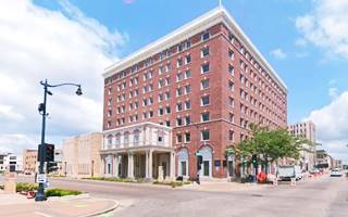
To your left, on the NW corner at E Capitol Ave (527 E Capitol Ave) is a classic hotel. Mentioned by Rittenhouse in 1946. The original hotel opened in 1867, after a fire in 1908 it was rebuilt as it stands now, in 1911. It served as a hotel until 1970.
Now it houses the Springfield office of the Illinois Commerce Commission. The local specialty, the horseshoe sandwich was first served here in 1928.
It was used by Gov. Adlai Stevenson as his campaign HQ during his bid for the presidency in 1952.

Leland Hotel vintage postcard, Springfield, Il. Source
Illinois State Capitol
As you look west (left) along E Capitol Ave, you can see the "new" state Capitol building, located at 301 South 2nd St.
State Capitol since 1877. It is crowned with a 405-foot dome (123.5 m). Guided tours available. The legislature is in session Jan-May and Oct-Nov.
Don't miss the statue of Lincoln in front of the building or the replica of Liberty Bell near the fountains on the Capitol's lawn.
Maldaner’s Restaurant
Continue north along South 6th, and ahead, at 222 S. 6th St Springfield
The restaurant opened in 1884 and is one of the finest in town. Rittenhouse mentioned it as being a "Good Cafe" its sign states "Oldest Restaurant on Rt. 66" (St. view.)
Old State Capitol
Listed in the National Register of Historic Places, State Historic Site and a National Historic Landmark
On the next square to your left on the block of S 6th St & E Adams St
Built in the Greek Revival style between 1837 and 1840, it was the state house from 1840 to 1876. When it was replaced by the current Capitol building.
Abraham Lincoln in 1858 and Barack Obama in 2007 announced their candidacies here. It was the county courthouse of Sangamon County from 1876 to 1966.
Abraham Lincoln Presidential Library & Museum
Two blocks further north at 212 North Sixth St. It has the world’s largest collection of documentary material related to Lincoln. Multimedia and interactive displays and a reproduction of the 1861 White House. Here, at E. Jefferson St. (IL-97) turn left and on the 7th block, to your left is a Historic Drive-Thru.
Maid-Rite Sandwich Shop
Listed in the National Register of Historic Places
To your left, at 118 N. Pasfield St.
This Maid-Rite Sandwich Shop is one of the few remaining in America. This restaurant opened in 1924 and was ran by Clyde Holbrook for the next 20 years. In 1926 he became part of the Maid-Rite franchise, and claims to be the first drive-thru window in the U.S.
South side of Springfield
City 66 South of Downtown
Sixth Street carried north and southbound traffic along City 66 until the early 1960s when it was split: northbound along 6th and southbound along 5th.
A drive southwards along S 5th takes you across pleasant wooded suburbs with nice homes.
When you reach E Ash St. take a short 0.7 mi side trip (map with directions) to visit a vintage neon sign museum.
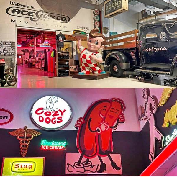
Ace Sign Company Antique Sign Museum
2540 South 1st Street
The Ace Sign Co. is over 75 years old and their museum has a collection of 85 signs, including those (and artifacts) from the now gone Bel-Aire Motel, and the Sonrise Donuts neon sign. More information at the Museum's website
Return to 5th Street to continue your southwards drive. On the south tip of 5th Street, you can take a side trip (1.6 miles - Map with directions) to see another classic attraction:
Lauterbatch Muffler Man
Americana and Kitsch
At 1569 Wabash Ave. Springfield
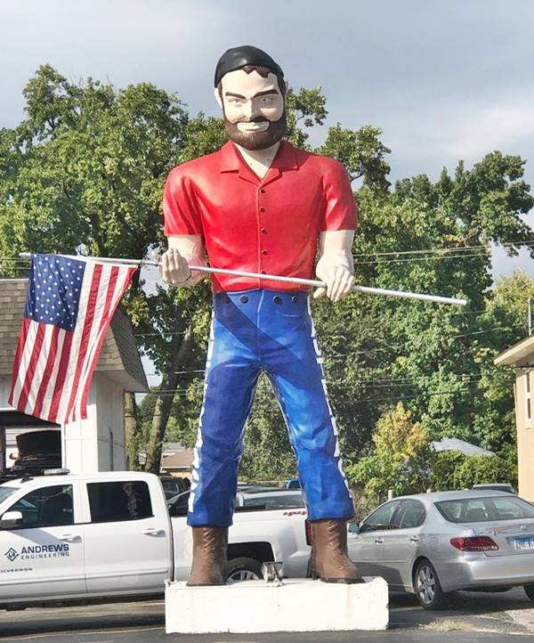
Erected in 1962, the Gigantic Tire Man was first displayed as advertising in the tire business owned by Russ Lewis on State and Laurel Streets in Springfield Illinois. He sold it shortly after. to the McGaughey Brothers, owners of the Roundup Cafe and Motel in Farmersville.
The Roundup had it until the motel closed in 1978 when I-55 was completed and their business lost customers; the Lauterbach giant still survives (having changed the tire for an American flag) in the parking lot of the Lauterbatch Tire and auto service.
Lauterbatch giant Muffler Man in Springfield, Illinois
>> Learn more about the other Muffler Men on Route 66
Retrace your steps back to S 5th St. and continue your journey. It merges into S 6th St becoming a wide avenue. This area has been greatly modified when the narrow street was widened in the 1950s. Ahead is a classic stop:
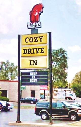
Cozy Dog Drive-In
To your right, at 2935 South Sixth Street. This was originally the site of the Abe Lincoln Motel
Not only a restaurant, but also a place full of clippings, old signs, exhibits and also Route 66 souvenirs for sale.
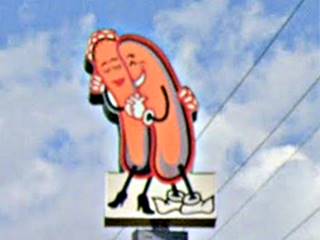
Its cute neon sign with hugging hot dogs is a classic on Route 66.
The Cozy Hot Dogs opened next to Lake Springfield in 1946 an sold the invention of Ed Waldmire, who came up with the idea of "Corn dog on a stick," a wiener fried with a corn batter while serving in the Air Force during WW II. After his leaving the army in 1946 he decided to sell them, his wife came up with the cute name "Cozy-Dogs."
Their first Cozy Dog House was located on South Grand between 5th and 6th St. Waldmire retired in 1975. In 1996 Cozy Dog moved to its current location, and is operated by Ed's Grandson Josh Waldmire. Ed's son, Bob Waldmire (1945-2009) also worked at the Cozy Dog, but later became an artist, traveling as a nomad in his school bus along Route 66. He retired in Hackberry AZ, and continued working towards the preservation of Route 66.
Continue along 6th Street to Copp's Corner where it meets the Bypass 66 alignment and the dead-end section along S 6th St, that ends half a mile south. Take I-55 Bus southwards.
Final leg of Route 66 Southwards from Copp's Corner
Towards Lake Springfield
Route 66 was a 2-lane highway south of this point when Rittenhouse drove along it in 1946. It was upgraded to a 4-lane alignment in the early 1950s. And by 1964, I-55 had been built over the old 4-lane highway, obliterating it.
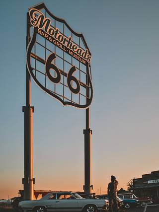
Route 66 Motorheads Bar and Grill & Museum
Cozy Dog Drive-In sign on US 66, Springfield, Il. Source
Modern Route 66 Attraction
At I-55's Exit 90, to your right, on the western side of the freeway at 600 Toronto Road.
It is Home to the worlds largest Route 66 shield measuring 32 by 32 feet (9.75 m per side) set atop two steel poles 60 feet (18.3 m) tall.
It offers food, live music and an assortment of Route 66 neon signs and billboards on the property and in the Museum.
Set in a 1971 Stuckey's the building is decorated with the original red neonsign with white letters of the former Bel Aire Motel, torn down by the city in summer 2015. See this street view of the complex with the Bel Aire sign and the giant shield.
Ahead at Hoechester Rd. (take the East Frontage Rd. to get there) is a former motel and two now gone lodging sites.
Inn of the Lamplighter
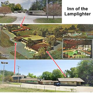
Then and Now views, Inn of the Lamplighter, US66 Springfield. Source, St view 1 & 2.
Click on image to enlarge it
Located to your left, on the east side at 6600 S 6th St (E Frontage Rd). Its postcard tells us it was located on an 8 acre property, with two heated pools, a lagoon, fireplace and color television in the lobby. Owned and managed by James R. Grady.
It had a series of buildings starting with a semi-circular group of units on the north side (still standing), and the main building and restaurant, and pools to the south (also still standing). You can see it in this 1966 aerial photograph looking soutwards. When I-55 was built and no Exit provided for the motel, it closed.
The other two sites no longer exist, and were:
Colonial Tourist Home (gone)
It was owned and ran by Harold John Hoechester (1885-1962) and his wife Anna Talbot. Harold was the son of pioneers who had settled here in the 1850s. They adapted their two story hip roof home into a "hotel" that let rooms to tourists. It remained in operation from the mid 1930s to the mid 1950s. Nowadays it is a Christian congregation at 6439 Canadian Cross Drive. You can see it in their postcard and also in this 1966 aerial photograph
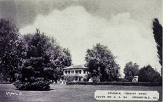
Colonial Tourist Home c.1930s on US66. Source. Click on image to enlarge it
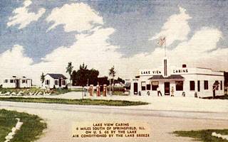
Bedini's Lake View Cabins. Source. Click on image to enlarge it
Bedini's Lake View Cabins
Mentioned by Rittenhouse in 1946; located opposite the Lamplighter, just south of it along Canadian Cross Drive. Their postcard stated they were "air conditioned by the lake breeze. Adolph Bedini was the owner and his some, "Smiling" Sam Bedini helped him run it. Adolph had migrated to the US from Italy, worked in coal mining, ran a gas station and even owned a pottery business (Bedini and Sons) in Springfield. They opened the gas station and cabins in 1941 and closed when the Lamplighter opened.
You can see it in this 1940s aerial photo on the lower left side of the image, just south of the crossroads of Hoechester Rd. and US66. Nothing remains of the site.

Current map showing flooded area (Lake Springfield) that cut the 1930-35 alignment of US 66 south of Springfield in Cotton Hill
The 1930-35 Alignment of Route 66
Here the highway originally followed a different alignment until the creation of man-made Lake Springfield in 1931-35 flooded part of the roadbed by the lake.
We describe this segment in detail in our webpage on the Springfield to Hamel 1930-77 alignment, and marked it with a green line in our custom map.
It begins on the eastern side of the freeway northwest of Toronto Rd., and then curves to the south towards Sugar creek. It passes under the railroad tracks and then is cut off by Springfield lake: the last section where it originally crossed Sugar Creek is now submerged under the waters of the lake. The old road resurfaces on the south shore of the lake.The now submerged bridge and viaduct is marked with a white line in our custom map.
It resurfaced during a severe drought in 1954 as you can see in the image.
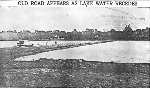
1930-35 US 66 viaduct at Sugar Creek reappears in 1954. Source
In 1932 A new bridge and alignment were built where I-55 now runs, for the 2-lane U.S. 66. In 1967 a new bridge was built beside it to carry the eastbound traffic (the old one carried westbound vehicles). They were replaced in 2001 (WB) and 2002 (EB).
Lake Springfield
The lake covers 4,260 acres (17200 ha.) and is Springfield's water reservoir. Set at 560 feet (171 m) above sea level it was formed when the Spaulding Dam was built across Sugar Creek in 1931-35.
On the south side of the lake the road split, with the E Lake Shore drive forking eastwards, and Route 66 running along the lake shore in a short segment that still survives on the south side of the river.
Surviving "Marina" segment
Shown in this map with directions, a short section of the original road survives here as I-55 was built further east. It is the Water Edge Drive, and runs parallel to the lake's shore at the local Marina. You can see it in this 1956 aerial photo
Further south this 1950s "freeway" is named Palm Rd., it has a narrow grass median strip.
Continue your Road Trip
Your journey through Springfield ends here. Continue your "Route 66 Road Trip" by heading west towards the next stop along the highway: Glenarm.

Sponsored Content
>> Book your Hotels in Illinois

Credits
Banner image: Hackberry General Store, Hackberry, Arizona by Perla Eichenblat
Jack DeVere Rittenhouse, (1946). A Guide Book to Highway 66.


