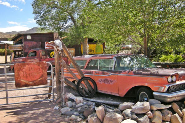
Vintage cars and Route 66 Memorabilia
Index to this page

TheRoute-66.com is reader-supported. When you buy through links on our site, we may earn an affiliate commission at no additional cost to you.
About Hackberry, Arizona
Facts, Trivia and useful information
Elevation 3,583 ft (1.092 m). Population 68 (2010).
Time zone: Mountain (MST): UTC minus 7 hours. Summer (DST) no DST⁄ PDT (UTC-7).
Hackberry is a tiny village in central Mohave County, on Route 66 in the northwestern region of Arizona.
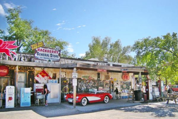
A view of Hackberry's General Store
History
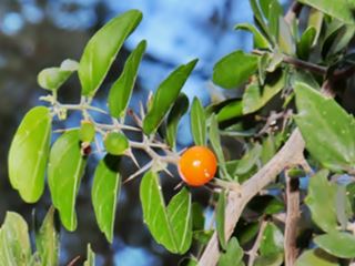
Berry, spines and leaves of a Hackberry
Credits
For the prehistoric and Spanish - Mexican history of this area, check our Peach Springs page.
In 1848, after defeating Mexico, the U.S. incorporated this territory as New Mexico (later it split Arizona as a separate territory).
In 1851 the area was explored by Captain Lorenzo Sitgreaves. He was followed six years later by Lt. Edward Fitzgerald Beale (1822-1893) who was commissioned with opening and surveying a wagon road along the 35th parallel from Fort Smith in Arkansas to California.
Beale passed through Hackberry and named the spot "Garden Spring". His route was used by many settlers on their waye to California and one of them, Charles Cummings, established a ranch here in the 1870s.
Shortly after, silver was discovered by Jim Music (1875) and the community grew. The post office opened in 1878.
The mine was named Hackberry after a Hackberry tree which grew beside a spring on the hill where the mine was located.
The Name: Hackberry
The Desert Hackberry (Celtis pallida). This thorny bush can grow up to 20 ft. high. It is a member of the Elm family. It grows in canyons, washes and the desert but is more frequent close to water sources.
Its yellow-orange fruits are eaten by the wildlife and were a staple in the Native Americans' diet.
When the the Atlantic & Pacific Railroad (later the Atchison Topeka and Santa Fe Railroad laid its tracks through the area in 1883, it built a station and named after the Hackberry mine.
The National Old Trails highway (N.O.T.) was built in the 1910s through the village, which was sustained mainly by a few small mines and ranches, however, by 1919 the mine had exhausted the silver ore and closed.
It was not until Route 66 was aligned along the N.O.T. in 1926 that traffic and new business reached the area.
Service stations opened along the highway and the Hackberry General Store (The Northside Grocery) opened to cater to travelers.
Business declined after 1979, when Route 66 between Kingman and Seligman was bypassed by I-40.
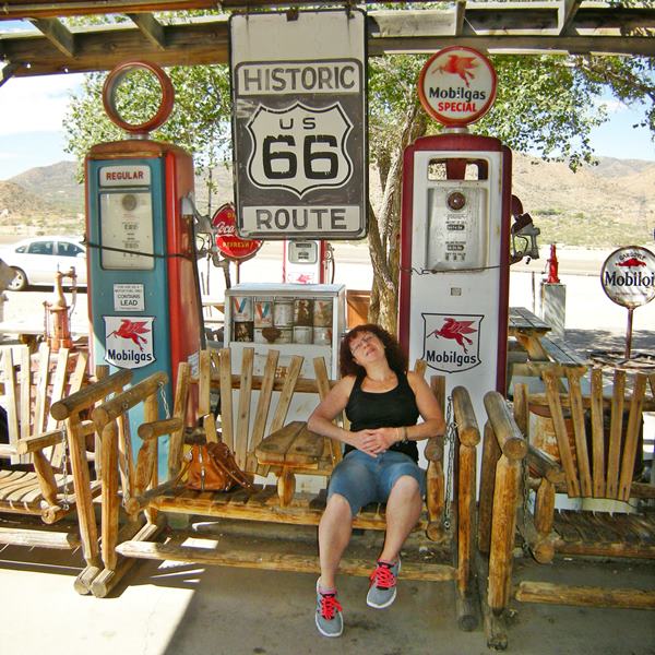
Old pumps and Hackberry's General Store
Getting to Hackberry
You can reach Hackberry along Historic Route 66 in Arizona from Seligman (east) or Kingman (west) and reach any of those towns via I-40 or from Las Vegas, Nevada, by US 93.

Where to Stay; lodging in Hackberry
There is plenty of accommodation close to Hackberry (sponsored content):
>> Book your Hotel in Kingman
More Lodging Near Hackberry along Route 66
Find more lodging & accommodation nearby there are plenty of lodging options in the cities and towns along Route 66; click on the links below to find your accommodation in these towns:
Heading East: In Arizona
- 24 mi. Peach Springs
- 35 mi. Grand Canyon Caverns
- 61 mi. Seligman
- 84 mi. Ash Fork
- 93 mi. Williams
- 126 mi. Bellemont
- 137 mi. Flagstaff
- 161 mi. Twin Arrows resort
- 196 mi. Winslow
- 228 mi. Holbrook
- 274 mi. Chambers
Heading West: Hotels & Motels in AZ & CA
- 29 mi. Hotel in Kingman
- 54 mi. Yucca
- 232 mi. Barstow
- 254 mi. Helendale
- 262 mi. Victorville
- 272 mi. Hesperia
- 284 mi. Cajon Junction
- 298 mi. Fontana
- 300 mi. San Bernardino
- 305 mi. Rancho Cucamonga
- 337 mi. Los Angeles
- 348 mi. Hollywood
- 360 mi. Santa Monica
You are so close to Las Vegas!
Click on Deals: Opens in new window
Grand Canyon Hotels
Click on Deals: Opens in new window
Find a hotel in neighboring Kingman
Booking.com>> RV campgrounds in Kingman
Weather in Hackberry
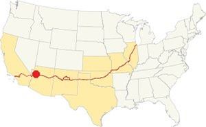
Location of Hackberry on Route 66
Hackberry is located in a dry region with a "cold semi-arid climate". Its altitude gives it colder winters and cooler summers than those in the neighboring desert area closer to the (lower) Colorado River.
Snow can dust the area ocassionally with around 3.7 inches (9.4 cm) yearly. Rainfall takes place 37 days per year, with 19.3 in. of rain (263 mm), with April, May and June being the driest months and August the wettest.
Average temperatures during the year: summer high (Jul) 97.8°F (36.6°C) , summer low 67.2°F (19.6°C). Winter high (Jan) 55.9°F (13.3°C), winter low 31.1°F (-0.5°C).
Tornado risk
As the town lies to the west of the Rocky Montains there are virtually no tornados in Hackberry. Tornado Risk: read more about Tornado Risk along Route66.
Map of Route 66 in Hackberry

Thumbnail of the 1935 Arizona highway map. Credits
Click on thumbnail map to enlarge
See this Map with US 66 Historic alignment in Hackberry.
When it was created in 1926, Route 66 was aligned along the National Old Trails highway from Williams to Kingman, and remaind along this course until its final decertification.
This segment is the Longest remaining section of Route 66 in the whole of the U.S.; it ends at Topock on the Colorado River.
Route 66 Alignment near Hackberry
With maps and full information of the old roadway.
- Kingman to Topock (next)
- Williams to Kingman (Hackberry's)
- Winona to Williams (previous)
Sights and Attractions in Hackberry
What to Do & See
Historic context, the classic Route 66 in Hackberry
In 1946 Jack DeVere Rittenhouse drove along Route 66 collecting information which he included in his book "A Guide Book to Highway 66". It is a great reference for those who want to know what US 66 was like in those days. Rittenhouse wrote the following about this town:
the town of Hackberry lies down in the valley across the railroad tracks. There are several large tanks in the town which contain the diesel oil used by the locomotives operating on the railroads through here. Along US 66 are 3 gas stations (one offering light repairs) and a lunchroom Rittenhouse (1946)
He added that it had 94 residents and does not mention anything else until Kingman, stating that the road leaft Crozier Canyon shortly after leaving Hackberry and ran "amazingly straight" along a "great plain" all the way into Kingman. Neighboring Antares was merely a railroad siding in those days.
Below is a "Then-and-Now" sequence of Route 66 close to Hackberry, in 1934 and nowadays. Note the same rock outcrop on the right side of the highway.

US 66 in Hackberry in 1934. Credits
"City Tour"in Hackberry
The village of Hackberry lies to the southwest of Route 66, beyond the railroad. You can reach it from the junction located by the General Store on Route 66.
It has a few scattered houses and dirt streets. If you are keen on the pre 1930s Route 66, here you can drive the existing section that begins at Hackberry Rd. to the east and ends 2 miles west of the town.
Hackberry's General Store on US 66
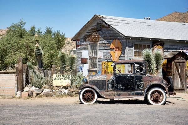
"Hackberry General Store
Also known as: Northside Grocery
11255 E Route 66 Hackberry. There was a service station in Hackberry in 1930, owned by Robert E. Brown. The 1937 mentions it in the directory of campgrounds and trailer parks: "HACKBERRY— U. S. 66 NORTHSIDE GARAGE & CAMP - On U. S. 66. 28 mi. e. Kingman."
The Store opened in 1934 on the new alignment of Route 66 that was built on the north side of the railroad and bypassed the small town.
It had a Conoco gasoline station and remained in operation until the Interstate bypassed this section of Route 66 in 1978. That year it closed.
Bob Waldmire acquired it, and re-opened it in 1992 as a souvenir shop and information center. He sold it in 1998 to John and Kerry Pritchard.
Bob Waldmire
Bob Waldmire (1945-2009). His mom and dad invented the corn dog in the 1940s and named it "Cozy Dog", selling it at their Cozy Dog Restaurant in Springfield MO, on Route 66.
Bob worked at his parents restaurant but later became an artist, traveling as a nomad in his school bus along Route 66. He retired in Hackberry, and continued working towards the preservation of Route 66.
His 1972 VW microbus inspired the character "Filmore" in the 2006 movie Cars.
A Route 66 Mural in Pontiac Illinois was painted in his memory, in 2009 by his friends and family.
The Pritchards retired in 2016 as John and Kerry Pritchard have retired (and John took his fantastic red 1957 Chevrolet Corvette with him).
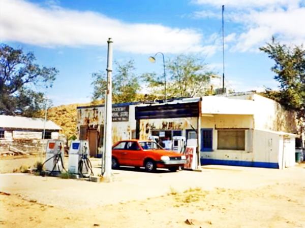
See these stills from a video by Anthony Reichardt filmed in 1993. It shows how the old store looked like almost 30 years ago!
In the upper image taken in 1991, we can see the gas pumps and the pole that at one time held the Conoco sign, and which is still standing. The lower image from 1993 shows that the pumps have gone.
Hackberry's General Store in 1991
Hackberry's General Store in 1993
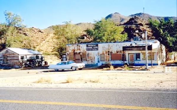
Now the General Store is run by Amy Franklin, who has placed a 1990 Corvette in front of the store.
General Store at Hackberry
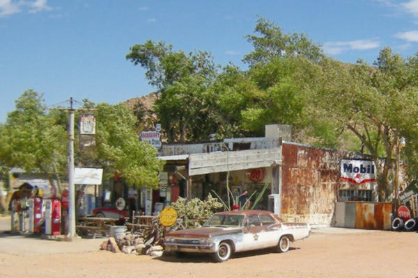
There is a lot to see when you visit the store. There are many vintage cars outside, from the "good old days" of the Mother Road.
The place is full of gadgets, signs, mementos, billboards and artifacts from the 1940s through the 1960s. It is a journey through time to stop at the shop.
The interior of the store has all kinds of Route 66 souvenirs so you can pick your choice. Read more at the official Hackberry General Store website.
At the General Store, an old pickup
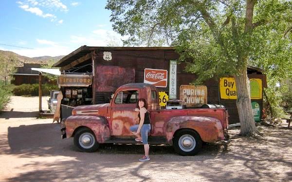
Continue your Route 66 road trip
This marks the end of this leg of your Route 66 Road Trip, continue your journey by heading west towards Antares.
Outdoors, National and State Parks
There are many outdoor places to enjoy nature close to Hackberry, from neighboring Peach Springs you can visit the Grand Canyon and go rafting along the Colorado River at Diamond Creek or enjoy the Grand Canyon Caverns along Route 66.
Read about the parks and outdoors in Kingman: you can visit the Grand Canyon Skywalk and the Hualapai Mountain County Park.
You can also drive up to the Grand Canyon, from Williams.
The Grand Canyon Skywalk
62 mi. See the Map with Directions.
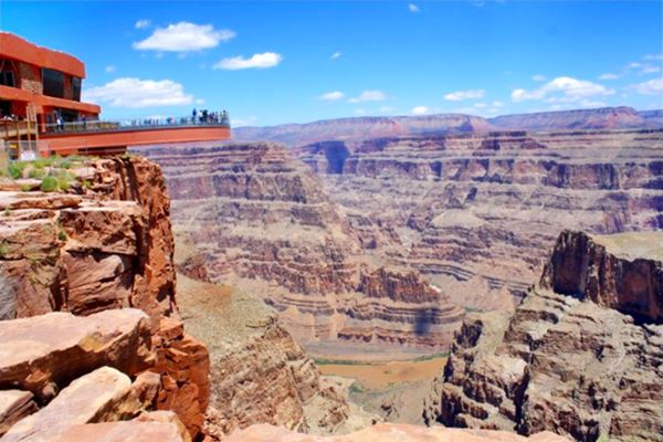
Opened in 2007 it is within the Hualapai Tribal land. It is a transparent horseshoe-shaped bridge that curves out and above the Grand Canyon 4,770 ft (1.450 m) above the Colorado River.
The best way to reach it is taking a tour as the roads are not in top conditions.
Read more at the Skywalk website.
Grand Canyon Skywalk
Sponsored content
Lake Havasu City

Lake Havasu City, the lake and London Bridge. Credits
The resort town of Lake Havasu City on Lake Havasu has beaches along the lake's scenic shoreline, an active nightlife and the original London bridge (you can take a Tour to visit it)

Some sponsored content
>> Book your Hotel in Lake Havasu City


Credits
Banner image: Hackberry General Store, Hackberry, Arizona by Perla Eichenblat
Jack DeVere Rittenhouse, (1946). A Guide Book to Highway 66.


