Route 66 in Central Oklahoma
Index to Tulsa Attractions
On this page.
On our Tulsa Page #1
Historic Context Route 66 in Tulsa: 1946
Jack DeVere Rittenhouse wrote about Tulsa in his classic "Guide Book to Highway 66", which he published in 1946 after driving Route 66 all the way from Chicago to Los Angeles. It gives us an idea of what it was like in Tulsa during US-66's heyday. In Tulsa Rittenhouse mentions the following:
Several hotels including: Adams, Alvin, Bliss, Bradford, Cadillac, Corona, Tulsa, Mayo, Mercer, Oklahoma, Plaza, Seneca and Wells; courts include: Cook's, Park Plaza, Anchor, Baker's, Blue Jay, Campbell's, El Reposo, Mid-Way, Rio, Shady-Rest, Tulsa, Whitt, Will Rogers, Grotto... garages: McGee, Apache & Cinn, Hocker...
two miles from the center of town, your pass a shady Park (R) occupying a city block... From this point... the highway is flanked with a constant succession of business establishments tourist courts, garages, gas stations, etc.
At 2 mi... your pass the Crystal City Amusement Park (L). Soon afterwards you enter the suburb of RED FORK, an industrial suburub of Tulsa containing many factories. Rittenhouse (1946)
Downtown Tulsa
Out of the list of hotels mentioned by Jack Rittenhouse in 1946, only a few buildings have managed to survive the ravages of time; we will describe them in our downtown Route 66 itinerary.
This short tour starts where our Eastern Tulsa tour ends on Elgin and 10th.
It is a 5.8 mile round trip from Elgin and 11th Street: see this Map with Directions
Art Deco Buildings in Tulsa
Oil wealth provided the funds for a surge building in the commercial district of Tulsa in the early 1920s. These were built in the Art Deco and Streamline Moderne styles, popular at that time.
Tulsa has one of the greatest collections of Art Deco buildings in the US.
Most of the buildings can be seen in the older downtown and midtown districts: Mid-Continent Tower, the Boston Avenue Methodist Church, and the Philtower are some examples.

Art Deco Style
Art Deco style also known as "moderne style" flourished between both World Wars (1914 - 1940). And became the predominant artistic style of the 1930s.
It influenced everything, from jewelry to book bindings to furniture, advertising and, of course, architecture.
Its name comes from the "L'Exposition Internationale des Arts Décoratifs et Industriels Modernes" held in Paris in 1925, where artists tried to blend the modern industrialized world with fine arts.
It was a symbol of wealth, luxury, and elegance that adopted symmetry, rich colors and bold rectilinear geometric shapes to exalt the technological progress of that period. It shunned the curves and the asymetrical art of the styles that preceded it.
It also included animals, stylized foliage, chevrons, zigzags, and other geometrical motifs as ornaments on Art Deco style buildings.
Vickery Phillips 66 Station
Listed in the National Register of Historic Places
Drive along Elgin Ave northwards. Set on the southwestern corner of Elgin and Sixth Stand, to your left, is a Historic Gas Station (602 S. Elgin Ave.) A cottage style Phillips 66 gasoline station built in 1931.

Built with the typical cottage style that was characteristic of Phillips in those days. See other examples along Route 66 in McLean, Texas, Cuba, Missouri or Baxter Springs, Kansas just to mention a vew.
The style is a "Cotswold Cottage" design, with a chimney, steep pitched roof, brick walls and a homey style which aimed at reassuring customers with an image of home and also helped them blend into a residential setting.
The service station was leased in 1939 to a private operator and by 1943 it was owned by V.W. Vickery who named it the "Victory V W Phillips 66" ("Victory" in a Second World War context was an eye-catcher).
With Route 66 realigned further south in the 1950s, and later I-44 taking most of the traffic, it finally closed in 1973, and was used as a paid parking lot. It was restored between 2006 and 2008 and is an Avis car rental facility.
Wells Hotel (Gone)
On the next corner, turn left into E 5th; ahead at 115 E 5th. Ahead, on the NE corner with Cincinnati, where the First Baptist Church now stands, once stoot the The seven-story Wells Hotel owned by Terrance Wells and his brother Lee, opened in 1923 here on the corner of 5th St. and Cincinnati with 200 rooms. 1930 photo of the Wells Hotel
Tulsa Club Building
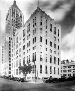
Tulsa Club 1930s, Tulsa, Oklahoma. Source
Art Deco
Opposite, on the NW corner is an Art Deco building. This 11-story red brick and white stone building was erected 1927 by the Tulsa Club and the Tulsa Chamber of Commerce it was designed by architect Bruce Goff. Vacant for many yeaers and vandalized often, it was renovated into a boutique Hilton hotel. This is its street view; same as in the 1930s picture.
Across the street, on the SW corner there was a D-X service station; you can see it in this photo c.1950, looking towards the old church and the Wells Hotel. 3
Mayo Hotel
Now head west along 5th Street to see one of the Hotels mentioned by Rittenhouse in 1946, at 115 West 5th St.
Listed in the National Register of Historic Places & Art Deco
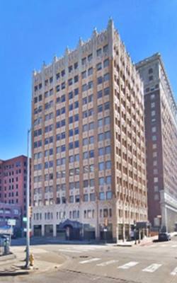
Now a 4-star hotel once again, it was built as a 600-room hotel in 1925. George Winkler designed it in a Chicago School Art Deco style. At street level, it has Greek Doric-style columns two stories-high supporting the 14 floors above them. The three lower floors and the uppermost one are faced in white stone.

Mayo Hotel 1920s postcard, Tulsa, Oklahoma.
Adams Hotel
Art Deco
Drive around the block to see another Art Deco hotel mentioned by Rittenhouse, at 4th St and Cheyenne Ave
The Adams Art Deco building with terra-cotta detailing was built as a luxury hotel in 1928. Later during the 1980s it became an office building and stood vacant until recently. Now it has been renovated into new apartments.
Its postcard described as: "Modern as Tomorrow... air conditioned rooms and Coffee Shop... Garage Facilities."

1930s postcard of the Adams Hotel, Tulsa, Oklahoma
Mayo Motor Inn
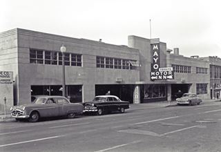
1950 photo Mayo Motor Inn, Tulsa. Source
Listed in the National Register of Historic Places & Art Deco
Just across from the hotel, on Cheyenne Avenue is a Classic Art Deco Garage at 416 South Cheyenne Ave. Tulsa
This garage with four parking levels was built in 1952. It was designed by Leon B. Senter & Associates. Its 15-foot high sign and the facade's crowning band of three bars are classic Art Deco.
Mayo Motor Inn in Tulsa, Oklahoma

Lost Spots in Downtown Tulsa
We will mention some of the spots noted by Rittenhouse in his 1946 Guidebook to U.S. highway 66. Almost all of them are gone (the exception is the greatly modified Bradford Hotel).
McGee's Garage (Gone)
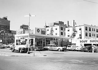
McGee's garage and D-X gas station c.1960, Tulsa. Source
Located on the NE corner of W 8th and Denver. This garage was mentioned in 1946 by Rittenhouse. It also had a D-X service station. It was torn down, now it is an empty lot (street view). Below is how it looked in the early 1960s, click on the image to enlarge it.
Alvin Hotel (Gone)
Also mentioned by Rittenhouse. Located on the NE corner of W 7th and Main. The 10-story, 200-room red brick building was torn down in the mid 1970s. It had an enormous sign on the corner. There is a plaque embedded in the sidewalk that says the Alvin was the site of the birthplace of the Society for the Preservation and Encouragement of Barbershop Quartet Singing in America. See this 1930s photo of the Alvin.2
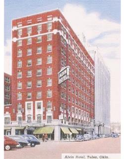
Alvin Hotel c.1940, Tulsa. Source
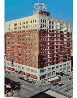
Hotel Tulsa c.1950, Tulsa. Source
Hotel Tulsa (Gone)
At 125 East Third, it had 350 rooms with "Radios - Garage Adjoining" Henry Ketchum acquired it in 1923 renaming it the New Tulsa Hotel. It was his second one, he also owned the Ketchum Hotel (later the Braford) on Main Street. Torn down in the 1970s, the Tulsa Performing Arts Center now stands on the site.
Bliss Hotel (Gone)
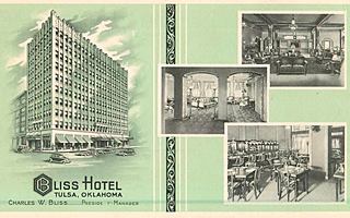
Bliss Hotel c.1930, Tulsa. Source
Click image to enlarge
Was located on Boston and 2nd Street with "250 rooms, 250 baths, circulating ice water and ceiling fans in every room... rates from $2.00. Air Cooled Coffee Shoop" also 2 blocks Union Station and the bus station.
The 10 story ZigZag style Art Deco was designed by Leland Shumway and built in 1929. Torn down in 1973
Bradford Hotel
Built in 1918, it later became Henry Ketchum's Ketchum Hotel. At 507 S Main and 5th. It later became the Bradford Hotel. A modern glass-curtain facade was added in 1979. Still standing. See its 1930s postcard and its current St view.
Some more lost hotels
The Cadillac Hotel was located at 507 1⁄2 South Boulder Ave. and two blocks east were the Corona Hotel at 608 1⁄2 South Boston Ave. opposite was the Mercer Hotel at 611 1⁄2 South Boston; beside the Seneca Hotel at 621 S Boston. Four blocks north was the Oklahoma Hotel at 206 E 2nd St.
Let's return to our Downtown Tulsa Tour.
Towards Eastern Tulsa along the original Route 66 alignment
Blue Dome Service Station
Drive east along 4th St. turn left on S. Detroit; see the sign indicating the 1926 alignment to your right at the corner with E 2nd., and turn right along it. To your right on the SW corner is an iconic service station.
It was said to have be inspired by the Haiga Sophia Church in Istambul, the Curch of the Holy Wisdom a cathedral built in Constantinople 532-37 AD by Byzantine emperor Justinian I; it became a mosque, then a museum, and now again, a mosque.
It was a built in the early 1920s for the local Chastain Oil Co. and designed by Lawrence Blue and Fred Knoblock. It closed in 1940. It reopened in 1949 1 under the ownership of George Andrew as the White Star Gulf Oil Station, it was open 24 ⁄ 7 and the station attendant lived inside the dome.

Blue Dome Service Station nowadays in Tulsa, Oklahoma

2nd St. gas station
Continue eastwards along E 2nd Street and ahead, on the NW corner of Kenosha is a gas station that appears in the 1958 aerial photograph of this area, it was a service station until recently, then it was repurposed as a cafe.
In the 1940s and 50s 2nd Street Carried traffic heading east along U.S. 75 and OK-33
Further east 2nd St was altered by I-244 and US-75 it will curve onto 1st Street; so turn right on S. Norfolk Ave. to reach 2nd again.
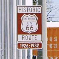
The sign ahead (right) shows you are driving along the Historic 1926-32 Route 66 alignment.
Sinclair and Groseclose garage
On the next corner, to your right is a former 1910s brick building that housed the Sinclair & Groseclose garage at 1338 E 2nd. 3.
B.F Goodrich - Phillips 66 Service Station
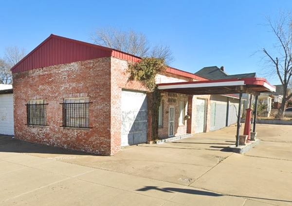
Kitty-corner from the garage, at 1401 E 2nd St. on the NE corner is an old brick service station. It has a flat canopy over a small pump island has two service bays, one on each side of the office. It is a 1920s building on what was Route 66 and later US 75 in Tulsa. It is described in the 1926-70 Oklahoma Route 66 Historic Resources Survey as a B.F. Goodrich ⁄ Phillips 66. The roof is a mid 2010s addition.
Historic Kendall Whittier District
Listed in the National Register of Historic Places
Ahead, wwhen you reach South Lewis Avenue turn north (left) following Route 66. This is a historic neighborhood.
This was Tulsa's first suburban commercial district. It has many red-brick buildings from the early 1900s.
Between Admiralty and 1st Street you will see a Historic Movie Theater.
Historic Circle Theater
Listed in the National Register of Historic Places
At 12 South Lewis. It is the only remaining cinema of Route 66's golden age. Built in 1928 it was built on the original 1926-32 alignment of Route 66. The Circle Theater is now known as the Circle Cinema.
Circle Theater was rescued from demolition and refurbished by the hard work of the Circle Cinema Foundation, and now thrives, with a fantastic retro neon sign.
One of 26 movie theaters in 1945, it is the sole survivor in Tulsa. It was built along the original 1926-1932 alignment of Route 66 as a two-story brick building with a sober design that also housed apartments above the theater. The building was known as the Chilton Building.
It screens a wide variety of movies as the non-profit Circle Cinema Foundation: documentaries, film festivals, films by filmmaking classes and local movies too.

historic Phillips 66 Station #473
Listed in the National Register of Historic Places
On the corner, turn left on East Admiral Blvd. dirve west for one block to visit a Historic Cottage Style Gas Station, now a chic bar at 2224 East Admiral Boulevard.
This cottage styled service station was built in 1929. It was known as the Phillips 66 Station #473, in 1941 it was expanded west, adding a service bay and garage.
historic Phillips 66 Station #473 in Tulsa, Oklahoma

Here you can turn around and head back into downtown Tulsa to head west and cross the Arkansas River; or take a very short sidetrip eastwards to see a few interesting spots along the 1926-32 Route 66.
Heading East along 1926-32 Route 66
Short side trip
In our Tulsa page #1 we described this alignment westwards from Mingo Rd. to the Admiral Twin Screen Drive-In; here we will describe some spots closer to Kendall Whittier.
See this map with directions (4.1 mi roundtrip).
Old Gas station
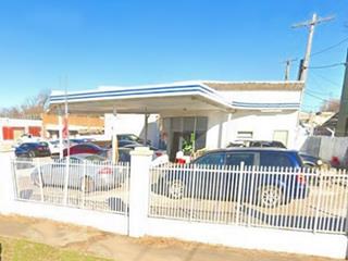
This gas station is set on the corner, and has its original porcelain enamel panels. Notice the two bands around the office and canopy. The two service bays are on the northeastern side of the property. The canopy is pentagonal, an odd shape, spanning the curve along N College Ave.
Anchor Court (Gone)
Continue west, passing by a lot at 3608 E Admiral Pl. site of the Anchor Court, mentioned by Rittenhouse in 1946 owned and ran by Mr. & Mrs. H.L. Burton, "Closest to Down Town Tulsa." (Anchor Court postcard).
Ahead is the Rose Hill Cemetery (left) is where Cyrus Avery, a native from Tulsa, known as the "Father of Route 66" rests.
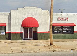
Just ahead at 4919 E Admiral Pl is a brick building with the appearance of a garage, store or gas station, it has an ornate brick laying and a cornice with pediments and the words "Newton 1934" in two places; its western tip has a curved corner (St view).
Turn around here enter the Crosstown Expressway westwards at N Yale, then take I-444 leaving it at E 7th St. to return to the starting point of your journey at S Elgin and E 10 th Street. From here you will drive west to complete your drive across Tulsa. We describe it below.
Into Western Tulsa
Drive west from the roundabout at 10th and South Elgin, after 5 blocks it merges into 11th Street. Originally, Route 66 met S Lawton Ave 0.7 miles west and turned left onto the avenue to head southwards to cross the Arkansas River. The construction of I-444 cut the link between 11th and Lawton so the current alignment crosses the freeway and runs along its southern side to reach the bridge and the river. See the green line in our custom map.
Crossing the Arkansas River
11th Street Arkansas River Bridge
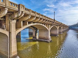
Arkansas River Bridge, Tulsa. Credits
Listed in the National Register of Historic Places
Built in 1916-17 this concrete bridge was the reason that Route 66 passed through Tulsa. The original bridge is sandwiched between to modern bridges, the Southwest Boulevard Bridge and I-244 Bridge.
It was the first multi-span concrete bridge in Oklahoma. Buitl to link the town's western oil refining area with its eastern downtown district, crossing the Arkansas River that here is 1,400 ft wide (430 m).
It has 18 spans mounted on piers set in the river bed. It is 1,470 feet long and was 34 feet wide. It included a railrod track along its central part and one lane for traffic.
Cyrus Avery, as a county Commissioner was involved in the bridge project and, when he was appointed in 1924 as a member of the Associated Highways Association of America's Joint Board, he supported the layout of a U.S. Highway through Tulsa, linking Chicago with Los Angeles; this highway would become Route 66.
The existing bridge was a key element to uphold Avery's position and the road was aligned through Tulsa.
The bridge was widened in 1934 to its current 52 feet 8 inche. To do this, a second bridge was built on the old one's eastern side and it was linked to it with a single deck. The curb to curb width was now 40 feet.
It was closed to traffic in 1980 and listed as a Historic Place in 1996. The bridge was renamed as the "Cyrus Avery Route 66 Memorial Bridge" in 2004. It remains fenced off for pedestrian and bicycle traffic.
Cyrus Avery Centennial Plaza
The Plaza is located on the eastern tip of the bridge. It has two attractions. You can park here; see this map showing the parking area.
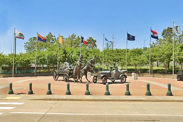
East meets West Statue
On the Cyrus Avery Centennial Plaza. On the western side of the junction of Route 66. and Riverside Dr.
The bronze sculpture is 20 feet tall by 40 feet and it shows the Avery family in a 1926 Ford encountering an oil-field wagon, with its horses bolting when they meet the car. It is the work of Robert Summers and was dedicated in 2012. It is flanked by the flags of the eight states Route 66 crosses. The old bridge end is just south of it.
Route 66 Gateway
By the Plaza, the gateway spans Route 66 allowing pedestrians to cross from the parking area to the Plaza. It welcomes visitors traveling along Old Route 66 as they enter or leave Tulsa.

Arkansas River
After the Mississippi and the Colorado, it is third most relevant river along Route 66 (the Colorado is longer, has a larger basin, but has a smaller discharge). With a length of 1,469 mi (2,364 km) it ranks 6th in lenght among American rivers. It is a tributary of the Mississippi River and runs from the Rocky Mountains eastwards. Its basin covers almost 170,000 sq.mi (440,000 km2). Its discharge is, on average, 40,000 cu ft. per second (1,100 m3⁄s). It was the route used by Natives, explorers and settlers to enter the West.
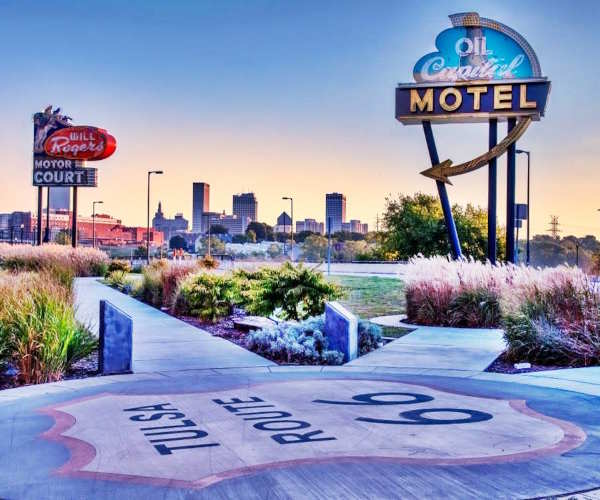
Neon Sign Park in Tulsa
Located on the western bank of the Arkansas River at the tip of the old bridge, to your right. There is no parking area, but you can reach it by walking across the river from the parking area in the Cyrus Avery Centennial Plaza using the pedestrian walkway on the bridge (eastern side of it).
The park has replicas of the neon signs of the Will Rogers Motor Court, the Oil Capital Motel and the Tulsa Auto Court.
Drive across the Arkansas River leaving Downtown Tulsa behind and head west along the old Route 66 alignment on Southwest Boulevard into Western Tulsa. After the bridge, and the Neon Park, you will reach a Historic gas station, to your right:
Cities Service Station #8
Listed in the National Register of Historic Places
1648 Southwest Boulevard. It is located on what then was Quanah Avenue (renamed Southwest Boulevard in 1957). Before I-244 was built, in the mid 1970s, the railroad ran along its western side.
Cities Service Station #8 Historic gas station in Tulsa, Oklahoma

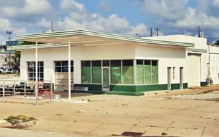
It is a typical "oblong box" style station that was in vogue between the 1930s and 50s. The two-bay garage was added to the original 1926 station in 1940 and then, the old office was demolished and replaced with the new office in the 50s, using large glass windows and the green trim that identified the Cities Service Co. brand.
West Tulsa
On the next block in the parking space by the sidewalk is a small Route 66 marker with information about West Tulsa. The town sprung up after the railroad crossed the river in 1883. When oil was discovered in Red Fork in 1901, population grew. The community was annexed by Tulsa in 1907. The road bridge brought cars along South Quanah Ave. and here, at West 17th and Southwest Blvd was the town's commercial district. After Route 66 was created there were garages, auto dealers, restaurants and three gas stations. All gone.
23rd St. and Route 66
There were many spots here too: Chicken 66 in 1950 offered "Chicken, French Fries, Rolls and Salad Box $1.00 TO GO" it was located at 23rd and Quannah. At 2333 SW Blvd. on its SE corner with 23rd St. was the Rio Court (Gone). Next to it at 2341 SW Blvd. was the Silver Castle #13 part of a hamburger restaurant chain founded in Tulsa in 1930.
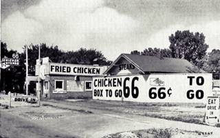
66 Chicken, West Tulsa. Source
Click image to enlarge
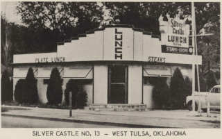
Silver Castle #13 West Tulsa. Source
Click image to enlarge
Howard Park
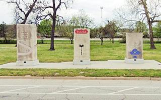
Head west. At 25th St. there was a garage and a Texaco on the left, and a Tydol opposite, on the western side of Route 66. Howard Park began here. Just ahead has three concrete monoliths (right) with Route 66 shields and depictions Cherokee symbols, industry, oil and transportation. There is a parking area in the Park.
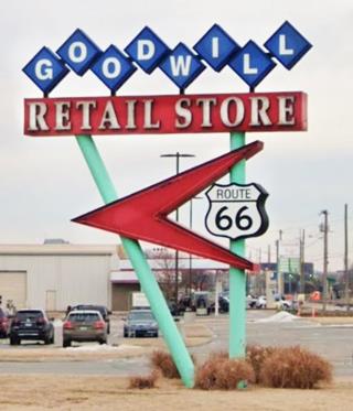
Continue west, the highway curves. Here is on the right is a great retro vintage neon sign at the Goodwill Store, right. It pays homage to Route 66 and the store's entrance has an Art Deco air to it, celebrating Tulsa.
Across the street on the eastbound lanes at the curve (St. view) is the First Oil Strike marker. It tells the story of the first "gusher" drilled close to this spot by Jesse A. Heydrick who was prospecting for some investors. The oil was struck on June 25, 1901.
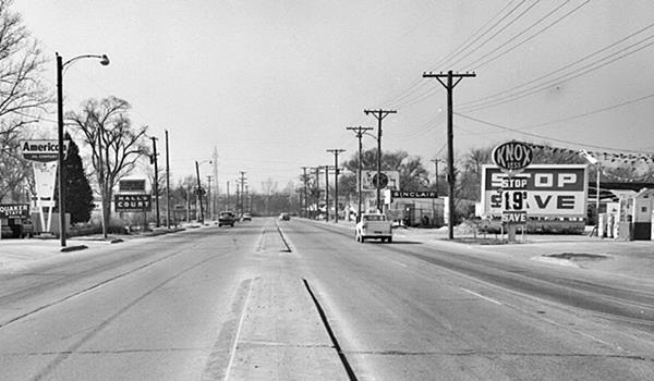
Now comes a short straight section here that in the 1950s had a "Knox-Less Serve Ur Self" gas station followed by a Sinclair station to the right, and an "American Oil Co." gas station to the left folowed by a motel, Hall's.
Hall's Court (Gone)
At 3411 Sapulpa Rd. it had 12 rooms, "Air-Conditioned, TVs, Family Rates, Truck Parking," their matchcover read "We are Just Home Folks." It was ran by Lilian and Gary Hall who moved here after WWII.
Below is a view of the block.
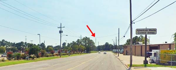
Same spot nowadays, looking west along Route 66, notice the same high voltage pylon in the distance (red arrow in the image).
U.S. 66 and U.S. 75 Fork
Ahead, the highway curved and here there were several motels. It was the fork of Route 66 with U.S. 75 and U.S. 169. In those days the latter two ran south down South Union Avenue while Route 66 ran towards the SW.
Plaza Park Court (Gone)
At 3515 SW Blvd. on the northeast side of Cherry Creek and the highway. It had its sign on the eastbound lanes too, to entice travelers. The company owned several motels located in Amarillo TX, Flagstaff AZ, and Raton NM, they were designed in an "El Alamo" style. It was ran by Milton Stroud and his brother. It opened in 1942 and was torn down in the late 1980s. Now a dumpster rental company stands on the spot (map marking the spot).
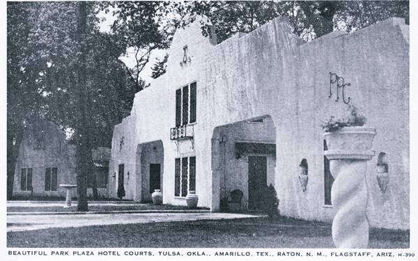
Plaza Park Court, Tulsa US 66. Source
Click image to enlarge
El Reposo Court ⁄ 66 Motel (Gone)
Located at 3660 Sapulpa Rd. (Now SW Blvd), the "El Reposo Tourist Court" was built around 1933 by Isaac Burnaman. Its postcard tells us it had "Tile Baths - Metal Furniture Beauty Rest Mattresses West of Tulsa, Okla. Owned - Operated by Mrs. Nora Wilson On 66 - 75 Highway." It had a small gas station and a cafe. Later it became the "66 Motel" and it was ran by Norma and Ken Undernehr from 1967 to the 80s. Razed in 2000. Now it is a Data Storage warehoused on the southwest side of the overpass of U.S. 75 and SW Blvd.
The hill behind the motel is Lookout Mountain that has an elevation of 932 ft (284 m) above sea level and stands 197 ft (60 m) above its surroundings.
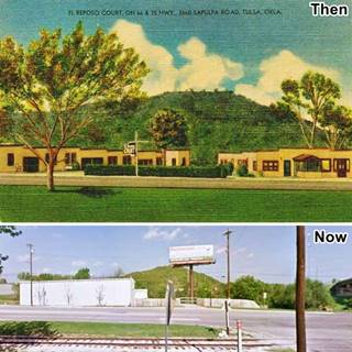
El Reposo Now & Then, Tulsa US 66. St. view
Click image to enlarge
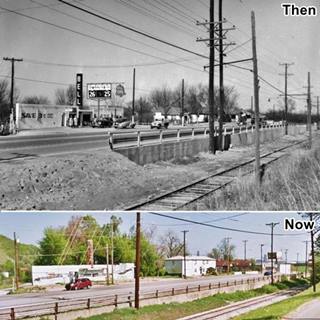
Bell Gas Now & Then, Tulsa US 66. St. view
Click image to enlarge
Bell Gas Station (Gone)
Pictured above in a 1950s and a 2012 view. The Bell gas station was torn down in 2013. Its concrete drive has survived and the "Bell" sign that can be seen in both images above has been restored and placed just down the road in the "Route 66 Historical Village."
Route 66 Historical Village
To your right, at 3770 Southwest Blvd. It is an open air museum with some large artifacts. See the restored Frisco 4500 Steam Engine, a passenger car, a caboose and a real oil derrick that is 194 feet high (59 m). Don't miss the large Route 66 shield and a replica of a Phillips 66 cottage-style gas station.
Next to it is a parking spot and a picnic area with a great retro vintage neon sign (pictured below) and the original "Bell" service station sign.
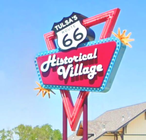
Shady Rest Motel (Gone)
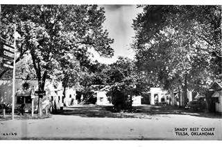
The Shady rest was located here, in what is now the picnic area at 3838 Southwest Blvd. It was built by Maurice Colpitts in 1935 with tiny 10 foot x 12 foot prefab cabins. Its 1940s postcard (click to enlarge) says "Innerspring Mattresses and Air-Cooled Cabins. Mr. and Mrs. P. M. Kelsay, Mgrs," in the 1950s, Bessie (Conner) Alberty owned and ran it. Torn down in 2005. See this view of the spot
Red Fork
Just ahead, the road curves west passing beneath I-244 at Red Fork (W 41st St and S 25th Ave.). This is a district of Tulsa and was apparently named after a fork in Cimarron River, that carries reddish silt into the Arkansas River. Here are some interesting landmarks.
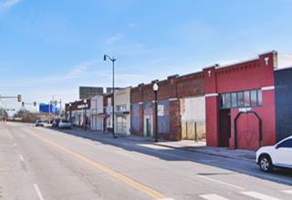
The images show a "Now and Then" view of the 4100 block of Southwest Blvd, Red Fork Tulsa; notice the same red-brick buildings on its eastern side.

Old Red Fork Teague Texaco
Ahead, to your left at 4207 Southwest Blvd is an old Teague-styled Texaco service station, now a car dealership.
It has a simple, clean, and streamlined style with a box-shaped station and a flat canopy with rounded corners and two ridge-like crests running across its top. It was a design adopted by Texaco in 1937,

>> Learn all about the Teague-style Texaco service stations along Route 66
Route 66 Western Gateway
Just 200 yards west is the Gateway, an artistic arch celebrating Route 66 and Tulsa, with a Route 66 shield on its tip and the word "Tulsa", it is a symbolic arch, built in two pieces, one on each side of the highway (the second part is a concrete block with a U.S. 66 shield. It complements the Eastern Gateway on the other side of town.
Site of Crystal City Amusement Park
Passing the gateway, to your left is an old 1950s sign, with empty panels and blue and yellow circular ones of a game arcade in the adjacent Crystal City Mall where an Amusement Park stood in the 1940s and 50s.
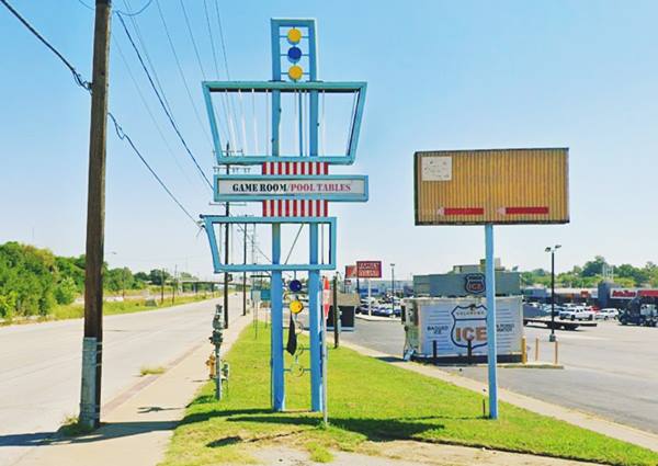
I-44 and Route 66 in SW Tulsa
Ahead at the junction of I-44, old Route 66 and I-244 there are several motels. Route 66 was realigned along I-44 when it was completed in the late 1950s. So many motels were built along it here and also eastwards towards the Arkansas River. To your right is the first classic motel.
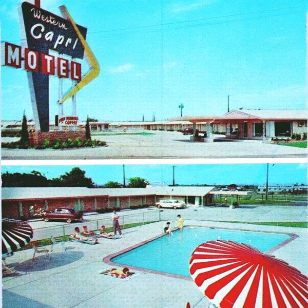
Western Capri Motel
5320 Sapulpa Rd. Still open as a motel though it lost its great neon sign and the large canopy by the office. It has the same layout and appearance as you can see in the "Then and Now" sequence. The postcard described it as follows: "Ultra-Modern... Room temperature at your immediate control - Free TV."
New Frontier Motel
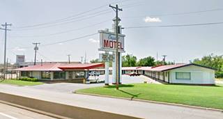
Then, at 5510 West Skelly Dr. was the "New Frontier Motel" that is still operating as the "Crystal Motel". Its postcard shown below says: "Located one quarter mile east of Turner Turnpike... coffee shop - Diner's Club - family accommodations - 24 hour switchboard."
The "Now and Then" sequence of the motel shows that the pool has gone and the sign has been replaced.

Former Skelly Oil
In the New Frontier postcard, to the left you can see the sign of a Skelly Oil Company gas station (the white "S" on a black background).It is painted onto the rectangular slab on the building's front. Below is the enlarged postwcard. The building is still there, with its flat canopy, vertical slab and canted plate glass office. It has been repainted gray. Now it is a used car lot. Notice the sign and empty pumps island on the corner (pictured below).
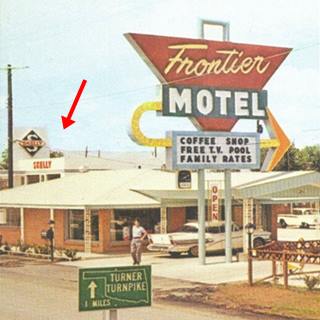
1950s view Skelly Oil, Tulsa, Oklahoma
Ahead is the "Interstate Inn" at 5554 S 48th W Ave, Tulsa followed by the "Gateway Inn" at 6600 West Skelley Drive. If you drive further west, you will leave Tulsa and head towards Sapulpa.
So use West 55th Street to cross the Freeway and return north along the eastern frontage road, West Skelley Drive, ahead at the junction of I-44 with I-244 to your right is a Classic Motel,
Winston's Motor Court
At 5609 W Skelly. It opened back in 1954 with 23 rooms and is still open, now as "Winston's Motel" offering long-term lodging. Its postcard said: "Ultra Modern - Coffee Shop - 1 Mile N.E. of Turnpike Gate on U.S. 66 & 75 - Okla 33." More units were added in the 1970s.
The slanting room over the office and the great neon sign are gone.
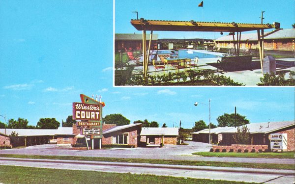
Sands Motel
Ahead, at 5125 W Skelly Dr is the former Sands Motel, now operating as an America's Value Inn. Its postcard pictured below says: "One mile from Turner Turnpike Gate... room climate control always at your fingertips... Continuous music at all times - Children's Playground... Tub and shower comb..." The classic neon sign has gone.

Some more motels along the 1959-1985 Route 66
Continue eastbound along the southern frontage Road of I-44, the Intersate carried Route 66 from 1959 to 85. There were also motels along it.
Rio Motel
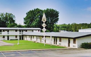
At 2222 W Skelly Dr. now it is the Royal Inn Express. It opened in 1958 with 80 rooms. Its Space-Age sculpture has survived (red arrow in the postcard; click on the image to enlarge it).
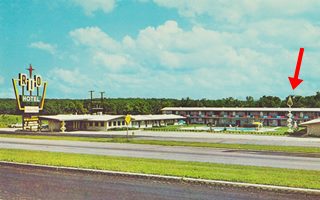
Rio Motel 1950s, Tulsa, OK. Source.
Click on image to enlarge
Oil Capital Motel
This 24-room motel opened in 1958 at 802 W Skelly Dr. It was owned by Robert and Bette Saxby until 1962 when Lee and Oleta Vaughan bought it. It had a real oil derrick and pumpjack. The Saxby's, along with business partners John and Earl Lewis, sold the property in 1962 to Lee and Oleta Vaughan. The postcard says: "24 air conditioned units, free continental breakfast... at the sign of the pumping oil well." The oil rig is gone but the motel is still there.
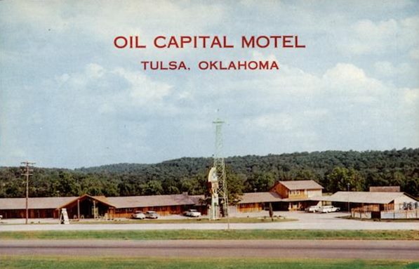
Oil Capital Motel 1950s, Tulsa, OK. Source.
Click on image to enlarge
Valley Inn
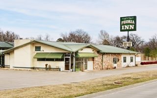
This motel located on the eastern side of the Arkansas River at 1347 East Skelly Dr. is now the Peoria Inn. It had 90 rooms, and its 1960s postcard proclaimed it as "Tulsa's futuristic look at roadside living." It recently lost its long canopy.
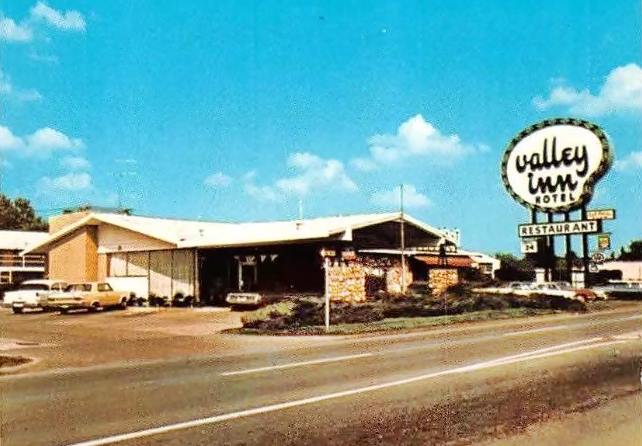
Valley Inn 1950s, Tulsa, OK. Source.
Click on image to enlarge
This leg of your Route 66 Road Trip through Tulsa ends here. Head south to visit the next town: Sapulpa.
Natural Attractions
National & State Parks
Redbud Valley Nature Preserve
North 161st East Avenue, 3.8 miles north of I-44 (Exit #237 is 161st East Ave.)
Managed by Nature conservancy and Oxley Nature Center, it preserves plants and animals unique to this area. Ideal for hiking and watching birds and animals. Restrooms, picnic tables and drinking water are available. Admission is Free. Wed. through Sun. 8 AM - 5 PM.
Municipal Parks
Arkansas River runs through the town, in a wide channel with flood control reservoirs. A permanent lake next to the downtown area is known as Zink Lake.
Tulsa has various forested parks (including the third largest municipal park in America, "Mohawk Park", and some hills like Turkey Mountain or Holmes Peak (the tallest point with 1,360 ft - 415 m).
Woodward Park
In midtown Tulsa is also a botanical garden and has the Tulsa Municipal Rose Garden, with more than 6,000 rose plants in 250 varieties.
The River Parks Turkey Mountain Urban Wilderness Area
68th and Elwood, Tulsa
South of Tulsa, on the west bank of the Arkansas River, only 7 miles from central Tulsa. It offers 45 miles of trails for hiking, running, mountain biking and horseback riding.
More Tulsa attractions on the Previous Page
We describe the Eastern Tulsa's attractions on Tulsa Page 1
Some sponsored content
>> Book your Hotel in Tulsa

Credits
Banner image: Hackberry General Store, Hackberry, Arizona by Perla Eichenblat
Jack DeVere Rittenhouse, (1946). A Guide Book to Highway 66.


