Route 66 Fun Facts you never imagined
Index to this page
Route 66 fun facts & trivia
Below we detail interesting information on Route 66.
History Trivia
Did you know that Route 66 celebrates its 100th anniversary in 2026?
Route 66 was commissioned in 1926.
It was going to be named U.S. 60 but was changed to 66 as it did not run coast-to-coast.
Cyrus Avery was part of the Committee that laid down the U.S. highway system. He drew it from LA to Chicago, in 1926, passing through his hometown of Tulsa, Oklahoma. He is known as the Father of Route 66.
The moniker Mother Road was coined by John Steinbeck in his novel "Grapes of Wrath" (1939).
Cyrus Avery created the other moniker: America's Main Street in 1926.
The worst stretch of Route 66 in the 1920s and 1930s was the muddy Jericho Gap in Texas.
The whole Route 66 was fully paved by 1938
The Interstate system that would replace it was created when US 66 was merely 30 years old (1956).
Route 66 was decertified as a U.S. highway in 1985 (before its 60th birthday).
The last town to be bypassed by the Interstate system was Williams, AZ. In 1984 (I-40).
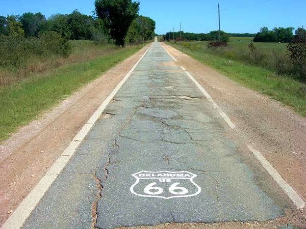
Ribbon Road: You can still drive down a narrow (9 foot wide) stretch of the 1920s road between Afton and Miami in Oklahoma.
The "Ribbon Road" in Miami, OK.
Its original alignment went through Las Vegas and Santa Fe in New Mexico, but an irate governor re-routed it to bypass them in 1937 to punish politicians in Santa Fe.
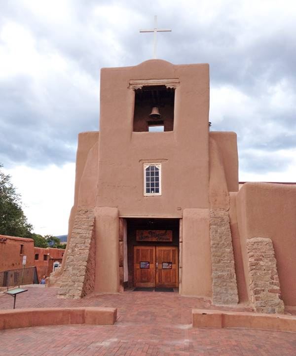
San Miguel Mission, also known as San Miguel Chapel, is a Spanish colonial mission church in Santa Fe, New Mexico, by Route 66. It was built between 1610 and 1626 and, with four hundred years of age, it is the oldest church in the United States. It is picture below.
The segment across San Bernardino County in California from Needles to Upland with 244 miles (393 km) is the longest segment within one county of the whole route and is 20 mi. longer than the distance between London and Liverpool in the UK.
The highway was aligned through San Fernando California and the California Highway Commission argued with the American Association of State Highway Officials that it was the Western terminus of the highway instead of Los Angeles.
San Miguel Mission, oldest church in the U.S., our photo from 2016:
American History
The decisive American Civil War Glorieta Pass Battle was fought on what is now Route 66 in New Mexico.
Zuni Pueblo just south of Route 66 in NM, was the place where Europeans and Native Americans first met (1540) in what later became the U.S.
The The expedition led by Lt. Edward Fitzgerald "Ned" Beale (1822 - 1893) to survey and build a wagon road from New Mexico to California, followed the 35th parallel, its course was later followed by Route 66. He used camels, imported from Tunis as pack animals. Though hardier than mules, the camels scared both horses and mules. The Army decided not to use camels in the future.
Geographic Trivia
Route 66 crosses the San Andreas fault in a place known as Blue Cut in the Cajon Pass, CA
It passed through Eight States: California, Arizona, New Mexico, Texas, Oklahoma, Kansas, Missouri and Illinois.
The Kansas segment is the shortest of the whole Route 66: barely 13 miles long.
The New Mexico segment is the longest of them all: 392 miles.
The route is over 2,000 miles long: 2,448 miles in 1926
Contemporary mileage is 2,278 mi.
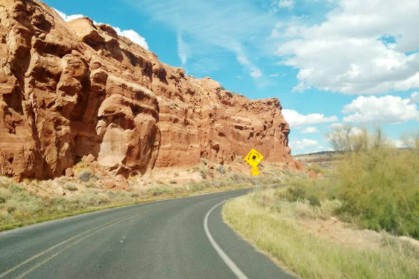
There are several Dead Man's Curves on Route 66, these are some: one near Carnuel in NM, another between Mesita and Laguna in NM, pictured below, and another in Towanda, IL.
Learn all about the Dangers of Route 66: the potential safety risks and why it was dangerous in the past. Plus some useful safe-travel tips.
Dead Man's Curve between Mesita and Laguna, NM
Route 66 crosses the Mississippi River at Saint Louis, Missouri
It crosses the Arkansas River in Tulsa, Oklahoma
It crosses the Colorado River in Topock, Arizona, and enters California.
Highest point on Route 66: There were several "highest points" over time.
- 7,550 feet (2,301 m). Glorieta Pass NM, Sangre de Cristo Mountains. Highest point from 1926 to 1937. On the Santa Fe Loop.
- 7,405 feet (2,257 m). Bellemont to Parks, Arizona, crossing the San Francisco Mountains, 1931-41 alignment.
- 7,245 feet (2,208 m). Continental Divide, New Mexico, crossing the Rocky Mountains. 1927-85 alignment.
- 7,102 feet (2,166 m). Sedillo, NM on the 1937-45 alignment, replaced when it was realigned, by a spot at 7.057 feet (2,150 m). Comer's Cafe close to Sedillo on the 1945-85 alignment. Crossing the Sandia Mountains.
- 3,595 ft (1,096 m). Sitgreaves Pass near Oatman, California, crossing the Black Mountains. 1926-53 alignment.
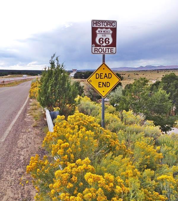
Dead End Sign on Route 66, Continental Divide New Mexico

When you drive down Route 66 you will go through the namesake: Miami, OK; Atlanta, IL; Milan, NM; Cadiz, CA (beside Chambless; Also the ancient town namesakes of: Jericho, TX and Carthage, MO. Country namesakes: Lebanon and Cuba both in MO. And also Yukon, OK. And pass near the "other" Las Vegas in New Mexico, not Nevada.
There are Two of each of these towns on Route 66: Springfield (MO, IL); Conway (TX, MO); Mc Lean (TX, IL) and Arcadia (OK and CA).
It crosses the Mojave Desert in California.
After Santa Monica, CA, which is at sea level, the next lowest point on Route 66 is not found west of the Rockies, Chicago is 579 ft., St. Louis is 466 ft. Instead it is found on the Colorado River, between Arizona and California: 456 ft. - 139 m, in Topock.
Passing Flagstaff (Exit 190) is the Arizona Divide with 7,335 ft. (2.237m) the highest point of the road in Arizona and all of Route 66. After the Continental Divide, the next highest part is east of U.S.285 and west of Santa Rosa in NM: with heights over 6,750 ft.
The "bent" Chain of Rocks Bridge lnks Mitchell IL with in St. Louis Mo., is a cantilever through-trussed bridge, 5,353 feet long and 24 feet wide, built in the 1920s. It was named for the rocky rapids in the Mississippi River which were difficult to navigate. It had a bend, near the center of the bridge, that was added to make navigation easier through the dangerous rapids.
Flagstaff NM, on Route 66, has an average yearly snowfall of 100.3 inches (254.76 cm) and is one of the snowiest incorporated cities in all of the United States.
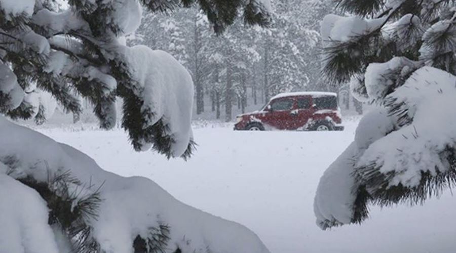
Winter of 2019 record snowfall
On February 21, 2019 a strong winter storm shut down schools across northern Arizona and dumped 40.8 inches (103.6 cm) of snow on Flagstaff, beating the 104-year-old-mark.
Snow on Route 66, winter 2019
Spurs of Route 66
The US Highway system uses three-digit numbers to designate spurs of one or two-digit routes. US 66 had spurs numbered 166 to 666, and some have survived even though US 66 was decommissioned:
US 166, still exists between Baxter Springs and Caldwell, KS. At one time it reached Springfield MO.
US 266, still exists between Henryetta and Warner in OK. only 43 miles long. At one time reached Oklahoma City.
US 366. Gone. Ran from Amarillo in TX through Clovis, Lincoln and Alamogordo in NM all the way to El Paso TX.
US 466. Gone. James Dean was killed on this highway. It ran from US 101 on the Californian coast all the way to Barstow CA, across to Las Vegas, Nevada and then to Kingman AZ.
US 566. Gone. From Lincoln to Socorro in New Mexico.
US 666. Gone. Now US 491, changed because 666 is "Satan's number". Read more: The Route of the Beast, U.S. 666 in Gallup NM.
> > Read about The six spurs of Route 66


