Missouri & Route 66
Index to this page
- Facts, Trivia, Useful Info
- History of Missouri
- Missouri's Geography & Weather
- Where to Stay in Missouri
- Maps of Route 66 in AZ
- Towns located on Route 66 in Missouri
- A List of Missouri's Main Route 66 Attractions
- Route 66 itinerary across the state
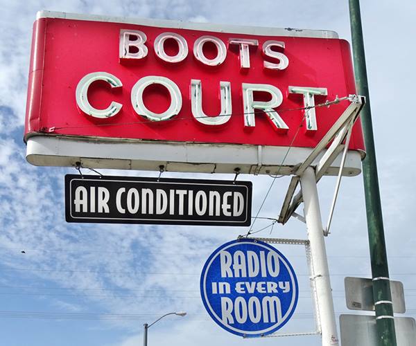
Neon sign of Boots Court in Carthage MO
About Missouri
Facts, Trivia and useful information
Area: 69,709 sq. mi. (180,533 km2). Population: 6,800,000 (2024).
Width: 240 mi. (385 km). Length 300 mi. (480 km)
Time zone (along U.S. 66 alignment): Central (CST): UTC minus 6 hours. Summer (DST) CDT (UTC-5).

Carl the Cheff, Springfield MO. Source.
- Nickname: "The Show Me State".
- Motto: "Salus populi Suprema Lex Esto" (Let the welfare of the people be the supreme law).
- Capital: Jefferson City
- Highest point: Taum Sauk Mountain, 1,772 ft. (540 m)
- 18th most populous state in America.
- 21st largest state in the U.S.
- Admitted as the 24th state of the Union on August 10, 1821
- Route 66 length in Missouri 313 miles (504 km).
5th longest stretch of US 66 - Springfield MO, is known as "The Birthplace of Route 66"
State's Nickname
The nickname "Show me State" has disputed origins, one version attributes it to Congressman Willard Vandiver who in 1899, who used it in a speech to state his skepticism, he needed to be shown something to believe in it, words would not convince him.
The Name: Missouri
The Missouri River gave its name to the state. In turn it originated from the local Missouri Indians. Their neighbors, the Miami-Illinois speakers called them the "ouemessourita", which meant "those who have dugout canoes."
.The History of Missouri

Main Street in Joplin, ca. 1910. Looking south from 5th. St. Source. Click image for St. View
The ancestors of Native Americans have lived in Missouri for at least 12,000 years, with mound builder cultures constructing massive earthwork structures along the eastern Mississippi area until 600 years ago.
The French from Canada advanced southwards and settled Missouri from the Great Lakes region via Illinois in the mid-1700s. However, St. Louis was founded by French from New Orleans in 1764. The region was known as Louisiana after the famous French King Louis XIV.
After the Seven Years' War (1763) France ceded Upper Louisiana to Spain, but Napoleon recovered it for France in 1800. Then, strapped for cash he sold it to the U.S. in 1803; it became the Louisiana Territory.
St. Louis was the starting point for the settlement of the West, hence its name "Gateway to the West". The famous Lewis and Clark Expedition to Oregon started off from this city.
This part of Louisiana became the Missouri Territory in 1812 and it joined the Union as a new state in 1821.
Settlers encroached on the native Osage and Kickapoo people who ceded their land in a series of treaties between 1808 and 1825; then, in 1830 they were relocated to reservations in the Indian Territory, that later became the state of Oklahoma.
The original native "traces" or trails from St. Louis to Springfield and SW Missouri were improved into dirt roads and a stage coach service ran along it. During the Civil War part of it became the "Wire Road" as it ran next to the telegraph line.
It became the main road between St. Louis and Springfield MO by 1920 it was the gravel surfaced state highway (MO-14). Route 66 was aligned along it in 1926.
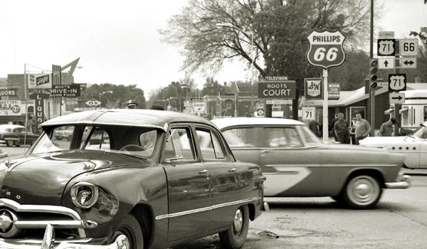
The Geography of Missouri
This Midwestern state is relatively flat north of the Missouri River which runs across the central part of the state to join the Mississippi River just north of Saint Louis. The NW tip is a high plain that reaches 1,200 ft (366 m). The Mississippi marks the state's eastern border, another low-lying area with an elevation of around 4200 ft (130 m).
South of the Missouri River lie the rolling hills of the Ozark Mountains made of limestone rocks that form caves and sinkholes. The elevation lies between 1,100 to 1,700 ft (520 m).
Missouri is located on a geologically stable region and there are no volcanoes. However Southeastern Missouri (New Madrid) suffered serious earthquakes in the early 1800s.
Missouri's Climate & Weather
Landlocked Missouri has a Humid Continental climate: summers are hot and humid; winters are cold with plenty of snow.
Lacking high mountains, the cold Arctic air in winter and the hot damp air from the Gulf of Mexico in summer, flow across the state unchecked.
It is part of the "Tornado Alley" and thunderstorms take place frequently during summer, causing tornados, which strike often.
Temperatures along US 66 average between 37°F and 18° F in winter (3 to -8°C) to 90°F and 66°F in summer (32 to 19°C).
Saint Louis
Average High ⁄ Low Temperatures in Winter and Summer:
Jan.: 38 ⁄ 21 °F (3 ⁄ -6 °C)
Jul.: 90 ⁄ 71 °F (32 ⁄ 22 °C)
Spring is a great time to visit Missouri; cherry trees and dogwood blossom across the Ozarks, don't miss them!
Cherry blossoms in Marshfield, Missouri

Cities along Route 66 in Missouri
Greater St. Louis is a large metropolitan area with a population (2024) of 2,242,000 inhabitants. Ranking 23rd in the USA. The city of Saint Louis city is far smaller: pop. 300,000. The largest city in the state is Kansas City with around 500,000 residents.
Around 959,000 people live along Route 66's corridor through Missouri, in small sized towns and villages and some larger cities like Springfield (pop. 170,000) the 3rd most populated city in the state, Joplin (pop. 58,000) ranks 11th. Cuba, and Rolla are other large cities on US 66.
Springfield, Rolla, Cuba and Joplin are the largest of them.
Culture

The Mother Road meets the Blues Highway in MO
Missouri as the Gateway to the West, received an influx of immigrants that blended in with the original French and Spanish settlers. It blended different ethnic groups and produced a culture that is friendly, enjoys music, food (barbecue) and the outdoors (in the Ozarks).
e influx of various ethnic groups and races helped create the two cities’ reputations for jazz, blues and barbecue. Most Missourians are friendly, open people, who enjoy music, food and outdoor activities.
It has been defined as "the easternmost western state, westernmost eastern state, northernmost southern state, southernmost midwestern state."
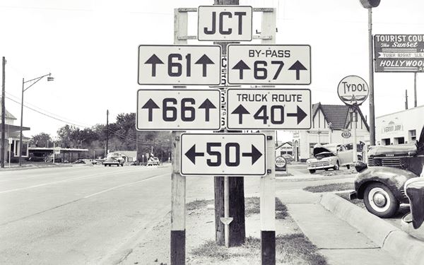
In Kirkwood, a suburb of St. Luis, Kirkwood Rd. carried US 66, bypass 67 (now US 67) and US 61 (which still runs along it). US Highway 61 was created together with US 66 in 1926; it runs between New Orleans, Louisiana and ends in the town of Wyoming, Minnesota.
US Hwy 66 is known as the "Great River Road" because it runs parallel to the Mississippi for 1,407 miles, but it is best known as "The Blues Highway" because it is linked deeply with the long history of blues music.
Where to Stay in Missouri: Hotels & Motels
Accommodation in Missouri
The towns along Route 66 offer many different lodging options. Check the hotels and motels in the main towns by following the links below, we list the towns along Route 66 from East to West.
Find your lodging in MO
On Route 66's Main alignment in MO
Eastwards
Westwards
- Hotels in Kansas
- Baxter Springs KS
- Galena KS
- Riverton KS
- Hotels in Oklahoma
- Miami OK
>> Check out the RV and Motorhome Parks & Campgrounds in Missouri.
Map of Route 66 through Missouri
Route 66 itinerary across Missouri
Below are the four legs we have split the course of U.S. 66 through Missouri, from East to West, starting at St. Louis, on the Mississippi River and ending on the SW corner in Joplin. Find a detailed description with modern and old maps:
Detailed description & Interactive maps
- Route 66 in St. Louis MO - map of this segment
- Gray Summit to Rolla - map of this segment
- Rolla to Springfield - map of this segment
- Springfield to Joplin - map of this segment
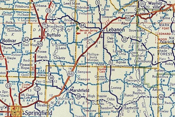
Towns located on Route 66 in Missouri
The cities are listed from East to West starting in St. Louis and ending in Joplin. Click on the links to get full info about that town.
East
A list of Route 66 Attractions in Missouri
Our List with the Top Ten Attractions on US 66 in MO
From St. Louis to Joplin, the Mother Road crosses the Ozarks and goes through many towns with plenty of interesting Route 66 classic icons. Below is the list of those who made it to our Top Ten attractions.
Route 66 Red Rocker
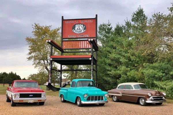
The Top 10 icons in Missouri

66 Drive-In Theatre, US 66, Carthage MO
- The World's (second) Largest Rocking Chair (Fanning)
- Meramec River US 66 Bridge (Eureka) Historic Site
- Big Chief Hotel (Wildwood) Historic Site
- Red Cedar Inn (Pacific) Historic Site
- Wagon Wheel Motel, Cafe and Gas Station (Cuba) Historic Site
- Historic Rock Fountain Tourist Court Motel (Springfield) Historic Site
- 66 drive-in theater (Carthage) Historic Site
- Circle Inn Malt Shop (Bourbon).
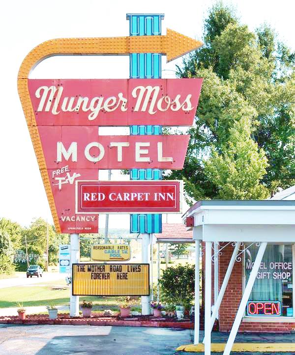
- Munger Moss Motel (Lebanon).
- Gillioz Theatre (Springfield) Historic Site
Munger Moss Motel Neon Sign, Lebanon MO
A list of Missouri's Attractions by Category
Within each category we list the stops and sights from East to West. There are many more, and we only listed some of them.
Service Stations
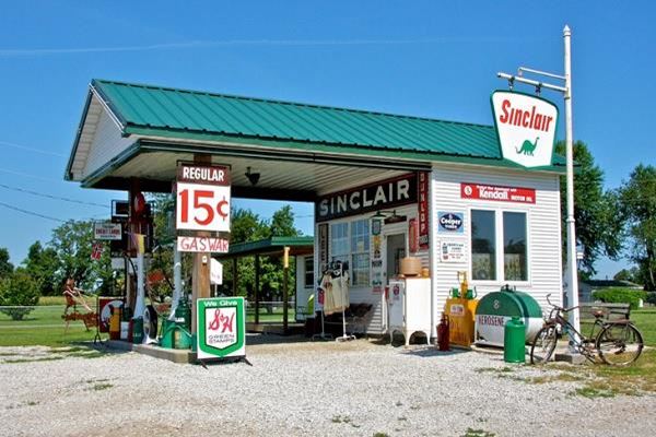
Gary's Gay Parita Sinclair
Nelson's Garage (St. Louis)
Miller's Phillips 66 Station (St. Louis)
St. Louis Phillips Gull Wing (St. Louis)
Old Texaco station (St. Louis)
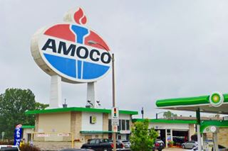
Giant Sign (St. Louis)
Trog’s Service Station (Kirkwood)
Old cottage-style gas station (Kirkwood)
Ballwin Gas (Ballwin)
Historic Kern Service Station (Pond)
Pond Texaco Gas Station (Pond)
Fox Creek Garage and Dealership (Fox Creek)
Phillips 66 Gull wing service station (Eureka)
1960s Phillips gull wing gas station, Eureka, Route 66, Missouri

The old Conoco gas station on Route 66, Cuba, MO
The Diamonds (Gray Summit)
Zephyr Service Station and Andy's Cafe (Villa Ridge)
Percy's Motor Co. (St. Clair)
Phillips 66 cottge gas station (Cuba)
Old Conoco Service Station (Cuba)
Kimberlin Bros - Ever Ready gas station (Cuba)
Derby Service Station (St. James)
Route 66 Motors (St. James)
Former Phillips 66 station (Rolla)
Sunset Rest Texaco and cabins (Devils Elbow)
Rock Face Phillips 66 (St. Robert)
Rigsby Standard Station (Waynesville)
Filling station (Waynesville)
Gascozark Cafe and Service Station (Gazcozark)
Old Phillips 66 Gull Wing Service Station (Hazelgreen)
Mobil Service Station (Lebanon)
Old Phillips 66 Service Station (Lebanon)
Old Conoco Station (Lebanon)
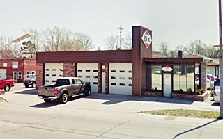
Woods DX Station nowadays. Lebanon
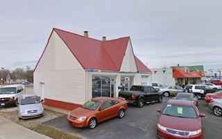
Carter & Lawson Mobil Station. Lebanon
DX Gas station (Lebanon)
Mobil Station (Lebanon)
Midway Cafe and Standard Station (Phillipsburg)
Carter & Lawson’s Underpass Cafe and Service Station (Phillipsburg)
O'Brien's Cabins, cafe and station (Sampson)
Oak Vale Park. Cafe, cabins and gas station (Niangua)
Cottage style Niangua Filling Station (Niangua)
Cottage style Niangua station nowadays
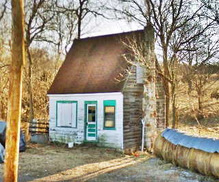
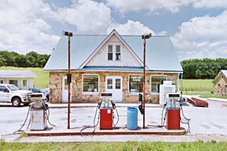
Rex Smith service station Bypass 66 Springfield, MO
Rex Smith Gas Station & Cabins (Springfield)
Rockhaven Restaurant, cafe, and filling station (Niangua)
Marshfield Oil Co. station (Marshfield)
McDowell's Garage (Strafford)
Tydol Gas Station (Springfield)
Sander's Service (Springfield)
D-X Filling Station (Springfield)
Danny's Service Station (Springfield)
Rathmel's frame Phillips66 (Springfield)
O’Dell Gas Station and Café (Springfield)
Rainey’s Wrecker Service (Springfield)
Ronnie’s Phillips 66 (Springfield)
Skelly filling station (Halltown)
Gay Parita Service station (Paris Springs)
Spencer Garage and Service Station (Spencer)
Miller's Station (Albatross)
Nichol’s Garage - Hardesty Station & Cabins (Avilla)
Cottage Phillips 66 (Avilla)
Old 1930s gas station (Avilla)
Below is a picture of two old Avilla station nowadays, restored, in Red Oak II (Carthage)

1916 Carthage Std. Oil station. Source

Avilla's Phillips 66. Source
1940s Gas station (Carthage)
Phillips 66 Station (Carthage)
Neatherry Station (Carthage)
Chet Campbell's Gulf Service Station (Carthage)
Texaco service station and Clover Inn Cafe (Carthage)
Historic Old Rock Sinclair filling station (Carterville)
Old Rock Gas station in Carterville, Route 66
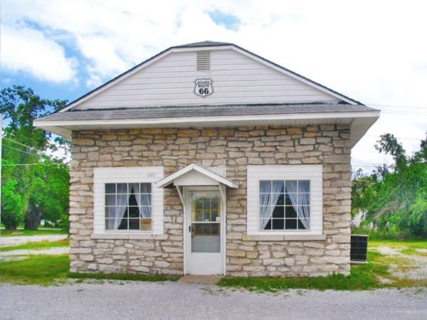
U.S. Filling Station (Webb City)
Site of Sinclair station (Webb City)
Webb City Filling Station (Webb City)
Cosden Service Station (Joplin)
Former Texaco Service Station (Joplin)
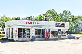
Texaco on West 7th St., Joplin
Texaco Gas Station #2 (Joplin)
Former gas station (Anderson's) (Joplin)
1930s Phillips 66 Service Station (Joplin)
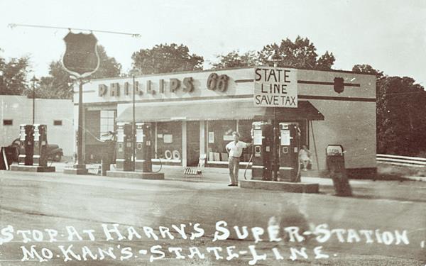
Harry's Phillips 66 Super Station (Joplin)
Former Sinclair? station (Joplin)
Welpman's Sinclair station (Joplin)
Humble or Magnolia 1925 gas station (Joplin)
Harry's Super-Station 1940s, Joplin MO
Motels & Hotels
Lit Beacon Neon sign, Route 66, Pacific Missouri. Source
Ivy Motel (Creve Coeur)
Duplex Tourist (Marlborough)
La Casa Grande Motel (Marlborough)
Chippewa Motel (Marlborough)
Pond Inn, 1910 (Pond)
Big Chief Hotel (Pond)
Al-Pac Motel (Pacific)
Beacon Motel and Neon sign (Pacific)
Trail's End Motel (Gray Summit)
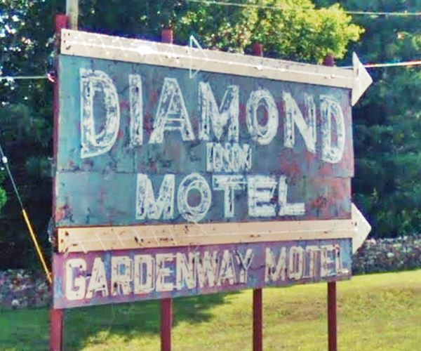
Gardenway Motel (Gray Summit)
Sunset Motel (Villa Ridge)
Skylark Motel (St. Clair)
St. Clair Motel (St. Clair)
Stanton Motel (Stanton)
Kovac’s Cafe and Motel (Stanton)
Shamrock Motel (Sullivan)
Shamrock Motel on Route 66 in Sullivan Missouri
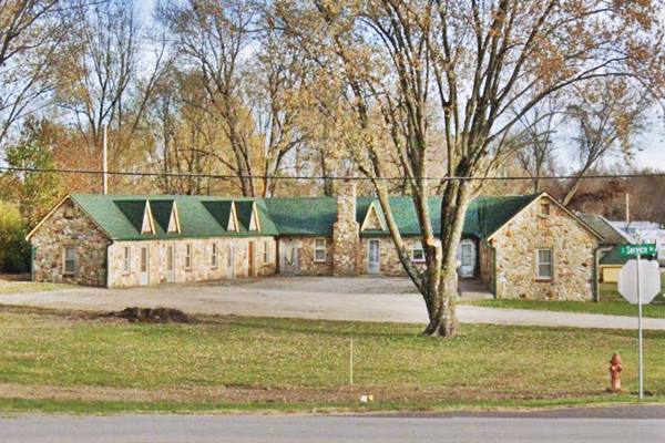
Grande Courts (Sullivan)
Bourbon Lodge café cabins and gas station (Bourbon)
Historic Wagon Wheel Motel, Cafe and Gas Station (Cuba)
Historic Wagon Wheel Motel, Route 66 in Cuba, Missouri
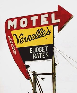
Neon sign of Vernelle's Motel on Route 66 in Newburg, MO. Source
Finn’s Motel (St. James)
Gateway Inn Motel (St. James)
Country Aire (old Dillon) Motel & RV Park (St. James)
Rock Haven Tourist Court (St. James)
American Way Motor Court (1940s) (St. James)
Vernelle’s Motel (Newburg)
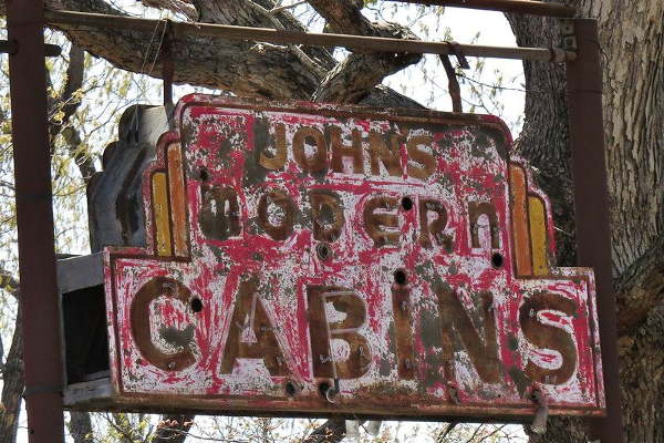
John’s Modern Cabins (Newburg)
Bell Haven court and service station (Buckhorn)
Lentz’s Oasis motel and station (Hazelgreen)
Munger Moss Motel (Lebanon)
Bell Motel (Lebanon)
Red Fox Motel (Lebanon)
Twin Oaks cabins and Texaco (Phillipsburg)
Abbylee Court( Niangua)
Fair Oaks Motel (Marshfield)
Rest Haven Motel today, Route 66, Springfield Mo street view
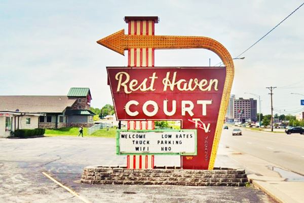

Classic Kel-Lake Motel sign, Carthage. Source
Otto's Motel Courts (Springfield)
Rest Haven Court (Springfield)
Flagship Motel (Springfield)
Glenstone Cottage Court (Springfield)
Dogwood Inn former Silver Saddle and Baldridge (Springfield)
Rail Haven (Springfield)
Kentwood Arms Motor Hotel (Springfield)
Rockwood Court (Springfield)
Shamrock Square Motel (Springfield)
Historic Rock Fountain Tourist Court (Springfield)
The Rancho Motel (Springfield)
Rancho Court - Trail's End Motel (Springfield)
Wishing Well Motor Inn (Springfield)
Boots Court Motel in Carthage, Route 66
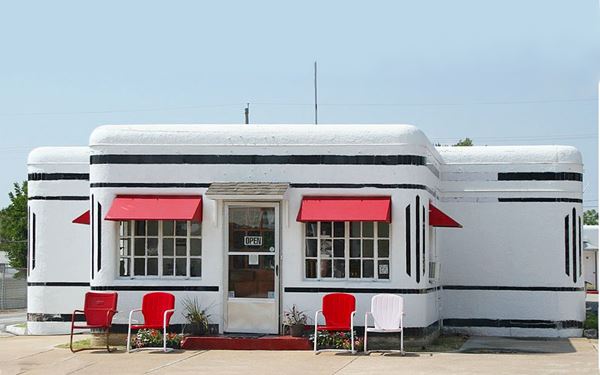

Modern Cabins neon sign, Plano MO. Source
Modern Cabins (Plano)
Castle Rock Cabins (Heatonville)
Shadyside Camp (Rescue)
Log City (Plew)
Kel Lake Motel (Carthage)
Lake Shore Motel (Carthage)
White's Court Cabins (Carthage)
Dazy Motel (Carthage)
Boots Court Motel (Carthage)
Plaza Motel (Joplin)
Bridges, Monuments, Trading Posts
The Chain of Rocks Bridge
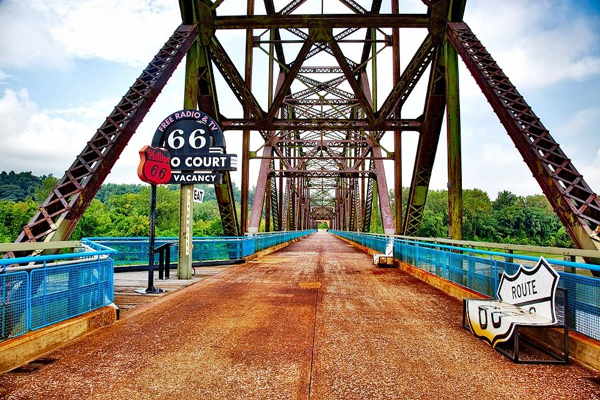
Chain of Rocks Bridge (St. Louis)
Gateway Arch (St. Louis)
Cloverleaf (Sunset Hills)
Meramec River US 66 Bridge (Times Beach)
Route 66 State Park (Times Beach)
Mural #1: Bette Davis Mural (Cuba)
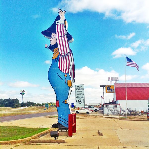
Mule Trading Post (Rolla)
Hillbilly Neon Sign (Rolla)
The "Hillbilly" at The Mule Trading Post

Neon Sign of the Totem Pole Trading Post.
Click for St. View. Source
Totem Pole Antiques Trading Post (Rolla)
Martin's Spring Store (Rolla)
Route 66 Bridge at Devil's Elbow (Devils Elbow)
Historic Stagecoach Stop (Waynesville)
Trail of Tears campsite (Waynesville)
Parson’s Store and Post Office (1890) (Laquey)
Historic Route 66 Gasconade Bridge (Hazelgreen)
Abou Ben Adhem Shrine Mosque (Springfield)
Gillioz Theatre (Springfield)
Gay Parita Store and Cafe (Paris Springs)
Avilla Post Office (in a 1915 Bank) (Avilla)
Dales Ole 66 Barber (Joplin)
State Line Mercantile (Joplin)
Oddities, Wacky Sights, Neon signs
Meramec Caverns painted Barn sign (St. Clair)
Indian Harvest Trading Post (St. Clair)
Meramec Caverns (Stanton)

Jesse James Hideout in Meramec Caverns. Credits

Rock chamber with stalactites and stalagmites. Meramec Caverns. Credits
Deadly Curve (Sullivan)
New Bourbon Tank (Bourbon)
The World's (second) Largest Rocking Chair (Fanning)
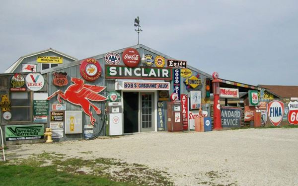
Bob’s Gasoline Alley (Fanning)
Murdon Neon Sign (St. James)
Bob’s Gasoline Alley
"stubby" Stonehenge (Rolla)
Historic County Jail (1860) (Rolla)
Half Curbs segment of Route 66 (Rolla)
1943 Route 66 alignment (Hooker)
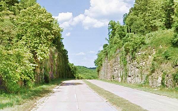
Hooker Cut (Hooker)
Hooker Cut nowadays in Hooker, Missouri

"Mega Mayor" muffler man, Uranus Missouri, St. Robert US 66. Source
Uranus Missouri (oddities and fun) (St. Robert)
Mega Mayor "Muffler Man" (St. Robert)
Frog Rock (Waynesville)
Two Meramec Caverns painted barns (Phillipsburg)
Painted barn with a Meramec Caves sign (Conway)
Two Main Streets (Strafford)
Springfield's "Carl the Chef" (Springfield)
Visitor Center neon sign (Springfield)
Birthplace of Route 66 sign (Springfield)
Red’s Giant Hamburg sign (Springfield)
Red Oak II (Carthage)
Whee! Bridge (Carthage)
Eastern terminus of US 66 (1974 to 1985) (Joplin)
The strange "Spook Lights" (Joplin)
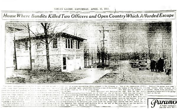
Bonnie and Clyde Garage Apartment (Joplin)
Original photo of the bandits Bonnie & Clyde's hideout (15-04-1933) in Joplin. Still standing.
Restaurants, Diners, Inns

Keys Cafe originally at Villa Ridge neon sign; now at Route 66 State Park,
Ted Drewes Frozen Custard (St. Louis)
Spencer’s Grill (Kirkwood)
The Green Parrot Inn (Kirkwood)
Steiny’s Inn (Times Beach)
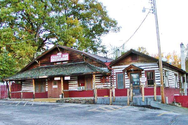
Historic Red Cedar Inn (Pacific)
Cave Cafe (Pacific)
Monroes Cafe (Pacific)
Site of Key’s Twin Bridge Gas Station and Cafe (Villa Ridge)
The Dine-O-Tel (St. Clair)
Snell's Cafe (Sullivan)
Circle Inn Malt Shop (Bourbon)
Sweeney's Cafe and Roedemeier's Garage (Bourbon)
Johnnie’s Bar (St. James)
Old Munger-Moss Sandwich Shop (Devils Elbow)
Caldwell's Cafe, station and Cabins (Gazcozark)

Circle Inn Malt Shop's Neon Sign, Bourbon Missouri. Source
Skyline Cafe (Marshfield)
Former Route 66 Crawford Cafe (Strafford)
Midway Service & Cafe (Avilla)
State Line Restaurant (Joplin)
Route 66 itinerary across the state of Missouri
Below is a detailed description of the alignment of U.S. 66 through New Mexicoa, from East to West. For each town we give details of Route 66's alignment through it. You can also click above on a town and read more about the course of US 66 in that specific community.
Missouri
California ¦ Arizona ¦ New Mexico ¦ Texas ¦ Oklahoma ¦ Kansas ¦ Missouri Illinois
Route 66 in Missouri
Current mileage: 313 mi.
St. Louis is the easternmost point of Route 66 in Missouri, and is the "Gateway to the West". The first city on Route 66 west of the Mississippi River.
Route 66 crosses the state with a Northeast - Southwest course, from St. Louis on the Mississippi River to Joplin in the "Tri-State" mining region (where OK, KS and MO meet).
Click on the detailed description with interactive maps of each leg across the state (in the yellow box at the start of each leg).
Starting on the MO-IL state line
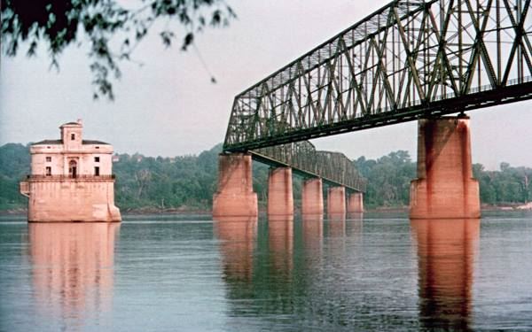
Chain of Rocks Bridge nowadays in Madison, Illinois
St. Louis
Route 66 had several alignments through East Saint Louis, Venice, and Mitchell in Illinois to cross the Mississippi into St. Louis and reach Missouri. In this itinerary we describe the northernmost one, used in the 1930s to 1950s which crossed the Mississippi River using the historic Chain of Rocks Bridge.
There were other alignments to the south, with four different bridges crossing the Mississippi River (the Route 66 in St. Louis MO leg is a detailed description of all these Route 66 alignment.
As the Historic Chain of Rocks Bridge is closed for car traffic, you must enter Missouri from Illinois along I-70, via the "New Chain of Rocks Bridge" (you can see the old bridge to the south of the new one).
From the middle of the Bridge (state line and mile zero) head west and leave the Interstate, to the right at Exit 34, take a left onto Riverview Drive, southwards. At Bellefontaine Rd, (4.5 miles) turn left onto N. Broadway Ave, at Calvary Cemetery, take a right onto Calvary Ave. (6 mi.) and at W. Florissant Ave, turn left, southwards.
Pass under I-70 and continue towards downtown Saint Louis.
Florissant Ave. ends at Mullanphy Ave. (11 mi.), follow the latter east and curve into N 13 St., left onto Cass Ave., and then right onto N. Tucker Blvd., southbound.
Keep on Tucker Blvd. crossing I-64 (U.S. 40) (13 miles) and cross the exchange between I-55 and I-44; the road keeps a southwesterly course becoming Gravois Ave. (14.2 mi.) known as Historic Route 66 and MO-30.
Looking down Market St. from City US 66 in downtown St. Louis, Missouri
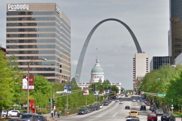
At the crossing with Chippewa St. (MO-366) (17 miles) take a right along MO-366 and follow it through Malborough (where the once famous Coral Court Motel stood), and Crestwood, followed by Sunset Hills and Fenton.
West of this point the old Route 66 is overlaid by the freeway. Access it (27 mi.) at I-44's Exit 276 and head west.
You will pass by the "Ghost Town" of Times Beach, evacuated in 1983 due to dioxin contamination, by the Meramec River; it is now the Route 66 State Park (37 miles) with the Meramec River U.S. 66 Bridge (Historic Site).
Eureka and Pacific
Just ahead is Eureka (39 mi.), leave I-44 it at Exit 261 (41.5 miles) in Allenton, cross to its south side and take a right onto Business Loop 44, former Route 66 which becomes Ossage St. as it enters Pacific (visit the Historic Site of the Red Cedar Inn) Cross the center of the city (46 miles) and keep on westwards along Bus. Loop 44 which is the south frontage road of I-44.
At its intersection with U.S. 50 (I-44 Exit 247) it reaches Gray Summit.
Gray Summit
The 1926 to 1932 alignment of Route 66 ran from St. Louis to Gray Summit in a course that ran north of I-44 (Read its description : 1926-32 Route 66 west of St Louis).
From Gray Summit, keep straight along the West frontage Road, which is the old U.S. 66 roadway, continue straight at and don't access I-44 at Exit 253, (51 mi.) go along The CO Rd 100, Historic Route 66, which crosses to the west of I-44 (52 miles) and passes by Villa Ridge. Stay along it passing Exit 247 where U.S. 50 forks to the west. It becomes I-40's north frontage Rd. At Exit 242, cross to the south side of I-44 (63 mi.) following Old '66 and that becomes N. Commercial Ave. as it crosses St. Clair (66 miles).
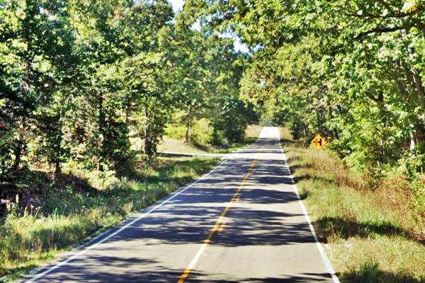
At Co. Rd. 30 go right and then cross I-44 at its Exit 239 and take a left along its north Frontage Road (U.S.66). At Hwy W, (74 mi.) cross to the East of I-44 (Exit 230), at Stanton. Here you can take a short side trip to the Meramec Caverns.
Turn right and keep along the south Frontage Road towards Oak Grove Village and then go through Sullivan (80 miles), and keep SW along W. Springfield Rd, and the South Service Rd., passing through Bourbon (86 mi.) along Historic Route 66. The road becomes the South Frontage Rd. again, passing by a "ghost town": Hofflins and 3.5 mi. ahead, entering Cuba passing through its business district (98 miles).
Cuba
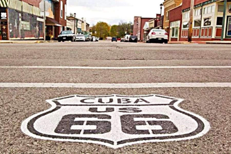
Cuba is famous for its murals, stop and enjoy them, also visit the Wagon Wheel Motel, a Historical Site.
Leave the town along Historic Route 66, passing through Fanning, site of the World's Second Largest Rocking Chair. Just ahead, next to Exit 203 follow US 66 as it becomes the South Frontage Rd. again. (103 mi.), passing by Rosati and through St. James (111 miles).
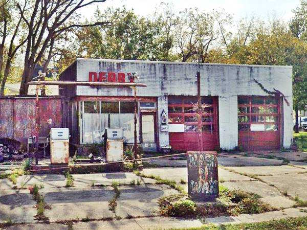
As the old US 66 passed to the north of what is now I-44, you must also cross I-44 here in St. James. So, take a right along Co. Rd. 8 and pass I-44 at its Exit 195 and take a left along the N. Outer Rd. westbound, which you will follow until meeting U.S. 63 (121 mi.) north of Rolla.
Rolla
Take a left, southward, cross I-44 and follow Co. Rd .70 through Rolla (123 miles). Visit its "Stubby Stonehenge" monument and its classic motels. Continue along Kingshighway, cross U.S. 63 and at the roundabout east of I-44, take Martin Springs Dr. (it is MO-7100) west. It becomes Eisenhower St. through Doolittle (130 mi.).
Keep west, it becomes Outer Rd. W. (MO-7300) through Newburg which ends as a dead end at Arlington you can avoid that by taking I-44 west at Exit 176 (133 miles).
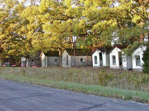
John’s Modern Cabins, Route 66 in Newburg, Missouri
Leave the Interstate at Exit 172 (137 mi.) and keep on the N. Outer Rd. through part of Jerome, Powellville and Clementine, till you reach Exit 169 (142 miles) and cross I-44 to its south side and take a right onto Z Road which is US 66. Here the 1940s four-lane divided highway through Hooker Cut begins.
Hooker Cut
The large rock road cut just east of the bridge over the Big Piney River is the famous "Hooker Cut", which when cut in the 1940s, was the deepest road cut in Missouri and the whole US with 90 feet.
It passes by Hooker and Devil's Elbow (147 miles) named after a sharp bend of the Big Piney River -here you can take the 1926-41 alignment or keep on the later one.
Ahead, at Exit 163, on the north side of the freeway is Morgan Heights on what used to be the 1926-41 alignment of Route 66. Keep westbound the road becomes I-44 Bus. Rd., crosses I-44 and goes through St. Robert (150 mi.)
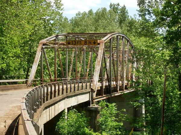
1923 Route 66 Bridge in Devil’s Elbow, Missouri
Waynesville
At Waynesville (152 miles), visit the Historic Pulaski County Courthouse. Leave town and go south (Hwy 17 - US 66) and at Exit 153, (158 mi.) cross to the south of I-44 at Buckhorn and stay on Hwy 17 or try the 1926-1930 alignment and visit Laquey. When MO-17 forks (161 mi.), take the right along AB Hwy - Route 66, westwards passing through Gascozark and one mile ahead Hazelgreen now on the S. Frontage Rd. of I-44. The historic bridge over Gasconade River (170 miles) is not open for cars but a new one was built beside it. The original roadway ran on the north side of I-44 for a short stretch here, but it is cut off from moder Old 66. Head west along the South Service Rd. westwards. At MO-F Exit 135, (179 mi.) the road crosses to the North of I-44, reaching Lebanon (186 miles) via Route 66 (I-44 Bus. Loop).
Lebanon
Continue along I-44 BL, first west and then south but, when you reach I-44 at Exit 127 don't enter, stick to the North Frontage Rd. (US.66) (MO-W) through Caffeyville and then cross to the south-east side of I-44 towards Phillipsburg at Exit 118 (197 miles).
Take a right along MO-CC (US-66 & South Frontage Rd.); pass Conway (202 miles). The road runs towards the south, well to the east of I-44, passing through a ghost town: Sampson.
It goes through Niangua and then Marshfield (215 mi.). Stick to MO-CC (US-66) as it approaches I-44, and passes through Red Top and Strafford (228 miles). It becomes Co. Rd. 744 follow it towards Springfield.
Springfield "the Birthplace of Route 66"
There are some sites that are listed in the National Register of Historic Places: Gillioz Theatre, the Rock Fountain Court and The Abou Ben Adhem Shrine Mosque. Don't miss the plaque on the Park Central Square, which dedicates Springfield as "the Birthplace of Route 66."
Co. Rd. 744 passes by Springfield on its northern side and intersects with U.S.160 (242 mi.). Take a left along U.S. 160 south to pass along the western side of Springfield.
At I-44 Bus. Loop, in SW Springfield (244 mi.) go right, cross I-44 and keep along Co. Rd. 266, passing through Halltown (259 miles), followed by the ghost town of Plano. When you reach the access to Co. Rd. 96 (261 mi.), keep straight on the "old" road, pass through Paris Springs and the road will curve following Johnson Creek to the SW.
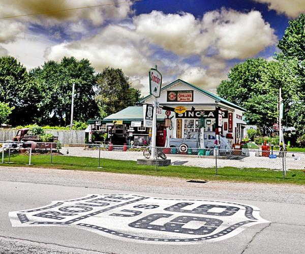
Cross Co. Rd. 96 and continue (Co. Rd. 266 becomes MO-N) for 1⁄2 mi. take a right across the old bridge on Lawrence Rd. (MO-2062), pass Spencer and join Co. Rd. 96. Go left (west). See the map above, this is shown with the black line. The road passes through two small communities: Heatonville and Albatross and then reaches Phelps (274 miles). Then come two more small communities: Rescue and Plew before reaching Avilla.
As you approach Carthage, just before County Lane 110, (293 miles) on the right side of the road is the old paved road surface of U.S. 66. At County Lane 118, it crosses to the south as Old 66 Blvd. joining Co. Rd. 66 further ahead by Kellogg Lake. The road keeps on SW and reaches Carthage (309 miles).
Carthage
Visit its Historic Site, the 66 drive-in theater. Take a right on Central Ave. and a right on Garrison Ave. and pass through the town (310 mi.). Take a right again along Route 66, cross I-49 (311 miles) and head west towards Joplin.
Joplin
One of Joplin's Route 66 murals
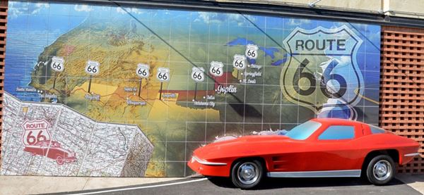
The town's name is mentioned in the song Route Sixty-six (Get your kicks...)
As in all big towns, Route 66 had several alignments into and through Joplin. We will describe only one of them: After leaving Carthage follow Route 66 and cross I-49 at its exit 46 (315 mi.). This is the 1926 alignment which crosses Carterville (319 miles). Take a right along the Main St. and head for Webb City, where it becomes Broadway (320 mi.); take a left along S. Orongo St. to 14th. St. then a right and at Route 66, I-49 Bus. Loop, a left. Take a right at E. Zora St., and a left at N. Florida Ave., a right on Utica St. until reaching Euclid Ave. which runs towards the SW. (324 mi.). At N. St. Louis Ave. go left until Broadway St. (turn right) until you reach Main St. and take a left through the center of the city (327 miles).
At 7th St. (MO-66) go right, a: Take a left along W. Old 66 Blvd. (the 1926 alignment) to the State Line and leave Missouri, to enter Kansas.
This is the end of the alignment. Total length 333 miles.
The later alignments followed MO-66 to the state line, and continued as KS-66 into downtown Galena KS, where both alignments met at Main St.
Some sponsored content
> > Book your Hotel in Lebanon

Credits
Banner image: Hackberry General Store, Hackberry, Arizona by Perla Eichenblat.


