Route 66; an itinerary
See our One Week Route 66 Road Trip Itinerary
We have put together a 1-Week Route 66 Road Trip Itinerary from Chicago to Santa Monica.
You can use it as a starting point for planning your own road trip.
Illinois
California ¦ Arizona ¦ New Mexico ¦ Texas ¦ Oklahoma ¦ Kansas ¦ Missouri ¦ Illinois
Towns located on the Illinois segment of Route 66
From East to West
Read all about Route 66 in the state of Illinois, its sights and landmarks.
Click on any town below to learn more about its classic stops, spots, attractions, history and more!
We have listed the 1926-1930 alignment towns further down because they lie on a separate segment southwest of Springfield.
East
List of the 1926-30 Route 66 Towns from East to West
This segment lies between Springfield and Staunton west of the later 1930-77 US 66:
Route 66 in Illinois
Chicago is the easternmost point of Route 66
Current mileage: 289 mi.
Route 66 crosses the state with a Northeast - Southwest course, from Chicago to East Saint Louis, linking Lake Michigan with the Mississippi River.
Chicago and Lake Michigan from the air
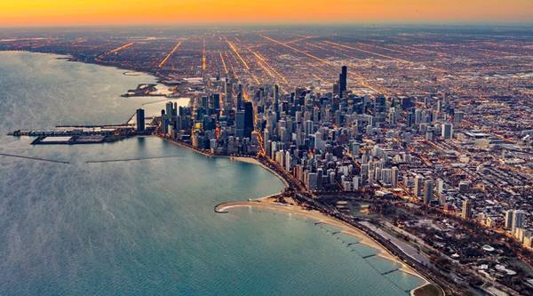
Route 66 starts (or ends) in Chicago at the intersection of Jefferson and Jackson Boulevard. Grant Park is the official eastern terminus of Route 66. At the intersection of Jackson and Michigan you will find the End Historic Route 66 sign.
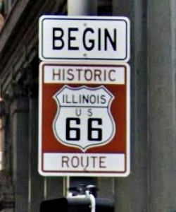
Begin sign, Route 66, Chicago.
From the start (or end) of Route 66, (mile zero) in Chicago, by historic Grant Park take W. Adams St. west until reaching the diagonally oriented W. Ogden Ave, turn left (actually the alignment in 1926 was along W. Jackson Blvd., but it now runs west to east, that is why you must take the following street). Follow Ogden until reaching Lawndale Ave (11 mi.) and turn left along it. At Joliet Rd., take a right and just keep on it. It is the Historic US 66 in Illinois.
Take a detour along W 55 St and East Ave. to bypass a closed section and return to Joliet Ave (14.8 mi.). Pass under I-294 and at Exit 276B access I-55, this Exit marks the border of Cook County, where Chicago is located.
Take I-55 westwards and at Exit 274 leave it to visit Dell Rhea’s Chicken Basket.
Follow I-55 to Exit 268, pass under I-55 and head SW along S. Joliet Rd.; it becomes N. Independence Blvd. (IL-53) in Romeoville. Follow IL-53 which overlaps with IL-7 (34 mi.) to Joliet.

The Neon Sign of the Historic Dell Rhea’s Chicken Basket, Willowbrook. Source

Gemini Giant, Wilmington
Joliet and Wilmington
It becomes N. Broadway St. and crosses the Des Plaines River via Ruby St., then turns right along IL-53 through downtown Joliet (39 miles).
Follow U.S. 6 south; at 4th Ave. it becomes U.S. 52, cross I-80 and leave US 52 staying on IL-53 which splits towards the right. The road curves to the SW to reach the towns of Elwood (54 miles) and Wilmington (68 miles), where it turns west and crosses the Kankake River.
As IL-53 it heads SW going through Braidwood (78 mi.) and then Godley and Braceville.
It reaches Gardner (104 mi.), going through the town along IL-29, (Main St.) and turning south along Historic Route 66 just before reaching I-55.
Dwight & Odell

Ambler’s Texaco Gas Station, Dwight. Source
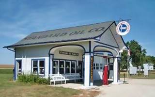
Historic Service Station in Odell, Illinois. Credits
U.S. 66 runs on the eastern (south) side of I-55 next to the railroad. Near Dwight at 110 mi you will see the old paved surface of the original alignment of U.S. 66, to your right.
Keep on U.S 66, which skirts around Dwight (111 mi.) site of the Ambler Texaco Station pictured above.
US 66 as frontage road of I-55 enters Odell along N. West St. (121 miles). Don't miss its Standard Oil service station (Historic Site) on S. West St. and Deer St., shown above.
Leave the later 1940s US 66 and go through the town along the original 1926 course of U.S. 66.
South of Odell US 66 runs beside I-55 once again, they separate (127 miles) near Pontiac.
Pontiac

Mural in Pontiac, Illinois. Ivo Shandor
Once again leave the later alignment of Historic US 66 and take the old 1920s alignment through town: right onto Pontiac Road (131 miles) and south down N. Division St., west along W. Lincoln Ave. and then again south along N. Ladd St.; you will reach the center of Pontiac(139 mi.)
Don't miss the town's Route 66 Murals.
You will cross Tuttle Creek and at W. Reynolds St. take a left onto Historic US 66 and leave town. The highway runs to the SW passing throughs Chenoa, (142 mi.). Leave US 66 to cross the town via N. Morehead St. Take a right at US 24 to return to Historic US 66.
Detailed description from Chicago to Pontiac with maps
West of Pontiac you'll follow I-55 into Lexington (150 miles), go through it along Parade Rd, Main St. and S. Grove St. and return to Historic US 66 (152 mi.)
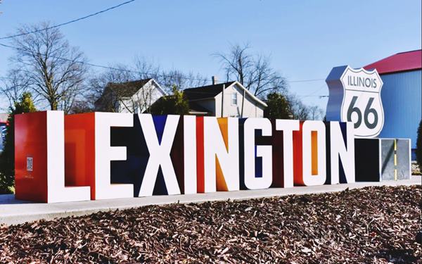
Route 66 runs beside I-55 into Towanda (159 mi.), hoome of the Dead Man’s Curve. Continue towards Normal and Bloomington.
Normal & Bloomington
Later alignments of US 66 circled around both towns along their eastern and southern sides (now the I-55 Bus. Loop.) We will describe the original 1926 alignment into Normal and Bloomington:
After reaching Veteran's Pkwy (I-55 Bus. Loop) (163 mi.) keep straight ahead, the road curves west and becomes Shelbourne St. west. Take a left along Henry St. south (164 mi.) which curves into Pine St. west and ends at N. Linden St., where you must take another left southwared, until Willow St. (165 miles). Turn right on Willow St. which will meet US Bus. 51 (166 miles). Turn left and pass through Illinois State University, heading southwared through Normal.
Visit Sprague’s Super Service, a Historic Site.
Historic Sprague’s Super Service in Normal, Illinois
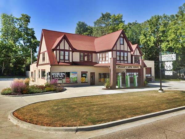
Head south into Bloomington (168.5 miles). Turn right at the crossing with S. Veterans Parkway (I-55 Bus. Loop) (170 mi.) and take a right onto Fox Creek Road (171 miles) to cross I-55. US 66 is the west frontage road all the way to Mc Lean (184 miles), passing though Shirley
and Funks Grove.
Cross McLean along N. Fisher St., Main St. and Dixie Rd., head SW to reach Atlanta (190 mi.)
Atlanta
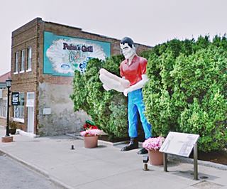
Drive through it along Arch St. and admire the Muffler Man Holding a Hot Dog.
Keep on Historic U.S. 66 and (198 mi.) cross I-55 at its Exit 133 to enter Lincoln.
Lincoln
Lincoln has plenty of Classic sights: leave Historic US 66 and take Kickapoo St., then west along Keosuk St. and southwest again via Sangamon St, taking 3rd St. west and Stringer Ave. to meet Historic Route 66 SW of the town (204 mi.)
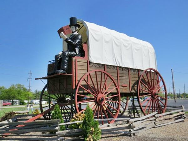
World’s Largest Covered Wagon in Lincoln, Illinois
As you approach I-55's Exit 123 turn left along Historic U.S. 66. It keeps a SW course going though Broadwell (211 mi.), Elkhart (215 mi.) and Williamsvillle (221 miles) where you will have to access I-55 South at Exit 109 along Stuttle Rd.
Leave I-55 at Exit 105 towards Sherman, along I-55 Business Rd. (227 mi.). Pass through it and head south into the State Capital City of Springfield.
Springfield
There are several alignments in Springfield which we describe in our Springfield, some go through the city (current I-55 Bus), others skirt it as the Historic US 66 Bypass (IL-29), and all meet on the south side of Springfield (where Stevenson Dr. meets I-55 Bus.; from there head south.

Detailed description from Pontiac to Springfield with maps
West of Springfield 1926-30 Alignment
Route 66's 1926-1930 alignment forks to the southwest in Springfield, going through the towns of Chatham, Auburn, Thayer, Girard and Carlinville, it meets the later alignment in Staunton.
See this detailed description of the old alignment: Springfield to Staunton (1926-30) - Map of this segment
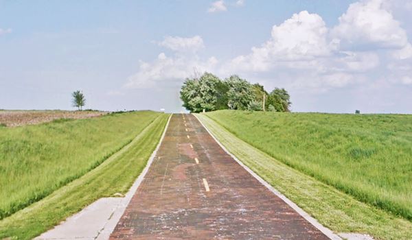
The main attraction on this segment is the Brick paved section of Route 66 in Auburn.
Red brick Route 66, Auburn Illinois
Main Route 66 1930-1979 West of Springfield
Go south, pass the exchange between I-55 and I-72; At I-55's Exit 88 (245 miles) take Palm Rd. South, to reach US 66 which is the western frontage road of I-55.
Pass Divernon (254 mi.) and Farmersville (263 miles). After Waggoner, at IL-24, you will switch to the east Frontage Road (278 mi.), reaching Litchfield (281 miles).
Litchfield
Drive through town along Old Rte. 66 (access it with a left at N. 13th Ave.), dont' miss the classic Ariston Cafe (Historic site). At Co. Rd. 1000 a right and a left will keep you southbound along US 66 (285 mi.), towards Mt. Olive.
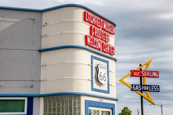

Soulsby’s Service Station, Mt. Olive Credits
As you enter Mt. Olive (289 miles) you can stay on Old Route 66 and bypass the town, or drive through it (city center 291 miles). Stop at the Soulsby Service Station, a Historic Site (see image).
Staunton
After crossing the railroad, take the right fork (295 mi.) passing under I-55 along Old 66 into Staunton, drive along its eastern side (297 mi.).
The replica gas station at Henry's Rabbit Ranch:
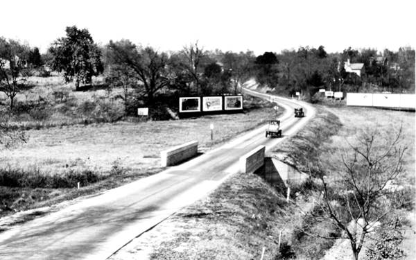
Keep south until Williamson Rd. forks to the right (299 miles), take this road which will meet IL-4 (300 mi.) and then take a left southbound. IL-4 meets I-55 at Exit 33, but stick to the west frontage Road, US 66 (303 miles).
The road will take you through Hamel (307 mi.)
Description from Springfield to Hamel 1930-79
Springfield to Hamel ⁄ Staunton (1930-1977) - Map of this segment.
Many Route 66 Alignments into St. Louis

Edwardsville IL. Route 66 shield monument. Source. Click for St. view
West of Hamel there are several Route 66 alignments in Illinois, and on the other side of the Mississippi River in Missouri too.
From our Hamel page you can follow these alingments and the towns along them.
There were 4 different bridge crossings across the Mississippi River, and at least 4 alignments into East St. Louis and St. Louis. In this itinerary we will skip those going south into East St. Louis and take the 1930s - 50s alignment, across the New Chain of Rocks Bridge. Which is the northernmost of these alignments.
Head SW along IL-157, which will take you to Edwardsville. At the crossing with IL-143 (315 miles), take a right and keep along IL-157 westwards and then SW, cross the S. University Dr. (321 miles) and continue along Chain of Rocks Road, crossing over IL-255 near its Exit 30. Keep your westerly course till IL-111, (324 mi.).
Keep west along the same road leaving IL-111 behind. The road meets the railway tracks (325 miles), and you must access I-270 to cross the tracks at Namekoi Rd. Right after crossing the railroad, take the exit to Old Alton Rd., turn right and pass under I-270, then a left to meet the W. Chain of Rocks Rd. which crosses the navigation channel of the Mississippi River (328 mi.) and keeps west.
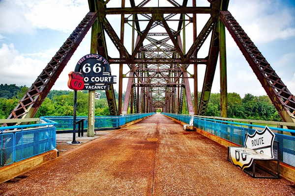
Chain of Rocks Bridge
At 330 mi, you will reach the end of the road at the Chain of Rocks Bridge with its bend in the middle. It does not allow heavy vehicle traffic. At this point Route 66 crossed the Mississippi River.
To cross the River you will have to go back along the same route, to IL-3, (332 miles), take a left and at Exit 3B head West along I-270, crossing the Mississippi River and leaving Illinois, to enter Missouri (335 mi.), which we describe below.
Description from Hamel to St Louis 1926-79
The Chain of Rocks Bridge
Missouri - Best Route 66 sights
California ¦ Arizona ¦ New Mexico ¦ Texas ¦ Oklahoma ¦ Kansas ¦ Missouri ¦ Illinois
Towns located on the Missouri segment of Route 66
List of Route 66 Towns in Missouri from East to West:
East
Route 66 in Missouri
Current mileage: 313 mi.
Route 66 crosses Missouri with a Northeast to Southwest course, from St. Louis, on the Mississippi, by the Illinois state line all the way to Joplin next to the Kansas State line.
>> Book your Hotel in Missouri
>> Check out RV and Motorhome Parks & Campgrounds in Missouri.
St. Louis
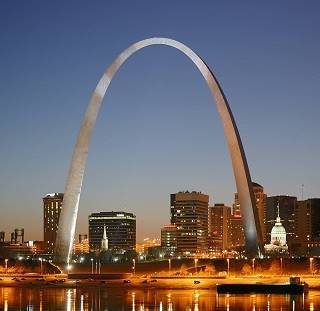
Saint Louis, Missouri. Source
Route 66 had several alignments through East Saint Louis and St. Louis. We described the northernmost one, used in the 1930s to 1950s, across the historic Chain of Rocks Bridge.
There were other alignments to the south, with four different bridges crossing the Mississippi River.
Read about all the Route 66 alignments in St. Louis.
As the Historic Chain of Rocks Bridge is closed for car traffic, you will enter Missouri from Illinois on I-70, using the "New Chain of Rocks Bridge;" you can see the old bridge to the south of the new one.
From the middle of the Bridge (state line and mile zero) head west and leave the Interstate, to the right at Exit 34, take a left onto Riverview Drive, southwards. At Bellefontaine Rd, (4.5 miles) turn left onto N. Broadway Ave, at Calvary Cemetery, take a right onto Calvary Ave. (6 mi.) and at W. Florissant Ave, turn left, southwared.
Pass under I-70 and continue towards the center of Saint Louis. Florissant Ave. ends at Mullanphy Ave. (11 mi.), follow the latter east and curve into N 13 St., left onto Cass Ave., and then right onto N. Tucker Blvd., southbound.
Keep on Tucker Blvd. crossing I-64 (U.S. 40) (13 miles) and cross the exchange between I-55 and I-44; the road keeps a southwesterly course becoming Gravois Ave. (14.2 mi.) known as Historic Route 66 and MO-30.
At the crossing with Chippewa St. (MO-366) (17 miles) take a right along MO-366 and follow it through Malborough (where the once famous Coral Court Motel stood), and Crestwood, followed by Sunset Hills and Fenton. The road will lead you (27 mi.) to I-44's Exit 276, use it to access I-44 westbound, the freeway overlays the old roadway.
You will pass the "Ghost Town" of Times Beach, evacuated in 1983 due to dioxin contamination, by the Meramec River; it is now the Route 66 State Park (37 miles). Visit the Meramec River U.S. 66 Bridge (Historic Site)-
Eureka
Ahead is Eureka (39 mi.)
1960s Phillips gull wing gas station, Eureka, Route 66, Missouri
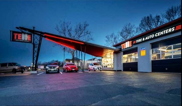
Continue along I-44 and leave it at Exit 261 (41.5 miles) in Allenton, cross to the south of I-44 and take a right onto Business Loop 44, which becomes Ossage St. as it enters Pacific (visit the Historic Site of the Red Cedar Inn) Cross the center of the city (46 miles) and keep on westwards along Bus. Loop 44 which is the south frontage road of I-44.
At its intersection with U.S. 50 (I-44 Exit 247) it reaches Gray Summit.
Route 66 in St. Louis
Description of this segment Route 66 in St. Louis MO to Gray Summit - map of this segment
West of Gray Summit
Lit Beacon Neon sign, Route 66, Pacific Missouri. Source
The 1926 to 1932 alignment of Route 66 ran from St. Louis to Gray Summit in a course that ran north of I-44 (Read its description : 1926-32 Route 66 west of St Louis).
From Gray Summit, keep straight along the West frontage Road, which is the old U.S. 66 roadway, continue straight at and don't access I-44 at Exit 253, (51 mi.) go along The CO Rd 100, Historic Route 66, which crosses to the west of I-44 (52 miles) and passes by Villa Ridge. Stay along it passing Exit 247 where U.S. 50 forks to the west. It becomes I-40's north frontage Rd. At Exit 242, cross to the south side of I-44 (63 mi.) following Old '66 and that becomes N. Commercial Ave. as it crosses St. Clair (66 miles).

Rock chamber with stalactites and stalagmites. Stanton Meramec Caverns. Source
At Hwy W, (74 mi.) cross to the East of I-44 (Exit 230), at Stanton (you can take a short side trip to the Meramec Caverns from here).
Turn right and keep along the south Frontage Road towards Oak Grove Village and then go through Sullivan (80 miles), and keep SW along W. Springfield Rd, and the South Service Rd., passing through Bourbon (86 mi.) along Historic Route 66. The road becomes the South Frontage Rd. again, passing by a "ghost town": Hofflins and 3.5 mi. ahead, entering Cuba passing through its business district (98 miles).
Shamrock Motel on Route 66 in Sullivan Missouri
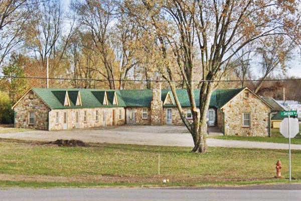
Cuba
Cuba is famous for its murals, stop and enjoy them, also visit the Wagon Wheel Motel, a Histori Site.

The old Conoco gas station on Route 66, Cuba, MO

The Red Rocker, Fanning, Missouri. Source
Leave the town along Historic Route 66, passing through Fanning, which has the World's Second Largest Rocking Chair. Just ahead, next to Exit 203 follow US 66 as it becomes the South Frontage Rd. again. (103 mi.), passing by Rosati and through St. James (111 miles).
As the old US 66 passed to the north of what is now I-44, you must also cross I-44. So take a right along Co. Rd. 8 and pass I-44 at its Exit 195 and take a left along the N. Outer Rd. westbound, which you will follow until meeting U.S. 63 (121 mi.) north of Rolla.
Gray Summit to Rolla
Detailed description: Gray Summit to Rolla - map of this segment
Rolla
The "Hillbilly" at The Mule Trading Post
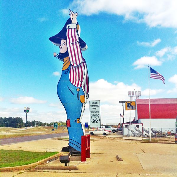
Take a left, southward, cross I-44 and follow Co. Rd .70 through Rolla (123 miles). Visit its "Stubby Stonehenge" monument. Continue along Kingshighway, cross U.S. 63 and at the roundabout east of I-44, take Martin Springs Dr. (it is MO-7100) west. It becomes Eisenhower St. through Doolittle (130 mi.).
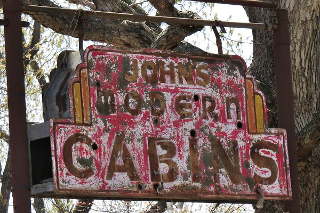
John's Modern Cabins neon sign, Newburg MO. Source
Keep west, it becomes Outer Rd. W. (MO-7300) through Newburg which ends as a dead end at Arlington you can avoid that by taking I-44 west at Exit 176 (133 miles). Leave the Interstate at Exit 172 (137 mi.) and keep on the N. Outer Rd. through part of Jerome, Powellville and Clementine, till you reach Exit 169 (142 miles) and cross I-44 to its south side and take a right onto Z Road which is US 66. Here the 1940s four-lane divided highway through Hooker Cut begins.
Hooker Cut
The large rock road cut just east of the bridge over the Big Piney River is the famous "Hooker Cut", which when cut in the 1940s, was the deepest road cut in Missouri and the whole US with 90 feet.
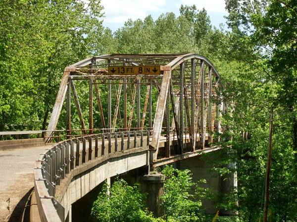
It passes by Hooker and Devil's Elbow (147 miles) named after a sharp bend of the Big Piney River -here you can take the 1926-41 alignment or keep on the later one.
1923 Route 66 Bridge in Devil’s Elbow, Missouri

"Mega Mayor" muffler man, Uranus Missouri, St. Robert US 66. Source
Ahead, at Exit 163, on the north side of the freeway is Morgan Heights on what used to be the 1926-41 alignment of Route 66. Don't miss Uranus a wacky spot. Keep westbound the road becomes I-44 Bus. Rd., crosses I-44 and goes through St. Robert (150 mi.)
Waynesville
At Waynesville (152 miles), visit the Historic Pulaski County Courthouse. Leave town and go south (Hwy 17 - US 66) and at Exit 153, (158 mi.) cross to the south of I-44 at Buckhorn and stay on Hwy 17 or try the 1926-1930 alignment and visit Laquey. When MO-17 forks (161 mi.), take the right along AB Hwy - Route 66, westwards passing through Gascozark and one mile ahead Hazelgreen now on the S. Frontage Rd. of I-44. The bridge over Gasconade River (170 miles) is not open for cars, so you have to get onto I-44 before: at MO-133, Exit 145, at Gascozark (168 mi.). Head west along I-44.
At Exit 140, leave I-44 and at MO-T take a left and a right, to take the South Service Rd. westwards (173 miles). At MO-F Exit 125, (179 mi.) the road crosses to the North of I-44, reaching Lebanon (186 miles) via Route 66 (I-44 Bus. Loop).
Lebanon
Munger Moss Motel Neon Sign, Lebanon MO
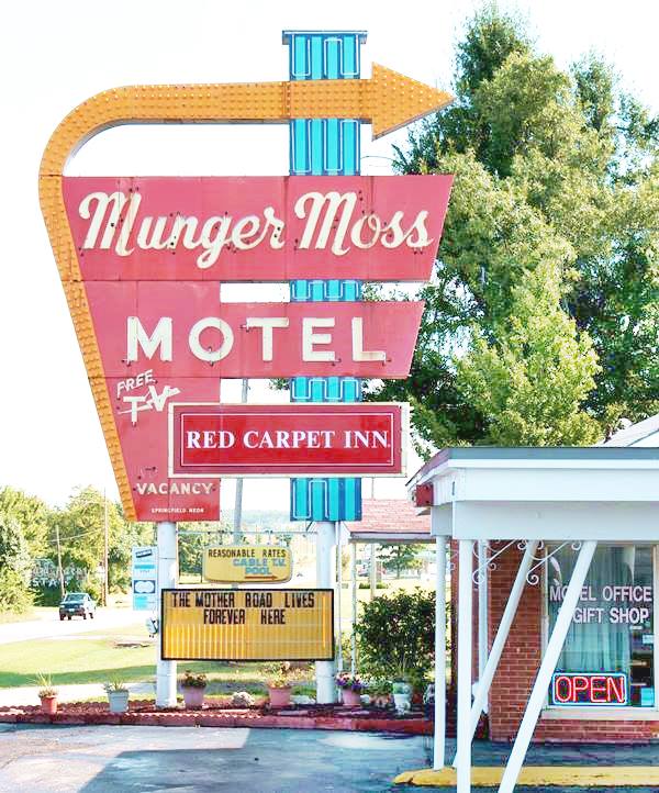
Continue along I-44 BL, first west and then south but, when you reach I-44 at Exit 127 don't enter, stick to the North Frontage Rd. (US.66) (MO-W) through Caffeyville and then cross to the south-east side of I-44 towards Phillipsburg at Exit 118 (197 miles).
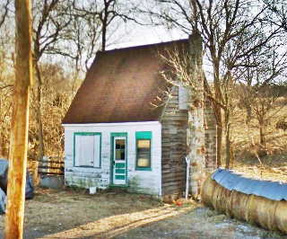
Niangua Filling Station, Niangua
Take a right along MO-CC (US-66 & South Frontage Rd.); pass Conway (202 miles). The road runs towards the south, well to the east of I-44, passing through a ghost town: Sampson.
It goes through Niangua and then Marshfield (215 mi.).
Stick to MO-CC (US-66) as it approaches I-44, and passes through Red Top and Strafford (228 miles) and becomes Co. Rd. 744 follow it towards Springfield.
Springfield "the Birthplace of Route 66"
Rolla to Springfield MO
Detailed description: Rolla to Springfield - map of this segment
There are three sites that are listed in the National Register of Historic Places: Gillioz Theatre, the Rock Fountain Court and The Abou Ben Adhem Shrine Mosque. Don't miss the plaque on the Park Central Square, which dedicates Springfield as "the Birthplace of Route 66".
Co. Rd. 744 passes by Springfield on its northern side and intersects with U.S.160 (242 mi.). Take a left along U.S. 160 south to pass along the western side of Springfield.
Rest Haven Motel today, Route 66, Springfield Mo street view
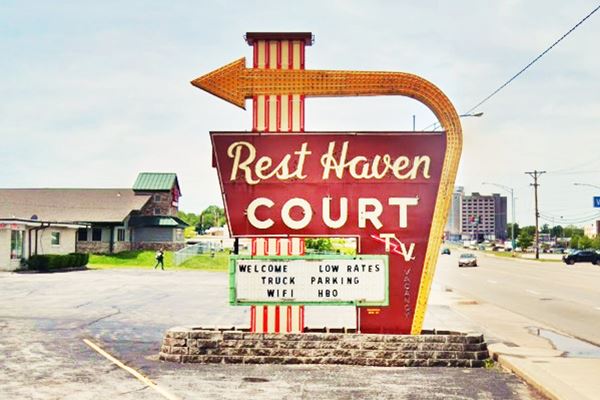
Springfield to Carthage
As you approach Carthage, just before County Lane 110, (293 miles) on the right side of the road is the old paved road surface of U.S. 66. At County Lane 118, it crosses to the south as Old 66 Blvd. joining Co. Rd. 66 further ahead by Kellogg Lake.

Gary's Gay Parita Sinclair Gas Station, Paris Springs. Source
At I-44 Bus. Loop, in SW Springfield (244 mi.) go right, cross I-44 and keep along Co. Rd. 266, passing through Halltown (259 miles), followed by the ghost town of Plano. When you reach the access to Co. Rd. 96 (261 mi.), keep straight on the "old" road, pass through Paris Springs and the road will curve following Johnson Creek to the SW. Cross Co. Rd. 96 and continue (Co. Rd. 266 becomes MO-N) for 1⁄2 mi. take a right across the old bridge on Lawrence Rd. (MO-2062), pass Spencer and join Co. Rd. 96. Go left (west). See the map above, this is shown with the black line. The road passes through two small communities: Heatonville and Albatross and then reaches Phelps (274 miles). Then come two more small communities: Rescue and Plew before reaching Avilla. The road keeps on SW and reaches Carthage (309 miles).
Carthage
Visit its Historic Site: the 66 drive-in theater. Take a right on Central Ave. and a right on Garrison Ave. and pass through the town (310 mi.). Take a right again along Route 66, cross I-49 (311 miles) and head west towards Joplin.

66 Drive-In Theatre, Route 66, Carthage, Missouri. Highsmith, Carol M.

Dale's Ole 66 Barber on Route 66, Joplin MO
Joplin
As in all big towns, Route 66 had several alignments into and through Joplin. We will describe only one of them: after leaving Carthage follow Route 66 and cross I-49 at its exit 46 (315 mi.). This is the 1926 alignment which crosses Carterville (319 miles). Take a right along the Main St. and head for Webb City, where it becomes Broadway (320 mi.); take a left along S. Orongo St. to 14th. St. then a right and at Route 66, I-49 Bus. Loop, a left. Take a right at E. Zora St., and a left at N. Florida Ave., a right on Utica St. until reaching Euclid Ave. which runs towards the SW. (324 mi.). At N. St. Louis Ave. go left until Broadway St. (turn right) until you reach Main St. and take a left through the center of the city (327 miles).
At 7th St. (MO-66) go right, a: Take a left along W. Old 66 Blvd. (the 1926 alignment) to the State Line and leave Missouri, to enter Kansas (333 miles).
The town's name is mentioned in the song Route Sixty-six (Get your kicks...)
The later alignments followed MO-66 to the state line, and continued as KS-66 into downtown Galena KS, where both alignments met at Main St.
Springfield MO to Joplin ⁄ Galena
Detailed description: Springfield to Joplin - map of this segment
Kansas
California ¦ Arizona ¦ New Mexico ¦ Texas ¦ Oklahoma ¦ Kansas ¦ Missouri ¦ Illinois
Towns located on the Kansas segment of Route 66
From East to West
Kansas, click on the town to see the towns located along Route 66.
Route 66 in Kansas
Current mileage: 13 mi. The shortest segment of US 66 in any state.
Route 66 across Kansas
Detailed description: Route 66 in Kansas - Map of this segment.
Route 66 American flag
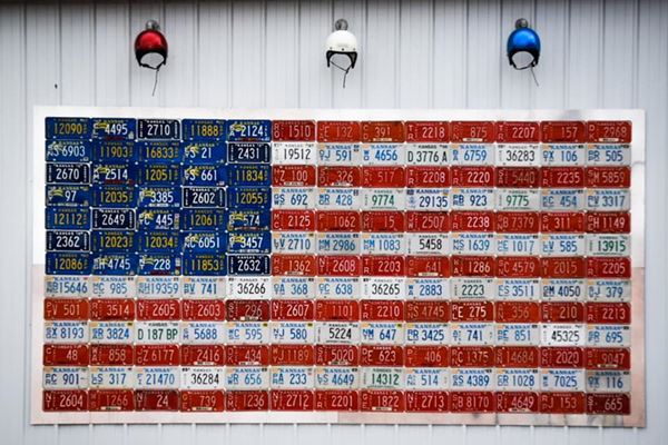
Route 66 Historic District (Galena)
Route 66 crosses the southeastern corner of Kansas. We describe the alignment starting on the border with Missouri, near Joplin following W. Old 66 Blvd. from the State Line (mile zero) wher it changes its name to Front St.
Galena
Follow it to Main St. on the northern side of Galena (1.3 mi.), take a left along Main Street into Kansas Route 66 Historic District-East Galena. At 7th St.(KS 66) turn right.
The road runs to the west, crosses Spring River and entering Riverton (5 mi.)
Riverton
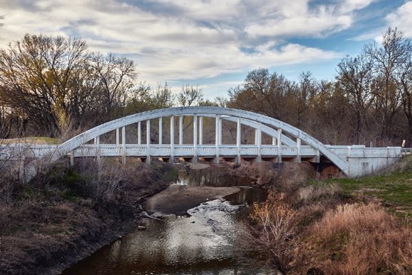
Visit the Williams' Store, a Historic Place. At the west of the town, the alignments split at U.S. 400 - Alt US 69: the later one follows U.S. 400 - Alt US 69), but the 1926 road keeps on west. Follow it to the Historic Bridge, over Brush Creek (7.5 mi.): the Rainbow Curve Bridge is the last Marsh Arch Bridge of all Route 66, and is listed on the National Register of Historic Places. After the bridge, the road curves south towards Baxter Springs.
Baxter Springs

1930 Phillips 66 Gas Station in Baxter Springs, Kansas. Source
US 66 enters the town (10 miles) and curves left to meet again with Alt US 69. Take a right. The road passes through the central part of the town. Visit the Baxter Springs Independent Oil and Gas, a listed as a Historic Place.
The road leaves town, curving around a Walmart (the 1926 alignment went behind it, along Roberts Rd. on the east and W 30th St. on the south).
Keep straight until you reach the Oklahoma state line (13 miles).
Route 66 leaves Kansas, and continues Alternate US 69 southwards towards Commerce in Oklahoma.
Oklahoma
California ¦ Arizona ¦ New Mexico ¦ Texas ¦ Oklahoma ¦ Kansas ¦ Missouri ¦ Illinois
Across Oklahoma
Kansas state line to Vinita OK
Detailed description: KS-OK state line to Vinita - map of this segment
Towns located on the Oklahoma segment of Route 66
Click on the towns below to place them on the itinerary (towns are listed from East to West).
Route 66 in Oklahoma
Current mileage: 376 mi.
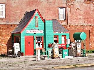
Hole in the Wall Conoco Station, Commerce OK. Source
Route 66 crosses the state from its Northeastern tip, to its western - central area, passing through the large cities of Tulsa and Oklahoma City.
From the Kansas state line (mile zero), follow Alt. US 69, which passes through Quapaw (5 miles), site of the mysterious Spook Lights on Route 66, turns west and joins US 69, and as such runs westwards to Commerce (10 mi.)
Commerce
It turns south through the town as Mickey Mantle Blvd. (the 1920s alignment took a right on D St. and another on Main St. meeting current alignment south of town). See its vintage service stations: Dairy King and Conoco Hole in the Wall. US 66 takes a southwared course as US 69, passing through the center of Miami (15 miles) along its Main St.
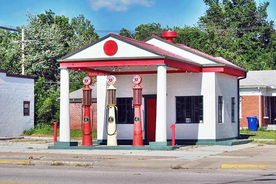
Marathon Oil, a historic gas station from the 1920s
Miami
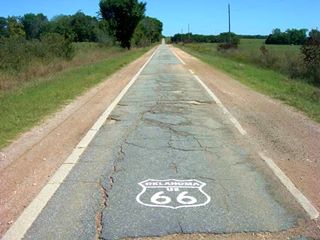
The 9 foot wide "Ribbon Road", Miami, Narcissa, Afton, Source
Visit the Miami Marathon Oil Company Service Station and the Coleman Theater (Historic Places). If you keep on south along the Main St. it becomes the "old" alignment of US 66 known as the "Ribbon Road", it runs between Miami and Afton.
Keep south till 3rd Ave. and take a right along Route 66 (US 69), westwards, crossing the Neosho River, and passing through the tiny town of Narcissa, don't miss the 1922 Ribbon Road only 9 feet wide, see the monument, on E-140 North of the town.
Cross I-44 - Will Rogers Turnpike, Toll Road (27 mi.) and US 60 to reach Afton (30 miles). US 66 continues with US 60 south and then takes a sharp curve to the west (35 mi.). It then crosses I-44 (Exit 249) and enters Vinita (45 miles).
Vinita
Vinita to Tulsa
Detailed description: Vinita to Tulsa - Map of this segment
Stop at the McDougal Filling Station and then go through town turning SW along Wilson St. (US 60 & 69). US 69 splits to the left and US 60 to the right (49 and 50 miles), keep straight along OK-66 highway through the tiny hamlet of White Oak and the town of Chelsea (63 mi.) with its Historic site, the Chelsea Motel.

Original 1950s Chelsea motel neon sign. Source. Click for St. view

World's Largest Totem Pole, Foyil. Source
OK-66 heads SW through Bushyhead (69 mi.), and Foyil (72 mi.) where you should stop at the "The World's Largest Totem Pole", a Historic Site.
Along OK-66 you'll reach Claremore (82 mi.): visit the Will Rogers Museum.
Catoosa
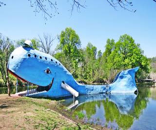
Big Blue Whale, Catoosa. Source
After crossing the Verdegris River you enter Catoosa.
Don't miss the Big Blue Whale right beside the highway (92.6 mi.).
Leave the town behind and take a left on N 193rd E Ave (Co. Rd. 167) crossing I-44 and turning right on E 11th St. This was the 1926-58 Route 66 alignment (96.3 miles)
It runs west into Tulsa.
Tulsa
Meadow Gold Neon Sign in Tulsa, Oklahoma


Stella Space Cowgirl, Tulsa, Route 66. Source
OK-66 runs with a westerly course, crossing I-44 and US 169 and US 75 (109 miles), entering the center of the city of Tulsa via E 10th St.
The city has so many sights that we have two pages covering them Tulsa page #1 and Tulsa page #2.
Tulsa has several historic sites on the National Register: The Circle Theater, Vickery Phillips 66 Station and the 11th Street Arkansas River Bridge.
Follow OK-66 it forks on the left at S. Denver Ave., crossing US 75 & US 64, heading towards the Historic bridge across the Arkansas River as Southwest Blvd., keep along this road as it crosses West Tulsa and Red Fork (113 mi.).
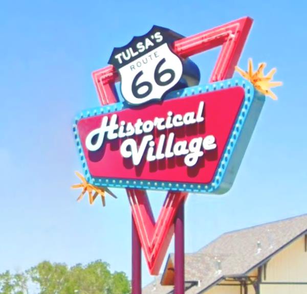
Tulsa to Chandler
Detailed description: Tulsa to Chandler - Map of this segment
Sapulpa
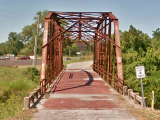
Rock Creek Bridge in Sapulpa
Notice the red brick deck
Click image for St. view
SW Blvd becomes Frankona Rd. and runs along the north of I-44, at 122 mi. it crosses to the south to merge with OK-66 and go through Sapulpa, entering it along OK-33 (E. Dewey Ave.) taking a sharp right turn. The Historic #18 Bridge at Rock Creek.

Skyliner Motel sign, Stroud, Source.
Click for St. view
Stay on OK-33 until it forks right towards I-44, then carry on straight along OK-66 through Kellyville (131 mi). US 66 crosses to the north side of I-44 (137 miles), leaves the interstate and heads west. Then it turns south to cross I-44 and enter Bristow (145 miles) down its Main St. See its Historic Landmarks like the Texaco Service Station.
US 66 turns right along W 4th Ave. and heads west passing through Depew (253 mi.) and south of I-44 : Stroud (164 mi.)
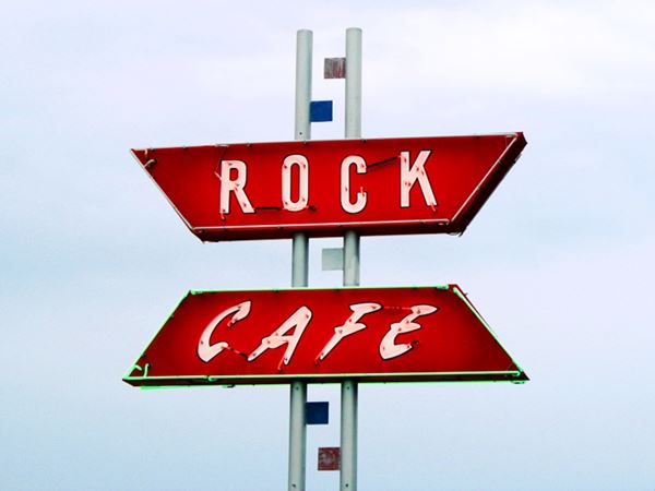
Don't miss the Historic Rock Café or the dirt surfaced original Ozark Trail road.
Rock Cafe sign- Route 66 in downtown Stroud, Oklahoma
Next comes Davenport (171 miles) with its Brick Paved Broadway Street (listed as a Historic Place), and Chandler.
Chandler
Chandler to Yukon
Detailed description: Chandler to Yukon - Map of this segment
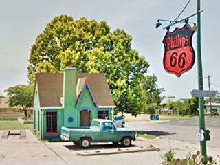
Phillips 66 Station, Chandler. A. Whittall
It reaches Chandler (177 mi.); visit the Phillips 66 Station.
Follow OK-66 west, passing through Warwick (185 miles) and its Historic
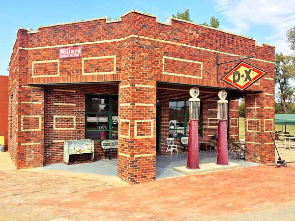
Historic Seaba's filling staton. Just west, it crosses to the north of I-44 (188 mi.) going through Wellston and crossing its Historic Bridge. Then comes Luther (197 miles)
with the Historic Threatt Filling Station and Arcadia (205 mi.).
Seaba's 1920s Filling Station
Arcadia
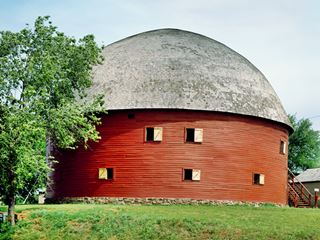
Round Barn, US 66, Arcadia OK. Carol M. Highsmith
Visit the Historic Round Barn and the Futuristic Pops 66.
US66 -now US77 crosses I-35 (at Exit 141) to enter Edmond's downtown area. Turn left along Broadway (214 miles), see the blue hippo and follow US 77 into Oklahoma City.
Oklahoma City
Oklahoma Cit has many interesting US 66 landmarks and we also dedicated two pages to it Oklahoma City and Oklahoma City Page #2. One of its sights is pictured below, the Historic Milk Bottle Grocery
The town's name is also mentioned in the song Route Sixty-six (Get your kicks on Route 66).
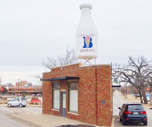
Leave US 77 at N. Kelley Ave. Exit (217 mi.) and go south along N. Kelley until reaching I-44 (222 miles), get onto it at Exit 128B westbound and immediately leave it (right) at Exit 128A, onto N. Lincoln Blvd., southbound.
This road will take you straight south right into the center of the city, by the State Capitol (225 mi.). Follow Lincoln Blvd., to the right and take a right turn along NE 23rd St. until reaching N. Classen Blvd. (227 miles), turn right along Classen heading north.
There were many alignments through Oklahoma city, this is only one of them.
At NW 39th St. turn left (west) (228 mi.), pass N. Young Blvd, turn right under I-44 to its north side, then turn left along its North Service Rd, get onto I-44 at Exit 124. Head west. Leave I-44 and go straight along NW 39th Expwy. (Route 66), which passes by the north shore of Lake Overholser. At North Canadian River is the Historic Lake Overholser Bridge and reaches Yukon.
Yukon
US 66 enters Yukon (240 miles)
Yukon to Clinton
Detailed description: Yukon to Clinton - Map of this segment
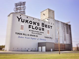
Yukon Mill elevators Yukon, OK. Source
Continue west, US 81 joins Route 66. Head north, into El Reno and stop by its Historic Sites: Avant Service Station, the Jackson Conoco Service Station, Hotel El Reno, and a real Old West US Cavalry Fort: Fort Reno.
Take US 81 and OK-66. Turn left onto Sunset Dr. - I-40 Bus Loop (254 mi.) westwards. At (258 mi.) signs say Fort Reno Visitor Center and also the brown shield of US 66. Head west along it, it runs to the north of I-40, and crosses US 270 (263 mi.).
The original 1926 alignment of Route 66, took a right here, passing through Calumet (5 mi to the north) and Geary, meeting the 1930s alignment further west near the Historic Canadian River Bridge. Keep westbound along the 1930s alignment of Route 66.
Hinton Junction Cafe and Courts.
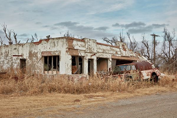
At US 281 Bus, take a right (270 miles) until Jones Rd. NW, turn left, to the West, (272 mi.). You will meet US 281 (274 miles); turn left as the road (also OK-8) heads west to past just south of the "ghost town" of Bridgeport (280 mi.)
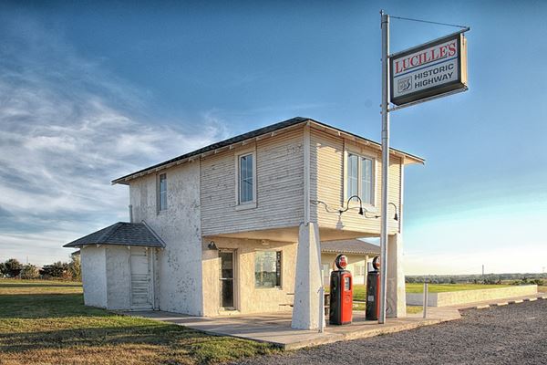
It then becomes the North Service Rd of I-40 (290 miles) going by Hydro (291 mi.); visit its Historic Provine Service Station (Lucille's Place).
Historic "Provine Station" also called "Lucille's Place"
Continue west along the I-40 Service Road to Weatherford (298 miles), along E. Main St. (see the Blair's Log Cabin built in 1892) and turn right along E. Main St. (I-40 Bus Loop) into the town; leaving it along S. 4th St.
The road turns west (OK-54) and becomes I-40s Frontage Road, crossing to its south side at Exit 71 (309 mi.); keep west until N2290 Rd, where you return back to the north side of I-40 (311 miles) along I40 Bus. Loop, and enter Clinton (314 miles).
Clinton
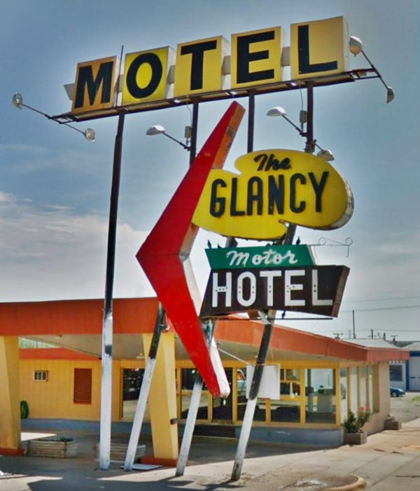
Neon sign of Glancy Motel, Clinton, Oklahoma
Clinton to Texola
Detailed description: Clinton to Texola - Map of this segment

Route 66 Museum in Clinton
Visit its Historic Site the 1937 Y Service Station and the Route 66 Museum.
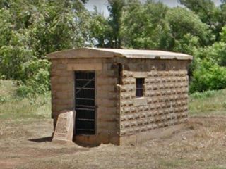
The road enters Clinton along W. Gary Blvd. and ends at I-40 - Exit 65, west of the town (317 mi.). At Exit 62, leave I-40, and get on its south side, head west along the Service Road, (319 mi.); at Exit 57, cross to the north of I-40 (324 miles), keep along the Service Road, reaching a "ghost town" Foss (328 mi.) (visit the "jail cell"); cross to the south at Exit 50 and enter Canute (335 miles) with its Historic Canute Service Station, the vintage Kupka's Service Station and the 1918 Canute Jail.
Cotton Boll Motel neon sign
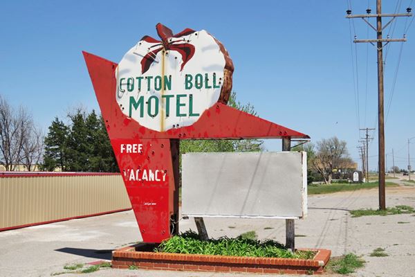

Canute Washita Motel Neon sign. Click for St. view, Source. Click for St. view
Elk City & Sayre
Once again cross to the North side of I-40 (N2050 Rd) (338 miles) and head west into Elk City visiting: Historic Casa Grande Hotel and its Museum Complex. Cross OK-34 and turn left and then right along I-40 Bus Loop, through the town (341 miles). It rejoins I-40 at Exit 32 (350 mi.); drive west along the service road; at Exit 25, turn right along I-40 Bus Loop into Sayre (359 miles).
Turn left along 4th St. to drive through it and visit the Historic Beckham County Courthouse, the Champin Service Station and the Sayre Downtown Historic District.
Then take I-40s North Service Road (362 mi.) west to drive by Hext. U.S. 66 passes to the south of I-40 (Exit 20 - 371 mi.), turns west into Erick along Roger Miller Blvd. (375 mi.). See the Roger Miller Museum and the vintage West Winds Motel.
Texola
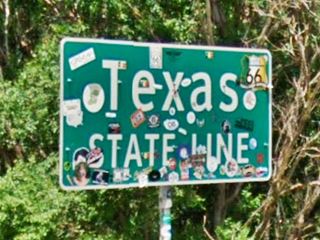
Go west along Route 66 after I-40 Bus Loop turns north, stay on E1240 Rd. all the way to Texola (382 miles), the last town in Oklahoma along U.S. 66; see the Jail and the Historic Magnolia Service Station. leave the small town along OK-30 which turns to the northwest and crosses the State Line into Texas (383 mi.). At the Texas state line, the road will become Spur TX 30 and head towards I-40, and Shamrock, TX.
Visit Itinerary Page 2 for the itinerary through the following states (Texas, New Mexico, Arizona and California).
Disclaimer
Mileage indicated above is approximate. These itineraries do not substitute for a roadway map. Road Trip Journeys takes no responsibility nor can be made liable for any errors, omissions, nor for user's safety and in no way warrants the safety or suitability of the suggested routes. Always drive carefully and obey road signs, Highway Code and police officers indications.
Although we have made an effort to make all information as accurate and updated as possible due to the diversity of changes that can occur anytime in an area we apologize for any inaccuracy you may come across.
When driving these itineraries, carefully compare information mentioned in them, or displayed on any pertinent maps, to all available navigation
sources, including information from street signs, visual sightings, and GPS. We welcome you sending us information whether for an update or a suggestion.
Continue your Journey on the Next Page
We describe the western itinerary along Route 66 in Itinerary Page 2
Some sponsored content
>> Book your Hotel in Tulsa

Credits
Banner image: Hackberry General Store, Hackberry, Arizona by Perla Eichenblat.


