New Mexico & Route 66
Index to this page

Route 66 highway sign c.1940-50s. Albuquerque Museum. Source
About New Mexico
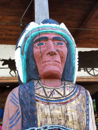
Indian Chief, Downtown Albuquerque. A. Whittall
Facts, Trivia and useful information
Area: 121,589 sq. mi. (315.194 km2). Population: 2,139,000 (2025 est.).
Width: 342 mi. (550 km). Length 370 mi. (595 km)
Time zone (along U.S. 66 alignment): Central (CST): UTC minus 7 hours. Summer (DST) CDT (UTC-6).
- Nickname: "Land of Enchantment".
- Motto: "Crescit eundo" (It grows as it goes)
- Capital: Santa Fe
- Highest point: Wheeler Peak, 13,167 ft. (4.013 m)
- 36th most populous state.
- Fifth largest state in the U.S.
- Admitted as the 47th state of the Union on January 6, 1912
- Route 66 length in NM is 392 miles (631 km), the longest mileage of the whole highway in any state.
Name: New Mexico
The Spaniards named it in 1563 after the Aztec (Mexica) Empire. At that time, what is now known as Mexico was named Nueva España (New Spain), and only after 1821 did it become Mexico. The word Mexico is a Nahuatl language one, formed by combining three words: "metztli" = moon; "xictli" = belly button or middle, and "co" = place; that is "in the middle of the moon (lake)."
New Mexico's History

Ruins of Pecos Pueblo,Pecos Mission Church in the background
The Clovis culture with a distinct stone tool industry dates back to almost 13,000 years, and is named after the site in Clovis, NM. These Paleo-Indians would later evolve into the Pueblo and Mongollon people met by the Europeans during their first forays into the region. Spaniard Francisco Coronado explored the area in 1541 seeking the mythical wealthy city of Cibola.
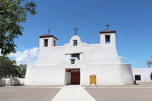
The area formed part of the Spanish Viceroyalty of New Spain, as the Province of New Mexico, created in 1598. Spanish missionaries settled the Sangre de Cristo Mountains founding Santa Fe in 1608 and again after the 1680-1692 Pueblo Indian Revolt. Albuquerque was established in 1706. The Spaniards built missions in the main native villages, and their adobe churches have survived can still be seen along Route 66.
Current appearance of San Agustín de la Isleta Mission in Isleta, NM
After Mexican independence in 1821, the province became part of Mexico. But it was annexed by the U.S. after deveating Mexico in the Mexican - American War (1846-48); it was established as a Federal Territory in 1850 and enlarged by the Gadsden Purchase of 1853.
During the Civil War the Confederate troops fought some battles with the Union forces in Glorita and Peralta (1862), that later were part of Route 66.
It was admitted in the Union in 1912, with its capital in Santa Fe.
Geography
Route 66 crosses the two prongs of the Rocky Mountains into New Mexico, the Sangre de Cristo Mountains east of Santa Fe, the Sandia Mountains east of Albuquerque and the Zuni Mountains west of Albuquerque.
Sandia Crest Aerial Tramway
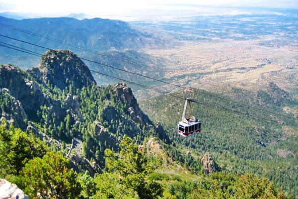
The Rio Grande River flows past Albuquerque. The eastern area is a high plateau that falls off towards the Texas Panhandle.
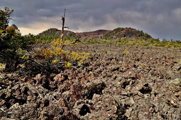
West of the Rio Grande is the rugged terrain if the Zuni-Bandera Volcanic Field, with some lava flows, that reach Route 66 near Grants.
The Grants lava flow is the youngest flow in the field and one of the youngest in the 48 contiguous United States.
The lava in the badlands here has been dated to between 2,910 and 3,080 years ago, very recent. Indeed, there were Native Americans living here at that time.
New Mexico, its Climate
Along the alignment of Route 66, in the higher parts of the State, summer temperatures are moderated by the altitude, averaging 70°F (26°C), but in other parts of the state, the temperature in July can exceed 100°F (38°C).
The state is arid or semi-arid and very dry: average rainfall is around 14 inches (350 mm) yearly.
It snows across the state in winter, especially in the higher northern mountains. Albuquerque averages around 2 inches of snow monthly in winter.
Bear in mind that altitude and dryness causes large swings between day and night temperatures, even in summer. Tornadoes are extremely unlikely in NM.
Cities in NM
Albuquerque is the largest city in the state (Pop. 559,000). Santa Fe is fourth with 90,000 in 2024
Around 500,000 people live along Route 66's corridor through New Mexico.
Culture

Indian dancers at Indian Pueblo Cultural Center. Source
It has over 134,000 Native Americans and is an important center of Indian culture. The main groups are Navajo, Apache and Pueblo.
The Hispanic culture also permeates the state (half of its population has Hispanic origin) both from the original Spanish colonists and the later Mexican immigration. There is a strong presence of Native American art and handicrafts. Buy an Indian souvenir during your trip.
Where to Stay in New Mexico
Find a hotel for your trip
The New Mexico towns along Route 66 offer different lodging options. Check out hotels and motels in the main towns.
Below you will find a list of some of the towns along Route 66 in New Mexico. Click on any of the links to find your hotel, motel or accommodation in these towns (listed from east to west):
On Route 66's Main alignment
The Santa Fe Route 66 segment
Eastwards
Westwards
>> Check out RV and Motorhome Parks & Campgrounds in New Mexico.
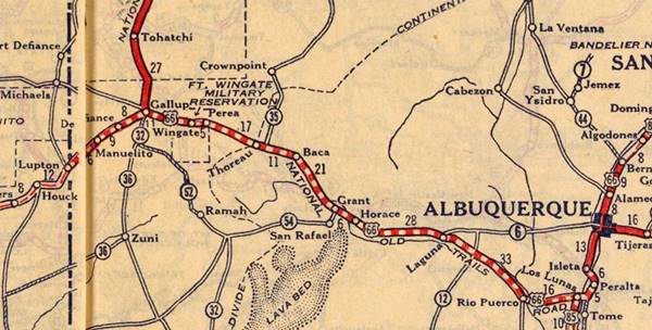
Map of Route 66 through New Mexico
Interactive Route 66 map in New Mexico
Below are the five legs we have split the course of U.S. 66 through NM, from East to West, starting at its eastern side in Glenrio on the Texas state line, to Lupton on the border with Arizona in the west. Find a detailed description with modern and old maps:
- Glenrio to Tucumcari - Map of this segment
- Tucumcari to Santa Rosa - Map of this segment
- Santa Rosa to Albuquerque - Map of this segment
- The Santa Fe Loop (1926-37) - Map of this segment
- Albuquerque to Lupton - Map of this segment
Towns located on Route 66
Below are links to oue pages on each city along Route 66 in New Mexico. Click to find out about their attractions, sights, stops, weather, history, maps, and where to stay along the way.
Click on the links below for complete information on each town, community, and village
New Mexico towns, from East to West
East
Santa Fe Loop forks to the north
Santa Fe Loop meets main '66 in Suwanee
Towns along the Santa Fe Loop
East
Forks from Main 66
- Algodones
- Bernalillo
- Goes through Albuquerque
- Isleta
- Peralta
- Los Lunas
Meets Main 66
West
A list of Route 66 Attractions in New Mexico
Our List with the Top Ten Attractions on US 66 in NM
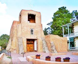
Historic Place: Oldest Church in the US, San Miguel Mission, Santa Fe. A. Whittall
- Saint Joseph Church (Laguna Pueblo) Historic Site
- San Miguel Mission oldest church in the U.S. (Santa Fe) Historic Site
- Blue Swallow Motel (Tucumcari) Historic Site
- De Anza Motor Lodge (Albuquerque) Historic Site
- Kimo Theater (Albuquerque) Historic Site
- Acoma Curio Shop (San Fidel) Historic Site
- Barrio De Analco (Santa Fe) Historic Site
- Whiting Brothers Service Station (Moriarty)
- Ruins of the Whiting Bros. Gas Station (San Fidel)
- Roy T. Herman's Garage and Service Station (Thoreau) Historic Site
Bonus Sights
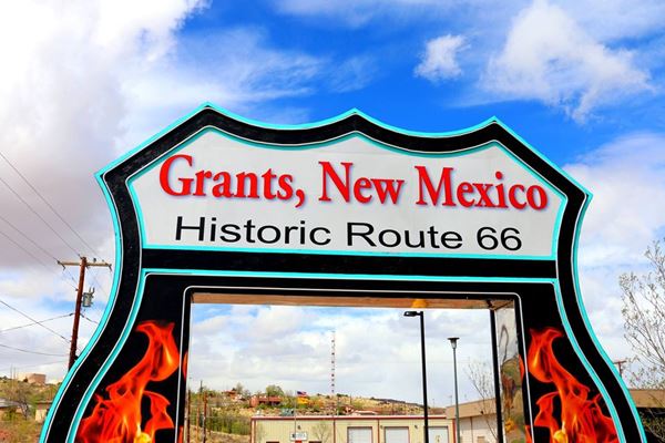
Don't miss these two Bonus New Mexico attractions: the Continental Divide and Route 66 Neon Drive-Thru Sign in Grants.
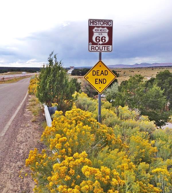
Dead End Sign on Route 66, Continental Divide New Mexico
A list of New Mexico's US 66 Attractions
Below we list the main attractions, stops and sights along Route 66 in New Mexico. They are listed from east to west along the main alignment, followed by the Santa Fe Loop.
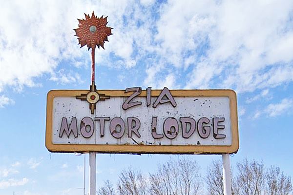

Oldest Church in the US
San Miguel Mission, Santa Fe, A. Whittall
Colonial Churches & Missions
Nuestra Señora de Dolores (Our Lady of Sorrows) (Tecolote)
San Jose Church (San Jose)
Mission Nuestra Señora de los Ángeles de Porciúncula de los Pecos (Pecos) Historic Site
Nuestra Señora de Luz Church (Canoncito) Historic Site
Cathedral Basilica of Saint Francis of Assisi (Santa Fe) Historic Site
San Miguel Mission oldest church in the U.S. (Santa Fe) Historic Site
Santo Domingo Mission (Santo Domingo)
Our Lady of Sorrows Church (San Lorenzo Sanctuary) (Bernalillo) Historic Site

Historic Zuni Mission church. Source
San Felipe de Neri (Albuquerque) Historic Site
San Agustin de la Isleta Mission (Isleta) Second oldest church in
the U.S.
Our Lady of Guadalupe (Peralta) Historic Site
Saint Joseph Church (Laguna Pueblo) Historic Site
Santa Maria Mission (McCartys)
San Esteban del Rey Mission Church (Acoma) Historic Site
Nuestra Senora de Guadalupe (Old Zuni) Mission (Zuni Pueblo) Historic Site
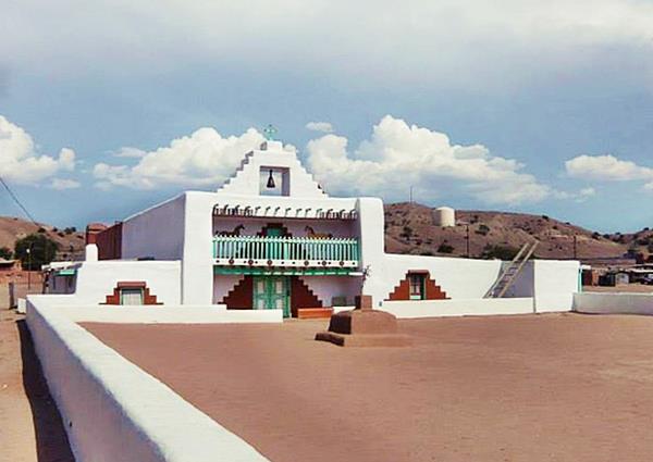
Classic Route 66 Motels
There are many, this is a list with some of them.
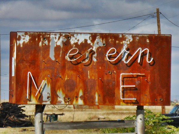
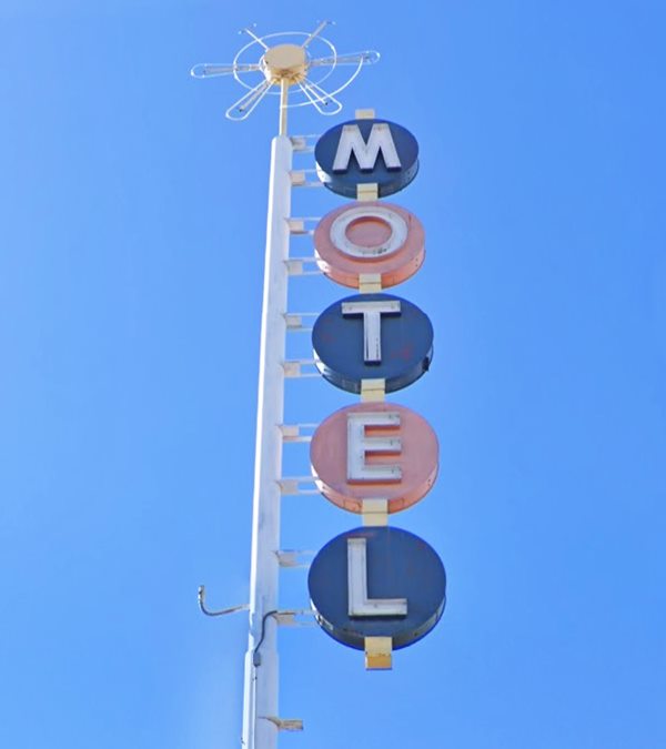
Can you read the motel's name?
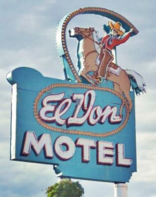
Iconic El Don Motel neon sign. Click for St. view
San Jon Motel (San Jon)
Blue Swallow Motel (Tucumcari) Historic Site
Cactus Motor Lodge (Tucumcari) Historic Site
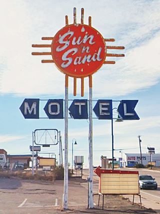
Sun and Sand motel neon sign (Santa Rosa)
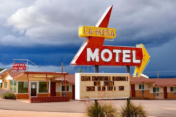
La Mesa Motel (Santa Rosa)
Sunset Motel (Whiting Bros.) (Santa Rosa)
La Loma Motel (Santa Rosa)
Sands Motel, Cactus Motel, and Lariat Motel (Moriarty)
El Vado Auto Court Motel (Albuquerque) Historic Site
De Anza Motor Lodge (Albuquerque) Historic Site
Tewa Lodge (Albuquerque) Historic Site
Luna Lodge (Albuquerque) Historic Site
Wayside Motel and Sands Motel (Grants)
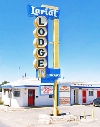
Lariat Lodge (Gallup)
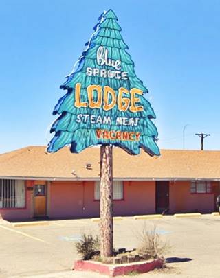
Blue Spruce (Gallup)
El Rancho Hotel (Gallup) Historic Site
Plaza Hotel (Las Vegas) Historic Site
Other Historic Sites and Sights
Theaters
Odeon Theater (Tucumcari) Historic Site
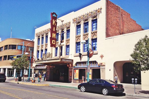
Kimo Theater (Albuquerque) Historic Site
El Morro Theatre (Gallup)
General Stores and Trading Posts

Indian Chief on Maisel's Indian Trading Post. Austin Whittall
Richardson Store (Montoya) General Store Historic Site
Bowlin's Old Crater Trading Post (Bluewater) Historic Site
Maisel's Indian Trading Post (Albuquerque) Historic Site
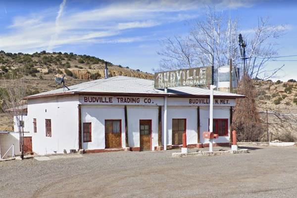
Budville Trading Post (Budville)
Acoma Curio Shop (San Fidel) Historic Site
Santo Domingo Trading Post (Santo Domingo) Historic Site
Historic Districts

Domingo Trading Post after restoration. Source
Park Lake Historic District (Santa Rosa) Historic Site
Barrio De Analco (Santa Fe) Historic Site
Nob Hill District (Albuquerque) Historic Site
Barelas-South Fourth Street Historic District (Albuquerque) Historic Site
Old Colonial Town of Albuquerque (Albuquerque) Historic Site
Route 66 Bridges
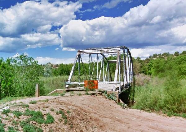
Pecos River Bridge (San Jose)
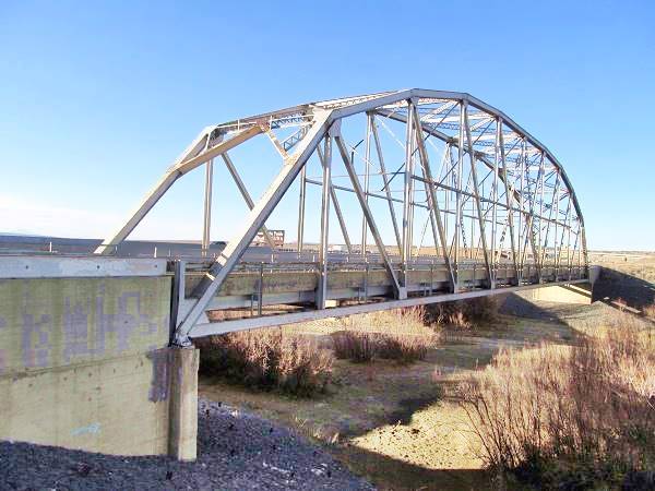
Rio Puerco Bridge (Suwanee) Historic Site
Rio Puerco Bridge, historic landmark
Other Landmarks
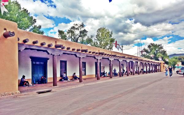
Palace of the Governors, a photo we took in 2016:

Santa Rosa Route 66 Museum, Source
County Courthouse (Santa Rosa) Historic Site
Greene Evans Garage (Moriarty) Historic Site
Jones Motor Company (Albuquerque) Historic Site
Nob Hill Shopping Center (Albuquerque) Historic Site
Fort Wingate (Wingate) Historic Site
Glorieta Pass Battlefield (Glorieta) Historic Site
Oldest House in the U.S (Santa Fe) Historic Site
Palace of the Governors (Santa Fe) Historic Site
Service Stations

Clines Corners Sign. Source
State Line Texaco (Glenrio) NM
Texaco (San Jon)
Esso (Santa Rosa)
Clines Corners
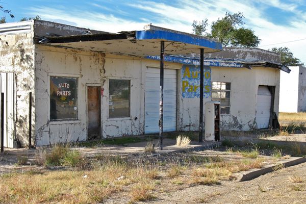
Old 1950s service station in San Jon
Polly Gas (Tucumcari)
Texaco (Tucumcari)
Whiting Brothers Service Station (Moriarty)
Moriarty Whiting Brothers Service Station

Gull Wing Phillips66 and Another Gull Wing (Albuquerque)
Ruins of the Whiting Bros. Gas Station (San Fidel)
Charleys Garage (Grants)
Magnolia (Grants)
Roy T. Herman's Garage and Service Station (Thoreau) Historic Site
Whiting Brothers Service Station and Motel (Continental Divide)
Whitting Bros. (Gallup)
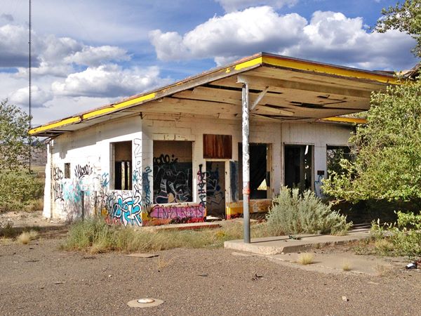
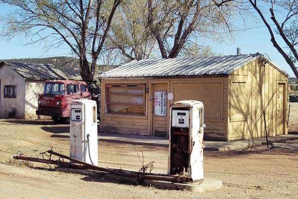
Abandoned Whiting Brothers Service Station near San Fidel, Route 66, New Mexico
Other Landmarks

Red Top Valentine Diner at Edgewood NM. Source
Club Cafe site (Santa Rosa)
Route 66 Auto Museum (Santa Rosa)
Longhorn Ranch (Moriarty)
Red Top Valentine Diner (Edgewood)
Dead Man's Curve (Carnuel)
Musical Highway (Carnuel)
Valentine Diner Police Substation (Albuquerque)
Owl Rock (Mesita)
Dead Man's Curve (Mesita)
Dead Man's Curve between Mesita and Laguna
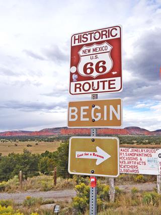
Route 66 "Begin" sign at Continental Divide
A. Whittall
Laguna Pueblo Historic Site
Acoma Pueblo (Acoma)
Lava flows by Route 66 (McCartys)
The Continental Divide Watershed (Continental Divide)
Kit Carson Cave (Church Rock)
Biblical verse sign (Rehoboth)
Zuni Pueblo (Zuni Pueblo)
Pecos National Historical Park (Pecos) Historic Site
Forked Lightning Dude Ranch (Pecos)
Santa Fe Trail Ending Place (Santa Fe)
San Felipe Pueblo (Algodones)
Coronado Historic Site and Kuaua Ruins, (Bernalillo) Historic Site
Route 66 itinerary across the state of New Mexico
Below is a detailed description of the alignment of U.S. 66 through New Mexicoa, from East to West. For each town we give details of Route 66's alignment through it. You can also click above on a town and read more about the course of US 66 in that specific community.
New Mexico
Route 66 in New Mexico
Current mileage: 392 mi.
New Mexico is the state with most mileage along Route 66. It is followed by Arizona with 388 mi.
Route 66 crosses NM from its eastern side in Glenrio, to its western side in Lupton, passing through Albuquerque, and the original alignment went through Santa Fe from 1926 to 1937.
Click on the detailed description with interactive maps of each leg across the state (in the yellow box at the start of each leg).
Starting on the OK-KS state line
Glenrio

San Jon motel neon sign, San Jon. Source
The starting point of the NM alignment is Glenrio, a Historic Site and Ghost Town, on the Texas state line, (mile zero). Follow Route 66 westwards, it is a gravel surfaced road that goes by two ghost towns, Endee and Bard.
The highway crosses San Jon River (7 miles) and heads west where it meets I-40 and becomes its South Service Road, (15 mi.). Entering the town of San Jon (18 miles). Follow Route 66 all the way to Exit 335 (38 mi.) as the Southern Frontage Road of I-40.
At the Exit, follow the road across I-40 into Tucumcari as I-40 Bus. Loop. - E. Tucumcari Blvd. (41 mi.)
Tucumcari
Tucumcari has plenty of attractions and classic motels and gas stations.

Blue Swallow Motel, New Mexico

Palomino Motel, Tucumcari
Palomino Motel, Tucumcari, New Mexico, Source
After visitng the town (41 miles), drive west until reaching US 58, where you take a left towards I-40 and get onto it, westwards at Exit 329 (44 miles). The old Route 66 continues but is cut at different places (on the North of I-40, as W. Tucumcari Blvd. and later at mile 70, you can spot it as the South Frontage Road which is inaccessible at this point).

You can leave I-40 at Exit 321 and go to the South Service Road, heading west along it (52 mi.) it passes to the north side of the Interstate (56 mi.).
Go by Montoya (63 miles) with its Historic site: Richardson Store. The road keeps close to I-40 and reaches Newkirk (75 mi.), and keeps due west until it reaches Cuervo. Drive west along the freeway to reach Santa Rosa. There is a dirt surfaced alignment from Cuervo to Santa Rosa, but it is only for the brave who are willing to drive a poor-surfaced county road (From Cuervo take Cross Rd. which adopts a SW course and separates from the Interstate. It will meet NM-156, (91 mi.) take a right along it to Santa Rosa).
Santa Rosa
By the Pecos River, this town has its fair share of Motels and old gas stations. Don't miss its refreshing Blue Hole pond.
Leave Santa Rosa town and head north (U.S. 84), cross to the North of I-40 at Exit 273, head West along the Interstate. At Exit 267 (119 miles), to the north, is NM 379, the original 1920s alignment via Santa Fe which was moved shortly after further west to what is now Exit 256 where NM 219 departs north to Santa Fe with US. 84, following the 1926-37 alignment known as the Santa Fe Loop, that we describe below. The later 1937-85 alignment to Albuquerque is described further down.
Route 66 through Santa Fe
>> The Santa Fe Loop (1926-37) - Map of this segment
This is the pre-1937 alignment, which curved north to Santa Fe, and then south back to Albuquerque. The later alignment cut straight west to Albuquerque from Santa Rosa via Moriarty.
Leave I-40 and drive north towards Las Vegas along it, passing by Dilia, and reach I-25 at Romeroville (Exit 239), along I-25 to the east is Las Vegas (the New Mexican town, not the one in Nevada).
Las Vegas
The Santa Fe Trail passed through this town. Visit its Las Vegas National Wildlife Refuge.
Return by I-25 to Romeoville and keep west along it. Take Exit 335 and follow the frontage road as it crosses back and forth across I-25. Pass Tecolote, and at Bernal take Hwy B26A on the south side and then back to the north side along the Frontage Road and, again, on the south at Pecos River. Go through San Jose.
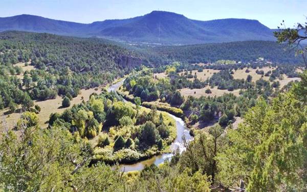
The road courses along a forested mountainous region. Passing Ilfeld and Rowe. At Exit 307 go to the north side along NM-63, and north to Pecos and take NM-50 to leave the town.
It curves westwards going through Glorieta; use Exit 299 to return to I-25 West. At Exit 294, take the "Old Las Vegas Highway" NM-300, which is the Frontage Rd. and becomes NM-466 as it reaches Santa Fe, the state capital city.
Go right into the city center along Pecos Trail, leaving NM-466; merge with the "Old Santa Fe Trail", and reach the downtown area.
Santa Fe

Santa Fe adobe buildings. P. Eichenblat
In the city's webpage, we list the Attractions & sights in Santa Fe.
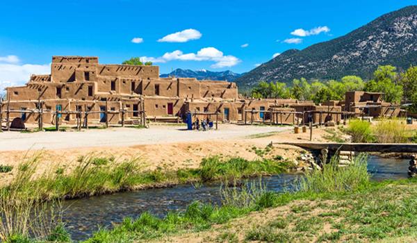
It is an ancient Spanish colonial town. Visit St. Francis Cathedral and the Palace of the Governors. Take in its typical building style with austere brown adobe and timber beams or "vigas". From Santa Fe you can visit the pueblos and enjoy nature. It is a full day tour from Santa Fe to Taos Pueblo visiting Native Pueblos along the way. These are eight Indian Pueblos located in the mountains between Santa Fe and Colorado. Buy souvenirs and experience the Native culture and foods. Check out some of their feast days to witness their celebrations and dances.
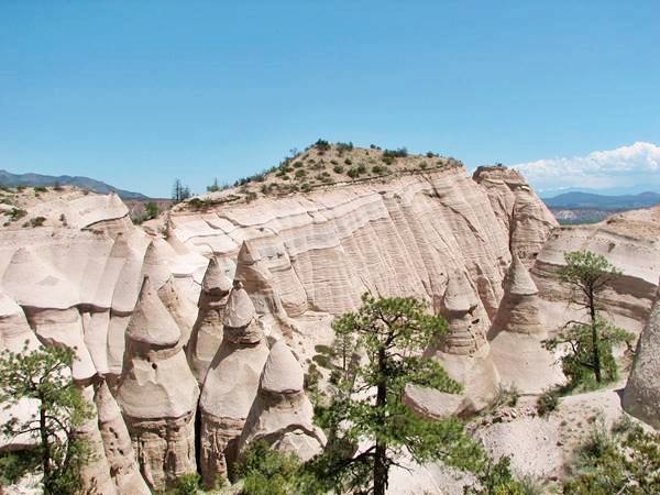
Hoodoos at Kasha-Katuwe Tent Rocks National Monument
Leave the center along Alameda St., Sandoval St. and then Cerrillos Rd. Cross US 84, keep SW, the road becomes NM-14. Get on I-25 at Exit 278.
At Exit 259 you can take a side trip to visit Santo Domingo with its Historic Places Santo Domingo Trading Post and Pueblo of Santo Domingo (Kewa Pueblo)
Leave I-25 at Exit 248 and take a right and then a left along Camino Real Pan American Central Hwy or NM-313, and follow it south through Algodones and Bernalillo all the way into Albuquerque.
At Sandia Pueblo it merges with NM-556 at a roundabout. Head west along NM556, it becomes 4th St. NW. At Lomas Blvd.
Albuquerque
Crossroads of Route 66
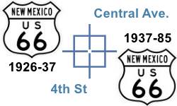
The old alignment enters Albuquerque along 4th St., which changes direction, so follow 5th until meeting the other (1937) alignment of US 66 from Santa Rosa via Moriarty, on Central Ave in the downtown district of Albuquerque.
Fourth Street and Central is one of the few places along Route 66 where two alignments cross each other.
Visit our attractions along the 4th Street webpage.
Now we go back to the post-1937 alignment:
The 1937 alignment west of Santa Rosa to Albuquerque
From the fork of the Santa Fe Loop along US 84, head west along I-40; it runs straight west for 25 miles, where it turns to cross some low hills. It crosses US 285 (158 mi.) at Clines Corners.
Trivia: Southwest, along U.S. 285, it is 158 miles to Roswell, of UFO fame.

Old neon sign, Longhorn Ranch, Moriarty NM.Source
Stay on I-40 west until Exit 197 (179 miles) to enter Moriarty along I-40 Bus. Loop, following old Route 66. Visit the Sunset Motel and Jr.'s Tire shop. (181 mi.)
Moriarty Whiting Brothers Service Station

Keep on this road until just before Exit 194, take a left and a right to follow NM-333 west, it runs south of I-40 towards the NW.
Go through Edgewood (189 mi.).
The highway climbs towards the forested Sandia Mountains.
Ahead, at Montezuma Heights you can take the 1930s-40s alignment, crossing to the north of I-40 (Exit 181 - 194 miles) and following Sedillo Hill Rd. (NM-306) which arches north to reach the highest spot of US 66 east of the Rocky Mountains.
Highest Point of Route 66 east of the Continental Divide
Exactly at Kimberly lane and NM-306 (Sedillo Hill Road). See this map marking the Exact Spot.
Altitude: 7,102 feet (2.166 m)
The highest altitude east of the Continental Divide, and the second highest point of its whole alignment of Route 66.
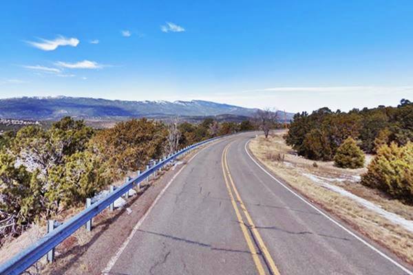
View along the Sedillo Hill Road at its highest point
Highest Spots Along Route 66
There are several passes along Route 66 where it crosses mountain ranges, the highest spots are the following:
- 7,550 feet (2,301 m). Glorieta Pass NM, Sangre de Cristo Mountains. Highest point from 1926 to 1937. On the Santa Fe Loop.
- 7,405 feet (2,257 m). Bellemont to Parks, Arizona, crossing the San Francisco Mountains, 1931-41 alignment.
- 7,245 feet (2,208 m). Continental Divide, New Mexico, crossing the Rocky Mountains. 1927-85 alignment.
- 7,102 feet (2,166 m). Sedillo, NM on the 1937-45 alignment, replaced when it was realigned, by a spot at 7.057 feet (2,150 m). Comer's Cafe close to Sedillo on the 1945-85 alignment. Crossing the Sandia Mountains.
- 3,595 ft (1,096 m). Sitgreaves Pass near Oatman, California, crossing the Black Mountains. 1926-53 alignment.
The road then curves south, crossing I-40 again (198 miles). Enter I-40 at Exit 178 westbound.
This alignment meets the later one further west.
At Exit 175, cross south again and take NM-333 west, it is the Old US 66. Pass through Tijeras (202 mi.) In this area, US 66 crosses the Cibola National Forest and the Salt Missions Trail. The road crosses to the North of I-40 (225 mi.) goes through Carnuel and again to the south of I-40 running west into the outskirts of Albuquerque.
Albuquerque
At eastern Albuquerque (229 miles), Route 66 becomes Central Ave. NE, entering the city. Albuquerque has many attractions and we dedicated several webpages to cover them all.
Keep along Central Avenue. It crosses I-25 (217 mi.) entering the oldest part of the city. Becomeing Central Ave NW. On the corner of 47h St (219 miles) Route 66 crosses itself: it crosses the old 1920s alignment that came from Santa Fe. This is the "Old Town" of Albuquerque.
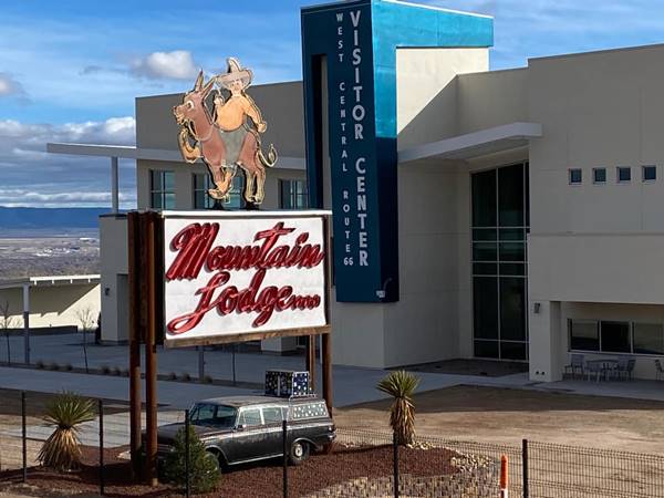
Follow Central Avenue as it curves around it and crosses the Rio Grande (221 mi.). The Avenue approaches I-40, passing by the West Central Ave. Route 66 Welcome Center. Ahead, cross to I-40's north side along Atrisco Vista Blvd. and follow the N. Frontage Road west at Exit 149. (228 miles), enter I-40 at Exit 140 (238 mi.) head west.
The old Mountain Lodge neon sign in its new home: West Central Route 66 Visitor Center at Nine Mile Hill
Leave I-40 at Exit 126 (251 miles) and go south until meeting Old US Hwy 66 at Suwanee and follow it west.
Laguna Cutoff
Here at Suwanee, eastwards along NM-6 is the 1926-37 US66 alignment coming from Albuquerque through: Los Lunas, Peralta and Isleta. It was replaced by the one running west of ABQ in 1937.
US 66 adopts a NW course from this point, crosses to the north of I-40 (261 mi.) becoming Indian Service Rd 522 passing Mesita.
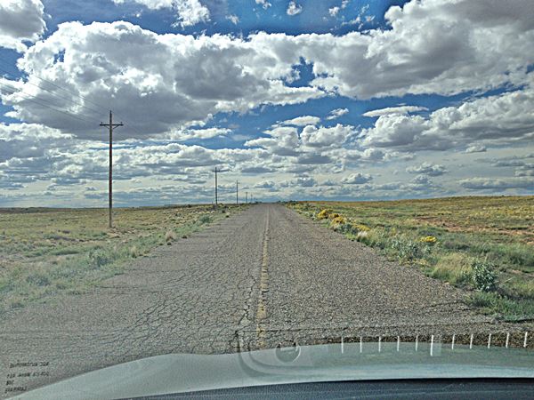
The original roadbed: Route 66 just west of Suwanee, NM heading towards Mesita:

Owl Rock by Route 66. Perla Eichenblat
Keep along this Old Route 66 as it goes by Owl Rock, and the 180° Dead Man's Curve, and enters Laguna Pueblo. Stop in LAguna to see the old (1600s) church and the Historic Pueblo of Laguna, cross San Jose River (268 miles). Don't access I-40, stick to NM-124, pass through Paraje, the entrance to Cubero (277 miles), and reach San Fidel (281 mi.).
San Fidel
Stop by the Acoma Curio Shop, a Historic Site. Continue west and at Exit 96, NM-124 crosses to the south side of I-40, follow it west, take a detour south to visit McCartys. At mile 289, Anzac Rd. (dirt and gravel) forks to the left. This is the old 1920s alignment, you can drive it or keep on NM-124 and merge with Anzac Rd. further west, where NM-124 crosses to the North of I-40, follow it into Grants (296 mi.).
Grants
Grants has many attractions; just to the north are the Casamero Anasazi ruins, and to the south, are the El Malpais National Monument, the La Ventana Natural Arch (NM 117) and the Cibola National Forest.
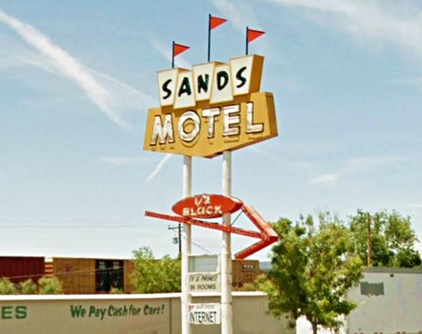
Sign of the Sands Motel on Route 66, Grants New Mexico
Next to Grants, on Route 66, is Milan (302 miles). US 66 is now NM-122, and acts as the North Frontage Rd. of I-40. To the south is Bluewater with its Historic Bowlin's Old Crater Trading Post, followed by Prewitt and just off Route 66, Thoreau at Exit 53 of I-40 (329 mi.). See the Historical Site: Roy T. Herman's Garage and Service Station.
Stay west on NM-122 at Exit 47 you will reach the Continental Divide, at 7,245 ft. (2.209 m), the rainfall goes west to the Pacific or east to the Atlantic from this point. The 1930s alignment merges with I-40 here. Go west along the Interstate. Take Exit 36 towards the N. Frontage Rd. (346 miles) head west. To the south of Exit 33, at Wingate is the Historic District, Fort Wingate. Pass Church Rock (352 mi.) followed by Rehoboth; cross to the SW of I-40 at Exit 26 (357 miles), entering Gallup.
Gallup Main Street
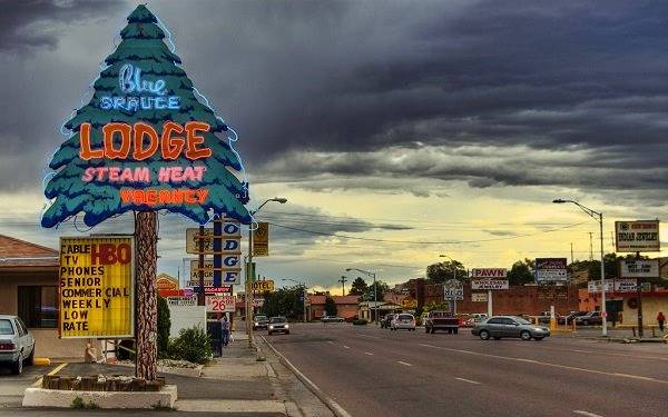
Wolfgang Staudt
Gallup
Gallup is mentioned in the song Route Sixty-six (Get your kicks...)
Check our page on Gallup, for its Attractions. Route 66 crosses the town, intersects its Main street (361 mi.) as Route 66 (I-40 Bus. Loop) , the town spreads south. Visit the Historic El Rancho Hotel, the Neon Art and El Morro Theater among other sights worth seeing.
At Exit 15, cross to the north of I-40 and stay on NM-118 west (366 miles), through Defiance, take a sharp right (368 mi.) to cross to the south of I-40 and continue west along NM-118. At Exit 8, US 66 crosses to the north side again, separates from I-40, Passing Manuelito at Surrender Canyon, and becoming its Service Road again (378 miles).
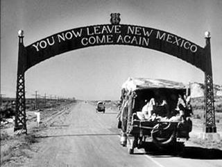
The Gateway Arch at New Mexico - Arizona state line on Route 66. From The Grapes of Wrath (1940)
The road crosses the Arizona state Line to become Grant Rd. there.
Mileage to this point (379 mi.).
This leg of your Route 66 road trip across New Mexico ends here in Lupton, Arizona. There was an archway here in the 1930s and 40s depicted in the Academy award winning movie Grapes of Wrath (see picture).
Sponsored Content

>> Book your Hotel in Albuquerque

Credits
Banner image: Hackberry General Store, Hackberry, Arizona by Perla Eichenblat.


