Table of Contents
Index to this page: The alignments with maps and full information in each of these states:

A map, Route 66... and live your adventure
- Route 66 Map (state by state)
- Maps of each Segment of Rte 66
- Map of Route 66 in each town
- More Maps of Route 66
- Altitude and Elevation Along Route 66
- Tornado Frequency Map along Route 66
- Route 66 Weather Maps
- Resources, more Route 66 maps
- More Useful Information about Route 66
Route 66 Map
Route 66 maps: State by State
- Illinois Route 66 Map
- Missouri Route 66 Map
- Kansas Route 66 Map
- Oklahoma Route 66 Map
- Texas Route 66 Map
- New Mexico Route 66 Map
- Arizona Route 66 Map
- California Route 66 Map
Maps of each Segment of Rte 66
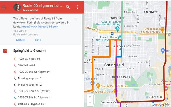
We have a detailed description of US 66 with the complete Route 66 alignment from Chicago IL to Santa Monica CA; this is a mile-by-mile description of all US66 alignments from 1926 until it was delisted in 1985.
Each segment of the highway mentioned in this page includes maps like the one shown below.
Map of Route 66 in each town
Each of the Towns along the highway have their individual webpages and in their "map" section you will find the one showing maps of Route 66's alignments in that town with a description.
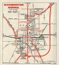
Click to see an example of a town map (Bloomington Il), it has a historic roadmap, an Illinois DOT map (shown below) and of course, our custom interactive map.
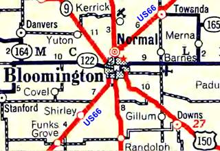
1936 IL DOT map of Normal and Bloomington, IL. Source
Click thumbnail map to enlarge
More Maps of Route 66
Altitude and Elevation Along Route 66
Our altitude webpage has plenty of information on the altitude of Route 66 as it crosses the US from Chicago to Santa Monica.
Learn about its highest points in the Ozarks and its passes in the Rocky Mountains; the maximum elevation it reaches in Arizona, and its sea level altitude when it reaches the Pacific Ocean.
See our US 66 Altitude information page.
Tornado Frequency Map along Route 66
See our Tornado Frequency Map along Route 66.
Route 66 Weather Maps
See our Route 66 weather maps which show rainfall and seasonal temperature along Route 66.

Resources: More Route 66 maps
By clicking on the links below you will leave our website. Thank you for visiting us and come back soon!
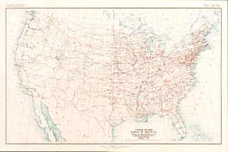
1926 US highways map with U.S. 66
- Oklahoma DOT US 66 maps webpage. Maps county by county and also by city.
- 1926 US highway system Map. It includes Route 66's original 1926 alignment
- Road Maps of Route 66 in Texas.
- 1915 Railroad Maps Kansas City to Los Angeles
- Arizona Highway maps by AZDOT with US 66.
- 1927 Maps of Arizona and New Mexico from the David Rumsey collection.
- IDOT's Illinois roadmaps from 1917 to 2014 including Route 66 and State Highway 4 that preceded it.
- National Old Trails and US 66 in California in the American Roads Forum.
- The Library of the University of Texas' Collection of maps of Texas towns including all the towns located along U.S. 66 in Texas
- Missouri Highway Map Archive 1918 - 2014 by the MO DOT.
- The United States Geological Survey's historical topographic map collection; just type in the location and select the year to find your map.
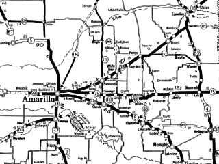
Historic Route 66 Maps in Texas
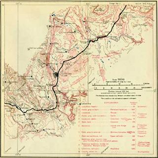
Thumbnail of one of the 1915 Railroad maps
More Useful Information about Route 66
- How long is Route 66?
- Where is Route 66?
- Can you still drive the entire Route 66?
- Where does Route 66 start and end?
- Is Route 66 worth driving?
- Brick paved segments on Route 66
- Is Route 66 dangerous for tourists?
- 10 Reasons to go on a road trip
- Why is Route 66 so famous?
- Detailed description of its alignment

Sponsored Content
>> Book your Hotel in Santa Monica

Credits
Banner image: Hackberry General Store, Hackberry, California by Perla Eichenblat


