Oklahoma & Route 66
Index to this page
- Facts, Trivia, Useful Info
- History of Oklahoma
- Oklahoma's Geography & Weather
- Where to Stay in Oklahoma
- Maps of Route 66 in AZ
- Towns located on Route 66 in Oklahoma
- A List of Oklahoma's Main Route 66 Attractions
- Route 66 itinerary across the state
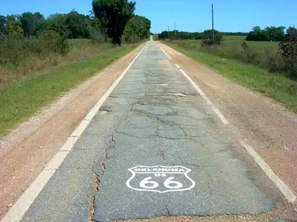
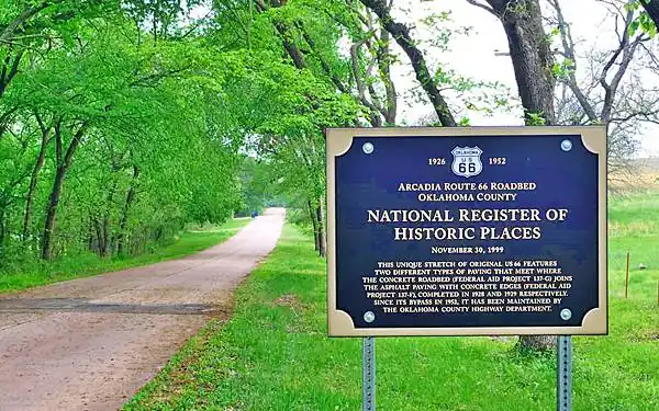
The "Ribbon Road" in Miami, OK.
About Oklahoma
Facts, Trivia and useful information
Area: 69,898 sq. mi. (181.195 km2). Population: 4,030,000 (2025).
Width: 230 mi. (370 km). Length 298 mi. (480 km)
Time zone (along U.S. 66 alignment): Central (CST): UTC minus 6 hours. Summer (DST) CDT (UTC-5).
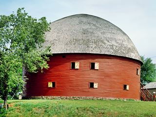
Round Barn, US 66, Arcadia OK. Carol M. Highsmith
- Nickname: "Sooner State".
- Motto: "Labor Omnia vincit" (Work conquers all).
- Capital: Oklahoma City
- Highest point: Black Mesa, 4,975 ft. (1.516 m)
- 28th most populous state in America.
- 20th largest state in the U.S.
- Admitted as the 46th state of the Union on November 16, 1907.
- Route 66 length in Oklahoma is 376 miles (605 km). 3rd longest after NM and AZ.
Name: Oklahoma
The Native American people, the Choctaw who originally lived in Mississippi and Alabama were mostly forcibly relocated in the 1830s to what is now Oklahoma. These people used the phrase "Okla Humma", to refer to the Native Americans.
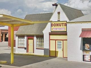
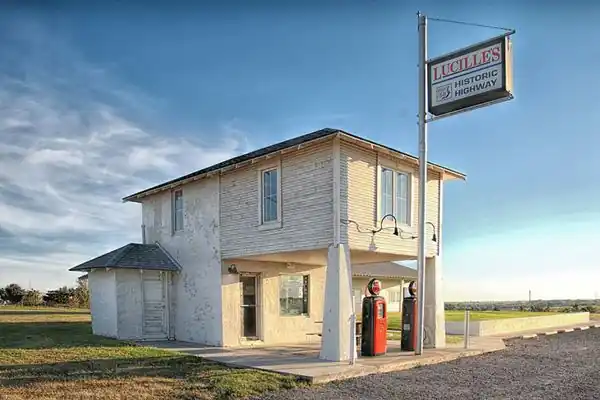
Historic "Provine Station" also called "Lucille's Place"
The History of Okalhoma
Paleo-Indians peopled the region some 15,000 years ago at the end of the last Ice Age. More recently, their descendants, the Wichita, Caddo, Osage, and Quapaw lived here and during the 1830s, groups like the Choctaw and the Cherokees were forced by the U.S. government to relocate in Oklahoma.
The Spanish explorer Francisco Vásquez de Coronado explored the area in 1541. It became part of the French Louisiana in the 1600s until it was purchased by the U.S. in 1803.
The original "Indian Territory" formed after 1831 to house all the Native Americans expelled from the states east of the Mississippi River was gradually carved up by white settlers, railway rights-of-way, and land taken by the Federal government. The Indian reservations were redrawn, and the land was opened for settlement.
Land Runs
The land was assigned in "land runs" where pioneers lined up at a starting point and rushed towards the land that was being granted as homesteads. Those who arrived first picked the best land. And those who arrived before the official opening date, did so "sooner", and this led to the state's nickname: "Sooner State."
The "all-Indian" state project failed and the territory became the 46th state in the Union in 1907.
The tragic Oklahoma City terrorist bombing of April 19, 1995, destroyed the Federal Building in that city, killing 168 people, including 19 children.
Geography
The relatively flat topography of Oklahoma has a slope from west to east and an average height of 1,300 ft. (400 m).
Oklahoma is located on a geologically stable region and there are no volcanoes in the state. Earthquake risk is low.
Climate
The open flat region of Oklahoma is subjected to the influence of the humid air from the Gulf of Mexico, the dry and hot air from the west, and the cold and dry air from Canada.
Tornados
This combination of weather factors leads to fluctuating and extreme climatic conditions: Oklahoma is located on the "Tornado Alley and is hit by an average of 62 tornados each year between April and June. This is one of the highest in the whole World.
The state's climate is humid and subtropical in its central regions.
It rains all year, with higher precipitation during late spring and summer (around 5 inches - 13 cm), with thunderstorms during this period.
Summers are hot and winters mild (but as mentioned above, cold spells with snow or freezing rain are common too). Oklahoma City experiences around 3 in. of snow monthly in winter.
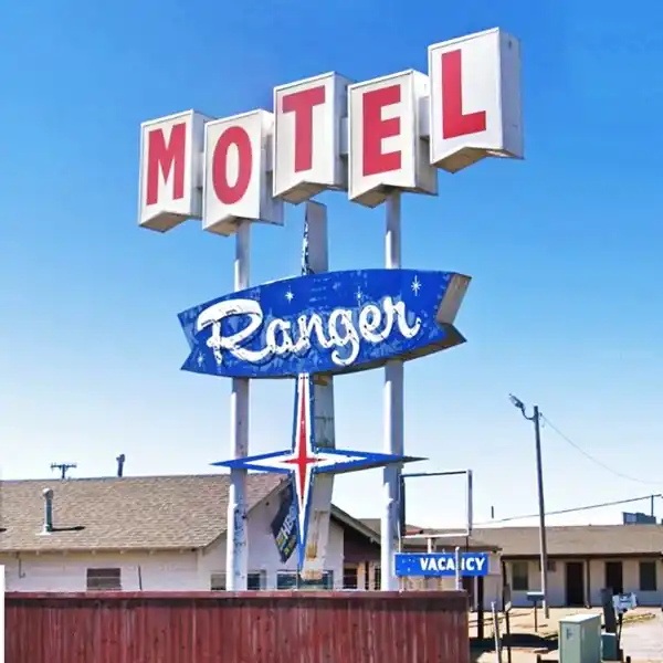
Ranger Motel Neon Sign, El Reno, Oklahoma
Cities
Oklahoma City is the largest city along Route 66 in the state. Pop. : 720,377 (2025), and a Metropolitan Area of 1,037,000. It is followed by Tulsa (Pop. 420,000) and a Metropolitan area with 807,000 residents.
Around 575,000 people live along Route 66's corridor through Oklahoma.

Culture
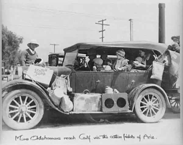
Oklahoma is a Southern state and the typical southern hospitality prevails. During the Dust Bowl period in the 1930s the migrant Oklahomans who fled west along Route 66 seeking jobs were referred to as "Okies". Their plight was recorded in the Pulitzer Prize-winning novel The Grapes of Wrath written by John Steinbeck in 1939, that became an Academy Award-winning movie in 1940.
Where to Stay in Oklahoma
Accommodation on US 66 in Oklahoma
The towns and cities along Route 66 offer different lodging options. Check the hotels and motels in the main towns by following the links below, we list the towns along Route 66 from East to West.
Find your lodging in OK
On Route 66's Main alignment
Eastwards
Westwards
>> Find RV campgrounds along Route 66 in Oklahoma
Map of Route 66 through Oklahoma
Route 66 itinerary across Oklahoma
Below are the legs we have split the course of U.S. 66 through Oklahoma, from East to West, starting at its NE corner in Commerce OK and ending on the state line in Texola. Find a detailed description with modern and old maps:
Towns located on Route 66
Below are links to oue pages on each city along Route 66 in Oklahoma. Click to find out about their attractions, sights, stops, weather, history, maps, and where to stay along the way.
Click on the links below for complete information on each town and village
Oklahoma towns, from East to West
East
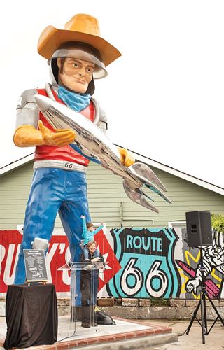
Buck Atom, the Space Cowboy Muffler Man in Tulsa, OK. Source
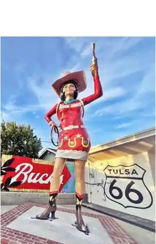
Stella the Space Cowgirl, Tulsa, Route 66. Source
A List of Oklahoma's Main Route 66 Attractions
Below we list the main attractions along Route 66 in Oklahoma, there are many more. They are listed from east to west.
Things to See & Do along Route 66
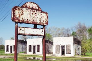
Remains of the 1930s Avon Court, Afton
Source
Classic '66 Motels & Hotels
Riviera Courts Motel (Miami) Historic Site
Acme Courts and Avon Court (Afton)
Hotel Vinita (Vinita) Historic Site
Site of the Lewis Motel (Vinita)
The Chelsea Motel (Chelsea) Historic Site
Historic Will Rogers Hotel (Claremore) Historic Site
Casa Loma Hotel (Tulsa) Historic Site
Hotel Lincoln (Stroud) Historic Site

Skyliner Motel sign, Stroud, Source. Click for St. view
Skyliner motel (Stroud)
Vintage Lincoln Motel (Chandler)
St. Cloud Hotel (Chandler) Historic Site
Tourist Court (Wellston)
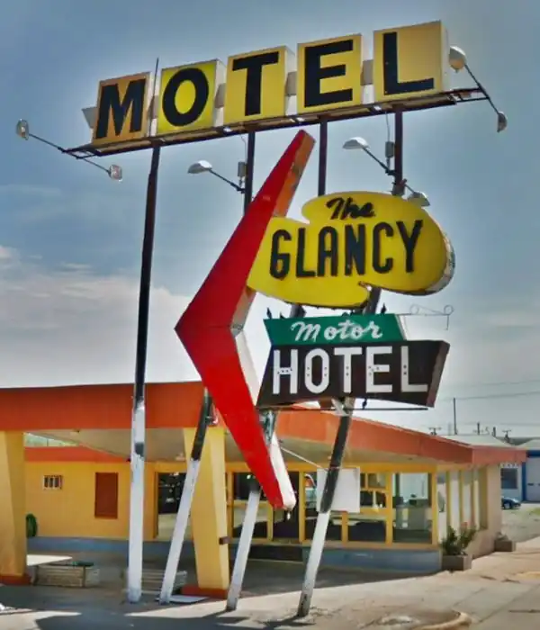
Hotel El Reno (El Reno) Historic Site
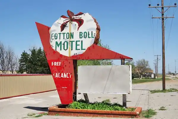
Cotton Boll Motel and the Washita Motel (Canute)
Casa Grande Hotel (Elk City) Historic Site
Flamingo Motel (Elk City)
1910 Old Boggs Hotel (Sayre)
West Winds Motel (Erick) Historic Site
Theaters
Coleman Theatre (Miami) Historic Site
Historic Circle Theater (Tulsa) Historic Site
Ritz Theater (OKC)
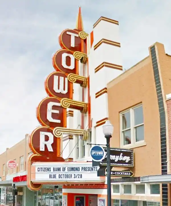
Tower Theater (OKC)
General Stores and Trading Posts and Cafes
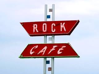
Historic Rock Cafe, Stroud, OK. Source
Dairy King (Commerce)
Buffalo Ranch (Afton)
Clanton's Cafe (Vinita)
McDonalds bridge-restaurant (Vinita)
Arrowood Trading Post (Catoosa)
Rock Café (Stroud) Historic Site
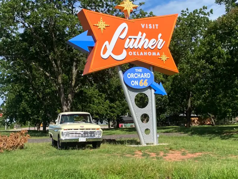
Engel's Dry Goods Store (Luther) Historic Site
Mulvey Mercantile (Yukon) Historic Site
1903 Gillespie Building (Geary) Historic Site
Owl Blacksmith Shop (Weatherford)
Owl Drugstore & Soda Fountain (Sayre)
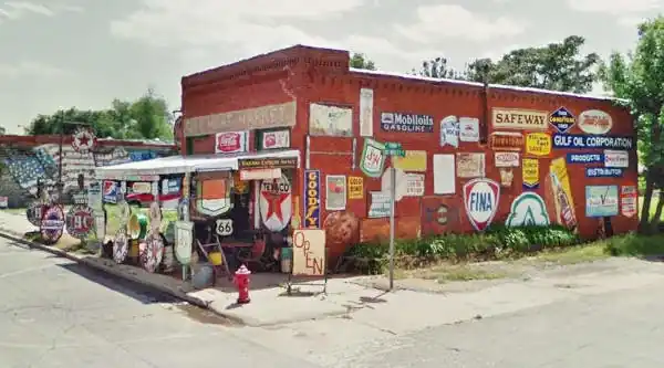
Sandhill Curiosity Shop (Erick)
The former City Meat Market, now Sandhill Curiosity Shop
Historic Districts
Sayre Downtown Historic District (Sayre) Historic Site
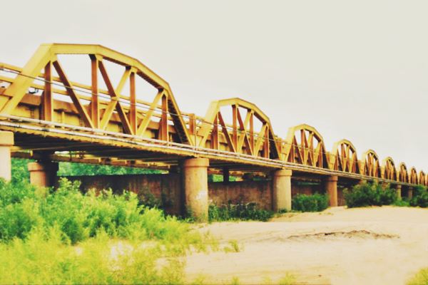
Route 66 Bridges
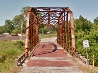
Rock Creek Bridge in Sapulpa
Notice the red brick deck
Horse Creek Bridge (Afton) Historic Site
Little Cabin Creek Bridge (Vinita) Historic Site
Pryor Creek Bridge (Chelsea) Historic Site
Bird Creek Bridge (Verdigris)
11th Street Arkansas River Bridge (Tulsa) Historic Site
Bridge #18 at Rock Creek (Sapulpa) Historic Site
Crybaby Brige (Kellyville)
Captain Creek Bridge (Wellston) Historic Site
Lake Overholser Bridge(Oklahoma City) Historic Site
Canadian River Bridge (Bridgeport) Historic Site
Remains of Toll Bridge (Bridgeport)
Timber Creek Bridge (Elk City)
Other Historic Sites...
Places listed in the National Register of Historic Places
Commercial buildings
Randall Tire Company (Vinita) Historic Site
Beard Motor Company (Bristow) Historic Site
Bristow Tire Shop (Bristow) Historic Site
Bristow Motor Company Building (Bristow) Historic Site
Crane Motor Co. (Chandler) Historic Site
Historic Tuton's Drugstore (Arcadia) Historic Site
Citizen's Bank (Edmond) Historic Site
Hedlund Motor Company Building (Elk City) Historic Site
First National Bank (Erick) Historic Site
Homes and Houses
Hogue Home (Chelsea) Historic Site
Belvidere Mansion (Claremore) Historic Site
1895 Farmhouse (Edmond) Historic Site
Storm House (Elk City) Historic Site
Miscellaneous Historic Spots and Sights

World's Largest Totem Pole, Foyil. Source
The World's Largest Totem Pole (Foyil) Historic Site
Brick Paved Broadway Street (Davenport) Historic Site
The Chandler Armory (Chandler) Historic Site
Round Barn (Arcadia) Historic Site
Armory (Edmond) Historic Site
First School in Oklahoma (Edmond) Historic Site
Czech Hall (the largest dance hall in the state) (Yukon) Historic Site
Chisholm Trail in Yukon (Yukon)
Carnegie Library (El Reno) Historic Site
Municipal Swimming Pool (El Reno) Historic Site
Historic Public Water Trough (Geary) Historic Site
Historic Weatherford Armory (Weatherford) Historic Site
McLain Rogers Park (Clinton) Historic Site
Historic Armory (Clinton) Historic Site
Whited Grist Mill (Elk City) Historic Site
Rock Island Depot (Sayre) Historic Site
Beckham County Courthouse (Sayre) Historic Site
Historic Park (Sayre) Historic Site
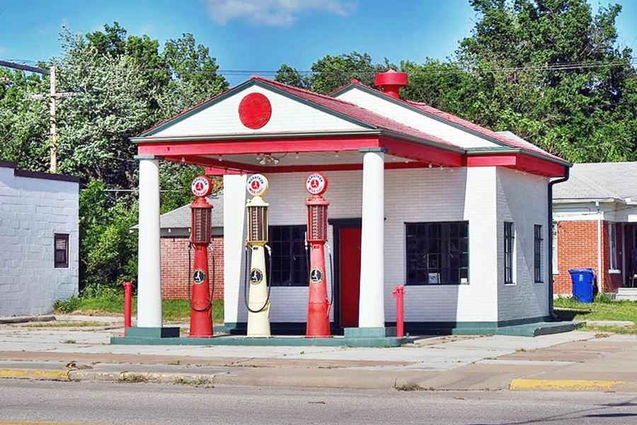
Route 66 Service Stations
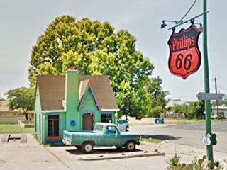
Phillips 66 Station, Chandler. A. Whittall
Conoco Hole in the Wall (Commerce)
Marathon Oil Service Station (Miami) Historic Site
Afton D-X Station (Afton)
McDougal Filling Station (Vinita) Historic Site
Sinclair Service Station (Tulsa) Historic Site
Phillips 66 Station (Tulsa) Historic Site
Cities Service Station #8 (Tulsa) Historic Site
Vickery Phillips 66 Station (Tulsa) Historic Site
Seaba's 1920s Filling Station
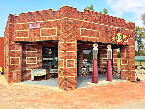
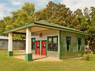
Texaco gas station, Foyil, OK. Source
Historic Texaco (Foyil)
Waite Phillips Filling Station (Sapulpa)
Bristow Firestone Service Station (Bristow) Historic Site
Texaco Service Station (Bristow) Historic Site
Texaco Station (Davenport)
Magnolia Station (Davenport)
Phillips 66 Station (Chandler) Historic Site
Historic Seaba's filling staton (Warwick) Historic Site
Threatt Filling Station (Luther) Historic Site
Ruins of a Conoco Service Station (Luther)
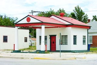
Historic Marathon Oil Service Station, Miami. Source
Click image for St. view
Futuristic Pops 66 Station
Avant Service Station (El Reno) Historic Site
Jackson Conoco Service Station (El Reno) Historic Site
Bridgeport Hill Service Station (Bridgeport) Historic Site
Provine Service Station - Lucille's Place (Hydro) Historic Site
Y Service Station (Clinton) Historic Site
Kobel's Place Service Station (Foss)
Canute Service Station (Canute) Historic Site
Kupka's Service Station (Canute)
Champin Service Station (Sayre) Historic Site
Magnolia Service Station (Texola) Historic Site
Ghost Towns (or almost!)
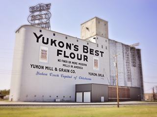
Yukon Mill , Yukon, OK. Source
Other Wacky, Weird and Interesting Landmarks
Spook Lights (Quapaw)
Mickey Mantle Boyhood Home (Commerce)
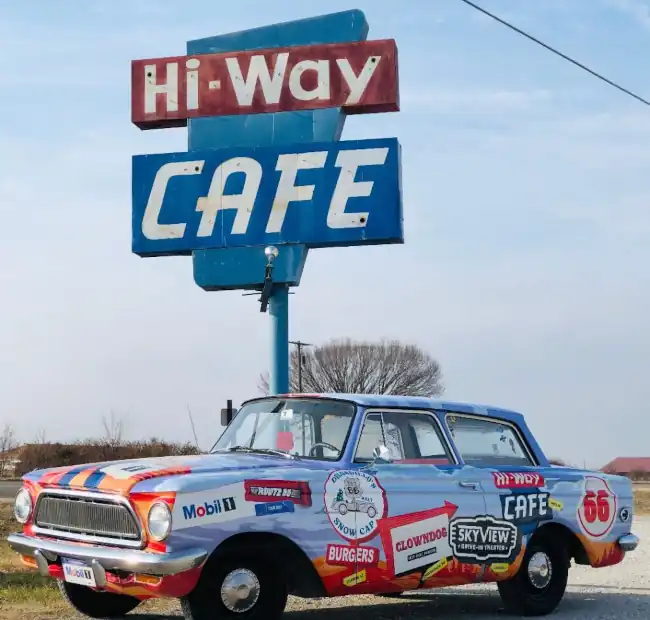
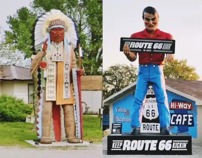
Hi-Way Cafe & Muffler Men (Vinita)
King Kong statue (Foyil)
Will Rogers Memorial (Claremore)
Will Rogers Birthplace Ranch (Claremore)
Radium Water (Claremore)
Blue Whale (Catoosa)

Golden Driller, 76 ft. tall. Source
Art Deco Buildings (Tulsa)
Golden Driller Giant statue (Tulsa)
Ghost Sign (Stroud)
Tallest Mural on Route 66 (Davenport)
First Spherical Tank (Davenport)
Unique Painted Barn (Chandler)
Blue Hippo (Edmond)
Yukon Mill (Yukon)
Streetcar (El Reno)
Ghost Mounds (Hydro)
Blair's Log Cabin built in 1892 (Weatherford)
Route 66 Museum (Clinton)
Museum Complex (Elk City)
World's tallest non-operating oil rig (Elk City)
Pedestrian underpass (Sayre)
Roger Miller Museum (Erick)
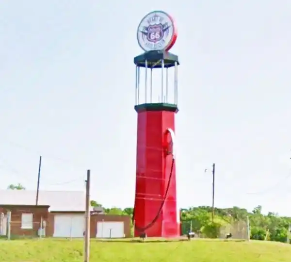
World's Tallest Gas Pump (Sapulpa)
Jails

Canute Jail
Source. Click image for St. view
Jail Cell (Foss)
Canute Jail (Canute)
Jail House (Texola)
Archaeological and Native American Sites
Claremore Mound (Claremore) Historic OK Marker
Fort Reno (El Reno) Historic Site
Historic Segments of Route 66
Some segments are Listed in the National Register of Historic Places
Ribbon Road - Nine-foot section (Miami to Afton) Historic Site
Original roadbed of 1926 (Sapulpa) Historic Site
Historic 1926 roadbed and Original Ozark Trail (Stroud) Historic Site
Gap and Loop (Wellston)
Original 1928 Route 66 roadbed (Arcadia) Historic Site
Bridgeport to Hydro (Bridgeport) Historic Site
Route 66 itinerary across the state of Oklahoma
Below is a detailed description of the alignment of U.S. 66 through Oklahoma, from East to West. For each town we give details of Route 66's alignment through it. You can also click above on a town and read more about the course of US 66 in that specific community.
Oklahoma
California ¦ Arizona ¦ New Mexico ¦ Texas ¦ Oklahoma ¦ Kansas ¦ Missouri Illinois
Route 66 in Oklahoma
Current mileage: 383 mi.
Route 66 crosses Oklahoma from its Northeastern tip near Miami, to its western side in Texola, passing through Tulsa and Oklahoma City.
Click on the detailed description with interactive maps of each leg across the state (in the yellow box at the start of each leg).
Starting on the OK-KS state line
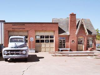
Phillips 66 station, Chandler
From the Kansas state line (mile zero), follow Alt. US 69, which passes through Quapaw (5 mi.) turns west and joins US 69, and as such runs westwards to Commerce (10 miles). Here it turns south through the town as Mickey Mantle Blvd. (the 1920s alignment took a right on D St. and another on Main St. meeting current alignment south of town). US 66 takes a southwards course as US 69, passing through the center of Miami (15 mi.) along its Main St.
Miami
Visit the Miami Marathon Oil Company Service Station and the Coleman Theater, Historic Places. If you keep on south along the Main St. it becomes the "old" alignment of US 66 known as the "Ribbon Road", which runs between Miami and Afton.
Keep south till 3rd Ave. and take a right along Route 66 (US 69), westwards, crossing the Neosho River, and passing through the tiny town of Narcissa, don't miss the 1922 Ribbon Road only 9 feet wide, see the monument, on E-140 North of the town.
Continue south, cross I-44 -Will Rogers Turnpike, Toll Road (27 miles) and US 60 to reach Afton (30 mi.). US 66 continues with US 60 south and then takes a sharp curve to the west (35 mi.).
Vinita
It then crosses I-44 (Exit 249) and enters Vinita (45 miles). Route 66 goes through the town turning SW along Wilson St. (US 60 & 69). US 69 splits to the left and US 60 to the right (49 and 50 mi.), keep straight along OK-66 highway through White Oak and Chelsea (63 mi.) with its Historic site, the Chelsea Motel.
OK-66 adopts a SW course through Bushyhead (69 miles), and Foyil (72 miles) where you should stop at the Ed Galloway's Totem Pole Park, a Historic Site.
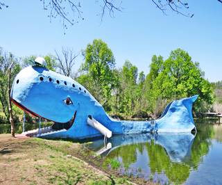
Big Blue Whale, Catoosa. Source
Keep on OK-66 passing by Sequoyah and reaching Claremore (82 mi.) where you can visit the Will Rogers Museum and and its "radium water baths", after crossing the town of Verdegris, and Verdigris River you will reach Catoosa.
Don't miss the Big Blue Whale (right by the highway, 92.6 miles).
Leave the town behind and take a left on N 193rd E Ave (Co. Rd. 167) passing I-44 and turning right on E 11th St. (96.3 mi.) towards Tulsa that lies straight ahead.
OK-66 runs with a westerly course, crossing I-44 and US 169 and US 75 (109 miles), entering the center of the city of Tulsa via E 10th St.
Tulsa

Tulsa, Route 66 Rising. source
Tulsa has three historic sites on the National Register: The Circle Theater, Vickery Phillips 66 Station and 11th Street Arkansas River Bridge.
Follow OK-66 as it forks on the left at S. Denver Ave., crossing US 75 & US 64, heading towards the Historic bridge across the Arkansas River as Southwest Blvd., keep along this road as it crosses US-75, and then I-244 to its northern side (113 miles), leaving Tulsa behind.
SW Blvd which later becomes Frankona Rd. will run to the north of I-44, and cross again, to its southern side (122 mi.) to merge with OK-66 and head south through Sapulpa, entering it along OK-33 (E. Dewey Ave.) taking a sharp right turn. The Bridge #18 at Rock Creek aheaed is a Historic Site.
Stay on OK-33 until it forks right towards I-44, then carry on straight along OK-66 through Kellyville (131 miles). The Route 66 crosses to the north side of I-44 (137 mi.). It departs from the interstate, heading west. But then turns south, crosses I-44 and enters Bristow (145 miles) down its Main St.
It takes a right and leaves the town along W 4th Ave. Stick to Route 66 as it heads west and reaches Depew (153 mi.) and then, on the south side of I-44, Stroud (164 mi.) along its Main St.; don't miss the Rock Cafe, a Historic Site.
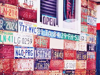
Licence plates Texaco, Davenport
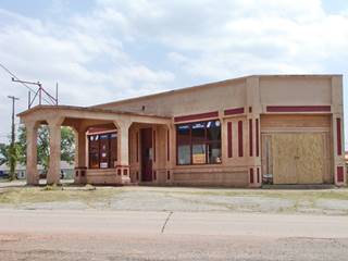
1920s service station, Depew. Source
Follow Route 66 west to Davenport (171 miles).
Chandler
You will reach Chandler (177 miles); visit the Chandler Armory, a Historic Site. Follow OK-66 west, passing through Warwick (185 mi.) and its Historic Seaba Station. Just west, it crosses to the north of I-44 (188 miles) going by Wellston with a western course & going by Luther (197 miles) with its Historic Site, the Threatt Filling Station and reaching Arcadia (205 mi.).
Arcadia
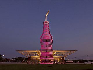
Pops Restaurant, Route 66, Arcadia
See the Round Barn, a Historic Site, and also, the modern architecture of the Pop's Restaurant. (After Coffee Creek, on the left you will see Pop's).
Keep straight ahead and cross I-35 (at its Exit 141) heading west along the original alignment of US 66, which is current US 77. Go through Edmond and in its downtown area, take a left along Broadway (214 miles) following US 77 into Oklahoma City.
Oklahoma City
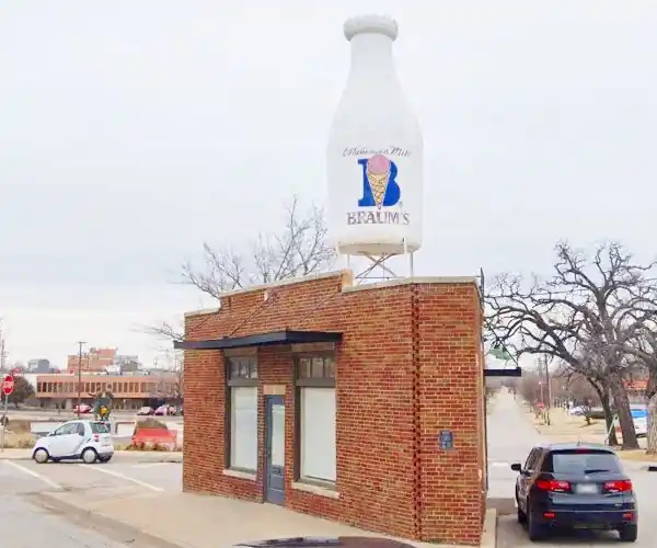
In Oklahoma City, visit the Historical Site: Milk Bottle Grocery
The town's name is mentioned in the song Route Sixty-six (Get your kicks...)
Leave US 77 at N. Kelley Ave. Exit (217 mi.), cross to the south of US 77 and head south along N. Kelley Ave. until reaching I-44 (222 miles). Then get onto it at Exit 128B westbound and immediately leave it to the right at Exit 128A, onto N. Lincoln Blvd., southbound.
This road will take you straight south right into the center of the city, by the State Capitol (225 mi.). Follow Lincoln Blvd., to the right and take a right turn along NE 23rd St. until reaching N. Classen Blvd. (227 miles), turn right along the Boulevard heading north.
At NW 39th St. take a left and head west (228 mi.). After N. Young Blvd, a right will take you under I-44 to its north side, then take a left along its North Service Road and get onto I-44 at Exit 124, heading west; leaving I-44 (which turns left) and following straight along NW 39th Expwy. (Route 66), which passes by the north shore of Lake Overholser, on the North Canadian River, using the Lake Overholser Bridge, a Historic Site. The road reaches Yukon (240 miles). Keep west, US 81 joins Route 66 the left and head north, into El Reno.
El Reno
Stop by El Reno's Historic Sites: Avant's Cities and Jacksons Conoco Service Stations and Fort Reno.
The road goes through its center along US 81 and OK-66. At Sunset Dr. (254 miles) take a left leaving US81, and head down Sunset Dr., which is also I-40 Bus. Loop. westwards.
Take a right along E1020 Rd., (258 mi.) which is Route 66 (signs say Fort Reno Visitor Center and also the brown shield of US 66). Head west along it, it runs to the north of I-40, and crosses US 270 (263 miles), the old 1920s alignment of Route 66, took a right here, passing through Calumet (5 mi to the north), and Geary, joining the later alignment further west, at Bridgeport, you can drive the 1926 loop or keep straight, westwards.
At US 281 Bus, take a right (270 mi.) until Jones Rd. NW, turn left, to the West, (272 mi.). You will meet US 281 (274 miles); turn left, to the southwest. The road (also OK-8), takes a westerly course and passes just south of Bridgeport (280 mi.), which is almost a ghost town.
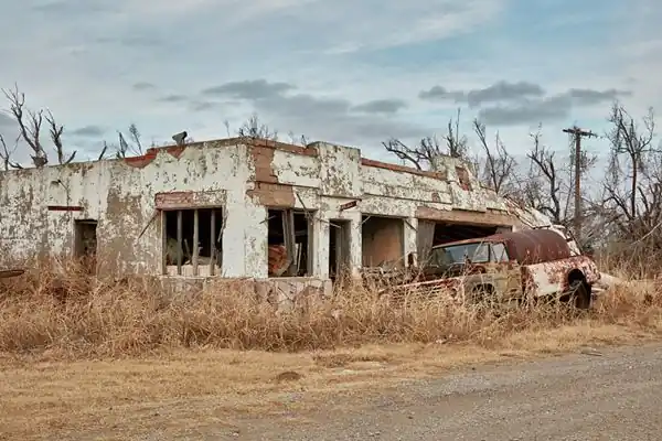
The road becomes the North Service Road of I-40 (290 miles) and passes by Hydro (291 mi.); visit the Provine Service Station (Historic Site).
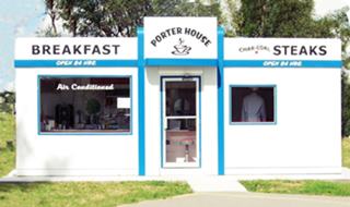
Porter House Valentine Diner, Weatherford OK. Click for street view.
Source
Continue west along the I-40 Service Road and reach Weatherford (298 miles), along E. Main St. Take a right along E. Main St. (I-40 Bus Loop) into the town and leave town along S. 4th St.
The road turns west (OK-54) and again runs west as the Frontage Road of I-40, crossing to its south side at Exit 71 (309 mi.); keep a westerly course until N2290 Rd, where you return back to the north side of I-40 (311 miles). Keep west, it is I40 Bus. Loop, and enter Clinton (314 mi.).
Clinton
Clinton has two Historic Sites: McLain Rogers Park and Y Service Station and Cafe. The road goes into the town along W. Gary Blvd., and then enters I-40 westwards at Exit 65, west of the town (317 miles).
At Exit 62, leave I-40, and get on its south side, head west along the Service Road, (319 mi.). At Exit 57, cross to the north of I-40 (324 miles), keep along the Service Road, reaching Foss (328 mi.), cross to the south at Exit 50 and enter Canute (335 miles).
Once again cross to the North side of I-40 (N2050 Rd) (338 mi.) and head west into Elk City, cross OK-34 and turn left and then right along I-40 Bus Loop, through the town (341 miles). The road rejoins I-40 at Exit 32 (350 mi.); keep along the service road, west. And at Exit 25, turn again right along I-40 Bus Loop. into Sayre (359 miles).
Sayre
At its 4th St. take a left passing through the town (see the Beckham County Courthouse, a historic site).
When you reach I-40, stick to its North Service Road (362 mi.). Head west. U.S. 66 passes through the ghost town of Hext and then to the south of I-40 at Exit 20 (371 miles) to then turn west and enter Erick along Roger Miller Blvd. (375 mi.). See the historic West Winds Motel. Keep west along Route 66 after I-40 Bus Loop turns north, stay on E1240 Rd. all the way to Texola (382 mi.), the last town in Oklahoma along U.S. 66, pass through it along 5th St. and leave the small town along OK-30 which turns to the northwest and crosses the State Line into Texas (383 miles). At the Texas state line, the road will become Spur TX 30 and head towards I-40. This marks the End of your trip through Oklahoma.

Sponsored Content
>> Book your Hotel in Tulsa


Credits
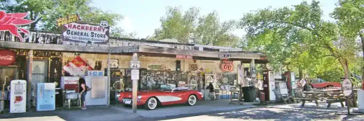
Banner image: Hackberry General Store, Hackberry, Arizona by Perla Eichenblat

