Parks along Route 66
Index to this page
Some useful Tips on National Parks
Access Fees & Passes
If you are planning to visit several National Parks over the course of one full year, you should consider buying the Annual Pass: It costs $80 you can buy it at most parks or online, from the USGS store (http://store.usgs.gov/pass). It admits pass owner/s (up to 2 persons can own a single pass) and the passengers in a non-comercial vehicle (for per-vehicle fee areas) or the pass owner + 3 adults at per-person fee areas. Note that photo identification will be requested to verify pass ownership and that children under 16 are always admitted free.
If you visit Yosemite ($30/car), Grand Canyon ($30/car) and Petrified Forest ($20/car) National Parks and you more than will cover the costs of your annual pass.
US citizens or permanent residents aged 62 or older can get a lifetime Senior Pass for $10. US citizens or permanent residents with permanent disability can obtain a free Access Pass.
The Top National Parks near Route 66
Grand Canyon and Petrified Forest
The two best known national parks of Route 66 are Grand Canyon National Park (very close to US66) and Petrified Forest National Park, which actually includes a segment of Route 66. We describe them both below:
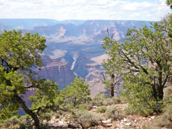
Grand Canyon National Park
World Heritage site of UNESCO
79 miles northwest of Flagstaff along US 180 (87 mi. via US 66 and NM 64). See a Map with directions and only 59 miles north of Williams along NM 64 and US 180 (Map with directions). Plan a full day trip to visit it.
>>More information at our webpage: Grand Canyon and Route 66.
What to do in one day?
This is perhaps one of the best known natural attractions in the U.S. We spent a full day at Grand Canyon in July and this is what we did:
We drove in through the South Entrance along AZ-64. We bought the Annual Pass for $80 (and saved a fortune because we used it at many parks on that trip: Zion, Bryce Canyon, Yellowstone, Yosemite, Arches, Capitol Reef, Grand Teton, Sequoia-Kings Canyon).
We parked at the Grand Canyon Visitor Center Parking Lot next to Mather Point. We then walked along the Rim Trail to the Village, a 2.1 mile walk (3,4 km). Very good views of the Grand Canyon, the geology -with stones that are hundreds of millions of years old exhibited along the way. Lovely pine trees shading most of the way.
There are restrooms at the Visitor Center, Village and Market Plaza. Take plenty of drinking water with you. Wear a hat and use sunblock in summer.
A free shuttle bus runs between the Visitor Center and the Village, passing through Market Plaza. There is another one, running west along Hermit Road (we took it) all the way to Hermits Rest (food, restrooms available there).
We walked around the Village and visited the main sights: Verkamp's Visitor Center, Hopi House (outside there were some natives performing traditional dances, worth seeing) and El Tovar Hotel. We then walk along the trail west to visit Lookout Studio and Kolb Studio and right there is the bus to Hermit's Rest. You can hop on and off the bus along the road. We took it to the end point and on the way back, walked a stretch of the rim from Hermits Rest to Pima Point (1 mi. - 1.6 km) where we took the shuttle bus back to our car.

More information at the park's Official website.
Petrified Forest National Park
It is the only National Park in the U.S. to include and protect a section of Route 66.

"The Tepees" Petrified Forest National Park. Austin Whittall
Its arid badlands of multi-colored stones with bands of red, violet, green, ochre and white sediments from the Triassic period 200-million years ago with trees and turnks of petrified wood, fossils, and historic sites!
Our experience at Petrified Forest: Tips
We visited the park driving westwards from Gallup to Kingman. So we only had a few hours but enjoyed it! we did the "half-day visit" described below. The Petroglyphs (Native American rock art) at Pueblo Puerco were unexpected. We also took some photos next to the rusting Studebaker. Blue Mesa was amazing!
Short 2 to 3 hour visit
At least Walk the Painted Desert Rim Trail to Kachina Point, Drive Blue Mesa Road and Stop at Rainbow Forest Museum to see the stone tree trunks strewn on the ground.
- Stop at the Painted Desert Visitor Center.
- Drive the 28 miles of road through the park: to the south, visit the Rainbow Forest Museum and watch the park film; walk Giant Logs and Crystal Forest trails; drive the Blue Mesa Road. To the north: Visit the Painted Desert Visitor Center and watch the park film.
- Drive the circuit and stop at the overlooks in the Painted Desert, include a stop at the Painted Desert Inn National Historic Landmark.
Half a Day visit
Add the following: to the 2-3 hour visit
- Drive through the entire park.
- Stop at Painted Desert Inn Museum (in the Historic Landmark).
- Walk the trails at Painted Desert Rim and Crystal Forest.
- Stop at the Route 66, Newspaper Rock, Agate Bridge, and Jasper Forest overlooks.
- Visit Puerco Pueblo, walk the Puerco Pueblo Trail.
- Hike the Blue Mesa and /or Agate House Trails.
- Walk the Giant Logs Trail (pick up a trail guide at Rainbow Forest Museum).
There is no overnight lodging in the park, camping in the park is limited to backpacking in the wilderness area and permits are required.
>> Find your Hotel in neighboring Holbrook
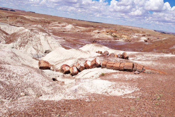
View of some petrified trees at Petrified Forest National Park

Ruins of the Puerco Pueblo site. Don't miss the rock art here!
A. Whittall
The Petrified Trees
200 million years ago, during the Late Triassic Epoch this area was a lush rainforest with ferns and coniferous treees 10 ft. in diameter and 180 ft. tall. As they died or fell they were buried by sediments or covered with volcanic ash (known as the Chinle Formaiton) that preserved them before they decomposed. Ground water later dissolved silica in the volcanic ash and saturated the logs and crystallized, replacing what was once living tissue with quartz. This preserves the life-like appearance of the wood.
Iron oxides give the petrified wood its red, organge and ochre hues.
60 million years ago, the uplift of the Colorado Plateau led to the erosion of the younger rock that overlay the Chinle Formation, and this uncovered the logs and fossil plants.
The park is one of the few in the world to have flora from the LateTriassic: cycads, ferns, ginkgoes, lycopods and more.
More details: Petrified Forest NPS Website.

1932 Studebaker, US 66 Holbrook. A. Whittall
See the Map showing location of the 1931 Studebaker
Painted Desert Inn
Petrified Forest N. P.Holbrook, AZ.
Listed in the National Register of Historic Places
A classic National Park lodge built in 1920 and restored to its original 1949 appearance. Now a museum.
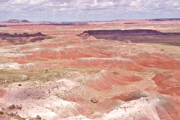
The views on this side of the park are amazing, the Painted Desert deserves its name.
Parks along U.S. 66
This is a state-by-state list and the states are listed alphabetically.
Click on the links to visit the state and find its Parks that are close to Route 66.
Arizona
California ¦ Arizona ¦ New Mexico ¦ Texas ¦ Oklahoma ¦ Kansas ¦ Missouri ¦ Illinois
There are many outdoor options to enjoy nature along Route 66, or close to it, in Arizona, below are some of them.
Near Flagstaff
> > Read about the parks near Flagstaff
Above we have described the Grand Canyon Nat. Park and the Petrified Forest National Park. Below we describe the other parks in Arizona.
San Francisco Volcanic Field

Snow dusted San Francisco Peaks, Flagstaff AZ. Source
The hills and mountains that surround Flagstaff and extend towards the Grand Canyon are geologically young as they formed during the last 6 million years. They are now extinct volcanoes forming the San Francisco Volcanic Field.
A hotspot below the Earth's mantle heated the magma which caused vast eruptions. As the American tectonic plate moved west, the volcanos spread eastwards.
This created the highest mountain in Arizona (San Francisco Mountain) alt. 12,633 feet (3.853 m) and also the youngest volcano in Arizona, Sunset Crater which erupted some 900 years ago.
Though quiet now, there will be more eruptions in the Volcanic Field, but when they will take place is not known. The volcanic field covers about 1,800 square miles (4.660 km2) is a great outdoors area. Most of it is lies within Coconino and Kaibab National Forests.
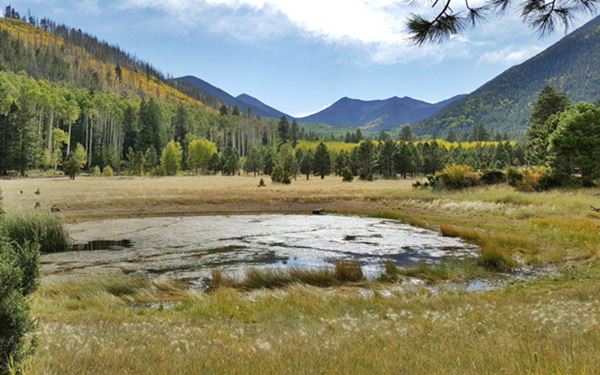
Coconino National Forest
Flagstaff is surrounded by the Coconino National Forest, with beautiful landscapes and great outdoors and also Native American sites, like the Ruins of Elden Pueblo.
It covers 1.856 million acres (751.000 ha.) and was created in 1898 as a forest reserve. It became a U.S. National Forest in 1908. It borders with the Kaibab National Forest towards the Grand Canyon. Check the Official website for complete information.
Walnut Canyon National Monument
It is 11.5 mi. southeast of Flagstaff (Map with Directions).
Check the Official website for more info. Open daily except Christmas, it has several trails which allow you to spot wildlife and visit the remains of Native buildings that dot the canyon walls. It was created as a Forest Reserve in the early 1900s, and designated National Monument over 100 years ago, in 1915.
Wupatki National Monument
It is 44 miles northeast of Flagstaff along US 89 (Map with Directions includes Sunset Crater Tour too.)
Open daily: 9 AM - 5 PM. The entrance fee covers both Wupatki and Sunset Crater National Monuments. Visit its The website. It preserves dozens of ancestral Puebloan villages of the Sinagua culture; the ruins dot the red sandstone cliffs.
You can stop by Sunset Crater on the way there or on the way back.
Sunset Crater National Monument
21 mi. from Flagstaff via US 89 (Map with directions from Flagstaff to Sunset Crater). This is a very young volcano only 900 years old. See its cinder cone and lava flows and hike the trail or just look at it from the viewpoint. Full details at the Official NPS website.
Oak Creek Canyon Scenic Drive a Day Tour to Sedona
Fully paved. To and from Sedona along Oak Canyon Scenic Drive is a 59 mi. circuit. If you choose to include the Red Rock Scenic Byway, it is a 87.5 mile (2 hour driving time) round trip. The road was built in 1914 and paved in 1938; see the Map with Directions.
Head south out of Flagstaff and take SR 89A towards Sedona. The road follows Oak Creek Canyon, with switchbacks and colorful rocks in a forested setting. After 14 mi. you will reach the Oak Creek Vista Point, stop for the view). And then you will reach Slide Rock State Park (21.5 mi.)

Scenery at Slide Rock SP, Source
Slide Rock State Park
Name after a natural water slide in the slippery solid rock bed of Oak Creek.
Slide Rock State Park is of Oak Creek. It has been the location of several western movies starring actors like Charles Bronson, John Wayne or Alan Ladd
Admission fee charged. Check the Official Slide Rock Park website for more info.
> > Motels and Hotels in Sedona.
Red Rock State Park

Scenery at Red Rock SP, Source
39 mi. from Flagstaff, just 9.4 mi. to the SW of Sedona, see this Map with directions.
Official website has more details.
A 286 acre. park, with hiking trails along the Oak Creek among meadows, red rock hills and juniper woods. The park has gift shop, picnic tables, visitors center and restrooms.
You can turn back and return along the Oak Creek Canyon Scenic Drive, or head 9.4 miles to the southwest to visit Red Rock State Park. You can also continue south and complete the circuit along the "Red Rock Scenic Byway".
Monument Valley

Monument Valley Navajo Nation Park. A. Whittall
Navajo Nation Park
It is 172 miles norteast of Flagstaff, a 3 hour drive along US 89, 160 and 163, on the Utah state line. See this Map with Directions.
Visit the Official website for complete information.
This is a classic image of scores of Western movies. The rock pinnacles and buttes surrounded by red sand and shrubs in a valley of ochres and reds. An amazing experience.
Wind and water have eroded the sandstone of the plateau for 50 million years. There are self guided tours and guided ones. Plus a visitors' center and Navajo crafts. The park covers 91,696 acres.
Little Colorado River Tribal Park
It has two viewpoints and includes the Grand Falls (mentioned above), Coalmine Mesa, Marble Canyon and East Rim of Grand Canyon areas.
The Official website has more information.
Near Winslow
Little Painted Desert

Little Painted Desert. Credits
18 miles north of Winlsow along NM.87. There is a road that leads to the rim, and from an overlook you have great vistas of the coloured hills that are amazing. This is a Map with Directions from Winslow to the Little Painted Desert.
Grand Falls or The "Chocolate Niagara"
It is a 26 mile drive (along a rough and unpaved road -check with the locals before driving there in a regular car) from Winona to the Grand Falls; see this Map with Directions.
Grand Falls on Little Colorado River
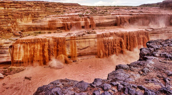
The falls are located inside the Navajo Reservation. March an April is the best time to visit the falls, which become a muddy water torrent falling 190 ft. (58 m). In summer it is mostly a trickle of water.
The Little Colorado River is dry most of the time. It only carries water between March and April during the spring snow-melt period so that is the best time to visit the falls.
A lava river flowed from Merriam Crater and spilled into the canyon of the Little Colorado River 150,000 years ago, it ran downstream for 15 miles and solidified. The lava dammed the river and caused it to deviate and fall over the Kaibab sandstone walls.

Deer in Hualapai Mountain Park. Credits
Check the Official website of the Navajo Nation Parks & Recreation for more information.
Hualapai Mountain Park
14 mi. from Kingman (Map and Directions).
Forested mountain range that rises above the arid surroundings. It was home to the "pine tree people", the Hualapai natives. Hiking, biking. Picnic areas and skiing in winter.
California
Los Angeles State Historic Park
1245 N. Spring St. Los Angeles, CA. With 32 acres of open space in the heart of Los Angeles, right next to Chinatown. Enjoy a view of downtown and unwind.
Mojave National Preserve
Close to Needles.
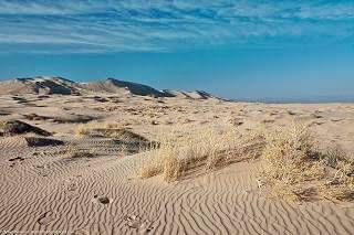
Kelso Dunes in Mohave Preserve California, Credits
The Mojave National Preserve protects almost 1.6 million acres of desert habitat; it is a scenic National Park located just west of Needles, between I-40, I-15 and the California - Nevada state line.
Observe Bighorn Sheep, visit the "Hole in the Wall" area, go along the "old Mojave Road" used by Indians and pioneers.
Visit the Cinder Cones, Cima Dome and Kelso Dunes.
Read more at the Official National Parks website
Dead Mountains Wilderness Area
12 mi. North of Needles, visit its Official BLM website.
Topock Marsh and the Havasu National Wildlife Refuge
Topock Marsh was created by the backwater that flooded the lowlands north of Topock after the construction of Parker Dam. There are several boat launches with access to the Colorado River such as the Topock Marina in Arizona (exit 1, I-40 AZ) and Park Moabi (south of Needles).
Topock Marsh is ideal for canoeing or kayaking. Reach the water at: North Dike, Five Mile Landing and Catfish Paradise. It is a great bird watching spot too. This is its: Official Havasu National Wildlife Refuge website.
>> Book your Hotel in Hotel in Lake Havasu City
Illinois
California ¦ Arizona ¦ New Mexico ¦ Texas ¦ Oklahoma ¦ Kansas ¦ Missouri ¦ Illinois
Below we list just a few of Illinois' natural preserves. Visit Illinois State Parks website for additional information.
Ottawa Trail Woods
200 W 47th St Illinois and Michigan Canal, Lyons. This forest preserve has picnic groves and shelters. It is part of the historic Chicago Portage waterway.
Prairie Bluff Joliet
Just north of Joliet, the 680-acre preserve protects a wetland on the Des Plaines River. It is ideal for Biking, Hiking or Running. Official website.
The Midewin National Tallgrass Prairie
Located in Elwood next to US 66, this is the only federal tallgrass prairie reserve east of the Mississippi River. It is in the central forest-grasslands transition ecoregion of the temperate grasslands, savannas and shrublands biome.
With the neighboring Des Plaines Fish and Wildlife Area and a other protected areas, it covers 40,000 acres of protected land.
Twenty seven American bison were introduced in 2015 to graze on introduced species and allow the native ones to gain a foothold in the area.
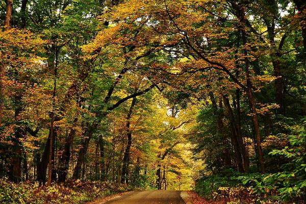
Wilmington Shrub prairie
Just south of Wilmington adjacent to Route 66, it is one of the few remaining examples of shrub prairie in Illinois it covers almost 143,000 acres.
Mazonia-Braidwood State Fish and Wildlife Area
At old Route 66 and Huston Rd. Braceville. Land dug up for coal, was abandoned in 1910 and land reverted to a natural state. Trees covered the area and ponds formed with rainwater. Now it is a hunting and fishing wildlife area that covers 1,017 acres. Learn more at the Mazonia-Braidwood website.
Funks Grove Nature Preserve
Funks Grove IL, has a National Natural Landmark protecting an "island" of forested land in the midst of the vast Grand Prairie of Illinois.
A place where the trees managed to survive the prairie fires and gain a foothold against the grasses. This one is the largest remaining intact prairie grove in the state, covering over 1,000 acres
Kansas
California ¦ Arizona ¦ New Mexico ¦ Texas ¦ Oklahoma ¦ Kansas ¦ Missouri ¦ Illinois
Parks in Kansas
The very short course of Route 66 through Kansas does not have any Parks along it. However you can read about all the Kansas State Parks at the website of the Kansas Department of Wildlife Parks and Tourism.
Mined Wildlife Area
Located in Pittsburg, 32 miles north of Baxter Springs and Galena; you can reach it via US-400.
It covers 14,500 acres of land that was surface mined between the 1920s and 1974. It has been restored and has over one thousand strip-mine lakes, wooded hills (oak, walnut, hickory) and is ideal for trekking, hiking, hunting, fishing and camping.
Missouri
California ¦ Arizona ¦ New Mexico ¦ Texas ¦ Oklahoma ¦ Kansas ¦ Missouri ¦ Illinois
Meramec State Park - Stanton

Meramec Caverns in Stanton, Missouri. Source
Just 8 mi. west of Stanton (on ROUTE 66), it was Created in 1926 and protects over 40 caves and a forested landscape. Don't miss Fisher Cave with massive columns and bear claw marks from the past. Rafts and canoes can be rented to have fun on Meramec River. Or fish, trek along its 13 miles of hiking trails or swim. The park has RV campsites, cabins and hotel
Read more at the Park's Website (there is an RV campsite there too).
Route 66 State Park near Eureka MO
Times Beach was a once bustling commnity but after being contaminated with dioxin in the 1970s, it was evacuated, demolished and decontaminated in the 1990s. Today it is the Route 66 State Park with its 1935 Steiny's Inn (Bridghead Inn), a 1932 section of the Mother Road and the now closed Historical Meramec River US 66 Bridge.
New Mexico
Parks near Grants and Gallup
There are several parks close to Grants in the Malpais area. The Spanish words "Mal" and "País" mean "Bad" and "Country" respectivley, hence: "Badlands", an appropriate name for the lava slag that covers most of the region.
El Malpais, National Monument and Nat. Conservation Area
The badlands of El Malpais are protected as both a National Monument and a National Conservation Area. El Malpais National Conservation Area has the incredible La Ventana Natural Arch. The Official Website has fulll information.
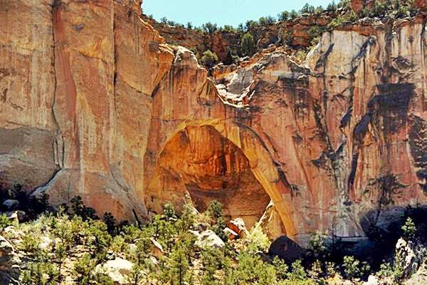
Click image for St vView
Lava Flows only 3,000 years old
The Zuni-Bandera Volcanic Field spans this part of New Mexico, and the Grants lava flow is the youngest flow in the field and one of the youngest in the 48 contiguous United States.
The flow came from a volcano located 25 mi (40 km) south of Grants, and when it reached the San Jose River it turned eastwards for another 6 mi (10 km) down the valley. The lava has been dated to between 2,910 and 3,080 years ago. And this is interesting: there is an Indian legend about it! The Pueblo people tell about a river of fire in the San Jose River Valley, so they must have witnessed the outflow.
Cibola National Forest- Mt. Taylor
The Cibola National Forest and National Grasslands (Official Website) covers 1.6 million acres in New Mexico, Texas, and Oklahoma. The Mount Taylor District close to Grants NM encompasses two mountain ranges Mt. Taylor and the Zuni Mountains.
Bluewater Lake State Park
25 mi. west of Grants. Read more at Bluewater Lake State Park. Ideal for fishing, hiking and watching wildlife. RV Campground.

El Morro Nat. Mon. Source
El Morro National Monument
Visit the Official Website for full info. Its Inscription Rock, accessible along an easy trail has over 2,000 inscriptions carved in the sandstone.
The name is Spanish and means "Bluff", "Headland". It is a great sandstone promontory which provides a shaded oasis for those travelling along the trails south of the Zuni Mountains. It was a camping spot and those explorers who passed by left their names dates or simply inscribed their symbols in the soft rocks, a memento of their visit: the Inscription Rock.
Near Tijeras
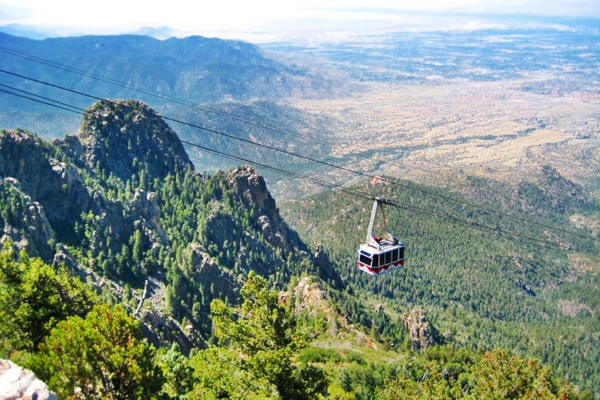
Cibola National Forest - Sandia and Mountanair
11776 Highway 337, Tijeras NM. (505) 281-3304. Official Website
The areas nearest to Tijeras are the Sandia and the Mountainair Ranger Districts.
Manzano Mountains State Park
The park is 46 miles SW of Tijeras (Map with directions).
A great place for hiking, birding, wildlife viewing and camping in the forests at the foothills of the Manzanos. There is a campground and RV Park.
Manzano Mountains: Apple Mountains
The range gets its name from the Spanish word "Manzano" or "apple tree", due to the old apple orchards in the town of Manzano. Though ledgend has them planted by the Spanish missionaries in the 1600s, the trees date back to the 1800s, but nevertheless, they are perhaps the oldest apple trees in the U.S.
Close to Albuquerque
Petroglyph National Monument
About 8 mi. northwest of Albuquerque. Access from Exit 154 of I-40, head north along Unser Blvd. for 3 mi. to Western Trail, gateway to the National. Monument. Below is a view of one of Albuquerque's volcanoes.
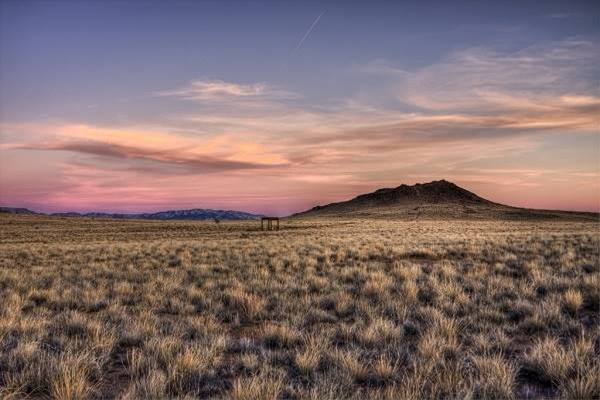
This volcanic area with the black volcanic rocks were sacred for the Pueblo people, who engraved their "petroglyphs" or rock art on them.
The National Monument is a day-use park that closes at 5 PM. Take your time (average hiking time through the park is from 1/2 to 4 hours). Stop at the visitor center is (at Unser Blvd. NW and Western Trail) for current park information, maps and brochures. Open 8 AM - 5 PM.
- Boca Negra Canyon. See some 100 petroglyphs along a paved trail guided with signs. Paid parking, drinking fountain and restrooms.
- Rinconada Canyon. A 2.2 mile round trip trail (no water) with 300 petroglyphs; 1.5 to 2 hour trek.
- Piedras Marcadas Canyon. A 1.5 mile rount trip trail (no water) with 500 petroglyphs; 1.5 hours.
The Volcanoes
The "Three Sisters" or Albuquerque volcanoes, and the West Mesa area formed simultaneously 150,000 years ago when the Earth's crust cracked and allowed magma to rise through it along a 5 mi. (8 km) fissure like a curtain of fire.
The Rio Grande Valley is actually a "rift", where the Earth's crust is thinner allowing lava to flow upwards, the valley to sink and the lateral areas to rise, like the Sandia Mountains to the east. There are several trails from 0.8 to 2 miles long, from easy to moderately strenuous, which allow you to view the volcanoes by hiking around the cinder cones. Great views of the Rio Grande Valley and the Sandia Mountains. Take water with you. Parking lot is located at Atrisco Vista Blvd. NW (former Paseo del Volcan), about 4.8 miles north of I-40. (see Street View).
More information at the National Parks website
Close to Santa Fe
Kasha-Katuwe Tent Rocks National Monument
41 miles SW of Santa Fe. Via I-25, exit 264 and NM 16 and 22. See Map and directions.
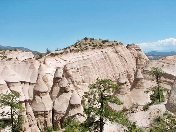
Near the Cochiti Pueblo the place is amazing with rock formations known as Hoodoos, cone shaped rocks of volcanic origin that formed around 6 million years ago.
There are trails that wind through canyons, climb to a mesa and give great vistas of the scenery.
For more details visit the Official Website.
Bandelier National Monument
15 Entrance Rd, Los Alamos, NM 87544. It covers almost 34,000 acres (13.630 km2) and preserves pueblo structures, petroglyphs and cliff dwellings dating back to the year 1,100 A.D.
Visit its Website. Ideal place for hikers with 70 miles of hiking trails. It was named after Swiss scientist Adolph Bandelier who studied the local cultures in the 1880s.
During World War II, it housed the scientists who worked on the Manhattan Project to develop the atom bomb.
There are bears and mountain lions in the park and you should try the Main Loop Trail which is 1.2 mi. (1.9 km) long and let's you visit some archaeological sites along the way.
Other parks near Santa Fe
- Lake Fenton State Park
- Valles Caldera National Preserve
- Santa Fe National Forest
Oklahoma
California ¦ Arizona ¦ New Mexico ¦ Texas ¦ Oklahoma ¦ Kansas ¦ Missouri ¦ Illinois
Near Vinita, Afton and Miami
Grand Lake State Park
The Grand Lake O'The Cherokees has a surface area of 45,000 acres and boasts 1,300 miles of coastline. The park is known as the "Crappie Capital of the World" and is ideal for swimming, walking and enjoying water activities. Read more at the official website.
It has several areas, accessible from Afton, Vinita and Miami.
Near Foss
Foss State Park
10252 Hwy 44, close to Foss. From I-40 take Exit 53, head north along OK-44 for 7 miles and then head west for 0.25 mi. along OK-73.
More information visit the Park's website. The Park is located on Foss lake and is the spot for hiking, riding, fishing, swimming and boating. There are RV campsites some of them full-hookups. It includes picnic areas, grills and restrooms.
Washita National Wildlife Refuge
The Refuge HQ is located close to OK-33 20 miles north of Foss, (see the Map, location and directions).
No fee charged. Hike the trails and watch the wildlife in the rolling hills and creeks. Visit the Refuge's website

Black Kettle National Grassland
Near Sayre
Black Kettle National Grassland
OK-47 and OK-47A, Cheyenne, Oklahoma, close to Sayre. See Map and Directions.
The Grassland is located 30 miles north of Sayre and covers about 30,000 acres of rolling hills, wetlands and prairies cut by serveral rivers and streams. Ideal for hicking, horseback riding, wildlife viewing. There are deer, turkey, geese, coyotes and bobcats.
Three lakes are used for swimmng, fishing and watersports. Free admission. Read more: Park Website.
Lodging in nearby Sayre, Cheyenne and Elk City.
It was the home of the Comanche Indians who hunted and camped in the area. The area was a Cheyenne and Arapaho Reservation in 1867, and the following year Lt. Col. A. Custer attacked a Cheyenne village ("Battle of Washita") killing the chief Black Kettle (1803-1868) and more than 100 Native Americans.
Texas
Towns and Cities along Route 66 in Texas
California ¦ Arizona ¦ New Mexico ¦ Texas ¦ Oklahoma ¦ Kansas ¦ Missouri ¦ Illinois
Some Parks in Texas close to US 66
View of Palo Duro Canyon
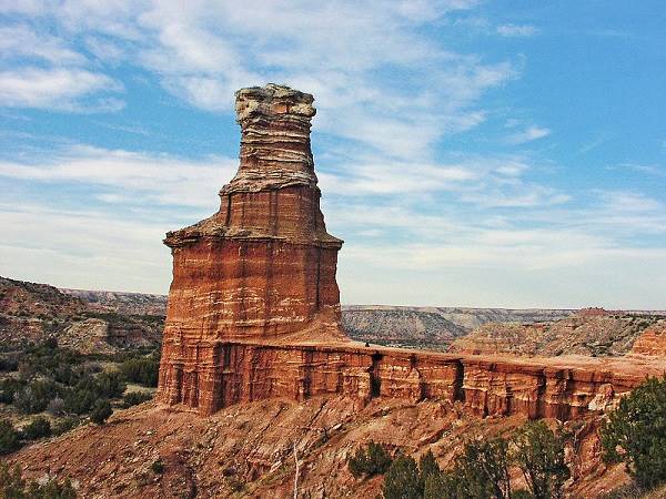
All these parks are close to Amarillo

Yellow wild flowers at, Amarillo
Lake Meredith National Recreation Area
Take TX-136 north and reach Fritch (29 mi). The road continues to Sandford and Sanford Dam. Borger is 13 miles west of Fritch.
The park is open all year round, 24 hours a day. Ideal spot for trekking, camping, horseback riding and of course, fishing, swimming and boating in the lake.
It is named after A. A. Meredith, former Borger city manager who promoted the dam (Sandford dam) on Canadian River to provide drinking waters to eleven Panhandle towns.
The dam was completed in 1965 and the lake covers 21,640 acres (8,760 hectares). Canadian River runs across the Panhandle and Oklahoma, to flow into the Arkansas River in eastern Oklahoma.
Alibates Flint Quarries National Monument
Take TX-136 north towards Borger. After about 30 miles, turn left from TX 136 onto Cas Johnson Rd, after 3 mi. at the "Y" intersection go right and after 2 mi. Access Station.
The quarries provided Native Americans with top quality flint stone for tools and weapons for over 13,000 years.
Palo Duro Canyon
33 mi SE of Amarillo: take I-27 southwards, and pass Canyon to take a left on TX 217 to Palo Duro Park
The Palo Duro Canyon State Park (27,173 acres) protects the second largest canyon system in the United States (after the Grand Canyon): it is 120 mi long and
between 600 and 800 ft. deep; it formed over the last million years. Its name is a Spanish word meaning "hard wood", derived from the tough Rocky Mountain Juniper trees that still grow in the Canyon.
At the Visitor Center you can buy books, jewelry, pottery and souvenirs. The Park has 30 mi. of trails for bikers, hikers and horseback riding.
Buffalo Lake NWR
32 miles SW of Amarillo. Take I-27 south and US 87 to Canyon, US 60 west to Umbarger and from there FM 168 S to the NWR.

Coyote at Buffalo Lake, Amarillo, Source
It began as a protected area around a lake formed by the 1938 Umbarger dam, and protects the best remaining short grass prairie in the U.S. of which 175 acres were designated a National Natural Landmark.
The now temporary lake forms during major storms in the Tierra Blanca Creek basin, as the springs that fed it ran dry in the 1970s.
Caprock Canyons State Park & Trailway
I-17 to Tulia and TX 86 east up to Quitaque. Take a left onto Ranch Rd 1065/Geisler to the park. About 100 mi (160 km) SE of Amarillo, in Briscoe County. It protects the official Texas State Bison Herd.
Some sponsored content
>> Book your Hotels in Flagstaff

Credits
Banner image: Hackberry General Store, Hackberry, Arizona by Perla Eichenblat


