Road Conditions along US 66
Index to this page
- Road Conditions Maps & Information
- 511: America's Traveler Information Telephone Number
- U.S. Route 66: The Road
- Weather & Driving
- Tips and Advice
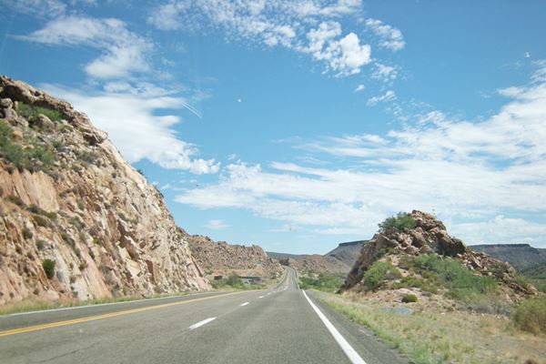
Route 66 in Arizona
Road Conditions Maps & Information
Useful information on Travel conditions
Below we share some useful links to the Departments of Transportation (DOT) of each state along Route-66:
California
California Department of Transportation, Caltrans.
See these Maps with road conditions:
Dial: 511
Before driving check the Caltrans Highway Information Network (CHIN): 800-427-7623
Arizona
AZDOT Map with road travel information (Arizona Department of Transportation).
Dial: 511
For Road Conditions, call: 800-432-4269
Online Traffic Emergency Alerts
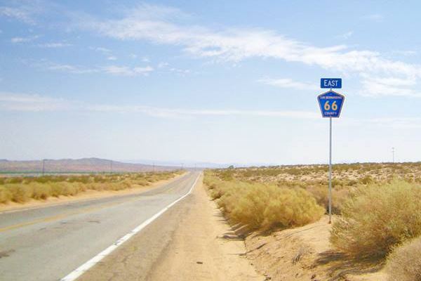
Route 66 between Victorville and Barstow, California
New Mexico
Map - New Mexico Department of Transportation
Dial: 511
Road advisory hotline: (800)432-4269
Texas
Map - Texas Department of Transportation, TxDOT Highway Conditions.
Contact the TxDOT at (800) 558-9368
DPS Stranded Motorist Hotline: (800) 525-5555. In an emergency call 911.
Driver resources (state laws and more)
Texas: DPS Stranded Motorist Hotline
DPS (Department of Public Safety) implemented a toll-free number to assist motorists with disabled vehicles on the Texas highways.
Use it to report non-emergency assistance. In case of emergency dial 911.
Only use it if you have a legitimate need for assistance, such as: stranded due to car problems, hazardous road conditions, debris on road surface, suspicious activities at a rest area, evidently intoxicated or dangerous drivers. If the situation is an emergency, call 9-1-1.
If tow trucks or non-towing service is provided, costs will be charged to the motorist.
Unnecessary calls can delay response to those callers who are in real need for assistance. Use the service with responsibility.
Texas Department of Public Safety, 512-424-2080
Oklahoma
Oklahoma Department of Transportation
For Road Conditions, call: 877-403-7623 or 405-425-2385.
Missouri
Missouri Department of Transportation Mo DOT
For Road Conditions, call: 888-275-6636
Kansas
Kansas Department of Transportation.
Dial: 511
For Road Conditions, call: 866-511-5368
Illinois
Illinois Department of Transportation
Call Traveler Info: 800-452-4368
511: America's Traveler Information Telephone Number
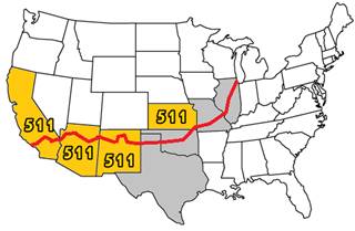
States with the 511
Travel information phone. A. Whittall
Some states have already implemented the system and others are adopting it.
It has been deployed in California, Arizona, New Mexico and Kansas (shaded yellow in the map).
While Texas, Oklahoma, Missouri and Illinois are implementing it (shaded gray in the map).
The 511 service is known as America's Traveler Information Telephone Number.
In those states where it is operational, you can obtain travel information by dialing 5-1-1 from your phone.
As with all phone services, you should always pull over and park in a safe location before making the phone call. Using a phone while driving causes distraction and is a serious safety hazard.
More details on 511 Federal Highway Administration

U.S. Route 66: The Road
Nowadays, over 85% of the original alignments of U.S. Route 66 are still drivable.
Many segments of the road are simple two-laned highways, so you should drive with care and pay attention to the road signs.
You can even drive through most of the infamous Jericho Gap, along dirt roads which turned to a sticky goo when it rained back in the 1920s and 30s, before the whole of U.S. 66 was paved. But make sure the road is dry before trying (see picture below!)

Watch out for Burros near Oatman Arizona.
Perla Eichenblat.
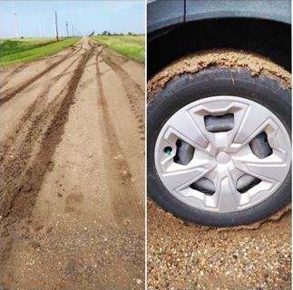
Mud at Jericho Gap, July 2021, Source
Old Route 66 is "old"
Not as safe as the freeway. Drive carefully
In some places the "old" Route 66 shows its age, with undulations, no shoulder, bumps and even pot-holes. The Kingman to Oatman AZ area of Route 66 has several sharp hairpin curves and steep grades; the road is narrow too and there are no guardrails either, for these reasons Sitgreaves Pass earned its name as "Bloody 66" in the 1950s.
Sigreaves Pass on Route 66
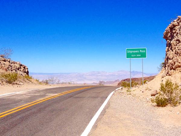
Kingman to Oatman Arizona in the Black Mountains, hairpin bend:
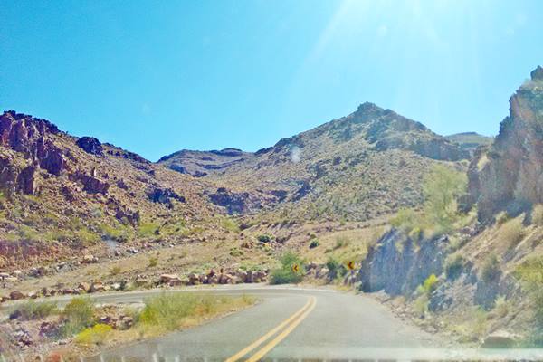
Dead Man's Curves
Towanda Dead Man’s Curve in Illinois was a lethal tight curve on the narrow 1930s alignment of the highway (it was bypassed after World War II). Westbound motorists often kept on straight causing accidents. You can still drive this segment. (Street View).
West of Albuquerque in New Mexico, in Mesita, there is another "Dead Man's Curve", a sharp loop where the road turns 270°: first you drive north, turn 90° to drive east, then 90° to drive north again, and finally 90° to head west!
Dead Man's Curve between Mesita and Laguna
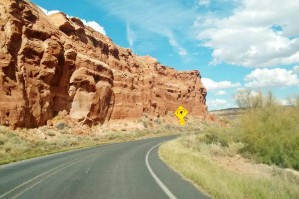
The remains of another "Dead Man's curve" can be seen at Parks, Arizona, on Route 66's 1926 to 1931 alignment. (see the spot on this map).
Yet another set of these deadly curves were located east and west of Rolla, Missuori; we describe these deadly curves on our Rolla webpage.
There was a Deadly Underpass in Bushland Texas, close to where now is the Cadillac Ranch, it was an "S" shaped tunnel, with two sharp 90° curves. Its remains can still be seen next to the freeway.
Another dangerous curve was Deadmans corner between Afton and Vinita in Oklahoma.
There were two Bloody Bridges in Plano, Missouri, and they were only upgraded in 1972, twelve years after Route 66 had been realigned along I-44, bypassing Plano.
Weather & Driving
Weather will influence your drive along Route 66, from thunderstorms in the Southwest during summer to snow in winter along any part of the road.
When planning your Road Trip, you can check the historical weather conditions along Route 66, and on your day to day trip, check the weather forecast for your daily drive (we include the specific weather data in each of the towns described in www.theroute-66.com). Be prepared.
Bear in mind that road conditions can vary and you may encounter snow in winter along most of its alignment, summer in the Mojave section can be extremely hot and strong winds can be encountered in the western Texas Panhandle.
You can check out the NOAA weather alerts for different States.
Tips and Advice
Check your itinerary each day before setting out on your roadtrip. Route 66's roadbed changes: in the west (Arizona, the Mojave, New Mexico) it is a single lane highway, in many parts of Missouri and Illinois too. In other parts (Hooker MO, for instance) it is a divided highway with four lanes.
Then there are the urban areas where Route 66 goes through the downtown district of many towns -it was known as "The Main Street of America".
Keep your eyes well open, follow the speed limits, and drive carefully. Head-on collisions can happen on single lane highways.
If you have to stop make sure the shoulder is firm, it isn't always paved on US 66, especially in rural areas. There may be soft soil, turf or a different level between the road and the shoulder.
>> Did you know that you can Drive the whole of Route 66 in 7 days?
Some sponsored content
>> Book your Hotel in Kingman


Credits
Banner image: Hackberry General Store, Hackberry, Arizona by Perla Eichenblat

