Texas & Route 66
Index to this page
About Texas
Facts, Trivia and useful information
Area: 268,581 sq. mi. (696.241 km2). Population: 31,853,800 (2025 est.).
Width: 773 mi. (1.244 km). Length 790 mi. (1.270 km)
Time zone (along U.S. 66 alignment): Central (CST): UTC minus 6 hours. Summer (DST) CDT (UTC-5).
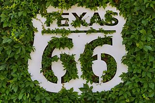
Texas Route 66 Shield. Highsmith, Carol M.
- Nickname: "The Lone Star State", which commemorates its independence war with Mexico and its existence as an independent republic. The "Lone Star" appears on its flag and state seal.
- Motto: Friendship
- State Song: "Texas, Our Texas"
- Capital: Austin
- Highest point: Guadalupe Peak, 8,751 ft. (2.667 m)
- Second most populous state after California.
- Second largest state in the U.S., after Alaska.
- Admitted as the 28th state of the Union on December 29, 1845
- November 22, 1963: President John F. Kennedy was assassinated in Dallas, TX.
- Dwight D. Eisenhower, 34th U.S. President and Lyndon B. Johnson, 36th U.S. President were both born in Texas.
- Route 66 length in Texas is 189 miles (304 km), the second shortest after Kansas.
The Name: Texas
Texas was used by the Spaniards in the 1700s to name the local Caddo natives and their territory.
They adopted a local word, "táysha," from the language of the Hasinai, Caddo, which meant "friends", "allies."
In Spanish, the "X" was pronounced like the English "sh" until 1815 when the Real Academia Española (Royal Spanish Language Academy) defined that "X" would be used for words of Latin origin and pronounced "ks", the words formerly written with an "X" would now use a "J" (which sounds similar to an English "H"). Other examples of "X" for "J" usage in Spanish are: Xavier (Javier), Mexico (Mejico), Ximena (Jimena), Xalisco (Jalisco).
The History of Texas
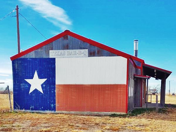
Texas has been inhabited for at least 10,000 years. During historic times, many Native American groups peopled Texas: the Caddo, Apache, Comanche, Choctaw, Hasinai, Kiowa, the Jumano, Tonkawa and Wichita, among others. They were mainly hunter-gatherer cultures. Nowadays they represent only 0.5% of Texas' population.
Spain extended its rule over Mexico in 1520 and expanded north into what is now into the Southwestern U.S. Spanish explorer Francisco de Coronado surveyed the area searching for "Eldorado" and reported the local buffalo hunting natives. The mythical city of "Cibola" was located in Texas.
The French encroached on the Spanish domains when René de La Salle founded Fort Saint Louis in 1685 at Matagorda Bay; but it only survived for four years.
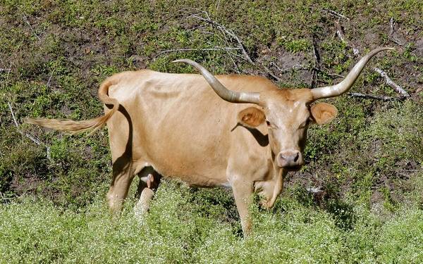
The Texas Longhorn, is a breed of cattle which gets its name from its very "long" horns that can measure up to 7 feet (2.1 m) from tip to tip. They originated from the cows and bulls brought from Spain to the New World in the early 1500s. Sturdy and well adapted to the dry conditions of the arid Iberian Peninsula, they survived well on the open Texas ranges, where water and food was scarce. They were favored by the first Ranches, but later, they were replaced with other cattle breeds because their lean beef and lack of tallow was not appreciated in the late 1800s and early 1900s. They are now considered an interesting beef stock due to their adaptability and disease resistance as well as their leaner and therefore healthier beef.
It was then that the Spaniards reasserted their rights and founded missions in the region that they named "Nuevo Reino de Filipinas" (New Kingdom of Philippines -after their king, Phillip or Felipe). However the more popular name of Texas prevailed.
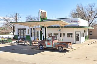
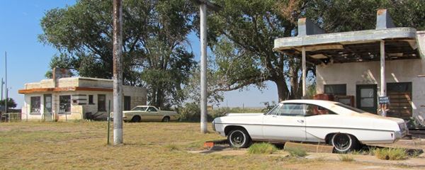
A view of vintage cars, a Route 66 diner, and gas station in Glenrio
In 1803, the U.S. government purchased Louisiana from France and claimed that Texas was part of that territory. Spain and the U.S. settled the issue with an agreement in 1819.
In 1821, Mexico gained its independence from Spain, and Texas formed part of the new republic. Mexico granted lands to colonizers and many Americans seized the opportunity, settling in Texas. However they often violated Mexican law, such as the law that prohibited slavery; so, Mexico imposed migratory restrictions and new taxes (1830).
This "oppression" led to revolt (1832) and demands for statehood within the Mexican Federation. Unrest persisted and erupted as the Texas Revolution (1835) and a provisional government. War ensued and Mexican President Antonio de Santa Ana led an army to quell the revolt.
He defeated the rebels at El Alamo but the Texans declared their independence (March 3, 1836), forming the Republic of Texas. War ended when Sam Houston defeated and captured Santa Ana at the battle of San Jacinto.
After Mexico attacked the Republic in 1842 it became clear that they needed additional resources. Houston's party promoted joining the U.S. which took place in 1845, when the U.S. annexed Texas, which became the 28th state of the Union on December 29, 1845.
Mexico opposed to the Texas border claimed by the U.S. and this led to a breakage of diplomatic relations and the Mexican-American War (1846 - 48). The war concluded with Mexico's defeat and the cession of what are now the states of Southwestern US (California, Utah, Nevada, Arizona, New Mexico, Texas and parts of Oklahoma, Colorado, Kansas and Wyoming).
Statehood brought an increase in slavery: African Americans worked as slaves in the cotton fields of eastern Texas. And after the election of Abraham Lincoln, Texas joined the pro-slavery secessionist states of the South, and became part of the Confederate States of America in 1861 and fought on its side during the American Civil War.
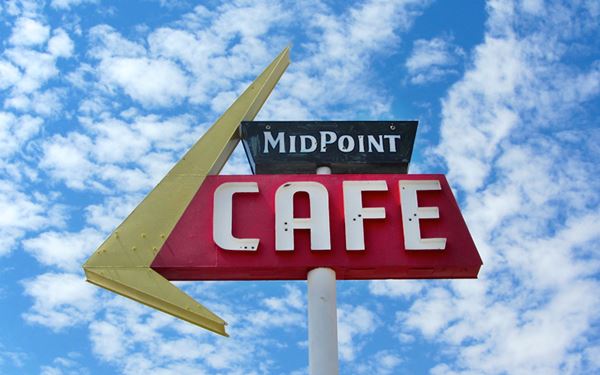
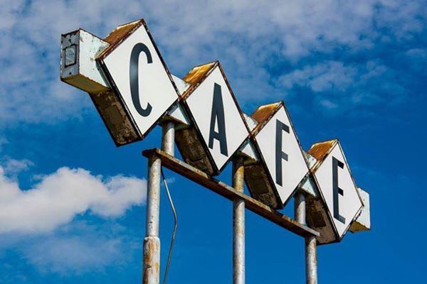
Midpoint café sign, Adrian, Texas
The last battle of the Civil War was fought at Palmito Ranch, close to Brownsville, Texas at Palmito Ranch. War ended with the victory of the Union. Slavery ended with the Emancipation Proclamation and in 1866, civilian government was restored in the State.
During the 20th century, oil was discovered (1901) and an Oil Boom boosted the state's economy, which was until then mostly based on farming and cattle raising.
The drought years of the Dust Bowl and the Great Depression impacted on employment and was only reverted by Federal funds during New Deal Programs (such as the one that helped pave U.S. 66) and later during World War II investment in military facilities, and POW Camps (like the one at McLean on Route 66).
During the Post War years, industry and services sectors grew and became an important part of Texas economy.
Geography
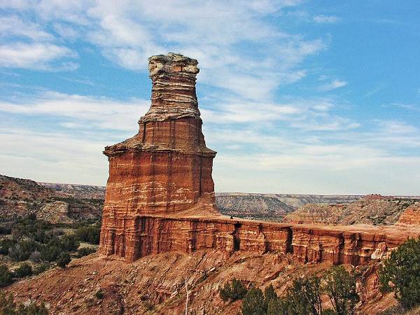
Despite popular belief, less than 10% of Texas is desert. Due to its size, it has several regions, and Route 66 crosses its Great Plains region in the Northern part of the state, in its "Panhandle" area.
Texas is located on a geologically stable region and there are no volcanoes in Texas. Earthquake risk is low.
View of Palo Duro Canyon
Texas' Weather
The size of Texas means that it spans different climate zones. The Panhandle region, where U.S. 66 runs is located in the north of Texas and winters tend to be colder. Rainfall increases from west to east and is highest on the coast of the Gulf of Mexico.
Snow is frequent in the Panhandle, where it snows several times during winter, but it is scarce in the rest of the state. Summers are quite hot and temperature increases with a southwards cline.
A Tornado forming in Texas
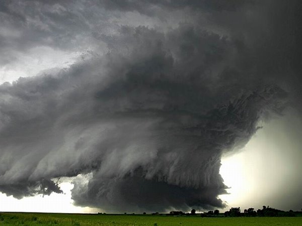
Thunderstorms take place frequently in northern and eastern Texas. Tornados strike often; Texas is part of Tornado Alley, and experiences an average of 139 tornados yearly. The Panhandle region (and the alignment of U.S. 66) has a high frequency of tornados too. (Full information on Tornadoes.)
Hurricanes hit the Gulf region; the worst natural disaster in U.S. history took place in Galveston Texas in 1900: the Galveston Hurricane killed between 8,000 and 12,000 people.
Texas Cities
Amarillo is the largest city along Route 66 in Texas, with 203,035 residents in 2024.The state has three very large cities: Houston with 2.3 Million inhabitants, San Antonio with 1.5 Million and Dallas with 1.3 Million; they are ranked among the ten most populous cities in America.
Around 250,000 people live along Route 66's corridor through Texas.
Culture
Texas culture arose from a mixture of Mexican - Spanish, and Anglo influences. Southern U.S. (Dixie), Western and 19th century immigrant traditions have also blended and shaped Texas culture.
Tacos, Burritos are typical in Texas cuisine. The cowboy and country western music are also typically associated with Texas.
"Texas-sized"
Everything is bigger in Texas. The size of the state, its variety and distinctness has led to an expression symbolizing something that is bigger than other similar objects: "Texas Sized".
Where to Stay in Texas
Accommodation in Texas
The towns along Route 66 offer different lodging options. Check out hotels and motels in the main towns:
Find your Accommodation
The towns along Route 66 in Texas offer different lodging options. Check out some of the hotels and motels in the main towns below listed from east to west
In Texas Along Route 66
>> There are RV campgrounds in Amarillo.
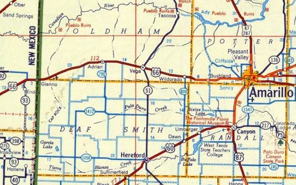
Map of Route 66 through Texas
Route 66 alignment through Texas
We divided the course of the highway across Texas into two legs, from Texola in the east to Glenrio on the NM state line. The midpoint of Route 66 is located in Adrian TX:
Route 66 (Shell) Map from 1956.
Towns located on Route 66
Below are links to oue pages on each city along Route 66 in Texas. Click to find out about their attractions, sights, stops, weather, history, maps, and where to stay along the way.
Click on the links below for complete information on each town and village
Texas towns, from East to West
A List of Texas' Main Route 66 Attractions
Below we list the main attractions along Route 66 in Texas, there are many more. They are listed from east to west.
Things to See & Do along Route 66
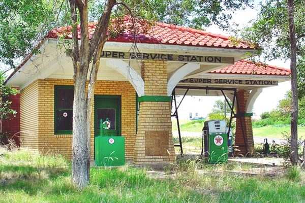
Texaco on Route 66 in Vega TX
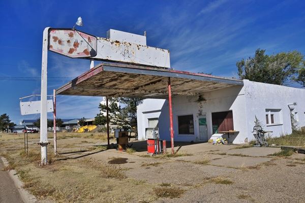
The alignment of Route 66 in Texas is the second shortest (after Kansas) but it is packed with plenty of classic icons, below are those that made it to our Top Ten list.
The Top Ten Route66 sights in Texas
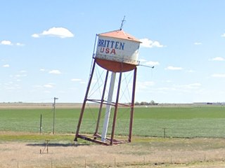
Leaning Water Tower in Groom TX.
Click for St. view
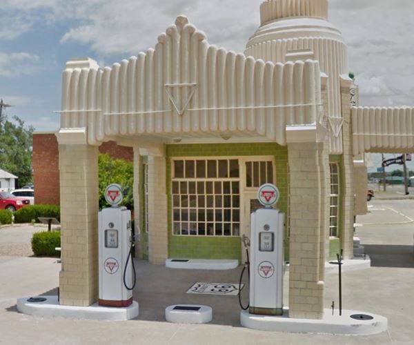
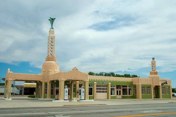
- Conoco Tower Station - photo above (Shamrock) Historic Site
- Cadillac Ranch (Amarillo)
- Midpoint of Route 66 - Cafe (Adrian)
- Triangle Motel (Amarillo) Historic Site
- Vega Motel (Vega) Historic Site
- Amarillo 6th Street District (Amarillo) Historic Site
- Glenrio Historic District (Glenrio) Historic Site
- Buggy Ranch (Conway)
- Historic Route 66 Segment (Conway) Historic Site
- Phillips Service Station (McLean) Historic Site
Conoco Tower Station
Listed in the National Register of Historic Places
In Shamrock
The "Conoco Tower Station" is an iconic and unique Art Deco landmark crowned by a 100 foot tower located six blocks from Shamrock's commercial center.
James Tindall and R. C. Lewis built it in 1936. It was the first commercial business to be built on U.S. Highway 66 in Shamrock and was quickly nicknamed the «Tower Station». It comprised a Conoco gas station, a diner named "U-Drop Inn", it is one of the tallest structures in the center of Shamrock and the neon-lighted tower lured in the customers. The building's facade is decorated with green and gold terracotta tiles and a distinctively Art Deco relief motif on canopies and tower bases.
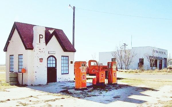
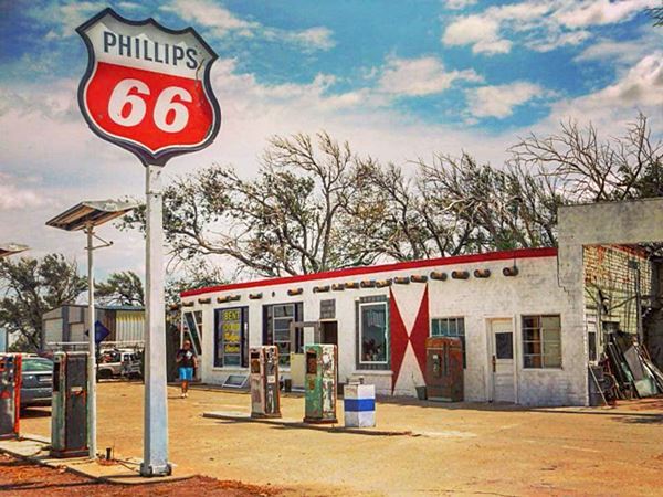
Phillips 66 Service Station, McLean
In McLean.Route 66 reached McLean in 1927 and shortly after Phillips Petroleum chose the town as the location of its first gasoline station in Texas, which stands to this day. The building is surprisingly small for modern travelers, it was built in Tudor Revival style (which imitated medieval English cottages with simple lines, steep pitched roofs, tall windows, brickwork walls and high chimneys). The service station closed in 1977 but has been restored to its original condition.
Buggy Ranch
In Conway, near the Original historic roadway, a stretch of the original 2-lane Route 66.
Bug Ranch, Graffiti covered Beetles nose down in the ground, Conway Texas
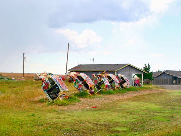
The Crutchfields have operated a service station and souvenir shop on the south frontage road of I-40 at its crossing with TX 207 in Conway since 1967.
But business took a turn for the worse when a Love's Travel Stop (a truck stop) opened on the other side of I-40: most of the potential customers went there. So the Crutchfields decided to create an attraction on the south side of the Interstate and found inspiration in the Cadillac Ranch (west of Amarillo): they parodied it by burying five Volkswagen Beetles (Bugs) nose down in the ground. Visitors came but business did not improve and the Crutchfields moved on. The visitors paint the cars with spray paint just like they do at the Cadillac Ranch.
Cadillac Ranch
The Cadillac Ranch is just east of Bushland next to Amarillo'sSoncy neighborhood.
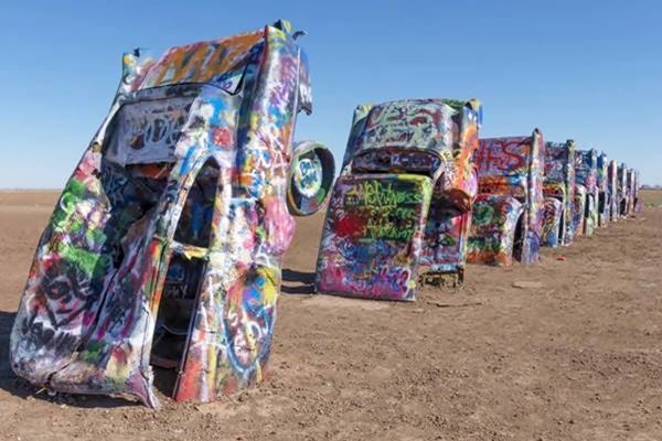
The Cadillac Ranch (also known as the Caddy Ranch), is a public art work, created in 1974 and exhibited in open ranchland which is used for farming and breeding cattle. This "work of art" consists of a group of 10 Cadillac cars buried nose-down in the ground, so that they can show off their tailfins, with an east to west alignment.Each car belongs to a different model, from 1948 to 1963.
Front view of the Cadillacs
Midpoint Café
The Halfway mark

Midpoint Cafe's neon sign, Source
In Adrian. This town has the honor of being the Geo-mathematical Center of Route 66: the original U.S. highway 66 ran 1,139 miles east to Chicago and the same distance west to Los Angeles.
This small rural town is the midpoint and halfway point of US 66.
There is a cafe at the site, with a restaurant, souvenir and antique shop.
This cafe bears the record of being the oldest continuously-operating cafe along U.S. Highway 66 between Amarillo, TX and Tucumcari, NM, as well as being the midpoint between Los Angeles and Chicago.
In 1928, two years after the creation of U.S. 66, a very simple brick building went up in Adrian to cater for the travelers: a one-room construction with a compacted earth floor which was known as "Zella's", after Zella Prin, who leased it.
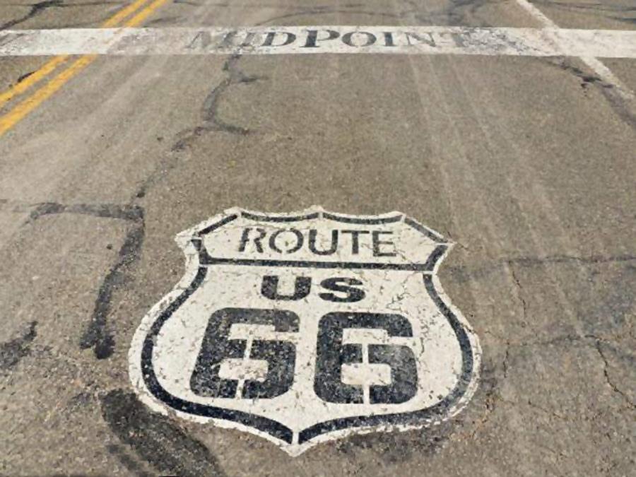
There are several markers on the midpoint of Route 66, you can take some nice pictures! Originally there was a sign, pictured further up, then shields and a painted band across the roadway marking the spot. Flags, an old windmill (the modern wind turbines can be seen in the fields behind the signs), and a marker of the "National Old Trails Road Association" stating 1139 mi. to Chicago and Los Angeles.
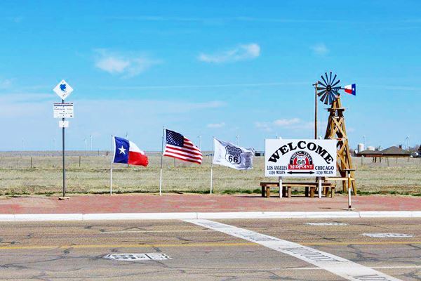
At the "Midpoint of Route 66", halfway between Los Angeles and Chicago there are some shields on the road
Glenrio Historic District, Glenrio, Texas & New Mexico
Listed in the National Register of Historic Places
In Glenrio's Historic District preserves several vintage gasoline filling stations, motels and diners of the period when Route 66 was the main road through the Panhandle region of Texas, between 1926 and 1985.
Glenrio is a ghost town that spans the Texas - New Mexico state line, with derelict buildings. It is located on the Historic alignment of U.S. Route 66, which shortly after entering NM, turns into a gravel surfaced road.
Route 66 itinerary across the state of Texas
Below is a detailed description of the alignment of U.S. 66 through Texas, from East to West. For each town we give details of Route 66's alignment through it. You can also click above on a town and read more about the course of US 66 in that specific community.
Texas
California ¦ Arizona ¦ New Mexico ¦ Texas ¦ Oklahoma ¦ Kansas ¦ Missouri Illinois
Route 66 in Texas
Current mileage: 189 mi.
Route 66 crosses TX along the northern part of the state, across the panhandle, near Shamrock, to its western side in Glenrio, going through Amarillo, Vega and Adrian.
Click on the detailed description with interactive maps of each leg across the state (in the yellow box at the start of each leg).
Starting on the OK-KS state line
Trivia: Adrian is the midpoint of the original Route 66
Leaving from Texola on the Oklahoma state line (mile zero), take the main road westwards. At the Texas state line (0.6 miles) it becomes Spur TX 30 which becomes the south service road of Interstate 40, and is the Historic Route 66 alignment. It crosses a "Historic Bridge" over the Chicago, Rock Island and Gulf Railroad (6.6 miles).
It becomes Business Loop I-40 at the interchange with I-40 (13.6 miles) and enters Shamrock as East 12th St.
At the northeastern corner of Main (U.S. Hwy 83) and E. 12th St. is a "classic": Conoco Tower Station (15 mi.)
Historic CONOCO Tower Station, Shamrock Texas
From: Shamrock to McLean
Leave Shamrock westwards along Bus I-40 (West 12th St.) which becomes State Spur 556. Ignore the road that leads (16 miles) to the right to I-40's north service road and keep on straight along the southern service road of I-40. Caution at the exit from I-40 (16.5 mi.) Head straight, at the crossing of Farm to Market Rd. 1547 (20.3 miles) is the access which leads into Lela on the north side of I-40 (Exit 157).
Head west, and (34 mi.) pass under I-40 to the north side frontage and turn left along 1st St. into McLean.
McLean
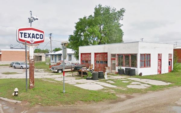
Visit its Historic Commercial District (Listed in the National Register of Historic Places) on First St. and the Phillips Service Station, and several others, like Crockett's Texaco pictured below (36 mi).
From McLean to Conway
Head west. At TX-273 (37 miles) turn left along TX-273 and pass I-40 (Exit 142). Take the south service road of I-40 westwards (37.2 miles) turn right at Co. Rd. 26 and left to go west on I-40s South Frontage Rd.
The service road becomes TX-271 Loop W. at I-40 Exit 135 (44 mi.), and then 3rd Street of Alanreed.
Visit its Texaco station and (45 miles) keep west along the S. Frontage Rd. at Exit 132 you must leave the old road. The Jericho Gap begins here and it is very difficult to follow the old US 66 (a dirt road).
Go west on I-40 to Exit 124 (55 mi.) and there take TX-70, cross to the south side of I-40 (here is the old Jericho Cemetery, a few miles SW of the Exit.
Otherwise keep stay with I-40 westbound and take the overpass at Exit 121 to continue along the south frontage road of I-40 west.
Groom
It is famous for its 198 foot tall Giant Cross pictured, and its Leaning water tower. At Exit 114 (66 mi.) the I-40 Frontage Road becomes I-40BUS and goes into Groom (Front St.), then it meets I-40 at Exit 110 (70 mi).
Head West on the South service road westwards, at CR-O (to your right which heads to I-40's Exit 98), begins the Historic US 66 segmentj, which now is TX-207 and heads straight towards the west.

Groom Cross. Source

Bug Ranch April 2021
Conway
Just ahead (83 miles) you meet FM 2161 (old US-66) which goes to Amarillo. Here is Conway. Turn right on TX-207 towards I-40 to visit (at Exit 96) the "kitschy" Buggy Farm.
From Conway to Amarillo on Historic US 66
Listed in the National Register of Historic Places
This segment of US 66 was listed in the National Register of Historic Places in 2007. Head west along FM 2161, (Historic U.S. Highway 66), it meets I-40 at Exit 89, end of the historic segment.
Stay on FM 2161, cross I-40 and drive west on the N. Frontage Rd. (93 mi.) at Exit 85 head NW into Amarillo:
Cross BL 40 towards the south, and keep on FM 2575 (which runs on the north side of I-40), cross CR A (94 miles), which then becomes NE 8th Ave. follow it until it ends (918 miles) with a sharp right curve becoming B Ave.
The original alignment of US hwy 66 kept straight west but the airport was built and the road no longer exists. You have to detour around the airport by taking B Ave. north until it meets BL-40 ⁄ US 60 - E. Amarillo Blvd. (99.2 mi.) turn right along it.
At Folsom Rd. (102 miles) take a left along Folsom and go south until Triangle Drive (old U.S. 66) which is cut ahead by Lakeside Drive ⁄ TX 335 (103 miles), go right to E. Amarillo Blvd and head west along it.
On Tirangle and Amarillo Blvd. is the Historic Triangle Motel. Stay on Amarillo Blvd. which at N. Pierce St. (US 87) reaches downtown Amarillo (108 mi.)
Amarillo
Keep on straight along Amarillo Blvd till you reach Pierce St. (US 87) in the center of the city (107 mi.) of Amarillo.
Turn south on Pierce St. (US 87) take a left, bridge over railroad and (108 mi.) turn right onto SE 6th Ave. (TX-279) it becomes SW 6th Ave. and goes through the Historic Sixth Street District.
Go left onto Bushland Ave (113 mi) pass the Golf Course and under Bell St. (114 mi.) to head left onto W. Amarillo Blvd. (I-40 Bus).
The road curves softly until crossing Coulter St. (5.8 miles), adopting a westward direction. After crossing TX-335 it reaches Soncy, passes in front of the Historic Helium Plant (118 miles) and before reaching the "S" curve under the old railway line, the old alignment takes a right 118 miles) onto Indian Hill Rd.
The Cadillac Ranch is to the south of I-40 (119 mi.) You can only reach it from I-40.
At Hill Dr. (121 mi.) turn left, haed west on I-40 westwards. At Exit 57, (14.7 mi.) you will reach Bushland. Stick to the North frontage road of I-40 passing Wildorado (131 miles), at Exit 49.
Vega
Head west and at Exit 37, the road goes on straight, as I-40 Business W ⁄ US-66 reaching Vega (145 mi), keep straight along Vega Blvd., passing I-40's Exit 35.
At Exit 28, (152 mi.) are the remains of what once was the town of Landergin.
Adrian
Midpoint of Route 66
After Exit 23 - 22, the road becomes I-40 Business again, entering Adrian (158 mi).
The Bent Door Cafe restored
After Adrian, at Exit 18, Co. Rd. 18 was Gruhlkey if you keep west on the Service Road it will end and as a dirt track head north; this is the old alignment of US hwy 66, which followed the now abandoned Rock Island Railway. It curves south again meeting I-40 at Exit 15, in the past, the road crossed what is now the Interstate, following the railway tracks south and then west.
You should get on I-40 at Exit 18. To the south of the Interstate you will see the old road next to the now lifted railway tracks.
Keep on I-40. You will see the dirt Route 66 to the south, as the South Service Road. Take Exit 0 (72.5), cross over I-40 and on the south side.
Glenrio
After the overpass you will meet ("T" crossing) US 66 running east - west. Take a right and reach Glenrio (73.1 mi from Amarillo) at the Texas - New Mexico State Line.
Total Texas Route 66 mileage: 183 mi.
This marks the End of your trip through Texas.
Sponsored Content

>> Book your Hotel in Amarillo Texas

Credits
Banner image: Hackberry General Store, Hackberry, Arizona by Perla Eichenblat.


