
Route 66; an itinerary
The Palomino Motel

See our One Week Route 66 Road Trip Itinerary
We have put together a 1-Week Route 66 Road Trip Itinerary from Chicago to Santa Monica.
You can use it as a starting point for planning your own road trip.
Texas
California ¦ Arizona ¦ New Mexico ¦ Texas ¦ Oklahoma ¦ Kansas ¦ Missouri ¦ Illinois
Texas, click on any town below to for full details on its history, weather, hotels, and of course all of its Route 66 stops, sights landmarks & attractions.
Towns located on the Texas segment of Route 66
Click on the towns below to place them on the itinerary (towns are listed from East to West).
Route 66 in Texas
Current mileage: 189 mi.
Trivia: Adrian is the midpoint of the original Route 66
Visit Itinerary Page 1 for the itinerary through the previous states (Oklahoma, Kansas, Missouri and Illinois).
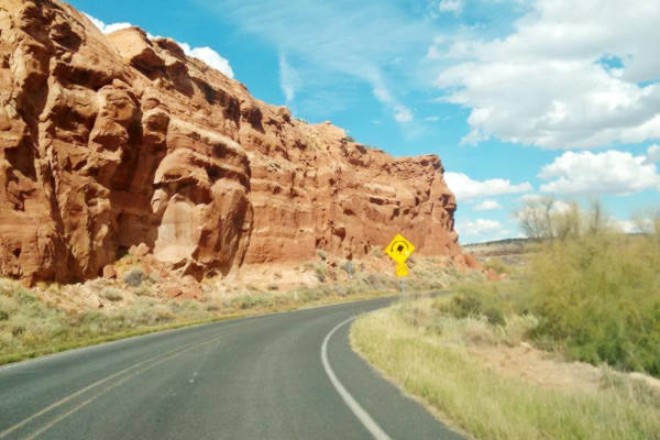
Route 66 crosses the Texas Panhandle with an East to West direction, from Texola on the Oklahoma Border to Glenrio on the NM - TX state line.
The original Route 66 nowadays is mostly the frontage road of I-40. The 1920s segment can be found in the Jericho Gap (dirt), where there is a part that is missing, so you will have to go along I-40.
Another missing segment is west of Landergin, where you will have to keep on I-40 to reach Glenrio.
There still is a segment west of Conway is protected as a Historic Site.
From: Texola, OK to Shamrock, TX
Detailed description from Texola OK to Amarillo TX with maps
From Texola in Oklahoma (mile zero), take the main road westwards. At the Texas state line (0.6 miles) it becomes Spur TX 30 which becomes the south service road of Interstate 40, and is the Historic Route 66 alignment. It crosses a "Historic Bridge" over the Chicago, Rock Island and Gulf Railroad (6.6 miles).

Historic Art-Deco Conoco service station Shamrock. Source

Restored Magnolia gasoline station. Route 66, Shamrock TX. Source
It becomes Business Loop I-40 at the interchange with I-40 (13.6 miles) and enters Shamrock as East 12th St.
At the northeastern corner of Main (U.S. Hwy 83) and E. 12th St. is a "classic spot" Conoco Tower Station (15 mi.)

From: Shamrock to McLean
Leave Shamrock westwards along Bus I-40 (West 12th St.) which becomes State Spur 556. Ignore the road that leads (16 miles) to the right to I-40's north service road and keep on straight along the southern service road of I-40. Caution at the exit from I-40 (16.5 mi.) Head straight, at the crossing of Farm to Market Rd. 1547 (20.3 miles) is the access which leads into Lela on the north side of I-40 (Exit 157).

Phillips 66 service station at McLean
Source
Head west, and (34 mi.) pass under I-40 to the north side frontage and turn left along 1st St. into McLean.
Visit its Historic Commercial District (Listed in the National Register of Historic Places) on First St., its old gas stations, specially the cottage style Phillips Service Station (36 mi).
Head west. At TX-273 (37 miles) turn left along TX-273 and pass I-40 (Exit 142). Take the south service road of I-40 westwards (37.2 miles) turn right at Co. Rd. 26 and left to go west on I-40s South Frontage Rd. The service road becomes TX-271 Loop W. at I-40 Exit 135 (44 mi.), and then 3rd Street of Alanreed. Visit its Texaco station and (45 miles)

Now take the S. Frontage Rd. at Exit 132 you must leave the old road; the Jericho Gap begins here and it is very difficult to follow the old US 66 (a dirt road). Go west on I-40 to Exit 124 (55 mi.) and there take TX-70, cross to the south side of I-40 (here is the old Jericho Cemetery, a few miles SW of the Exit and some ruins of a motel). Otherwise keep with I-40 westbound and take the overpass at Exit 121 to continue along the south frontage road of I-40 west.
Groom
It is famous for its 198 foot tall Giant Cross, and its Leaning water tower. At Exit 114 (66 mi.) the I-40 Frontage Road becomes I-40BUS and goes into Groom (Front St.), then it meets I-40 at Exit 110 (70 mi).

Tourist Court in Jericho, Route 66, Texas Gap. Source

Leaning Water Tower in Groom TX.
Click for St. view

Bug Ranch April 2021
Conway
Head West on the South service road westwards, at CR-O (to your right which heads to I-40's Exit 98), begins the Historic US 66 segment, which now is TX-207 and heads straight towards the west.
Just ahead (83 miles) you meet FM 2161 (old US-66) which goes to Amarillo. Here is Conway. Turn right on TX-207 towards I-40 to visit (at Exit 96) the "kitschy" Buggy Farm.
From Conway to Amarillo on Historic US 66
Listed in the National Register of Historic Places

Cowboy Motel neon sign. Amarillo. Click for St. view, Source
This segment of US 66 was listed in the National Register of Historic Places in 2007. Head west along FM 2161, (Historic U.S. Highway 66), it meets I-40 at Exit 89, end of the historic segment.
Stay on FM 2161, cross I-40 and drive west on the N. Frontage Rd. (93 mi.) at Exit 85 head NW into Amarillo:
Cross BL 40 towards the south, and keep on FM 2575 (which runs on the north side of I-40), cross CR A (94 miles), which then becomes NE 8th Ave. follow it until it ends (918 miles) with a sharp right curve becoming B Ave.
The original alignment of US hwy 66 kept straight west but the airport was built and the road no longer exists. You have to detour around the airport by taking B Ave. north until it meets BL-40 ⁄ US 60 - E. Amarillo Blvd. (99.2 mi.) turn right along it.
At Folsom Rd. (102 miles) take a left along Folsom and go south until Triangle Drive (old U.S. 66) which is cut ahead by Lakeside Drive ⁄ TX 335 (103 miles), go right to E. Amarillo Blvd and head west along it.
On Tirangle and Amarillo Blvd. is the Historic Triangle Motel. Stay on Amarillo Blvd. which at N. Pierce St. (US 87) reaches downtown Amarillo (28.5 mi.)
Amarillo
Detailed description from Amarillo to Glenrio TX with maps

Keep on straight along Amarillo Blvd till you reach Pierce St. (US 87) in the center of the city (107 mi.) of Amarillo.
Turn south on Pierce St. (US 87) take a left, bridge over railroad and (108 mi.) turn right onto SE 6th Ave. (TX-279) it becomes SW 6th Ave. and goes through the Historic Sixth Street District.

Cities Service (Moe) station. Click for St. view

Taylor's Texaco Station. Click for St. view
Go left onto Bushland Ave (113 mi) pass the Golf Course and under Bell St. (114 mi.) to head left onto W. Amarillo Blvd. (I-40 Buss).
The road curves softly until crossing Coulter St. (5.8 miles), adopting a westward direction. After crossing TX-335 it reaches Soncy, passes in front of the Historic Helium Plant (8.5 miles) and before reaching the "S" curve under the old railway line, the old alignment takes a right 118 miles) onto Indian Hill Rd.
Cadillac Ranch
The Cadillac Ranch is to the south of I-40 (119 mi.) You can only reach it from I-40 (See how to reach Cadillac Ranch).
Front view of the Cadillacs

At Hill Dr. (121 mi.) turn left, haed west on I-40 westwards. At Exit 57, (14.7 mi.) you will reach Bushland. Stick to the North frontage road of I-40 passing Wildorado (131 miles), at Exit 49.
Vega
Head west and at Exit 37, the road goes on straight, as I-40 Business W ⁄ US-66 reaching Vega (145 mi), keep straight along Vega Blvd., passing I-40's Exit 35. At Exit 28, (152 mi.) are the remains of what once was the town of Landergin.
Texaco on Route 66 in Vega TX

Adrian

Midpoint Cafe in Adrian, Texas
Source
Midpoint of Route 66
After Exit 23 - 22, the road becomes I-40 Business again, entering the small town of Adrian (158 mi).
It is roughly the midpoint between Chicago and Los Angeles. Cafes and gas stations catered to travelers here. Good spot for pictures.

After Adrian, at Exit 18, Co. Rd. 18 was Gruhlkey if you keep west on the Service Road it will end and as a dirt track head north; this is the old alignment of US hwy 66, which followed the now abandoned Rock Island Railway. It curves south again meeting I-40 at Exit 15, in the past, the road crossed what is now the Interstate, following the railway tracks south and then west.
You should get on I-40 at Exit 18. To the south of the Interstate you will see the old road next to the now lifted railway tracks.
Keep on I-40. You will see the dirt Route 66 to the south, as the South Service Road. Take Exit 0 (72.5), cross over I-40 and on the south side.
Glenrio
After the overpass you will meet ("T" crossing) US 66 running east - west. Take a right and reach Glenrio (73.1 mi from Amarillo) at the Texas - New Mexico State Line.
A view of vintage cars, a Route 66 diner, and gas station in Glenrio

Total Texas Route 66 mileage: 183 mi.
>> Book your Hotel in Texas
New Mexico
Read all about Route 66 in NM in our New Mexico webpage
NM Towns on US 66
Towns located on the New Mexico segment of Route 66, from East to West
East
Santa Fe Loop forks to the north
Santa Fe Loop meets main '66 in Suwanee
Towns along the Santa Fe Loop
East
Forks from Main 66
- Algodones
- Bernalillo
- Goes through Albuquerque
- Isleta
- Peralta
- Los Lunas
Meets Main 66
West
Route 66 in New Mexico
Current mileage: 392 mi.
New Mexico is the state with most mileage along Route 66. It is followed by Arizona with 388 mi.
At Albuquerque, two alignments of Route 66 cross each other, The the "Old" Santa Fe Loop went through Vegas and Santa Fe, the other (after 1938), bypassed them.
Route 66 crosses the state of New Mexico from Glenrio on the Texas border to Gallup in the higher region of western NM. The old alignment runs mostly parallel to I-40.
Glenrio
The journey starts here on the state line, mile zero.
Detailed description from Glenrio to Tucumcari with maps

State Line Bar Glenrio NM. Source
From Glenrio (Historic Site and Ghost Town) on the Texas state line (mile zero), follow the gravel surfaced Route 66 westwards. The town in both Texas and New Mexico has the same name!
You'll cross San Jon River (7 miles), meet I-40 and follow its South Service Road (15 mi). Paved road starts just west of San Jon enter the town (18 mi.)
Old 1950s service station in San Jon

Tucumcari

Blue Swallow Motel, New Mexico
At Exit 335 (38 mi.) go into Tucumcari via I-40 Bus. Loop (E. Tucumcari Blvd).
A drive along Route 66 will take you past almost all of its "Must-see places": the Blue Swallow Motel,
Cactus Motor Lodge, Odeon Theater, Mesalands Dinosaur Museum and the famous Teepee Curio Shop.
Tucumcari is a place to savour the vintage feeling of Classic Route 66, packed with gas stations and motels.
Detailed description from Tucmcari to Santa Rosa with maps

Tee-Pee Curios neon sign, Source. Click for street View
From downtown (41 miles) keep west and at US 54, take a left and get onto I-40 westwards at Exit 329 (44 miles).
Old Route 66 continues but is cut off: to the North of I-40, as W. Tucumcari Blvd. and later at mile 70, you can spot it as the South Frontage Road which is inaccessible here.
Get off I-40 at Exit 321 take South Service Road, west it passes to the north side of the freeway (56 mi.)
Drive past Montoya (63 miles) see the Historic Richaredon Store. Next is Newkirk (75 mi.) followed by Cuervo where it passes to the south side again (Exit 291 - 84 mi.) here cross I-40 and turn right after the bridge.
The road forks, the right branch heads back to I-40 (Frontage road). Take the left fork Dirt road, poor conditions we describe it. But you can take I-40 and skip the dirt road. The original roadway takes a SW course leaves I-40 behind. Turn right onto NM-156 (91 mi.) also in poor conditions. Further west, you'll reach I-40 and U.S. 84 (100 miles) at Exit 277. Follow US 84 to enter Santa Rosa (102 mi.)
Santa Rosa


Santa Rosa Route 66 Museum, Source
In Santa Rosa see theSun and Sand motel neon sign, the Route 66 Auto Museum. Head north on U.S. 84 and west along I-40 at Exit 273. At Exit 267 (119 miles) to your right is NM 379: the original 1920s alignment through Santa Fe. At the next Exit 256, NM 219 departs north to Santa Fe with US. 84, following the 1930s Route 66 alignment, We describe it below.
Original Route 66 through Santa Fe: "Santa Fe Loop"
Detailed description Santa Fe Loop with maps
The Santa Fe Loop (1926-37) - Map of this segment
The 1926 to 1937 Route 66 ran in a wide circle heading north to Romeroville, Pecos, crossing Glorieta Pass, reaching Santa Fe and then curving south, through Pueblos like Santo Domingo, and onwards through Algodones to reach Albuquerque and continue south to through Isleta and Los Lunas to Suwanee.
We decribe this original alignment in detail in our Santa Fe Loop web page.

Santa Fe

Historic Place: Oldest Church in the US, San Miguel Mission, Santa Fe. A. Whittall

Santa Fe adobe buildings. P. Eichenblat
In the city's webpage, we list the Attractions & sights in Santa Fe. It is an ancient Spanish colonial town from the late 1600s. Visit St. Francis Cathedral and the Palace of the Governors. Take in its typical building style with austere brown adobe and timber beams or "vigas". From Santa Fe you can visit the pueblos and enjoy nature. It is a full day tour from Santa Fe to Taos Pueblo visiting Native Pueblos along the way. These are eight Indian Pueblos located in the mountains between Santa Fe and Colorado. Buy souvenirs and experience the Native culture and foods. Check out some of their feast days to witness their celebrations and dances.
Getting back to the 1937 alignment:
Detailed description from Santa Rosa to Albuquerque with maps

Clines Corners Sign. Source
From the crossroads where U.S. 84 heads north, continue west by staying on I-40. It meets U.S. 285 (158 mi.) at Clines Corners.
Trivia: 158 miles to the SW along U.S. 285 is Roswell, of UFO ⁄ UAP fame.
Continue on I-40 west until Exit 197 (179 miles) to enter Moriarty along I-40 Bus. Loop. Visit the Sunset Motel and the Whiting Bros. gas station. At Exit 194 take a left and a right to follow NM-333 west, it runs south of I-40. Drive by Edgewood (189 mi.) and at Montezuma Heights hills begin. Take the 1930s-40s alignment by crossing to the north of I-40 (Exit 181 - 194 miles). Follow Sedillo Hill Rd. (NM-306) which arches north, and then south, crossing I-40 again (198 miles), get on I-40 at Exit 178 go west.
At Exit 175, cross south again and take N-M-333 west, it is the "Old US 66" through Tijeras (202 mi.) Here US 66 crosses the Cibola National Forest and the Salt Missions Trail. At (225 mi.) drive by Carnuel and again, to the south of I-40 head into Albuquerque.
Albuquerque
Detailed description from Albuquerque to Lupton with maps


El Vado neon sign nowadays
US 66 becomes Central Ave. NE (229 miles) as it enters Albuquerque.
The city has so many stops, sights and landmarks that we have split the town into six separate webpages to be able to describe them in detail.
This first page gives a general overview of the city, Route 66 maps, its history, weather, and its lodging and accommodation options as well as the Best Top 5 things to see and do in ABQ. The other five pages cover the town's districts from east to west:

Premiere Motel 1960s neon sign, Albuquerque
Click image for St. view
Index to our six pages on Albuquerque & Route 66
- Albuquerque (this page: an overview)
- Eastern Albuquerque
- Nob Hill
- Downtown
- Old Town & Western Albuquerque
- 4th St. Route 66 - 1926-37 Sights
Keep along Central Avenue, which crosses I-25 (217 mi.) to enter the oldest part of the city; it Becomes Central Ave NW, and on the corner of 47h St (219 miles) Route 66 crosses itself: it crosses the old 1920s alignment that came from Santa Fe. This is the "Old Town" of Albuquerque. The highway crosses the Rio -Grande River (221 mi.) and climbs west out of town along the Nine Mile Hill; it approaches I-40, but don't enter it. Cross to its north side along Atrisco Vista Blvd. and follow the N. Frontage Road west at Exit 149. (228 miles). Enter I-40 at Exit 140 (238 mi.). Leave I-40 at Exit 126 (251 miles) and go south until meeting Old roadway US Hwy 66, at Suwanee; here you'll meet NM-6 from the east; it is the 1926-37 US66 alignment coming from Albuquerque through Los Lunas, Peralta and Isleta.
Dead Man's curve at Laguna
The road heads NW course crosses to the north of I-40 (261 mi.) becoming Indian Service Rd 522. Drive by Mesita along this Old Route 66 and see two landmarks: the Owl Rock and the 180° Dead Man's Curve before reaching Laguna.
Dead Man's Curve between Mesita and Laguna
Laguna Pueblo
Stop at the historic (1699) Laguna Pueblo and Saint Joseph Church both listed in the National Register of Historic Places. Cross San Jose River (268 mi).

Budville Trading Co., Budville NM
Pass by Paraje, the "eastern gateway" to "Sky City": the historic Acoma Pueblo.
Avoid I-40, stick to NM-124 to drive by Budville and Cubero (277 mi.) and reach San Fidel (281 mi.)
San Fidel
Stop by the Historic Acoma Curio Shop and the Ruins of the Whiting Bros. Gas Station.
Abandoned Whiting Brothers Service Station near San Fidel, Route 66, New Mexico
 2016 A. Whittall")
Go west, cross I-40 at Exit 96 along NM-124, passing McCartys. At mile 289 black basaltic lava flows and Anzac Rd. (dirt and gravel) forks to the left; it is the 1920s alignment, you can drive it or keep to NM-124 and merge with Anzac Rd. further west, where NM-124 crosses I-40 again and heads into Grants (296 mi.)
Grants


Sands Motel Neon sign, Grants
The "Uranium Capital of the World" has many spots to stop and see. Route 66 runs along its Main Street.
After Grants comes Milan (302 mi.) US 66 is now NM-122, and is I-40s North Frontage Rd. To the south is Bluewater with the Historic Bowlin's Old Crater Trading Post, followed by Prewitt and Thoreau.
Thoreau & Continental Divide

Dead End Sign on Route 66, Continental Divide. A. Whittall
At Exit 53 (329 mi) is Thoreau. See Roy T. Herman's Garage and Service Station and go west on NM-122 at Exit 47 you will reach Continental Divide.
At 7,245 ft. (2.209 m) is is the continental watershed: rainfall goes west to the Pacific or east to the Atlantic from this point.
The 1930s alignment merges with I-40 here take the freeway till Exit 36 (346 mi.) and at Exit 33: Wingate with its Historic Old West Fort Wingate. Close by are two ghost towns: Coolidge and Perea.
Pass Church Rock village (352 mi.) and Rehoboth and at Exit 26 (357 mi.) head into Gallup.
Gallup

Blue Spruce Neon Sign, Gallup. Click for St. view

Lariat Lodge Neon Sign, Gallup. Click for St. view
Route 66 crosses the town, intersects its Main street (361 mi.) as Route 66 (I-40 Bus. Loop).
There is plenty to see: Red Rock Park, venue for rodeos, bull-riding, the Inter-Tribal Indian Ceremonial and the Red Rock Balloon Rally, the Classic Route 66 El Rancho Hotel, the 1928 El Morro Theatre and the Lariat Lodge.
Take a day tour to Visit Zuni Pueblo and Grants via El Morro National Monument and the "Badlands".
The town's name is mentioned in the song Route Sixty-six (Get your kicks on Route 66).
Final Leg in NM

Come Again Arch at NM AZ state line. US 66 Lupton, 1938. Source
Click image to enlarge
At Exit 16, I-40 to the north, follow NM-118 west (366 mi.) through Defiance, take a sharp right (388 mi.) to cross I-40 and go west along NM-118. At Exit 8, US 66 crosses to the north side again passing Manuelito at Surrender Canyon. Becoming I-40 Service Road again (378 miles). Here it leaves New Mexico to enter Arizona at the state Line; where it becomes Grant Rd.
Mileage to this point (379 mi.).
Arizona
California ¦ Arizona ¦ New Mexico ¦ Texas ¦ Oklahoma ¦Kansas ¦ Missouri ¦ Illinois
Towns located on Arizona's Route 66
List of Route 66 Towns in Arizona from East to West:
See our page on Arizona.
Some of the towns located on the Arizona segment of Route 66
Route 66 in Arizona
Current mileage: 388 mi.
Visit our Arizona Route 66 map, with the location of each town, and links on the map that give full details on attracions, sights, Route 66 icons and more.
Route 66 crosses the state of Arizona from Lupton on the New Mexico state line to Topock on the Colorado River next to California. The old alignment runs mostly parallel to I-40 or is buried under the freeway, except for a long intact "historic" stretch between Seligman and Flagstaff.
Trivia: Williams, AZ was the last point on all of US 66 to be bypassed by an Interstate highway>.
Lupton to Holbrook
Detailed description from Lupton to Winslow with maps

From the New Mexico state Line, mile zero, go west along Grant Road until Exit 359, where you should cross to the South Frontage Rd. of I-40 and head west (0.5 miles). Pass by Lupton. Just west of Exit 351, (8.5 mi.) at the fork go left along Allentown Rd. and then right along Apache County Road 7240, it is the 1920s alignment of Route 66.
Near Houck (Exit 348) is Historic Querino Canyon Bridge.
When you reach US 191 by Sanders (21 miles) cross I-40 (Exit 339) turn right on North Frontage Rd towards Chambers.
Pass by Navajo. Stay on the N. Frontage Rd. (Pinta Road) and enter the Petrified Forest National Park, the only National Park on Route 66.


The "Tepees" Blue Mesa, Petrified Forest Nat. Park, AZ.
A. Whittall

Petrified tree trunks. Petrified Forest N.P.
A. Whittall
At Exit 303, you can stay on I-40 until reaching Holbrook, or test your luck on the old 1920s dirt surfaced US. 66: at Painted Desert Indian Center (59 mi.) take the south Frontage Rd. west. It becomes Goodwater Rd., Coyote Rd., crosses to the north of I-40. Go left (65 mi.) along Pima St. in Sun Valley, in the outskirts of Holbrook.
Holbrook
Take exit 289 onto I-40 Bus. Loop (73 mi.) into Holbrook. You will leave town along US 180 (W. Hopi Drive); it has many motels and classic spots including the famous Wigwam Motel.


Here it is! billboard, Jack Rabbit Trading Post
Get onto I-40 West at Exit 285 (78 miles). Old US 66 alternates as south and north frontage Rd. Leave I-40 at Exit 277 into Joseph City along hwy 40B, its Main St. was US 66. (87 mi). Visit two Route 66 icons: Howdy Hanks on Main Street. Get on I-40 at exit 274. After 6 miles stop at the Jack Rabbit Trading Post,with its famous "Here it is!" billboard.
Leave I-40 at Exit 264 (98 mi.), follow Hubbard Rd. (on the north side of the Interstate, west) it will merge with I-40 at Exit 257 (105 miles), cross to the south side and enter Winslow along I-40 Bus. Loop (E 3rd St.).
Winslow
Detailed description from Winslow to Winona with maps
Follow US 66 through the center of the town (109 mi) and visit its classic landmarks.

The "Standing on a Corner" mural and statue, Winslow
Austin Whittall
At Exit 252, (112 mi.) get on I-40 west. The N. Frontage Rd. is the old US 66 (dirt road here). Pass by Leupp Corner and the now defunct Meteor City.
Take Exit 233 (130 mi.) south and head towards Barringer Crater with its Meteor Crater (just 6 mi south of I-40).
At Exit 233, on the southern tip of the RV Camp is Route 66 with a NW - SE direction, go right. Enjoy the old road which at Exit 230 (134 mi.) reaches Two Guns. Get back on I-40 west after seeing the sights: Canyon Diablo gorge with a 1915 Route 66 Canyon Diablo Bridge listed in the National Register of Historic Places and an eerie Apache Death Cave and very nearby, the Canyon Diablo ghost town.

At Exit 219 is Twin Arrows (145 mi.) Trading post, a landmark.
To your right is US 66 (Now AZ-394), inaccessible from I-40 unless you drive back east along it by getting off at Exit 211 (154 mi.)
Winona
Drive I-40 to Winona and then AZ-394 Townsend - Winona Rd. See the Historic Walnut Canyon Bridge.
Suddenly after all that arid desert, green pine trees appear on the hills.
Detailed description from Winona to Williams with maps
Winona and Flagstaff are both mentioned in the song Get your kicks on Route 66.
Go straight until meeting US 89 and take a left (164 mi) into Flagstaff.

Monte Vista Hotel in Flagstaff AZ. Source.Click on image for Street View
Flagstaff
US 180 meets I-40 Bus. Loop, passes the historic Railway Station (172 mi.) in downtown Flagstaff; head south side and exit westwards. Packed with classic sights and plenty of natural attractions. Flagstaff is a good place to stop and enjoy.
Grand Canyon
From Flagstaff you can visit the Grand Canyon.
But bear in mind that it is a full day excursion. If you have the time, we highly recommend it. The Grand Canyon is unique in many ways.
You can drive there from Flagstaff along US180 Spend the whole day there and drive back via US180 and AZ-64 to Williams, and spend the night there.

View of the Grand Canyon. Austin Whittall

View of the Grand Canyon. Austin Whittall
Towards Williams
Get on I-40 at Exit 191 west (178 miles). At Riordan, Exit 190 is the Arizona Divide the highest point of the current highway in Arizona with 7335 ft (2.237m)
Just north of Flagstaff is Humphrey's Peak, an extinct volcano (12,633 ft. - 3.853 m), the highest point in Arizona, and site of the Arizona Snowbowl ski center.
")
General Store, Parks AZ. A. Whittall
You can reach Williams along I-40 or follow the old Route 66: take Exit 185 at Bellemont, visiting the Pine Breeze Inn, and then head north along Hughes Ave. and left onto Historic Old Hwy 66 - Branningan Park Rd.(184 mi.)
Highest Point along Route 66
Bellemont is the highest town of all Route 66, at 7,132 feet above seal level. And the original 1926-41 Route 66 along Branningan Rd. still has the highest point of the whole Route 66, at 7,405 feet above seal level!
Leave Exit 178 behind, pass by Parks visiting the Parks General Store, (192 miles).
Go west, pass Exit 171 (198 miles) and keep along Deer Farm Rd. until Exit 167 (203 miles), there cross I-40 and follow AZ-51A west to Bearizona Park (210 mi.) and turn left towards Williams.
Williams
Detailed description from Williams to Kingman with maps

US 66, Main Street in Williams
A. Whittall
Drive its historic downtown Williams (212 mi.), the Railway Station with its steam engines is an interesting sight. The trains go up to the Grand Canyon.
There are many motels to visit along the Urban Route 66 in Williams.
Elvis Presley is alive in Williams Arizona!


DeSoto's Beauty and Barber Shop Ash Fork
Get back onto I-40 west at Exit 161, go west to Exit 145 and enter Ash Fork (229 mi.) along Lewis Ave., return to I-40 at Exit 144.
At Exit 139 (236 miles) leave I-40 to drive the longest stretch of intact road surface of US 66 in the U.S.: "Arizona Historic Route 66", listed in the National Register of Historic Places. Head west towards Seligman.
Seligman
Drive through Seligman along Chino St. (254 mi.) stop at Delgadillo's Historic Route 66 visitor Center (Mr. Delgadillo promoted the AZ Route 66 Association).
Close up of Seligman Sundries store

Seligman's Central District is a Historic Site.

Route 66 the Main Street, Seligman
A. Whittall

"Zoomie" the apatosaurus. Grand Canyon Caverns
The road passes by the Grand Canyon Caverns (279 miles), and reaches Peach Springs (291 mi.)
Peach Springs
This is Indian territory, it is part of the Hualapai Indian Reservation; visit the Peach Springs Trading Post, Historic Site. Head west to Truxton (288 mi.), see Frontier Motel and Café, pass through Valentine (309 mi.
The Frontier Motel and Café

Hackberry

Relaxing on the bench next to the gas pumps, Hackberry General Store. A. Whittall
Stop at Hackberry with its Hackberry General Store, on the right (314 mi.) is worth stopping at. It was a general store and now is a gift -curio shop.
At 320 mi. the road turns to the SW at Antares (see the Giganticus Headicus). Drive straight into Kingman where US 66 becomes E. Andy Devine Ave and crossing I-40 (337 miles).
Kingman
The town's Commercial District is a Historical site.
Along Route 66 there are many classic motels and buildings.
Detailed description from Kingman to Topock with maps
The Classic Trovatore Motel in Kingman

US 66 passes the Historic Powerhouse (341 mi.), and turns to the south becomes the south Frontage Rd. of I-40 and at Exit 44, crosses to the west of I-40. Turn right along AZ-10, Oatman Rd and head SW. (346 mi.)
The road reaches the Black Mountains (359 mi.) and crosses them in a very snaking course, with sharp curves, left and right zig-zagging up and down. Sitgreaves Pass (3,652 ft.), is the summit. The worst part is over, when the road turns south again (368 mi.), and runs along the western slope of the mountains.
Oatman
US 66 reaches Oatman (370 miles), an old gold mining town. Visit the Durlin (Oatman) Hotel Historic Place.

Watch out for Burros sign near Oatman Arizona.
Perla Eichenblat

Oatman Hotel sign. A. Whittall
Two burros in Oatman, on Route 66.

Leaving the mountains you enter the desert again in "Wild Springs wilderness" you reach Topock (390 mi.) and the segment ends at Exit 1 of I-40 at 395 miles, get on the freeway and Head west.
I-40 crosses the Colorado River; to the south is the Old Trails Arch Bridge (Historic Site). As you cross the river you leave Arizona and enter California. Mileage to this point (396 miles).

Dust Bowl and the Great Depression, "Grapes of Wrath", US66 and the Trails Arch Colorado River Bridge

The Trails Arch Bridge, Topock AZ- Source
California
Towns located on the California segment of Route 66
East
Route 66 in California
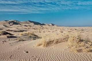
Kelso Dunes in Mohave Preserve California, Source
Current mileage: 318 mi.
Road Closures
Updated Oct. 26, 2024
Since 2017 Route 66 has been closed west of Essex, all the way to Chambless. The road east of Essex to I-40's Exit 115 (Mountain Springs) is also closed. There is full information, with maps at the San Bernardino County Road Closed web page).
Detailed description from Topock to Barstow with maps
Route 66 crosses California from the Colorado River to the Pacific coast, from Needles to Santa Monica through the Mojave Desert and Los Angeles.

Route 66 Motel Neon Sign
We will start in the middle of the bridge on I-40, over the Colorado River, (mile zero), at the Arizona state line.
The original Route 66 bridge is the steel arch bridge just south of I-40. It is a Historic bridge, and it appears in the movie "Grapes of Wrath".
You are entering the driest part of the trip, the Mojave Desert region, which was the toughest on both drivers and vehicles in the old-days. Keep on I-40, which turns north, towards Needles.
Leave I-40 at Exit 148, (6 miles) turn west and then north along Five Mile Road, and then north along U.S. 95, pass under I-40 (at Exit 144) and enter Needles.
Needles
The old Stout Texaco restored:

Drive through the town (13 mi.) and follow Broadway St. (US 66), follow it, and take a left at Needles Highway, pass under I-40 and keep north, the road (River Road) crosses I-40 again (Exit 141 - 16 mi.), follow the fork left along the National Trails Highway and return to I-40 at Exit 139 (18 mi.)
West of Needles: The Mojave

Roy's Motel neon sign . Source
Leave I-40 at Exit 133 (24 mi.) go north along U.S. 95 ant (30 mi.) take a left along Hwy 66 into Goffs (45 mi.) heading SW to cross I-40 at Exit 107 (55 mi.) at Fenner. Here it meets the National Trails Highway and both head SW by Essex. But, as mentioned further up, the road is closed.
Then come Chambless and Amboy (94 mi.), through the desert, with mountains to the north and south.
Amboy
Stop by the classic Roy's Cafe and Motel. The dark cinder cone of Amboy Volcano is to the south of Route 66 next to Amboy. The road skirts its lava field and turns NW.

Ludlow
You go by Bagdad and reach I-40 by Exit 50 in Ludlow (122 mi.)
At Ludlow, cross I-40 and turn left along the north frontage Rd. (National Trails Highway).

Two old trucks Ludlow Service Station. Source
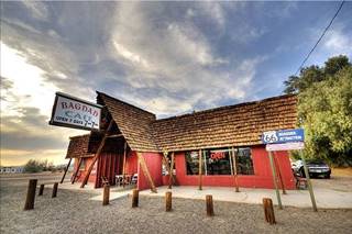
Bagdad Cafe, Newberry Sgs. Source
Newberry Springs
Route 66 crosses to the south side of I-40, then crosses the railroad, heading west south of I-40. After Exit 23 it passes by Bagdad Cafe, reaching Newberry Springs, and crosses I-40 at Exit 18 (154 miles).
Go past Daggett (166 mi.) and when you reach Nebo St. you must take a left to return to I-40 (168 mi.) because although US 66 keep on straight, it enters the Marine Base.
Get on I-40 at Exit 5 and leave at Exit 2 - 171 mi.), pass under I-40 and take East Main St. entering Barstow (173 mi.)
Barstow
Detailed description from Barstow to Pasadena with maps
Barstow and San Bernardino are both mentioned in the song Route Sixty-six (Get your kicks...)

Henning Motel Sign in 2016. Austin Whittall

The Torches Motel, Barstow
At Exit 1, follow Main St. cross I-15 and head west. See all the iconic Route 66 motels in town.
The road arches through Barstow, crosses CA-58 and takes a Southwesterly course. It will pass through small towns of Lenwood (179 miles), Helendale (197 miles), and Oro Grande (205 mi.)
Elmer's bottle Ranch on Route 66

Victorville

Neon Sign at Emma Jean's Cafe, Victorville. Source
It becomes North D St. and passes under I-15 at Exit 153, entering Victorville (210 miles).
Take a right onto Seventh St. south and at Exit 150 join I-15 as frontage road, heading SW into the pass between the San Gabriel and San Bernardino Mountians, along "St Andreas Fault".
View of the San Gabriel Mountains seen from Cajon Pass

San Bernardino

Neon sign of the Oasis Motel, San Bernardino. Click image for street view
They it curves south through San Bernardino National Forest. You can take Exit 129 (234 mi.) and follow Cajon Boulevard across the pass. Re-enter I-15 at Exit 124, Kenwood Ave. towards San Bernardino. After the interchange of I-15 with I-215 keep right and exit again, onto Cajon Blvd. (242 mi) to enter San Bernardino.
The later "Post-1930s alignment" followed Kendall St. and then south along North E. St. until W. 5th St. where it turned west again.
It was on N. E St. that McDonald's opened their first Hamburger store
There are many motels and old gas stations in town, but don't miss the Wigwam Village #7 Historic motel.
The Wigwam Motel in San Bernardino

Cajon Blvd. turns into Mount Vernon Ave. take it south until W. 5th St. and take a right (252 mi.) At Lytle Wash Creek it becomes Foothill Blvd. (CA 66).
The road goes through Rialto, Fontana (259 mi.) and Rancho Cucamonga (268 mi.) with a westerly direction.

Richfield Service Station, Rancho Cucamonga. Source
It keeps on west through a chain of towns: Upland, Claremont (275 mi), heads NW at La Verne to cross CA 210 and go through Glendora (284 mi.)
After Azusa it becomes Huntington Dr. through Monrovia (with Historic Aztec Hotel).
It crosses I-210 (Exit 33 - 294 mi.) becoming Colorado Blvd., on the south of the Interstate. Passes through Lamanda Park and into Pasadena (302 mi.).
Pasadena
The Route 66 sign of the Hiway Host Motel

Detailed description from Pasadena to Santa Monica with maps
Pasadena to Santa Monica - Map of this segment
It includes the Historic Arroyo Seco Parkway segment used by Route 66 from 1940 to 1964.

Historic "Surplus" neon sign, Pasadena
There are many classic sights in Pasadena along Colorado. At this point there are several alignments of Route 66 into Los Angeles: the original 1926 one that ended in downtown Los Angeles, later 1930-40s variants through Northeast Los Angeles, and the late 1940s ⁄ 50s road which we describe below.
Los Angeles
In downtown Pasadena turn left onto Arroyo Parkway southwards which becomes CA 110 and in South Pasadena turns west as Historic Arroyo Seco Parkway. It passes on the north side of Montecito Heights, and right in front of the Dodger Stadium and take Exit onto US 101 N, at the Four Level Interchange (right;311 miles), along the Hollywood Freeway.


The head of "Chicken boy". Los Angeles. Source
At Exit 7, leave US 101 towards Santa Monica Blvd. (315 mi.) and take a left along Santa Monica Blvd. (CA 2) Here you will meet the 1930s and 40s alignment again.
Hollywood

Griffith Observatory, Los Angeles. Source
Click to enlarge
The Boulevard takes you through the heart of Hollywood, a district of Los Angeles, and the city of West Hollywood, and then it takes a southwesterly direction through Beverly Hills and passes under I-405 (325 mi).
End of Route 66: Santa Monica
Original US 66 ended in downtown Los Angeles (1926) it was later moved to the Pacific Coast Highway (then US 101 Alternate) which is current SR 1, in Santa Monica, California.
It heads towards the sea, through Santa Monica. Where it used to end, on Lincoln and Olympic Blvd. in the 30's and 40's. Below is a view of the formal endpoint:
Official Western "End" of Route 66, Santa Monica California

But don't turn left on Lincoln Blvd. Keep straight ahead to its western terminus, on Ocean Avenue, 0.3 miles north of the Santa Monica Pier.
The endpoint of Route 66
Here by the sea, is the unofficial Western terminus of Route 66. (396 mi.).
There is also plaque at Ocean Ave. and Santa Monica Blvd. that dedicates US 66 as the Will Rogers Highway.
The "End of the Trail" sign on Santa Monica Pier

Disclaimer

Aerial view of Santa Monica Pier, Santa Monica.
Mileage indicated above is approximate. These itineraries do not substitute for a roadway map. Road Trip Journeys takes no responsibility nor can be made liable for any errors, omissions, nor for user's safety and in no way warrants the safety or suitability of the suggested routes. Always drive carefully and obey road signs, Highway Code and police officers indications.
Although we have made an effort to make all information as accurate and updated as possible due to the diversity of changes that can occur anytime in an area we apologize for any inaccuracy you may come across.
When driving these itineraries, carefully compare information mentioned in them, or displayed on any pertinent maps, to all available navigation
sources, including information from street signs, visual sightings, and GPS. We welcome you sending us information whether for an update or a suggestion.
See the Eastern part of this Itinerary
We describe the eastern itinerary along Route 66 in Itinerary Page 1
Some sponsored content
>> Book your Hotel in Los Angeles
Credits
Banner image: Hackberry General Store, Hackberry, Arizona by Perla Eichenblat.