
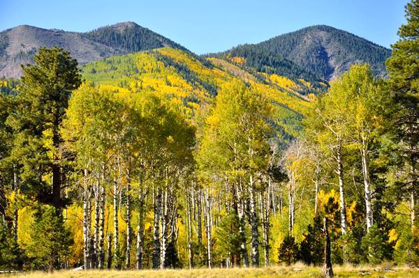
Route 66 in the Mountains and Pine Forests
Index to this page
More on Flagstaff Page #1
About Flagstaff, Arizona
Facts, Trivia and useful information
Elevation 6,910 ft (2.106 m). Population 65,870 (2010).
Time zone: Mountain (MST): UTC minus 7 hours. Summer (DST) no DST⁄ PDT (UTC-7).
Flagstaff is a city in northwestern Arizona, it is the county seat of Coconino County.

The north - central part of Arizona has been inhabited for over ten thousand years. During more recent periods, the region of the San Francisco Mountains has been the home of the "Sinagua" people, hunter gatherers who also grew crops of squash, beans and corn. They lived between the Verde Valley, Mogollon Rim. and Sedona to the south and Wupatki, Sunset Crater and the Little Colorado River to the north.
The name "Sinagua" combines the Spanish words "sin" (without) and "agua" (water), because this area lacks permanent rivers. The Sinagua culture peaked between 500 and 1220 AD after which a severe drought forced them to migrate into New Mexico with the Anasazi people. By 1400 AD they had all gone. Their abandoned pueblos can be seen at Ruins of Elden Pueblo and Wupatki National Monument.

Further east lived two other groups, the Navajo (or Diné) people and the Hopi who descend from the Anasazi people, and like them are farmers.
The Spanish explored the area in 1541, discovering the Grand Canyon, but they never occupied what would later become Arizona. They settled furhter east in New Mexico.
After Mexico's independence from Spain in 1821 it took possession of the territory but lost it after the 1846-1848 war with the US.
In 1857, Lt. Edward Fitzgerald "Ned" Beale (1822 - 1893) surveyed a wagon road from Ft. Smith Arkansas to California and passed through Flagstaff.
During the American Civil War, the Unionist government created the Territory of Arizona (1863) separating it from New Mexico. By the mid 1870s settlers began arriving. One of them, Thomas F. McMillan (or McMillon) moved to the area in 1876 and established his sheep ranch just north of the present city of Flagstaff. His home is the oldest home in Flagstaff and is part of the Museum of Northern Arizona.
The name: Flagstaff
At the ranch of pioneer and father of Flagstaff, Thomas F. McMillan, the Second Boston Party raised the flag that gave the town its name on July 4, 1876, centennial of the American Independence.
The Atlantic and Pacific Railroad, later Atchison Topeka and Santa Fe Railroad (AT&SF) laid their tracks through Flagstaff in 1883 and linked up with the California railroad at Needles, CA., creating a transcontinental link and plenty of traffic through the region.
The first railway station was located at the base of Mars hill at Old Town Spring (with plenty of water for the steam engines) but the sloping ground was not suitable for building a townsite, so the station was moved further east, beyond the Rio de Flag river, to its current location.

The belligerent Apaches living south of Flagstaff finally surrendered to Generals Miles and Crook in 1886, pacifying the region. Coconino County was formed in 1891 and the town was chosen as its county seat. The University of Northern Arizona opened its doors in 1899.
Flagstaff's economy was based on lumbering and cattle. The tourism industry began early as stage coaches departed from Flagstaff to the Grand Canyon and did so until the railway line from Williams to the Grand Canyon was built in 1908.
In the early 1900s, a shorter road between Winslow and Flagstaff became necessary, and the National Old Trails highway association surveyed one through Winslow. Route 66 was aligned along the National Old Trails in 1926 and traffic began flowing through Flagstaff.
Getting to Flagstaff
You can reach it via Interstate 40 or Old Route 66 heading east from Kingman, and along I-40 west from Winslow. I-17 links it with Phoenix.
Where to Stay: Your Hotel in Flagstaff
There are many hotels and lodging options on Route 66 in Flagstaff.
>> Book your Flagstaff
More Lodging Close to Flagstaff along Route 66
There are plenty of lodging options in the cities and towns along Route 66 east and west of Flagstaff; click on the links below to find your accommodation in these towns, listed from east to west:
Eastwards
In Arizona Along Route 66
Westwards
You are so close to Las Vegas and the Grand Canyon!


>> There is a RV campground in Flagstaff
Weather in Flagstaff

Location of Flagstaff on Route 66
The climate in Flagstaff is dry and semi-continental. Seasons are marked, with cold winters with abundant snow and a dry, windy spring. Summer is hot and dry until July, when the humid
summer monsoon period begins. Fall is dry and pleasant.
The average high temperature in summer (July) is 81.2°F (27.3°C). The winter (Jan) average high is 42.5°F (5.8°C). The record high is 96°F (36°C) in July. The average low in summer is 50.9°F (10.5°C) and in winter it is 17.3°F, well below freezing (-8.2°C). Record low is -30°F (-34°C) in January.
Rainfall is scarce and averages 21.86 in per year (555 mm); around 8 in. (200 mm) fall during the Summer Monsoon period between July and Oct, and another 8 inches between December and March.
Flagstaff is one of the snowiest incorporated cities in the US
Yearly 101.7 inches of snow fall in the area (258.3 cm), between late Sept. and early May you may encounter snow.
There are 88 days a year with precipitation, 35 with snow and the relative humidity fluctuates from 34% to 62% (June and January).
Tornado risk
All the area that is located to the west of Rocky Mountains hardly has any tornados. Tornado Risk: read more about Tornado Risk along Route66.
Flagstaff, Arizona, its Sights and Attractions
Things to Do and Places to See
Tour Northwestern Flagstaff
To the west is Lowell Observatory, to the northwest is the Museum of Northern Arizona and further along the highway the Arizona Snow Bowl on Humphrey's Peak, open year round for trekking or skiing. Even further away is the Grand Canyon National Park.
Lowell observatory
Registered National Historic Landmark and Arizona Treasure
1400 W Mars Hill Rd, Flagstaff. 1.4 mi. west of town, see the Map. There is an admission fee. Visit the Official website for complete information.
Founded in 1894 by Percival Lowell to observe the "canals" on Mars it was here that dwarf planet Pluto was discovered in 1930.
Take a northwestern course along U.S. 180 to visit the Museum of North Arizona

Museum of Northern Arizona
Oldest House in Flagstaff
The oldest home in Flagstaff
Thomas F. McMillan (or McMillon) moved to the area in 1876, setting up his sheep ranch and home here, on what is now the Museum. His home is part of the museum and is the oldest home in town.
Located on 3101 N. Ft. Valley Rd. Flagstaff. It is 2.9 mi. north of town along US 180
(See Map). Visit the Official website for more details.
The museum spans 200 acres and includes a campus, laboratories and a collection with over five million Native American artifacts, specimens and art pieces. Founded in 1928 it also has a gift shop with Native American crafts.

West of Flagstaff on Route 66
A drive along the 1936 to 1968 Route 66 (After 1968, it realigned to what is now I-40).
Drive to the point where Mike's Pike meets Milton Road and head west along it. The Old Route 66 reaches a point where it splits towards the west and US 89A heads south towards Sedona. Keep along what is now I-40 Business Loop - US 89 westwards.
You will soon reach a classic diner, Galaxy Diner, on the left side of the highway:
Galaxy Diner
931 West Route 66. It was established in 1952 and has somehow managed to remain open, with its classic nostalgic air. See a Street View.
Camp Kit Carson
Keep on straight and pass by a campsite mentioned by Rittenhouse in his book. (2101 W Rte 66). Now it is an RV park in the forest. (Street View).
Pine Springs Camp
2.8 miles west of Flagstaff on Old Route 66; see Map with Directions, you will pass the Pine Springs Resort & Garage on Route 66. The setting is nice as this part of Route 66 crosses a forested area with pines. The abandoned motel has been demolished. It stood on the north (right) side of the road (2011 Street View.)
Keep on Route 66 until accessing I-40 on Exit 191. From here westwards the old roadbed is overlaid by the freeway.
National and State Parks
There are many outdoor options to enjoy nature and the outdoors in Flagstaff.
San Francisco Volcanic Field
The hills and mountains that surround Flagstaff and extend towards the Grand Canyon are geologically young as they formed during the last 6 million years. They are now extinct volcanoes forming the San Francisco Volcanic Field.
A hotspot below the Earth's mantle heated the magma which caused vast eruptions. As the American tectonic plate moved west, the volcanos spread eastwards.
This created the highest mountain in Arizona (San Francisco Mountain) alt. 12,633 feet (3.853 m) and also the youngest volcano in Arizona, Sunset Crater which erupted some 900 years ago.

Though quiet now, there will be more eruptions in the Volcanic Field, but when they will take place is not known.
The volcanic field covers about 1,800 square miles (4.660 km2) is a great outdoors area. Most of it is lies within Coconino and Kaibab National Forests.
Coconino National Forest
Flagstaff is surrounded by the Coconino National Forest. It is a diverse area with beautiful landscapes and many attractions: Red Rock State Park in Sedona, Ruins of Elden Pueblo
It covers 1.856 million acres (751.000 ha.) and was created in 1898 as a forest reserve. It became a U.S. National Forest in 1908. It borders with the Kaibab National Forest towards the Grand Canyon.
Check the Official website for full details.

Day tour south of Flagstaff
Oak Creek Canyon Scenic Drive
Fully paved. To and from Sedona along Oak Canyon Scenic Drive is a 59 mi. circuit. If you choose to include the Red Rock Scenic Byway, it is a 87.5 mile (2 hour driving time) round trip.
The road was built in 1914 and paved in 1938; see the Map with Directions of the whole tour.
Lockett Meadow, Coconino National Forest
Head south out of Flagstaff and take SR 89A towards Sedona. The road follows Oak Creek Canyon, with switchbacks and colorful rocks in a forested setting. After 14 mi. you will reach the Oak Creek Vista Point, stop for the view (see a Street View). And then you will reach Slide Rock State Park (21.5 mi.)
Slide Rock State Park

Scenery at Slide Rock SP, Source
Its name is due to a natural water slide in the slippery bed of Oak Creek.
Many western movies have been shot here starring
John Wayne, Alan Ladd, Charles Bronson and Jimmy Stewart.
Great trekking among red and ochre mountains with pine forests.
Admission fee charged. Check the Official Slide Rock Park website for more info.
Sedona
Keep southbound and 29.5 mi from Flagstaff, you will reach the town of Sedona.
There is plenty to see and enjoy in Sedona. Visit the Chapel Of The Holy Cross set atop the red rocks of a butte. Don't miss the Sedona Heritage Museum on what once was the homestead of the Jordan Family.
Stop by at Tlaquepaque Arts and Crafts Village, an outdoor market dating back to the 1970s, fashioned after a traditional Mexican village.
Red Rock State Park

Scenery at Red Rock SP, Source
39 mi. from Flagstaff, just 9.4 mi. to the SW of Sedona, see this Map with directions.
Official website has more details.
A 286 acre. park, with hiking trails along the Oak Creek among meadows, red rock hills and juniper woods. The park has gift shop, picnic tables, visitors center and restrooms.
You can turn back and return along the Oak Creek Canyon Scenic Drive, or head 9.4 miles to the southwest to visit Red Rock State Park. You can also continue south and complete the circuit along a scenic byway.
Red Rock Scenic Byway
Designated as Arizona's first "All-American Road".
Head south along SR 179. The red rock country has natural sculptures (Steam Boat Rock, Bell Rock, and more). When you reach the freeway I-17 (44 mi.) and head north, back to Flagstaff.
End of the tour.
Tour to the South East of Flagstaff
Head east towards Winona and visit the Grand Falls, the "Chocolate Niagara" on the Little Colorado River.
Grand Falls on Little Colorado River

Walnut Canyon National Monument
It is 11.5 mi. southeast of Flagstaff (see this Map with Directions).
Check the NPS website.
Open daily except Christmas, it has several trails which allow you to spot wildlife and the remains of Native buildings that dot the canyon walls. It became a protected area as a Forest Reserve in the early 1900s, and was designated National Monument 100 years ago, in 1915.
View at Walnut Canyon National Monument

Northeast of Flagstaff
Wupatki National Monument
It is 44 miles northeast of Flagstaff along US 89 (Map with Directions).
Open daily from 9 AM to 5 PM. The entrance fee covers both Wupatki and Sunset Crater National Monuments. The NPS website has more information.
It preserves dozens of ancestral Puebloan villages of the Sinagua culture; the ruins dot the red sandstone cliffs.
You can stop by Sunset Crater on the way:
Sunset Crater National Monument

View of the cinder cone of Sunset Crater volcano. Click image for Street View
21 mi. from Flagstaff via US 89 (Map with directions from Flagstaff to Sunset Crater).
This is a very young (900 year old) volcano, that altered the forest around it with its cinder cone and lava flows. There is a trail you can hike and a viewpoint.
More information at their website.
Scenic Loop Drive
Drive from Sunste Crater Nat. Mon. to Wupataki (1 hour - 34 miles) along a scenic loop road through meadows, pine forests and the red sandstone.
Tour to the Northwest of Flagstaff
Arizona Snow Bowl
Located on the majestic San Francisco Peaks it is only 14 miles north of Flagstaff en route to the Grand Canyon. It opened in 1938 and can be visited in winter (for skiing and snowboarding) and summer (hiking and sightseeing). Map with directions.
More information here: Official website.
Grand Canyon National Park
World Heritage site of UNESCO
79 miles northwest of Flagstaff along US 180 (87 mi. via US 66 and NM 64). See a Map with directions.
The incredible Grand Canyon is a short drive away from Flagstaff; plan a full day trip to visit it.
More information at the Park's Official website.
North of Flagstaff, Navajo Land
Monument Valley

Monument Valley Navajo Nation Park. A. Whittall
Navajo Nation Park
It is 172 miles norteast of Flagstaff, a 3 hour drive along US 89, 160 and 163, on the Utah state line. See this Map with Directions.
Visit the Official website for complete information.
This is a classic image of scores of Western movies. The rock pinnacles and buttes surrounded by red sand and shrubs in a valley of ochres and reds. An amazing experience.
Wind and water have eroded the sandstone of the plateau for 50 million years. There are self guided tours and guided ones. Plus a visitors' center and Navajo crafts. The park covers 91,696 acres.
Little Colorado River Tribal Park
It has two viewpoints and includes the Grand Falls (mentioned above), Coalmine Mesa, Marble Canyon and East Rim of Grand Canyon areas.
The Official website has more information.
Flagstasff's Route 66 attractions on the Previous Page
In the Previous Page you'll find Flagstaff's classic Route 66 attractions:
Some sponsored content
Lake Havasu City

Lake Havasu City, the lake and London Bridge. Source
The resort town of Lake Havasu City on Lake Havasu has beaches along the lake's scenic shoreline, an active nightlife and the original London bridge (you can take a Tour to visit it)
The adjacent state park is open 24 hs, and there is an entrance fee. It is located on a reservoir on the Colorado River. You can hike and enjoy the riverside.
Visit the scenic shoreline with beautiful beaches, nature trails, boat ramps, and many convenient campsites.
>> Book your Hotel in Lake Havasu City
Learn more about the outdoor sites in the Havasu State Park official website.
>> Book your Hotel in Holbrook AZ
Credits
Banner image: Hackberry General Store, Hackberry, Arizona by Perla Eichenblat.