The eastern and western terminus of Route 66
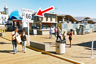
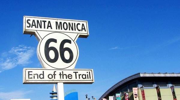
The "End of the Trail" sign on Santa Monica Pier
Index to this page - Contents
- Where does Route 66 Start and End
- U.S. Highways start and end at both tips of their alignments
- The Different Start and End points over the years
- The San Fernando CA Terminus
- The "End" for Route 66: its new start and end points
Where does Route 66 Start and End?
The classic alignment of Route 66 from 1936 to 1974 ran between Chicago, Illinois and Santa Monica, California.
However, before and after those dates the highway had other eastern and western starting and ending points, see below.
Maps showing the beginning and end of U.S. 66 over the years
The following maps show the different endpoints (and starting points) over the years:
1926-1927
East: Cicero, IL
West: Los Angeles, CA
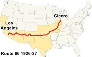
US 66 Cicero IL to Los Angeles CA (1926 to 1927)
1927-1935
East: Chicago, IL
West: Los Angeles, CA
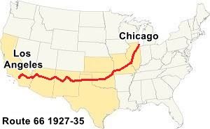
US 66 Chicago IL to Los Angeles CA (1927 to 1935)
1935-1964
East: Chicago, IL
West: Santa Monica, CA
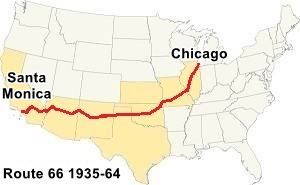
US 66 Chicago IL to Santa Monica CA (1935 to 1964)
1964-1974
East: Chicago, IL
West: Needles, CA

US 66 Chicago IL to Needles CA (1964 to 1974)
1974-1979
East: Scotland, MO
West: Needles, CA

US 66 Scotland MO to Needles CA (1974 to 1979)
1979-1985
East: Scotland, MO
West: Sanders, AZ
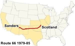
US 66 Scotland MO to Sanders AZ (1979 to 1985)
So over the years the highway had quite a few eastern and western terminus. More details below.

U.S. Highways start and end at both tips of their alignments
A U.S. highway linking town A with B, starts in A and ends in B for those driving from A to B. While for those driving from B to A, the highway starts in B and ends in A.
U.S. highways don't have a single starting point or ending point. Their terminus are both start and end points. The example below will help clarify this.
Someone driving east to west from Chicago along Route 66 will reach the intersection of Lincoln Blvd and Ocean Blvd. in Santa Monica California, endpoint of his or her journey, and see the following sign ahead, on the southwest corner: "HISTORIC California US 66 ROUTE - END," as shown in the image below.
Western "End" of Route 66, Santa Monica California
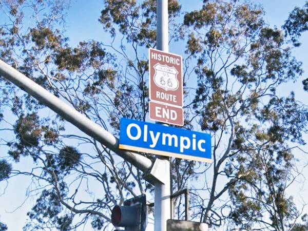
Across the street, on the eastbound lanes, on the northeast corner of this intersection, is a similar sign that reads: "HISTORIC California US 66 ROUTE - BEGIN." This is the start point for someone who will drive along Route 66 west-to-east, staring in Santa Monica and ending in Chicago. See the picture of this sign below.
Western "Begin" point of Route 66, Santa Monica California
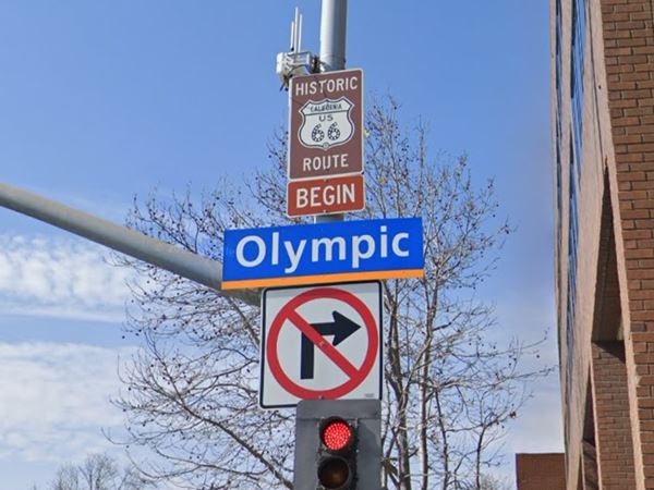
So where the highway starts or ends depends on which direction you are going.
Start and End signs in Chicago
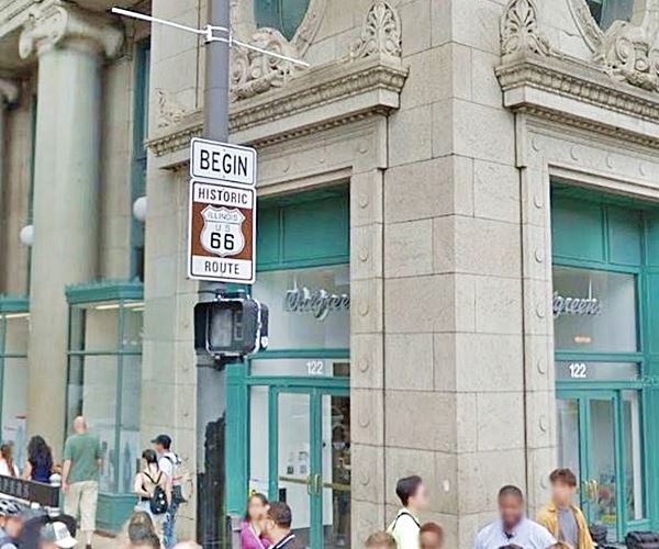
Route 66 'Begin' Sign
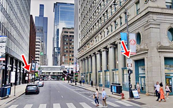
The sign is located at 99 E Adam St. (NW corner with Michigan Ave.), another sign is on the south side of the street, halfway down the block.
The image below shows the signs marking the eastern starting point of Route 66 in Chicago (there are two signs, marked with the red arrows), the Sears Building in the background.
Eastern "Begin" point of Route 66, Chicago Illinois
Close up of the Route 66 "Begin" sign, in Chicago, Illinois
Sponsored Content
Route 66 'End' Sign
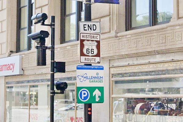
But as we said before, Route 66 also "Ended" in Chicago, for those driving east, and the sign is on the next street, one block south, on E Jackson St. and Michigan Ave.
Route 66 "End" sign, in Chicago, Illinois
The Different Start and End points of Route 66 over the years
As mentioned further up, Route 66 had different terminus in the east and west over the course of its existence.
Cicero, the first eastern terminus
When U.S. highway 66 was created in 1926, in Illinois it was aligned along Route No. 4 created in 1918 when bond was issued to build decent surfaced roads in the state of Illinois. It was known as the SBI 4 (State Bond Issue) highway number 4.

Creation of State Hwy. 4, Illinois. Source
State Route 4 ran all the way to East St. Louis, but didn't start in Chicago. It began in Cicero, the first town west of Chicago.
The text (see image) gives us its starting point: "ROUTE No. 4. Beginning at the intersection of 48th and Ogden Avenues in the Town of Cicero, Cook County, and running in a general southwesterly direction to East St. Louis...."
Initally Route 66 and State Bond Issue (SBI) 4 overlapped until the signs of the old state higway were finally replaced by the U.S. 66 shields in 1927.
We haven't been able to find when the eastern terminus was moved to Grant Park in Chicago, but it surely took place in 1927, however, according to Russell A. Olsen in "The Complete Route 66 Lost & Found," the eastern terminus moved from Cicero into downtown Chicago in 1931.
Chicago Eastern Terminus of Route 66
Route 66 started and ended at the same spot, on Jackson and Michigan Ave from 1927 or 31 until the mid 1950s.
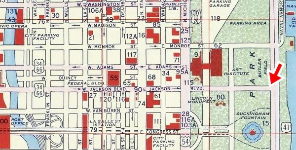
In mid 1950s Jackson became a one way street, heading (eastwards) and Adams St. carried the westbound traffic. Route 66 and U.S. Hwy 34 were both extended beyond Michigan Ave. to link with US 41 (which ran along Lake Shore Blvd.) the two highways followed Jackson Ave, a two way street east of Michigan Ave to meet U.S. 41 at the Outer Drive.
The 1956 Shell Oil Road map of Downtown Chicago, below, shows us a new Jackson Blvd. linking Michigan with Outer Drive (Route 66 ends at the red arrow on the right). Notice the east and westbound alignments of US 34 and 66 marked with their shields on the left side of the map.
1956 Shell Oil map of Downtown Chicago, Illinois
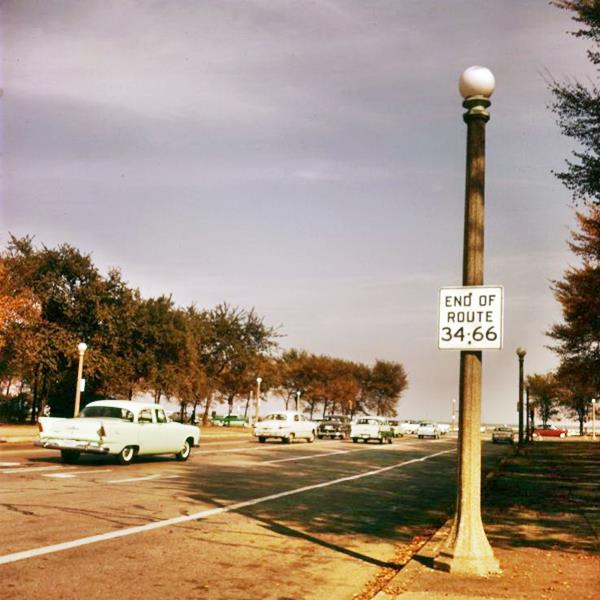
And the following photograph taken in Grant Park, on Jackson Blvd. looking east towards Lake Shore Blvd, from the 1950s is more than eloquent with its white sign with black letters: "END OF ROUTE 34 -66."
End of US 66 and 34 1950s in Chicago, Illinois
The San Fernando Terminus
Route 66 Alignment into Los Angeles
When U.S. Highway 66 was created in 1926 it made sense to align it along the existing state highways, and from San Bernardino to Pasadena, it followed State Route 9. This highway had been created in 1910 under the first state bond issue and it linked "San Fernando to San Bernardino."
The following map ("Los Angeles and Vicinity") shows the highways in the Los Angeles region in 1927; notice , including U.S. 66, 99 and 101. You can follow Route 66 from Victorville in the east, to San Bernardino and then westwards to Pasadena (on the lower left side). The U.S. Highway shields give a general idea of the alignment, but none of them appear within Los Angeles.

1927 Road map, SW CA
Click on image to enlarge.
Source

Detail 1930 roadmap
Click on image to enlarge.
Full map
The black and white 1930 thumbnail map above also shows the alignment of Route 66 from Victorville to Los Angeles. Notice the detail with the alignment into Pasadena and onwards into Los Angeles. However, both of these maps are how the map-makers interpreted the alignment of the highways, which may not correspond to their "real" or "official" courses.
Our next section will look into this matter, which is interesting from a historical perspective.
To San Fernando California?
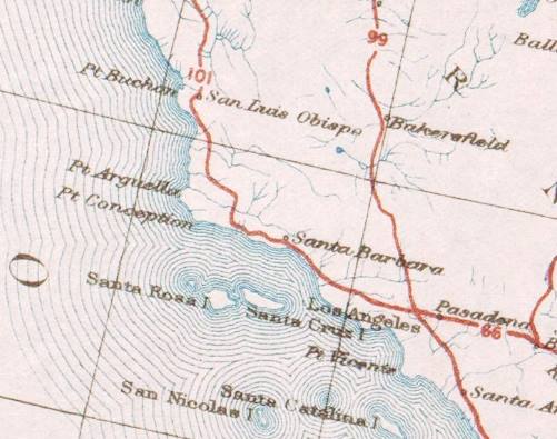
Detail 1926 US Highway map roadmap. Source
Click on image to enlarge.
The US Highway map (click on the image to enlarge it) shows the "United States system of highways: adopted for uniform marking by the American Association of State Highway Officials, November 11, 1926." U.S. Hwy 66 crosses Pasadena with an east-to-west alignment and ends at a junction with U.S. 99 & U.S. 101 in the city of Los Angeles, California. A letter sent by the American Association of State Highway Officials (AASHO) to the California Highway Commission's (CHC) State Highway Engineer, Mr. Robert M. Morton, dated July 7, 1926 confirmed this endpoint; the letter (pictured below) mentions Los Angeles as the terminus of the highway.
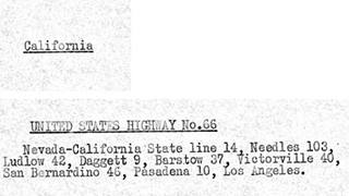
1926 U.S. 66 alignment in California. Source
Click on image to enlarge.
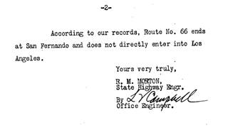
March 1, 1927 letter. U.S. 66 alignment to San Fernando. Source
Click on image to enlarge.
But Mr. Morton (see the image above) wrote to the AASHO on March 1, 1927 questioning their alignment. He stated that "Route No. 66 ends at San Fernando and does not directly enter into Los Angeles."
Corroborating this stance on a San Fernando terminus, Morton sent some corrections to the AASHO on April 21, 1927. They had sent him a description of the highways in California to check and correct, as they would be included in the April 1927 issue of "American Highways", the AASHO's magazine. Once again Morton wrote about Route 66 decaring that "the route does not enter the City of Los Angeles, the termination being at San Fernando which is north of Los Angeles." (see the red underlined text in the image below).
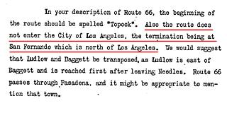
April 21, 1927 letter. U.S. 66 alignment to San Fernando. Source
Click on image to enlarge.
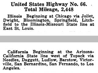
Route description U.S. Highway 66, 1927. Source
Click on image to enlarge.
The American Higways April 1927 issue (image above; see the full issue) gives the following route for U.S. 66 as it reaches its western endpoint: "... Barstow, Victorville, San Bernardino, San Fernando, to Los Angeles." So, it does mention San Fernando, but as a waypoint; the AASHO chose to ignore Morton's remark about Route 66 ending in San Fernando and not going into Los Angeles.
It seems that for the AASHO, Route 66 end point was located in Los Angeles, but, somehow the highway went through San Fernando before reaching LA.
On the other hand, the CHC considered that it bypassed LA and ended in San Fernando.
The problem with the alignment decreed by the AASHO's alignment is that San Fernando is located 22 miles to the northwest of Los Angeles. So this route would have meant a drive to that point, and then turn around and head back south into Los Angeles.
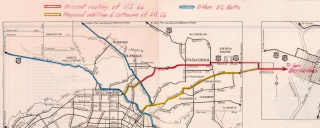
Our custom map shows the AASHO waypoints, State Route 9 alignment west of San Bernardino into to Pasadena (red line) because Route 66 was aligned along it. It also shows (blue line), a tentative alignment that would have had to run between Pasadena, San Fernando, and the endpoint in Los Angeles.
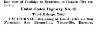
1928 U.S. 66 waypoints. Source
The January 1928 issue of California Highways and Public Works, the official journal of the state's Dept. of Public Works, published the waypoints of Route 66 from west to east (page 33), and once again it mentions San Fernando: "Beginning at Los Angeles via San Fernando, San Bernardino, Victorville, Barstow..." 6
The situation is quite confusing, and it continued for some years: the 1930 Road Map of the state of California, published by the California Department of Public Works, Division of Highways still showed Route 66 as ending in San Fernando and not returning to Los Angeles (see the maps below).
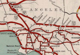
1930 CHC Map, Los Angeles (front). Source
Click on image to enlarge.
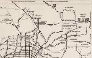
1930 CHC Map, Los Angeles (back). Source
Click on image to enlarge.
Why Was San Fernando Included in Route 66?
One possibility is that the AASHO officials in Washington assumed that San Fernando was some town east of Los Angeles, located between LA and San Bernardino, like Duarte, San Dimas, or Asuza. However, as mentioned further up, the CHC had told them that San Fernando was north of Los Angeles. So the AASHO should have checked the maps and modified the alignment.
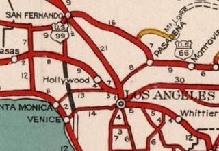
1934 CHC map of Los Angeles. Source
Another possible explanation is that State Route 9, carrying U.S. 99 and apparently U.S. 66 (as the map seems to show), crossed Eagle Rock, which was annexed by the city of Los Angeles in 1923. So, we could assert that this alignment "goes through" Los Angeles' Eagle Rock neighborhood.
The San Fernando waypoint seems to have been dropped in 1930, because later correspondence by the CHC mentions Los Angeles as the terminus of Route 66.
This spur into San Fernando had its U.S. 66 shield removed in the 1934 CHC map (pictured), but it still didn't show the course of any U.S. highway across the city.
The "Real" End of Route 66 in Los Angeles (1926-35)
Route 66 was originally created as a highway linking Chicago with Los Angeles, and its western terminus was located somewhere in downtown LA. But exactly where has been controversial.
On the northwest corner at Ezat Delijani Square on Broadway and 7th. St. is the sign marking the point where Route 66 "ended", its "Western Terminus" from 1926 when it was created until 1936 when it was extended to Santa Monica.
The sign marking the 1926 Western Terminus of Route 66
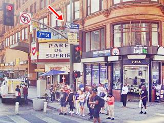
The name on the other sign, "Ezat Delijani" remembers a philanthropist who helped revitalize four historic downtown movie palaces.

The Official Endpoint in Los Angeles 1926-1935
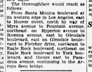
1929 article with Route 66 alignment in LA. Source
Click on image to enlarge.
While the CHC and AASHO were discussing the San Fernando waypoint, the local media seemed to know its course.
An article published by the Eagle Rock Advertiser in 1929 gives the following Route 66 alignment (west to east): "This is a new highway grouping that will lead to the east. It begins with Santa Monica boulevard, uses Fletcher drive, Eagle Rock boulevard, York Boulevard, Monterey road..."
This course agrees with the alignment informed by the Santa Monica Outlook in June 1929 (pictured above): "From Santa Monica boulevard at its western edge in Los Angeles, east to Hoover street, north by way of Myra avenue to Fountain avenue, northeast on Hyperion avenue to Rowena avenue, east to Glendale boulevard, east on Glendale boulevard to Fletcher drive, northeast to Eagle Rock boulevard, northeast on Eagle Rock boulevard to York boulevard and thence east to Pasadena avenue, continuing to the Arroyo Seco Bridge."
We marked its course with a red line in our custom map.
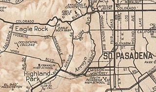
1930 map Los Angeles. Source
Click on image to enlarge.
This means it crossed into South Pasadena along Pasadena Ave. no course is given into Pasadena, but a 1930 map of the area by the ACSC (see image) suggests with the thicker lines marking the roads, that it followed Mission Ave eastwards and Fair Oaks northwards to Colorado Ave.
On February 5 1930, the Los Angeles City Council defined the route that U.S. 101 and U.S. 99 would take across the city, but when it came to U.S. 66 they stated "On Route #66, due to the uncertainty as to the location of this Federal Highway, we recommend that no markers be placed at the present time." See the image of the minutes below.
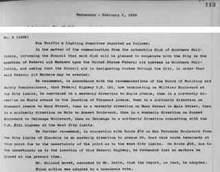
Los Angeles City Council minutes, Feb. 05, 1930. Source
Click on image to enlarge.
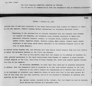
Los Angeles City Council minutes, Jan. 12, 1931. Source
Click on image to enlarge.
Eagle Rock Alignment 1931-1935
The following year, on January 12, 1931 at the request of the Automobile Club of Southern California who wanted to mark the highway 66 along a route they designated, and into Santa Monica, who had also requested that the ACSC sign it, the City Council defined the alignment as follows: "Beginning at the intersection of Colorado Boulevard with the boundary line between Los Angeles and Pasadena, and extending along Colorado Boulevard to Eagle Rock Boulevard (formerly Glassell Avenue), to Fletcher Drive, Glendale Boulevard, Rowena Avenue, Hyperion Avenue, Fountain Avenue, Myra Avenue, Viaduct under Sunset Boulevard to and along Santa Monica Boulevard to the easterly boundary line of the City of Santa Monica." (see the minute above).
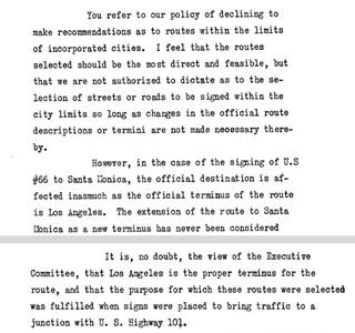
April 1931, CHC letter to the ACSC. Source
Click on image to enlarge.
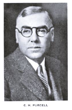
Charles H. Purcell, 1932. Source
But the Council had overstepped their authority, the terminus was in Los Angeles, not Santa Monica, so it couldn't be extended into the neighboring city.
On April 17, 1931 when Charles H. Purcell (1883-1951), the Highway Engineer wrote to the Automobile Club of Southern California (ACSC) regarding the signing of U.S. 66 to Santa Monica; he indicated that althouth the CHC was "not authorized to dictate as to the selection of streets or roads to be signed within the city limits" (that was reserved for the City Council), but that "the official terminus of the route is Los Angeles."
Therefore since the AASHO hadn't approved a new terminus to the highway the signs extending Route 66 to Santa Monica had to be removed. He also said that "Los Angeles is the proper terminus for the route, and that the purpose for which these routes were selected was fulfilled when signs were placed to bring traffic to a junction with U.S. Highway 101."
We marked the spot in our map; U.S. 66 would have met U.S. 101 at Sunset Blvd.
Alternate 66 alignments
Chapter 807 of the 1931 California statutes came into effect on Aug 14, 1931 giving the CHC authority to define the location of the state highways within a municipality, to acquire land and right of way and to build, improve and maintain them. City councils had to cooperate with them.
With this in mind, Purcell wrote to the AASHO (September 3, 1931) because he wanted guidance on aligning Route 66 in Los Angeles. He now said that the highway ended at its junction with U.S. 99 at Fletcher and San Fernando Road (see the marker in our custom map).
The letter explained that the CHC wanted to mark "two alternate streets. For example the logical western terminus of U.S. 66 is at the Plaza in Los Angeles. However, if the route is signed by the most direct streets to that point traffic which does not desire to go into the business district but simply reach U.S. 99 or U.S. 101 to go north is directed several miles out of their way through heavy traffic. It is my thought thast it would be an advantage to traffic to sign one route by the most direct streets into the Plaza and sign another route by the most direct streets to an intersection with U.S. 99 and U.S. 101."
Purcell insisted on November 13, 1931, adding a map (pictured - click on it to enlarge it) and stated that "The terminus of U.S. 66 is designated as Los Angeles and it would seem that the logical point to terminate the route would be at a junction with U.S. 101 and U.S. 99 practically at the center of the business district of that city. This plan requires all through traffic to follow the heaviest traveled arteries of the city. On the other hand if a route is signed which will allow traffic to avoid the most congested area the city is by-passed. This is shown in the attached map. U.S. 66 as now signed terminates at the junction with U.S. 99 at Fletcher Drive and San Fernando Road. We had in mind recommended extension of U.S. 66 as shown in yellow to a junction with U.S. 101 at Sunset Boulevard, also the signing of an alternate route as shown into the heart of the city." See the map in pdf format
The Eagle Rock alignment is shown with a green line in our custom map.
The AASHO replied in Nov. 1931 and suggesting that "the real answer to your problem is to carry U.S. 66 to Santa Monica. You certainly should carry the numbers further into Los Angeles than you are now doing," adding that alternate routes should always end on the other route, so it couldn't be a spur. But the state didn't want to extend the highway to Santa Monica and insisted on a forked with two endpoints, one downtown, the other on Routes 99 and 101. Several letters came and went on this matter during 1931. But the alternate alignment from Arcadia along Huntignton was never approved.
Western Terminus moved from Los Angeles to Santa Monica in 1935

Route 66 extended to Santa Monica (1935) Source
The American Association of State Highway and Transportation (or AASHTO) announced on June 17, 1935 that "U.S. 66, extended from Sunset Boulevard in Los Angeles to Santa Monica via Santa Monica Boulevard," as shown in the image (page 19 of the State Sign Routes, California Highways and Public Works, Oct. 1935).
And where was the new western terminus located?
Official Terminus of US 66
Lincoln Blvd. and Olympic Blv., Santa Monica. Map showing the spot.
The Western Terminus of Route 66 from 1936 to 1964 was located on the intersection of Lincoln Blvd. with Olympic Blvd.
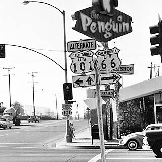
Route 66 western terminus in the 1950s, Santa Monica Source
The AASHTO set it at "... Lincoln Boulevard to the terminus at Pennsylvania Avenue..." at that time, after Colorado Ave., were the tracks of the Pacific Electric Railway Company, a streetcar or tramway, followed by Pennsylvania Ave. But when the modern Santa Monica Freeway (I-10) was built along the old streetcar line right of way, it obliterated Pennsylvania Avenue which was replaced by what is now Olymipic Blvd. So the modern terminus is located on Olypmic Blvd.
The Mother road ended here and never reached Santa Monica Pier or Ocean Ave. This was the end of the road until 1964, when the highway was decommissioned in this area and moved east (more on this below).
The image shows the spot in the 1950s, notice the Penguin neon sign on the western side of Lincoln Blvd., which is still there.
Photo of Mel's Drive In and the End of the Road sign on Lincoln and Olympic Blvds.
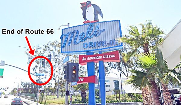
The many ending points of Route 66 in Santa Monica
However, most believe that Route 66 ends at Santa Monica Pier, and this is a very good example of excellent marketing by a Route 66 souvenir shop located on the pier.
Then there is the bronze marker on Santa Monica and Ocean Ave., a memorial to Will Rogers, which states that it is "The End of the Trail". Confusing isn't it?. Below is the true story of the western tip of Route 66.
Will Rogers Memorial Plaque
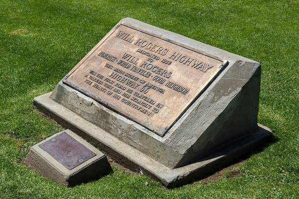
Despite its official ending point on Lincoln and Ocean Blvds., the U.S. Highway 66 Association campaigned from 1935 to 1950 to have the highway renamed as the Will Rogers Jr. Highway and to move its terminus to Palisades Park on Ocean Avenue and Santa Monica Blvd. See this Map showing location.
The spot is 0.7 miles west of the "real" endpoint of Route 66; and there is a plaque on the sidewalk in Palisades Park, on the western side of Ocean Avenue, among the palm trees that reads:
WILL ROGERS HIGHWAY
Dedicated 1952 to WILL ROGERS
Humorist - World Traveler - Good Neighbor
This Main Street of America
HIGHWAY 66
Was the first road he traveled in a career that led him straight to the hearts of his countrymen
It was placed here in 1952 to promote a movie shot by Warner Brothers about the life of the famous star, "The Will Rogers Story". The U.S. 66 Highway Associaton and Ford Motor Company also took part of the promotion and a caravan drove along Route 66 from Saint Louis to Santa Monica placing memorial markers at each state line. They chose this spot -which is not the exact end of Route 66, but, a kind of "state line" (next to the Pacific Ocean) to place the final marker.
Will Rogers Memorial Plaque in Santa Monica
Santa Monica Pier "End of the Trail"
The third and final marker is located on Santa Monica Pier, see this map showing where the sign is.
This is the last marker in Santa Monica, and it is 0.3 miles south of the Will Rogers Plaque.
It is a "modern" sign that was erected during the Pier's centennial year, on Veterans Day, 2009. The idea was concevied by the Route 66 Alliance, the Santa Monica Convention and Visitors Bureau, the non-profit Santa Monica Pier Restoration Corp. and 66 to Cali Inc. (a Route 66 souvenir company)
They formalized the notion held by the general public that Route 66 actually ended on the Pier, and therefore designated Santa Monica Pier as the West Coast's end to Route 66.
Since the D.O.T. had no more say in the matter (U.S. 66 had been decommissioned long ago), this is a local "official" post-mortem relocation of the western end point of an "officially" defunct highway. Marketing and promotion are the prime movers of this new endpoint.
The "End" for Route 66
The demise of Route 66: its new start and end points
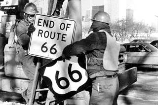
Route 66 shield being removed, Jan 1977, Chicago. Source. Click image to enlarge
The signs were all removed when U.S. 66 was decertified in Illinois in 1977 and the Eastern Terminus moved to Scotland MO close to Joplin, where it remained until 1985 when the highway was completely delisted.
The signs in Grant Park were taken down on January 17. 1977 and there is a great photograph of this event (see image).
The image shows two workers removing the US 66 Shield and the "End of Route 66" sign on a chilly January day. In the background you can make out the Aon Center skyscraper (in those days it was the Standard Oil Building, completed in 1974).
New Beginning and New End Signs
The 1992 "Route 66 Law" or "U.S. Route 66 Designation Act" designated the existing portion of Route 66 in Illinois as a State historic highway. In consequence the former US 66 was marked with the typical brown signs across the state of Illinois, signs that include those at its Eastern Terminus, the road effectively got a new "start", which are those that we mentioned further up (see Start and End signs in Chicago).
The Decommisioning of US 66 began in California in 1964
On Aug 26, 1963 the state's Higway Commission requested the "Elimination of Route 66... Between Jct. U.S. 95 Needles and Santa Monica" it was approved by the AASHO on Nov. 14, 1963. I-40 and I-15 replaced the former alignment between Needles and Santa Monica. At the same time the state had also requested eliminating Alt 66 from Pasadena to Los Angeles through Eagle Rock. This was also authorized. 1. However, the state's Highway Commission included the alignment of Route 66 between Pasadena and Needles in its maps until 1970 (see the maps.)
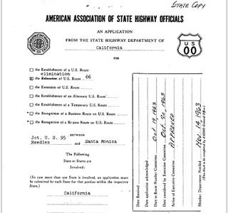
End of Route 66 moved from Santa Monica to Needles, 1964. Source.
Click image to enlarge

End of Route 66 moves to Pasadena, 1964. Source
The process took time; the first segment of Route 66 to lose its certification was the one located in Los Angeles County in 1964, it was replaced by State highways Route 2 and Route 11.
The remaining stretch of US 66 in California was decommissioned from Pasadena all the way to the Arizona border, to the "intersection of U.S. 95 near Needles, California" after I-40 was completed across the Bristol Mountains in 1972 (Source) or 1973 (Source).
This was completed on Jan 1, 1975. Route 66 now ended close to the Colorado River near Needles CA, at its junction with US 95.
Route 66 is Decertified in Illinois and Missouri - 1974
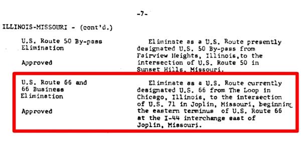
Following the completion of the interstate system in Missouri, on June 24, 1974, the American Association of State Highway and Transportation (or AASHTO) decided to move the eastern terminus of Route 66 from Chicago, Illinois to western Missouri, placing it close to Joplin in Missouri.
This shortened Route 66 eliminating its designation in Illinois and most of Missouri.
The new eastern terminus was located at I-44's exit 15 east of Joplin, in the town of Scotland MO (see it on a map).
Decertified in Illinois and most of Missouri - 1974
It wasn't implemented immediately, but you can see it in this MO DOT map from 1978.
Arizona was next - 1979
The next step took place when the American Association of State Highway and Transportation (or AASHTO) decided to move its western terminus eastwards.
On June 29, 1979 the AASHTO moved the "end point" from Needles east, across most of Arizona, to Sanders, close to its border with New Mexico, to its junction with U.S. 191 (see map).
Decertified in California and most of Arizona - 1979
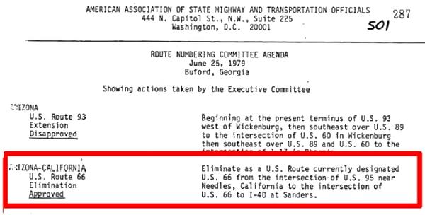
The Western Terminus of Route 66 remained in Sanders until the whole highway was eliminated in 1985.
US 66 Fully Decommissioned in 1985
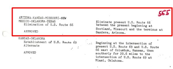
It was finally completely eliminated when it was decommissioned on June 27, 1985.
The American Association of State Highway and Transportation Officials voted decertify it-
Elimination of U.S. Route 66 - APPROVED - Eliminate present U.S. Route 66 between the present beginning at Scotland, Missouri and the terminus at Sanders, Arizona. AASHTO (1985)
That was it, this act eliminated the last segment of US 66 that ran across Oklahoma, Texas, New Mexico, Kansas, and the two short segments that remained in Missouri and Arizona.
Route 66 had officially disappeared.
Decertification of U.S. 66 - 1985

Some sponsored content
>> Book your Hotel in Santa Monica

Sponsored Content

Credits
Banner image: Hackberry General Store, Hackberry, Arizona by Perla Eichenblat
Illinois Highway Improvement Blue Book see p. 103
Route 66 in Illiniois, NPS
California Highways and Public Works, Mar-Apr. 1964. p.12
1. Route Numbering Archive AASHTO file Other (49).PDF, search terms: Route Number: 66.


