Route 66 in Chicago IL
Index to this page
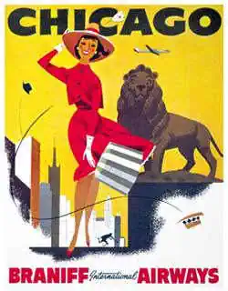
Chicago in a 1960 Braniff ad
Chicago IL
Facts, Information and trivia
Elevation: Elevation 594 ft (181 m). Population 2,611,867 (2025).
Time zone: Central (CST): UTC minus 6 hours. Summer (DST) CDT (UTC-5).
Chicago is the only incorporated town in Cook County, Illinois, and the county seat.
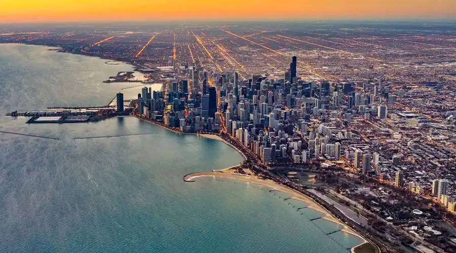
History of Chicago
This marshy area where the Chicago River flowed into Lake Michigan was inhabited around eleven thousand years ago, when the ice sheets retreated north after the end of the last Ice Age leaving the Great Lakes in their wake.
These Paleo Indians evolved into the Native American Potawatomi tribe that lived here, they trekked across a short gap or "continental divide" between the Des Plaines and Chicago River and navigated them in canoes.
When the French explorers reached the area in 1673, rowing upstream along the Mississippi and Illinois Rivers their native guides showed them the portage point (now a National Historic Site, close to Lyons on Route 66).
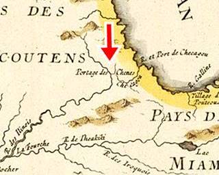
Chicago Portage in a 1700s map
Father Jacques Marquette and Louis Jolliet were the first Europeans to use it. The portage was a muddy slough 8 mi. long (13 km). René-Robert La Salle (1643-1683), another French explorer realized its strategic importance and recommended establishing an outpost here.
The 1750s French map of the western regions of "New France" (Canada), show the "R(iviere) et Port de Checageu" (River and Port of Checageu) the Checageu River and, marked with a Red arrow, the "Portage des Chenes" (Portage of the Oaks) that linked it to the R. des Illinois (Illinois' River)
The name "Chicago"
The first written record is "Checagou" by La Salle in 1685, he applied it to the river and portage, and it was the name of a wild onion plant that grew along its banks.
France ceded the territories to Great Britain in the 1750s after being defeated in the "Seven Years War." Shortly after it became part of the U.S., following its independence from Britain. The Indians ceded the mouth of the Chicago River to the U.S. by the Treaty of Greenville (1795) and in 1803 U.S. soldiers erected fort Dearborn at the river's mouth. It was rebuilt in 1816 (the natives had burned it down during the Anglo-American War of 1812).
In 1818, this territory incorporated into the Union as the state of Illinois. There was trading along the portage, but the roads were terrible. Chicago was platted in 1829 and incorported as a city in 1833.
Cook County was created in 1835 and named after Daniel Pope Cook (1794-1827) newspaper editor and politician, he was the first Attorney General of Illinois, and later a congressman.
Cook County is the second-most populous county in America after Los Angeles County, and both lie on US 66.
Illinois & Michigan Canal
A group of businessmen organized to build a canal to link the Great Lakes with the Mississippi River to move their farm's produce and trade with the eastern states, and allow goods to move west, linking the Great Lakes with the Gulf of Mexico via the Illinois and Mississippi rivers. Work began in 1836 and concluded in 1846.
Fort Dearborn was deactivated in 1837.
The town grew as a trade crossroads, a hub linking the north, the Mississippi, the Great Lakes, and the East Coast. The Railroads in the mid 1800s fueled its growth and made it the gateway to the west.
The city burned down during the Great Chicago Fire in Oct. 1871, that killed over 300 people and razed 3.3 square miles (900 ha) of the city leaving 100,000 people homeless.
Some Chicago Trivia
Chicago is the third most populous city in the U.S., and has more than 2.7 million residents, It is also the most populous city in the state of Illinois and the Midwest.
Almost 9.5 million people live in the Chicago metropolitan area making it the third-largest in the U.S.
Route 66 was aligned along Ogden Ave. across Chicago, from its starting point by Lake Michigan in 1926 and remained there until 1977 when it lost its certification.

Accommodation in Chicago
> > Book your hotel in Chicago
Find More Accommodation close to Chicago along U.S. 66
Below you will find a list of some of the towns along Route 66 west of this town; click on any of the links to find your accommodation in these towns (shown from east to west):
Along Route 66 in IL
- Hotels in Illinois
- Route 66 Starting point ▸ Chicago
- Lockport
- Willowbrook
- Bolingbrook
- Plainfield
- Romeoville
- Joliet
- Wilmington
- Dwight
- Pontiac
- Chenoa
- Normal
- Bloomington
- Atlanta
- Lincoln
- Springfield
- Raymond
- Litchfield
- Staunton
- Williamson
- Hamel
- Edwardsville
- Collinsville
- Troy
- Glen Carbon
- Pontoon Beach
- Granite City
- East St. Louis
West in Missouri
- Hotels in Missouri
- Florissant MO
- Bridgeton MO
- St. Louis MO
- Kirkwood MO
>> See the RV campgrounds in Chicago and in Joliet.
The Weather in Chicago
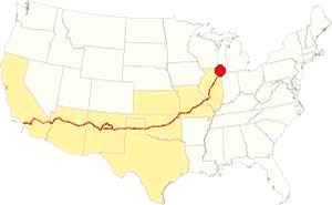
Map showing the location of Chicago, Illinois on U.S. 66
The climate of Chicago is classified as humid continental and has clearly marked seasons with hot and often humid summers, cool and wet springs, mild falls and cold winters.
Temperatures: Average high in Jan (winter) 31°F (-0.3°C) and the average low is 17°F (-8.6°C). Average high in Jul (summer) 84°F (29°C), with an average low of 64°F (17.7°C).
Precipitation: Rainfall is between 3 and 4.3 (78 and 110 mm) inch per month between April and November, falling to around 1.7 in. monthly (28 mm) during winter. Average rainfall is 36.82 inch (936 mm).
Snow: The city gets 28 inches of snow per year (71 cm), with the first snowfall usually taking place in November and the last one happening in April (with less than a quarter inch -8 mm). You shouldn't see snow from May to September.
Tornado risk
Cook County may get hit by around 4 tornados per year. Tornado Risk: read more about Tornado Risk on US 66.
The Maps of Route 66 in Chicago
>> Our Custom map shows the alignment of Route 66 in Cicero.
The map below was published in 1924, two years before the creation of U.S. Highway 66, it shows the "Auto Trails" around Chicago. "Auto Trails" were roads that were in good shape, and could be used by cars. Some are marked with numbers inside black boxes; these are the "named trails." Like "78", which was the "Southwest Trail" or "15", the "Cannon Ball Trail". Illinois State highways are marked with numbers inside white circles. For instance Route 66's predecesor, State Highway 4, is marked with a "4" inside a white circle in this area and it can be seen running from Chicago to Lyons.
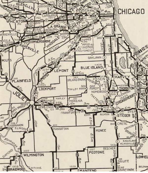
Route 66 Created in 1926
Route 66 was created in 1926 and aligned along State Hwy 4 west of Chicago. It was extended into the city along Ogden to its starting point by Lake Michigan.
>> We describe in detail Where Route 66 Starts and Ends in a dedicated webpage.

1927 Chicagoland map. Source

1928 Illinois State roadmap (see State Hwys 4 and 4A). Source
After 1926, Route 66 can be seen running westwards from Chicago.
The old Route 66 is a Historic highway and has also been designated as a National Scenic Byway and an All-American Road in the state of Illinois.
The Route 66 alignments near Chicago
Description and interactive maps of US 66.
- Pontiac to Springfield (next)
- Chicago to Pontiac (Chicago's)
Chicago's Route 66 Landmarks and Attractions
What to see in Chicago, the "Windy City"
US Hwy 66 End and Begin Signs
Start your Chicago City Tour at the real Eastern Terminus of Route 66 in Grant Park:
Eastern Terminus of Route 66
Route 66 was created in 1926 to link Chicago with Los Angeles, and unlike the Interstate highways whose exits are numbered from west to east or from south to north, U.S. Highways don't have a beginning or an end, or do they?
Chicago: The starting point of Route 66
Even so, Chicago is considered as Route 66's "Starting Point": From here people headed west to seek new lives, jobs or vacations. The destination lay in the west... Santa Monica was the The Western Terminus of Route 66 or "End of the Trail" for Route 66. So Chicago was where it began.
The eastern terminus was moved from the Cicero-Chicago city limits to Grant Park in Chicago, in 1927, however, according to Russell A. Olsen in "The Complete Route 66 Lost & Found," the eastern terminus moved from Cicero into downtown Chicago in 1931.
Route 66 started and ended at the same spot, on Jackson and Michigan Ave from 1927 or 31 until the mid 1950s. Then, Jackson became a one way street, heading (eastwards) and Adams St. carried the westbound traffic. Route 66 and U.S. Hwy 34 were both extended beyond Michigan Ave. to link with US 41 (which ran along Lake Shore Blvd.) the two highways followed Jackson Ave, a two way street east of Michigan Ave to meet U.S. 41 at the Outer Drive.
The following photograph taken in Grant Park, on Jackson Blvd. looking east towards Lake Shore Blvd, from the 1950s is more than eloquent with its white sign with black letters: "END OF ROUTE 34-66." This is the view at that Same Spot nowadays.
End of US 66 and 34 1950s in Chicago, Illinois
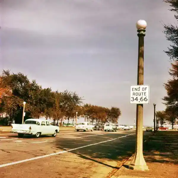
The "End" for Route 66
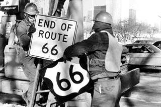
Route 66 shield being removed, Jan 1977, Chicago. Source. Click image to enlarge
The signs were all removed when U.S. 66 was decertified in Illinois in 1977 and the Eastern Terminus moved to Scotland MO close to Joplin, where it remained until 1985 when the highway was completely delisted.
The signs in Grant Park were taken down on January 17. 1977 and there is a great photograph of this event (see image).
The image shows two workers removing the US 66 Shield and the "End of Route 66" sign on a chilly January day. In the background you can make out the Aon Center skyscraper (in those days it was the Standard Oil Building, completed in 1974).
New Beginning and New End Signs
The 1992 "Route 66 Law" or "U.S. Route 66 Designation Act" designated the existing portion of Route 66 in Illinois as a State historic highway. In consequence the former US 66 was marked with the typical brown signs across the state of Illinois, signs that include those at its Eastern Terminus, the road effectively got a new "start".
Route 66 'Begin' Sign
The sign is located at 99 E Adam St. (NW corner with Michigan Ave.), another sign is on the south side of the street, halfway down the block.
The image below shows the signs marking the eastern starting point of Route 66 in Chicago (there are two signs, marked with the red arrows), the Sears Building in the background.
Eastern "Begin" point of Route 66, Chicago Illinois
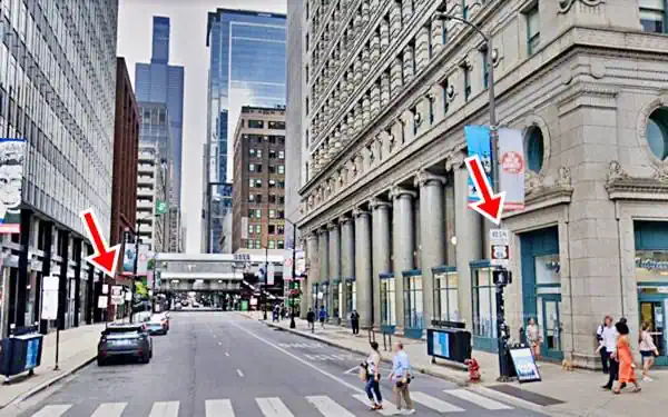
Below is a close up of the Route 66 "Begin" sign.
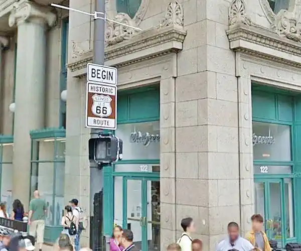
Route 66 'End' Sign
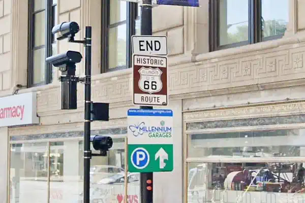
But, as we said before, for those driving eastwards, Route 66 "Ended" in Chicago The "End" sign is here too, one block south of the "Begin" sign, on E Jackson St. almost at Michigan Ave.
Grant Park
A sight in itself
Listed in the National Register of Historic Places
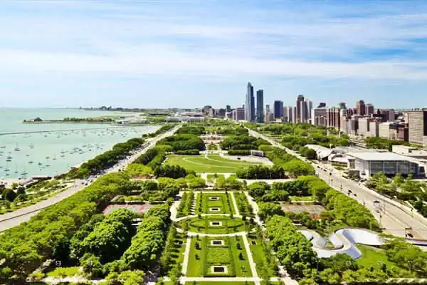
This is the Eastern Terminus of Route 66. Here was the "End of Route 66 sign" where East Jackson Blvd. met US 41, by the shore of Lake Michigan.
It dates back to 1844 when it was created as Lake Park. In 1901 it was renamed after US President Ulysses S. Grant, and grew to its present size (319 acres or 1290 ha) through land reclamation projects.
It lies east of the built up area on Michigan Blvd. When the railroad was built along the shore of Lake Michigan, a lagoon was formed which was filled in to extend the park, which continued into the 20th century.
It is bound by Randolph Dr. and the Chicago River on the north, Lake Michigan on the east, Michigan Ave on the west and McFetridge Dr. on the south. Open from 9 AM in the morning daily.
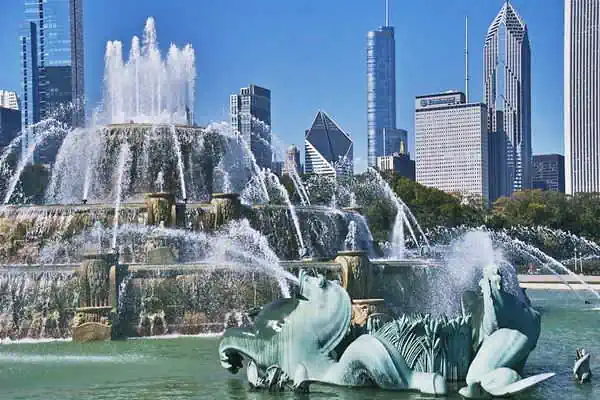
Buckingham Fountain
Don't miss the Buckingham Fountain, 300 yards south of E. Jackson between S. Lake Shore Dr. and S. Columbus Dr., it was built in 1927, a local landmark. One of the largest fountains in the world, it was modeled after the Latona Fountain at the Palace of Versailles of King Louis XIV of France, built between 1668 and 1689 it celebrates Apollo as a child, and his mother Leto or Latona (Zeus fathered her children Apollo and Artemis). It is meant to be an allegory of Lake Michigan.
There are several insititutions located in the park.
Adler Planetarium
1300 South Lakeshore Drive. It is America's first planetarium, built in 1930 on what was then an artificial island on Lake Michigan.
Shedd Aquarium
1200 South Lake Shore Drive. The world's largest indoor aquarium, with over 20,000 animals.
The Field Museum
1400 South Lake Shore Drive. A must-visit Natural History Museum, it holds "Sue" the World's largest T-Rex "Sue", Egyptian mummies and more! Like the The Route 66 Benld Meteor that fell in 1938 in Benld on the 1926 US 66 alignment.
Cloud Gate
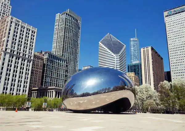
At the Park's northern tip, stands "Cloud Gate;" a giant mirror-like stainless steel, curved sculpture by Anish Kapoor, also known as "The Bean", it was built between 2004 and 2006.
The Loop
Continue your walking tour in "The Loop" (Chicago's central business district. Named after the cable car and elevated railway encircled the area like a "loop").
To your right (north) facing Michigan Ave., between W. Jackson and W. Adams is the Art institute.
The Art Institute of Chicago
111 South Michigan Avenue. With a large collection of Impressionist paintings it also has a Route 66 Exhibit.
Along Route 66 in Downtown Chicago
Route 66 Begins
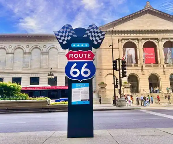
Centennial Marker Sign Where Route 66 Begins
In 2024, the Chicago Tourism Office launched a campaign to honor Route 66 ahead of ahead of the Route 66 Centennial (1926-2026). You can find one here across from the Art Institute, by the Orchestra Hall, at the beginning of Route 66. There are other signs along Ogden Avenue at 1969 W. Ogden, 3100 W. Ogden and 3801 W. Ogden.
As you turn the corner from Michigan into E Adams St. on the north side of the street is the famous BEGIN Historic Illinois US 66 brown and white road-sign shield on a light post, there is second one on the south side of Adams, half way down the block, to your left. We have already described these road-signs further up in our Route 66 'Begin' Sign section.
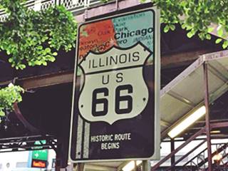
"Historic Route 66 Begins" marker sign. Source
Historic Route 66 Marker Sign
On the corner, to your left ( SE corner here) of Wabash and Adams is a formal Route 66 "Begins" marker sign (street view), pictured. With a U.S. 66 shield superimposed on a map of the Chicago area.
Here, running above Wabash is the the elevated railroad known as The Chicago "L" (short for "elevated") which dates back to the 1890s.
Berghoff Restaurant
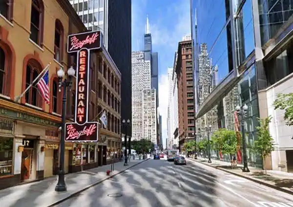
Continue walking west along Adams, one block west is the famous German Restaurant, Berghoff's. Don't miss its neon sign.
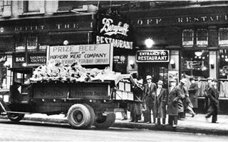
Berghoff in the 1930s. Source.
Click image to enlarge
17 West Adams. This restaurant has been owned and operated by the Berghoff family since it opened back in 1898. Herman Berghoff emigrated from Germany to America in 1870, and among other things, he opened his own beer brewery in Indiana. He moved to Chicago in 1893 to sell his beer at the Chicago World Fair, and it went so well that he moved here to W Adams St. in 1898.
Midland Hotel (now W-Hotel)
Head west, after crossing La Salle St., to your right is the former Midland Hotel, now the "W Hotel" at 172 W Adams, Chicago
Now it is a luxury Starwood Hotel, the "W Chicago City Center Hotel" and its facade remained untouched.
The businessmen club named the Midland Club commissioned architect V. H. Vitzthun to build an Art Deco styled skyscraper. The tower combined offices and the club. But, the Crash of 1929 and the Great Depression that ensued upset the plan, most of the building's office space remained vacant. So in the mid 1930s, the club leased some of it to the Midland Hotel which ended up buying the building in the 1940s.

W-hotel, former Midland, Chicago, Il. St view

Midland Hotel vintage postcard, Chicago, Source
The 1950s postcard above describes the Midland as "Chicago's 'friendliest' hotel, located in the downtown loop area... TV. Ticker Tape Lounge. Coffee Shop..." (Ticker Tape to follow your shares ups and downs!).
Sears Tower
Continue westwards passing under the Elevated Railroad at Wells St. On the next block, at S. Franklin St. (233 South Wacker Drive) is the former Sears Tower; the tallest skyscraper on Route 66.
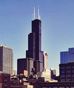
Sears Tower, Chicago, Il. Source
Now named "Willis Tower", but best known as the Sears Tower; it is a 110-story building. It is 1,450 feet high (442 m) and when it was finished back in 1973 it became the tallest building in the world (overtaking the Twin Towers of the World Trade Center in New York). It eventually lost its title; and now after the completion of the New World Trade Center building in NYC in 2014, it is the second tallest building in the US and the Western Hemisphere and the 16th on a global scale.
It was the work of architect Fazlur Rahman Khan, and is now named after Willis Group, who lease space in the skyscraper.
More than one million people visit its "Skydeck" observation deck each year: on the 103rd floor, 1,353 feet up in the air, with stunning vistas of Chicago and four states; you can see up to a distance of 50 miles (80 km).
Drawbridge capital of the world
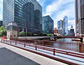
Route 66 Drawbridge, Chicago, Il. St. view
Cross the Chicago River's South Branch using the Original Route 66 Bridge that carried Route 66, built in 1927 and rehabilitated in 1996, it is a Double Trunnion Bascule Deck Truss (Status: Open to traffic).
The Chicago River runs through Chicago, including its central downtown district. Over the centuries it evolved into a system of rivers and canals (now 156 miles or 251 km long).
It's flow was reversed and now instead of discharging into Lake Michigan, it flows westwards into the Mississippi River through the Des Plaines and Illinois Rivers.
The first bridge across it was built in 1832, and it peaked at 52 bridges in the 20th century. Now 38 remain, all of them different types of movable bridges.
One block past the river, to your left is Chicago's Union Station, the railway depot. Ho inside to take a peek at its Beaux-Arts style facades with Corinthian columns, its lavish bronze lamps and the vast Hall.
Union Station Trivia
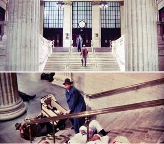
The shootout sequence with the baby's pram rolling down the stairs in the movie "The Untouchables" (1987) was shot here (current view). Other movies filmed here include My Best Friend’s Wedding and The Sting.
Lou Mitchell’s Restaurant
Turn south along S. Clinton St. to West Jackson St. that carried eastbound Route 66 traffic into Chicago, and to your left on the south side of Jackson is the Historic Lou Mitchell's Restaurant.
Listed in the National Register of Historic Places - Neon Sign
At 565 West Jackson Boulevard. Strategically located on the former eastbound US 66 into Chicago, a few blocks from Lake Michigan and the eastern terminus of the Mother Road. It is a Route 66 Hall of Fame Inductee.
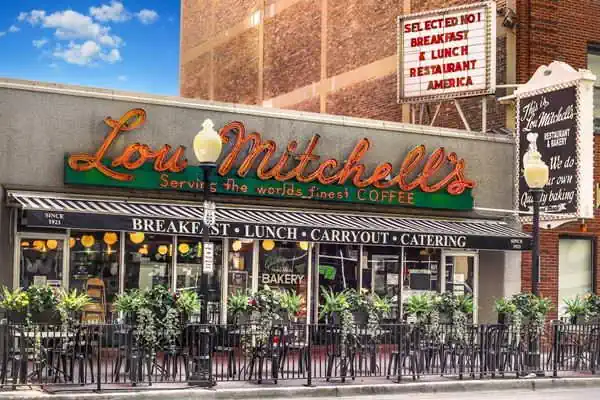
The neon sign is the original one, from 1949, and it announces "Lou Mitchell's Serving the World's Best Coffee". Its facade with aluminium and glass is the original one, and most of its interior is also original and virtually unchanged.
It was founded by William Mitchell, who ran a restaurant on the other side of Jackson, back in 1923. He named it after his son Lou who worked hiere until he was in his seventies when he sold it to his niece. It is run by her family today.
Turn back and walk down Jackson to the "END" sign of Route 66 at Michigan Ave., and this is the end of your walking tour in "the Loop". Get your car and drive west to see some more of the few remaining Route 66 Landmarks in Chicago.
Sights and Attractions as you drive out of Chicago
Driving Route 66 in Chicago
Old St. Patrick's church (1856)
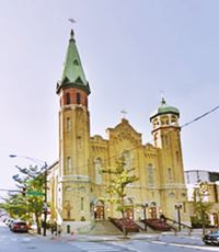
Drive west along Adams St. On the NW corner with S Desplaines St (700 W Adams) is the oldest standing church in Chicago, St. Patrick's church with its distinctive steeples, one sharp and tall, the other onion-shaped has been standing here since it was built in 1856 and predates the Great Chicago Fire of 1871.
Turn left when it meets Ogden Avenue. Here across the road, on the NW corner is a Vintage Gas Station:
Former Amoco Gas Station
1676 W Ogden Ave. Chicago. The photograph below in its credits tells us that this was a "Typical Standard Oil gas station" of the 1970s, it was strategically located on Adams St. and Ogden Ave., the photograph was taken on Dec. 24, 1976 shortly before Route 66 was decertified.
The place has been repurposed but its origin as a gas station cannot be denied, now it is a taco restaurant. The two garage bays to the right of the old office are now windows. Below is a 1976 and a current view of the site.
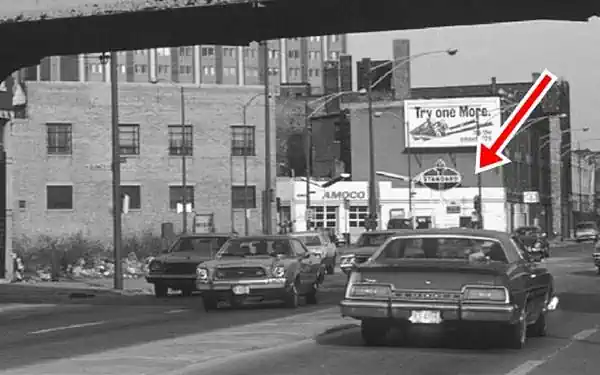

West, beyond the overpass, to your left is W. Jackson St. which took eastbound U.S. 66 traffic into Chicago's Loop. Turn along it, and on the second block, to your left is a Classic Hotel.
Former Rosemoor Hotel
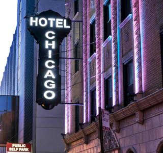
1622 W Jackson Blvd, Chicago. This hotel which is still open, now as the "Hotel Chicago" used to be the Rosemoor Hotel, which as listed in the 1961 Hotel Directory of Chicago, had 150 rooms from $4.00 and up. At that time it was owned by DeWoskin & Co and managed by John Temple. Later it fell on hard times and lodged Single Room Occupancy tenants until it was refurbished and modernized in 2014.
Its classic neon sign has been saved and still lights up the facade, but with the new name:

Neon sign Rosemoor Hotel, Chicago, Il.
Return to Ogden Ave. and head west along it, this was Route 66's alignment.
Ogden Avenue
Ogden Ave. Chicago, Cook County. The name Ogden comes from the Old Enlgish words "ac" (oak) and "denu" (valley). The surname means "oak valley".
The throughfare was named for Chicago's first mayor: William Butler Ogden. This avenue runs for 37.5 miles (60.4 km) from Chicago (Chestnut St. near Milwaukee and Chicago Avenues) all the way to Naperville, IL.
When Chicago was a fort on Lake Michigan (Fort Dearborn) in the early 1800s, the trappers used a muddy trail known as "Ottawa Trail" that linked the fort with what nowadays is the village of Lisle, 25 miles west of it.
The trail was improved and a stagecoach service was established, stopping at what now is Hinsdale in the 1830s, but the cart traffic ruined the dirt road, forming ruts. The trail was a muddy bog during the rainy season. Then some entrepreneurs built a toll road, the "Plank Road", which made traffic flow easily across the quagmire.
Plank Road
Construction began in 1848 and it was known as "The Southwestern Plank Road", it was the first of many that would radiate from Chicago. This one followed the trail to Lyons and in 1851 it was extended through Lisle to Naperville.
The road was built with transversal wooden planks laid on top of log stringers that ran lenghtwise (24 feet x 4 in). The plank boards were 3 to 4 inches thick, 6 inches wide and 8 feet long. Making the road a narrow 8-foot wide structure. A skim coat of sand was applied over the planks to help reduce wear from the wagon wheels.
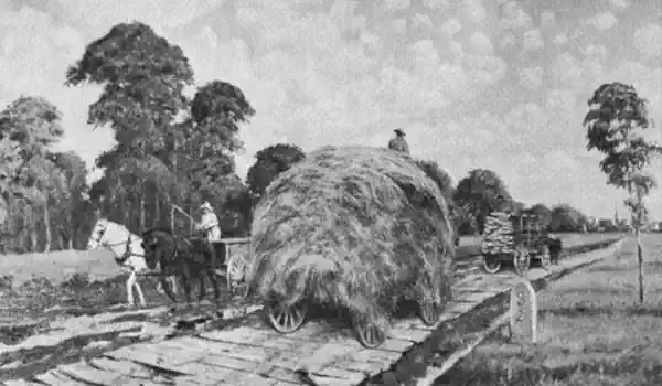
Toll fees were charged ranging from 3¢ for one hog or sheep, 12¢ for a horse and rider to 37¢ for a cart drawn by four hourses.
They were short lived, the wood warped and rotted, upkeep was expensive, and the railroads that were faster and cheaper wiped them out. When the Chicago, Burlington and Quincy railroad began operating in 1863, the traffic along the plank road declined.
The trail was re-named in 1877 as Ogden Avenue. The planks gone, it became a gravel surfaced road. But by the early 1900s the first cars appeared and by 1914 it had been paved becoming a main throughfare.
Route 66 and US 32 were aligned along it in 1926 and in the 1930s it was widened to four lanes.
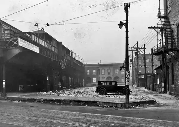
Former site of Ogden "L" station
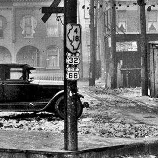
Route 66 shield on Ogden Ave. 1930. Source.
Drive westwards along Ogden Avenue. At Ogden and Van Buren (1830 W Ogden) the avenue crosses I-290. But before the freeway was built in 1955, the Metropolitan West Side Elevated Railroad, part of the "L" lines ran east to west over Ogden here since 1895. The picture below taken on Dec. 31, 1930 shows Ogden Station on the Garfield Park Route of the railroad. Notice that Ogden was signed with U.S. Highways 66 and 32 shields, and Illinois State Highways 4 and 18.
U.S. Route 32 was short-lived, it was created in 1926 but was replaced by U.S. 34 in Chicago and half of Illinois, and U.S. 6 westwards to Omaha Nebraska.
Ahead, to your left, at 1969 W Ogden is another Route 66 Centennial marker (St view, mentioning the hospital.
Former Mercury Oil gas station
Continue west along Ogden and, to your right on the SW corner of Ogden and S Western Ave. (1254 S Western Ave) is a vintage service station.
Former Mercury Oil gas station in Chicago, Illinois
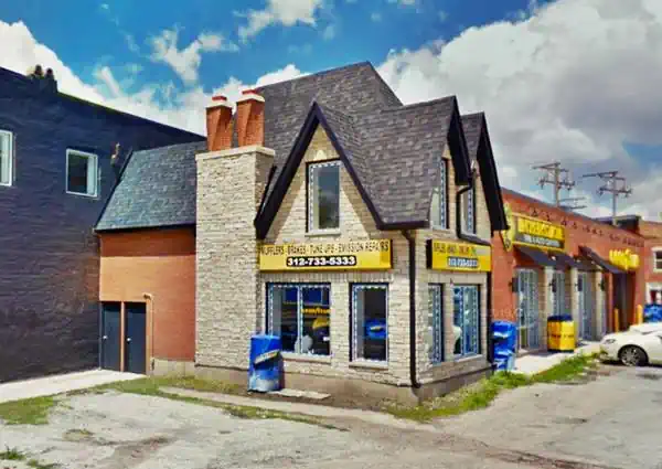
The modern Goodyear - Interstate Auto Center (now a tire sale, muffler, tune up and repair shop) has a very interesting "cottage" style gas station building. It dates back to the 1930s, and in 1941 it appeared listed in the Chicago Business directory as a Mercury Oil Company gas station. It can be seen in this 1938 aerial photo.
Continue west and pass through Douglass Park which is one of Chicago's largest parks. It was created in 1869 as the "South Park" and it covers 173 acres (29.5 ha). In 1871 it was named for U.S. Senator Stephen A. Douglas. Finally, in 2020, it was was renamed for abolitionists Frederick and Anna Douglass.
There is another Centennial marker here at 3100 W. Ogden on the SW corner with Albany Ave (St. view. Ahead is the Historic Castle Car Wash:
Castle Car Wash
Listed in the National Register of Historic Places
3801 W. Ogden. There is a Centennial Marker sign on the corner here too.
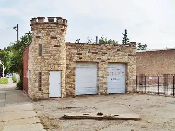
This building, on the SE corner of Ogden and Hamlin, was designed to look like a castle from the Middle Ages, was built in 1925 and is the only historic gas station on U.S. 66 within Chicago's city limits. It is rumored to have been one of Al Capone's hideouts.
John J. Murphy ran it as a gas station for over 40 years. In the 1970s it became a S&B Standard Service, and in the 1980s a Car Wash.
Kildare Gas
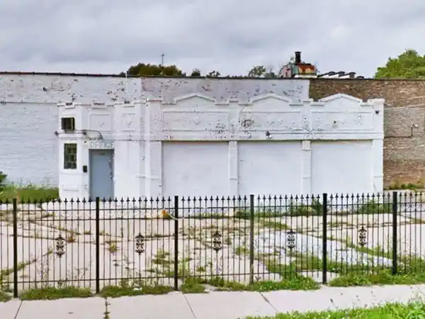
Drive west, and on the corner with Kildare (4300 Ogden) is a former 1940s gas station that has been modified, its three service bays have been closed in and the wide doors replaced with windows. Notice the crenels on the parapets with diamond decorations and the canted corner office.
Continue your Road Trip
This marks the end of your drive through Chicago so head west along Route 66 into neighboring Cicero or visit some more Attractions in Chicago:
Some more Chicago attractions
Some of the city's many sights
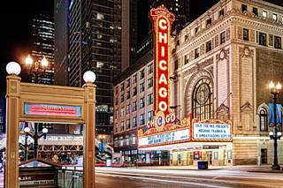
Chicago Theater. Source.
The Chicago Theatre
175 North State St. In Downtown Chicago it is a classic landmark with a fantastic marquee. It was built in 1921 with 3600 seates, and it is listed in the National Register of Historic Places.
360° Chicago
Formerly John Hancock Observatory. At 875 North Michigan Avenue, 94th Floor. This observatory offers some great views of the city from a height of 1,000 feet. Café on 94th floor. More info at their website: 360chicago.com.
Wrigley Field
1060 West Addison St. Home of the Chicago Cubs, built in 1914, it is the second oldest ballpark in America.

Sponsored Content
>> Book your Hotel in Chicago

Credits
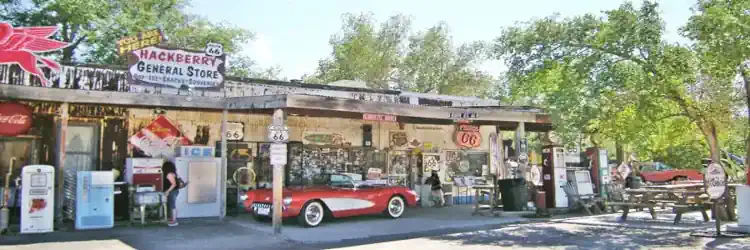
Banner image: Hackberry General Store, Hackberry, Arizona by Perla Eichenblat.

