Index to this page
Route 66 across Kansas
Kansas Route 66 Itinerary and maps
Each /leg of Route 66 described below has an interactive map and many image maps so you can follow the alignments of the highway along the way:
- This leg: Route 66 in Kansas - map of this segment
Oklahoma, next leg
Missouri, previous leg
Background on Historic Route 66
The original roads in this region were dirt surfaced trails that zig-zagged between the towns following the property lines they had right angle (90°) curves as they crossed the countryside.
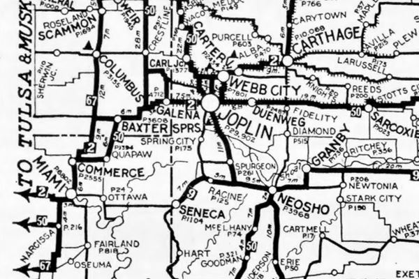
Poorly maintained, they were full of potholes and ruts. Then, in the early 1900s the Ozark Trails Association, a private project, lobbied and worked hard to improve these roads. By the mid 1910s they had succeded. The map below published in 1924 shows that by that time there was a large network of "Auto Trails", that were suitable for cars.
These "trails" would be the basis for the State Highways of the early 1920s, and in 1926 many were incorporated into the U.S. Highway system, including Route 66.
The map shows highway "2", the Jefferson Highway from Carthage MO, through Galena KS and Miami OK. Higwhay "50" was the "Ozark Trails", that would later become Route 66. You can follow it from Sarcoxie MO, through Joplin MO, Baxter Springs KS, and Vinita OK.
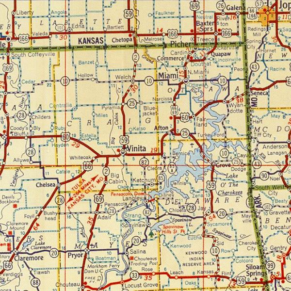
1948 Shell Roadmap northeast Oklahoma
Click on map to enlarge
Source
Route 66 would be paved between 1926 and 1933, and in some areas realigned to make it safer and shorter.
The thumbnail map (click on it to enlarge) is a Shell Highway map published in 1948; you can follow Route 66's alignment from the upper right corner in Kansas into Oklahoma. By then the Mother Road was a two-lane paved highway.
Route 66 from Galena to Baxter Springs
Into Galena
We will cross the state from East to west, starting in Galena.
1926-61 US 66
The original Route 66 (the 1926 - 1961 alignment) is the continuation of Missouri's "Old Route 66 Boulevard", which in Kansas is renamed as "Front Street". This road enters the town from the northeast (See this Map of US 66 alignment in Galena.)
>> blue line in custom map shows the 1926-61 US66 into Galena.
1961-85 US66
In the mid 1940s it was also routed along East 7th St. And it became the only alignment of US 66 in 1961. This was done to avoid having the traffic go through downtown Galena along its Main Street. It was also a 4-lane highway with less sharp curves. See this 1961-85 US66 map with directions.
>> blue line in custom map shows the 1961-85 US66 into Galena.
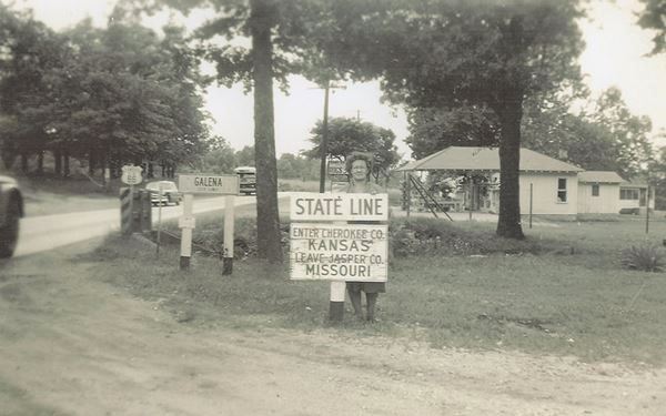
State Line
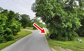
We will begin our Kansas Route 66 itinerary on the state line to the northeast of Galena. As you cross the border an old bridge over a creek, affluent of the Spring Branch, built with the 1926 alignment is still standing (red arrow in the picture).
Historic Viaduct Front St. Bridge
The highway then curves and crosses the railway using the Historic viaduct built in 1923. It is over 200 ft. long, and meets the town's Main Street, turning south along it.
The bridge predates Route 66 by three years, and was built to carry Jefferson Highway. It was chosen to become part of its alignment when the Mother Road was created in 1926. It was a safe way across those busy railroad tracks.
The bridge's pillars were repaired in 2010 and the roadwork and deck were restored in 2017.
It turns left, southwards along Main Street, and after going through the Downtown district, turns 90° right, to head west along W 7th. to leave the town. Here it meets the later 1961 US 66 alignment.
Route 66 into Riverton
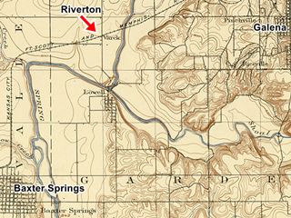
The highway runs east to west and enters Riverton. Click on the thumbnail for a large size map (published in 1900). It shows "Varck" on the Kansas City, F.C. Scott, and Memphis Railroad, that would later become Riverton. You can also see Galena and Baxter Springs. The main link between the Galena and Baxter Springs was a zigzag course through the town of Lowell, where it crossed Spring river.
The "auto trails" of the 1910s followed this zig-zag course from Galena to Baxter Springs via Lowell (approximate map).
But when Route 66 was established in 1926 it was given a straighter course. You can see it in the map below, published in 1927, that marks it with a solid red line, meaning that it was paved.
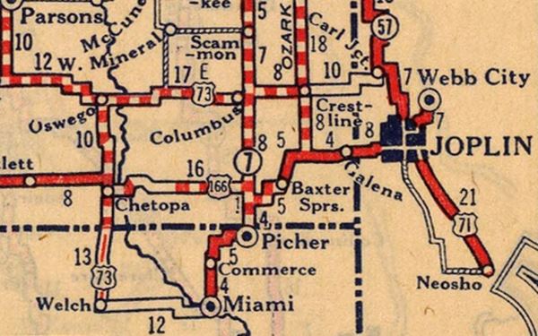
>> violet line in custom map shows the Riverton alignment. Gaps in black.
The "Rainbow Bridge"
Listed in the National Register of Historic Places since 1983
Route 66 crosses Bush Creek, just 2.5 miles west of Riverton using a concrete arch bridge built in 1923, three years before the US66 was established.
Here the highway curves and leaves its E-W direction, to head south. The bridge is elegant and slender, with a pair of concrete arches. It is 130 feet (40 m) long, 20 feet wide (6.1 m) and the rise of the arches is 27 feet (8.2 m) and is the only one of its kind in Kansas (two other bridges were also located on the Route 66 stretch in Kansas Willow Creek and Spring River have been torn down).
The bridge was repaired in 2005.
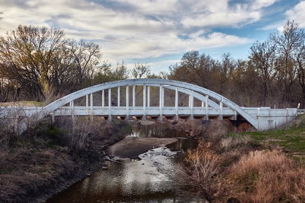
After the bridge, the road heads south towards Baxter Springs
Into Baxter Springs
This is the map with directions into Baxter Springs.
In the early 1960s a bypass was built from Baxter Springs to Riverton (Alt US 69 and US 400, see map with directions) because the Rainbow bridge was narrow and congested, and had two sharp curves at its north and south access points (blue arrows in the map). In 1992 a new bridge was built next to it. The bridge was declared a Historic Place and saved from demolition.

1959 USGS Map of Bush Creek and U.S. 66, Riverton, Kansas. A. Whittall
Historic Route 66 segment
Listed in the National Register of Historic Places
Drive south along the "Historic Section" of Route 66 (Bush Creek to Willow Creek), the roadbed is only 25 feet wide and has grassy shoulders. It has the feel of the original 24-foot wide historic highway. The culverts along it date back to 1923.
>> violet line in custom map shows the historic segment into Baxter Springs.
Then, Old Route 66 approaches the north side of Baxter Springs and at 2nd St. it curves east to meet Military Ave. And at the junction, turn right and head south into Baxter Springs.
US 66 crosses US 166
In downtown Baxter Springs, 12th Street is U.S. Route 166 (US 166), running west to east across the city. It is an original route from the 1926 US Highway system, so it was born together with Route 66.

US 66 and US 166 shields
It is a "spur route", and therefore has a three digit number, the last two are the number of its "parent" highway (US 66) and the first digit is the number of the spur, in this case it is the first, hence "1".
It is one of the two surviving Route 66 spurs: only US 166 and US 266 survived. A third spur, US 666 in New Mexico was renumbered as US 491 in 2003 because it was the biblical "mark of the Beast" - read more The Route of the Beast, U.S. 666.
Original Alignment South of Baxter Springs
Curve on the Original 1926-60s Route 66 South of Baxter Springs
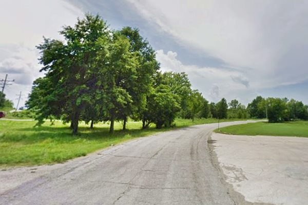
On the south side of the city, at 24th St. the old highway forks to the left and has a sharp curve (red arrow in the image map).
>> violet line in custom map shows the old curve.

1959 USGS map and both Route 66 alignments
This old alignment went straight south and then curved sharply west and again sharply south (a sharp "S") shown with a solid red line in the image map.
This roadbed has survived and is now known as Roberts Road.
To drive it, turn off the main highway by taking a left to take Roberts Rd. (see this Map with directions).
The curve was softened in 1969 (blue arrows in image map), and is the current alignment just west of the old one. Both alignments meet at W 30th and Route 66.
>> yellow line in custom map shows the 1960-85 alignment curve.
The highway then runs with a straight north to south course to the Oklahoma state line.
This is the end of the itinerary across Kansas, follow the next one, from here to Vinita:

Some sponsored content
> > Book your accommodation in Baxter Springs

Credits
Banner image: Hackberry General Store, Hackberry, California by Perla Eichenblat
Jack DeVere Rittenhouse, (1946). A Guide Book to Highway 66.


