Index to this page
Route 66 from KS-OK state line to Vinita
Oklahoma Route 66 Itinerary and maps
Each leg of Route 66 described below has an interactive map and many image maps so you can follow the alignments of the highway along the way:
- KS-OK state line to Vinita - map of this segment
- Vinita to Tulsa - Map of this segment
- Tulsa to Chandler - Map of this segment
- Chandler to Yukon - Map of this segment
- Yukon to Clinton - Map of this segment
- Clinton to Texola - Map of this segment
Texas, next leg
Kansas, previous leg
Historic Route 66 OK state line to Vinita
Background on Historic Route 66
The "Ribbon Road" in Miami, OK.

by Jimmy Emerson, DVM
1948 Shell Roadmap northeast Oklahoma
Click on map to enlarge
Credits
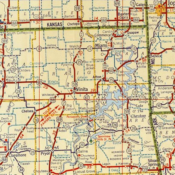
The thumbnail map (click it to enlarge) was published in 1948. It is a Shell Highway map. You can follow Route 66 from the upper right corner in Kansas, to the lower left corner through Vinita.
But before 1948, U.S. Highway 66 had already undergone sevral realignments from its original 1926 roadbed.
The original roads in the area were dirt surfaced highways that zig-zagged between the towns and were filled with potholes and ruts. It was not an easy feat to drive along them.
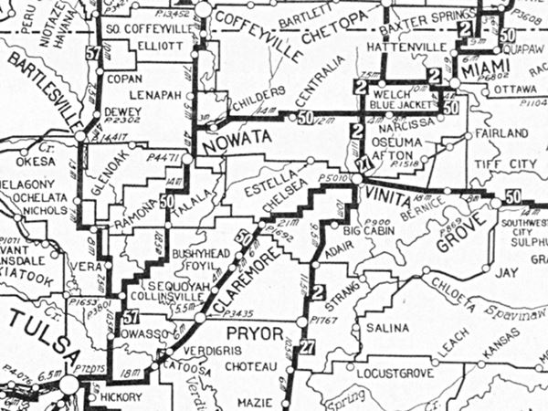
The Ozark Trails Association embarked on improving these roads in the early 1900s, and by 1924 (when the map below was published) there was a relatively good network of "Auto Trails."
These trails could be driven by cars and were quite good. They served as the basis for the State Highways that Oklahoma would build in the early 1920s, and later, in 1926 by the U.S. Highway system, including Route 66.
The map shows highway "50", meaning the "Ozark Trails", that would later become Route 66. You can follow it from Baxter Springs KS to Vinita OK (on the lower right left corner), notice that it bypassed Afton, which was later included along Route 66.

From the Oklahoma State Line to Vinita
To Quapaw
We will drive west, coming from Baxter Springs (Kansas), towards Quapaw.

1927 Map Federal Aid Highways. Source
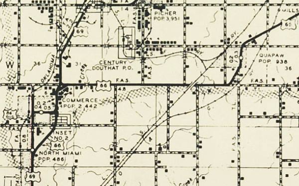
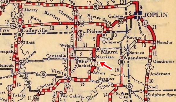
The map was published in 1927 shows the highways built under the 1921 Federal Aid Highway System. At that time there is no highway between Miami, Commerce and Quapaw, but you can make out the "Ribbon Road" highway south of Miami through Narcissa.
The Federal funded highway shown in the map runs through Cardin and Picher into Kansas. The letters "A", "C" and "E" indicate the type of paving used on the highways.
Route 66 alignment in Quapaw
The highway was paved in 1933 with Portland cement, the first one (1926-32) was a dirt road.
The original 1926-32 alignment was never paved. According to the Oklahoma DOT maps followed the course shown in the following map:
>> brown line in our custom map is the 1926-32 US66 into Quapaw.
South of Quapaw it had an "L-shaped" course, that was dirt surfaced until 1933, when a soft curve made it safer and shorter. That same year the highway was paved with Portland concrete all the way to Commerce.
>> orange line in our custom map is the 1926-32 US66 South of Quapaw.
The railroad underpass west of Quapaw (Street view) was built in 1939.
>> red line in our custom map is the 1933-85 alignment into Quapaw.
Commerce
Head west towards Commerce. The map below (1950s) shows the alignment from Quapaw to Commerce.
>> pale blue line in our custom map is the Quapaw to Commerce US66 alignment.
Conoco "Cottage style" Service Station, US66 in Commerce
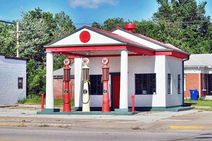
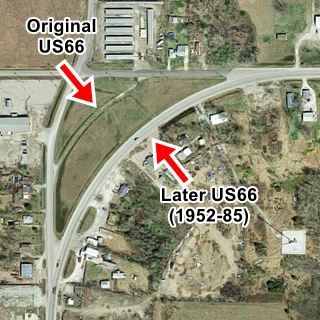
As you reach the northeastern side of Commerce, both Route 66 and US 69 change their east-west direction and curve south. Here, to your right is a "Roadside Park", bound by E 50 Rd. on the north, US 69 (N Park Circle) on the east, and on the west by N Mickey Mantle Blvd. it is roughly triangular. The original Route 66 alignment cuts an arch across the western side of the park and can be clearly seen from its northern and western sides. Only in 1952 would the present alignment (now US69) be built to the east of the older one.
>> yellow line in our custom map is the 1952 US66 at the Roadside Park.
All US 66 alignments headed south from here and followed the following alignments:
1. The original 1926 to 1952 Route 66 ran through Commerce 1926-52 US 66 map with directions.
>> pale blue line in our custom map is the 1926-52 US66 through downtown Commerce.
2. Then in 1952 it was routed to bypass the town 1952-85 US 66 map with directions. The following map from the early 1950s shows the new bypass, and the original alignment renamed as BYP 66. Notice how US 69 had a different alignment to its present one, forking from US66 on the north side of Commerce. Now it does so further east.
>> yellow line in our custom map is the 1952 US66 around Commerce.
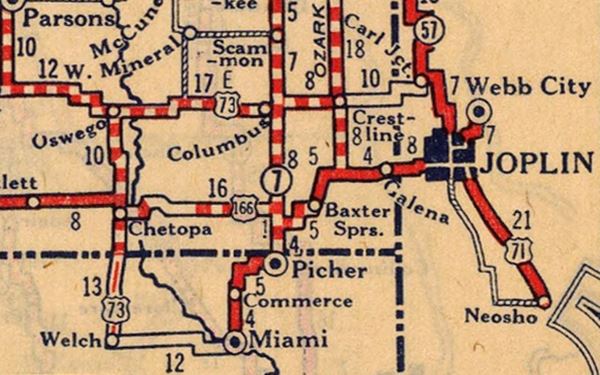
Marathon Oil, a historic gas station from the 1920s

Miami
Head southwards form Commerce to Miami.
>> green line in our custom map is Miami's Route 66.

The two alignments of Route 66 on the south side of Miami
1. Old 1926-37 Route 66 Alignment
The original Route 66 alignment, laid down in 1926, didn't turn on 3rd Ave, instead it continued straight southwards along Main Street and became the Ribbon Road or Sidewalk Road. This is the 1926 alignment map with directions of US 66 in Miami.
You can drive this alignment which meets the later one, 6.4 miles southwest of this point.
>> yellow line in our custom map is the 1926-37 US66 South of Miami (includes Ribbon Road) .
2. The 1937-1985 US 66
This one heads west, along E 3rd Ave., crossing the Neosho River and then curving southwards in a shorter and straigher alignment compared to the first one.
>> gray line in our custom map is the 1937-85 US66 South of Miami.
A view of the Historic Ribbon Road

The Ribbon Road or Nine-Foot-Section of Route 66
Listed in the National Register of Historic Places
This very old section of Route 66 lies between Miami and Afton. It predates the creation of the highway as it was completed between 1921 and 1922, over four years before the creation of Route 66. Actually Route66 was aligned along this pre-existing road when it was commissioned in 1926.
The original Route 66 was pieced together linking different State highways, and these roads had different surfaces, paving and even widths.
The famous "Sidewalk road" or "Ribbon Road" is a very narrow section of the Mother Road. It was used between 1921 and 1937 when it was replaced by a shorter and, even more important, wider stretch of road (current U.S. 69) between Miami and Afton.
This section has a paved surface that is only 9 feet wide (2.75 m), flanked by two five-foot gravel shoulders.
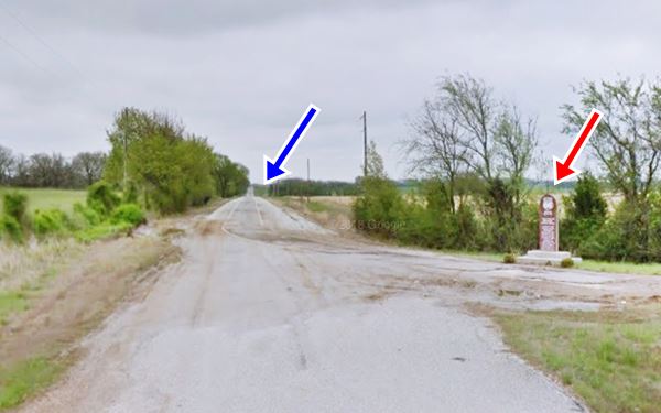
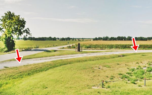
The road has sharp 90° curves and can still be driven along. It has been resurfaced but is still operational. There is a marker near Narcissa next 140 Rd. and U.S. 69 detailing its history. Map showing where marker is.
View of the Marker (red arrow) and the Historic Ribbon road (blue arrow) at the point where it meets the 1937 alignment.
> > Learn more about the Route 66: The Ribbon Road
1927 Map showing the Historic Ribbon Road, US 66 in Oklahoma
Source
Map of the Ribbon Road
The thumbnail image map (click it to enlarge) shows the alignment of the Ribbon Road from Miami to Narcissa, in orange. The pale blue line marks the later (1935) Route 66 alignment.
Miami is in on the upper right side.
See this Map with directions of the Ribbon Road to Narcissa.
Narcissa
The Original Ribbon Road alignment and later 1937 one meet at Narcissa. And from here head south towards Afton. It forked at its southern tip, on the north side of I-44
>> teal line in our custom map is Route 66 south of Narcissa.
Afton
The fork marks the two alignments into Afton.
1926-37 alignment
Following the southern part of the "Ribbon Road" into Afton (map with directions).
>> orange line in our custom map is the Ribbon Road into Afton.
1937-85 alignment
It heads south, crosses the freeway and then turns to the SW towards Afton
>> red line in our custom map is the 1937-85 US66 into Afton.
Both alignments meet on the eastern side of Afton where you can see a segment of the original Ribbon Road. There is a marker there and the old roadbed that curves on the south side of the 1938-85 alignment.
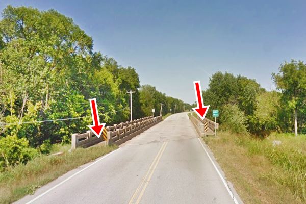
Historic Afton Bridge
Ahead is a historic bridge as you enter Afton. Planners had expected the town to grow eastwards, but it didn't.
Listed in the National Register of Historic Places in 1995
It was built in 1936 by Pharaoh & Co. as part of the Public Works program during the Great Depression. It is unique because it has two pedestrian walkways protected by concrete guard rails (see arrows in the image below).
The concrete bridge with steel girders has three spans and a total length of 143 ft.
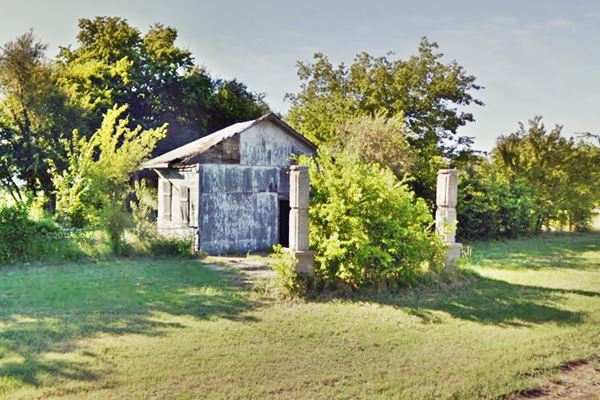
Route 66 passes through Afton as its Main Street, and on the western side of the town it runs sharply southwards and after 4 miles, it takes another sharp 90° turn westwards towards Vinita. At this last turn, is the old Springerville Gas Station.
>> red line in our custom map is the 1926-85 Afton to Vinita US66.
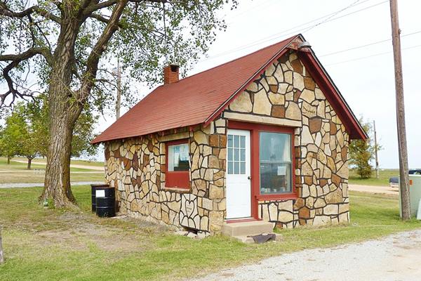
Ahead is McDougal Filling Station. built in 1940 by Grace and George McDougal. It was designed to look like a house.
Listed in the National Register of Historic Places
Historic McDougal Gasoline Station, Vinita
Abe Ezekowitz. Click image for St. view

Little Cabin Creek Bridge, Vanessa Ezekowitz Click image for street View
It is followed by he now closed Historic Little Cabin Creek Bridge.
Listed in the National Register of Historic Places
Built in 1934-5 to carry Route 66 across the Little Cabin Creek. It is closed to traffic. The bridge is 388 ft. long and is 24 feet wide between curbs. It consists of 8 steel stringer I-beam approach spans and a central 95-foot Parker Pony Truss. A new bridge was built to replace it, on the south side of the old one, so the highway bends soutwards.
>> black line in our custom map is the original roadbed and bridge at Little Cabin Creek
Vinita
Ahead the highway curves to the north to pass under I-44 and enter Vinita.
>> violet line in our custom map is US 66 into Vinita
This is the end of the itinerary at the eastern side of Vinita.

Some sponsored content
> > Book your Hotel in Vinita

Credits
Banner image: Hackberry General Store, Hackberry, California by Perla Eichenblat
Jack DeVere Rittenhouse, (1946). A Guide Book to Highway 66
Route 66 Maps. Oklahoma D.O.T.


