What can you drive of US 66?
Table of Contents
Index to this page:
- The Many alignments of Route 66
- What parts of Route 66 can still be driven
- Driving Route 66's existing segments
- Route 66 lasted for 59 years
- How was Route 66 eliminated?
- Route 66 reborn
- Route 66 Preservation efforts
The Many Alignments of Route 66
There isn't "one" alignment of Route 66. There are many, and most of them have survived. Below, we explain how these different alignments originated.
When the highway was created in 1926 as part of the U.S. Highway system, each state defined a course for it across its jurisdiction. This first 1926 to early 1930s course pieced together different state highways that had been paved in the early 1920s, or roads that were unpaved but were the best option to link towns along the course of Route 66.
These first roadways had zig-zagging courses with sharp 90° turns, followed by the "section line roads" that marked the lines used by surveyors to map the counties and towns. These were bypassed with straighter courses that both shortened the alignments and made them safer. Several cut-off alignments along the highway shortened it, like the El Reno cutoff in Oklahoma that eliminated the road through Geary and Calumet; or the Boise segment in Texas, or the one that cutoff Cubero NM, just to mention a few. These old segments were cut-off from the highway, some abandoned, some upkept as county roads
Later in the 1940s, towns were skirted with "beltline" or "bypass" alignments that avoided the congested commercial districts and "City" alignments that crossed them.
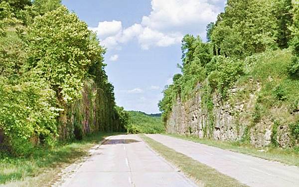
In the early 1940s, coinciding with WWII, some modern freeways were built to carry Route 66 like the surviving Historic Arroyo Seco Parkway in Los Angeles or the still driveable, but now bypassed Freeway in Hooker MO.
This segment in Hooker Cut can still be driven
From 1930 to 1950, several Alternate 66 alignments were created parallel to the "Main" one: Wellco Corners to Gardner near Chicago, Carthage MO, the one in Joplin MO, Oklahoma City, Alt 66 in San Bernardino, California, and the one leading into Los Angeles CA.
Realignments continued into the 1950s, like the one that bypassed Oatman, AZ to avoid the high pass across the Black Mountains. The highway was rerouted through Yucca in 1952.
After the Interstate system was created in 1956, Route 66 was aligned along it as it was built, like I-55 in Illinois, I-44 in Oklahoma, or I-15 in California.
What parts of Route 66 can still be driven
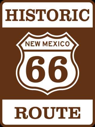
A New Mexico "Historic Route 66 Sign
Many original sections of US 66 have survived as state or county highways, freeway frontage roads, and as streets, avenues, or boulevards in the towns, villages, and cities that it went through.
It is these segments that can still be driven as they are correctly maintained and signed.
Many of them have signs that mark them as "Historic Route" followed by the state name and the US 66 shield.
Our website has a detailed US 66 Itinerary so you can start planning your route 66 road trip. And a Detailed Description of Route 66 with maps showing the alignments and the gaps in the old roadway.
We also describe the alignment that can be driven through each of the Towns on Route 66. Click on a town to learn all about what stretch of Route 66 can be driven there.
Maps showing what you can and can't drive of Route 66
Each of our website's Route 66 Maps show the alignments that can still be driven and those that are gone and lost forever.
As an example is the map of Route 66 through Oklahoma City, shown below where the sections that cannot drive are shown in black (segments now gone -cut by the freeway) and red (buried under the freeway). And in the other colors (Pale Blue and Green) are Route 66 segments that can still be driven.
Route 66 alignments into LA
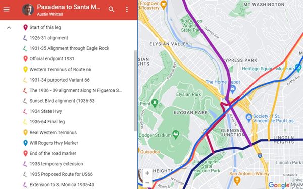
And you can check this same map on an interactive version here: custom map of Route 66 into Los Angeles
Read on below to learn more about the demise and rebirth of US 66. And how many sections of Route 66 survived for you to drive them.
Example of Driveable segments: California
Many people ask us:
>> How Much Of Route 66 Is Still Driveable In California?
Answer: Over 95% of Route 66 in California is still driveable.
Driving Route 66's existing segments
The surviving Roadway
Roughly 85% of the original Route 66 can still be driven. There are a few gaps in the old alignments where the old roadway is cut by the Interstate, and in the places where it is overlaid by the alignments of the freeways (I-55, I-44, I-40, and I-15). In these cases, you have to drive the freeway to bridge the gaps.
But in many places, the highway has kept its original course. The images below show Route 66 at the same spot in Valentine, Arizona; as it was in 1934 and as it is today. The same rock outcrop is on the right side of US 66.

US 66 in Valentine in 1934. Source
Visit our Road Conditions to learn where to find updated road information.
There are well-maintained segments, especially in the urban areas, where Route 66 became the Interstate Business loops or routes, and runs down the towns' Main Streets. In other sections, the old roadway became the freeway's frontage road and also has good upkeep. State highways usually numbered "66" or "Historic Route 66" are in general, in good shape; several of them have maintained a four-lane divided highway alignment since the 1950s.
There are also many miles of dual lane highway where one should drive with care, following the speed limits and overtaking only when it is safe to do so. Traffic along these sections is not what it was in the highway's heyday; it is mostly local traffic or Route 66 roadtrippers.
Nevertheless keep your eyes open at crossroads, and in urban areas, remember that Route 66 was "America's Main Street" and runs through the downtown areas of many towns.
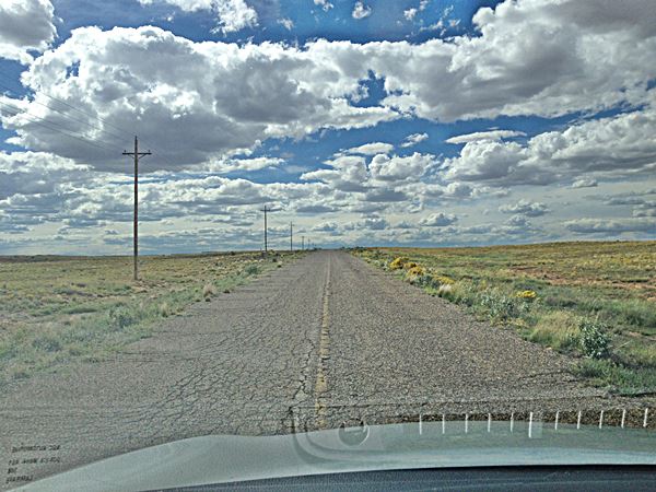
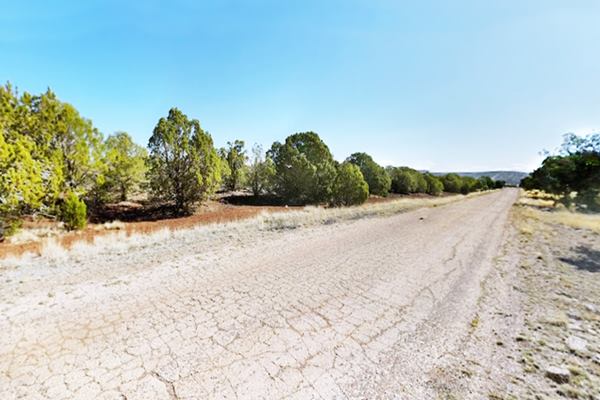
We drove a rough asphalt surfaced section from Suwanee to Mesita in NM along the 1926-50s Historic US Highway 66. It was cracked, uneven, and had some potholes, with overgrown shoulders and, in some parts, just plain dirt and gravel. Quite an experience! Below is a picture I took looking forward, through the windshield:
The original roadbed: Route 66 just west of Suwanee, NM heading towards Mesita:
Dirt or Gravel sections
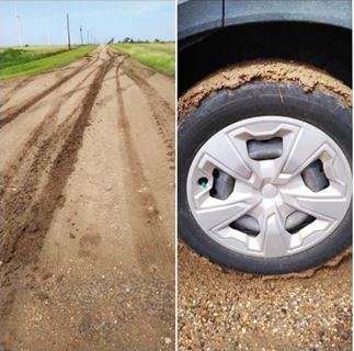
Mud at Jericho Gap, July 2021, Source
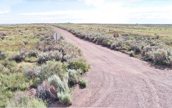
There are also dirt surfaced sections like the infamous Jericho Gap in Texas, the dirt road from Glenrio to Bard NM, where the original asphalt roadway was removed and replaced with gravel to reduce maintenance costs. Another unpaved section is the 1926-30 Route 66 alignment from Allentown to Sanders, AZ or the Petrified Forest segment in AZ near Holbrook.
Original Paved Roadway segments
There are many places along the highway where the original roadway has been preserved and can be driven.
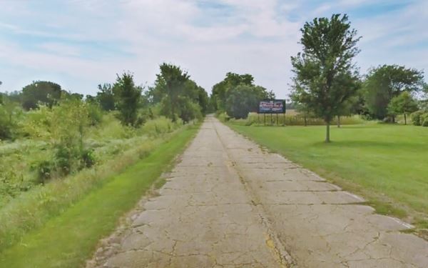
In other parts it is closed off.
1926 roadbed of Route 66 south of Salt Creek Lincoln, Illinois
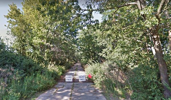
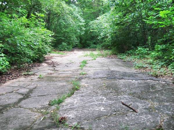
Or overgrown with shrubs and trees.
Route 66 by Carpenter Park (1922-1936) in Sherman, Illinois
Route 66 lasted for 59 years
US highway 66 was created in 1926 and was realigned many times: it was straightened out, paved, moved about; loops were cut off to shorten it such as the Santa Fe Loop in New Mexico, it was also extended (from downtown Los Angeles to Santa Monica on the Pacific Ocean).
Then, starting in 1940 it was gradually incorporated to freeways like the Historic Arroyo Seco Parkway in 1940 (the Nation's second freeway and the first west of the Mississippi River).
In the mid 1950s came the Interstate system to provide safer and more efficient highways and it was rerouted onto the interstate system.
This marked the beginning of the end for Route 66.
As the Interstate system advanced, Route 66 was decommissioned piecemeal between 1964 and 1985.
The process ended on June 27,1985, when the last remaining segment US 66 was decertified and removed from the federal highway system.
How was Route 66 eliminated?
Decommisioning of US 66 began in California in 1964
The first segment of Route 66 to lose its certification was the one located in Los Angeles County in 1964.
The western terminus of Route 66 was moved from Santa Monica to Needles.
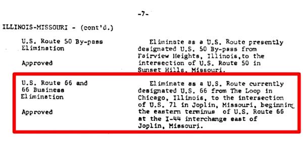
Route 66 is Decertified in Illinois and Missouri - 1974
Following the completion of the interstate system, on June 24, 1974, the American Association of State Highway and Transportation (or AASHTO) decided to move the eastern terminus of Route 66 from Chicago, Illinois to western Missouri, placing it close to Joplin MO. The new eastern terminus was located at I-44's exit 15 east of Joplin, in the town of Scotland MO.
Decertified in Illinois and most of Missouri - 1974
Arizona was next - 1979
The next step took place when the American Association of State Highway and Transportation (or AASHTO) decided to move its western terminus.
Three and a half years later, on June 29, 1979 the AASHTO moved it eastwards, all the way across Arizona, to Sanders. The Western Terminus of Route 66 would stay in Sanders until the whole road was eliminated in 1985.
US 66 Decommissioned in 1985
It was finally completely eliminated when it was decommissioned on June 27, 1985.
The American Association of State Highway and Transportation Officials voted decertify it:
"Elimination of U.S. Route 66 - APPROVED - Eliminate present U.S. Route 66 between the present beginning at Scotland, Missouri and the terminus at Sanders, Arizona."
That was it, it eliminated US 66 in Oklahoma, Texas, New Mexico, Kansas and the two short segments that remained in Missouri and Arizona.
Route 66 had officially disappeared.
Route 66 reborn
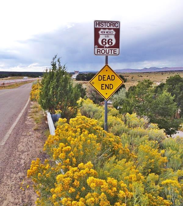
Although Route 66 no longer exists as a U.S. Highway, the efforts of the communities along "America's Main Street" have kept it alive. Many organizations and associations are dedicated to promoting Route 66 and preserving it, so that we can drive it today and in the future.
Not exactly a dead end, but a second chance!
Route 66 Preservation efforts
Thanks to them, we can still drive Route 66
It all began with Angel Delgadillo, a barber from Seligman Arizona.
When I-40 bypassed Seligman and Route 66 stopped bringing him customers, he took action writing letters, petitioning to the authorities, and prodding his colleagues to do the same.
He had a vision, make Route 66 into a Historic Highway to promote travelers to drive it.
He gathered business owners and on February 18, 1987 they organized the Historic Route 66 Association of Arizona.
They lobbyied the county authorities in Coconino, Mohave and Yavapay, as well as the Arizona state legislature and succeeded.
Drive Route 66 in California
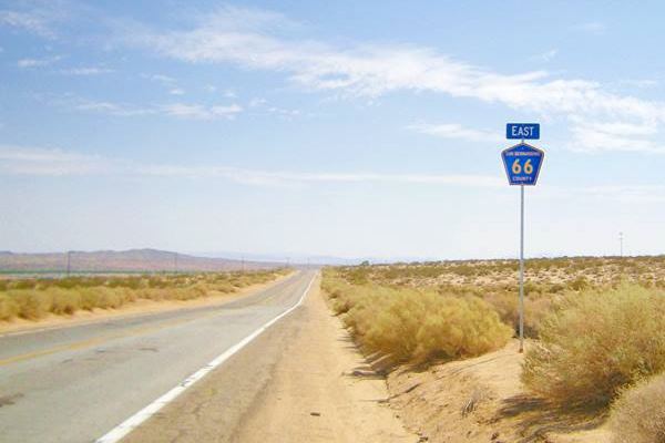
Barely two years after it was decommissioned, Route 66 was reborn when in November 1987, the State of Arizona declared the former section between Seligman and Kingman as "Historic Route 66" of Arizona.
It later extended all the way through Oatman to Topock, on the state line, becoming The longest remaining stretch of Route 66 in the Country: 159 miles (256 km) of original Route 66 that you can still drive.
His efforts were imitated, and other states folowed the example of Arizona.
Finally, in 1990, the US Congress passed the "Route 66 Study Act" which recognized the importance that US 66 had as a symbol of America and its values.
This Act of Congress authorized a study, conducted by the National Park Service to understand the importance of Route 66, which in turn led to the law that created the National Park Service Route 66 Corridor Preservation Program.
This program sources technical and financial help to preserve and protect Route 66 and its heritage so we can all learn from it, enjoy it and drive along it.
2020 Route 66 Centennial Commission Act
The President signed the "Route 66 Centennial Commission Act" in December 2020. This legislation creates a commission with members from each of the eight states along US 66.
The commission will work on securing funds to support the preservation of Route 66, and identify ways to honor the Mother Road on its 100th anniversary (this year, 2026). Read all about the planned celebrations at our Route 66 Centennial (1926-2026) webpage.
This year, as Route 66 celebrates its Centennial, we should also remember that 2026 also commemorates 41 years since it was decertified as a U.S. Highway.
>> Read more: Route 66 hasn't existed since 1985!
>> Did you know that you can Drive the whole of Route 66 in 7 days?

Sponsored Content
>> Book your Hotel in Hollywood

Credits and Further Reading
Banner image: Hackberry General Store, Hackberry, AZ by Perla Eichenblat


