Seligman where Historic U.S. 66 was born
Index to this page
About Seligman, Arizona
Facts, Trivia and useful information
Elevation 5,242 ft (1.598 m). Population 851 (2025).
Time zone: Mountain (MST): UTC minus 7 hours. Summer (DST) no DST⁄ PDT (UTC-7). In the 1940s, Pacific Time Zone began in Seligman.
Seligman is a town located on the northern border of Yavapai County, in northwestern Arizona. It has been called "a flat spot in the desert" due to its meadows surrounded by high mesas.
Northwestern Arizona has been inhabited for over 10,000 years. The Native American Havasupai (also known as Supai) and the Hualapai people were farmers who lived to the north and west of what is now Seligman in the Grand Canyon region.
Arizona was a province of the Spanish Empire in America but they never settled the area. They did however survey the copper mines near Jerome, AZ in the 1600s.
After its independence in 1821, Mexico assumed sovereignity over the territory but lost it to the U.S.A. after its defeat in the Mexican American War of 1846-48.

Jesse Seligman. Source
Lt. Edward "Ned" Fitzgerald Beale was commissioned by the U.S. government to survey and open a wagon trail from Ft. Smith (Arkansas) to California. He passed through what is now Seligman.
Once the US Army subdued the Navajo people of eastern Arizona in the 1870s, white settlers flowed west and a stage stop on the Mojave Road was established here.
The Atlantic & Pacific Railroad (later the Atchison Topeka and Santa Fe Railroad) reached what is now Seligman in 1882 and built a depot named "Prescott Junction" after the "peavine" railway (Prescott and Arizona Central Railway Co.) that linked Phoenix, Prescott with the main A.T. & S.F. line.
In 1886 it was renamed Seligman. In 1891 the Prescott rail link was moved east to Ash Fork to shorten it so Seligman became a large switching yard and cattle shipping center. Passenger trains ceased stopping in Seligman in 1984.
The Name: Seligman
It was named after Jesse Seligman (1827-1894), banker, philanthropist, born in Bavaria, Germany. He was one of the founders of the New York City bank, J.W. Seligman Co., who helped finance the construction of the railroad in the region.
His surname means "blessed man" in German and Yiddish.
James A. Lamport claimed his homestead her in 1895 and after he subdivided it, it became part of the downtown area as the Lamport addition.
By 1915 there was a road from the railroad depot to Cataract Canyon, a branch of the Grand Canyon with high red cliffs and waterfalls 67 mi. north of town.
The National Old Trails Highway was routed through the town in the 1910s and Route 66 used this alignment when it was created in 1926. The highway became a central part of the town's life (Read more about Seligman Commercial Historic District) until the town was bypassed by I-40 in 1978.
Rebirth: Birthplace of Historic Route 66
When the freeway drew the traffic away from the town, its economy slumped. Local residents led by Angel Delgadillo formed the Historic Route 66 Association of Arizona and persuaded the State of Arizona to list Route 66 as a Historic Highway.
This "saved" the Mother Road and restored some of its former glory. Now many nostalgia seeking travelers drive through Seligman to get their kicks on Route 66.

Your Hotel in Seligman
Find your room in the motels in Seligman (sponsored content):
>> Book your room in Seligman
More Accommodation near Seligman on Route 66
There are plenty of lodging options in the cities and towns along Route 66 east and west of Seligman; click on the links below to find your accommodation in these towns, listed from east to west:
Eastwards
In Arizona Along Route 66
Westwards
You are so close to Las Vegas and the Grand Canyon!
>> RV campground in Ash Fork and Grand Canyon Caverns
The Weather in Seligman
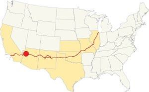
Location of Seligman AZ on Route 66
Due to its altitude Seligman is not so hot in summer as other parts of Arizona but it is lower and therefore has less snowfall than the higher cities of Flagstaff and Williams.
The weather is dry with average summer high (Jul) is a hot 92.6°F (33.7°C) and the average summer low is 56.3°F (13.5°C). During winter, the average high (Jan) is around 53°F (11.7°C) and the average low is cool 23.4°F (-4.8°C).
Rainfall is around 12.9 inches per year (328 mm). There are around 54 rainy days each year. The rainy season is July to September with 5.5 in (140 mm).
Snowfall is 11 inches (28 cm) starting late in October and ending in late April. On average there are 6 snowy days per year.
Tornado risk
This part of Route 66, to the west of the Rocky Mountains has no tornado events. Tornado Risk: read more about Tornado Risk along Route66.
Map of Route 66 in Seligman
Visit our Williams to Kingman page for the description of this alignment. Below is the color coded interactive map:
>> Custom map of Route 66 in Seligman
The thumbnail map below published in 1935 shows the course of Route 66 between Williams and Kingman.

Thumbnail of the 1935 Arizona highway map. Source
Click on thumbnail map to enlarge
We describe the alignment in detail in our William to Kingman alignment page.
Heading west from I-40's Exit 139 is the 1926 to 1979 stretch of Route 66. It is known as Crookton Road, there are several pre-1940s segments in this area One is at Crookton Hil: map of the old alignment we also mark it in our custom map of "old & missing segments" with an orange line.
The current roadway was built in the 1930s and carried Route 66 until 1979, but the original 1926 highway can still seen after the railroad bridge. This roadbed winds across the current road. We have marked it with a Pink line in our custom map.
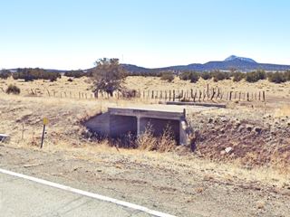
Among the shrubs and stunted trees you can make out the cracked concrete, sun baked asphalt and even some old culverts and concrete bridges (pictured below - click images for St. views).
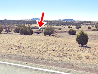
See this satellite view where the old cracked roadbed can be seen next to modern '66, we marked it with red arrows.
When the highway reaches Seligman it has two alignments: until 1930 it went along Railway Ave. and Main St., as shown in this Map. Later it was realigned along the current alignment on Chino Street.
This is the US 66 alignment in Seligman
Route 66 Alignment near Seligman
With maps and full information of the old roadway.
- Kingman to Topock (next)
- Williams to Kingman (Seligman's)
- Winona to Williams (previous)
Sights and Attractions in Seligman, Arizona
Birthplace of Historic Route 66
Historic context, the classic Route 66 in Seligman AZ
For those interested in the "good old days" of Route 66, Jack DeVere Rittenhouse's book, written in 1946, "A Guide Book to Highway 66" is a great resrource.
Rittenhouse lists the Seligman as follows:
Pop. 500... hotels: Havasu, Navajo, Central, and Seligman; courts: Deluxe and Court Royal; garages: Olson and Seligman; cafes... Seligman still retains much of its apperance of a cattle town, with its sidewalk awnings and even occasional hitching rails. Rittenhouse (1946)
By the way, hitching rails were used to tie up horses.
He added that the time zone changed here and that west of the town were the Deer Lodge cabins and the Hyde Park café and cabins.
A Busy Highway
A lot of traffic went through Seligman: at the end of 1937, the Arizona Highway Department reported that the number of cars traveling on Route 66 that year with out-of-state plates numbered 514,332.
But it took some time to improve traffic congestion in the town; only in 1963 did the Highway Department widen Route 66 through Seligman to four lanes.
Road Trip through Seligman
Into Seligman along Route 66
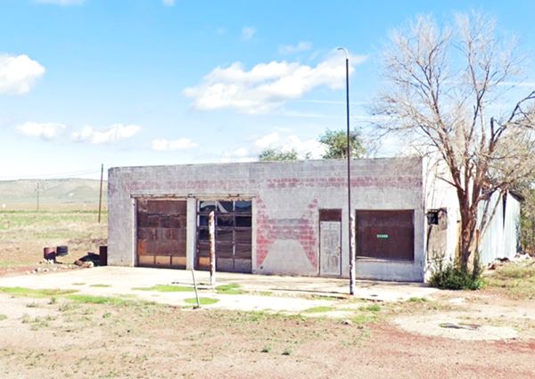
We will drive into Seligman coming from the east, from Ash Fork and driving west. After passing the rear end of the KOA campground (it faces the modern I-40 Bus. Lp. 1970s access from the Freeway) and the Bill Mar Den Motel, to your right you will spot an old Phillips 66 station.
Old icebox style gas station
The box-shaped building has two multipane glass service bays and a corner office. You can still make out the red harlequin diamond painted on the wall typical of a 1950s Phillips 66 service station.
Burma Shave Signs
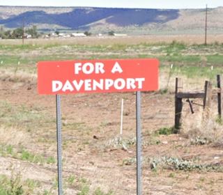
It is followed by a "Burma Shave" set of red signs with white letters that are designed to look like original Burma Shave advertising.
Burma-Vita was a company based in Minesota. Starting in 1926 with the creation of the U.S. highway system they began to advertise their "Burma Shave" shaving cream using these red signs. They spaced them some hudred feet apart, and each sign had a few words, that combined with the text on the other signs formed a rhyme.
This one reads: "If hugging on highways - is your sport - trade in your car - for a Davenport - Burma Shave" (Davenport is the name of a sofa ⁄ couch bed that could be slept on made by the now defunct A. H. Davenport Co. of Massachusetts.)
Other examples of Burma jingles: "Are your whiskers - When you wake - Tougher than - A two-bit steak? - Try - Burma-Shave" and "The bearded lady - Tried a jar - She's now - A famous - Movie star - Burma-Shave."
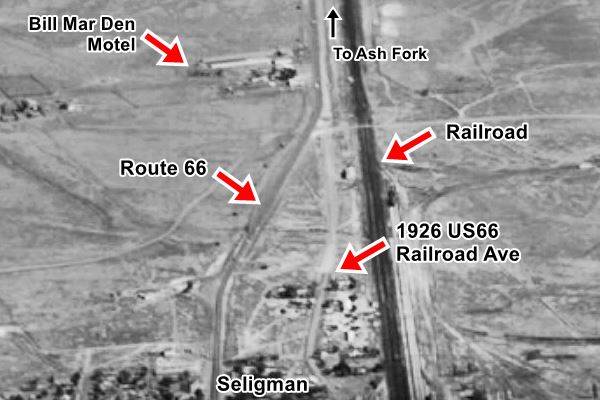
Along this section, to your left, between the railroad tracks and the highway is a dirt road, Railroad Ave. that was the original 1926 Route 66 access into Seligman. Ahead when you reach the Stop sign turn left to visit the motel and an old gas station, both facing the access road to the freeway.
Below is an aerial photograph looking east. You can see the original US66 along Railroad Ave., the motel and the 1930s Route 66. I-40 Bus Lp. hadn't been built at that time.
See this satellite view of the same spot nowadays.
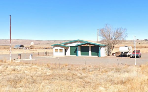
As you drive east you will see, to your left an old gas station:
Gulf gas station
The gas station has Ranch Style influences and may date back to the late 1960s; a low-sloping three-part front-gabled roof, with secondary gable inset for the office and the two service bays on the right. Two pump islands and two 1970s gas pumps.
Bill Mar Den Motel (Stagecoach Motel)
To your right, facing the Gulf station, at 21455 West I-40 Business Loop. The Stagecoach 66 Motel is still operating. When it opened in the early 1960s, it was known as the "Bill Mar Den Motel." It had 44 air conditioned units, heated pool and shuffleboard. It was the location of a Ford TV commercial back in the 60s.
It originally faced Route 66, the postcard below shows its entrance on US66 in a Then and Now sequence. When W I-40 Business Loop opened, the sign and entrance were switched to the northern side of the property. The red arrow marks the same hill far to the north.
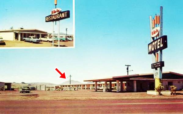
Same hill in the distance in both images (red arrow). Nowadays a large tree grows next to where the neon sign once stood.
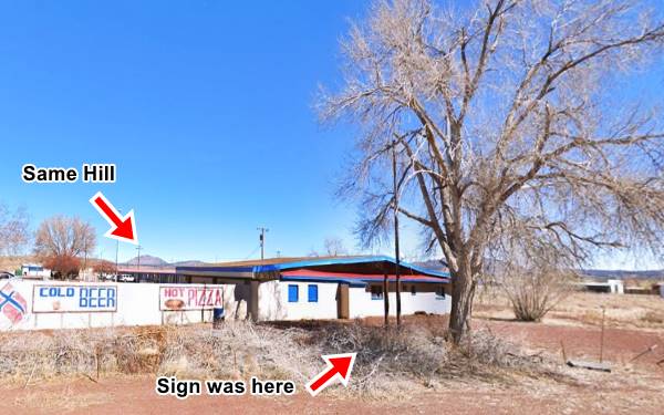
The motel has an iconic space-age Googie style neon sign, a tribute to the designers of the 1960s.
Betty Boop standing with a pizza held high was painted on the base of the sign recently, anothe example of Route 66 Americana.
Googie Architecture
Pronounced "gu:jee", it was a form of modern building design inspired in the Atomic and Space ages.
It its main features are the use of geometric shapes, vast glass surfaces, symbolic motion designs (atoms, boomerangs, wing shapes, disks) and Space Age themes.
It appeared in California in the late 1940s and was popular until the mid 1960s. Cafes, motels, and service stations sported these modern designs.
Site of the Whiting Bros station
Turn around and head west into Seligman. After the junction with Route 66, are the city limits and the site of the Whiting Bros. gas station, long gone. Below is a photo from 1983 and the current view of the same spot. The station was to your right (see the spot).
Read more about Whiting Bros. & Route 66
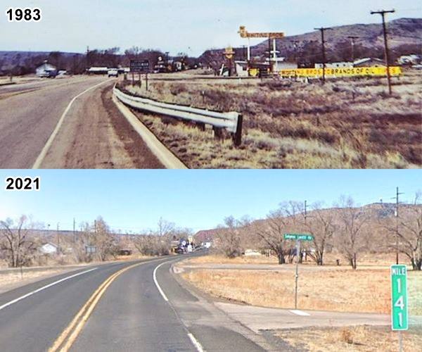
The town begins here. Click on the thumbnail image it is a 1960s postcard looking west along Route 66 across Seligman, we marked the surviving buildings on the north side of the highway.
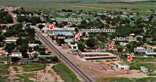
Air view of Seligman (looking west). Source
Click on image to enlarge
Standard Gas Station
To your right, hidden behind the containers, to your right at 22133 W Old Hwy (Acme Mobile Storage) is the old icebox gas station you can see it on the lower right side of the aerial view.
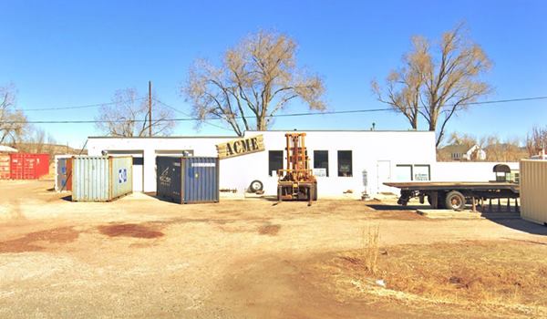
Aztec Motel
Next to the old gas station, to your right at 22200 Route 66. The first building here was built in 1915 by Juan Delgadillo (the uncle of the Juan who owned the Snow Cap further down the road); he ran the motel with is wife, Pancha. The place also had a small gas station and a restaurant.
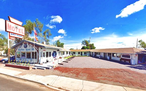
It changed hands in 1955 and was modified; it has remained unchanged and in operation ever since. As you can see in the "Then and Now" images below even the sign is unchanged:
A vintage postcard of the Aztec Motel
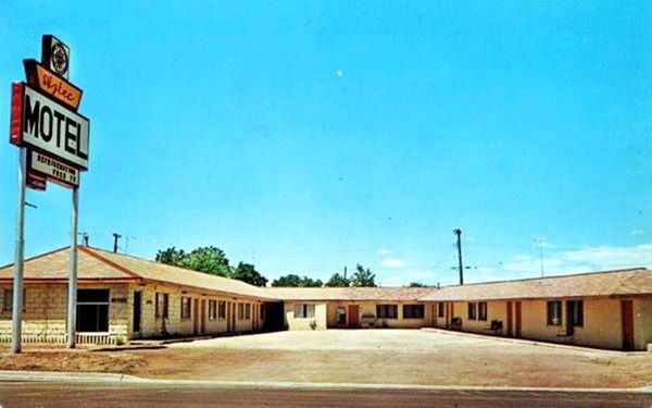
The postard says: "Aztec Motel is located half way between Hoover Dam and the Grand Canyon on U.S. Hwy. 66." Now murals cover the units' walls:
City Tour in Seligman: walking tour of the Route 66 classics
Seligman Commercial Historic District
Listed in the National Register of Historic Places
The Historic District

Supai Motel neon sign. Source
The downtown area was centered around the railroad station, on Main and Railway Ave. one block to the east. The original town
grew along both of these streets and westwards along Chino Ave.
There was a Harvey Hotel by the station (demolished in 2008) and the Havasu (mentioned by Rittenhouse) on Main and Railroad Ave. (also gone), built to cater to those traveling by rail.
The National Old Trails Highway was routed along these streets in the 1910s and Route 66 in 1926. However, when Route 66 was realigned along eastern Chino Street in 1933, the commercial buildings followed it: Car dealerships, service stations, curio shops, and motels were built along it. This is what (in part) survives until this day as the "Seligman Commercial Historic District."
It had its boom period for three decades until 1963, when news of the new Interstate that would bypass Seligman stopped all new commercial construction in town.
Park your car and get ready for a short walk. Start your tour at the eastern tip of town, across the street from the Aztec Motel, on the southeastern corner of Route 66 (East Chino St. and Lamport).
Snow Cap Drive-In
At 301 East Chino Street (East "Historic Route 66"). This is a "mom and pop" Route 66 Café that used an eye catching parapet on the roof with ice cream cones decorating it.
Juan Delgadillo and his family built it in 1953. He became part of the Snow Cap Drive-In chain of Prescott Arizona and sold their ice creams until the company went broke in 1997. Juan negotiated with them and became owner of the brand name, the last Snow Cap in operation.
Delgadillo's Snow Cap Drive-In nowadays
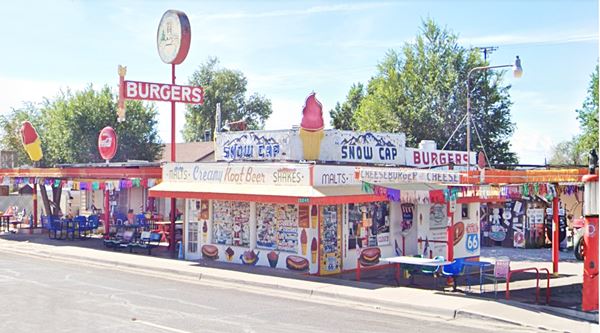
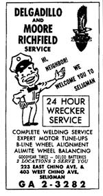
Telephone directory advertisement.
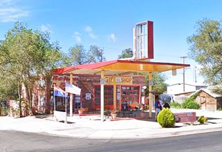
Old Richfield Service Station
Walk west. Ahead to your left is an old gas station, now J&R Mini Mart and Café. It was built in 1949 as the Richfield Gas Station and Garage owned by Joe Delgadillo with Moore (they had another station on the west side of town). During that period it switched brand to Mobil.
When traffic dropped after I-40 opened the store became a grocery, a Thai restaurant, and finally a gift shop and mini-mart.
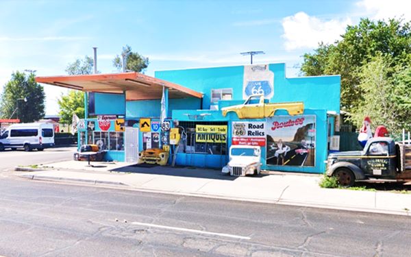
Notice the canopy over the gas pump port is still in place. Next to it, to the west, is the original Texaco gas station sign that belonged to the service station that was in front of it, across Route 66, on the westbound traffic side of the street.
Angel & Vilma Delgadillo Gift Shop
At 22265 W. Historic Route 66. It was built in 1914 and has two residences. Angel Delgadillo set up his pool hall and barber shop there in 1972 with a striped barber pole on the facade! In 1987 it became the office of the "Historic Route 66 Association of Arizona" and this prompted Angel (founder and president of the Association) to sell Route 66 souvenirs in his shop. This new business grew and took over the old pool hall part of the store.
Court Deluxe
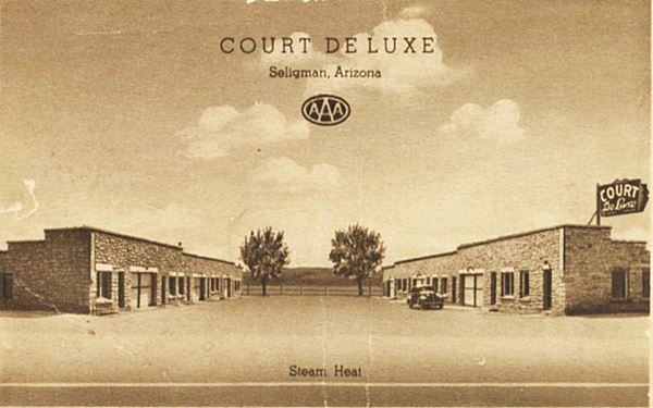
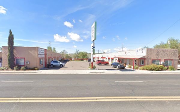
The adjacent house (right - west) was built by Frank Campbell in 1925. He also built the motel next to itin 1932. The old "auto court" is set on the NE corner of Floyd St. and Chino St. at 22295 W. Historic Route 66
It has been catering to travelers ever since, first as the "Court Deluxe" and later as the "Deluxe Motel" and the "Deluxe Inn".
Its 1930s postcard says: "Steam Heat. Back of card: COURT DE LUXE, new, fireproof, on U. S. Highway No. 66 at SELIGMAN, ARIZONA. Two hours drive to the scenic Grand Canyon, three hours to Boulder Dam. Quiet, restful, attractively furnished, fireproof. Steam heated rooms with or without tub or shower baths and kitchenettes. For one or the family. Closed garages. Popular prices. Robert Jones, Manager." Below is a Then and Now set of images:
Olson's Shell Station
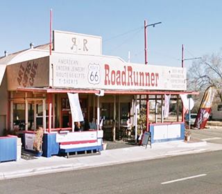
Across the street, on the SE corner of Floyd you will see the refurbished remains of an old Shell Service Station built in 1961. Olson also owned the station across the street (now Roadrunner gift shop). Olson's Shell, now a gift shop. Notice its butterfly canopy and the brick two-bay building.
Originally a Mobil station stood here.
Rusty Bolt
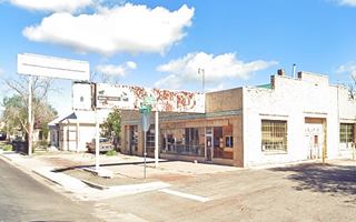
Next door to it is the "Rusty Bolt" with its unusual facade in a building from 1933, used over the years as a dry-cleaners, 24-7 restaurant and nowadays a curio shop with mannequins decorating it, even on the second floor.
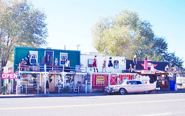
There is a vacant lot next to it, where a cafe stood until it burned down in 1962.
Former double dogleg at Route 66 and Main St.
Head west and the next corner has gone through many changes over the years: Route 66 had two sharp 90° turns, a set of offset doglegs at its junction with Main Street.
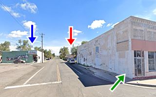
On the NW corner was the aptly named "Corner Bar and Hotel", it was built in 1928. A fire razed it in 1962. To the east, along Main was the Morris Cafe. The image below looks north along Route 66 the blue arrow marks the old Corner Bar and Hotel, the red arrow marks the Pitts & Washington Central Commercial; the dashed line is the built area that was removed north of Main St. when Chino Ave. was widened to four lanes in 1963.

Route 66 widened
In the late 1950s and early 1960s traffic was congested in Seligman and the two offset doglegs at Main added to the problem. After the Corner Hotel burned, two additional lanes were added to Chino, on the south side east of Main, and on the north side west of main, this eliminated the two sharp turns.
Beale Trail Marker
There is a small gazebo on the corner in a tiny park. The marker next to the gazebo (Street view). Its inscription remembers the expedition led by Lt. Edward Beale between 1857 and 1860 that used camels for pack animals; its goal was to build a wagon road that was used until 1883.
The trail runs north of Seligman and the deeply rutted trail can still be seen there.
Copper Cart
Cross Main, on the south side of the street is a restaurant was built in 1952 at 103 W Chino Ave. The postcard below, from the 1960s advertises it: "THE COPPER CART RESTAURANT in Seligman, Arizona This is a delightful spot to stop for a meal when you are driving along U.S. Highway 66. With food comparable to that found in fine city eating places and with its clean and attractively decorated cafe and dining room, you'll want to make it a point to stop here for a meal."
See how it looked in the mid 1960s (date guessed, based on the cars parked in front of it).
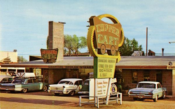
Same sign is there, but was moved to the corner
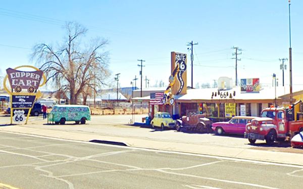
Next door is a building that is over one hundred and ten years old:
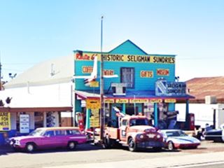
Historic Seligman Sundries
At 115 East Chino St. The building dates back to 1905, when it was the Pioneer Hall Theatre and Dancehall. When Route 66 opened in 1926 it switched to become a Soda Fountain, Trading post, and drugstore: Ted's Fountain Trading Post. The postcard below, from the 1940s gives us an idea of what it sold: "Seligman AZ - Ted's Fountain Trading Post: Famous For Malts. RT66-2113", and on the back: "Navajo Rugs, Curios, Sundries. Back of card: The home of Ted's famous Malts is located halfway between Grand Canyon and Boulder Dam on Highway 66. Dealers in Navajo rugs and jewelry, Indian baskets and curios of many tribes. Elevation 5260. Distances from Seligman."
During the 1950s it had a neon sign shaped like a thunderbird. Now it became a curio - souvenir shop and coffee house, the Historic Seligman Sundries.
An old postcard (1940s) of Ted's Fountain Trading Post
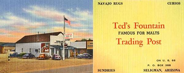
Close up of Seligman Sundries store
Seligman Garage
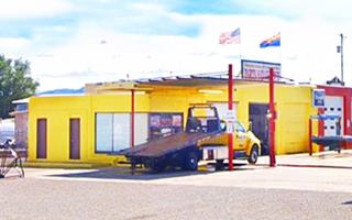
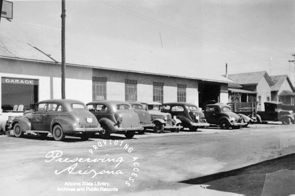
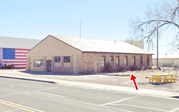
Next to the Sundries store is a large stone building with multi-pane windows and a gable roof. This is the "Seligman Garage" mentioned by Rittenhouse in 1946. Over the years it has been a Chevron station, Standard Oil station, garage with towing service, and even a Studebaker agency. It was built in 1934 by Cook, Sykes and Lamport.
Looking east at the garage in the 1930s.
Same wall nowadays. The buildings to the south (right) have been torn down, and the old service bays' entrances have been walled up and more windows added, but the building is the same:
Walk Back
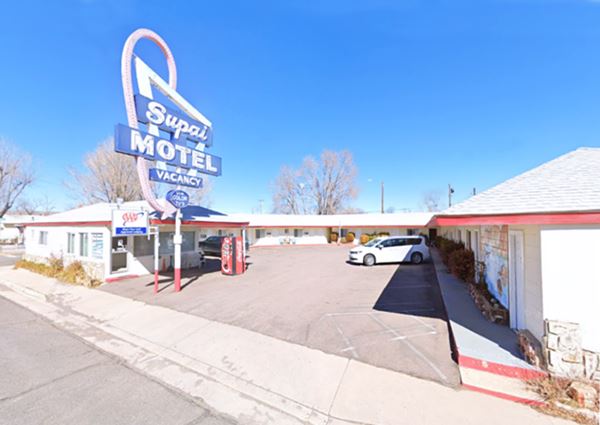
Now cross the street to its northern side. Here is the Supai Motel.
Supai Motel
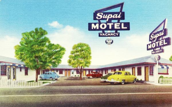
On the corner of Route 66 and 1st St. at 22450 Route 66. This is an iconic Route 66 motel with its distinctive neon-light sign. It opened in 1952
>>You can Book a Room in this motel.
The early 1950s postcard below states: "SUPAI MOTEL SELIGMAN, ARIZONA. Phone - 953. Seligman's newest and finest motel. (In center of City on Highway 66.) Tile baths, tubs or showers. Air-Conditioned by Frigidaire, panel type heat. Franciscan furniture, spring air mattresses, carpeted floors. Owned & Operated by Mr. and Mrs. H. Lanier."
A late 1950s postcard of the Supai Motel
Cottage Hotel
Take a short detour to visit a historic hotel: Walk west passing in front of the Supai Motel, take a right and head one block north along to 1st Street and then northwards along it tp the first corner (Schoney Ave), on the NW corner is the "Cottage Hotel" Built in 1912, it is a registered historic building owned by the Seligman Historical Society. The 1940 Arizona Highway magazine mentioned it. It is slowly deteriorating (compare its current appearance below with this 2011 street view).

Vintage 1915 photograph of the Cottage Hotel. Source
Nomad Motel
Postcard motel, Seligman AZ
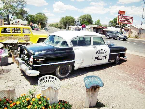
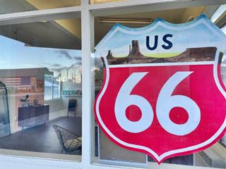
Return to Route 66 head east and following the Supai is another Motel that when it was builot in 1962 it was called the "Nomad Motel". It was renamed in 1970 as the "Romney Motel", and is still open and since 2022 is the "Postcard Motel".
There were two other Nomad motels on Route 66, one in Ash Fork AZ, the other in Needles CA. They had an Arabic style in its neon sign, bulbous domes over the office, and crenelated parapets on the units' buildings.
>>You can Book a Room in this motel.
Black Cat Bar
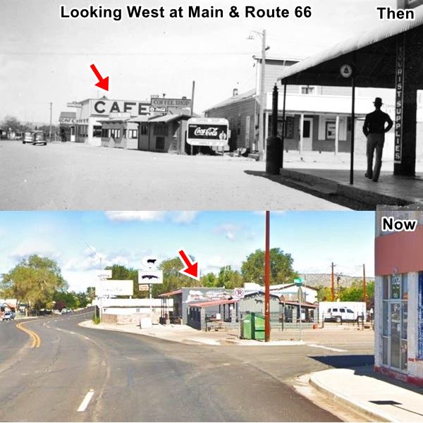
Next to it is what remains of the "Black Cat Bar. Tom and Maude Jolly owned the "Black Cat Café" on Railroad Ave. but when business moved to Route 66 they did the same in 1935.
F. Hyde bought it and renamed it the "Black Cat Buffet".
When US 66 was widened through town in 1963 the original building was torn down to make way for the new westbound lanes. But a new building had been built behind it. It's still in operation.
The image below shows a "Then and Now" sequence looking west from Main and Route 66 in the 1930s and now. The red arrow marks the Black Cat Bar. The building on the right is still standing and we describe it further down.
Main Street
Ahead is the corner of Main Street. You will spot two buildings along it: one on the northwest corner, now a grocery (Blue arrow in the images below) at 100 North Main St. Notice the Seligman mural on the wall. The second building is across Main Street, the Old Post Office; a brick building with corbels on its front and side walls (Red arrow).

A 1940 photo looking along N. Main St. from Route 66. Source
Pitts & Washington Central Commercial
The old theater to the left of the 1940s image is gone. On the northeastern corner of Main St. and Route 66 (Green arrow above) is one of the oldest buildings in Seligman, Central Commercial store.
Pitts & Washington store was built by Jim Pitts in 1903. When Route 66 opened in 1926 it was acquired by the Commercial Company of Kingman and renamed Central Commercial. As you can see below, after closing in the early 1960s it lost its canopy.
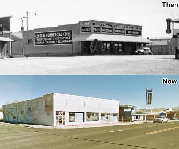
Next door is the Canyon Lodge; it opened as the Moki Motel at "114 E Chino Ave." in 1962. In 1970 it became the Canyon Shadows. Now as the Canyon Lodge it still caters to travelers with Elvis, Marilyn Monroe and John Wayne themed rooms,
Olson dealership and Shell Gas Station
Next to the motel was a garage (Dr. Connor's Shell and Chevrolet agency - see it in this 1941 photo looking east along Route 66 and incorrectly captioned as being taken in Ash Fork). It later became Olson Chevrolet dealership. It also had a Shell filling station (facing the one on the eastbound lanes). It was also the place where Greyhound busses stopped in town. It dates back to 1933 and after closing in 1985 it reopened in 1998 as the Road Trip Museum ⁄ Return to the 50s Gift Shop. Below is a "Then and Now" set of pictures (notice the same canopy and signpost!):
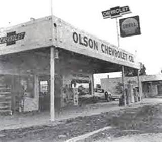
Olson Chevrolet and Shell c.1960. Source
Wilkinson Ford and Texaco Station
Head east, and on then next block at the corner with Floyd St. at 222 East Chino St. is a former Texaco station.
Built in 1936 it has housed many buildings but served mainly as a Texaco Station during the heyday of Route 66. It was also Donovan's Garage and later Wilkinson's Ford dealership (pictured below):
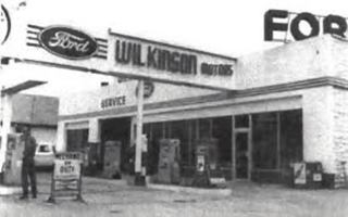
Wilkinson Ford and Texaco c.1960. Source
The whitewashed sign on the western side of the property is the original one, and you can make out the ghost word "TEXACO" under the white coat of paint.

Your walking tour ends here. Return to your car and drive west.
West side of Seligman
Old motel and gas station
Drive by the sights you saw on your walking tour and, ahead after passing the Supai, to your left, on the third block you will see the remains of an old gas station and motel.
You can see the station's pump island, office and lights. The units to the left have enclosed garages. We haven't been able to identify the names of the motel or the filling station, and the numbers along Route 66 have changed over the years. There was an "El Camino Motel" on this side of the road, at 227 W Chino Ave. in 1960

Another old Texaco
Across the street, to your right, on the corner of Route 66 and Indian School St. is another service station. Below is a "Then and Now" sequence of Seligman's Chino St. here, looking eastwards. The Texaco is on the left side of the image:
A Photo from 1947 showing Route 66 in downtown Seligman
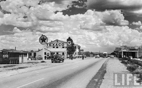
In the photo below you can see the western side of Seligman, looking east along what then was a two-lane highway. The street was widened in mid 1960s and many of the buildings on the right side of the road lost the overhangs on their facades. The red arrow shows the old Texaco nowadays, and ther two story building behind the Texaco is a now gone motel. In the distance, behind the bus is a building that stood on the northeastern corner of Main and Route 66, where the highway had two right angle turns, the Corner Cafe and next to it the Home Cafe To the right is the West End Mobil gas station and garage.
The same spot on Route 66 today
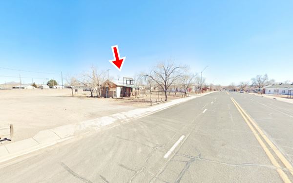
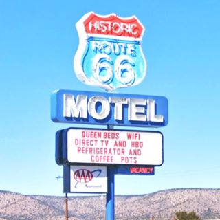
Navajo Motel now the Historic Route 66 Motel
The Navajo stands at what was 420 W Chino Ave in the early 1960s (now 22750 Route 66), its postcard tells us: "NAVAJO MOTEL 15 Deluxe Units - individually controlled heat - tiled showers. Phone: 784 Mr. and Mrs. E. A. Shipsey Owners and Managers."
Its long and low layout hasn't changed (compare postcard below with its Currrent apparance). Now it is the "Historic Route 66 Motel" with a great neon sign:

Vintage postcard Navajo Motel. Source
>>You can Book a Room in this motel.
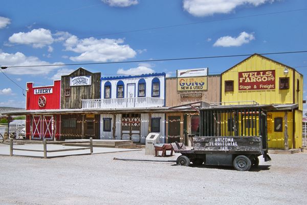
Next to it, passing the Roadkill Cafe with mock wild west buildings in its parking lot (pictured below), to your right at 452 W Chino was the B&H Texaco. Still standing (see picture).
Facing the old Navajo motel at 427 W Chino was the 17-unit "Court Unique" motel (torn down) located where the Family Dollar and the post office building now stand. To its right was Harold Johnson's Chevron at 427 W Chino (earlier Jack Lanier's) and on its left side was Delgadillo and Moor's second Ritchfield station (403 W Chino).
Leaving Seligman
A 1951 roadmap of the Seligman to Kingman US 66, Truxton does not appear (it was founded that year).
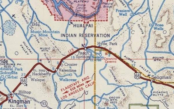
Head west along Route 66 from downtown Seligman. At the western tip of town the 1926-30 alignment turned south (on the west side of the modern Chevron gas station located there by the entrance ramps to I-40) and crossed the tracks. We describe this alignment in our special page about Route 66 from Williams to Kingman and marked the old aligment with Navy Blue line in our custom map of Route 66 in AZ (west of Seligman).
The highway runs to the left of a mesa known as Aubrey Cliffs, a red sandstone formation and then descends into the wide Aubrey Valley named aftger a Santa Fe Railroad pathfinder.
Pica Motel and Gas Station
After driving 18.7 mi. west of Seligman, to your left you will see some trees and the 1946 Pica Motel, named for the nearby railroad siding. It was not mentioned by Rittenhouse as it was completed after his trip through the area. There was a gas station here and a motel both still visible on the private property. Old whitewashed motel sign still standing. See it in this 1974 aerial photo and this street view.
Deer Lodge
The 1940s to 1979 road runs in a long straight stretch through Aubrey Valley passing by Rittenhouse's "Deer Lodge" (17 mi.), on the south side of the highway. Deer Lodge had "Cabins and gas." They are long gone, only rubble and the driveway remain (Street view). Just two miles ahead is "Hyde Park", to the right on a rise at the west side of Aubrey Valley among juniper-covered hills.
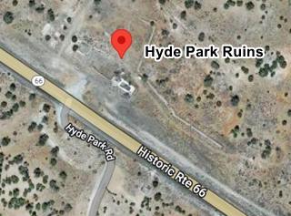
Hyde Park
Rittenhouse mentioned it as a Café with cabins and gasoline.
It's slogan was "Park your Hide at Hyde Park" and was the nearest lodging to the famour "Yampai - Coconino Caverns" (now the Grand Canyon Caverns). All that remains of it are the
foundations and rubble as you can see in the satellite view below.

"Zoomie" the apatosaurus in Grand Canyon Caverns, your next stop.
Continue your Road Trip
This marks the end of your Route 66 road trip in the Seligman, head west and visit the next stop on your journey: Grand Canyon Caverns.
Outdoors, National and State Parks
Diamond Creek and the Grand Canyon
The Grand Canyon and the Colorado River are located to the north of Seligman and accessible through neighboring Peach Springs. The Grand Canyon gorge here is 2,000 ft. (600 m) high and Diamond Creek, an intermittent stream, flows into the Colorado River at this point, flowing through the Hualapai reservation.
It was for many years the main tourist spot on the Grand Canyon, as it was one of the few places where the Colorado River itself could be reached easily, and there was a hotel at this spot, the Diamond Creek Hotel.
All this came to an end when the railway link was built between Williams and the Grand Canyon in 1907.
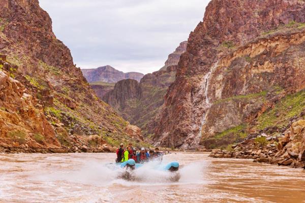
The Diamond Creek Road (dirt & gravel road) runs along the creek's canyon and provides the only access to the Colorado River between Lees Ferry and Pierce Ferry. The Hualapai tribal government charges a fee for all vehicles and people traversing the road (about $30 ⁄ person). Map of the road from Seligman.
Be careful with Flash Flooding during the rainy period. It can be dangerous and damage the road. The road is better suited for SUVs (don't take a rented vehicle along it as it may violate your rental contract).
Hualapai River Runners
Diamond Creek on the Grand Canyon is where the whitewater rafting trips start out from; you can book one-day Colorado River trips or whitewater rafting tours at the Hualapai Lodge. From March through October.
See a 360° view at Diamond Creek on the Colorado River
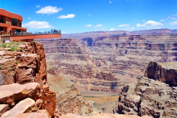
The Grand Canyon Skywalk
Opened in 2007 it is within the Hualapai Tribal land. It is a transparent horseshoe-shaped bridge that curves out and above the Grand Canyon 4,770 ft (1.450 m) above the Colorado River.
The best way to reach it is taking a tour as the roads are not in top conditions.
Read more at the Skywalk website.
Grand Canyon Skywalk
Lake Havasu City
Some sponsored content

Lake Havasu City, the lake and London Bridge. Source
The resort town of Lake Havasu City on Lake Havasu has beaches along the lake's scenic shoreline, an active nightlife and the original London bridge (you can take a Tour to visit it)
The adjacent state park is open 24 hs, and there is an entrance fee. It is located on a reservoir on the Colorado River. You can hike and enjoy the riverside.
Visit the scenic shoreline with beautiful beaches, nature trails, boat ramps, and many convenient campsites.
>> Book your Hotel in Lake Havasu City
Learn more about the outdoor sites in the Havasu State Park official website.
>> Book your Hotel in Ash Fork AZ


Credits
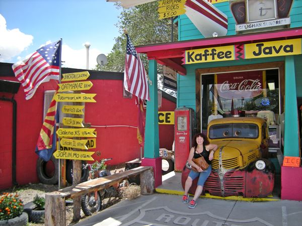
Banner image: Hackberry General Store, Hackberry, Arizona by Perla Eichenblat
Jack DeVere Rittenhouse, (1946). A Guide Book to Highway 66.


