Table of Contents
Index to this page:
- This segment on Route 66: California itinerary and maps
- Historic background of this segment
- The Arroyo Seco River
- Figueroa Street Tunnels (1931-35)
- Figueroa Street Bridge (1937)
- Arroyo Seco Parkway's construction (1935-1940)
- Extended south into Los Angeles across Elysian Park (1940-43)
- Four-Level Interchange (1949-1964)
- Terminus moved in 1964 From Santa Monica to Needles
- Hotels
>> See our custom and interactive Map of this segment with the alignments from Pasadena to Santa Monica
And our other two custom maps:
This Segment on Route 66
California Route 66 Itinerary and maps
Each leg of Route 66 described below has an interactive map and many image maps so you can follow the alignments of the highway along the way:
- Topock to Barstow - Map of this segment
- Barstow to Pasadena - Map of this segment
- This leg: Pasadena to Santa Monica - Map of this segment
- Santa Monica End of the Trail!
Pasadena to Los Angeles Route 66: the alignments before Arroyo Seco Parkway
Historic Context
1880s-1910s
The first cities in the San Gabriel Valley and along the Arroyo Seco River were established in the 1880s when a rail network was built between them and Los Angeles.
The Atchison Topeka & Santa Fe railroad and the Southern Pacific railroad were the main players. The towns had streets, and some dirt trails linking them with the surrounding farmland.
The Pacific Electric Railway Co. streetcar system was owned by Henry Edwards Huntington (1850 - 1927); it was also known as the "Red Cars" (after the color of the streetcars) and was a system of electric streetcars and buses that linked Los Angeles with its suburbs. Along Route 66 it reached San Bernardino. It was the largest electric railway system in the world in the 1920s.
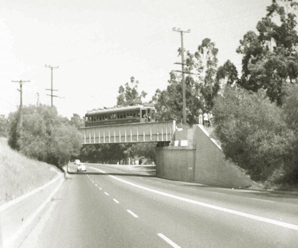
The first streetcars reached Pasadena in 1895 and ran along a short stretch of the Arroyo Seco River from York St. in Garvanza, Los Angeles to South Pasadena.
As cars became popular after the 1940s, it lost customers. It declined gradually, closing lines and ceased operating in 1964.
Starting in the late 1880s, the state of California enacted laws to build and maintain highways. This was funded with special appropriations, but funds were generally insufficient, so starting in 1909 the state started issuing bonds with the goal of creating an interconnected state-wide highway system.
At that time, in the 1910s the use of automobiles had grown and there was a nation-wide movement promoting better highways that could be driven by cars.
Private groups were formed like the Lincoln Highway and the Ozarks Trail associations and they lobbied for, built, and signed "trails" across America.
One of these groups was the "National Old Trails" (N.O.T.) Association whose goal was to build a highway linking New York with Los Angeles. The Automobile Club of Southern California (ACSC) published maps showing its alignment, like the one in the image, printed in 1912, that shows the N.O.T. highway as it enters Los Angeles.
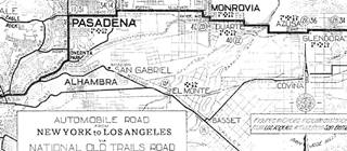
1912 N.O.T. Road map
Click on image to enlarge.
Source
1910s - 1920s
These associations got the federal government involved in 1916 and federal funds were provided to the states to build an interstate highway system. It was reorganized after 1918 and by 1921 it contemplated that the federal government provide financial aid to the states so that these could build highways. There were some restrictions on how to apply these funds, but it helped develop the highway system.
In 1926 the interstate highway network was organized into a coherent numbering system and that was when U.S. Highway sustem was born and U.S. 66 with it. 1
U.S. designated highways were built and maintained by each state, but their alignment and terminal points were agreed upon with the Federal authorities, the Association of State Highway Officials (AASHO). The staff in Washington DC had to give the final approval for new highways, realignments, and also kept the system working coherently.
The AASHO had been founded in 1914, and it changed its name in 1973 to American Association of State Highway and Transportation Officials (AASHTO).
It is interesting to point out that the first highway markers didn't appear on California highways until January 1928, and this work was done by the Automobile Club of Southern California a in this area, at its own cost. Only in 1934 was the California Division of Highways given the authority to sign highways. 2
Route 66 Alignment into Los Angeles
When U.S. Highway 66 was created in 1926 it made sense to align it along the existing state highways that generally followed the N.O.T. alignments. So, westwards from San Bernardino all the way to Pasadena, it followed State Route 9, a highway had been created in 1910 under the first state bond issue. 3

Detail 1930 US 66 map
Click image to enlarge
See the full map
The image shows a 1930 map with the course of Route 66 from Victorville to Los Angeles. Notice the detail showing the alignment into Pasadena and onwards into Los Angeles. However, both of these maps are how the map-makers interpreted the alignment of the highways, which may not correspond to their "real" or "official" courses as defined by the AASHO, the California Highway Commission (CHC), or the Cities themselves, who until 1933 defined which streets the highways ran along.
1926: Route 66 is created. The Los Angeles Terminus
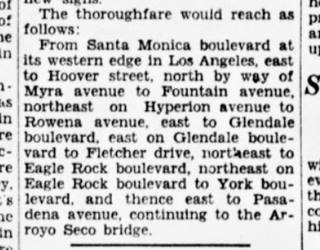
1929 article with Route 66 alignment in LA. Source
Click on image to enlarge.
By 1929 the AASHO, CHC and LA city council still hadn't aligned the highway, but the local media seemed to know its course.
An article published by the Eagle Rock Advertiser in 1929 4 gave the following alignment for Route 66 "This is a new highway grouping that will lead to the east. It begins with Santa Monica boulevard, uses Fletcher drive, Eagle Rock boulevard, York Boulevard, Monterey road..."
This course coincides with the one reported by the Santa Monica Outlook in June 1929 (see the image): "From Santa Monica boulevard at its western edge in Los Angeles, east to Hoover street, north by way of Myra avenue to Fountain avenue, northeast on Hyperion avenue to Rowena avenue, east to Glendale boulevard, east on Glendale boulevard to Fletcher drive, northeast to Eagle Rock boulevard, northeast on Eagle Rock boulevard to York boulevard and thence east to Pasadena avenue, continuing to the Arroyo Seco Bridge." 5
>> We marked this alginment with a red line in our custom map of the Route 66 alignments into Los Angeles.
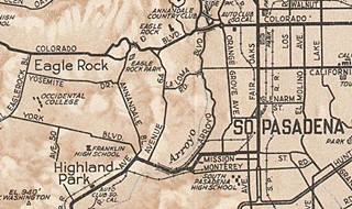
1930 map Los Angeles. Source
Click image to enlarge.
The highway crossed from Los Angeles (west to east) into South Pasadena along Pasadena Ave. No course is given from South Pasadena to Pasadena. However, a map published in 1930 by the ACSC (pictured) suggests a couse, marked with the thicker black lines: it ran south along Fair Oaks, then west along Mission Ave and across the Arroyo Seco River along Pasadena, and then with a NE-SW course along it and finally into LA along Pasadena Ave and Broadway.
>> We marked this alginment with a yellow line in our custom map.
Eagle Rock Alignment 1931-1935
On January 12, 1931 the Los Angeles City Council agreed to the request of the Automobile Club of Southern California to mark Route 66 as follows: "Beginning at the intersection of Colorado Boulevard with the boundary line between Los Angeles and Pasadena, and extending along Colorado Boulevard to Eagle Rock Boulevard (formerly Glassell Avenue), to Fletcher Drive, Glendale Boulevard, Rowena Avenue, Hyperion Avenue, Fountain Avenue, Myra Avenue, Viaduct under Sunset Boulevard and along Santa Monica Boulevard to the easterly boundary line of the City of Santa Monica, and westwards into Santa Monica. 6
However, the California Highway Commission instructed the Automobile Club of Southern California (ACSC) that "the official terminus of the route is Los Angeles," telling them to remove the signs in Santa Monica and ratifying that "Los Angeles is the proper terminus for the route [at the] junction with U.S. Highway 101." 7
We marked the spot in our map; U.S. 66 would have met U.S. 101 at Sunset Blvd.
Shortly after, in Aug. 1931, Chapter 807 of the 1931 California statutes came into effect, and it gave the CHC authority to define the location of the state highways within a municipality, to acquire land and right of way and to build, improve and maintain them; it also stated that City councils had to cooperate with the CHC.
So in September 1931, the CHC once again stated that U.S. 66 ended at its junction with U.S. 99 at Fletcher and San Fernando Road (see the marker in our custom map).
The Commission wanted to have two alternate alignments for Route 66 into Los Angeles: 7
- One in the northeast, far from the business district and its congestion, where highway 66 could "simply reach U.S. 99 or U.S. 101" at Fletcher Dr.
- Another where "the logical western terminus of U.S. 66 is at the Plaza in Los Angeles."
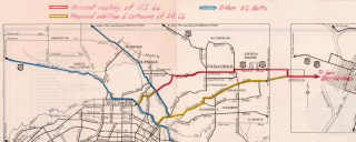
Nov. 1931, CHC map of US 66, Los Angeles. Source
Click image to enlarge.
The CHC insisted on November 13, 1931, adding a map (pictured - click on it to enlarge it) where he again recommended that "it would seem that the logical point to terminate the route would be at a junction with U.S. 101 and U.S. 99 practically at the center of the business district of that city."
They added that "U.S. 66 as now signed terminates at the junction with U.S. 99 at Fletcher Drive and San Fernando Road. We had in mind recommended extension of U.S. 66 as shown in yellow to a junction with U.S. 101 at Sunset Boulevard, also the signing of an alternate route as shown into the heart of the city." 8
The AASHO replied in Nov. 1931 and suggested that the highway should be extended to Santa Monica and that alternate alignments were possible but they couldn't be spurs, they had to meet further down the alignment. Many letters came and went between CHC and the AASHO during 1931 and 32 but, the alternate alignment from Arcadia along Huntignton into downtown LA was never approved.
The CHC's map shows that the alignment along Pasadena Ave and York Blvd into South Pasadena had been abandoned, and had probably never been signed. The alignment of Route 66 had been marked from the Colorado Street Bridge in Pasadena, across the Eagle Rock district of Los Angeles, and along Eagle Rock Blvd. southwards to San Fernando Rd.
>> We marked this new course with a green line in our custom map.
Clearly, the CHC wanted Route 66 to reach downtown Los Angeles and to also reach U.S. 101 on the NW side of the city center.
The matter was dropped as the City had decided to build a new throughfare across Elysian Park to decongest the Broadway - Pasadena Ave axis, and that is what led to the construction of the Figueroa Street Tunnels, and the Arroyo Seco Parkway.
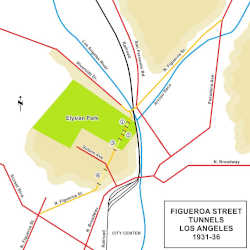
Figueroa Street Tunnels (1931-35)
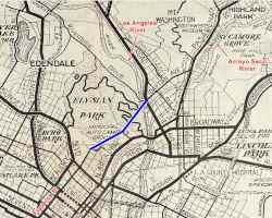
1930 ACSC map, Los Angeles. Source
Click image to enlarge.
The map -click on it to enlarge it- shows the central part of the city of Los Angeles in 1930. The traffic reaching the city from the east along Huntington Dr., flows into Broadway or, via Mission Rd. merges with Alhambra Rd. traffic onto Main St. The traffic from the north along Pasadena Ave. meets the traffic from the northwest along San Fernando Rd. at Broadway. Both Broadway and Main enter the commercial district and only then can westbound traffic use Sunset Blvd. to continue its journey.
The City decided to build an alternate throughfare along the eastern side of the hilly Elysian Park (blue line in the map), that would link Pasadena Ave and San Fernando Rd. traffic with Sunset skirting the downtown district along its NW flank.
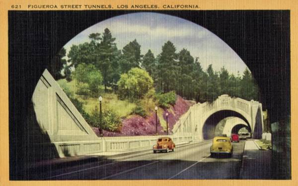
The extension of Figueroa St. aross the Elysean Park was done in stages. The park is located on a large hilly sectin 200 to 400 feet above the Los Angeles River's level. The city decided to build a road with a straight course through the park, but, to preserve the natural setting, it would include several tunnels.
In 1928 plans were ordered for this project. In 1929 Riverside Drive was extended southwards along the north side of the park, and then it turned to the NE crossing the Los Angeles River ending at San Fernando Road.
North of this point, Dayton Avenue was renamed N FigueroaSt. from the Los Angeles River to Avenue 39. From 39th to York, Pasadena Ave. was renamed N Figueroa St., and Annandale all the way to Colorado Blvd. in Eagle Rock was also renamed N Figueroa St.
South of Riverside Dr., three tunnels were dug through the hills between the Los Angeles River in the north and Solano Avenue in the south. We marked them ①, ②, and ③ in our map.
The junction of the northern tunnel and former Dayton Ave wasn't neat: Figueroa St. turned sharply towards the NE to meet Riverside Dr (see picture below) and then again, a 90° turn to cross the Los Angeles River
>> See the bordeaux line in our custom map.
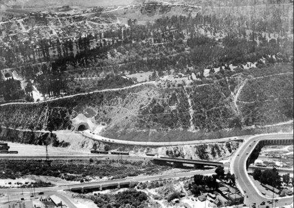
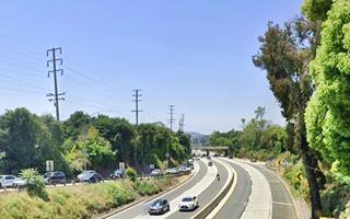
The image above looks south across the Los Angeles River to the hilly Elysian Park. The northernmost tunnel on Figueroa St. can be seen on the left (and another tunnel on the middle left side), and the road turns right immediately after leaving the tunnel, merging with Riverside Dr. that here turns sharply north to cross the river and meet San Fernando Rd. on the lower left side of the image. This is the same view nowadays where you can see the improvements brought on by the northbound bridge built in 1936 and opened in 1937 and the southbound lanes of Arroyo Seco Parkway (Pasadena Freeway) added a few years later.
At its southern tip, was the exit of the third tunnel; here traffic turned east and flowed along Solano Ave. onto Broadway and into the downtown district. The three tunnels were completed and opened to traffic in 1931. Work on the longest (4th) tunnel and its link with Figueroa St. south of the Elysian park was hampered by the Great Depression and lack of funds it took until 1935 for work to start on it.
The fourth and southernmost tunnel was completed in August 1936, marked ④ in our map, and a new extension of N Figueroa St. linked it with Sunset Blvd.
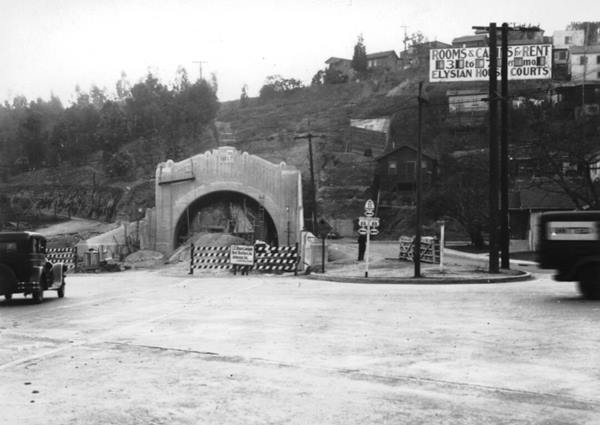
The picture above taken in 1935 shows the north portal of the fourth Figueroa St tunnel under construction at that time. Notice the road signs with State Hwy 11, and U.S. 66 and U.S. 88 on the right side of the image, guiding traffic towards Solano Ave. This is the same view at this spot nowadays.
The black and white image below taken in 1938 looks along Figueroa Street just east of Elysian Park and Chavez Ravine from the north tip of the 3rd tunnel; notice that before the completion of Arroyo Seco Freeway, the tunnels carried traffic in both directions. The color image shows that same spot nowadays.
So, in 1935 Route 66 was realigned through the three northern Figueroa Street tunnels into Downtown Los Angeles and the old terminus on Fletcher Dr. and San Fernando Rd. was abandoned.
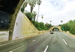
The tunnels have been used as movie locations in several films including The Terminator (1984), Independence Day (1996) and Blade Runner (1982).
Figueroa Street Bridge (1937)

Figueroa St. bridge on Los Angeles river. Source
Click on image to enlarge.
The cumbersome right angle curves at Riverside Dr and the Los Angeles River caused traffic congestion so a straight course across the river linking the northern tunnel with former Dayton Ave was planned and built.
The new bridge also crossed the railroad tracks that ran along both sides of the river and San Fernando Road. The bridge officially opened July 6, 1937. 9
This bridge was also part of the project that would link the tunnels with the Arroyo Seco Parkway.
Realignment and extension to Santa Monica (1935)
With the completion of the four tunnels, Route 66 was aligned along Figueroa into Los Angeles downtown and, onwards to its new western terminus on the Pacific Ocean in Santa Monica.
That same year the Arroyo Seco Parkway project was added to the state highway system by an act of the state legislature (July 1935). Pasadena and Los Angeles city conciles approved the parkway plan in April 1936 and the CHC also gave its approval. 10
The Arroyo Seco River
The Arroyo Seco (Spanish for "Dry Stream") is a temporary river that is almost 25 mi. long (40 km) running from the San Gabriel Mountains to its confluence with the Los Angeles River on the NE side of the Elysian Park in Los Angeles.
It is a natural drainage channel that carries rainfall from the mountains to the sea, and it excavated a shallow gully that in early spring became a stream and during rainy winters, became a rushing river.
Its average discharge is 10.1 cu ft ⁄ s (0.29 m3 ⁄ s) but its maximum can reach 8,620 ft ⁄ s (244 m3 ⁄ s).
To control its floods, the Los Angeles County Flood Control District built a dam at Devil's Gate gorge in 1920 and most of the riverbed was contained in a concrete channel built after the devastating Los Angeles Flood of 1938. The flood damaged the work going on at that time on the Arroyo Seco Parkway.
The Great Flood of 1938
Starting February 27, 1938 two storms converged on the Los Angeles area and it rained for five days. 32 inches or rain fell in the San Gabriel Mountains and ran downhill flooding the city and its suburbs. When the waters receded, they had destroyed over 5,600 homes, killed 87 people and caused damges exceeding $1.67 billion (in 2024 dollars).
See the picture showing the washed out bridge at Avenue 43. It was rebuilt in 1939; it looks south. The Southwest Museum can be seen on Mt. Washington; compare it with the current St. view where the river runs in a channel on the right.
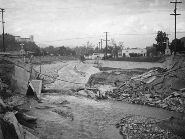
The valley carved by the river was a natural route used by the Native Americans, and later in the 1880s, from Los Angeles to Pasadena it was used by the railroad and the electric trolley.
The local citizens in the early 1900s wanted the river to become a park. There were many suggestions for a parkway to be built along the arroyo, including one put forward by the Automobile Club of Southern California in 1921. Finally, the focus shifted towards a faster, commute efficient highway that was routed in 1935 along the west bank of the Arroyo between the Figueroa Street Bridge and Bridewell St. where it crossed the Arroyo and ran eastward across South Pasadena and then curved around Raymond Hill, heading northward into Broadway at Glenarm Street in Pasadena.
Arroyo Seco Parkway's construction (1935-1940)
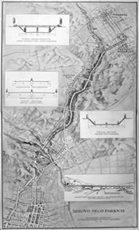
Arroyo Seco Parkway 1936 map rendering. Source.
Click image to enlarge.
The map (click on it to enlarge it) shows a view of the planned parkway from Pasadena to Los Angeles. The divided highway section starts at Glenarm St and ends at the Figueroa Street Tunnels.
It was designed in a period when freeways were unknown; inspired by the German Autobahn but in an urban setting. It is a blend of a "freeway" and a "parkway". The freeway elements are the graded overpasses, the high-speed and limited-access road with on and off ramps. The parkway design can be seen in the landscaping and the fact that it ran through a parkland.
Before the highway was built, the flooding caused by the river had to be solved. The funds for a survey of the Los Angeles River watershed were appropriated by Congress in March 1936, and the work began in 1938. The flood struck while the 9.5-mile-long Arroyo Seco Flood Control Channel was being built. The part that had been built survived the flood.
During the construction of the Arroyo Seco Parkway, Route 66 traffic was realigned along N Figueroa St. all the way to the tunnels at Elysian Park. The former alignment along Eagle Rock Blvd. and Fletcher Dr. was discarded.
>> See the red line in our custom map.
It was concevied as a divided highway that would allow drivers to move at high speeds. Its median would protect drivers from head-on collisions and chain link fences would prevent children or animals straying onto the lanes.
The inside lanes were 12 feet wide, two feet wider than the previous highway standard, and the lane next to the 10 foot shoulder, was 11 feet wide.
The inner lanes were paved in black colored asphalt concrete that was .17' thick, and the outer lane with gray portland cement concrete .55' thick that was increased to .75' at its outer edge.
The roadbuilding engineers used the different colored paving to serve as guides to keep the drivers in their lanes and help reduce the chance of accidents.
During construction, in 1938, the project changed and converted the planned inner 10-foot-wide shoulders into travel lanes. This implied building a special 8" barrier curb on the median. The new roadway was 35 feet wide with a 12 foot center lane and two 11 foot flanking lanes (one foot was used by the curbs).

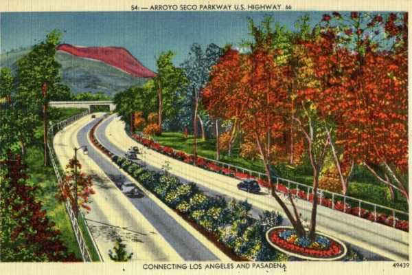
The image above looks south along the freeway from the Orange Grove Ave. brige in South Pasadena. Notice that the roadway had asphalt and portland cement concrete pavements side-by-side. Compare it with the same view from the same spot, nowadays.
The road was designed for the maximum speed limit in California at that time, 45 miles per hour. The engineers created canted or "superelevated" curves to help the cars stay in their lanes and reduce the effect of the centrifugal force on them.
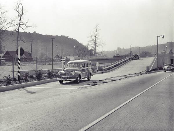
The parkway no grade crossings, it employed on-off ramps and did not use cloverleafs. These exit and access ramps were terribly short by our modern standards, but were a great change in the 1940s (pictured below). Notice the "Stop" sign and the "Stop" painted on the ramp's tip.
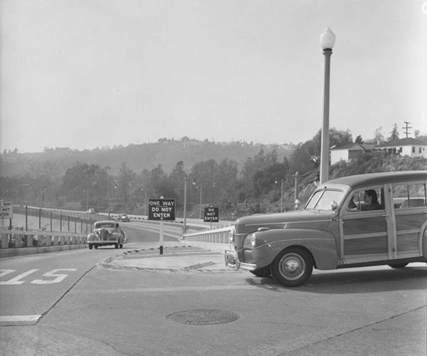
It also employed safety signs such as "No Left Turn", "One Way - Do Not Enter" to guide traffic (see picture below) to prevent accidents. The signs used tiny glass beads to make them reflective at night. The shrubs in the central median were planted to shield drivers from the glare of the headlights of the traffic in the opposite lanes.
The exit and access ramps were terribly short by our modern standards, but were a great change in the 1940s.
There were lights at the intersections and the steep 1:1 slopes were stabilized and beautified with native shrubs and vines. The original bridges crossing the arroyo were kept in place these included four bridges that predate the Parkway: The 1895 Santa Fe Arroyo Seco Railroad Bridge, the 1912 York Boulevard Bridge, the 1925 Avenue 26 Bridge, and the 1926 Avenue 60 Bridge.
New bridges to span the parkway were built in South Pasadena and Los Angeles.
The project cost $5,750,000.
Route 66 ran along it from Pasadena to the junction of Figueroa and Sunset Blvd. and westwards along Sunset towards its terminus in Santa Monica.
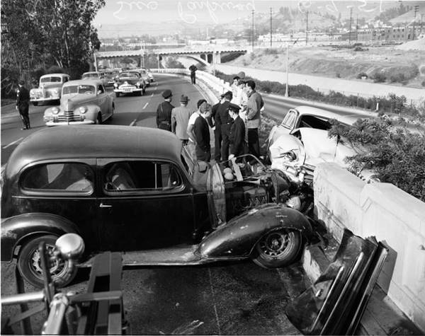
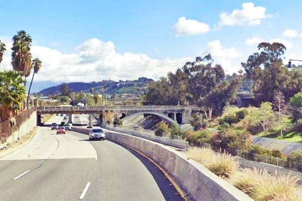
Same spot nowadays as shown in the 1940s photo above; notice same arched bridge on the upper right side, it carries Avenue 26 across the parkway and the channel of the Arroyo.
Extended south into LA across Elysian Park (1940-43)
The engineers foresaw that the traffic would still be congested even after the Parkway was completed to the Figueroa Street Tunnels. There were two reasons for this: the three lanes of the Parkway constricted into the two-lane Figueroa Street Viaduct, a bottleneck. And the traffic heading north that turned left onto Riverside Drive blocked the traffic heading south across the viaduct. There was also at-grade intersections along Figueroa at Solano St., Bishop Road and other streets as it entered the northern part of Los Angeles Business District.
Two months before the Parkway opened, the California Division of Highways started planning a new 2.2-mile extension that would be a four-lane divided highway across Elysian Park to eliminate the congestion.
The extension meant building a second viaduct across the Los Angeles River on the north side of the Park, and a new roadway with four lanes parallel to the Figueroa Street Tunnels. These in turn would become one way and carry northbound traffic. All grade crossings would be eliminated. The left turn onto Riverside passed beneath the southbound lanes.
The picture below was taken in 1941. It looks north at the existing Figueroa St. and third tunnel at Solano St. with the new viaduct being built to carry southbound lanes over Solano, in the distance Park Row Dr. arched bridge can be seen under construction spanning the new cut that will cary the extension. This is the same view nowadays. The Solano Elementary School on the left, is still standing.
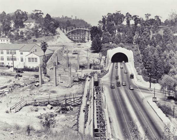
The cost was estimated at $4 million and was funded by the City of Los Angeles, the state gasoline tax and the Federal WPA (Works Progress Administration).
The roadway was incorporated into the National Strategic System of Roads in 1941 as the nation saw that WWII was imminent and fast roads would have strategic importance. This ensured that labor, steel and concrete were available for the construction.
Instead of building tunnels across the Elysian Park, the engineers opted for an open-cut method, it was deemed safer than tunnels in the event of earthquakes. It was also $1 million cheaper than tunnelling.
The new southbound lanes would run along a 46-foot wide roadway starting with the new second Los Angeles River Bridge, parallel to the existing Figueroa Street Viaduct. The slope in the cut had a 1:1 gradient and was 60 feet wide at its base. The high hill by the Los Angeles river was the deepest cut, with a depth of 70 feet.
The following image looks south towards a smog-laden Los Angeles, taken on February 20, 1958 from the Los Angeles River on the north side of the Elysian Park. You can see the second set of lanes, westbound, running on the right (north) side of the lanes that run through the Figueroa Street Tunnels carrying eastbound traffic towards Pasadena.
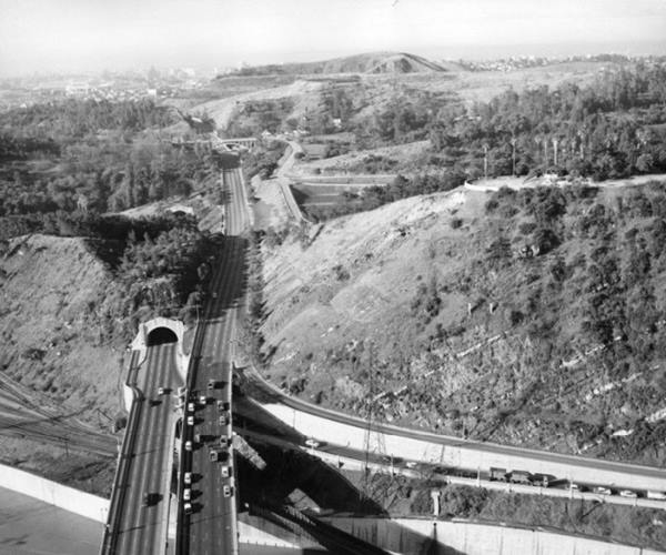
The Southerly Extension was completed in less than three years and opened on December 30, 1943. It reached Figueroa St at its junction with New Depot St. where the traffic flowed south for two blocks to Sunset Blvd. that carried U.S. 101.
Below is a view taken in 1948, at the intersection of N. Figueroa (running upper left to lower right) and Sunset Blvd. (running across the image), the streetcar can be seen on Sunset Blvd. it looks towards the south. Here Route 66 took a right along Sunset Blvd. towards Santa Monica. The Union Service Station pictured in the photo stood on the SW corner of the crossroads at 900 West Sunset Blvd.
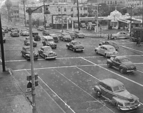
At last the business districts of Los Angeles and Pasadna were linked by an eight-mile freeway. However a new network of high-speed roads had been projected and the Arroyo Parkway had to link up with them; the section along Figueroa from Adobe St. to Sunset Blvd. was temporary.
Four-Level Interchange (1953-64)
U.S. Highway 101 (State Route 2) was also being upgraded as the Cahuenga (Hollywood) Freeway. Work had began on it in San Fernando Valley across Cahuenga Pass in the late 1930s, it would cross Hollywood and central Los Angeles and meet the Arroyo Seco Freeway there.
In 1946 a half-mile long extension was approved and the Arroyo Freeway was extended following its NE-SW course to the designated site of the interchange between freeways. Work on the 4-lane extension began in late 1947.
The engineers designed a $1.5 million four-level interchange that did away with the typical clover-leaf exchange. Instead it was a direct freeway-to-freeway connector.
It was the first "Stack" interchange in the world. It was 65 feet high and supported by reinforced concrete pillars and it ensured that traffic could flow 270-degrees as it turned in different directions. It was completed in 1949 and opened in 1953.
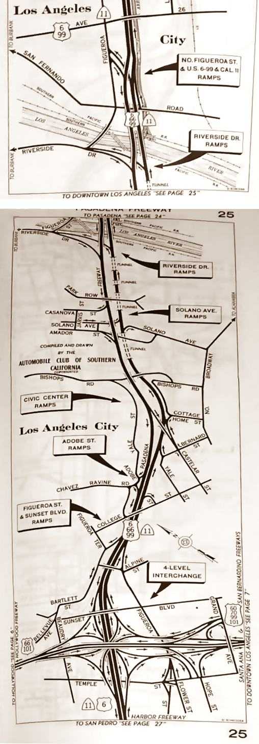
U.S. 101 along the Hollywood Freeway, U.S. 70 and U.S. 60 along the Santa Ana Freeway, and U.S. 66 with U.S. 6 and U.S. 99 along the Arroyo Seco Parkway met here in an amazing hub. The map further up (click on it to enlarge it) shows the Arroyo (Pasadena) Freeway from Highland Park across Elysian Park all the way to the four-level interchange where it meets the Hollywood Fwy.
The construction required tearing down a neighborhood with an area equivalent to a square with 1,000 feet-long sides. Below is a view of it in the 1950s, and this is its current St. view.
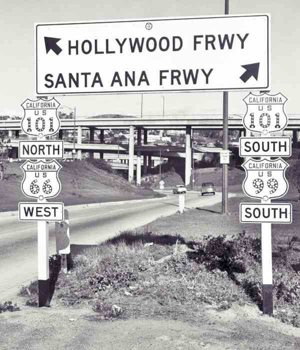
The Arroyo Seco Parkway was renamed Pasadena Freeway the following year (1954).
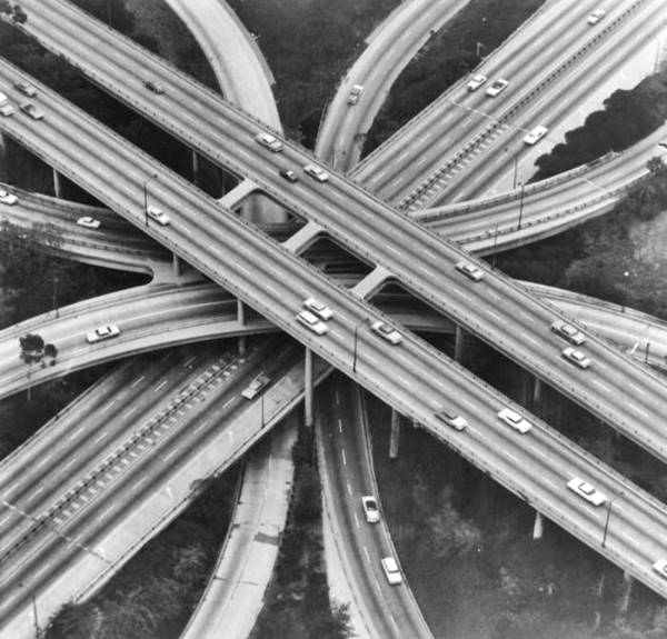
See this aerial view of the stacked interchange nowadays. Below is another view of it, seen from the lowest level.
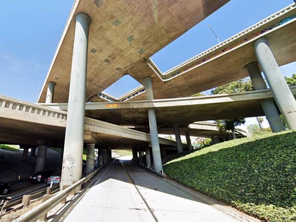
From the interchange, the Santa Ana Freeway continued with a NW-SE course, and the Harbor Freeway carried US 6 to its terminus in Long Beach. Route 66 turned towards the NW along the Hollywood Fwy towards Santa Monica.
Our custom maps mark the alignments that extended US 66 from the downtown district of Los Angeles to Santa Monica as follows:
- The 1936-53 Sunset Blvd. alignment from Los Angeles to Hollywood: brown line in our custom map.
- The 1953-64 Freeway alignment from Los Angeles to Hollywood: pale blue line in our custom map.
- The 1936-64 Santa Monica Blvd alignment all the way to Santa Monica: yellow line in our custom map.
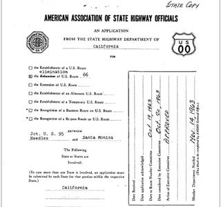
End of Route 66 moved from Santa Monica to Needles, 1964. Source.
Click image to enlarge
The Decommisioning of US 66 began in California in 1964
On Aug 26, 1963 the state's Higway Commission requested the "Elimination of Route 66... Between Jct. U.S. 95 Needles and Santa Monica." and the elimination of Alt 66 between Pasadena and Los Angeles via Eagle Rock. The AASHO approved this move on Nov. 14, 1963. So the interstate highways I-40 and I-15 replaced the former alignment between Needles and Los Angeles. 11
The western terminus of Route 66 was "officially" moved from Santa Monica to Needles in 1964, However, the state's Highway Commission included the alignment of Route 66 between Pasadena and Needles in its maps until 1970 co-signed with State Hwy. 248.

Hotels along this leg of your road trip
Find your accommodation
Los Angeles and its suburbs offer plenty of lodging options for those travelling along Route 66, you can book a hotel or motel there:
>> Book your Hotel in Los Angeles

Sponsored Content
>> Book your Hotel in Santa Monica

Credits and Further Reading
Banner image: Hackberry General Store, Hackberry, AZ by Perla Eichenblat
Arroyo Seco Parkway, The Historic American Engineering Record. J. Philip Gruen and Portia Lee, August 1999.
11. Route Numbering Archive AASHTO file Other (49).PDF, search terms: Route Number: 66.
6. Coucil Minutes Archive, 1/12/1931, File Name 1121931. N° 5789.
7. Route Numbering Archive AASHTO file Other_CA_1931__.PDF, search terms: Year: 1930, State, CA.


