Table of Contents
Index to this page:
- California Route 66 Itinerary and maps
- Historic background of this segment
- 1926-31 San Fernando as 1st Western Terminus of US 66
- The "Real" End of Route 66 in Los Angeles
- Alternate 66 alignments in the early 1930s
- Historic Colorado Street Bridge
- 1935 Realignment
- Extension to Santa Monica and confirmation of its former downtown terminus
- The 1926 - 1934(?) Alignment into L.A.
- Route 66 in the City Center of Los Angeles
- Figueroa Street Tunnels
- Los Angeles 1926-35 Western Terminus Sign
- 1936: Route 66 extended from Los Angeles to to Santa Monica
- The Many Western endpoints of Route 66
- Arroyo Seco Parkway: 1st Freeway in the West
- Terminus moved in 1964 From Santa Monica to Needles
- Alternate US 66 1940-1964
- Hotels
>> See our custom interactive Map of this segment: Pasadena to Santa Monica
And our two other custom and interactive maps:
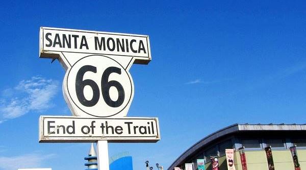
The "End of the Trail" sign on Santa Monica Pier
Pasadena to Santa Monica CA, itinerary and alignment
California Route 66 Itinerary and maps
Each leg of Route 66 described below has an interactive map and many image maps so you can follow the alignments of the highway along the way:
- Topock to Barstow - Map of this segment
- Barstow to Pasadena - Map of this segment
- This leg: Pasadena to Santa Monica - Map of this segment
- Santa Monica End of the Trail!
Arizona, previous leg
Pasadena to Santa Monica along Route 66
Historic Background of the last leg of US Highway 66
The state of California enacted several laws starting in the late 1800s to build and maintain highways funding them with special appropriations, but funds were insufficient, so starting in 1909 it began issuing bonds to create an interconnected state-wide highway system. This process also coincided with a nation-wide movement promoting better highways suitable for automobiles. Private associations were organized to build and sign "trails" across America. One of these was the "National Old Trails" (N.O.T.) Association, who lobbied for a highway linking New York with Los Angeles. The Automobile Club of Southern California (ACSC) published maps showing its alignment, distances between towns and the services that could be expected (gasoline, garages, hotels) along the way. The following map, published in 1912 shows the N.O.T. highway into Los Angeles.
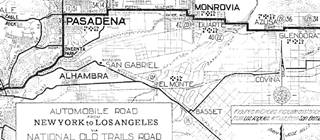
1912 N.O.T. Road map
Click on image to enlarge.
Source
These "Better Roads" associations finally got the federal government involved, and federal funds were provided to the states to build an interstate highway system. It was implemented in 1916, and reorganized after WWI. By 1921 it contemplated that the federal government provide financial aid to the states so that these could build highways. There were some restrictions on how to apply these funds: federal-aid highways could not exceed 7% of the state's total highway mileage, 3⁄7 of the system had to be "interstate" highways, and these could absorb up to 60% of the funds, the remainder was used for "farm-to-market" highways. But it helped develop the highways and improve them.
Finally, in 1926 the highway network was organized into a coherent numbering system and that was when U.S. Highway 66 was born. 1
U.S. designated highways were built and maintained by each state, but their alignment and terminal points were agreed upon with the Federal authorities (the Association of State Highway Officials (AASHO) who had to give the final approval. AASHO was founded in 1914, and it changed its name in 1973 to American Association of State Highway and Transportation Officials (AASHTO).
It is interesting to point out that the first highway markers didn't appear on California highways until January 1928, and this work was done by the Automobile Club of Southern California a in this area, at its own cost. Only in 1934 was the California Division of Highways given the responsibility for signing highways. 2
Route 66 Alignment into Los Angeles
When U.S. Highway 66 was created in 1926 it made sense to align it along the existing state highways, and from San Bernardino to Pasadena, it followed State Route 9. This highway had been created in 1910 under the first state bond issue and it linked "San Fernando to San Bernardino." 3
The following map ("Los Angeles and Vicinity") shows the highways in the Los Angeles region in 1927; notice , including U.S. 66, 99 and 101. You can follow Route 66 from Victorville in the east, to San Bernardino and then westwards to Pasadena (on the lower left side). The U.S. Highway shields give a general idea of the alignment, but none of them appear within Los Angeles.

1927 Road map, SW CA
Click on image to enlarge.
Credits

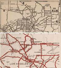
Detail 1930 roadmap
Click on image to enlarge.
Full map
The black and white 1930 thumbnail map above also shows the alignment of Route 66 from Victorville to Los Angeles. Notice the detail with the alignment into Pasadena and onwards into Los Angeles. However, both of these maps are how the map-makers interpreted the alignment of the highways, which may not correspond to their "real" or "official" courses.
Our next section will look into this matter, which is interesting from a historical perspective.
The First Western Terminus of Route 66
San Fernando California?
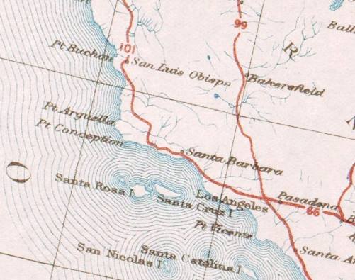
Detail 1926 US Highway map roadmap. Source
Click on image to enlarge.
The 1926 US Highway map (click on it to enlarge it) shows the "United States system of highways: adopted for uniform marking by the American Association of State Highway Officials, November 11, 1926;" as you can see, Highway 66 goes through Pasadena with an east to west course, and meets U.S. highways 101 and 99 in Los Angeles CA.
The alignment shown in the map was confirmed in a letter from the American Association of State Highway Officials (AASHO) Executive Secretary to the California Highway Commission's (CHC) State Highway Engineer, Mr. Robert M. Morton, dated July 7, 1926 (pictured below) mentioning the terminus in Los Angeles, 10 miles from Pasadena. 4
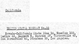
1926 U.S. 66 alignment in California. Source
Click on image to enlarge.
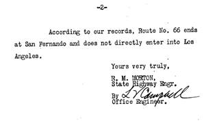
March 1, 1927 letter. U.S. 66 alignment to San Fernando. Source
Click on image to enlarge.
However, Morton wrote back, in a letter dated March 1, 1927, 4 stating that "Route No. 66 ends at San Fernando and does not directly enter into Los Angeles," as shown in the image above. 4
On April 21, 1927 Morton sent some corrections to the AASHO regarding the description of the highways in California that would be included in the April 1927 issue of the AASHO's newsletter, "American Highways", where, regarding Route 66, he stated again that "also the route does not enter the City of Los Angeles, the termination being at San Fernando which is north of Los Angeles." We underlined this text in red in following image. 4
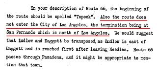
April 21, 1927 letter. U.S. 66 alignment to San Fernando. Source
Click on image to enlarge.
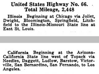
Route description U.S. Highway 66, 1927. Source
Click on image to enlarge.
Some of the corrections suggested by Morton were taken into account because the American Higways April 1927 issue (image above), 5 (see the full issue) gives the following route for U.S. 66 as it reaches its western endpoint: "... Barstow, Victorville, San Bernardino, San Fernando, to Los Angeles." It mentions San Fernando, but the AASHO chose to ignore Morton's remark about it ending in San Fernando and not going into Los Angeles.
It seems that for the AASHO, Route 66 ended in Los Angeles, but somehow went through San Fernando before reaching it. However, for the CHC, it bypassed LA and ended in San Fernando.
The problem in AASHO's alignment is that San Fernando is 22 miles to the northwest of Los Angeles. So this route would have meant a drive northwards and then back south into Los Angeles.
See our custom map (AASHO 1926 Route 66 Waypoints) where we mark these waypoints mentioned by the AASHO officials we also included State Route 9 alignment west of San Bernardino into to Pasadena (red line) because Route 66 was aligned along it. The final leg of the alignment would have had to run between Pasadena, San Fernando and then onwards to its endpoint in Los Angeles. See the blue line in our map showing a possible course for Route 66 based on these waypoints. Clearly there is something odd odd with the San Fernando as an AASHO waypoint.
U.S. 99 ran along the following course: "...Bakersfield, Los Angeles, Pasadena, San Bernardino..." overlapping Route 66 east of Pasadena, and U.S. 101 used this other route: "...Santa Barbara, Ventura, Los Angeles, Santa Ana...." If all three met as shown in the U.S. Highways map of 1926 further up, the junction had to happen in Los Angeles.
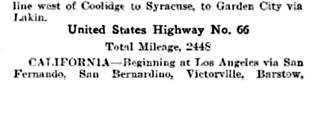
1928 U.S. 66 waypoints. Source
The January 1928 issue of California Highways and Public Works, the official journal of the state's Dept. of Public Works, published the waypoints of Route 66 from west to east (page 33), and once again it mentions San Fernando: "Beginning at Los Angeles via San Fernando, San Bernardino, Victorville, Barstow..." 6
The situation is quite confusing, and the 1930 Road Map of the state of California, published by the California Department of Public Works, Division of Highways still showed Route 66 as ending in San Fernando and not returning to Los Angeles (see maps below).
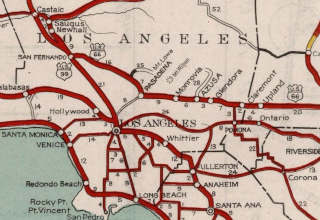
1930 CHC Map, Los Angeles (front). Source
Click on image to enlarge.
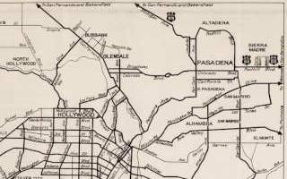
1930 CHC Map, Los Angeles (back). Source
Click on image to enlarge.
The back of the 1930 CHC map (shown above) marks the main avenues and only signs U.S. 66 into Pasadena, and U.S. 99 along Michigan Ave. and Foothill. How Route 66 reached San Fernando and then Los Angeles is not shown. This lack of clarity is also seen in the 1927 map further up, where the U.S. shields end on the outskirts of Los Angeles, in San Fernando (U.S. 99), Monrovia (U.S. 66), and Hollywood (U.S. 101). Their course across the city isn't shown.
Why San Fernando?
One option is that the AASHO officials in Washington assumed that San Fernando was some town east of Los Angeles between it and San Bernardino, like Monrovia, or Arcadia, Duarte or San Dimas. But, as shown further up, the CHC had told them that San Fernando was north of Los Angeles. So they should have known better.
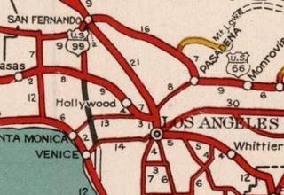
1934 CHC map of Los Angeles. Source
Another possible explanation is that State Route 9, carrying U.S. 99 and apparently U.S. 66 (in the map it seems so), crossed Eagle Rock, which was annexed by the city of Los Angeles in 1923. So, it can be said that this alignment goes through Los Angeles' Eagle Rock neighborhood.
The San Fernando waypoint seems to have been dropped in 1930, because later correspondence by the CHC mentions Los Angeles as the terminus of Route 66.
This spur into San Fernando had its U.S. 66 shield removed in the 1934 CHC map (pictured), but it still didn't show the course of any U.S. highway across the city.
The "Real" End of Route 66 in Los Angeles
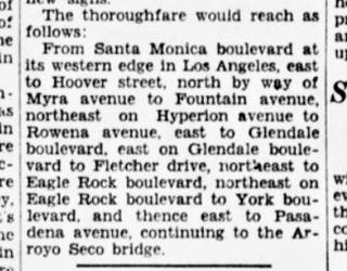
1929 article with Route 66 alignment in LA. Source
Click on image to enlarge.
While the CHC and AASHO were discussing the San Fernando waypoint, the local media seemed to know its course.
An article published by the Eagle Rock Advertiser in 1929 7 gives the following Route 66 alignment (west to east): "This is a new highway grouping that will lead to the east. It begins with Santa Monica boulevard, uses Fletcher drive, Eagle Rock boulevard, York Boulevard, Monterey road..."
This course agrees with the alignment informed by the Santa Monica Outlook in June 1929 (pictured above): "From Santa Monica boulevard at its western edge in Los Angeles, east to Hoover street, north by way of Myra avenue to Fountain avenue, northeast on Hyperion avenue to Rowena avenue, east to Glendale boulevard, east on Glendale boulevard to Fletcher drive, northeast to Eagle Rock boulevard, northeast on Eagle Rock boulevard to York boulevard and thence east to Pasadena avenue, continuing to the Arroyo Seco Bridge." 8
We marked its course with a red line in our custom map of the Route 66 alignments into Los Angeles.
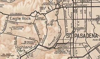
1930 map Los Angeles. Source
Click on image to enlarge.
This means it crossed into South Pasadena along Pasadena Ave. no course is given into Pasadena, but a 1930 map of the area by the ACSC (see image ) suggests with the thicker lines marking the roads, that it followed Mission Ave eastwards and Fair Oaks northwards to Colorado Ave.
On February 5 1930, the Los Angeles City Council defined the route that U.S. 101 and U.S. 99 would take across the city, but when it came to U.S. 66 they stated "On Route #66, due to the uncertainty as to the location of this Federal Highway, we recommend that no markers be placed at the present time." 9 See the image of the minutes below.
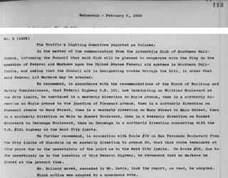
Los Angeles City Council minutes, Feb. 05, 1930. Source
Click on image to enlarge.
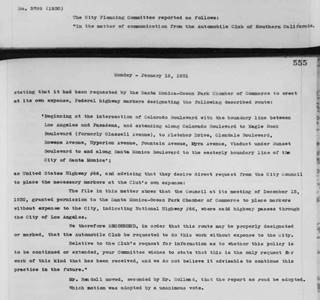
Los Angeles City Council minutes, Jan. 12, 1931. Source
Click on image to enlarge.
Eagle Rock Alignment 1931-1935
The following year, on January 12, 1931 at the request of the Automobile Club of Southern California who wanted to mark the highway 66 along a route they designated, and into Santa Monica, who had also requested that the ACSC sign it, the City Council defined the alignment as follows: "Beginning at the intersection of Colorado Boulevard with the boundary line between Los Angeles and Pasadena, and extending along Colorado Boulevard to Eagle Rock Boulevard (formerly Glassell Avenue), to Fletcher Drive, Glendale Boulevard, Rowena Avenue, Hyperion Avenue, Fountain Avenue, Myra Avenue, Viaduct under Sunset Boulevard to and along Santa Monica Boulevard to the easterly boundary line of the City of Santa Monica." (see the minute above). 10
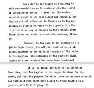
April 1931, CHC letter to the ACSC. Source
Click on image to enlarge.
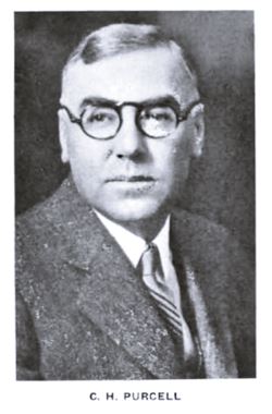
Charles H. Purcell, 1932. Source
But the Council had overstepped their authority, the terminus was in Los Angeles, not Santa Monica, so it couldn't be extended into the neighboring city.
On April 17, 1931 when Charles H. Purcell (1883-1951), the Highway Engineer wrote to the Automobile Club of Southern California (ACSC) regarding the signing of U.S. 66 to Santa Monica; he indicated that althouth the CHC was "not authorized to dictate as to the selection of streets or roads to be signed within the city limits" (that was reserved for the City Council), but that "the official terminus of the route is Los Angeles."
Therefore since the AASHO hadn't approved a new terminus to the highway the signs extending Route 66 to Santa Monica had to be removed. He also said that "Los Angeles is the proper terminus for the route, and that the purpose for which these routes were selected was fulfilled when signs were placed to bring traffic to a junction with U.S. Highway 101." 11
We marked the spot in our map; U.S. 66 would have met U.S. 101 at Sunset Blvd.
Alternate 66 alignments
Chapter 807 of the 1931 California statutes came into effect on Aug 14, 1931 giving the CHC authority to define the location of the state highways within a municipality, to acquire land and right of way and to build, improve and maintain them. City councils had to cooperate with them. 19, 20
With this in mind, Purcell wrote to the AASHO (September 3, 1931) because he wanted guidance on aligning Route 66 in Los Angeles. He now says that the highway ended at its junction with U.S. 99 at Fletcher and San Fernando Road (see the marker in our custom map).
The letter explained that the CHC wanted to mark "two alternate streets. For example the logical western terminus of U.S. 66 is at the Plaza in Los Angeles. However, if the route is signed by the most direct streets to that point traffic which does not desire to go into the business district but simply reach U.S. 99 or U.S. 101 to go north is directed several miles out of their way through heavy traffic. It is my thought that it would be an advantage to traffic to sign one route by the most direct streets into the Plaza and sign another route by the most direct streets to an intersection with U.S. 99 and U.S. 101." 11
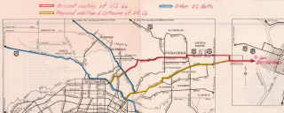
Nov. 1931, CHC map of US 66 in Los Angeles. Source
Click on image to enlarge.
Purcell insisted on November 13, 1931, adding a map (pictured - click on it to enlarge it) and stated that "The terminus of U.S. 66 is designated as Los Angeles and it would seem that the logical point to terminate the route would be at a junction with U.S. 101 and U.S. 99 practically at the center of the business district of that city. This plan requires all through traffic to follow the heaviest traveled arteries of the city. On the other hand if a route is signed which will allow traffic to avoid the most congested area the city is by-passed. This is shown in the attached map. U.S. 66 as now signed terminates at the junction with U.S. 99 at Fletcher Drive and San Fernando Road. We had in mind recommended extension of U.S. 66 as shown in yellow to a junction with U.S. 101 at Sunset Boulevard, also the signing of an alternate route as shown into the heart of the city."12
The AASHO replied in Nov. 1931 suggesting that "the real answer to your problem is to carry U.S. 66 to Santa Monica. You certainly should carry the numbers further into Los Angeles than you are now doing," adding that alternate routes should always end on the other route, so it couldn't be a spur. But the state didn't want to extend the highway to Santa Monica and insisted on a forked with two endpoints, one downtown, the other on Routes 99 and 101. Several letters came and went on this matter during 1931. But the alternate alignment from Arcadia along Huntignton was never approved.
Purcell's map shows that the alignment along York Blvd into South Pasadena had been abandoned (probably never signed), instead a new course had been defined from the Colorado Street Bridge in Pasadena, across the Eagle Rock district of Los Angeles, and along Eagle Rock Blvd. southwards. See this alignment marked with a green line in our custom map.
Clearly, the CHC wanted Route 66 to reach downtown Los Angeles and to also reach U.S. 101 on the NW side of the city center.
1931-35 Alignment through Eagle Rock
This alignment is shown with a green line in our custom map.
The highway left Pasadena westwards along Colorado crossing the Arroyo Seco along the Colorado Street Bridge.
Colorado Street Bridge
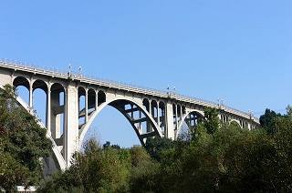
Colorado Street Bridge, Pasadena. Source.
Listed in the National Register of Historic Places
Located on Colorado Blvd. and Arroyo Seco canyon, the bridge was completed in 1913. It replaced the burdensome downhill and uphill route across the steep slopes of Arroyo Seco River gully.
The Arroyo Seco (Spanish for "Dry Stream") is a temporary river that is almost 25 mi. long (40 km) running from the San Gabriel Mountains to its confluence with the Los Angeles River.
It was a natural route from Los Angeles to Pasadena and was used by the railroad, the electric trolley and later by the Los Angeles' first freeway, the Arroyo Seco Parkway that was built in 1940 as a parkway next to the Arroyo Seco which had been recently channeled.
The curved bridge allowed it to find support in the river bed and its concrete arches rising 150 ft. above the river bed made it the highest concrete bridge of its time.
The bridge had two lanes and was 28 feet wide plus plus the 5 ft. sidewalks on each side. It carried Route 66 until the Arroyo Seco Parkway was completed in 1940 to relieve traffic along the by then congested bridge.
The highway went west to Eagle Rock along Colorado Blvd. and south along Eagle Rock Blvd. To San Fernando Blvd. (which carried US 99). Highway 99's course into Los Angeles ended on 20th Ave.
However, we don't have evidence of Route 66 using this course other than two references, one is the National Register of Historic Places form for U.S. Highway 66 in California; it confirms that a temporary alignment was set up "after the Arroyo Seco Parkway project was initiated in 1938, U.S. Highway 66 traffic was temporarily re-routed over the Colorado Street Bridge through Eagle Rock, south on Eagle Rock Boulevard to connect to the downtown terminus until the new highway opened in 1940." 15. Another reference is Stephan Joppich whose website 23, 24 that shows a "Construction Alignment 1934-36" along San Fernando Rd. between Eagle Rock Rd. and N Figueroa St. but we have not been able to validate it with other sources. Nevertheless, we marked it with a violet line in our custom map.
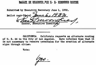
1932, AASHO and ALT 66 in Los Angeles. Source
Click on image to enlarge.
In 1932 the CHC requested permission for an alternate routing of U.S. 66 in the City of Los Angeles, the AASHO replied that it wasn't necessary to receive permission to place signs for alterate alignments through cities (see picture).
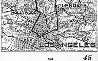
1933, ACSC map, Los Angeles. Source
Click on image to enlarge.
There is no evidence whether the CHC created an ALT 66 alignment at this time, but a map by the Automobile Club of Southern California published in 1933 (click on the image to enlarge it) shows the U.S. 66 shield on an alignment running south of Alhambra into Los Angeles (see the shield above the "E" of Los Angeles on the lower right side of the map. It runs along Ramona Blvd. what now is I-10. Was it a mistake of the ACSC?
In August 1933, new legislation gave the CHC the authority to sign and maintain all state highways including the U.S. designated ones that ran along them. This also included the sections that ran across incorporated cities. This empowered the CHC, who could now define these alignments.
The 1934 CHC maps (click on image to enlarge it) show different the main roads in the area, and the state highway numbers. There are three corridors linking Pasadena (on Route 66) with Los Angeles, and the highway ran along one of them.
- Through South Pasadena. Using Fair Oaks, Mission St. and Pasadena Ave. This wasn't a state highway.
- West side of Arroyo Seco. Using Colorado, and Figueroa St. which is also marked in the map as state hwy. 165.
- Through Eagle Rock (the U.S. 66 alignment), along Colorado (state hwy. 161), Eagle Rock Blvd. and Fletcher (state hwy. 162). It skirted around downtown Los Angeles to meet U.S. 101 on Sunset Blvd. The city center could be reached using and US 99 along San Fernando Rd. (state hwy. 61) to Figueroa St.
1935 Realignment
In 1935 several events took place that reconfigured the course of Route 66.
The Eagle Rock Advertiser reported on May 13, 1935 that the Highway 66 signs in Eagle Rock were changed and those at Fletcher and Riverside Drive directed the Highway 66 traffic away from Eagle Rock to North Figueroa. 13
The new route "was changed some months ago by way of N Figueroa and El Modena." 14
The original roadway into Eagle Rock from Pasadena had been a winding one by Eagle Rock hill as you can see in the S-shaped alignment just west of Colorado St. bridge (green line in our custom map). But in 1935 it had been straightened out and realigned along El Modena Ave., which was graded, widened and extended across this area replacing the former one (black line in our custom map). El Modena was later renamed as Colorado Road. 14
The realignment was "said to be temporary." 16
But actually, this realignment was a preparation for changes that were going to be implemented shortly: Route 66 was going to enter downtown Los Angeles and then be extended to Santa Monica. A new alignment was going to be aligned along the Elysian Park into LA.
Route 66 into Los Angeles City Center
As mentioned in the previous section, there was no official highway alignment into downtown Los Angeles however the ACSC did show a preferred alignment from Pasadena into Los Angeles city center. We marked this alignment with a blue line in our custom map.
This hypothetical first alignment used by Route 66 from (1926 to 1931) ran southwards from Pasadena into South Pasadena along Fair-Oaks Ave. past its downtown commercial district and continued south until it met Huntington Drive, here it took a right and followed Huntington Dr. until it reached North Broadway; following it all the way into downtown Los Angeles. Ending on 7th. Street. The first western terminus of the Mother Road.
The 1926 - 1934(?) Alignment into L.A.
This alignment does not seem to have been officially recognized or signed as it does not appear in the official California Higways Commission's maps. However, it appears in old maps following Fair Oaks Ave. from Pasadena through South Pasadena, and then south until it meets Huntington Drive, and then west along Huntington until N. Mission Rd. and then taking Broadway to 7th Street.
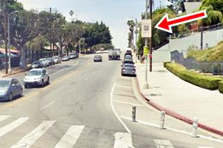
Historic Route 66 1926-34 alignment sign
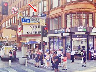
Huntington Drive becomes N Mission Drive and the alignment turns right along N Broadway. Here on the eastern side of the street there is a Historic Route alignment sign that reads "Historic Route [U.S. 66 shield] circa 1926 to 1934." See red arrow in the image above.
Follow North Broadway as it heads west, crosses I-5 and then the Los Angeles River and the railroad tracks to turn towards the southwest skirting the Elysian Park area.
Broadway and Solano
It meets Route 66's 1935-36 alignment at Solano Ave.; this one came from the three northern Figueroa St. Tunnels that used Solano to reach Broadway and Sunset Blvd. until the completion of the 4th tunnel August 5, 1936.
The highway approaches the downtown district of the city of Los Angeles. crossing Chinatown.
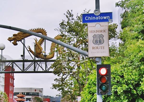
Further ahead there is a Chinatown archway across North Broadway as it reaches César Chávez (pictured above). Here there is a second Route 66 alignment sign.
Historic Route 66 1926-34 alignment sign in Chinatown
There is a second Historic U.S. 66 alignment sign, in Chinatown, on the NE corner of N Broadway with César Chávez that also reads "Historic Route [U.S. 66 shield] circa 1926 to 1934."
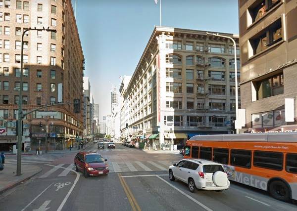
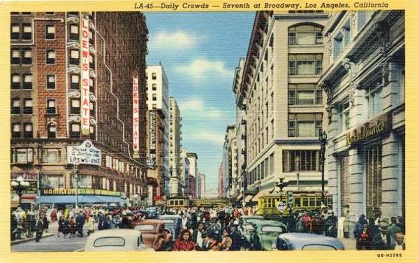
Ahead North Broadway becomes South Broadway and reaches 7th. Street which was is proclaimed as the original end point of Route 66:
The intersection of 7th Street and Broadway in Downtown Los Angeles was the crossroads of the Western United States in the 1920's... In 1924 it was documented to be the most heavily-traveled intersection in the world with 504,000 persons crossing the intersection in 24 hours. This included 200,000 persons in streetcars, 35,000 persons in automobiles, and 269,000 pedestrians. This volume exceeded those in London (Hyde Park Corner – 478,000), New York (5th Avenue and 42nd Street) and Paris (Place de l'Opera – 384,000). In 1930, this volume would reach an astonishing 750,000 persons passing through daily. In 1926, Broadway (ending at 7th Street) was designated as the most westerly segment of the original routing of US 66, while 7th Street was designated as part of the original segment of US 101. John E. Fisher Transportation Topics and Tales: Milestones in Transportation History in Southern California
Now and Then Broadway and 7th Street Los Angeles
South Broadway and 7th St. Los Angeles nowadays, this was the "mythical" 1926-36 terminus of Route 66 in downtown L.A.
Striking contrast in the past there were more cars, trams, and a lot of people, but the same buildings and the "Sprekles..." sign though faded and ghostly, is still there on the wall:
1940s postcard view of the S. Broadway and 7th St. Los Angeles
Los Angeles, the first western Terminus (1926-35) Sign
Route 66's western terminus has even been marked with a sign in downtown LA: on the southwest corner at Ezat Delijani Square on Broadway and 7th. St. is the sign marking the point where Route 66 "ended" stating that this was its western terminus from 1926, when it was created until 1936 when it was extended to Santa Monica. This is an Urban Myth. The highway entered the City Center, but ended on Sunset Blvd. 1.2 miles to the northeast of this point.
The sign marking the 1926 Western Terminus of Route 66
The name on the other sign, beneath it, remembers Ezat Delijani, a philanthropist who helped revitalize four historic downtown movie palaces.

Extension to Santa Monica and confirmation of its former downtown terminus
On June 14 1935 the CHC requested the extension of US 66 to Santa Monica and it specifically mentioned its current terminus as being located on Broadway and Sunset Blvd., the junction with US 101 and US 99 in downtown Los Angeles. 17 Finally after nine years, Route 66 ended at its intersection with US 101 and US 99.
This shows that the CHC had agreed with the AASHO; the highways had to meet in the business district of Los Angeles. It also meant that a new alignment was in place to take traffic there; and this one ran along N Figueroa.
We mark this alignment with a yellow line in our custom map. It crossed the Colorado Street Bridge, and went along El Modena (black line) then south along N. Figueroa all the way to the Los Angeles River. There a new roadway had been built and a series of four tunnels through Elysian Park. The old alignment along Eagle Rock and Fletcher was abandoned.
Figueroa Street Tunnels
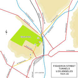
The extension of Figueroa St. aross the Elysean Park was done in stages. Until then all the traffic into the city south of the confluence of the Arroyo Seco and the Los Angeles rivers ran along the eastern bank of Los Angeles river (see Pasadena Ave, San Fernando Rd., and N. Broadway in the map. Red lines mark the main throughfares); the north bank was occupied by the Elysian park, on a large hill 200 to 400 feet above the river's level. Further south, the streets crossed the river into the central district of Los Angeles.
The city decided to build a road with a straight course along the eastern flank of the park and to preserve the natural setting, it would include several tunnels. In 1928 plans were ordered for this project. In 1929 Riverside Drive was extended southwards along the north side of the park, and then it turned to the NE crossing the Los Angeles River ending at San Fernando Road (marked with an orange line). From this point Figueroa St. extended northwards and improved (orange line). The section of what is now Figueroa St. in Highland Park above Avenue 39 was known as "Pasadena Avenue" until Figueroa was extended through Elysian Park. The portion of what is now Figueroa between the Los Angeles River and Avenue 39 was originally known as Dayton Avenue until the Arroyo Parkway went through the area.
Three tunnels were dug through the hills between the Los Angeles River in the north and Solano Avenue in the south, marked ①, ②, and ③ in the map. Figueroa St. was paved through them and at its northern tip it turned sharply left to meet Riverside (see picture)
See the bordeaux line in our custom map.
At its southern tip, traffic flowed along Solano Ave. onto Broadway and into the downtown. This work was completed in 1931.
South of the Figueroa St. Tunnels
Fourth Figueroa Street Tunnel
From the opening of the first three tunnels in November 1931 until the completion of the 4th tunnel August 5, 1936.8, traffic followed into Los Angeles from San Fernando Rd. Riverton Dr. and North Figueroa through the three tunnels and then took Solano Ave to its intersection with Broadway and into the city's downtown district. But at that time (1931) there was no terminus in downtown LA, it was still located on San Fernando Rd. and Fletcher Dr.
Work on the fourth tunnel began in 1935 and the picture below taken in 1935 shows the north portal of the fourth Figueroa St tunnel while it was under construction. Figueroa already carried Route 66: Notice the road signs to the right with the shields of State Hwy 11, U.S. 66 and U.S. 88 on the right side of the image, guiding traffic towards Solano Ave. This is the same view at this spot nowadays.
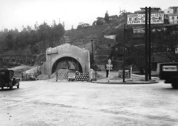
In November 1936 traffic was aligned through the 4th tunnel along Figueroa St. all the way to Sunset Blvd. We marked the tunnel as ④ in our map, and the extension with an orange line.
The image below looks along Figueroa Street just east of Elysian Park and Chavez Ravine, notice that before the completion of Arroyo Seco Freeway, the tunnels carried traffic in both directions. This is a current st. view at the same spot shown in the image below.
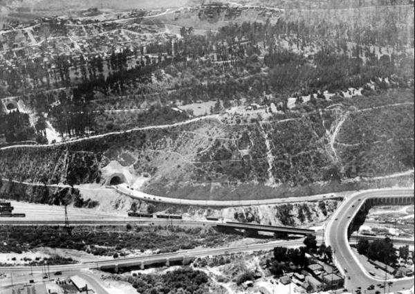
The image above looks south across the Los Angeles River to the hilly Elysian Park. The northernmost tunnel on Figueroa St. can be seen on the left (and another tunnel on the middle left side), and the road turns right immediately after leaving the tunnel, merging with Riverside Dr. that here turns sharply north to cross the river and meet San Fernando Rd. on the lower left side of the image. This is the same view nowadays, with the changes brought on by the northbound bridge built in 1936 and the southbound lanes of Arroyo Seco Parkway (Pasadena Freeway) added a few years later.

Figueroa St. bridge on Los Angeles river. Source
Click on image to enlarge.
The bridge across the Los Angeles river avoided the right turn at the exit of the tunnel and the 90° turn onto the Riverside bridge. It also crossed the railroad tracks that ran along both sides of the river and San Fernando Road. The bridge officially opened July 6, 1937. 21
The bridge was also part of the project that would link it with the Arroyo Seco Parkway a route that was added to the state highway system by an act of the state legislature in July 1935. Pasadena and Los Angeles approved the parkway plan in April 1936 and the CHC also gave its approval. 22
With the completion of the four tunnels, Route 66 was aligned along Figueroa into Los Angeles downtown and, onwards to Santa Monica.
The 1934 traffic density map published by the CHC shows that the state highway north of York Ave. ran along Avenue 64 and not along N Figueroa St. 15. This gives an idea of the state of flux in these alignments.
1936: Route 66 extended from Los Angeles to to Santa Monica

AASHO extends US66 to Santa Monica, 1935. Source
Click on image to enlarge.

Route 66 extended to Santa Monica, 1935 Source
On July 8, 1935 the AASHO approved the extension of Route 66 to Santa Monica. This would allow an Alternate alignment into Los Angeles, and the October 1935 issue of California Highways and Pubilc Works informed that "U. S. 66 extended from Sunset Boulevard in Los Angeles to Santa Monica via Santa Monica Boulevard."
When Route 66's western ending point was moved from S. Broadway and Sunset Blvd. in L.A., to Santa Monica, it was again realigned. Our custom maps mark the alignments that extended US66 from Los Angeles to Santa Monica as follows:
- The 1936-53 Sunset Blvd. alignment from Los Angeles to Hollywood: brown line in our custom map.
- The 1953-64 Freeway alignment from Los Angeles to Hollywood: pale blue line in our custom map.
- The 1936-64 Santa Monica Blvd alignment all the way to Santa Monica: yellow line in our custom map.
Sunset Blvd. The 1935 - 1953 alignment
Sunset Blvd. follows the path of a 1780s cattle trail from the Pueblo de Los Angeles to the ocean. This alignment headed NW from Figueroa St. on the 1935 alignment and then along Sunset Blvd. until Myra Ave. where it turned left and then SW until reaching Santa Monica Blvd and from there westwards all the way to Santa Monica. Then in the late 1940s it was realigned on the Freeway US 101 up to Santa Monica Blvd., from the exchange with the Arroyo Seco Parkway, a building project that took several years to be completed.
Hollywood Freeway 1953 - 1964
The Hollywood Freeway carried US 101 and replaced Sunset Blvd. after its completion (1953-1964).
US 101 marks the northern limit of the L.A. Westlake neighborhood and the southern one of Echo Park and Silver Lake. Then it enters Hollywood neighborhood where Route 66 takes a left along Santa Monica Blvd.
Santa Monica Blvd. 1935 - 1964
The highway heads west, until the "End of the Road" in Santa Monica and crosses two other cities: West Hollywood and Beverly Hills and the Western part of L.A.:
West Hollywood
This city is surrounded by Los Angeles, north, south and east, and to its west is Beverly Hills (City map). Route 66 ran from the easter border with L.A. -halfway down the block between N. Sycamore Ave and N. La Brea Ave. on Santa Monica Blvd. all the way to N. Doheny Drive on the border with Beverly Hills, a total lenght of 2.9 miles.
Beverly Hills
To its east is West Hollywood, and Los Angeles is to its west, south and north (City map). US 66 starts at N. Doheny Dr. on the border with West Hollywood and ends on Heath Ave. in the west; total length: 1.8 miles.
West Los Angeles
Once again US 66 enters Los Angeles city west of Beverly Hills and runs for 3.6 miles between Heath Ave. and Centralia Ave., crossing the Century City and West Los Angeles neighborhoods of Los Angeles City. Map of US 66 in West Los Angeles.
Santa Monica
West of Centralia Ave., Route 66 enters Santa Monica (City map) and originally headed south along Lincoln Blvd, where it took a left and ended on the junction with Olympic Blvd.
The Many Western endpoints of Route 66
Official Terminus of US 66
Lincoln Blvd. and Olympic Blv., Santa Monica. Map showing the spot.
The Western Terminus of Route 66 from 1936 to 1964 was located on the intersection of Lincoln Blvd. with Olympic Blvd.
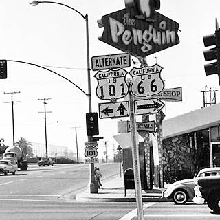
Route 66 western terminus in the 1950s, Santa Monica Credits
The AASHTO set it at "... Lincoln Boulevard to the terminus at Pennsylvania Avenue..." at that time, after Colorado Ave., were the tracks of the Pacific Electric Railway Company, a streetcar or tramway, followed by Pennsylvania Ave. But when the modern Santa Monica Freeway (I-10) was built along the old streetcar line right of way, it obliterated Pennsylvania Avenue which was replaced by what is now Olymipic Blvd. So the modern terminus is located on Olypmic Blvd.
The Mother road ended here and never reached Santa Monica Pier or Ocean Ave. This was the end of the road until 1964, when the highway was decommissioned in this area and moved east (more on this below) to Needles CA.
The image shows the spot in the 1950s, notice the Penguin neon sign on the western side of Lincoln Blvd., which is still there.
Photo of Mel's Drive In and the End of the Road sign on Lincoln and Olympic Blvds.
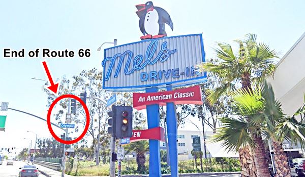
The many ending points of Route 66 in Santa Monica
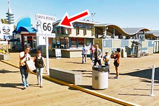
However, most believe that Route 66 ends at Santa Monica Pier, and this is a very good example of excellent marketing by a Route 66 souvenir shop located on the pier.
Then there is the bronze marker on Santa Monica and Ocean Ave., a memorial to Will Rogers, which states that it is "The End of the Trail". Confusing isn't it?. Below is the true story of the western tip of Route 66.
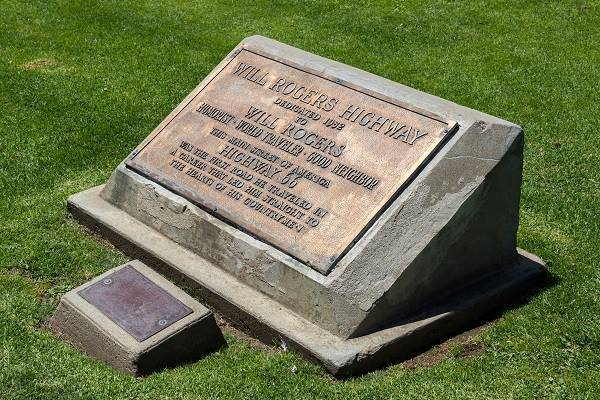
Will Rogers Memorial Plaque
Despite its official ending point on Lincoln and Ocean Blvds., the U.S. Highway 66 Association campaigned from 1935 to 1950 to have the highway renamed as the Will Rogers Jr. Highway and to move its terminus to Palisades Park on Ocean Avenue and Santa Monica Blvd. See this Map showing location.
The spot is 0.7 miles west of the "real" endpoint of Route 66; and there is a plaque on the sidewalk in Palisades Park, on the western side of Ocean Avenue, among the palm trees that reads:
WILL ROGERS HIGHWAY
>Dedicated 1952 to WILL ROGERS
> Humorist - World Traveler - Good Neighbor
> This Main Street of America
>HIGHWAY 66
>Was the first road he traveled in a career that led him straight to the hearts of his countrymen
It was placed here in 1952 to promote a movie shot by Warner Brothers about the life of the famous star, "The Will Rogers Story". The U.S. 66 Highway Associaton and Ford Motor Company also took part of the promotion and a caravan drove along Route 66 from Saint Louis to Santa Monica placing memorial markers at each state line. They chose this spot -which is not the exact end of Route 66, but, a kind of "state line" (next to the Pacific Ocean) to place the final marker.
Will Rogers Memorial Plaque in Santa Monica
Santa Monica Pier "End of the Trail"
The third and final marker is located on Santa Monica Pier, see our custom map showing where the sign is.
This is the last marker in Santa Monica, and it is 0.3 miles south of the Will Rogers Plaque.
It is a "modern" sign that was erected during the Pier's centennial year, on Veterans Day, 2009. The idea was concevied by the Route 66 Alliance, the Santa Monica Convention and Visitors Bureau, the non-profit Santa Monica Pier Restoration Corp. and 66 to Cali Inc. (a Route 66 souvenir company)
They formalized the notion held by the general public that Route 66 actually ended on the Pier, and therefore designated Santa Monica Pier as the West Coast's end to Route 66.
Since the D.O.T. had no more say in the matter (U.S. 66 had been decommissioned long ago), this is a local "official" post-mortem relocation of the western end point of an "officially" defunct highway. Marketing and promotion are the prime movers of this new endpoint.
Arroyo Seco Parkway
Listed in the National Register of Historic Places. National Civil Engineering Landmark. National Scenic Byway. California Historic Parkway.
The State Assembly passed Bill 2345 authorizing the construction of the Arroyo Seco Parkway. Governor Frank Merriam signed it on July 13, 1935. The bill didn't specify the exact course of the parkway. 18
The Los Angeles freeway system was born with the Arroyo Seco Parkway in 1940 built between L.A. and Pasadena. Route 66 was aligned along it from 1940 to 1964.
The use of automobiles in LA had grown considerably in the 1920s so the city evolved and planned its layout around the car. This led to the building of the First Freeway in the West; actually it was a blend of "freeway" and "parkway". The freeway elements are the graded overpasses, the high-speed and limited-access road with on and off ramps. The parkway design can be seen in the landscaping and the fact that it ran through a parkland (ie. Elysian Park).
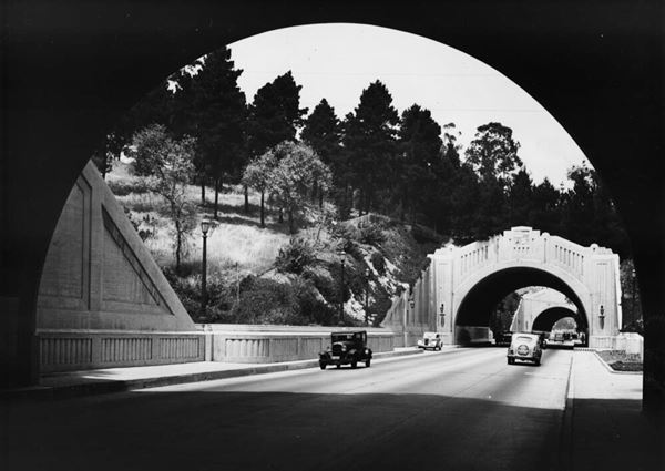
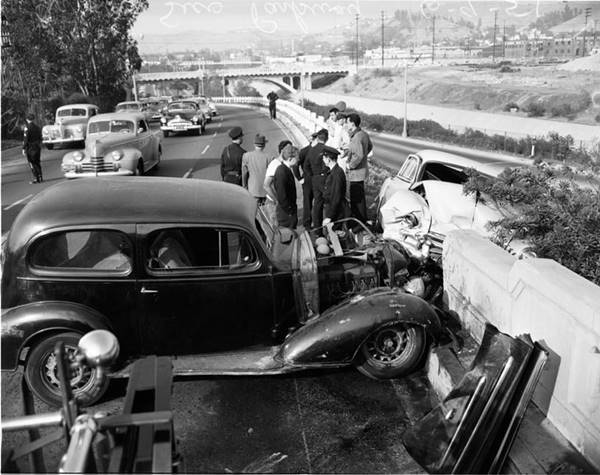
It had 6 lanes and was designed for 27,000 automobiles per day (it now carries over 120,000 cars daily). Below is a "Then and Now" view of the same spot along the parkway.
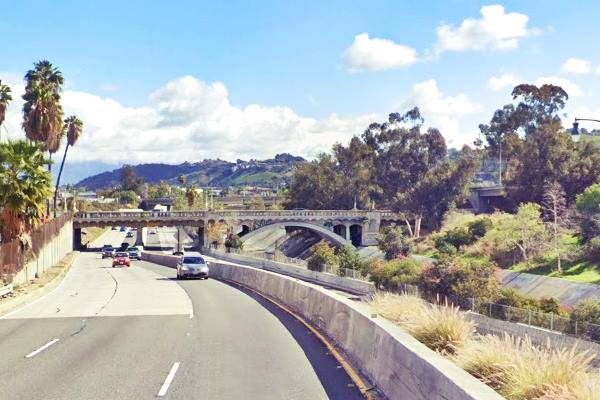
Same spot in a vintage 1940s photo on the Arroyo Seco Parkway; notice same arched bridge upper right:
Several bridges and the four Figueroa Street tunnels further south (that later carried the northbound traffic) were built in Art Deco style. There are four bridges that predate the Parkway: The 1895 Santa Fe Arroyo Seco Railroad Bridge, the 1912 York Boulevard Bridge, the 1925 Avenue 26 Bridge, and the 1926 Avenue 60 Bridge.
Trucks were banned in 1943. The parkway was extended in 1953 along the Elysian Park, on the western side of the Figueroa St. tunnels, but instead of tunnelling, it was cut into the hillside. It reached the Four-Level Interchange in downtown L.A. The following year it was renamed Pasadena Freeway.
It became the alignment of Route 66 in 1940 and the old route along Colorado Blvd. and Figueroa St. became Route 66 Alt, one of the earliest examples of the use of the "alternate" designation, which would become far more common during the early 1960s as Interstate highways bypassed the central districts in cities across the U.S.
The construction of I-210 in 1958 reduced the flow of cars along Colorado Blvd. and U.S. Highway 66 through Pasadena.
It was this freeway carried travellers into Los Angeles during World War II and it set the example followed around the world for freeway construction.
>> Learn more about the Historic Arroyo Seco Parkway
1936-1939 Temporary Alignment
We marked this alignment with a red line in our custom map.
This alignment followed the 1935 alignment across Colorado St. bridge into Eagle Rock but now turned south along the western flank of the Arroyo Seco using N. Figueroa St. Avenue 64 was also used by the southbound traffic.
The former route further west beame CA 134 (on Colorado Blvd.) and CA 61 (Eagle Rock Blvd.)
It linked up with the Figueroa Tunnels after crossing the Los Angeles River.
In 1940 when Route 66 was realigned along the Arroyo Seco Parkway it became Alternate 66
Alternate US 66
In 1959 the American Association of State Highway and Transportation Officials (AASHTO) came up with the definition of the "Alternate" designation. As shown further up, they had been toying with this idea since the early 1930s.
It was to be used to designate a highway that branches off from the main one, passing through certain cities and then links up with the main route again.
If the Main and alternative routes followed a similar course, the better built or shorter highway would be the one marked as "Main", while the other would become the "Alternate" one.
There are only six places along Route 66 where an Alternate 66 alignment existed: From East to West they were this one close on Route 66 into Chicago, Carthage MO, the one in Joplin MO, Oklahoma City, Alt 66 in San Bernardino, California, and this one leading into Los Angeles.
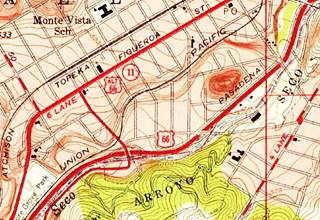
The image below, a 1953 USGS Map, shows both US 66 on the Pasadena Freeway and Alt 66 on Figueroa St. just north of their intersection at Los Angeles River.
It was eliminated in 1964 when Route 66 was decertified all the way from Santa Monica to Needles.

1956 Shell Roadmap, SW CA
Click on image to enlarge.
Credits
The image shows how the highway system had evolved by 1956, with Route 66 reaching the Pacific Ocean in Santa Monica.
The Decommisioning of US 66 began in California in 1964
Terminus moved in 1964 From Santa Monica to Needles
On Aug 26, 1963 the state's Higway Commission requested the "Elimination of Route 66... Between Jct. U.S. 95 Needles and Santa Monica" it was approved by the AASHO on Nov. 14, 1963. I-40 and I-15 replaced the former alignment between Needles and Santa Monica. At the same time the state had also requested eliminating Alt 66 from Pasadena to Los Angeles through Eagle Rock. This was also authorized. 25
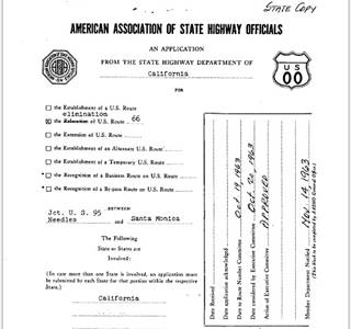
End of Route 66 moved from Santa Monica to Needles, 1964. Source.
Click image to enlarge
The first segment of Route 66 to lose its certification was the one located in Los Angeles County in 1964, it was replaced by State highways Route 2 and Route 11.
The western terminus of Route 66 was "officially" moved from Santa Monica to Needles in 1964 using I-15 and I-40 all the way from San Bernardino to Needles. However, the state's Highway Commission included the alignment of Route 66 between Pasadena and Needles in its maps until 1970 co-signed with state hwy. 248 (see the maps.)

End of your journey
The journey we began in Chicago ends here, on the Pacific Ocean in California.
First Section, the beginning of Route 66
>>The first section in our Road Trip itinerary is in the east, in Chicago: Chicago to Pontiac
How much of Route 66 is still driveable in California?
Many people ask us:
>> How Much Of Route 66 Is Still Driveable In California?
Answer: Over 95% of Route 66 in California is still driveable.
Hotels along this leg of your road trip
Santa Monica has plenty of lodging options for those travelling along Route 66, you can book a hotel or motel there:
>> Book your Hotel in Santa Monica
More Accommodation nearby along Route 66
Below you will find a list some of the towns along U.S. Hwy 66 east and west of Pasadena; click on any of the links to find your hotel in these towns.

Sponsored Content
>> Book your Hotel in Santa Monica

Credits and Further Reading
4. Route Numbering Archive AASHTO file Other_CA_1926__.PDF, search terms: Year: 1926, State, CA.
9. Coucil Minutes Archive, 2/05/1930, File Name 1051930. N° 3 (1929).
10. Coucil Minutes Archive, 1/12/1931, File Name 1121931. N° 5789.
11. Route Numbering Archive AASHTO file Other_CA_1931__.PDF, search terms: Year: 1930, State, CA.
14. Eagle Rock Advertiser, Volume 8, Number 53, 31 October 1935 page 5
16. Eagle Rock Sentinel, Volume XXVII, Number 81, 17 January 1936 page 1
17. Tom Fearer (2022). The Arroyo Seco Parkway and early terminus points of US Route 66 in Los Angeles. 04.Sep.2022
19. Route Numbering Archive AASHTO file Agenda(5).PDF, 101277384 barcode. Search terms: Year: 1932.
25. Route Numbering Archive AASHTO file Other (49).PDF, search terms: Route Number: 66.
Jim Ross, (2022). San Fernando endpoint of Route 66, 27.Sep.2022
Banner image: Hackberry General Store, Hackberry, AZ by Perla Eichenblat


