Route 66 in Los Angeles CA
Index to this page
About Los Angeles California
Facts, Trivia and useful information
Elevation: 308 ft (94 m). Population 3.822.000 (2025).
Time zone: Pacific (MST): UTC minus 8 hours. Summer (DST) PDT (UTC-7).
Los Angeles, also known by its initials, L.A., is a city located Route 66 in Los Angeles County in southern California. It is the second largest metropolitan area in the US with nearly 18.3 million residents.
The history of Los Angeles
This area has been inhabited for over 10,000 years since the end of the Last Ice Age. In more recent times there were several native groups such as the Cahuilla, Tongva people in the mountains and the Chumash along the coast. These were reported by the Spanish explorer Juan Cabrillo who reached the area in 1542, anchoring in what is now San Pedro.
The area was explored by Spainiards from Mexico in the late 1700s and the Mission San Gabriel Arcangel was established here by the Franciscans in 1771. The town of Los Angeles was founded in 1781 and named El Pueblo de Nuestra Señora Reina de los Ángeles de la Porciuncula, in English this translates as "The Town of Our Lady Queen of the Angels." It was located at a strategic site besidew the Los Angeles River.
This region was a part of the "Alta California" (Upper California) province of the Spanish Mexican Viceroyalty of Nueva España. (New Spain).
Mexico won its independence from Spain in 1821 and California became part of the new nation. During the 1830s the Mexican goverment nationalized most of the properties of the Catholic Church in Mexico, and in Los Angeles it covered the Mission's land. The governor granted titles to it to Mexican citizens.
The Mexican - American war of 1846-48 led to Mexico's defeat and the cession of California (and also most of what is now America's Southwest: Arizona, Colorado, Nevada, Utah, and New Mexico) to the U.S.
California became a state in 1850, Los Angeles incorporated as a city that same year.
L.A. grew slowly and in the 1870s, it competed with San Francisco to become the main port and railroad hub in California. The port of San Pedro was built at that time, and L.A. city limits expanded to annex it.
Oil was discovered in 1892. The city grew by annexing other districts (like Hollywood or Eagle Rock) and built an aqueduct to provide drinking water to its residents.
The film making industry moved to L.A. from New York to take advantage of the sunny California weather, ideal for filming. It centered around the foothills in Hollywood.
The Name, Los Angeles
Portolás 1769 expedition discovered and named the Los Angeles River on the festive day of Nuestra Señora de los Angeles de Porciúncula which is the name of a chapel in Assisi, Italy.
When the town was founded it was named after the river as "Reina de los Angeles" (Queen of Angels), but Pueblo de Los Angeles stuck (town of Los Angeles).
By the early 1900s, the use of the automobile began to grow and by 1910 it had increased considerably. That led to the creation of the associations, like the National Old Trails (N.O.T.) Association, that pormoted better highways and roads, suitable for cars. The N.O.T. worked actively towards a highway link between New York and Los Angeles. The road was built, and it later encompassed several California state highways. It left L.A. along Huntington Ave. northeast across South Pasadena, then through Pasadena, and from there eastbound to San Bernardino along the Foothill Blvd.
Route 66 is created in 1926
Route 66 was established 1926 and was aligned along the state highways mostly along the N.O.T. highway all the way from Chicago to Los Angeles. Ending in Pasadena. U.S. 66 Would go through many changes in its alignment, both east and west over the following years which we describe below in our Maps section.
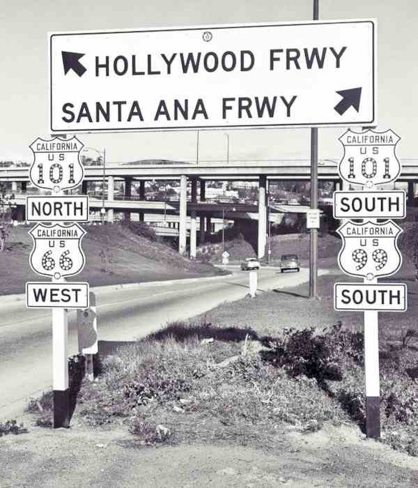
The Los Angeles freeway system which began in 1940, with the Arroyo Seco Parkway and Route 66 was aligned along it. More freeways were built (like the "Hollywood Freeway", along which Route 66 was aligned in 1953) and after 1956 the Interstate highway system was built. Route 66 was decomissioned here in 1964 and the western terminus of US 66 moved to Needles CA.

Accommodation in Los Angeles
You can find many lodging options in neighboring Los Angeles.
> > Book your Hotel in Los Angeles
More Lodging close to Los Angeles along Route 66
Below you will find a list some of the towns along U.S. Hwy 66 east and west of Los Angeles; click on any of the links to find your hotel in these towns.
>> Check out the RV campground near Los Angeles, in Pomona
The Weather in Los Angeles
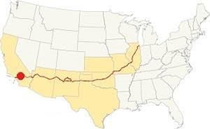
Location of Los Angeles on Route 66
The climate in Los Angeles is a Hot Summer Mediterranean one. Rather dry and hot in summer but cool and wet during winter (which can bring heavy rains), proximity to the ocean has a moderating effect on the daily temperature swings.
The January night temperature can be quite cool. Spring is warm and Summers are hot, with high temperatures extending into October which brings a short Fall, cool and hot, erratic.
Los Angeles has some 290 sunny days each year and during fall (autumn) strong dry winds blow from the desert (Santa Ana winds) drying out the area and increasing the risk of wildfires in the foothills. The summer average high is 92°F (33°C) and the average low is 68°F (19°C).
During winter the average high is (Jan) 71°F (21°C) and the average low is 49°F (9°C) in winter, the peaks of the San Gabriel Mountains receive snow, and may very rarely fall in Los Angeles. You may occasionally experience some frost during winter (Dec. to Mar.)
Rainfall averages 21 in. per year (535 mm), most rain falls during the period from November to April, the rest of the year less than 0.5 in. falls monthly. There are 43.8 rainy days yearly.
Tornado risk
Los Angeles is located very close to the Pacific Ocean and well beyond the Rocky Mountains which are the western limit for tornadoes, so there is no risk of tornadoes in the city. Tornado Risk: read more about Tornado Risk along Route66
Map of Route 66 near Los Angeles
>> Custom map alignments of US66 in this area
And our two other custom and interactive maps:
National Old Trails Highway (N.O.T.)
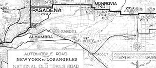
1912 N.O.T. Road map
Click on image to enlarge.
Credits
The 1910s N.O.T. highway system was aligned along Foothill Blvd and Colorado Blvd. into Pasadena from San Bernardino as it approached Los Angeles along its transcontinental course from New York.
The N.O.T. map (click to enlarge) shows its alignment across this area, it can be seen turning south into South Pasadnea along Fair Oaks Ave. and Huntington Dr. south of Pasadena as it heads into Los Angeles and enters the city using Broadway.
Route 66 Map
In 1926 Route 66 was aligned along the state highways all the way to Pasadena. The following map shows the highway in the Los Angeles region in 1927. You can follow Route 66 from Victorville in the east, to San Bernardino and west to Pasadena and Los Angeles. Los Angeles is on the lower left side of the map.

1927 Road map, SW CA
Click on image to enlarge.
Credits
The black and white 1930 thumbnail map above also shows the alignment of Route 66 from Victorville to Los Angeles notice the detail with the alignment across South Pasadena into Los Angeles is the one described further up and coincides with the N.O.T. alignment.
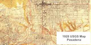
The other map below, was published in 1928; it shows Route 66 into Pasadena and then a fork, one highway crosses Arroyo Seco in Pasadena and enters Eagle Rock, the other follows Fair Oak, Mission St., crossing the Arroyo Seco in South Pasadena into the Los Angeles' Garvanza neighborhood. But no shields are shown.
There were several alignments of Route 66 from Pasadena into Los Angeles during the period spanning 1926 to 1940. It was only after 1940, when the Arroyo Seco Parkway became the route for US 66 into LA that these changes stopped. Contemporary maps don't clearly mark the course of US 66 into LA, and we have written extensively about it in our Pasadena to Santa Monica alignment webpage.
Our custom maps show these alignments, one through South Pasadena, another through Eagle Rock.
Finally there was an Alternate Route 66 alignment from Los Angeles into Pasadena along N Figueroa St. and Colorado Blvd.
1936: Route 66 extended from Los Angeles to to Santa Monica
When Route 66's western ending point was moved from downtown L.A., to Santa Monica, it was again realigned our custom map shows the different courses it took over the years.
Sunset Blvd. The 1936 - 1953 alignment
Brown line in our custom map.
Sunset Blvd. follows the path of a 1780s cattle trail from the Pueblo de Los Angeles to the ocean. This alignment headed NW from N. Broadway, along what is now W. Cesar E Chavez Ave (named so in 1994 along with Macy Street and Brooklyn Avenue in honor of the late Mexican-American union leader and civil rights activist). It followed its continuation, Sunset Blvd. until Myra Ave. where it turned left and then SW until reaching Santa Monica Blvd and from there westwards all the way to Santa Monica. Then in the late 1940s it was realigned on the Freeway US 101 up to Santa Monica Blvd., from the exchange with the Arroyo Seco Parkway, which took several years to be completed.
Hollywood Freeway 1953 - 1964
Pale Blue line.
The Hollywood Freeway along which US 101 ran, replaced Sunset Blvd. after its completion (1953-1964). US 101 marks the norther limit of the L.A. Westlake neighborhood and the southern one of Echo Park and Silver Lake. Then it enters Hollywood neighborhood where Route 66 takes a left along Santa Monica Blvd.
Santa Monica Blvd. 1936 - 1964
Yellow line.
It heads west, until the "End of the Road" in Santa Monica and crosses two other cities: West Hollywood and Beverly Hills and the Hollywood and Western part of L.A..
West Hollywood
This city is surrounded by Los Angeles, north, south and east, and to its west is Beverly Hills (City map). Route 66 ran from the easter border with L.A. -halfway down the block between N. Sycamore Ave and N. La Brea Ave. on Santa Monica Blvd. all the way to N. Doheny Drive on the border with Beverly Hills, a total lenght of 2.9 miles.
Beverly Hills
To its east is West Hollywood, and Los Angeles is to its west, south and north (City map). US 66 starts at N. Doheny Dr. on the border with West Hollywood and ends on Heath Ave. in the west; total length: 1.8 miles.
West Los Angeles
Once again US 66 enters Los Angeles city west of Beverly Hills and runs for 3.6 miles between Heath Ave. and Centralia Ave., crossing the Century City and West Los Angeles neighborhoods of Los Angeles City. Map of US 66 in West Los Angeles.
Santa Monica
West of Centralia Ave., Route 66 enters Santa Monica (City map) and originally headed south along Lincoln Blvd, where it took a left and ended on the junction with Olympic Blvd. Read More on The Western Terminus of Route 66 1936-1964.
Route 66 Alignment near Los Angeles
With maps and full information on the Mother Road.
- Pasadena to Santa Monica (Los Angeles')
- Topock to Barstow (Previous)

Sights and Attractions in L.A.
The Big Orange Route 66 Landmarks
Get your Route 66 Kicks in Los Angeles
"Route Sixty-six" is an emblematic song that immortalized Route 66 in the minds of several generations as an iconic Road Trip, a journey where the traveler can get his kicks, enjoying and savoring the moment and the freedom of riding the Mother Road. It was written by Bobby Troup in 1946, and since then it has been a hit evoked by all those who have driven (or dream about driving along) Route 66.
>> Read More: Get your Kicks on Route 66, full details on the song and its context.
The songs' lyrics mention Los Angeles using its abbreviation, LA.
If you ever plan to motor west,
Travel my way, take the highway that is best.
Get your kicks on Route sixty-six.
It winds from Chicago to LA...Words and Music by Bobby Troup, Copyright 1946. London Music.

The Spots and Sights along Route 66 in Los Angeles
The size of the city and the different courses adopted by U.S. 66 over the years make it hard to follow one single itinerary to visit the different Route 66 attractions in Los Angeles, so we have described them along each of the alignments.
- The Eagle Rock Alignment (1931-36)
- The N. Figueroa St. Alignment and later Alt US 66 (1936-1964)
- Arroyo Seco Parkway alignment (1940-1964)
- The N.O.T. Alignment into L.A. (1926-1931)
- Chinatown
- Downtown Los Angeles
- Sunset Boulevard alignment (1936-1953)
- The Hollywood Freeway (1953-1964)
- Santa Monica Blvd. alignment in West L.A. (1936-1964)
The Eagle Rock Alignment, 1931-36
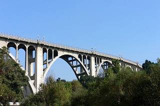
Colorado Street Bridge, Pasadena. Source.
This was the first realignment of Route 66 into the city (detailed description in our Pasadena to Santa Monica alignments page). It begins in Pasadena, where hte highway followed West Colorado Blvd. crossed the Arroyo Seco River using the historic Colorado Street Bridge built in 1913 (pictured). It ran westwards into Eagle Rock along W Colorado Blvd., which in those days had a different alignment as the Ventura Freeway hadn't been built. Its course, marked with a green line in our custom map, was located on the north side of the current freeway. Later, after Ventura Fwy was built, the current Colorado Blvd. alignment was built here (violet line) all the way to Avenue 64, the city limits with Los Angeles' Eagle Rock district.
Eagle Rock
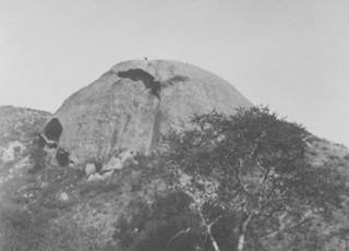
Eagle Rock hill, 1911. Source
Click to enlarge
Eagle Rock incorporated as a town in 1911 and was annexed by Los Angeles in 1923, with the threat of an inadequate water supply and the promise of an upgraded school system. The hill on the eastern side of the town is known as Eagle Rock, the photographs dating back to the late 1800s and early 1900s seem to have been retouched. See the 1911 picture and the current view to decide for yourself.
The name: Eagle Rock
Eagle Rock is named after a mountain that the Spaniards appropriately called "Piedra Gorda" or "Fat Rock". The urban myth says it got its present name from a native Tongva legend about an eagle that was punished by the Sun god for clutching an infant, and turned to stone.
The original alignment followed a winding course north of modern Colorado St. west of Pasadena (green line in our map) it curved around the park and then headed south along Eagle Vista Drive. Later, in 1935 El Modena Avenue was paved, widened and graded (black line in our map) to carry Route 66 to N. Figueroa St. and cutoff Eagle Rock.
Eagle Rock Route 66 Sights
The 1946 Central Los Angeles yellow pages directory lists the motels under the "Automobile Courts" entry, and service stations. Below we mention them, marking those that have been torn down with a red cross ❌.
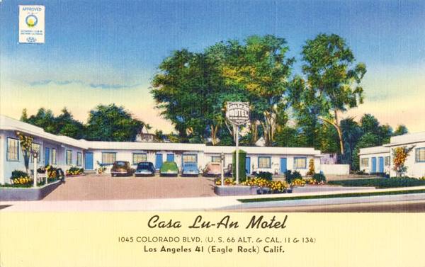
Casa Lu-An Motel
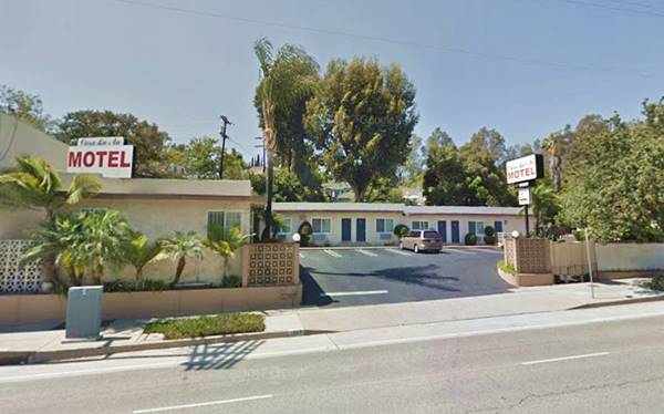
After passing Figueroa Street, at 1045 Colorado Blvd. Eagle Rock, to your right. This is a classic Route 66 motel and it is still operating under the original name. The 1940s post card below tells us that it was located on "1045 Colorado Blvd. (U.S. 66 Alt. & Cal. 11 & 134) Los Angeles 41 (Eagle Rock)... A new, 14 unit, fully carpeted "roomy" motel with glass-door, full-tile showers or tubs. Fully equipped kitchens. Near good restaurants. Owner operated."
The motel's building looks almost the same, the old sign of course, has been changed for a more modern one, which is a pity.
Ahead, on the NW corner curve where Colorado meets Eagle Vista Dr. was Allan's Mohawk Service Station ❌ (1429 Colorado) ahead, to your left, on the SE corner with Los Robles St was the M&L Service Station ❌ (1450 Colorado). Across from it, on the SW corner is another motel that has survived and is still open.
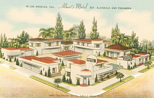
Albert's Motel, now the Islander Motel
At 1460 Colorado Blvd. and listed in the yellow pages of 1946 as Albert's Auto Court, it is still open and became the Islander Motel. The round sign on the corner building and also have an interesting neon motel sign have survived.
Their vintage postcard says: "... Healthiest spot in LOS ANGELES. Near all points of interest. 10 minutes to Hollywood. On State Hwy. 134, 1/2 mile west of U. S. Hwy. 66. Single rooms or complete, cozy apartments for 1 or 6 persons. Daily maid service. Closed garages. Free recreation grounds. An ideal spot for a vacation or honeymoon retreat...Mr. Albert, Owner and Manager." Albert Dejacomo opened his motel in 1937 with an innovative Streamline Moderne style. Later it was owned by Mr. & Mrs. Jes. Wejroch; and finally by Mr. & Mrs. A. Kossyo.
the Islander Motel (former Albert's Motel) nowadays
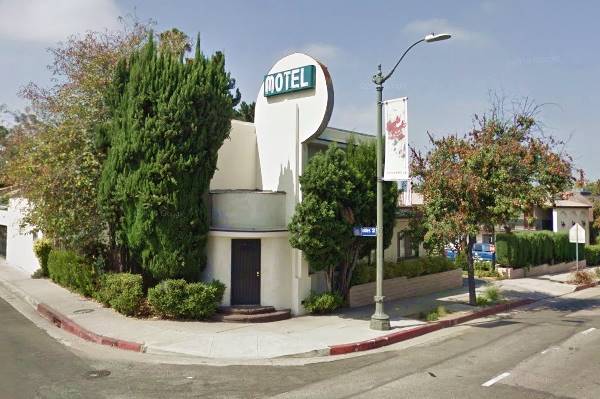
The Hi-Motel ❌ was on the corner, across the street, to your right at 1485 Colorado; its yellow pages entry of 1946 says "Modern Btwn Pasadena & Glendale-Hwy 134." It was torn down in the late 1960s, and a church now stands on the property. See its U-shaped layout around a central courtyard in this aerial picture taken in 1952.
Cindy's Diner & Neon Sign
US 66 Classic Neon Sign
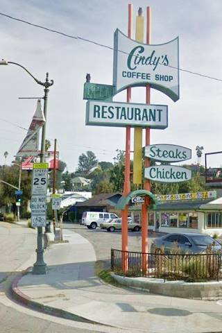
On the next block, to your left, at 1500 Colorado Blvd. This is a typical American diner and has a retro style to it. A place to eat hamburgers and pancakes. The best feature is the neon sign, an example Googie architecture with colorful panels and poles designed to catch the eye of drivers along the highway.
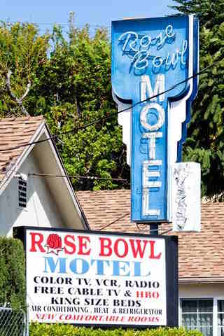
Rose Bowl Motel sign. Credits
Rose Bowl Motel
Across the street, to your right, at 1529 Colorado Blvd. Its yellow pages entry in 1946 reads "Rosebowl Motel Member Hotel & Motel Assn of Calif 12 Modern Units - Centrally Located". Its neon sign is pictured above (St. view of the sign).
Next door was the Rose Bowl Service Station ❌ (1539 Colorado) and ahead was Joe Kopietz's K Service Stn ❌ (1644 Colorado).
Across the street is a historic service station, Risk's Standard Station.
The Jay Risk Standard Oil Service Station
L. A. City Historic-Cultural Monument
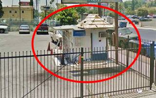
Barely visible, sandwiched between to buildings, at 1659 Colorado Blvd. The metal building was constructed in 1919 in the "House with Canopy" style for the Standard Oil of California Company. John Milton "Jat" Risk (1889-1963) moved it in 1931 from its original site at the Standard Oil's plant at 1726 N Spring St. to this spot on Route 66. It served as a filling station until 1939 when it was repurposed as a fruit and vegetable market. By 1947 it had become George Clairville's plumbing shop. 1 See its St. view.

On the 1700s block were the now gone Riley King Service Station ❌ (1701 Colorado) and the Eagle Rock Super Service ❌ (1719 Colorado). Then, in the middle of the block, the buildings of a former motel.
Pueblo Motel & Dining Room
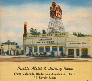
1750 Colorado Blvd. Its 1950 postcard describes it as "A Lovely 42 unit motel with Coffee Shop and Dining Room in connection. Full-Tile Showers; Garages; Free Radios. Television in Lobby. Cafe Open 7 A.M. until 10 P.M. Sleep «Off the Highway»."
The building that housed the Dining Room and the "Pueblo Barber Shop" has survived, and in the back part of the property you can still see the hip roofed cabins. Below is a the "Then and Now" set of images.
Welcome Inn, Former Eagle Rock Travelodge
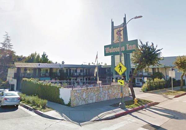
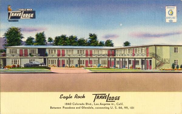
On the next block, at 1840 Colorado Blvd. is the former Eagle Rock TraveLodge. The building is still a motel, but now it is the Welcome Inn.
The postcard tells us that it was "A '50 constructed, 24 unit, nicely furnished, fully carpeted motel with tubs or tile showers. Some kitchenettes. Close to Good Restaurants."
Antique ca. 1950s66 in Los A postcard view of the Travelodge at Eagle Rock now the Welcome Inn
At 2150 of Colorado, Eagle Rock Boulevard heads off to the south. Route 66 ran along it all the way to San Fernando Road to end at its intersection with Fletcher Dr. where it met U.S. higway 99.
There are no surviving buildings of the 1930s Route 66 period along Fletcher or Eagle Rock Blvd.
The Western Terminus at Fletcher & San Fernando Rd
The California Highway Commission stated in letter, in 1931, that Route ngeles ended at its junction with U.S. 99 at Fletcher and San Fernando Road (see the marker in our custom map).
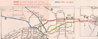
Nov. 1931, CHC map of US 66 in Los Angeles. Source
Click on image to enlarge.
The letter also explained that "The terminus of U.S. 66 is designated as Los Angeles and it would seem that the logical point to terminate the route would be at a junction with U.S. 101 and U.S. 99 practically at the center of the business district of that city. This plan requires all through traffic to follow the heaviest traveled arteries of the city. On the other hand if a route is signed which will allow traffic to avoid the most congested area the city is by-passed. This is shown in the attached map. U.S. 66 as now signed terminates at the junction with U.S. 99 at Fletcher Drive and San Fernando Road. We had in mind recommended extension of U.S. 66 as shown in yellow to a junction with U.S. 101 at Sunset Boulevard, also the signing of an alternate route as shown into the heart of the city."2
The AASHO replied in Nov. 1931 and suggesting that "the real answer to your problem is to carry U.S. 66 to Santa Monica. You certainly should carry the numbers further into Los Angeles than you are now doing," adding that alternate routes should always end on the other route, so it couldn't be a spur. But the state didn't want to extend the highway to Santa Monica and insisted on a forked with two endpoints, one downtown, the other on Routes 99 and 101. Several letters came and went on this matter during 1931. But the alternate alignment from Arcadia along Huntignton was never approved.
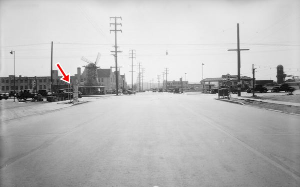
The image (click on it to enlarge it) looks towards the southwest along Fletcher Dr. towards San Fernando Rd. It was taken in 1932. The windmill atop the SW corner building was part of Van de Kamp's Holland Dutch Bakers complex. Although the windmill is gone, the two-story red tiled roofed Dutch-styled buidings along Fletcher, have survived until now. The red arrow marks the sign pointing towards the north; we make out a U.S. 66 shield on it. The modern image shows the same spot nowadays, the red tiled buildings are the old bakery.
Van de Kamp's Holland Dutch Bakeries was founded in 1915 in Los Angeles and its stores had windmills atop their restaurants. The company went broke in 1990 and the brand is now owned by Pinnacle Foods Group.
This marks the end of the Eagle Rock section of your Route 66 Road Trip; turn around and return along Colorado to North Figueroa Street to head south along it towards L.A, taking the second course used by Route 66 into the city.
The N. Figueroa St. Alignment: Alt US 66
This was the 1936-39 alignment of U.S. 66 that became the 1940-64 Alternate 66.
Head south along N. Figueroa St., the 1946 yellow pages mention many service stations, most of them gone; we mark these with a red cross ❌
Here was Volby's Service Station ❌ at 7025 N Figueroa; and the highway enters the Highland Park district of Los Angeles. Ahead are two surviving former filling stations Wood's (6625 N Figueroa) and Nelson's (6024 N Figueroa); whose buildings are still standing and house auto repair shops.
Miner's Service ❌ at 6501 was torn down, a ranch style Shell Service Station was built there in the late 1960s, and it houses a used car dealership. The upright chimney-like parapet used to carry the Shell logo (St. view).
John R. Johnsons station ❌ (6300 N Figueroa), the Signal Station ❌ (5800), and Standard Station ❌ (5437) have also gone.
Chicken Boy - Muffler Man
Route 66 Kitsch and Americana, wacky sights

The head of "Chicken boy". Source
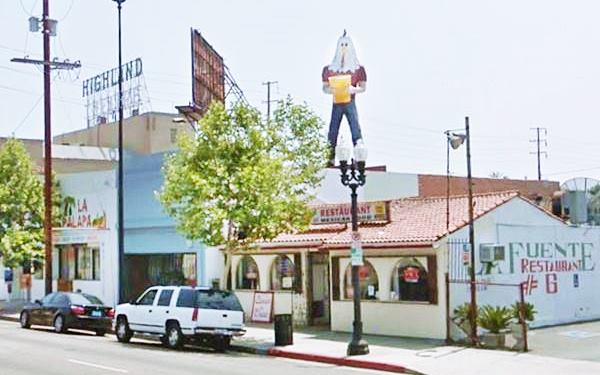
To your left at 5558 N Figueroa St. Here you will see a gigantic fiberglass statue placed on the rooftop of a design studio and gallery. It has a human body and a chicken's head. It is 22 ft. tall (6.7 m). It faces south.
It dates back to the 1960s when it was the eye-catching sign of a restaurant that sold fried chicken and was located at 450 Broadway close to 5th in downtown Los Angeles. It was an adapted muffler-man fiberglass statue onto which the chicken's head was added. Below it can be seen in 1973 at its original location.
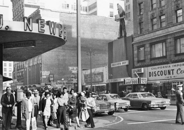
Graphic Designer Amy Inouye was captivated when she first saw the Chicken Boy, and when she learned that the restaurant was closing back in 1984, she rescued the statue and stored it for 23 years before obtaining the permits from the city that let her set it up on the roof of her studio in Highland Park. 3
In 2010 California Governon Arnold Schwarzenegger gave Amy and the Chicken Boy the Historic Preservation Award; Amy says that Chicken Boy is the "Statue of Liberty of Los Angeles."
The Chicken Boy nowadays

>> Learn all about The Muffler Men on Route 66
The 1950 Sanborn map shows a now gone Auto Service, Used Cars Sales, Gas & Oils at 5424 N Figueroa, followed on the corner by Norman Church's Station (5400 N Figueroa), and the old building here appears in the 1950 Sanborn map and now, it is a small coffee shop. The next four gas stations are all gone ❌: Big Pine Service Stn (5330 N Figueroa), Don's Richfield Service (5201) and the Highland Associated Service (5138). There still is a Shell at 5137 N Figueroa but the original station ran by Irving G. Antram in 1946 is gone.
The picture below was taken in Nov. 1942 taken at 5237 N. Figueroa St. Notice the sign on the side of the building with the "Upholstry sign" reading "Cars Last Longer 'Go Farther Service'." Next door is a cafe, the sign says "Eat Rite. This is the view at that same spot nowadays; the Presbiterian Church is still there.


Alexandria Motel 1940s. Los Angeles Route 66. Source
Click to enlarge
At 4972 N Figueroa was the Idyllwild Inn ❌ with 15 apartments and 20 rooms, as shown in the 1950 Sanborn map.
Alexandria Modern Cabins appears in the map and also in the yellow pages: "30 cabins With Showers-Highland Park 4562 N Fgroa."
"Shed" style gas station
On the next corner, to your left, at 4532 North Figueroa. The first gas stations appeared in the 1910s and were a small shed with the pumps located in front on a gravel drive. This is one of those curbside stations. It has a hip roof and is very close to the sidewalk, surrounded by parking area, now fenced in. It appears in the 1950 reprint of the Sanborn Fire Insurance Co. map of this area pictured below.
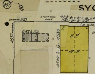
Old station in the Sanborn map, 1950. Source
The 1950 Sanborn map shows a Gas Station and Auto Repair Garage at 4400 N Figueroa, a Union Service (4325 N Figueroa) and a Signal Service (4201), these last two listed in the 1946 phone directory. Finally there were two gas stations, one at 3926 N Figueroa the other at 3710. All of them gone ❌.
Walker Station
At 3500 N. Figueroa, A. M. Walker's station figures in the 1946 yellow pages and the Sanborn map (1950), the building on the corner was the pumping area, and the one just north of it, the greasing shop. Both have survived, there is a repair shop on the property.
Macchia and Banto's Cypress Mobil Station
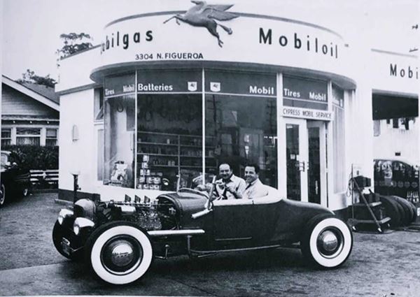
At 3304 N Figueroa on the NE corner with Cypress is the former Mobil Service Station owned by Sal Macchia and Louis Banto.
They can be seen at their station in their roadster featured in the Hot Rod Magazine issue of July 1950. 4
The station had the "Drum design" created by Frederick Frost, that represented the shape of an oil can, and gave a half-cylinder shape to the sales office and display room. It was popular during the 1940s.
Route 66 Marker
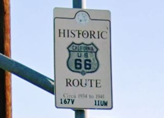
On the NE corner of 26th Ave. and N Figueroa St. there is a City of Los Angeles marker that reads "Historic Route 66, Circa 1934 to 1941", it is on the traffic light post.
Westwards there were five more gas stations, all gone ❌ four here at the crossroads, the Standard Oil Ave. 26 & Figueroa (2601 N Figueroa St.), a gas station (2600) shown in the Sanborn map of 1950; on the south side of 26th was Stapp's Union Service (2250), Gas & Oil (2251), and H B Melear Station (2000). Traffic heading west after this point would have used the Figueroa Street Tunnels described in the next section.
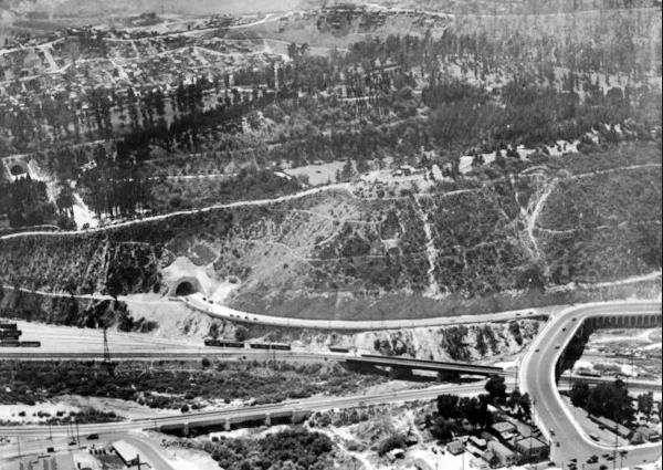
The image above looks south across the Los Angeles River to the hilly Elysian Park. The northernmost tunnel on Figueroa St. can be seen on the left (and another tunnel on the middle left side), and the road turns right immediately after leaving the tunnel, merging with Riverside Dr. that here turns sharply north to cross the river and meet San Fernando Rd. on the lower left side of the image. This is the same view nowadays, with the changes brought on by the northbound bridge built in 1936 and the southbound lanes of Arroyo Seco Parkway (Pasadena Freeway) added a few years later.
Figueroa Street alignment continues across the park, through a series of tunnels that we describe in the next section.
Here it meets the Arroyo Seco Parkway described further down. The Parkway replaced the Figueroa St. alignment in 1940 between Pasadena and LA.
Figueroa Street Tunnels
Figueroa Street originally ran northwards across central Los Angeles and ended just a few blocks north of Sunset Blvd., at the foot of the hills of Elysian Park. Further north, on the north side of the Los Angeles River, what is now N Figueroa St. was called Dayton Ave., that linked San Fernando Rd. with Pasadena Ave. and all the way to York Blvd., modern N Figueroa St. was called Pasadena Ave.
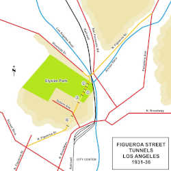
The extension of Figueroa St. aross the Elysean Park was done in stages. Until then all the traffic into the city south of the confluence of the Arroyo Seco and the Los Angeles rivers ran along the eastern bank of Los Angeles river (see Pasadena Ave, San Fernando Rd., and N. Broadway in the map. Red lines mark the main throughfares); the northwestern bank of the river was occupied by the Elysian park, on a large hill 200 to 400 feet above the river's level. Further south, the streets crossed the river into the central district of Los Angeles.
The city decided to build a road with a straight course along the eastern flank of the park and to preserve the natural setting, it would include several tunnels. In 1928 plans were ordered for this project. In 1929 Riverside Drive was extended southwards along the north side of the park, and then it turned to the NE crossing the Los Angeles River ending at San Fernando Road (marked with an orange line). From this point Dayton Ave was renamed Figueroa St. and improved (orange line). As mentioned above, the section of what is now Figueroa St. in Highland Park above Avenue 39 was known as "Pasadena Avenue" until Figueroa was extended through Elysian Park.
Three tunnels were dug through the hills between the Los Angeles River in the north and Solano Avenue in the south, marked ①, ②, and ③ in the map. Figueroa St. was paved through them and at its northern tip it turned sharply left to meet Riverside (see picture)
See the bordeaux line in our custom map.
At its southern tip, until the fourth tunnel was completed, traffic flowed along Solano Ave. onto Broadway and into the downtown district. This work on the first three tunnels was completed in 1931.
The fourth and southernmost tunnel was finished in August 1936 and is marked ① in our map, and a new extension of Figueroa linked it with Sunset Blvd. (orange line).
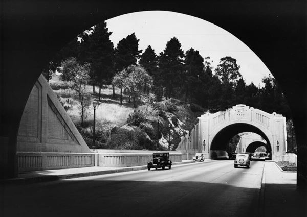
The image below looks along Figueroa Street just east of Elysian Park and Chavez Ravine, notice that before the completion of Arroyo Seco Freeway, the tunnels carried traffic in both directions. This is a current st. view at the same spot shown in the image below.
Los Angeles River Bridge

Figueroa St. bridge on Los Angeles river. Source
Click on image to enlarge.
The bridge across the Los Angeles river avoided the right turn at the exit of the tunnel and the 90° turn onto the Riverside bridge. It also crossed the railroad tracks that ran along both sides of the river and San Fernando Road. The bridge officially opened July 6, 1937. 5
The bridge was also part of the project that would link it with the Arroyo Seco Parkway a route that was added to the state highway system by an act of the state legislature in July 1935. Pasadena and Los Angeles approved the parkway plan in April 1936 and the CHC also gave its approval. 6
With the completion of the four tunnels, Route 66 was aligned along Figueroa into Los Angeles downtown and, onwards to Santa Monica.
The 1934 traffic density map published by the CHC shows that the state highway north of York Ave. ran along Avenue 64 and not along N Figueroa St. 7. This gives an idea of the state of flux in these alignments.
The Los Angeles River marks the end of the Figueroa St. tour, you can continue along Figueroa St. by driving onto the Arroyo Seco Parkway for our third itinerary, described in the next section.
Arroyo Seco Parkway Alignment
Listed in the National Register of Historic Places. National Civil Engineering Landmark. National Scenic Byway. California Historic Parkway.

The First Freeway in the West
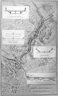
Arroyo Seco Parkway 1936 map rendering. Source.
Click image to enlarge.
This was the 1940-1964 alignment (it is shown Pale Blue in our custom map. Its northern part begins in Pasadena and runs southwards across South Pasadena and originally ended here at the Los Angeles River and the traffic continued into Los Angeles along Figueroa through the tunnels.
To drive it all, head southwrds along the Freeway through Elysian park, reach the "Four Level Interchange" where Route 66 took a right, along US 101 towards Hollywood. To drive the whole Parkway, keep southbound, then leave the freeway and return northbound, you can drive the whole Parkway until it ends, in Pasadena. The trip in itself is "the" attraction. See this map with directions of the 20 mile-long itinerary driving the whole Arroyo Seco Parkway.
We describe it in a separate page:
>> All you need to know about the Arroyo Seco Parkway
South of the Figueroa St. Tunnels
Fourth Figueroa Street Tunnel
From the opening of the first three tunnels in November 1931 until the completion of the 4th tunnel August 5, 1936.8, traffic followed into Los Angeles from San Fernando Rd. Riverton Dr. and North Figueroa through the three tunnels and then took Solano Ave to its intersection with Broadway and into the city's downtown district. But at that time (1931) there was no terminus in downtown LA, it was still located on San Fernando Rd. and Fletcher Dr.
Work on the fourth tunnel began in 1935 and the picture below taken in 1935 shows the north portal of the fourth Figueroa St tunnel while it was under construction. Figueroa already carried Route 66: Notice the road signs to the right with the shields of State Hwy 11, U.S. 66 and U.S. 88 on the right side of the image, guiding traffic towards Solano Ave. This is the same view at this spot nowadays.
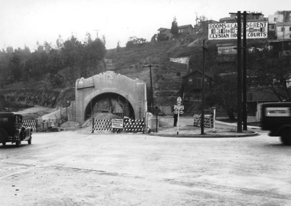
In November 1936 traffic was aligned through the 4th tunnel along Figueroa St. all the way to Sunset Blvd. No sights remain on this alignment like The Mayo Motel ❌ at 840 N Figueroa and a Richfield Service Station ❌ at 801 N Figueroa. In 1940 work began on an extension of the Arroyo Seco Parkway across the Elysian Park it was completed in 1943. And in 1946 work began on an extension towards the new Hollywood Freeway. Both highways would meet at the Four Level Interchange built in 1949 and opened in 1953.
Until then, traffic flowed south along Figueroa to its intersection with Sunset Blvd. Here there was a service stations on each of the four corners, all gone ❌ Donovan's Texaco (867 W Sunset) on the NE corner, Standard Service (901 W Sunset) on the NW corner, an Art Deco styled Union Oil station (900 W Sunset), SW corner and Johnny's Associated Service on the SE corner (866 W Sunset). The image below looks towards the Union Oil Station on Feb. 2, 1941.

The Figueroa Street Alignment ends here.
The 1926 - 1934(?) Alignment into L.A.
As explained in our Pasadena to Santa Monica alignment webpage this alignment does not seem to have been officially recognized or signed as it does not appear in the official California Higways Commission's maps. However, it appears in maps like the one in the image, following Fair Oaks Ave. from Pasadena through South Pasadena, and then south until it meets Huntington Drive, and then west along Huntington until N. Mission Rd. and then taking Broadway to 7th Street.
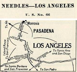
Route 66 into Los Angeles, 1930 roadmap
Click on image to enlarge.
Full map
Almost all of the 1930s sights along it have been torn down. There is a surviving Service Station at 5117 Huntington Dr. now repurposed as a store, the pump island and the flat tin canopy with rounded tips have survived, and the store has expanded under the canopy and into the service bays (pictured above).
Gordon's gas station ❌
Gordon's was located at 4691 Huntington Dr. owned by Gordon Spencer was torn down. Below is a view of it back in 1977, taken by John Margolies.

The Palms Tourist Camp ❌ at 4200 Huntington Dr. South. Frank Williams built the cabins using Celotex brand fiberboards made from waste sugar cane. Notice the palm trees behind the complex (pictured below).
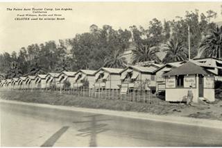
The Palms Tourist Camp c.1932. Los Angeles Route 66. Source
Click image to enlarge
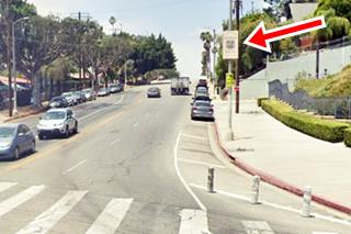
Historic Route 66 1926-34 alignment sign
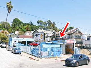
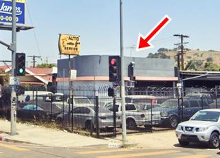
Ahead, Huntington Drive becomes N Mission Drive. Turn right along N Broadway. Here on the eastern side of the street there is a Historic Route alignment sign that reads "Historic Route [U.S. 66 shield] circa 1926 to 1934." See red arrow in the image above.
Follow North Broadway as it heads west, crosses I-5 and then the Los Angeles River and the railroad tracks to turn towards the southwest skirting the Elysian Park area. It meets Route 66's 1935-36 alignment at Solano Ave.; this one came from the three northern Figueroa St. Tunnels that used Solano to reach Broadway and Sunset Blvd. until the completion of the 4th tunnel August 5, 1936.
The highway approaches the downtown district of the city of Los Angeles.
Downtown Los Angeles
- Chinatown
- Olvera Street
- Downtown Los Angeles
- Los Angeles City Hall
- Historic Broadway Theater
- The 1926 Terminus of Route 66
Chinatown
Route 66 ran along Broadway towards Chinatown. There is a classic Gas Station at 1001 N Broadway, to your right on the corner with Bernard St., it has a flat tin canopy over a single pump island and two service bays with multi-pane doors (St. view).
Chinatown is a neighborhood of Los Angeles.
The first Chinese arrived in Los Angeles around 1852. Then came a large influx of Chinese that were hired in China's Guangdong (Canton) province to build the Central Pacific Railroad in the 1860s. They settled in Los Angeles near what is now the Union Station and Old Chinatown was born in 1880 expanding until property ownership and citizenship laws restricted further growth. It later declined into a sordid district with opium dens and gambling houses. The residents were finally evicted in 1931 to make room for the new Union Station on the site of Old Chinatown.
The New Chinatown was created in the mid 1940s but by the late 1950s the restrictive legislation was eliminated. Chinese were now free to settle wherever they chose to.
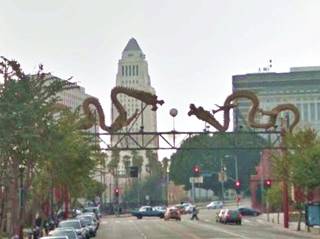
The East Gateway is located at 947 N Broadway, on Gin Ling Wy. Further ahead there is an archway across North Broadway as it reaches César Chávez (pictured above). Here there is a second Route 66 alignment sign.
Historic Route 66 1926-34 alignment sign in Chinatown
There is a second Historic U.S. 66 alignment sign, in Chinatown, on the NE corner of N Broadway with César Chávez that also reads "Historic Route [U.S. 66 shield] circa 1926 to 1934."
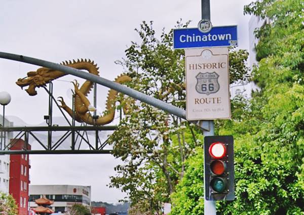
Ahead North Broadway becomes South Broadway and reaches 7th. Street which was is proclaimed as the original end point of Route 66:
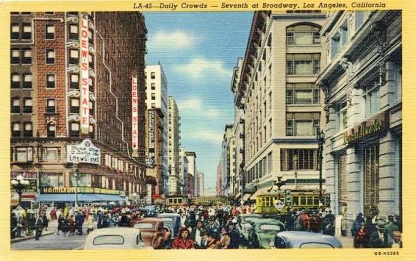
The intersection of 7th Street and Broadway in Downtown Los Angeles was the crossroads of the Western United States in the 1920's... In 1924 it was documented to be the most heavily-traveled intersection in the world with 504,000 persons crossing the intersection in 24 hours. This included 200,000 persons in streetcars, 35,000 persons in automobiles, and 269,000 pedestrians. This volume exceeded those in London (Hyde Park Corner – 478,000), New York (5th Avenue and 42nd Street) and Paris (Place de l'Opera – 384,000). In 1930, this volume would reach an astonishing 750,000 persons passing through daily. In 1926, Broadway (ending at 7th Street) was designated as the most westerly segment of the original routing of US 66, while 7th Street was designated as part of the original segment of US 101. John E. Fisher Transportation Topics and Tales: Milestones in Transportation History in Southern California
Now and Then Broadway and 7th Street Los Angeles
South Broadway and 7th St. Los Angeles nowadays, this was the "mythical" 1926-36 terminus of Route 66 in downtown L.A.
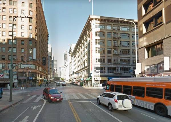
Striking contrast in the past there were more cars, trams, and a lot of people, but the same buildings and the "Sprekles..." sign though faded and ghostly, is still there on the wall:
1940s postcard view of the S. Broadway and 7th St. Los Angeles
Olvera Street
Part of El Pueblo de Los Angeles Historic Monument
At W. Cesar E Chavez Ave, take a left towards Main Street to visit the famous Olvera Street, just two blocks away:
Olvera Street, Los Angeles (Map with Location).
This was the original townsite where Los Angeles was founded; the old town's city center and main square (plaza) was right beside it. The 1818 Avila Adobe house is here too.
Originally named Wine St. it was renamed in 1877 to honor the first Superior Court Judge of L.A. County, Agustín Olvera.
The street was the creation of Christine Sterling (1881-1963) who as a preservationist alos helped save Avila's Adobe. In 1930, Olvera St. opened, as a Mexican marketplace on a pedestrian street.
Avila Adobe is the oldest house in Los Angeles, and it it located on Olvera. It was built by Don Francisco Avila in 1818.
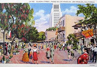
1930s color postcard Olvera Street Los Angeles. Source
Click to enlarge
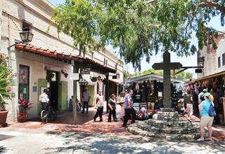
Olvera Street nowadays, Los Angeles. Source
Click to enlarge
Head back to Broadway and head west towards the center of the city where many iconic buildings survive:
Los Angeles City Hall
200 N. Spring Street, to your left, one block from Broadway, across the Grand Park.
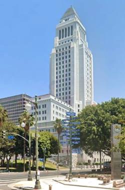
Built in 1928 and recently seismically stabilized and restored, it was designed in "Modern American" style by architects, John Parkinson, Albert C. Martin, and John C. Austin. Its crowning stepped pyramid is its outstanding Art Deco feature. It has an observation deck free of charge open weekdays 8 AM to 5 PM; entrance is on 201 N Main St.
Broadway Theater and Commercial District
Listed in the National Register of Historic Places
Along Broadway between 2nd and 9th Streets.
this area was residential until the early 1900s when it boomed into a commercial and entertainment district, and Broadway became the main street in town.
It was a theatrical center after 1910 with luxurious theaters which were the venues of premiers for the Hollywood movie industry.
Route 66's original terminus was located on Broadway and 7th Street. Below we list some of its main buildings:
- Million dollar Theatre (307 S. Broadway - 1918) a movie palace. Recently restored.
- Roxie Theatre (518 S. Broadway - 1931) Art Deco building. Lobby is nowadays a retail store.
- Arcade Theatre (534 S. Broadway - 1910) its lobby is currently a retail store.
- Cameo Theatre (528 S. Broadway -1910) closed in 1991, now it is a retail store.
- Lerner's (533 S. Broadway - 1931), a women's clothing store buitl in Art Deco Style.
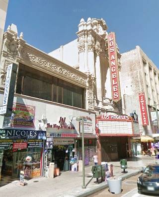
- Los Angeles Theatre (615 S. Broadway - 1931) a movie palace in lavish ornate style (pictured).
The western terminus of Route 66 (1926-36)
Route 66 Attraction
Located at Ezat Delijani Square on the intersection of Broadway with 7th. St.
There is a sign on the southhwest corner marking the spot and it informs that Route 66 ended at this point, its Western Terminus from 1926, when it was created until 1936 when it was extended to Santa Monica.
>> Read about The Western Terminus of Route 66 1936-1964
The sign marking the 1926 Western Terminus of Route 66
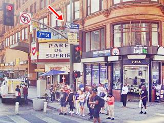
The name on the other sign, beneath it, remembers Ezat Delijani (1928-2011), a philanthropist who helped save and revitalize four historic downtown movie palaces.
There are many hotels and motels in Los Angeles catering to those driving along Route 66 (and also U.S. Highways 6, 60, 70, 99 and 101). We will only mention those along the actual alignment of Route 66.
From the downtown district, the highway was extended westwards to Santa Monica in 1935 and it headed towards the NW along Sunset Blvd. until 1953 when it was realigned along the Hollywood Freeway. It went through the East Hollywood and Hollywood districts of LA, then left the city to go through West Hollywood and Beverly Hills. Then it reentered Los Angeles again in its Westwood and Century City districts, crossing West Los Angeles before reaching Santa Monica.
Westwards from Downtown to Santa Monica through LA
Our custom maps mark the alignments that extended US 66 from the downtown district of Los Angeles to Santa Monica as follows:
- The 1936-53 Sunset Blvd. alignment from Los Angeles to Hollywood: brown line in our custom map.
- The 1953-64 Freeway alignment from Los Angeles to Hollywood: pale blue line in our custom map.
- The 1936-64 Santa Monica Blvd alignment all the way to Santa Monica: yellow line in our custom map.
Sunset Boulevard. The US 66 alignment 1936 - 1953

Olive and Skyline motels entries in the 1946 Phone Directory
From Broadway and Sunset (from 1926 to 36) or North Figueroa St. and Sunset (from 1936 to 53), U.S. 66 ran west along Sunset Blvd. In 1953 the extension of the Pasadena Freeway southwards was completed, and it linked up with Hollywood, Harbor and Santa Ana freeways at the four-level interchange. Route 66 was aligned along the extension and along Hollywood Freeway until its decertification in this area in 1964.
One block west of N Figueroa, to your left, you can see the Four Level Interchange from Sunset Blvd. where it crosses the Pasadena Freeway. All the old gas stations have been torn down ❌: Elmer C Lentz (1100 W Sunset), Texaco Service (1106), H G Miller's (1261), Peak's Service (1475), Standard Station (1516), Cline's Service Station (1918), Blenco Benny (1920), Motor Inn Supply (2040), Lambert's Super Service (2501), Richfield Service (3140) and Atomic Service (3500 W Sunset Blvd.)
But all three motels along West Sunset Blvd. have survived.
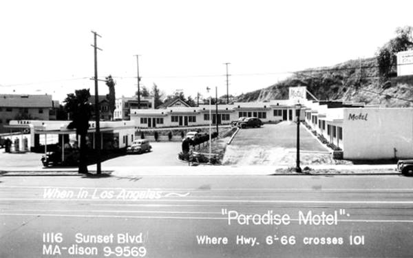
The Paradise Motel
Just one block after crossing Pasadena Freeway, to your left at 1116 Sunset Blvd. is the mid 1940s "The Paradise Motel." Its postcard proclaimed that it was "In the center of L.A. and Everything... All super highways lead to Grand Junction and the Paradise Motel - one block north."
The Texaco service station on the corner has gone and the neighborhood is more built up, but the "L" shaped layout of the motel remains untouched.
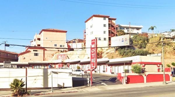
Skyline Motel
It appears in the 1946 telephone directory at 1425 West Sunset, and the building is still there, though no longer a motel. See it in this 1948 aerial photo, sith arch-shaped garages facing the driveway on the corner (St. view).
Olive Motel
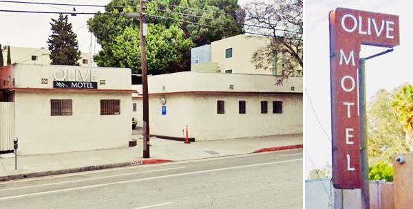
The Olive Motel at 2741 Sunset Blvd. dates back to 1946. It has a "L" shaped layout in Streamline Moderne style, designed by Edith Mortenson Northman (1893-1956). Its neon sign is a classic.
It was the site of a 2007 murder of a 15-year old homeless girl, Alyssa Gomez. The murderer Gilton Pitre, 38, was sentenced to life.
.
On the 4000 block Route 66 takes a left to head west along Santa Monica Blvd., the alignment that will take it westwards to the Pascific Ocean. The 1936-53 Alignment along Sunset Blvd. ends here.
Below we describe the 1953 to 1964 Hollywood Freeway alignment.
The Hollywood Freeway
The Pasadena Freeway was extended in 1953 from its terminus at Figueroa, all the way to the brand new junction of four freeways just west of downtown Los Angeles.
The Hollywood Freeway was planned in 1924 to link downtown L.A. with the San Fernando Valley in the north, it was part of the highway system designed for Los Angeles, that included the Arroyo Seco Parkway to Pasadena, Harbor Fwy to Long Beach, and the Ramona Freeway to Pomona. The Hollywood Fwy section along which Route 66 was aligned opened in 1954. It is, after the Arroyo Seco Parkway, the second oldest freeway in the city. It is now part of US 101 north of the Four Level Interchange. But, until 1964, Route 66 also ran along it all the way to Santa Monica Blvd.
Four-Level Interchange (1953-64)
U.S. Highway 101 (State Route 2) was also being upgraded as the Cahuenga (Hollywood) Freeway. Work had began on it in San Fernando Valley across Cahuenga Pass in the late 1930s, it would cross Hollywood and central Los Angeles and meet the Arroyo Seco Freeway there.
In 1946 a half-mile long extension was approved and the Arroyo Freeway was extended following its NE-SW course to the designated site of the interchange between freeways. Work on the 4-lane extension began in late 1947.
The engineers designed a $1.5 million four-level interchange that did away with the typical clover-leaf exchange. Instead it was a direct freeway-to-freeway connector.
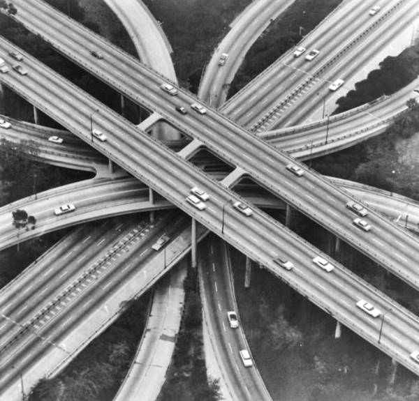
It was the first "Stack" interchange in the world. It was 65 feet high and supported by reinforced concrete pillars and it ensured that traffic could flow 270-degrees as it turned in different directions. It was completed in 1949 and opened in 1953.
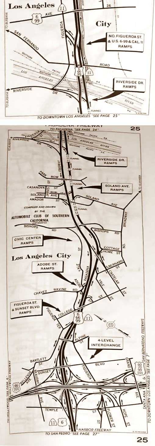
U.S. 101 along the Hollywood Freeway, U.S. 70 and U.S. 60 along the Santa Ana Freeway, and U.S. 66 with U.S. 6 and U.S. 99 along the Arroyo Seco Parkway met here in an amazing hub. The map further up (click on it to enlarge it) shows the Arroyo (Pasadena) Freeway from Highland Park across Elysian Park all the way to the four-level interchange where it meets the Hollywood Fwy.
The construction required tearing down a neighborhood with an area equivalent to a square with 1,000 feet-long sides. Below is a view of it in the 1950s, and this is its current St. view.
The Arroyo Seco Parkway was renamed Pasadena Freeway the following year (1954).
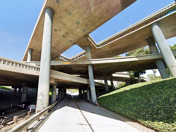
See this aerial view of the stacked interchange nowadays. Below is another view of it, seen from the lowest level.
From the interchange, the Santa Ana Freeway continued with a NW-SE course, and the Harbor Freeway carried US 6 to its terminus in Long Beach. Route 66 turned towards the NW along the Hollywood Fwy towards Santa Monica.
The Starlite Motor Hotel
We mention one motel along this alignment, at 250 Silverlake Blvd. The Starlite Motor Hotel is still open as a motel now known as the Silver Lake Hotel of the Quality Inn chain. It is an imposing structure, with a "V" shaped three story building overlooking both Smilax St. and Silverlake Blvd. which could be seen from the Freeway with its (now gone) neon sign perched on the roof.
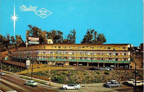
At Exit 7, Route 66 left the Hollywood Freeway to run west along Santa Monica Blvd.
Hollywood & Western Los Angeles on Route 66
Route 66 took a left along Santa Monica Blvd. through Hollywood, a district of Los Angeles before passing through two other, separately incoporated cities: West Hollywood and, right next to it, Beverly Hills.
Then, on the western side of Beverly Hills, Los Angeles city appears once again and Route 66 crosses this district towards the last town on Route 66, Santa Monica.
- Hollywood's Chinese Theatre
- The Hollywood Walk of Fame
- Griffith Observatory
- Hollywood Sign
- Temple View Travelodge (Azul Inn)
Hollywood
A Neighborhood of Los Angeles
This is a 2.1 mile-long segment along Santa Monica Blvd. from US-101 and the Hollywood Freeway to the West Hollywood city limits between N. Sycamore Ave and N. La Brea Ave. on the 7000s block of Santa Monica Blvd; see this Map of the segment.
Los Angeles has hundreds of attractions and landmarks with many exotic and interesting sights, but we will focus on the few that are close to Route 66 or those that can give you a great view of the City.
The Demise of Gas Stations
Nowadays there are some 145,000 service stations across the country, a decline from the peak of 226,000 stations in 1972. 9, 10 During this period, the number of vehicles grew from 119 million in 1972 to 296 million nowadays. Better mileage helped reduce the demand: in 1949 cars provided 15.0 miles per gallon (mpg), in 2024 it improved to 24.4 mpg. ,
Of the 24 service stations along this section of Santa Monica Blvd in 1946, only four have survived:
Lost Gas stations ❌
The following filling stations have been torn down:
Carr's Union Service, 4460 Sta Monica Blvd; Kratzer & Barton (4822); Texaco Service (4901); Douglas Service (4953); Richfield Station (5080); Halring Clarence (5101); Sta Monica & Ardmore Stn. General Petroleum Corp of Calif (5136); Ferrick & Knott (5300); Heckler Bros (6150); X&N Stns. (5911 and 6379); Whitcomb LG Super Svc. (6312); Carol Wages (6400); Standard Stations (6401, 6101, 8461, 7078 and 4666); Shearer (6450); Coleman Brothers Service (6521) and Joe's Signal (7051 Santa Monica Blvd).
The surviving gas stations are Libow's Service, now a car wash, at 4451 Santa Monica (St. view), Maughmer's MV Service (4751) now an auto repair shop, highly modified, but still there, canopy and service bays standing (St. view), Larry's Automotive Service (5015) now a repair shop (St. view) and One Stop Service Stn at 5255 Santa Monica Blvd. also a mechanic shop (St. view).
Sears ❌
At 5601 Santa Monica, it stood over those driving along the Boulevard since it opened back in 1928. It was a landmark seen by those driving Route 66 from 1936 until the highway was decertified in 1964. The building was torn down in 2023. Below is a 1950s view looking west along Santa Monica Blvd. The Sears is on the north (right) side of the street. This is the view at the same spot nowadays.

Hollywood Forever Cemetery
Ahead at 6076 Santa Monica Blvd. on the south side of the highway, to your left, is a landscaped green area; a cemetery where many stars and celebrities rest, including Rudolph Valentino, Judy Garland, Mickey Rooney, Tyronne Power, and Mel Blanc.
It opened in 1899 as Hollywood Cemetery and after 1939, it was renamed the Hollywood Memorial Park, until 1998 when it adopted its current name. All those driving Route 66 from 1936 to 1964 passed by it.
At La Brea Ave. Route 66 enters the City of West Hollywood and reappears in Los Angeles 4.7 miles further west after crossing West Hollywood and Beverly Hills.
Below are some must-see spots in Hollywood that aren't related to Route 66, but are worth visiting.
The Flagship Imperial '400' Motel in Hollywood
When you reach Highland Ave (on the 6700 block of Santa Monica Blvd), four blocks north (to your right) is Sunset Boulevard. Here is the first Imperial 400 Motel ever built. It was located at 6926 Sunset Blvd. in Hollywood, Los Angeles, California. It opened in July 1960. The building is still there, and it is a motel, now named Hotel Hwood. Below is a "Now and Then" set of pictures of this classic motel.
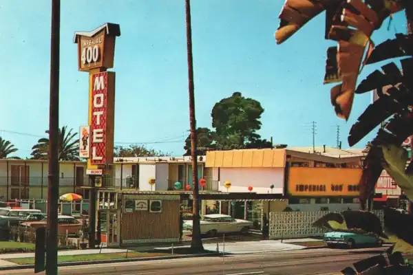

Imperial '400' Motels and Route 66
Learn all about these Space Age motels along U.S. 66.
> > Read more: Visit our Imperial "400" Motels on Route 66 webpage.
Hollywood Side Trip Must See Sights
Take a right along N. La Brea Ave. and drive 1 mile north to reach Hollywood Blvd. here is the classic Chinese Theatre and the Hollywood Walk of Fame along Hollywood Blvd. (Map with directions); Take a right along Hollywood Blvd. and park your car.
TCL Chinese Theatre
Los Angeles Historic and Cultural Monument
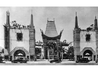
1927 Grauman's Chinese Theater. Source
Click to enlarge
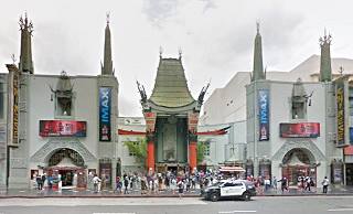
At 6925 Hollywood Blvd. Hollywood, Los Angeles. This movie theatre that now has 3D Imax projectors was built in 1927 in an opulent oriental pagoda style. It opened as Grauman's Chinese Theatre. Star Wars premiered here in 1977.
Don't miss the concrete blocks in the court which record the signatures, footprints, and handprints of almost 200 popular movie stars since the 1920s.
The Hollywood Walk of Fame
There are over 2,500 five-pointed stars embedded in the sidewalk along fifteen blocks of Hollywood Blvd. with the stars. The Hollywood Walk of Fame comprises more than 2,500 five-pointed terrazzo and brass stars embedded in the sidewalks along 15 blocks of Hollywood Boulevard and three blocks.
Return to Route 66 and drive west through both West Hollywood and, right next to it, Beverly Hills, to reach L.A. once again.
West Los Angeles
This is the final and westernmost segment of Route 66 through L.A. It lies between the cities of Beverly Hills and Santa Monica, this is the Map of the segment, which is 3.6 miles long and begins in the east, on Heath Ave. and ends in the west on Centinela Ave. in the West, crossing the Century City and West Los Angeles neighborhoods of Los Angeles City. Almost all of the classic Route 66 spots have vanished over time, like the Fox Motel at 10269 Sta Monica Blvd. Torn down in 2014 when it was the "Stars Inn"; see this view of it in 2014 shortly before it was razed.
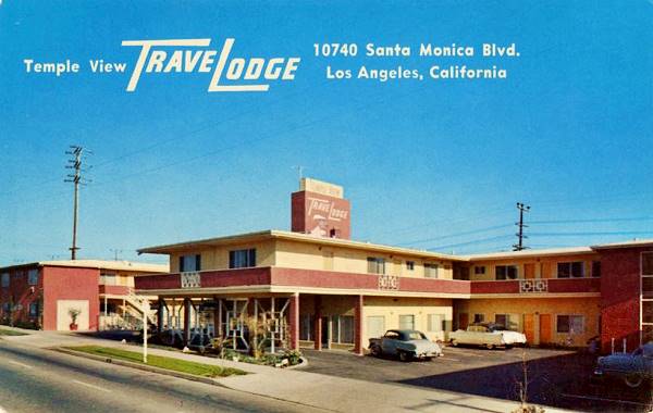
Former Temple View Travelodge now Olivia Hotel
Still going strong, at 10740 Santa Monica Blvd. Los Angeles. The postcard below states "Temple View Travelodge Near the Mormon Temple, centrally located. 57 Modern Units, wall to wall carpeting. Some Kitchenettes. Television and Radios. Room Phone Service. Heated Pool." It has changed names and was modernized in 2024. The original building is now concealed by a perforated sheet metal screen, but the turret and overall design are unaltered (St. view).
Former Sea Gull Motel
The Sea Gull Motel at 10811 Santa Monica Blvd. figures in the 1961 business directory of Los Angeles, and according to its 1960s postcard below, it was "Quiet, clean, Air conditioned units, T.V. & phones in all rooms..."
Still running as a hotel, now as the "Royal Santa Monica Motel" with the same neon sign (with the sea gull removed), now protruding more into the roadway.

Route 66 decorative signs
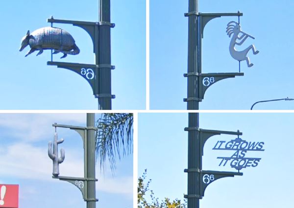
Don't miss the Urban Art, placed on the lamp posts along the Boulevard all the way from Beverly Hills city limits to I-405. These metal "sculptures" depict things related to Route 66 like a cactus, an armadillo, a Zia symbol, a phrase (It Grows as it Goes), a Kokopelli (flute player), and a surfboard among others.
Head west into Santa Monica and the "End of the Road" or take one of the side trips below.
Side Trips
Griffith Observatory
Los Angeles Historic-Cultural Monument
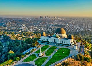
Griffith Observatory, Los Angeles. Source
Map with Directions from Sunset Blvd. and Santa Monica Blvd. (7 mi round trip).
This Art Deco building was built in 1933 at 1,134 feet above sea level, on the southern slope of Mount Hollywood, in Griffith Park. An ideal spot to get a great view of Downtown L.A., Santa Monica and the Hollywood Sign.
Admission is free and it was built on land donated by Col. Griffith J. Griffith to the city, who also provided the funds for the observatory, planetarium and exhibition hall.
It served as location in the James Dean film Rebel Without a Cause (1955) for the knife fight scene, La La Land (2016) with its Planetarium dance scene, and The Terminator (1984) first arrival scene among others.
Hollywood Sign
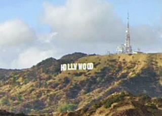
Erected in 1923 to promote a local real estate development named "Hollywoodland", it was later shortened to "HOLLYWOOD".
It is located on Mount Lee in the Hollywood Hills. Each letter is 45 ft. tall (15 m) and the sign measures 350 ft. long (110 m).
Continue your Road Trip
This marks the end of this leg of yor Route 66 road trip and completes the drive across the City of Los Angeles. Head west along the Santa Monica Blvd. to complete the whole journey in its final leg across neighboring Santa Monica.

Sponsored Content
>> Book your Hotel in Santa Monica

Credits
Banner image: Hackberry General Store, Hackberry, Arizona by Perla Eichenblat
A Guide to the Golden State; Federal Writers' Project of the Works Progress Administration, Hastings House, New York, 1939.
Jack DeVere Rittenhouse, (1946). A Guide Book to Highway 66.


