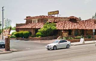
Route 66 in Rancho Cucamonga CA
Index to this page
About Rancho Cucamonga California
Facts, Trivia and useful information
Elevation: 1,207 ft (368 m). Population 174,710 (2025).
Time zone: Pacific (MST): UTC minus 8 hours. Summer (DST) PDT (UTC-7).
Rancho Cucamonga is a city located on Route 66, in southwestern San Bernardino County in the south of California, and it forms part of Los Angeles' suburbs.
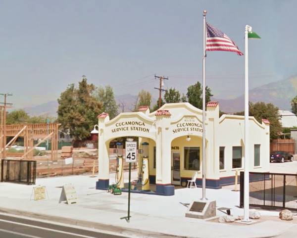
The old Richfield Service Station in Rancho Cucamonga
The History of the city of Rancho Cucamonga, California
Southern California has been inhabited for at least 10,000 years. More recently, the local natives were known as the "Tongva", and they lived in the Los Angeles Basin. They settled in Rancho Cucamonga near Red Hill around 1200 AD. These "Kukamongan" Natives were part of the Tongva, and known by the Spaniards as Gabrielino or Gabrieleño people, named so after the San Gabriel Mission. They numbered around 5,000 to 10,000 at the time of European contact.
The Spanish settled in Mexico in 1520 and from there they explored California starting in 1602. They founded Los Angeles in 1769 and from there advanced 8 mi. west setting up the Mission San Gabriel Arcangel (1771). Spanish Captain Juan Bautista de Anza camped in the area at Arroyo de los Osos (now Bear Gulch in Cucamonga) in 1774. The Mission San Gabriel established in Rancho Cucamonga (Cucamonga Ranch) as a site for grazing their cattle.
In 1821 Mexico had become independent from Spain and retained California. In 1839 the Mexican governor, Juan Batista Alvarado granted Tiburcio Tapia the land that would become the "Rancho Cucamonga". This tract of land covered 13,000 acres. Tapia had been Alcalde in Los Angeles and a soldier as well as merchant. He built the fortified Tapia adobe house on Red Hill to protect it from Indian raids.
It was located on the meeting point of the Mojave Trail with the Camino Real and the Spanish Trail. The Butterfield Stagecoach Route also passed through here after 1848.
Tapia died in 1845. Two years later Mexico was defeated by the U.S. in the Mexican American War (1846-48) and it was forced to cede what now are Colorado, Arizona, New Mexico, Utah, Nevada, and California, the latter became a state of the U.S. in 1850.
Tapia's Ranch was sold in 1858 to John Rains, an American who had married the heir to the Chino Rancho, Maria Merced Williams (Chino is just south of Modern Cucamonga). Rains planted 160 acres of vines and produced wine, creating the oldest winery in California; he also built the Rains House in 1860.
Rains was murdered in 1862. A post office located at the base of Red Hill in 1864 in what was to become Rancho Cucamonga. The first school here opened in 1870 and the following year, Isaias Hellman, a banker, bought the ranch and formed Cucamonga Company to develop the land.
The San Bernardino & Los Angeles Railway incorporated in 1886 and built a line between San Bernardino and Duarte the following year; at Duarte it linked with the Los Angeles and San Gabriel Valley Railroad reaching Los Angeles.
Twentyfive stations were created along the railroad and many of them became townsites like Rialto, Fontana, and Cucamonga. Shortly after, the Atchison Topeka and Santa Fe railroad acquired these railroads to complete its line from St. Louis to Los Angeles.
Hellman also brought water to the community in 1887, from irrigation tunnels dug into Cucamonga Canyon.
Cucamonga, the name
The word "Cucamonga" is probably a Native American Tongva place name, the suffix "nga" derived from "ngna", is found in many Tongva place names.
It is said to mean "sandy place" or "land of many waters" and also "light over the mountain."
The diary written in 1849 by George Q. Cannon, describing his journey in California, includes many variations of the name: Cocomungo, Cocoa-Mungo, Chocomonga, Cocommingo, Cocomonga, Cocomongo, Coco Mongo, Comingo, and Pokamongo.
The funny and strange sounding "Cucamonga" name became famous across the nation as a distant odd-named place.
The town prospered as an agricultural area and was described in 1915 as "specializ[ing] in raisin and table grapes and in wines, of which it produces large quantities. The largest single vineyard in the world is located here. Cucamonga also has about 2,000 acres of oranges and lemons and 2,000 acres of peaches."
The National Old Trails highway was aligned through the area in the early 1900s, and in 1926 U.S. Highway 66 was created using Foothill Blvd. as its roadway.
In 1977 the communities of Cucamonga, Etiwanda, and Alta Loma voted to merge into a single city, and adopted the name of "Rancho Cucamonga".

Accommodation in Rancho Cucamonga
You can find your room in Rancho Cucamonga.
> > Book your Hotel in Rancho Cucamonga
More Lodging near Rancho Cucamonga along Route 66
Below you will find a list some of the towns along Route 66 east and west of Rancho Cucamonga; click on any of the links to find your hotel in these towns.
>> Check out the RV campground near Rancho Cucamonga, in San Bernardino
The Weather in Rancho Cucamonga
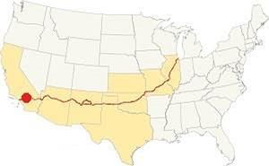
Location of Rancho Cucamonga on Route 66
The weather in Rancho Cucamonga is warm Mediterranean (Continental Mediterranean climate), which has hot and dry summers with cool - chilly winters. The town has on average, 287 sunny days per year and the strong, hot and dry Santa Ana wind blows through Cajon Pass during fall; it dries the area increasing the risk of wildfires the foothill communities.
During winter, the average high reaches (Jan) 69°F (20°C) and the average low is 46°F (7.2°C). For summer the average high is 95°F (35°C) and the average low is 63°F (16.8°C). Rainfall averages 14.8 in. per year (375 mm), with the period April to October being the driest one. Snow can be seen on the San Gabriel Mountains, but never along Route 66.
Tornado risk
As Rancho Cucamonga is located very far from the Rocky Mountains (western limit for tornadoes), there is no risk of tornadoes in this area.
Tornado Risk: read more about Tornado Risk along Route66.
Map of Route 66 in Rancho Cucamonga
>> Custom map of Route 66 through Rancho Cucamonga.
National Old Trails Highway (N.O.T.)
During the early 1900s, the use of the automobile was increasing, and a dirt trail near the tracks in Cucamonga was incorporated into the National Old Trails (N.O.T.) Association highway that was built to link Los Angeles with New York; the road was aligned close to the tracks of the AT & Santa Fe railroad through the states of California and Arizona. It ran along Foothill Blvd.
The Automobile Club of Southern California's map of 1912 shows the N.O.T. highway running on the north side of the Santa Fe Railroad, passing through Rialto and heading straight, west until reaching Cucamonga, that in those days it did not have the "Rancho" part appended to its name. It was set at "46 mi. from LA".
In 1926 U.S. Highway 66 was established, and it was aligned along the N.O.T. roadway. It was upgraded and widened after that date. The map below was published one year later (1927) and you can follow Route 66 from Victorville through Cajon, San Bernardino and west into Los Angeles; Cucamonga appears in the map.

1927 Road map, SW CA
Click on image to enlarge.
Credits

1956 Shell Roadmap, SW CA
Click on image to enlarge.
Credits

Detail 1930 roadmap
Click on image to enlarge.
Full map
The thumbnail map shows the alignment of Route 66 from Victorville to Los Angeles, you can see Cucamonga on it.
The map further up shows the same area in 1956; a freeway now links Victorville with Cajon and San Bernardino with Los Angeles.
This eastern part of Route 66 in the Greater LA area is still quite open, you can see many fields and open lots of land among the urbanized areas, despite the new malls and buildings, quite a few of the classic Route 66 motels have survived.
In the 1950s, the freeway system in LA would start to divert traffic away from Route 66. By 1964, Route 66 had been replaced by the freeway, and traffic along Foothill Blvd. dwindled. In 1964 the western terminus of Route 66 was formally moved from Santa Monica to Needles CA; however, only the highways up to Pasadena were decertified, the remaining ones remained signed as Route 66 until I-40 was completed between Barstow and Needles in the early 1970s and Rancho Cucamonga was bypassed for good.
Route 66 Alignment near Rancho Cucamonga
With maps and full information on the Mother Road.
- Pasadena to Santa Monica (Next)
- Barstow to Pasadena (Rancho Cucamonga's)
- Topock to Barstow (Previous)

Route 66 landmarks in Rancho Cucamonga
Historic context of US 66
The "Guide to the Golden State" written in 1939 by WPA said the following about this segment of Route 66 during the pre-World War II days:
... West of Fontana vineyards cover the foothills, dotted with wineries.
CUCAMONGA, 14.5 m. (1,220 alt., 2,040 pop.), named for CUCAMONGA PEAK (8,911 alt.), the shopping center of a grape and olive-growing district, has several wineries. WPA (1939)
Jack DeVere Rittenhouse drove along Route 66 in 1946, gathering information for his book "A Guide Book to Highway 66", he described this area, with it small towns as follows: " Many of them are so close together as to be practically indistinguishable from each other..." and added that after passing through Fontana, "... you pass through vineyard country and orange groves. Through Cucamonga at 329 mi".
Cucamonga in popular culture
The town's strange, odd-sounding name gave it an aura of a distant and exotic location, like Timbuktu or Shangrila, but, it also made it the butt of jokes.
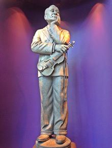
Jack Benny statue, Cucamonga.Source
Jack Benny Statue
Jack Benny (1894-1974), an American comedian, radio, television, and film actor often joked about the town's name in his shows. There is a statue of him, with his violin (which he played badly as part of his character - who was also a miser), in the lobby of Cucamonga's Family Lewis Playhouse Theater in the city's Victoria Gardens Cultural Center, 12505 Cultural Center Dr., Rancho Cucamonga
Warner Brothers' cartoon characters also mentioned Cucamonga on several occasions. Or it appeared as a far-off destination as shown in the image below, where the green decal shows "Cuca Monga" among other places such as Bali Bali, Pongo Pongo, Java and Mexico.
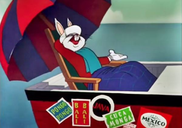
Daffy Duck (Daffy Duck Video) parodies a scene from the Jack Benny TV show of the 1950s (See the Video) where the train station announcer called out "Train leaving on track five for Anaheim, Azusa and Cuc... amonga!" of course no such train existed.
Bugs Bunny also mentions Cucamonga in many cartoons. For instance in the 1948 cartoon "My Bunny Lies Over the Sea" he is looking at a map (1948) and states: "Let's see now: through Azusa, turn left at Cucamonga, 'til you hit Los Angeles, then straight out Wilshire Boulevard 'til you hit the La Brea Tar Pits. Hmmm… this don't look like Los Angeles to me. I knew I should've taken that left turn at Albuquerque;" mentioning four towns along Route 66! He is really far from Los Angeles, in fact he is in Scotland. Also see Bugs in Transylvania Video - 1963)
The voice behind all three Cucamonga's was that of Mel Blanc.
Road Trip leg through Rancho Cucamonga
We will begin this leg of our Route 66 Road Trip on the eastern side of town, coming from Fontana. Driving westwards, when you cross East Avenue at East Etiwanda Creek, you enter Cucamonga.
The 1954 USGS map (click on it to enlarge the image) shows Route 66 running straight east to west along Foothill Blvd., through Cucamonga, curving around Red Hill, and entering Upland. They were separate towns at that time, and it was mostly a rural area with buildings at some of the crossroads. They had not yet linked into a vast suburban sprawl. The first landmark is on the eastern side of town, the winery, it can be seen on the right side of the thumbnail map, by Deer Creek.
Mission Winery (Virginia Dare Winery)
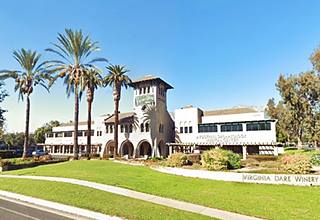
To your left, at 10470 Foothill Blvd. on the NE corner with Haven Ave. is a modern business center with an imposing tower with a hip roof with red Spanish tiles. This is what remains of the Mission Winery.
The original building was built by Chinese workers back in 1908. One of its two bell towers has survived until now.
San Gabriel Mission planted grapes to Cucamonga in 1838. John H. Klusmann, a German, and C.W. Post established the Mission Winery here in 1910. They sold it in 1918 to Garrett & Co., who sold it under their Virginia Dare Winery brand.
Garret had been founded in 1835 in North Carolina, and moved to Broolyn, New York. They owned 750 acres of vines that produced wine that was shipped to Brookyn for blending and bottling. They sold home-winemaking products during the Prohibition and survived it.
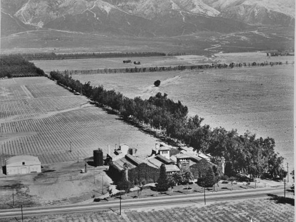
The image below was taken in 1925 and looks towards the northeast, with Foothill Blvd. running left to right across the image and Haven Ave running soutwards from the mountains (top).
The view, towards the north is great, you can see the San Gabriel Mountains and the outstanding peak of Mount Cucamonga, which has an altitude of 8,911 ft. (2.718 m). These mountains are covered in snow during winter.
Virginia Dare (1587-?) was the first Anglo-American born in what is now the U.S., in the English colony in Roanoak of Virginia, and named after it. What became of her is a mystery because the colony and its residents had vanished when the replenishment ship arrived in 1590.
The winery closed in 1960, and Garrett sold its wine division in 1965. Vineyards in this region decreased from some 23,000 acres in 1960 to less than 1,000 by 2000. Garrett.
A fire struck the winery in 1964, and it was the location of some episodes of the 1960s TV series "Combat" because of its European look.
In 1984 the old building was about to be remodeled, but the concrete remains lacked structural rebar steel so only the front bell tower could be saved; it was reinforced and is part of the modern building that now stands on the property.
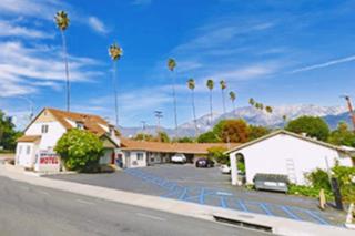
The next cluster of historic buildings was located at Hermosa Ave. Here on the NE corner there was a tavern and a motel (both torn down in 2017), on the NW corner there appears to be another motel, long, U-shaped layout, that appears in the 1948 aerial picture of this spot.
The first buildings along Route 66 appeared after Ramona Ave. mostly along the north side of the highway. The local 1948-51 phone directory lists several businesses here, all of them long gone:
310 E Foothill, Mobile gas station,in 1947 ran by Joseph Guidera Joseph, by 1951 it was Newmann's Service
312 E Foothill, Shamrock Cafe
296 E Foothill, Balber Brothers gas station
280 E Foothill, Dolly's Cafe
176 E Foothill, Ramirez Bros. service station
156 E Foothill, Cafe
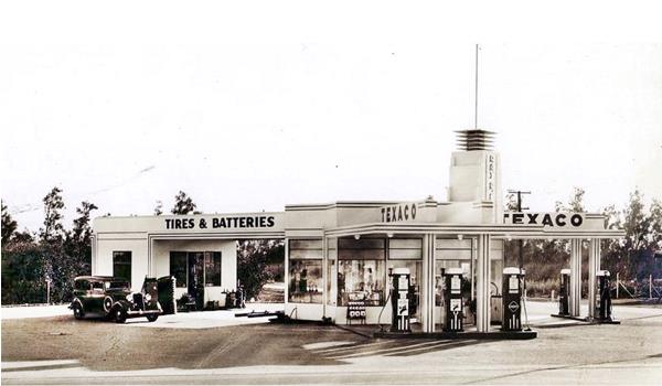
103 E Foothill Bob Ford's Texaco; on the SE corner with Archibald Ave.
Bob Ford's Texaco (gone)
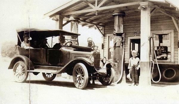
Ford's Texaco stood where the Bank of America now stands. It began in the 1920s as a woodframe building (pictured below), the child is Ray, Bob's son.
A few years later he upgraded it, with a multipane window office and added a second pump island with more gas pumps.
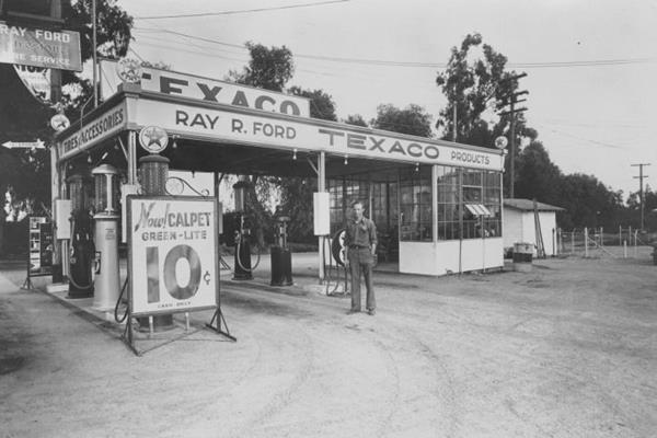
By the late 1930s the station had become a modern one, with pumps facing both Route 66 and Archibald, as you can see below.
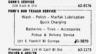
1948 phone directory ad of Bob Ford's Texaco.
Bob sold the property in 1963 to the Bank of America, whose original building stood across Foothill, on the NE corner.
The image below taken in 1942 looks eastwards along Foothill Blvd. To the left in the distance at the crossroads with Archibald Ave. you can see Ford's Texaco, and closer, on the SW corner, a Union 76 gas station followed by a Cafe and a market (now Liquor store and Deli). To the right, on the north side of the road in the foreground ist the classic Richfield station followed by the Cafe Italiano, and the old Bank of America, and next to it, Vath's drug store and soda fountain. This is the same view nowadays. Only the Richfield and the Market have survived.
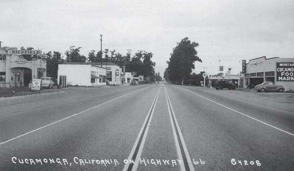
Almost tewnty years later, in the early 1960s, musician and composer Frank Zappa (1940-1993), described the crossroads in his autobiography Real Frank Zappa Book (By Frank Zappa, Peter Occhiogrosso, 1989) as follows:
Cucamonga was a blotch on a map, represented by the intersection of Route 66 and Archibald Avenue. On those four corners we had an Italian restaurant, an Irish pub, a malt shop and a gas station.Frank Zappa (1989)
These would be the starting on the NE corner and moving clockwise Vath's drug store (malt shop), Ford's Texaco (gas station); was the Irish Pub the Tavern at 9741 Foothill or was it Carl's Liquor Store? the Italian restaurant was on the NW corner the Café Italiano at 9671 Foothill; torn down in the 1990s.
Cucamonga Market
One of the few "old" buildings still standing in Cucamonga. It was built by Henry "Hank" Klusman, born in Germany and migrated to California and owned a construction company. The Cucamonga Public Market dates back to the early 1900s. You can see it in the 1920s picture below, and in the 1970s. This is the current St. view of the building; Notice how now, the open doorways of the old market have been walled in and there is a store at each side of the building.
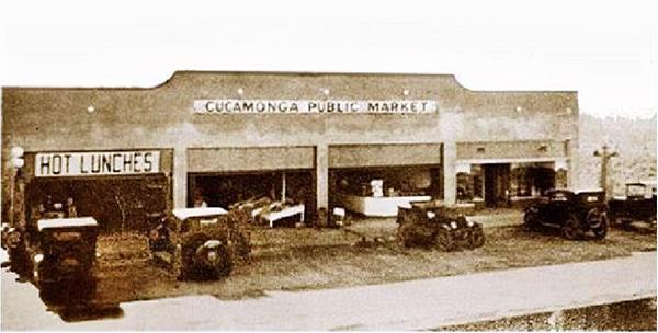
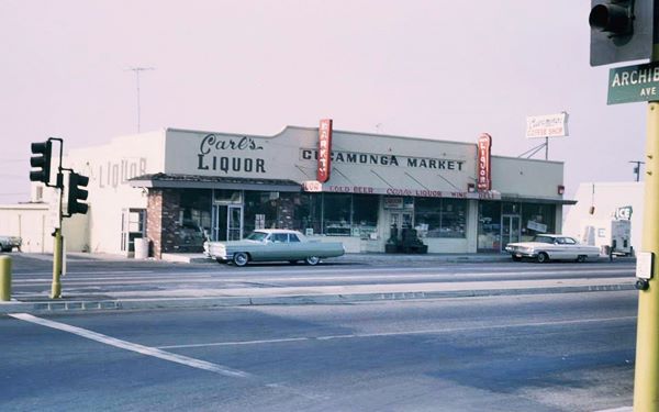
The image above shows Carl's Liquor, and Cucamonga Cafe in the early 1960s. Before Carl's, it had been the Asti Cafe, owned by John Nozenzo (1895-1948); he was an Italian who had migrated directly to Cucamonga at the age of 18. He later changed the name to Lucy and John's Cafe. In 1936, the San Bernardino County issued its approval to the "application of J. B. Nosenzo for dance license to conduct dance In Lucy & John Cafe, Cucamonga."
Then he moved the cafe to another location futher west (read about Lucy & John's further down). He worked with his American-born wife, Lucy Core.
Cucamonga Service Station
Historical Landmark Marker
To your right, At 9670 E Foothill Blvd., on the north side of the street is a classic spot and must-see-landmark, the best known Route 66 landmark in Cucamonga: The Cucamonga Service Station.
The Cucamonga Service Station was built in 1915 by Henry Klusman and owned by William Harvey.
It was built in the Mission Revival and Spanish Colonial architectural styles with Spanish tiles crowning parts of its roof.
At that time, Foothill Blvd. was a state highway part of the N.O.T. It sold gas to motorists and the local farmers.
In 1925, one year before Route 66 was created it was sold to Ancil Morris, who became a Richfield distributor. The repair shop - garage was owned by Virgil Davis.
The 1948 telephone directory lists it under the old numbering system as "Cucamonga Service Station 116 W Foothill - Morris & Woodrow 116 W Fothill Blvd." Below is a 1930s view, with the original "Drive In" archways flanking the main building and leading to a Tire and Garage Service area behind it.
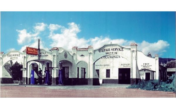
Shortly after, the two archways were removed as you can see in the following image:
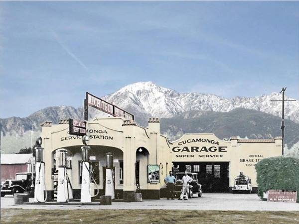
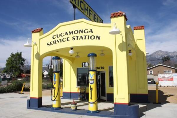
From the late 1940s till its closure in 1971, it was owned by Cucamonga's first Fire Chief, Arvid Lewis. In the 1970s, it became an Arco gas station. It stood abandoned for years. It was declared a Historical Landmark by the City Council in 2009. The service garage collapsed and was torn down by the city in 2011; the station and garage can be seen in this 2007 St. view. Restoration began in 2013, it reopened in Aug. 2015 and is now a Route 66 Museum.
The old Richfield Service Station in Rancho Cucamonga
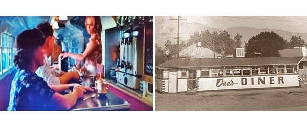
On the western side, beside the service station was Nellie-Ann & Dee's Diner, at 102 W Foothill, an old bus that had been repurposed as a diner. Prior to the early 1950s it had been Milmar Drive In. It was also known as Dolly's Diner. It closed in 1974 and was taken down in the 1990s. It appeared in the 1974 movie "Big Bad Mama," starring Angie Dickenson and William Shatner, as a diner in 1932 (see a still below, shot inside the diner, with Angie Dickinson behind the counter).
Cucamonga Motel (gone)
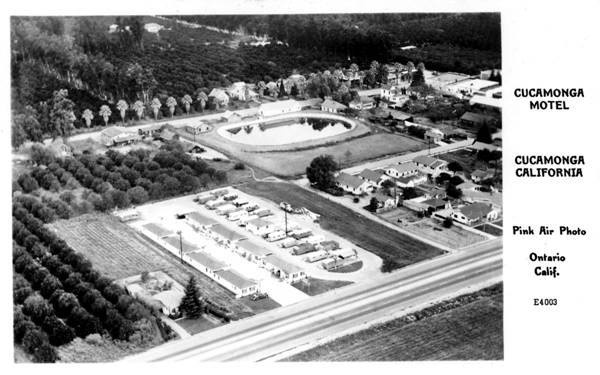
Just ahead, also on the north side of the highway, the motel is pictured below. It was listed in the 1948 phone book (Cucamonga Motel 168 W Foothill blvd Cucmga). It stood where the California Bank & Trust now stands, at 9590 Foothill. Notice the rural setting in the photo in comparison to this current aerial view.
New Kansan Motel
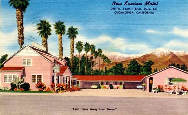
Head west and on the NE corner with Hellman Ave (9300 E Foothill Blvd.) is another motel. It was listed in the 1948 phone directory as the "Cucamonga Lodge 298 W Foothill blvd Cucmga" using the old numbering system. Later it changed its name to New Kansan. Its 1950s postcard tells us it was "Your home away from home," that it had 10 carpeted units with tiled showers, and that the lounge had a TV.
The New Kansan in a vintage postcard
Thomas Winery
California Historic Landmark
Continue west for half a mile to 8916 Foothill to visit the the oldest commercial winery in California, and the second oldest in the U.S.
The California Spanish mission vineyards of the 1700s provided wine for communion services and also for the congregation, as well as brandy. The cuttings to establish Cucamonga's vineyard came from the Mission San Gabriel Arcágel. The Mission at San Gabriel had the largest vineyard in the area, producing 500 barrels of wine per year in the 1820s.
Tiburcio Tapia, in 1839 planted his own vines on his Ranch and began winemaking here. It was expanded by John Rains in 1860 and the vineyard spanned 580 acres.
A disease called phylloxera, caused by a louse, damaged these vineyards and others in Southern California during the 1870s. this shifted wine-making north, to Napa Valley where disease-resistent grapes grew.
Ida and Hugh Thomas purchased the winery and the 450 acres of vineyards in 1920 and planted new types of grapes and creating Thomas Winery (Cucamonga Vintage Co.) At that time, immigrants, mainly Italian also planted their vineyards here in Cucamonga and they prospered despite Prohibition, producing grape juice (that could be fermented into wine at home -bypassing the alcohol ban). There were 34,000 acres of grapes here at the end of WW II, it was the largest grape-growing area in the U.S.
The winery originally had thick adobe walls, and it has been preserved, housing a restaurant, coffee shop and a new winery.
On the NW corner of the parking lot you will see a a historic marker of describing Tapia Adobe Site, its text reads: "In 1839 Governor Juan Alvarado granted the 13,000-acre tract called Cucamonga to Tiburcio Tapia, an ex-soldier who was a prominent merchant and alcalde in Los Angeles. A half-mile west of this marker Tapia, employing Indian laborers, immediately built an adobe house on a vantage point on Red Hill. The large adobe was abandoned in 1858 when Tapia's heirs sold the rancho. The adobe soon disintegrated into its native earth. This marker is located on land which once was a part of Tapia's rancho."
From the winery you can take a short 0.3 mile drive north along Vineyard Ave. (Map with directions) to visit the 1860s house of John Rains, Ranch Cucamonga.
Rains House
Listed in the National Register of Historic Places
Strategically located at the foot of Red Hill, close to Cucamonga Canyon Wash. Now 8810 Hemlock. It was built in 1860 by John Rains, as his home. He was the owner of the Cucamonga Ranch. It wasn't an adobe structure, instead he used bricks fired at the site. It later was abandoned for many years, but in the 1970s the community mobilized and saved it. There is an admission fee.
Head back to Route 66 to continue your westward journey. Here, the highway curves south to go around Red Hill, the site upon which Tapia built his adobe home in 1839.
Ahead to your right is a 3-acre park with a parking area, restrooms, and access to the Pacific Electric Trail used by trekkers, runners and cyclists. It links Upland, Rancho Cucamonga, Fontana and Rialto. It was built on the old tracks (that were removed) of the Pacific Electric Railway Co. (PE); it was also known as the "Red Cars" (after the color of the streetcars) and was a system of electric streetcars and buses that linked Los Angeles with its suburbs. Along Route 66 it reached San Bernardino. It was the largest electric railway system in the world in the 1920s. As cars became popular, it lost customers. It declined gradually, closing lines and ceased operating in 1964.
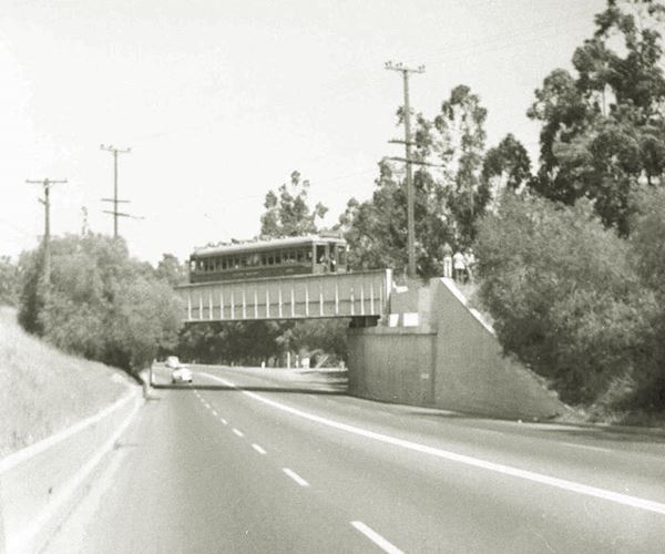
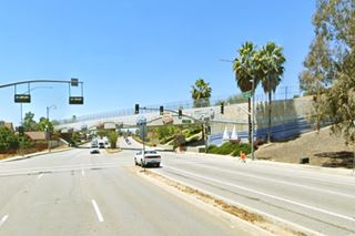
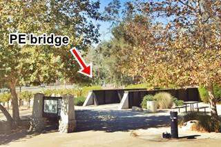
The bridge that spans Route 66 here is modern and was put in place in 2011 (pictured below) and it replaced the 81 year-old steel bridge. The old bridge that was shorter (route 66 was narrower in those days) was preserved as a monument in the park (see picture below), and you can also see some grapevines there.
Sycamore Inn
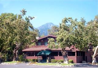
Sycamore Inn, Cucamonga.Source. Click image for St. view
Beyond the former Pacific Electric (PE) Railroad bridge, the highway curves north following the base of Red Hill, and 200 yards west, on your rith is the Sycamore Inn at 8318 E Foothill Blvd.
The place where the Sycmore Inn stands was chosen by William "Uncle Billy" Rubottom for his "Mountain View Inn" that he built on the road that linked San Bernardino with Los Angeles in 1848.
It soon became a Butterfield Overland Stagecoach stop.
The current building was built in 1920 by a local citrus farmer, John Klusman and his brother Henry, in a country-inn style, similar to those they had known in their native Germany. They called it Sycamore Inn, Irl Hinrichsen, a Dane, bought it in 1939. Its postcard stated: "Good Food... a cocktail lounge... widely known for its extensive wine list; private dining areas... Bear Gulch-Cucamonga One Mile East of Upland, California, on Highway 66."
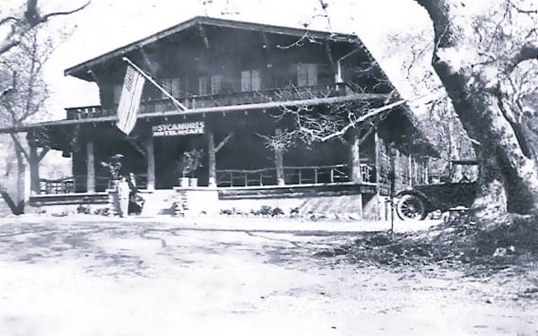
There is a myth that says that both Marilyn Monroe and Elizabeth Short (Black Dahlia) visited the Sycamore Inn a few weeks before they died.
The sycamore, or Platanus racemosa is a local species of Plane tree, also known as California sycamore, Western sycamore, California plane tree, and in Spanish Aliso. It is found near rivers, springs and in humid spots in canyons.
The Red Chief Motel (gone)
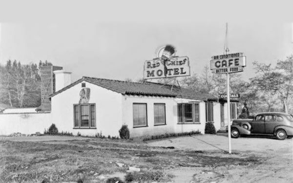
Red Chief 1930s, Cucamonga.Source
Right next to the Sycamore Inn is the site of a now gone classic Route 66 motel, the Red Chief Motel, at 8270 E Foothill Blvd.
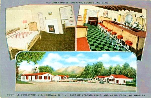
Built in 1932 as an auto court with cabins that had a garage and a kitchen laid out behind the main building that served as a café and later as a cocktail bar.
In 1962 it became the Sycamore Motel. More recently the cabins were razed and only the building survived as Gao Sushi. But it was torn down in 2019 (see it in 2018 before it was razed). Gone for good. Its matchbook advertised: "Red Chief Motel Cocktail Lounge and Dining Room ⁄ 16 Unit Deluxe Motel One Mile East of Upland Calif. On Highway 66 P.O. Address, Cucamonga."
Lucy and John's Cafe
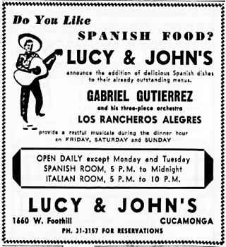
Lucy & John's 1951 advertisement. Source
As mentioned further up, they owned a cafe in downtown Cucamonga, and in 1941 they built a restaurant on the west side of town close to Upland at what now is 8189 E Foothill Blvd. (to your left on the south side of the highway).
It not only offered Italian food, but also Spanish and Mexican dishes. After the death of John in 1948, Lucy continued running it for some time, but sold it to Clearman and Penn and retired to the coast. It burned down in 1955.
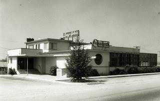
Some parts of the original building survived the fire, including the bar. John Clearman rebuilt it in a different style, and turned it into the "Magic Lamp."
The Magic Lamp
The original building is still recognizeable even though it has been roofed with Spanish tiles and its walls covered with brick. Even the round window facing Route 66 is still there.
The classic neon sign is worth a photo: an Aladdin-genie like lamp mounted on a brick pillar with the words "Magic Lamp Inn - Cocktails - Dinners." It actually lights up with a flame!
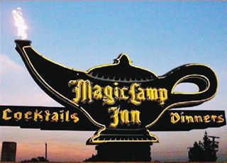
Magic Lamp neon sign nowadays. Source
Tapia Adobe Site
At the corner, to your right, Red Hill Country Dr., leads to the site of the now gone Tapia Adobe.
The original fortified home built by Tiburcio Tapia in 1839 as the headquarters for his Rancho Cucamonga, was located on Red Hill, an elevated vantage point, that dominated the surrounding area. It was built in adobe (sun dried bricks made of clay and straw). Thick walls that kept it cool in summr and warm in winter.
The building survived its owner's death in 1845, and was still standing in 1849. Later it was abandoned and the adobe walls washed away as time passed.
Continue your Road Trip
This marks the end of this leg of your journey. Continue your Route 66 Road Trip by heading west towards the next town along the highway: Upland.

Sponsored Content
>> Book your Hotel in Santa Monica

Credits
Banner image: Hackberry General Store, Hackberry, Arizona by Perla Eichenblat
A Guide to the Golden State, by the Federal Writers' Project of the Works Progress Administration, Hastings House, New York, 1939.
Jack DeVere Rittenhouse, (1946). A Guide Book to Highway 66.


