Route 66 in Daggett CA
Index to this page
About Daggett
Trivia, Facts, and interesting information
Elevation 2,008 ft (612 m). Population 484 (2025).
Time zone: Pacific (MST): UTC minus 8 hours. Summer (DST) PDT (UTC-7).
Daggett is an unincorporated community located on Route 66, to the east of Barstow, in central San Bernardino County in the southeast of California.
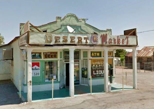
View of the Desert Market at Daggett (2012)
The History of Daggett, California
Visit our Barstow web page to learn more about the early history of this area.
Mojave Trail or Mojave Road
The Mojave Trail was the first trade route linking California with Arizona, New Mexico, and Utah. Gold rush miners and settlers used it to reach California.
It was marked out in the 1780s and crossed the Mojave Desert north of what is now Daggett, following the Mojave River.
However, in 1882 the railroad had reached the area and opened a transcontinental rail link that replaced it.
The Natives used a trail from Cajon Pass, a gap between the San Bernardino and San Gabriel Mountains in the south to the Colorado River in the east, that followed the Mojave River and other springs across the Mojave Desert.
Father Garces used the trail during his mission to the Hopi Indians in Arizona in 1776 and Jedediah Smith was the first American to use it westward, from Utah in 1826.
By the late 1820s, "The Old Spanish Trail" had been opened by Mexican traders in New Mexico and it linked with the Mojave Trail at Soda Lake.
Mojave River
The Mojave is an itermitent river that flows in a closed basin with an area of 4,580 sq. mi. (11.862 km2), its source is in the San Bernardino Mountains at almost 3,000 ft. altitude (900 m) and it discharges into Soda Lake, in the Mojave Desert.
It is a source of water used by the desert animals and plants, and also by those crossing the Mojave since prehistoric times.
110 mi long (177 km), its discharge varies from nil to a maximum of 70,600 cu. ft. (2.0000 m3). Most of its water flow is underground as the river bed is dry most of the year.
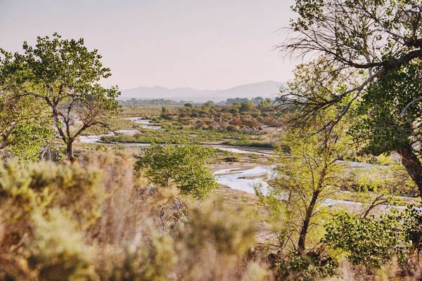
Father Garces named it Arroyo de los Mártires (Martyrs' Creek) in 1776. When Jedediah Smith followed it westwards into California in 1826 he named it "Inconstant River".
The underwater course of the Mohave River was marked by vegetation growing next to it, and therefore was in sight of Route 66 and the SF Railroad all the way from Newberry to Victorville.
After the area became part of the U.S. Lt. Edward Fitzgerald "Ned" Beale surveyed a wagon trail from Arkansas to California (1857); his Trail crossed the Colorado River at Ft. Mohave and linked up with the Mojave Trail there. The flow of settlers irked the Paiute, Mojave, and Chemehuevi natives and Fort Cady (1860) and Fort Mohave (1859) were established to keep them under control.
Camp Cady - Fort Cady
The U.S. Army established a camp to the north of Daggett in 1860 and named it after Major Albemarle Cady, a friend of Major James Carleton who founded it during a campaign against the Paiute Indians. The fort was abandoned during the American Civil War between 1861 and 1863, after which it was garrisoned until the natives were finally pacified in 1871.
It is 12 miles north of Daggett. A historical marker was placed at the site.
The Railroad in Daggett
Silver was found in the Calico Mountains in 1881 and the Southern Pacific Railroad (SP) extended its line from Mojave to a point it named "Calico Junction" in 1882. It was named so after the closest town, (what is now the Calico Ghost Town). The following year it was renamed "Daggett" to avoid confusion.
Dagget, the name
The town was named after California's lieutenant governor (1883-87), John R. Daggett (1833-1919), who incidentally was the owner of the Bismark mine in Calico.
At that time, calcium borate (borax) was discovered in the mountains and also shipped to the new town to be moved from there by rail. A mill was set up to process the silver ore, and it remained in operation for 15 years until the silver price crashed and mining ended abruptly.

J. R. Daggett. Source
During 1883 the Atlantic & Pacific Railroad (A & P - that later was absorbed by the Atchison Topeka & Santa Fe Railroad) finished its line across New Mexico and Arizona and crossed the Colorado River into California at Needles. There it met its competitor, SP who had just finished its line that crossed the Mojave from Daggett.
In 1884 A &P forced its rival to sell them the line and by 1885 it had reached Los Angeles through Cajon Pass.
In 1903, the San Pedro, Los Angeles & Salt Lake Railroad built their line from Las Vegas to Los Angeles through Daggett (it later became part of the Union Pacific RR).
Calico was the terminus of two branch lines, the Columbia Mine Railway and the Borate & Daggett line.
Decline
The mines and the railroad made the town's economy grow until the borax mining stopped in the area, closing the branch feeder tracks. Then the railroads moved their maintenance yards to Barstow; and the local business followed them. The economy suffered and Barstow overtook Daggett due to its key location on the N.O.T. and Arrowhead highways. Finally, a fire razed Daggett's commercial district in 1908, sealing the town's decline.
National Old Trails Highway
In the early 1900s the use of automobiles had grown considerably and the National Old Trails (N.O.T.) built a highway across the Mojave from Barstow to Needle as part of its road that linked Los Angeles and New York. It's course followed the tracks of the Santa Fe RR and therefore passed through Daggett.
Route 66 was aligned along the N.O.T. highway in 1926, and paved and straightened out in 1928. It remained in use until I-40 replaced it in the early 1960s, bypassing Daggett.

Where to Stay near Daggett
There is no accommodation in Daggett. But there is also lodging close to Daggett in neighboring Barstow:
> > Book your Hotel in Barstow
More Lodging Near Daggett along Route 66
Below you will find a list of some of the towns along Route 66 east and west of Daggett; click on any of the links to find your hotel in these towns.
>> Check out RV campground nearby in Newberry Springs and Barstow
The Weather in Daggett
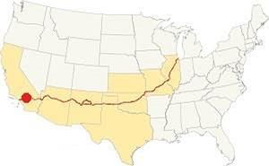
Location of Daggett on Route 66
Daggett is located in the Mojave Desert and therefore has a "mild desert climate": its weather is very dry and hot.
Winter average temperatures (Jan) are quite cool: high 60.7°F (16°C) and the low is almost freezing: 36°F (2.2°C). Summer (Jul), high is a very hot: 104.2°F (40.1°C) with an average low of 73.3°F (22.3°C).
Daggett's rainfall is only 4.1 in. year (145 mm). It never snows in Daggett. The dry months are April, May and June with less than 0.15 in. per month (3.8 mm), more rain falls during July and Nov. through March with 0.4 to 0.6 in. each month (10 - 15 mm.). Expect strong thunderstorms during summer.
Extreme Heat and Dehydration Warning
During summer, make sure you stay hydrated. The hot and dry desert climate can dehydrate you quickly. Drink plenty of water and dress for the heat.
Read more how to keep healthy in hot temperatures.
Tornado risk
Daggett is located well beyond the western limits of the Rocky Mountains, so there is no risk of tornadoes in this area.
Tornado Risk: read more about Tornado Risk along Route66.
Map of Route 66 in Daggett
Read about the Topock to Barstow alignment in our dedicated webpage. Below is an interactive map of this section:
Map of this segment in Daggett.
The first alignment of Route 66 in 1926
The first highway to reach Daggett was an Auto Trails one, built in the 1910s, a dirt track. It had a winding course, poor marking, if any, and it lacked bridges.
You can see its alignment in the thumbnail map (click on it to enlarge it) and the map below; both show Daggett next to Barstow.
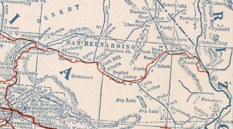
1927 Road map, western CA
Click on image to enlarge.
Credits
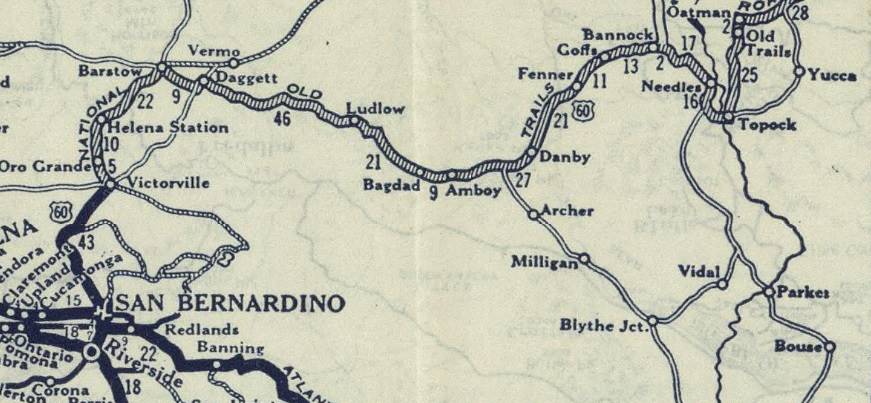
1926 Road map, western CA
Click on image to enlarge.
Credits
The map above (from 1926) -click on thumbnail to see large size map- shows the Highway as U.S. 60! Read why Route 66 was almost named Route 60.
This map is the first to show the alignment of a U.S. highway in Western California.
The Automobile Club of Southern California (ACSC) map of 1912 tells us that the old highway crossed to the north of the SF RR at Minneola, 2 mi. west of Newberry and kept on that side of the tracks til reaching Daggett, (4 mi. west). Daggett had Garage, meals, lodging, and oil. Here it crossed to the south side of the tracks and headed west to Barstow reaching it after 9 miles.
Three years later, the ACSC map infomed that the road through Minneola, Daggett to Barstow remained unchanged, though there were more signs along it. Daggett had "Meals - Lodgings, Gasoline - Oil."
The USGS survey along the Santa Fe railroad in 1915 pointed out that "Daggett... is a supply source for mines and ranches the Calico Mountains north of that town..."
The 1920s N.O.T. guide mentions Daggett as having a population of 100. "Stores and garages, campground. Gateway to Famous Death Valley and 40 mule team borax field. Some of the original old wagons can be seen here...."
US 66 in Daggett
Just before being incorporated into the brand new US Highway 66, in 1926, the road had a straighter course west of Newberry going through Minneola, passing Gale station and Dagget, which is shown as having a Post Office. It was also the terminus of the Arrowhead Trail to Salt Lake City. Nebo Station appeared before Barstow but no services were provided.
From Newberry Springs to Daggett
1926 - 28 alignment
The road, from Newberry Springs to Daggett ran on the south side of the tracks of the Santa Fe Railroad up to Minneola, a small train stop. There it crossed to the north side of the tracks (see the violet line in our map and went through Daggett along Santa Fe St. (map, crossing to the south of the railway at the Dagget - Yermo Rd. and then turning west and heading straight towards Barstow.
1928 realignment
US 66 was realigned to shorten it and make it safer, so the two grade crossings were eliminated and the road kept a straight course west of Minneola, on the south side of the SF Railway. Just west of that station, it passed through the California Agricultural Inspection Station. It bypassed the old commercial district in Daggett, so the shops relocated along the new roadway.
Marine Base at Nebo
West of Daggett, the road passes through a military facility, so you must take a detour at Nebo St., head south to I-40 (Exit 5) and head west to bypass it. Get off I-40 at Exit 2 and head west along E. Main St. in Barstow.
By 1960, traffic through the town measured at the California Agricultural Inspection Station in Daggett had reached 357,000; the road was overcrowded and unsafe. This led to its replacement by I-40 during the late 1960s. The Interstate bypassed the town and the whole of Route 66 from there to Needles was also bypassed.
Route 66 Alignment near Daggett
With maps and full information on the Mother Road.
- Barstow to Pasadena (Next)
- Topock to Barstow (Daggetts')
- Kingman to Topock (Previous)
Getting to Daggett
You can reach the ghost town driving along old Route 66, which here is named "Old National Trails Highway". Also from I-40 at Exit 7 (or from exits 5 or 12 east or west of town).

US 66 landmarks & sights in Daggett
An Old Mining and Route 66 town
Historic context, the classic Route 66 in Daggett
Jack DeVere Rittenhouse drove along Route 66 in 1946, compiling information for his self-published"Guide Book to Highway 66". Thanks to him we have a good idea of what US 6 was like in those days. Below is what he had to say about Daggett:
... a tree shaded little old town that was formerly the location of smelters which handled the ore brought down from the nearby mountains. Some of the old store buildings remain, but the town is now quiet. There are two trailer camps but no cabins. Cafés, garage and gas stations. Rittenhouse (1946).
The WPA's 1939 California guide describes Daggett as follows (1):
DAGGETT... (2,006 alt., 102 pop.), a gay camp when gold and silver mines in this region were working at capacity is virtually deserted, though still a shipping point for the mines. Along the tree-lined dry wash of the Mojave River, US 66 travels to BARSTOW WPA (1939)
Route 66 Road Trip: Daggett segment
Drive west along the N.O.T. Highway from Newberry Springs across the desert. Six miles west of I-40s Exit 18 at Newberry Spgs. you will reach the Inspection Station (map).
California Agricultural Inspection Stations
The last 1953-1967 Quarantine Station
The inspection (later quarantine) stations were established here and in Yermo to prevent the introduction of diseased fruits and plants into California to protect its crops and citrus groves.
Cars were stopped and checked here and at other stations along California's borders. Travelers were given an admission certificate to continue their journey.
There were three inspection sites in Daggett over the years, more on the first two below. This station was the last one, and its remains can still be seen. Built in 1953 it closed in 1967 when I-40 reached Daggett.
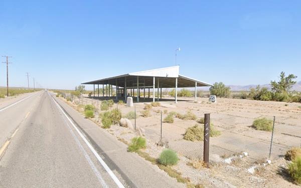
Continue westwards for 5 miles, and after crossing a bridge over a wash, you reach the eastern side of Daggett where there are two landmarks.
Sportsman's Club
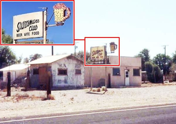
To your left, on the south side of the highway (35757 N.O.T. Hwy) is a small building that was the Sportsman's Club.
The now empty neon sign had a mug of beer jutting out towards the highway, lit up with light bulbs, and the panel with its name offered "Beer Wine Food." It vanished in the early 2010s probably bought by a collector.
While the sign was still there, years ago...
Site of the Second Inspection Station (1930s-53) ❌
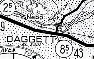
1934 map of Route 66, Daggett. Source. Click to enlarge
Opposite the Sportsman's Club, on the north side of the highway is a small group of trees. Here was the site of the second inspection station, on the western side of town. It was moved here before 1934 because it appears in the ACSC map (click on it to enlarge) published in 1934. You can see the two buildings in this 1952 aerial photograph, the original cabin to the left and the new addition to the right. The image below (1) shows the station in the 1940s:
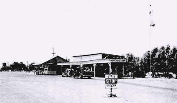
This inspection station was the location of a scene in the award-winning movie "The Grapes of Wrath", shot in 1940.
Daggett and the novel and movie "The Grapes of Wrath"
This Pulitzer Prize-winning novel was written in 1939 by Nobel Prize author John Steinbeck (1902 -1968).
>> Learn more on our Grapes of Wrath webpage.
The novel "The Grapes of Wrath" is set in the U.S during the mid-1930s. At that time, the Great Depression and the Dust Bowl drought had disrupted the American economy and millions were unemployed and defaulting on their mortgages; farmers and laborers were out of money and luck.
Steinbeck portrays the fate of a family of sharecroppers, the Joads, who lose their farm and home; so they pack their scant belongings and head west, to California, seeking a new start. The novel was published on April 14, 1939 by Viking Press-James Lloyd.
The Movie "The Grapes of Wrath"
The book was filmed as a movie directed by John Ford with a screenplay by Nunnally Johnson. The cast included Henry Fonda, Jane Darwell and John Carradine.
The Joads drive west towards California along Route 66, and the movie gives us irreplaceable glimpses of the Mother Road in 1940. One of the key scenes was shot in Daggett, the California Inspection Station.
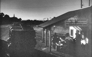
The Daggett Inspection Station. From The Grapes of Wrath (1940) Source.
Click to enlarge
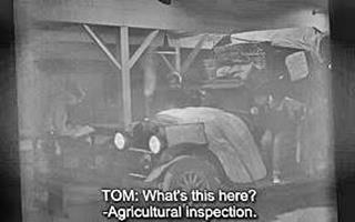
Daggett Inspection Station US66. From The Grapes of Wrath (1940)
These people in bad shape. when they reached Daggett they were stopped. The following is an excerpt from the book with the strained exchange at the Inspection Station:
It was near midnight when they neared Daggett, where the inspection station is. The road was flood-lighted there, and a sign illuminated, "KEEP RIGHT AND STOP." The officers loafed in the office, but they came out and stood under the long covered shed when Tom pulled in. One officer put down the license number and raised the hood.
Tom asked, "What's this here?"
"Agricultural inspection. We got to look over your stuff. Got any vegetables or seeds?"
"No," said Tom.
"Well, we got to look over your stuff. You got to unload."
Now Ma climbed heavily down from the truck. Her face was swollen and her eyes were hard. "Look, mister. We got a sick ol' lady. We got to get her to a doctor. We can't wait." She seemed to fight with hysteria. "You can't make us wait."
"Yeah? Well, we got to look you over."
"I swear we ain't got anything!" Ma cried. "I swear it. An' Granma's awful sick."
"You don't look so good yourself," the officer said.
Ma pulled herself up the back of the truck, hoisted herself with huge strength. "Look," she said.
The officer shot a flashlight beam up on the old shrunken face. "By God, she is," he said. "You swear you got no seeds or fruits or vegetables, no corn, no oranges?"
"No, no. I swear it!"
"Then go ahead. You can get a doctor in Barstow. That's only eight miles. Go on ahead."
Tom climbed in and drove on. John Steinbeck - The Grapes of Wrath
At that time, during the Dust Bowl and the Great Depression, the station also served as a "border control", turning back many of those seeking jobs in California. J. Gregory (1989) states that these border posts show that these internal migrants were "a despised and economically impaired group,... scorned newcomers", in fact, many of them returned to their abandoned homes, but others stayed and made good in California.
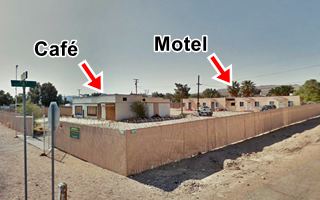
Kelley's Motel and Restaurant Sign
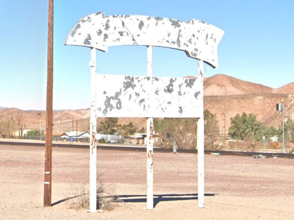
Head west and at the junction of Route 66 and C Steet, to your left is the Post Office with a marker whose plaque tells the story of Daggett. Juts ahead, to your right is a whitewashed arrow that used to point to Kelley's Restaurant and motel that were to the left, on the south side of the highway at its intersection with B St. (35650 Route 66).
Kelley's was one of Daggetts cafés, established in 1947 by James and Elsie Kelley.
Their Café also comprised a gas station (gone) and a motel that he began building in 1946 with three blocks of four units each (2), but was stopped by a suspension order of the Civilian Production Administration.
The place now has 12 units used as apartments.
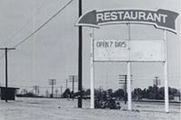
Kelley's arrow, 1985. Source. Click to see original image
They had a sign shaped like a curved arrow with the word "Restaurant" written across it to attract customers as you can see in the black and white thumbnail of a photograph taken in 1985 by Quinta Scott and published in his book Along Route 66.
View of the "curved arrow" nowadays
Shell Station
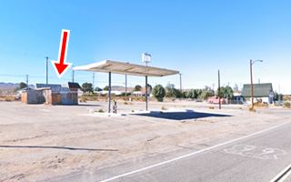
Head west and on the SE corner with A St. is the site of a Shell station pictured by American pop artist Edward Ruscha back in 1962. Ruscha lived in Los Angeles and drove along U.S. 66 quite frequently; he was also captivated by it. He captured images of gas stations along it during those trips that he compiled and published in 1963 as a book, Twentysix Gasoline Stations. One of those black and white pictures of 26 gasoline stations along Route 66 is this one, which he captioned "Shell, Daggett, California." The St. view shows that the original office is standing, but its long, flat canopy was replaced by a butterfly wing one.
Edward Ruscha's Daggett Shell station, 1963© (detail)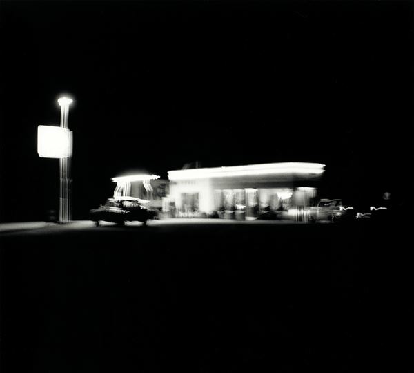
Russian House
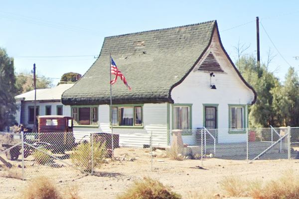
Cross to the west side of A Street and to your left on the SW corner is a house with a curiously shaped roof known under different names such as Ski Lodge, Sksi Slope, and Russian House:
It is a wood frame one-floor-with-attic building with a very oddly shaped roof, a Bochka roof, Russian word for "barrel". A traditional roof that is shaped like a half-cylinder with a peaked elevated upper part and the lower part of the cylinder curving into the walls.
It has windows in the front and sides and a door set in the facade. The attic has a triangular ventilation opening in the peak of the roof.
It served as a California Welcome Center built back in the 1920s and was opposite the Inspection Station set across the highway. There is a version that it was the office of a land development company promoting neighboring Minneola. After the welcome center closed (perhaps during the Great Depression) Marie "Ma" Millet purchased the property and lived there. She also ran a Café on the premises. It closed for good in 1947.
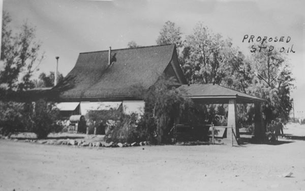
Below is a photograph of it from the 1920s or 30s. At that time, A St. didn't exist south of the highway.
Looking west at the Ski Slope house
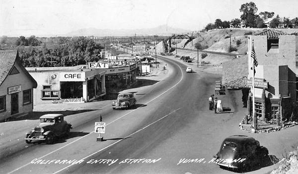
The design was used at other Welcome Centers like the one pictured below, on US 80, west of Yuma on the left side of the image (same spot nowadays).
Welcome Center (left) in Winterhaven, California, on the CA-AZ state line
The Ski-Slope or Russian House in Daggett
First Inspection Station
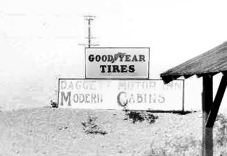
Daggett Modern Cabins sign, Route 66. Source. Click to enlarge
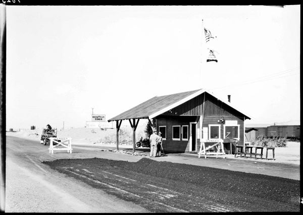
The first inspection station in Daggett stood opposite the Ski Lodge, to your right between the railroad and US66, it was located on the N.O.T. highway that came from downtown Daggett and crossed the tracks along A St. and then turned west towards Barstow. Route 66 was aligned along it in 1926. Below is a view of this building in the 1928 to 1930 period, while U.S. 66 was realigned and paved along its current roadway, it was at this time that the inspection station within the building was moved to the location on the eastern side of town opposite the Sportsman's Club. Nothing remains of the original site or building.
The image below shows the inspection station and a sign to the left (see thumbnail image) announces the "Daggett Motor Inn - Modern Cabins". Was this the first or the second station?
Mugwumps Service Station
The photograph further up showing the Ski Slope house, says "Proposed Std. Oil" with an arrow marking the western side of the property where Mugwumps is now located. The right-angled corners on the canopy were a feature of Chevron stations from the 1950s onwards. This station appears in the 1952 aerial photographs, so we suspect it was a Standard Oil Chevron station and not a Texaco as some have suggested. It was Jobby Halls station at one time.
View of the Mugwumps Service Station

Mugwumps is not a brand of gasoline; it is the name of a recent business that operated in the old building. Mugwump is an Algonquian word "mugquomp meaning "important person or war leader," and it was used in American politics (US presidential election of 1884), it is also the name of a 1960s rock band, and is used in the W. S. Burroughs' novel "Naked Lunch."
Downtown Daggett and original 1926 Route 66 alignment
Turn around, and head north (left) along the Daggett-Yermo Rd., you will cross the tracks into the old townsite.
Below are the buildings that can still be seen in Daggett:
Santa Fe - Union Pacific Railroad Junction
Look right, along the railroad tracks at the grade crossing (level crossing) you will see three sets of tracks: The Santa Fe ones to the south run towards the east and just ahead, the Union Pacific ones to the north, curve to the northeast heading to Las Vegas.
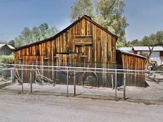
Alf's Blacksmith Shop
Take a right along the first street, Santa Fe Street, that was the original 1926-28 alignment of Route 66 and the N.O.T. highway before that. On the first corner, take a left along First Street and one block north is the Old Blacksmith Shop. On First St. between Mojave Rd. and Santa Fe St.
Dating back to 1894, this wooden structure was where the large Borax wagons used to haul out the mineral from Death Valley were built (one is on exhibition at the site).
Turn back to Santa Fe St. and head east, on the next corner is the famous General Store:
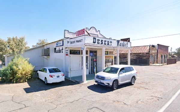
Desert Market
At 35596 Santa Fe St., on the NE corner with Mill St.
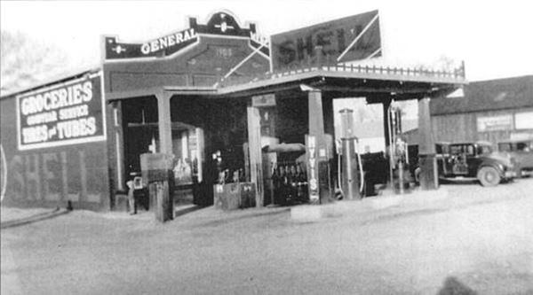
It was originally a wood structure, but it was rebuilt after the 1908 fire in cement, and was known as "Ryerson's General Store". It was a place where miners traded their gold dust for dollars.
The place sold Shell gasoline at one time, and had two pumps in front of the store. It was a General Store and also sold tubes, tires, and groceries. It had a flat canopy held up by two columns, jutting out in front of the store which was later removed together with the gas pumps.
It is relatively unchanged despite being over 100 years old, compare the "Then and Now" images of the store.
1920s photo of the General Store in Daggett, CA
Stone Hotel
Listed in the National Register of Historic Places
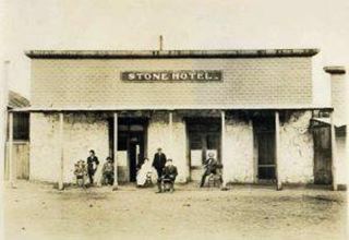
Stone Hotel c.1910. Source
Adjacent to the General store, on its eastern (right) side is the historic Stone Hotel:
At 35630 Santa Fe St. Built in 1883 it originally had two stories, but after the 1908 fire, it was rebuilt with only one floor. It has two-foot-thick adobe and stone walls.
It was for many years the only hotel in the town; it had a 40-foot square structure built in stone to withstand fires (3).
To its left is another wooden structure, the People's General Store dating back to 1908. It was the Thistle General Merchandise Store with a Western False Front style, a one-story, wood frame building.
View of the Stone Hotel today
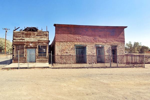
Compare it with its former appearance in the 1940s. The store is very deteriorated, but the hotel is fine. The "pool" to the right of the hotel, behind the car is long gone.
1940s photo of the Stone Hotel in Daggett, CA

At the eastern end of the block, on the south side of the road close to the tracks, is a historic site with a marker:
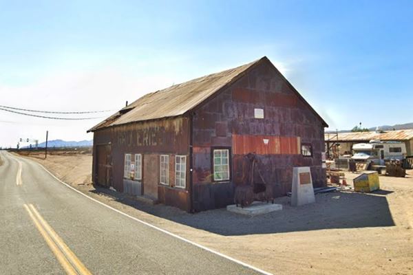
Fout's Garage
Historic Marker
Fourth St. and Santa Fe St. to your right. This is a very rusty steel building that was originally located in Marion, Francis Marion Smith's "borax town" on Calico Dry Lake in the 1880s. It was later pulled to Daggett in 1896, by a twenty-mule team and placed by the Mojave River Bridge on the Daggett-Yermo road, where it served as the roundhouse for the narrow gauge railroad of the Waterloo Mine.
It was moved (again) to its present location in 1896 (or 1912 according to another version), where it became a livery stable and a garage and an auto repair shop on the N.O.T. that passed right beside it. The Fout brothers bought it in 1946 and ran it as a garage until the mid-1980s.
See the historic plaque on the marker in the middle of the western facade of the building, it tells its story.
Continue your Road Trip
Your journey through Daggett ends here. Continue your "Route 66 Road Trip" by heading west towards the next town on the highway: Barstow.

Side Trip to Calico Ghost Town
State Historical Landmark and "California's Silver Rush Ghost Town"
Located at 36600 Ghost Town Road, Yermo. It is 6.8 miles north of Daggett, see this Map with directions.
Mojave River Bridge
Just 0.5 mi. north of Daggett along the Daggett-Yermo Rd. (map showing the spot), is the bridge across the Mohave River.
The "river" is a dry sandy area that sometimes may carry water on the surface. The river actually flows beneath the sandy bed.
Ghost Town
Keep northbound and you will reach the Ghost Town of Calico
Established in 1881 it was restored by Walter Knott in 1951 and donated in 1966 to San Bernardino county.
This was the hub for 500 mines, including the famous mines of Odessa, Waterloo, Garfield, Maggie, and Bismark, among others. They produced $86 million in silver and $45 million in borax.
With the drop in silver prices in the mid-1890s, the mines closed and the town disappeared. It is now a County Regional Park with shops, restaurants, and camping facilities. Remember that the mines are off-limits and dangerous, and must not be approached for any reason!
The Silver mining town of Calico, CA
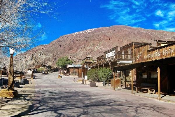
Visit the Calico Jail or Maggie Mine with the "Glory Hole" as well as the Calico-Odesssa Railroad. You can pan for gold or visit the replica of the 1880s schoolhouse.
Open daily 9 AM – 5 PM, except Christmas Day. Read more at the San Bernardino Co. Parks website.

Sponsored Content
>> Book your Hotel in Barstow

Credits
Banner image: Hackberry General Store, Hackberry, Arizona by Perla Eichenblat
A Guide to the Golden State, by the Federal Writers' Project of the Works Progress Administration, Hastings House, New York, 1939.
Jack DeVere Rittenhouse, (1946). A Guide Book to Highway 66.


