Route 66 in Barstow CA
Index to this page
About Barstow California
Facts, Trivia and useful information
Elevation 2,175 ft (663 m). Population 24,666 (2025).
Time zone: Pacific (MST): UTC minus 8 hours. Summer (DST) PDT (UTC-7).
Barstow is a city located on Route 66, in central San Bernardino County in central southwestern California. It is almost midway between Las Vegas, Nevada and Los Angeles, California.
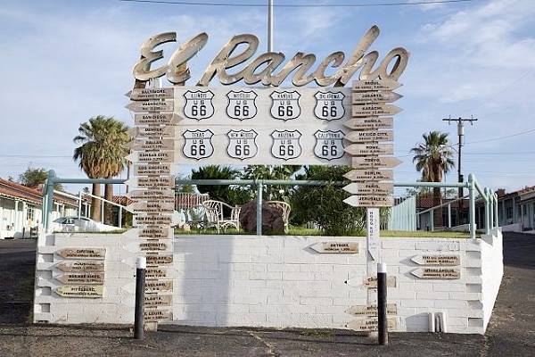
The classic Route 66 Sign (in the middle of the image) with mileage and Route 66 state shields at El Rancho Motel
The History of Barstow, California
Barstow may be the oldest inhabited spot in the New World if the archaeological site known as The Calico Early Man Site has been dated correctly; it is 200,000 years old. The dating and the stone tools found have been hotly debated, and some consider them Geofacts, that is, stones shaped by the forces of nature and not made by prehistoric humans.
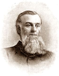
Mr. William Barstow Strong
More recently the natives that lived along the Mojave River were known as the "Vanyume" or "Beñemé" and were named so by a Spanish missionary, Father Garces during his 1776 expedition to Arizona, during which he trekked along the Mojave and crossed the Desert.
These Native Americans traded with other tribes living along the Colorado River and on the Pacific coast. They spoke a dialect of the Serrano language ("Serrano" in Spanish means "mountain people", as they lived in the San Bernardino Mountains to the south of Barstow). They fed on oak acorns gathered in the San Gabriel and San Bernardino Mountains and numbered around 1,000 at the time of Spanish arrival. Their ancestors created the stone engravings at the Fossil Canyon Petroglyph Site Archeological Site near Barstow.
The Spanish had explored California in 1602 and founded Los Angeles in 1769. From there they moved west and established the Mission San Gabriel Arcángel (1771) and in 1810 the area of San Bernardino was explored and a mission was established in 1819, San Bernardino followed by a Ranch in 1842.
In 1780 the Mojave Trail was opened, linking California with Arizona, New Mexico, and Utah. It crossed the Mojave Desert north of the modern I-40 and US 66, following the Mojave River.
Mojave Trail or Mojave Road
The Natives used a trail from Cajon Pass, a gap between the San Bernardino and San Gabriel Mountains in the south, that reached to the Colorado River in the east along the Mojave River and a series of water holes across the Mojave Desert. Father Garces used the trail during his mission to the Hopi Indians in Arizona in 1776.
Jedediah Smith was the first American to use it westwards, from Utah in 1826, a few years after Mexico became independent from Spain (1821) and California became part of its territory. By the late 1820s "The Old Spanish Trail" had been opened by Mexican traders in New Mexico, and it linked with the Mojave Trail at Soda Lake, the drainage point of the Mojave River.
The US defeated Mexico in the 1846-48 war, and California became a state of the Union in 1848.
The Mormons expanded west, settling along the "Mormon Corridor" from 1850 to 1890 by the members of The Church of Jesus Christ of Latter-day Saints, commonly known as Mormons. They purchased the San Bernardino ranch in 1851, founding the town. San Bernardino County was formed in 1853.
The US Army Lt. Edward Fitzgerald "Ned" Beale surveyed a wagon trail to California in 1857, which crossed the Colorado River at Ft. Mohave (near Needles) linking up there with the Mojave Trail. A steady inflow of settlers used this Mojave Trail, and this irritated the d native people (Paiute, Mojave and Chemehuevi). The government established Fort Cady (1860) and Fort Mohave (1859) to control the natives and protect those using the trail.
The area where Barstow is now located was a camping spot used by those trekking the trail. And as the area had willows, cottonwoods and wild grapes, it was named "Grapevines", near what is now North Barstow (Map showing its location). Later, it became a trading post that supplied the travellers and the miners prospecting the mountains in the area.
Camp Cady - Fort Cady
The U.S. Army established a camp to the northeast of Barstow in 1860 and named it after Major Albemarle Cady, a friend of Major James Carleton who founded it during a campaign against the Paiute Indians. The fort was abandoned during the American Civil War between 1861 and 1863, after which it was garrisoned until the natives were finally pacified in 1871.
The Army set up a camp near Barstow in 1858, naming it "Camp Sugar Loaf" and in 1864 Abram Jacoby ran a trading post here. A mine claim by George Lee in 1875 used the name "Grapevine" for the mine.
The Railroad in Barstow
Silver was found in the Calico Mountains in 1881 and the Southern Pacific Railroad (SP) extended its line into the area from Bakersfield and built a siding at Grapevine which it named "Waterman Junction" after Robert W. Waterman, a mine owner (Waterman mine is located 4 mi. to the north of Barstow along Irwin Rd.)
In 1883 SP's competitor, the Atlantic & Pacific Railroad (A & P, that later was absorbed by the Atchison Topeka & Santa Fe Railroad) carried its tracks across the Colorado River into California at Needles, linking its network (to Kansas and Missouri) with that of SP who had just finished its line that crossed the Mojave from Waterman Junction.
In 1884 A &P forced its rival to sell them the line and planned to reach Los Angeles through Cajon Pass, but speculators had bought the land at Daggett, point from which the tracks would turn towards Los Angeles; they wanted to re-sell it at exorbitant prices so the railroad moved the planned junction of the Mojave line and the Cajon Pass line to the west, to what would become Barstow. The post office was established in 1886, and the city was incorporated in 1947.
Barstow, the name
The station was named after William Barstow Strong (1837-1914). He was the president of the AT & SF Railway (1881-1189), also known as William B. Strong.
Barstow is a common surname in Yorkshire England, named after an Anglosaxon village "Bairstow" from "beger" (berry) and "stow" (place)
Borax, silver and gold mining declined by the early 1900s but the town had also become a railroad town (the maintenance shops had been moved there from Daggett, and as a main railroad link between Union Pacific and the AT&SF railroads.
In the early 1900s, cars began to be used and by 1910, decent highways were necessary. The National Old Trails (N.O.T.) built a road from Los Angeles that passed through Barstow towards Needle in its alignment that lined California with the eastern US.
The 1915 USGS survey along the Santa Fe railway informs that Barstow was an important division point on the railroad, as the Los Angeles - San Diego line split here from the Bakersfield - San Francisco one. It mentions the "spacious hotel (named) Casa del Desierto (house of the desert)".
Route 66 was aligned along the N.O.T. Highway in 1926. And paved shortly after.
The Great Depression hit business in Barstow yet thousands of displaced farmers (who lost their properties due to mortgage foreclosures and the Dust Bowl drought) drove by Barstow seeking jobs in California. There was an inspection station just northwest of Barstow, at Yermo, built in 1930, stopping tainted fruit and turning back "unwanted" migrants, just like the California Agricultural Inspection Station in Daggett, on Route 66.
World War II boosted its economy when a large U.S. Marine Corps supply depot and the Fort Irwin training center were established.
After the war, traffic along the US 66 grew, and also on US 91 (both highways crossed each other in downtown Barstow). Safer and less congested highways were needed, and this came as the Interstate system. I-15 and I-40 replaced the two U.S. Highways in Barstow. This change hurt many of the Route 66 motels and shops catering to travelers in downtown Barstow, but many of them are still operating (below we detail the classic Route 66 attractions in town).

Where to Stay in Barstow: Accommodation
Lodging in the city; check out the hotels and motels in Barstow and find your room.
> > Book your Hotel in Barstow
More Lodging Near Barstow along Route 66
Below you will find a list of some of the towns along Route 66 east and west of Barstow; click on any of the links to find your hotel in these towns.
>> Check out RV campground in Barstow
The Weather in Barstow
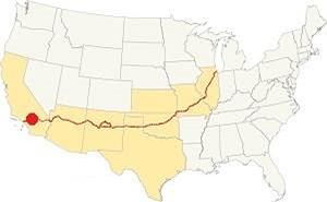
Location of Barstow on Route 66
The weather in Barstow is dry and hot, a Desert climate. Summers are hot (highs above 100°F, 38°C) and winters have cold mornings (lows close to 30°F or -1°C below freezing). Daily temperature swings are about 30°F (16°C) due to the dryness. Rainfall is around 4.1 in. (105 mm) with about 70% of it falling during the period between Nov. and Apr. Snow may fall occasionally in very small quantities.
The Average temperatures are: in summer (Jul) high around 105°F (41°C) and low of74°F (23°C). During Winter (Jan), high is 61°F (16°C) and low 37°F (3°C).
Extreme Heat and Dehydration Warning
During summer make sure you stay hydrated. The hot and dry desert climate can dehydrate you quickly. Drink plenty of water and dress for the heat.
Read more how to keep healthy in hot temperatures.
Tornado risk
Barstow is located well beyond the western limits of the Rocky Mountains, so there is no risk of tornadoes in this area.
Tornado Risk: read more about Tornado Risk along Route66.
Map of Route 66 in Barstow
Read about the Barstow to Pasadena alignment in our dedicated webpage (previous segment is the Topock to Barstow.
Below is an interactive map of the alignment:
Map of this segment in Barstow.
The first alignment of Route 66 in 1926
The first highway to reach Barstow was an Auto Trails one, built in the 1910s, a dirt track. It had a winding course, poor marking if any and it lacked bridges.
You can see its alignment in the thumbnail map (click on it to enlarge it) and the map below.
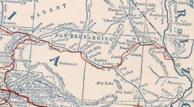
1927 Road map, western CA
Click on image to enlarge.
Credits
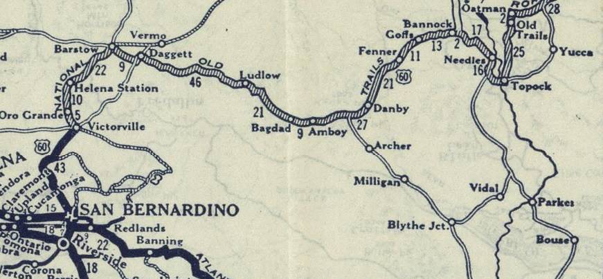
1926 Road map, western CA
Click on image to enlarge.
Credits
The map above (from 1926) -click on thumbnail to see large size map- shows the Highway as U.S. 60! Read why Route 66 was almost named Route 60.
This map is the first to show the alignment of a U.S. highway in Western California.
National Old Trails Highway (N.O.T.)
The Automobile Club of Southern California (ACSC) 1912 map tells us that Barstow had "Meals and lodging, Gasoline, Oil" and that it was 142 miles from Los Angeles.In 1915 it had added "Garage - Repairs" and two Club Signs. The map showed the "Harvey House" the road crossed to the north of the SF RR tracks east of town and then back to the south side short of the station, it then curved back eastwards before going west again well to the south of town, it did an "S" through Barstow, as shown in this map; it met the Santa Fe RR about 6.5 miles south of Barstow near Lenwood, possibly along Grandview Rd.
That same year, the road linking San Bernardino with Barstow through Cajon Pass became California highway LRN 31, San Bernardino County upkept it until the mid-1920s.
The N.O.T. guidebook published in the 1920s has the following to say about Barstow: "Population 500... Harvey House, hotels, garages, camp grounds, etc. Division point of Santa Fe railway. Supply point for gold and silver mines.."
In 1926, the N.O.T. highway was incorporated into the US highway network and the part west of New Mexico became US 66. Nevertheless, Route 66 was known as the "National Old Trails Road" for many years in California. By 1926 the alignment across the north side of town was still there, but the main road followed its current alignment along Main Street
After the war, traffic grew, peaking in 1960: Barstow combined US 66 with some 357,000 travelers (in 1960) and US 91 with 814,000; all of which went on to Los Angeles along old Route 66 south of Barstow through Victorville and Cajon Pass. A new safer road was needed and it came in the shape of I-15 and I-40, the interstate system that replaced both US 66 and US 91.
Daggett to Marine Base at Nebo
West of Daggett, the original roadway passes through a military facility, now it can't be driven. We marked this gap at Nebo with white line in our custom map. Part of the old alignment can be seen on the north side of the highway at Exit 2.
To bypass the Base you must take a detour at Nebo St., head south to I-40 (Exit 5) and head west to bypass it. Get off I-40 at Exit 2 and head west along E. Main St. in Barstow (map Daggett to Barstow).
Into Barstow
At Exit 2, follow E Main St. westwards and take a right at Montara Rd. passing under I-40 head north. Here is another gap caused by Exit 1, we marked it with a violet line in our custom map. The highway heads to the N.E. as East Main St. curves as it meets the SF tracks. The road then crosses over I-15. Keep on Main Street into downtown Barstow.
This marks the endpoint of this segment on the eastern side of Barstow. Ahead lies the Mojave River valley and Cajon Pass the access to San Bernardino and Los Angeles.
Getting to Barstow
You can reach Barstow along old Route 66, which here is named "Old National Trails Highway". Also from I-40 and I-15.
Route 66 Alignment near Barstow
With maps and full information on the Mother Road.
- Barstow to Pasadena (Next)
- Topock to Barstow (Barstow's)
- Kingman to Topock (Previous)

Attractions and things to see in Barstow
Some Barstow Trivia:
Get your Kicks in Barstow
"Route Sixty-six": is a "classic" song that seared Route 66 in the minds of several generations as a wonderful Road Trip. A journey where you can get your kicks, a Carpe Diem on wheels, driving, living the moment and enjoying the freedom of riding the Mother Road.
The song was written in 1946 by Bobby Troup and has been a hit evoked by all those who have driven (or plan to do so) along Route 66.
Read More: Get your Kicks on Route 66, full details about the song.
Barstow is one of the two California towns mentioned in the song (along with San Bernardino). It is mentioned in the following stanza:
Now you go through Saint Looey
Joplin, Missouri,
And Oklahoma City is mighty pretty.
You see Amarillo, Gallup, New Mexico,
Flagstaff, Arizona.
Don't forget Winona,
Kingman, Barstow, San Bernardino. Bobby Troup Route Sixty-six (1946)
All the Classic Motels and Route 66 landmarks
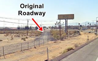
Driving west from Daggett and after driving along the freeway to bypass the Nebo base, there is an old stretch of original roadway that can be seen on the north side of the highway at Exit 2 (see image below).
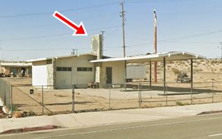
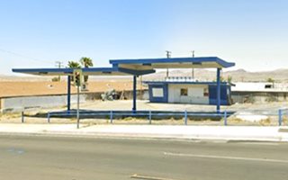
1960s Gas station
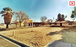
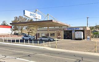
Here, to your right is a 1960s gas station built in a ranch-style with a chimney-like pylon that was used by Shell from 1940 to 1970 and Texaco from 1960 to 1970. It has a gently sloping gabled roof and canopy. It has a stone pylon that extends vertically over the office and service bays and was used to display back-lite company logo (red arrow), gable canopy covers two sets of pump islands. The aerial photo of the area shows it was already here in 1970. It is pictured above.
Greystone Cafe & Motel ❌
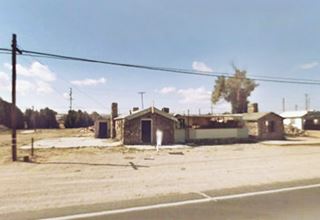
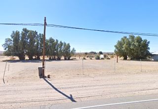
As the freeway cuts the old alignment, pass beneath I-40 and follow East Main westwards. Roughly 3⁄4 of a mile west is the site of a now-gone classic motel and cafe. The place opened in 1918 and in the 1950 telephone directory (1) its ad offered "Air cooled cabins, Texaco Service, Garage, Cafe, Weekly Rates." It was torn down in 2008. Below is a view of the place now, and in 2008 as it was being razed. Only the trees remain.
Unnamed Motel ❌
Continue west, at the curve 0.7 mi ahead, where the Walmart is now located, was the site of a motel from the 1960s. Razed as progress erases the old Route 66 site by site; it appeared in this 1970 aerial photo. It was built after the freeway cut Route 66 here in the 1960s, where Exit 1 is now located.
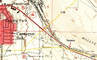
The phone book from the early 1950s mentions that at 2021 East Main St. was "Buttler's Texaco Service" that sold Firestone products. As you can see in the map (click on it to enlarge - we marked the roadways of I-15 and I-40 with yellow lines) at that time there was no I-40, and as this gas station was on the north side of U.S. 66 it was razed when the freeway was built and the old highway cut by it here at Exit 1.
From here to where I-15 now runs, none of the 1950s landmarks have survived east of I-15's Exit 1848. This 1959 aerial photo shows what this area looked like before the freeways were built.
Water Tank from the 1930s
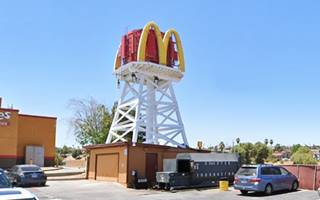
On the Northeastern side of the overpass where Main St. crosses I-15, to your right, in the McDonald's parking lot is the old wooden water tank that used to be located from the 1930s to the 1960s in the Mojave Water Camp, later Poe's Cafe 30 miles east of here, on Route 66 near Newberry Springs.
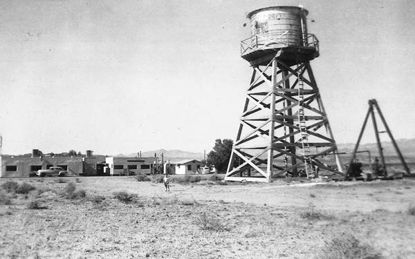
Water Tank and Poe's Cafe and Station 1940s. US66 Newberry Spgs. Source
Ahead, at 1470 E Main St. to your right is a 1980s building, now a Circle-K gas station (St. view). It has gable-roofed canopies and a building with Spanish tiles and a Mission Revival style, including a bell tower! This was the style adopted by the Terrible Herbst gas stations. The company began in Chicago, Illinois in 1938. Edward Herbst, owner of Martin Oil, expanded his service stations chain by being a tough player by selling gasoline at lower prices and adding convenience stores to his stations.
Route 66 Monument
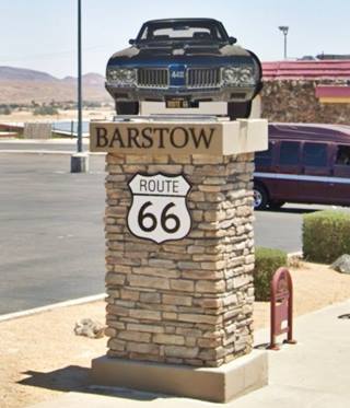
Also to your right at 1305 E Main, is one of the Route 66 monuments, a stone column with the effigy of a car and a U.S. Hwy. 66 shield (see picture).
Imperial 400 Motel
On the next corner, to your right, at 1281 E Main St. This was the Imperial 400 (now the Best Motel) was part of a motel chain founded in 1959 in Los Angeles.
Its buildings had a characteristic "butterfly sunflap roof" or "gull-wing" shaped roof like the one facing Route 66 on this motel. This was a Space Age Googie style design typical of that period and was created by Californian architects Don Palmer and William Kriesel (P&K).
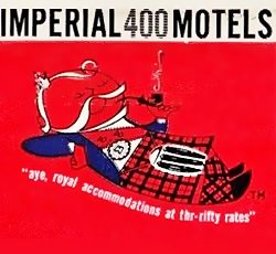
Imperial 400 ad c.1960s. Source.
The franchise used the concept in the first motel of the chain on Sunset Blvd. in Los Angeles. It was a great success so they adopted it for the whole franchise chain. Their slogan was "Aye, royal accommodations at thrifty rates." They grew too fast (opening one new site every ten days) and after building 179 motels they filed for Chapter 11 bankruptcy in 1965. They sold out to new owners, but eventually the motels changed hands and are now operated by different independent owners (2).
Imperial 400 Motel vintage postcard
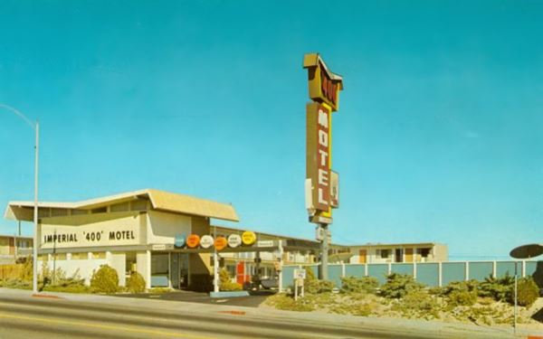
The "Then and Now" set of images shows that the canopy over the entrance has been removed with its 60's colored oval signs, and the main sign has been toned down from a classic Route 66 sign to a more sedate variety.
Imperial 400 Motel nowadays, it is a "Best Motel":
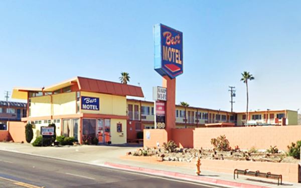
Imperial '400' Motels and Route 66
Learn all about these Space Age motels along U.S. 66.
> > Read more: Visit our Imperial "400" Motels on Route 66 webpage.
Astro Budget Motel
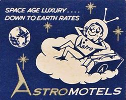
Astro motels ad c.1960s. Source.
Adjacent to the old Imperial 400, to your right at 1271 E Main St. is another classic early 1960s motel. It is the Astro Budget Motel with a "modern" Space-Age style design and part of the Astro Chain that covered California, Arizona, Utah and even Kansas. The Glendale California-based chain began in 1962 and Frank Schneider was the architect who created their design. They promised "Space Age Luxury...Down to Earth Prices."
Astro Motels and Route 66
Learn all about these Space Age motels along U.S. 66.
> > Read more: Visit our Astro Motels on Route 66 webpage.

Astro Motel 1960s postcard. Source Click image to enlarge
Vagabond Motor Hotel
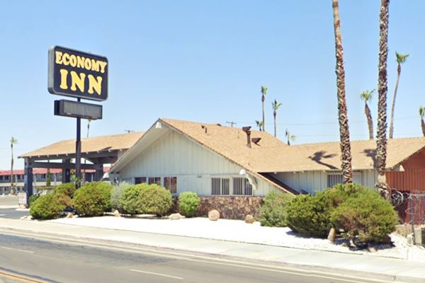
Continue west and ahead on the same block to your right at 1243 E Main is another classic motel, the old Vagabond Motor Inn that later became the Thriftylodge and now is the Economy Inn Barstow, a 3-star motel. The postcard pictured below announced: "67 luxury units. Free TV. Room phones...customized furniture... Your midway stop between Los Angeles and Las Vegas."
Vagagond Motor Hotel a vintage postcard
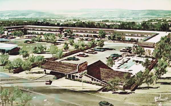
It has retained its original appearance, with the long sloping gabled roof over the main entrance and the lobby and its ranch style, a jewel from the late 1960s.
Economy Inn Motel nowadays, formerly the Vagabond:
Town and Country Motel
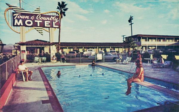
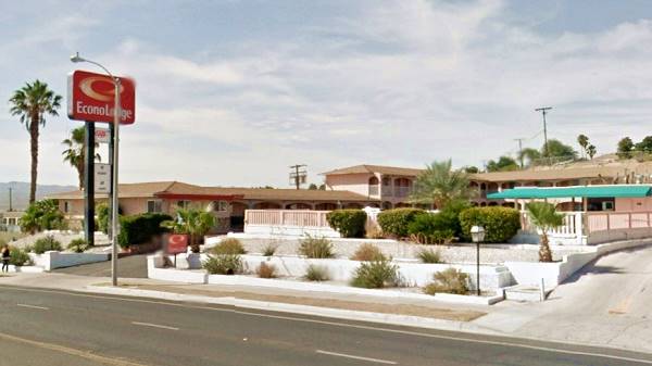
Opposite, to your left, on the south side of the avenue (1230 E Main St.) is the former Mom and Pop operated "Town and Country Motel" that has now became the Econo Lodge. Below is a 1950s postcard that stated "30 units... Full-tile showers... swimming pool... Carroll and Veda Aeschbacher Owners and Operators". It is a pity that its awesome Motel Sign is no longer there. Below is a "Then and Now" view.
Town and Country Motel c.1960s
Town and Country Motel nowadays, it is the Econo Lodge.
1960s Denny's Diner
Next door, to the right, is a modern "Denny's" open and serving meals and opposite, to your right, on the north side of the street, adjacent to the Vagabond at 1231 E Main, is an original Denny's building dating back to the '60s.
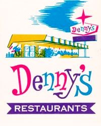
Denny's 1960s matchbook. Source
The former Denny's Diner had its trademark classic "Boomerang Roof" which is a design from the early 1960s by Armet & Davis. It is also a Googie Space Age style with bold slanting structures that give a sense of motion.
There are more classic Denny's on Route 66: the
Denny’s Diner in Needles CA, the Denny’s Tucumcari Diner, the Kingman AZ Denny's Diner,
one in Gallup NM and another in downtown Albuquerque (Whole Hog Cafe).
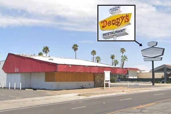
The current restaurant has kept the original diamond-shaped neon sign, now whitewashed. Compare the inset of a Denny's sign with this site's sign below and to the sign of the contemporary Denny's across the street:
Former Denny's diner with original sign:
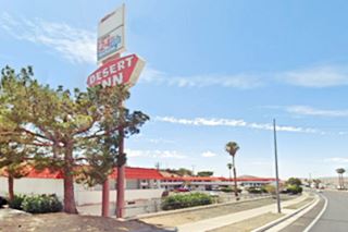
Desert Inn
Ahead, to your left is a classic since 1956, the Desert Inn at 1100 E Main St. Their 1950s postcard had the following description "DESERT INN MOTEL BARSTOW, CALIFORNIA 1100 East Main Street; Phone 2146 On U. S. 66 at Eastern entrance; 150 miles from either Las Vegas, Needles, Los Angeles or Bakersfield. Opened 1956 with 97 units - singles to suites at reasonable rates. TV, Refrigerated air; excellent food & cocktail lounge adjoining."
Almost 70 years later it is still with us operating under the same name. The old motel sign has been replaced and the roof has a Spanish tile touch to it, but it is basically the same.

The Desert Inn motel in a 1950s Postcard Source. Click to enlarge
Hillcrest Motel
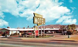
1950s Hillcrest Motel. Source. Click to enlarge
On the north side of Route 66 (to your right) is Jenny's Grill, formerly located at the old Denny's and who built their new restaurant with a design similar to the old one, a canted roof with eaves reminiscent of the Googie-style Denny's. Ahead and also to your right is the former Hillcrest Motel at 1111 E Main.
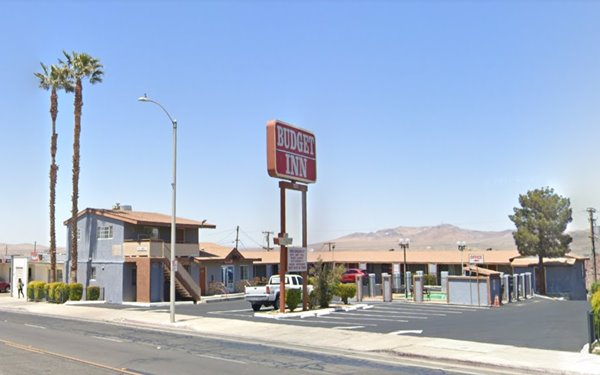
The Hillcrest Motel building has survived and is now the Budget Inn. In the 1950s, it had 15 units and a one-story office. Below is a "Now and Then" set of images.
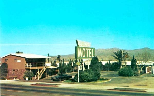
The 1970s motel had 17 units. The original building is still there. Oddly, the staircase leading up to the second floor of the front office has been moved from one tip of the building to the other. The color theme has changed (brown and rocks out). There is less greenery and its Route 66 Motel sign is completely different (no longer a trapezoid with the word Hillcrest, crossed by a rectangle with the word Motel), once again, a Route 66 sign has been lost.
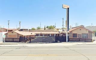
Hillcrest Motel nowadays. Aa Budget Inn:
Head west. Ahead, at the intersection of East Main and Muriel Dr. there are two vintage gas stations.
Alexander's Mobil Station
On the SE corner, at 1000 E Main. This is a cleaners store but once was Alexander's Mobil Service according to the 1950s yellow pages (3), pictured below as it stands nowadays, the canopy is still there it used to span two parallel sets of pump islands, now part of it has become part of the store.
Premium Oil
Diagonally across Main, on the NW corner, at 931 E Main is the former Premium Oil Co., also mentioned in the '50s yellow pages. It has detached butterfly canopies and is closed. Pictured above.
Sands Motel
On the SW corner opposite both gas stations, at 924 E Main St. is the old Sands Motel. Its postcard below says it was a "New, 13 unit motel with individually controlled air-conditioning... TV in units...Mr. & Mrs. W. H. Rickson, managing owners." The Sands Motel is still operating under the same name.
Sands Motel in a vintage 1950s postcard
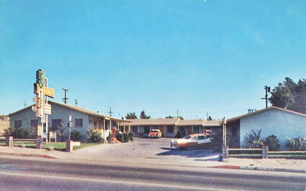
The hotel is relatively unchanged and until ten years ago, it had its original neon sign, now gone (to some collector maybe). Below is the current view.
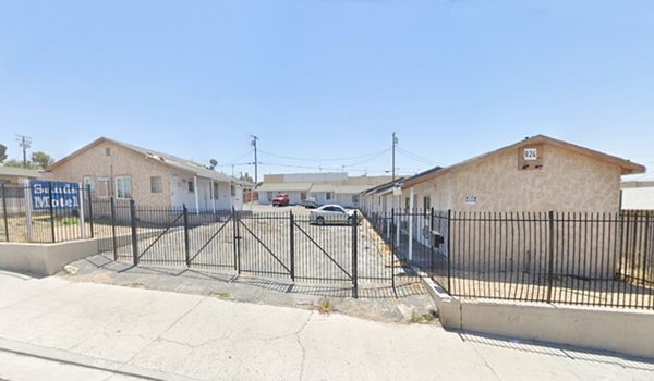
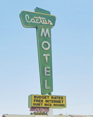
Cactus Motel Neon sign Barstow. St. view
Cactus Motel
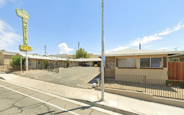
To your left, on the right side of the Sands at 916 E Main is The Cactus, another classic Route 66 Motel.
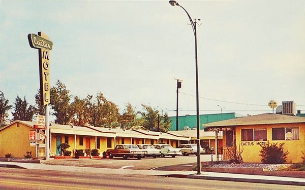
Its postcard pictured below tells us that it was "A nicely furnished 13 unit motel. Some fully equipped kitchenettes. TV. Individually controlled heat and air-conditioning. Restaurant and shopping center nearby." It was run by Lorains & Fred Luchsingers.
As the image shows, the original sign is still alive and kicking!
The Cactus Motel is still operating under the same name.
Cactus Motel in an early 1960s postcard
Brant's Motel
Opposite the Cactus Motel and next to Premium Oil Co. at 921 E Main (right) is the Brants Motel, from the 1950s. It has lost its enormous motel sign but the layout is unchanged. Their postcard, posted in 1961, stated: "Heated Pool - Air Conditiones - Vented Heat... Tubs and Showers - Family units divided... Accommodations for those in wheelchairs. Mr. & Mrs. R. H. Brant, Mgr.-owners."
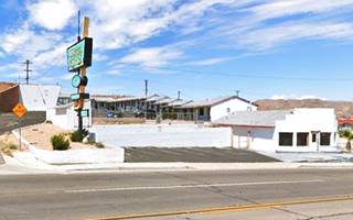
The building is intact and the old Brant's is now the 66 Motel, its nice neon sign is gone though, below is a "Then & Now" set of photos:

Brant's Motel, 1950s Postcard. Source
Stardust Inn
To your right at 901 East Main Street. It isn't a classic motel but its neon sign is awesome!
The Beacon Tavern ❌
To your left at 726 E Main St. to your left, after the U-Haul, was the famous Beacon Tavern that in its later years was known as the Beacon Motor Inn Hotel. This landmark began as a project of the Richfield Oil Co. and the Highway Communities Inc. who joined forces in 1928 to build a chain of hotels that included service stations and restaurants every 50 miles along the Western Coast from Mexico to California.
Beacon Tavern with its Richfield tower
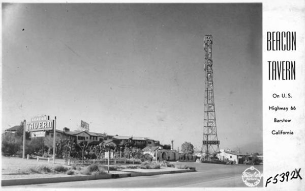
They would also have a steel tower 125 ft. high (38 m) resembling an oil derrick with the name "Richfield" written on it in 10-foot-tall letters. The tower would serve as a navigation aid for aeroplanes (there was no GPS or radar in those days).
Barstow's was the first and last complete unit to be built because the Great Depression that began in 1929 brought the project to an abrupt end.
Beacons were built at Palm City, CA, El Centro, Visalia, Castaic, and Los Angeles. The hotels were to be built in a Spanish Mission style and would be known as "Beacon Taverns", an odd name because it was a hotel, and Inn would have been more adequate because a tavern is a pub, bar, place where alcoholic breverages are sold, but these were the days of Prohibition, so it is quite baffling.
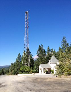
I photographed a similar tower by a former Richfield service station near Mount Shasta, California on old U.S. 99 (see the picture I took in 2016, and this St. view).
Barstow's Tavern had 50 rooms and opened on June 27, 1930. Over the years many Hollywood stars stayed here until I-15 was completed in 1957, making the stop at Barstow unnecessary. The Tavern was demolished in 1970. This aerial photo shows it in 1952.
Village Hotel and Café
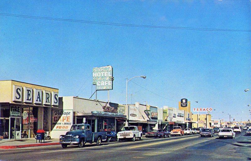
Continue west. There is a stretch with no surviving landmarks until you reach the downtown district: In the middle of the 300s block (right) there is another Route 66 marker-monument. On the next block's corner by Union Bank (right) there was a Texaco ❌ and on the western tip of the 200s block to your right is a classic neon sign fading under the desert sun with the words "The Village, Hotel, Air Conditioned, Cafe, Chop Suey" written on it. Below is a "Then and Now" view of that block.
Looking to the NE along Main Street's 200 block in the early 1960s
Looking to the NE along Main Street's 200 block in 2023
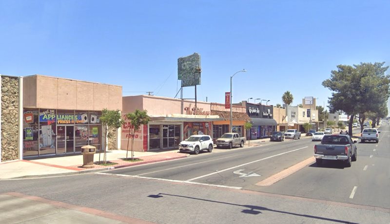
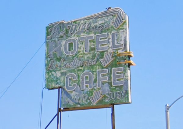
Its yellow pages ad from 1959-62 announced "Village Hotel Fine Accommodation Lowest Rates Air Conditioned Harry & Joe Gee - Props 205 E Main." (4). The store on the corner was a Sears, and the building is still standing.
El Rancho Motel ❌
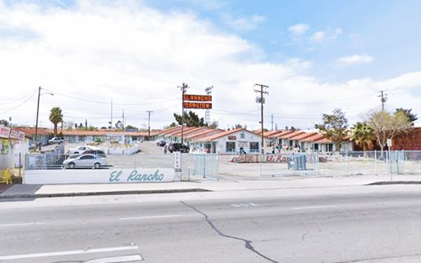
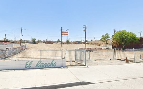
On the next block, to your left at At 112 E Main, was the El Rancho Motel that was destroyed by a "suspicious fire" in July 2022 (5). Prior to the fire it had been Red Tagged over and considered uninhabitable. It has since been torn down and all that remains is its tall sign.
Railroad Ties
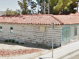
Railroad ties in the wall of El Rancho. St. view. Click image to enlarge
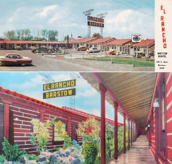
Cliff Chase built it in 1947 and used railroad ties (or sleepers) to build it. He got them from the Tonopah & Tidewater Railroad in neighboring Ludlow. The T&T had just shut down at that time. They were covered with stucco in the late 2010s.
The motel grew from 50 to 150 rooms over the years, but closed in 1979, reopening after being restored in 1987. Closed again in 1991, it opened once again in 1994. Now it is gone for good.
El Rancho in the 1950s
More Changes since the 1950s
Below is a set of "Then and Now" images looking east along Main St., just west of its junction with 1st (click on them to enlarge). As you can see (signs on the right) U.S. 66 East heads straight and U.S. 91 North turns left to cross the railroad along 1st to head to Las Vegas. The Union 76, Shell, and the El Rancho on the right have gone. Also the Richfield on the SE corner of S. First St. and the Texaco on the SW corner (not shown in this image, but you can see them in this 1950s picture) On the left only Barstow Pharmacy building survived (3) in the images above., the Standard Oil, Gold Stone Club, and Melrose Hotel (2) are gone. Further east, the Village Cafe mentioned further up is marked with (1).
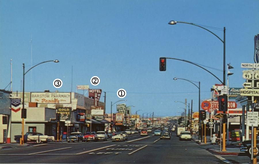
1950s Downtown Barstow. Source. Click to enlarge
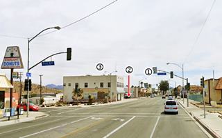
Downtown Barstow nowadays. St. view. Click to enlarge
Barstow Pharmacy
Marked with (3) in the images above. Established in 1905, it was a Rexall Drug Store and according to the 1959-62 telephone directory it was managed by Andy Croal (6)
On the north side of the 100s West block, nothing remains from the 1940s or 50s, on the south side is Barstow's Garage but the other buildings have also gone.
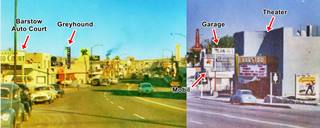
In the thumbnail image (click on it to enlarge) we combined two views looking eastwards along Main St. from the curve at the Garage. We identified some buildings that have been torn down, like the Greyhound depot at 145 W Main, and Uncle Neal's Pancake House further east. The Barstow Auto Court is still there, now as The Route 66 Hotel. On the south side is the garage, a Mobil station and Barstow Theater, both of them gone.
Barstow Garage
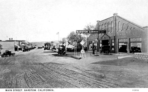
Head west and at 134 West Main, to your left, is a building that is almost 100 years old Barstow Garage. The old garage became a New Life Fellowship church (New Life Fellowship is a Non-Denominational Christian church). Below you can see what it looks like now and an old vintage postcard of it from the 1920s, the caption reads "Main Street, Barstow, California." Notice the unpaved street and the 1920s cars! Later it became Dean and Lawson garage.
Barstow Garage in a vintage postcard
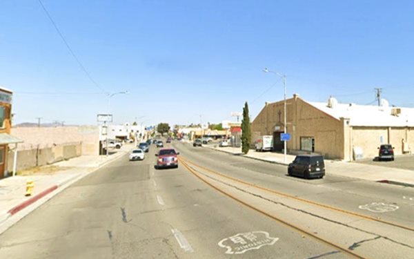
On the western side of the garage, there was a Mobil gas station and a Texaco across the street. Both have gone. Here the road starts curving towards the southeast and climbs Beacon Hill. In the parking lot of the church, there was a theater, the 600-seat Barstow Theatre. It opened in 1950 and closed in 1988. Razed.
The Route 66 Motel
To your right is the Route 66 Motel across from the site of the theater at 195 W. Main St. is a classic motel. It dates back to 1922, when it was the "Barstow Auto Court" and it was listed under this name in the 1950s phone directory: "14 family units . 16 hotel units, Kitchenettes... M. L. O'Harra Owner" (7). It is still operating as a motel.
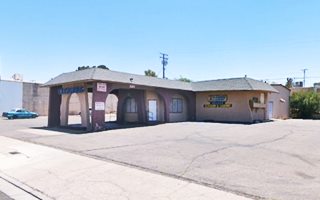
The Torches Motel
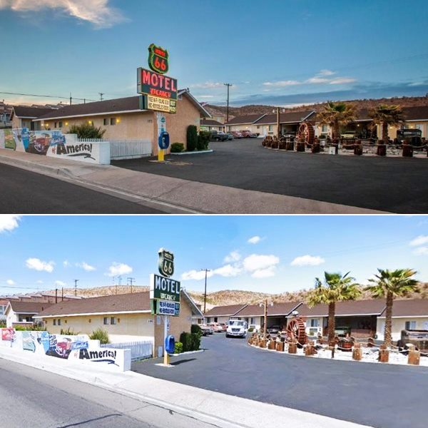
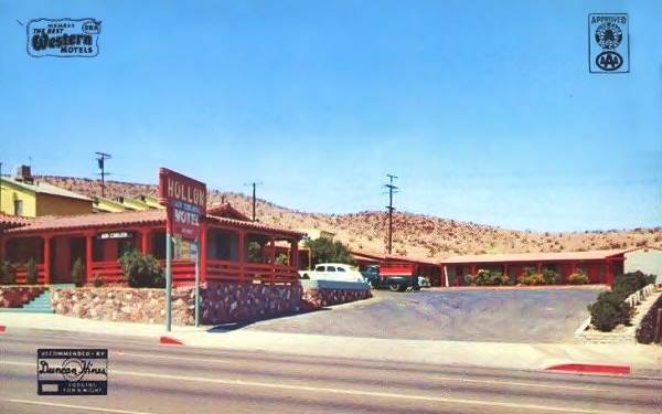
To your right, at 201 W. Main St., adjacent to The Route 66 motel. It began as the Hollon Motel and changed its name to Torches Motel it is still open and welcoming guests on Route 66.
The Hollon's postcard below described it as a "New, modern, hotel-type air-cooled units... One-half block to cafes, theatre, and drug stores. Mr. and Mrs. Wm. V. Hollon, Managing Owners,"
Hollon Motel in a 1940s postcard
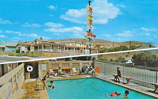
When it became the Torches, it added a modern sixties neon sign with an arrow and white and yellow colored panels arranged vertically with the word "Motel". At that time Myrl and Hal Hardisty owned it, and it had "15-units, T-V, A⁄C, Heated Pool, free coffee... pets, at-door parking."
The Torches Motel nowadays
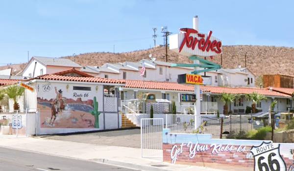
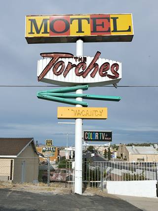
The Torches Motel neon sign. Source
The Torches Motel "Route 66 sign"
The general layout and the office of the motel are roughly the same, but the pedestrian entrance with the steps facing Route 66 has gone, and the stone wall facade has been whitewashed and murals decorate the walls.
Its 1960s neon sign has survived, though shorter, with the MOTEL panels now horizontal instead of vertical.
Skyview Motel - now Plaza Hotel
Adjacent to the Torches is the closed Plaza Hotel. Its original name was the Skyview. To your right at 203 W Main St.
The postcard below says it had "20 new, individually controlled refrigerated and air conditioned units... Wall to wall carpets. Radios. Excellent restaurant."
The restaurant and Cafe were located in the building that is now vacant, but still standing at the foot of the hill where the motel is set.

The Skyview motel, 1950s Postcard. Source
Sage Motel
Opposite the Skyview, to your left on the south side of Route 66 is the former Sage Motel at 220 W Main St.
Another "unchanged" gem on Route 66, the sign is a newer one, as you can see comparing the Vintage postcard below with its current appearance. It had 15 units, "Panelray vented heat. Wall-to-wall carpets. TV in units."
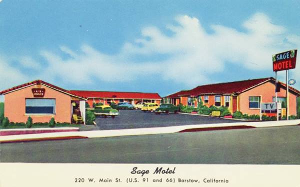
Ainlay Mobil
Continue westbound for five blocks and at 700 W Main, to your left, on the SW corner with A Ave. is a gas station that formerly was Ed Ainlay's Mobil Service according to the 1950s yellow pages. Pictured below.
La Siesta Motel
731 W Main St. (right side of Route 66), it closed and was repaired nicely. Compared to the old postcard, it has added a two-story building by the highway and retained the line of single-story, gable-roofed. It's postcards boasted: "LA SIESTA MOTEL Eight units, singles, doubles & suites all with tile baths, Beautyrest mattresses, Panel Ray heat, and all individually air-conditioned. Edna & Fred Andert, Managers. Phone 6901."
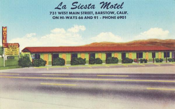
Across the street at 720 W Main there is a building "Gianni's Apartments", built in 1949, that seems to be a motor court. However, we haven't been able to confirm it.
Topper Motel
At 800 W main, to your left, this 15-room motel was advertised in the 1950s phone book. St. view.
Mathews Texaco
Oppposite Topper, at 821 W Main is former Mathews Texaco Service Station, and it appears in the early 1950s as Good Frank's Texaco (St. view).
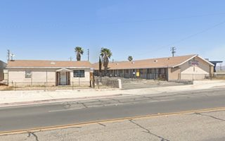
Casa Loma Motel
Next to Topper's at 860 West Main St. (left) is the former Casa Loma Motel that has now changed its name to Sunset Inn. Its postcard says it was "A fully modern motel with tile showers... Steam heat. Close to a good cafe. Owner operated." Its name means "House on the Hill."
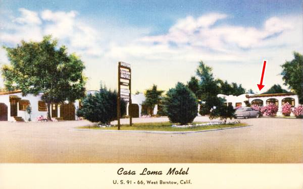
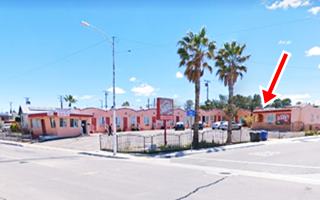
The trees (Tamarisks?) have mostly gone, replaced by palm trees. The quaint cottage-style units are still there, though painted differently. But the place is relatively intact, of the three arch shaped windows on the far right with pink flowers under them, one survives (red arrow in both Then and Now views).
Barstow Oasis ❌
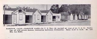
Barstow Oasis c.1930s. Source. Click to enlarge
To your right, where the Barstow Recycling center is now located (911 W Main) you will spot another Barstow stone marker. Here, during the 1930s, 40s, and 50s was the 18-unit Barstow Oasis, with a service station (9).
La Casa Court
Also to your right at 1101 W Main was Walt and Ethel Zieske's The La Casa Court "The Home of Cleanliness" There is an apartment complex made up of gable-roofed cabins with a garage between them. The cottage by the highway has a different design and must have been the Motor Court's office. See it in this St. view.
Ahead are two former gas stations, to your left at 1140 W Main (St. view) is Newbern's Richfield Service, and ahead, also on the left is Webster's Shell station (St. view); both appeared in the late 1950s yellow pages.
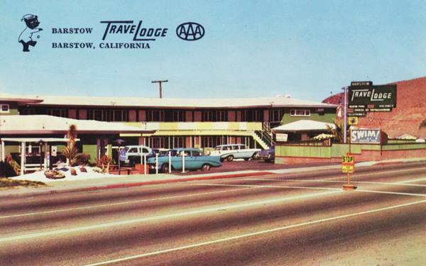
Travelodge
At 1261 W Main, across from the Shell, to your right is the Nites Inn Motel, formerly the Barstow Travelodge.
Its 1950s postcard below says it had Radio and T.V. in the rooms plus a heated swimming pool. The phone book tells us that Dick and Evelyn Dinan were Co-owners and Managers in 1956 (7).
The palm trees by the front office and the pool have grown taller, the color theme has changed and so has the sign, but the place is almost intact.
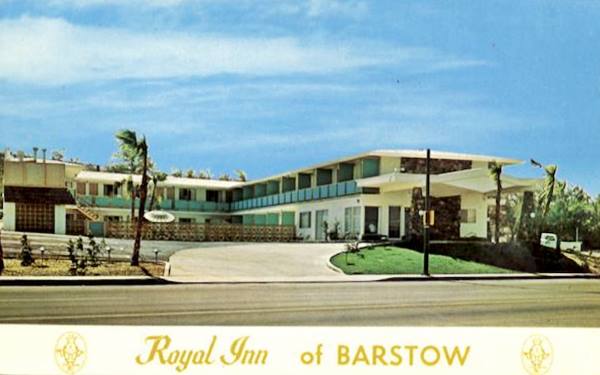
Royal Inn Of Barstow
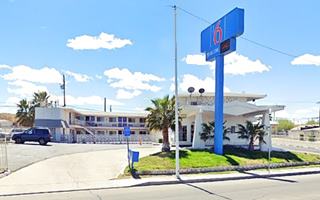
Ahead, to your left, at 1350 W. Main St. The former Royal Inn Motel, in the 1970s became the Sunset Inn (8) and is still operating, now it is a Motel 6.
Its postcard tells us the following: "Barstow's newest and most luxurious. Reasonable guaranteed rates. Central air conditioning. Color TV every room. Large heated swimming and therapy pools....."
The building with the diamond-shaped canopy is unchanged and still open as a motel.
Desert Lodge Motel
Located one mile west of Barstow, this motel must have been located here, the 1952 aerial photo only has one building here, where the Motel 7 is now located, on the SW corner of G Ave and West Main. The current building with flat roofs and stepped parapets does not look like the gable roof tiled buildings in the 1950s postcard. But there is no other option in the area in the 1950s. We will continue our research to clarify the point.
A Tour Circuit around Barstow
A 9.5 mi. circuit visiting Barstow Harvey House and two of Barstow's Museums: the Western America Railroad Museum and Route 66 "Mother Road" Museum, as well as Tom's Certified Welding & Machine Shop, the Skyline Drive In movie theatre, the Mojave River Valley Museum, and the Desert Discovery Center. See Map with directions.
Head north along North First Avenue and, after crossing the tracks, stop at the Barstow Harvey House to visit two of Barstow's museums: Route 66 "Mother Road" Museum and the Western America Railroad Museum.
Casa del Desierto Harvey House
Register of Historic Places and California Historical Landmark #892
At 685 North 1st Av. (Map showing Location)
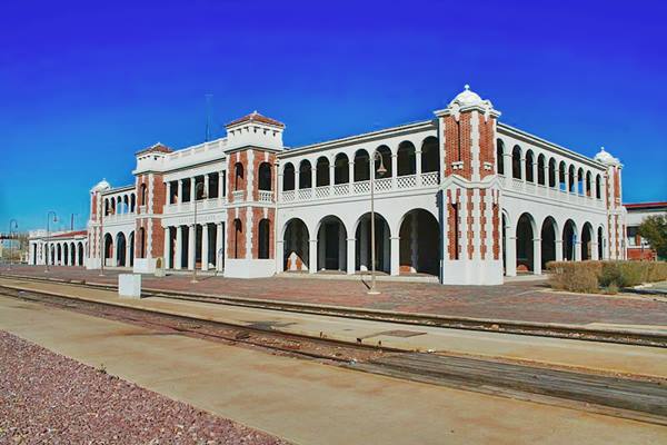
The Barstow Harvey House was built at Barstow station in 1911; it is also known as the "Casa del Desierto" (Desert House) Hotel.
The first AT&SF hotel built in 1885 burned down in 1908 and was replaced by this building that combines Spanish Renaissance and Classic Revival styles with pointed roofs on its corner towers.
The Santa Fe RR closed the station in 1975 and Barstow City acquired it in 1990, it also repaired it after being badly damaged by the 1992 earthquake. Currently many of the city's offices are located in the old hotel as well as two Barstow Museums.
Francis W. Wilson, the architect who designed it, also designed the Fray Marcos Hotel in Williams and the El Garces Hotel in Needles, all of them part of the Santa Fe Railroad.
The Barstow Harvey House
Harvey Houses
Frederick Henry "Fred" Harvey (1835 - 1901) was a businessman who developed the concept of efficient and clean service for those travelling by rail. So he signed agreements with the main railroad companies and built lunch rooms, diners, restaurants, hotels, and souvenir shops. They were the "Harvey Houses". The Atchison, Topeka and Santa Fe Railway was one of the companies he served so his hotels can be seen across New Mexico right next to their tracks.
There are two museums housed in the Harvey House:
Western America Railroad Museum
On the East side of the Harvey House. 685 N 1st Ave, Barstow
The Western America Railroad Museum is a railroad museum located in Barstow, set in a real railroad depot.
It collects, preserves and displays the railroad history in the Pacific Southwest: uniforms, tools, railroad artifacts and rolling stock such as locomotives. Open 11 AM – 4 PM, Fri, Sat, Sun. Read more at the Railroad Museum website.
Route 66 "Mother Road" Museum
Designated a "Roadside Attraction" in 2003 by Hampton Inn Hotels
On the western side of the Harvey House. 681 N 1st Ave.
The Route 66 Mother Road Museum dates back to 2000, and it displays many historic photographs and artifacts (signs, shields, and collectibles) of Route 66 and its historic context, including pioneer wagon trails and the history of automobiles.
Read more at the Barstow Route 66 Museum website.
Continue your tour northwards driving along N 1st St. take a left along Fort Irwin Rd. and then another left on Old Hwy 58. You will reach Tom's Certified Welding & Machine Shop:
Tom's Certified Welding & Machine Shop
28664 US Highway 58. This is a "must-see sight" in Barstow if you are interested in old signs, here you have all sorts of signs, in all sizes and colors. Signs that bring back memories from a bygone era.
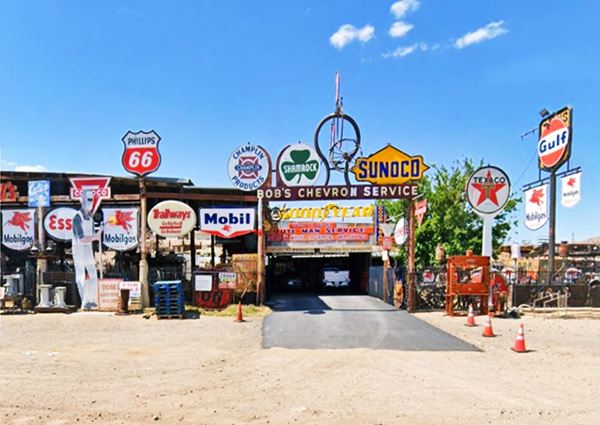
Retrace your steps, take a left on Ft. Irwin Rd. and a right along eastbound Old Hwy 58 until reaching an authentic drive-in
Skyline Drive In
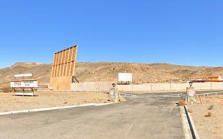
At 31175 Old Hwy 58. Although it is not a Route 66 period drive-in movie theatre, it is a unique chance to see a film at an American drive-in. It shows two different movies on its two screens 5 days a week with digital technology.
Read more at the Skyline Drive In Facebook.
Continue eastwards along Old Hwy 58 and get on I-15 westbound at Exit 185, leave the interstate at the next exit (183) along Barstow Rd. take a left at E. Virginia way to visit the third museum of this circuit:
Mojave River Valley Museum
270 E Virginia Way, Barstow. See map, two blocks from I-15's Exit 183.
The Mojave River Valley Museum is dedicated to the preservation and promotion of the scientific, historical and cultural heritage of the Mojave River Valley. Open daily 11 AM – 4 PM. Visit the Mojave River Valley Museum website.
Go back to Barstow Rd. and take a left, you will soon reach the Desert Discovery Center:
Desert Discovery Center
831 Barstow Rd, Barstow. See map, 3 blocks from I-15 Exit 183.
This Museum in Barstow is a community education center of the Bureau of Land Management. It is a 7,000 sq.ft. facility surrounded by 12 acres of public land next to downtown Barstow. It promotes awareness of desert life through formal and informal programs which focus on the natural, historic and cultural aspects of the Mojave Desert.
The "Old Woman meteorite" is the largest meteorite found in California and the second largest in the US you can see it at the Desert Discovery Center. The Desert Discovery Center is open Tue - Sat 11 AM to 4 PM.
Head north along Barstow Rd. to reach downtown Barstow, the endpoint of your City Tour.
Tours & Itineraries near Barstow
Mojave River
The Mojave is an itermitent river that flows in a closed basin with an area of 4,580 sq. mi. (11.862 km2), its source is in the San Bernardino Mountains at almost 3,000 ft. altitude (900 m) and it discharges into Soda Lake, in the Mojave Desert.
It is a source of water used by the desert animals and plants, and also by those crossing the Mojave since prehistoric times.
110 mi long (177 km), its discharge varies from nil to a maximum of 70,600 cu. ft. (2.0000 m3). Most of its water flow is underground as the river bed is dry most of the year.
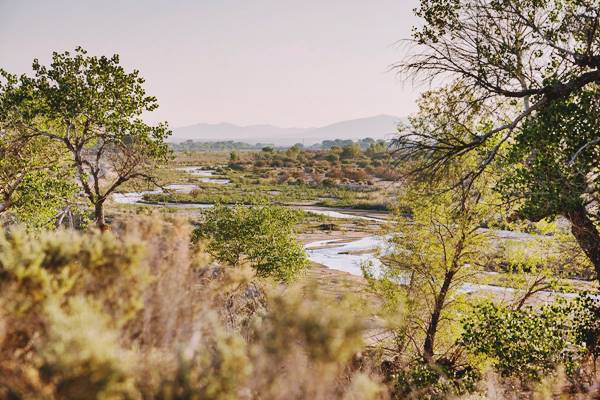
Father Garces named it Arroyo de los Mártires (Martyrs' Creek) in 1776. When Jedediah Smith followed it westwards into California in 1826 he named it "Inconstant River".
The underwater course of the Mohave River was marked by vegetation growing next to it, and therefore was in sight of Route 66 and the SF Railroad all the way from Newberry to Victorville.
The Calico Early Man Site
Located north of I-15, east of Barstow (17 mi. of which 2 are dirt). (Map with Directions).
It is an archaeological site in a now dry lake (Lake Manix) from the Pleistocene that dried at the end of the last Ice Age when this region became a desert.
The site has evidence of the oldest stone tools found in America, they are around 200,000 years old and are controversial since the accepted date for the peopling of the New World is some 20,000 years ago and, 200,000 years ago modern Homo sapiens had not yet left Africa. The BLM closed the site in 2019 until further notice.
Side Trip to Calico Ghost Town
State Historical Landmark and "California's Silver Rush Ghost Town"
Located at 36600 Ghost Town Road, Yermo. It is 12 miles northeast of Barstow, see this Map with directions.
Ghost Town
Keep northbound and you will reach the Ghost Town of Calico
Established in 1881 it was restored by Walter Knott in 1951 and donated in 1966 to San Bernardino county.
This was the hub for 500 mines, including the famous mines of Odessa, Waterloo, Garfield, Maggie and Bismark among others. They produced $86 million in silver and $45 million in borax.
With the drop in silver prices in the mid-1890s the mines closed and the town disappeared. It is now a County Regional Park with shops, restaurants, and camping facilities. Remember that the mines are off-limits and dangerous, and must not be approached for any reason!
The Silver mining town of Calico, CA
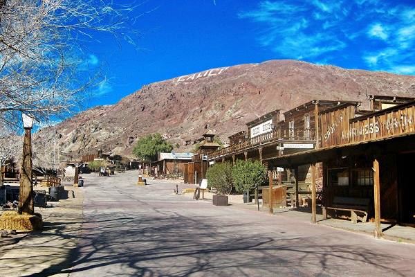
Visit the Calico Jail or Maggie Mine with the "Glory Hole" as well as the Calico-Odesssa Railroad. You can pan for gold or visit the replica of the 1880s schoolhouse.
Open daily 9 AM – 5 PM, except Christmas Day. Read more at the San Bernardino Co. Parks website.
Continue your Road Trip
Your journey through Barstow ends here. Continue your "Route 66 Road Trip" by heading west towards the next town on the highway: Lenwood.

Sponsored Content
>> Book your Hotel in Barstow

Credits
Banner image: Hackberry General Store, Hackberry, Arizona by Perla Eichenblat
A Guide to the Golden State, by the Federal Writers' Project of the Works Progress Administration, Hastings House, New York, 1939.
Jack DeVere Rittenhouse, (1946). A Guide Book to Highway 66.


