Historic Route 66 Kingman to Topock
Background on Historic Route 66

National Old Trails Map Needles CA-Topock AZ. 1915. Source
Click on thumbnail map to enlarge
In the 1910s, the National Old Trails Highway (N.O.T.) laid its route from California to Kansas, and the road crossed the Colorado River from Needles, California into Arizona north of Topock. At first it used a ferry as you can see in the map (click on thumbnail map for full sized view) but by 1916 the historic Trails Arch Bridge was built.
The "Auto Trails" were a contemporary movement, promoting decent hard surfaced roads across America. Roads that could be used by cars. They had their individual markings -like the N.O.T. had and drivers had to follow posts painted with the markers of each Trail.

National Old Trails Map Needles CA-Topock AZ. 1915. Source
Click on thumbnail map to enlarge
In the thumbnail "Auto Trails" roadmap from 1924 (click on it to enlarge), the following trail numbers appear (black box with white numbers): (20) was the Evergreen National Highway, (22) was the National Old Trails, it signs were marked with posts with red, white, and blue bands, (32) was the New Santa Fe Trail, and (64) was the National Park to Park Highway. Notice how the trails followed the railroad around the Black Mountains via Yucca. The same path followed by I-40 nowadays. The ferry still existed, to then north of the bridge.
Route 66 was aligned along the N.O.T. to Kingman in 1926 but went through Oatman, crossing the Black Mountains so that it could be used by the mines in that area to move their ore out.
At the Colorado River it used the old bridge and during the 1930s many farmers escaping the "Dust Bowl" drought, crossed it westbound seeking jobs in California, as starkly portrayed in John Seteinbeck's 1939 book "The Grapes of Wrath". The movie based on the book, included a shot of Route 66's bridge across the Colorado River.

Thumbnail of the 1935 Arizona highway map. Source
Click on thumbnail map to enlarge

Thumbnail of the 1971 Arizona highway map. Source
Click on thumbnail map to enlarge
In 1952, Route 66 was realigned, bypassing Sitgreaves Pass and Oatman. Instead it ran along level ground close to the railroad, to Kingman through Yucca (see map above).
Interstate 40 advancing eastwards from California crossed the Colorado River in 1966 and replaced U.S. 66 in this area. The small settlement of Topock was bypassed as few cars left I-40 at Exit 1.

Route 66 from Kingman to Topock
Kingman, starting point of this leg
We will start on the western side of Kingman and head west.
1926-40s course of Route 66
The first alignment of US 66 out of Kingman (1926-early 1940s) went along 2nd St. southbound and ran to the east of the later alignment, sandwiched between the tracks (See map) and the hills.
Later alignment
The highway was realigned in the 1940s and it was used until the freeway was built in 1979. This roadway ran to the east of I-40 westwards all the way to McConnico (see map of this alignment), where it turned west following the 1926 alignment.
There is a missing section here, 1,000 ft. long -300 m- that is cut by the freeway. We marked it with a black line in our custom map of Route 66 in AZ.
From here the higway headed west towards Cool Springs and Oatman along current state Hwy 10 (see map of this alignment).
Jack Rittenhouse drove along Route 66 in 1946, collecting information which he included in his book "A Guide Book to Highway 66", a great resource for those keen on learning more about US 66 during the post-war period. Oddly, Rittenhouse describes this 5 mile segment from downtown Kingman to McConnico as "Sitgreaves Pass" (which in fact is located on the summit of the Black Mountains).
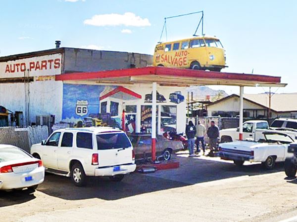
The Kingman Whiting Bros. gas station was located on the southwestern side of Kingman, now it is Dans Auto Salvage at 2666 S Highway 66:
Dans Auto Salvage, west of Kingman
Whiting Bros. and Route 66
> > Read more: Visit our Whiting Bros. and Route 66 webpage.
Learn all about the motels and gas stations of Whiting Bros along US 66 in New Mexico and Arizona.
After visiting the former Whiting Bros. station, you can head west towards the Historic Route 66 Back Country Byway.
The Historic Route 66 Back Country Byway
Back Country Byway

Back Country Byway sign. Austin Whittall.
This section of Route 66 from Kingman to Topock has been designated a Back Country Byway, within the BLM (Bureau of Land Management).
The road is legally accessible by any vehicle under 40 feet in length. The part of the road passing through the mountains is a very narrow two-lane with no shoulders, extremely tight switchbacks and many steep drop-offs. Wide vehicles and vehicles over 30 feet in length should use extreme caution when driving this road.
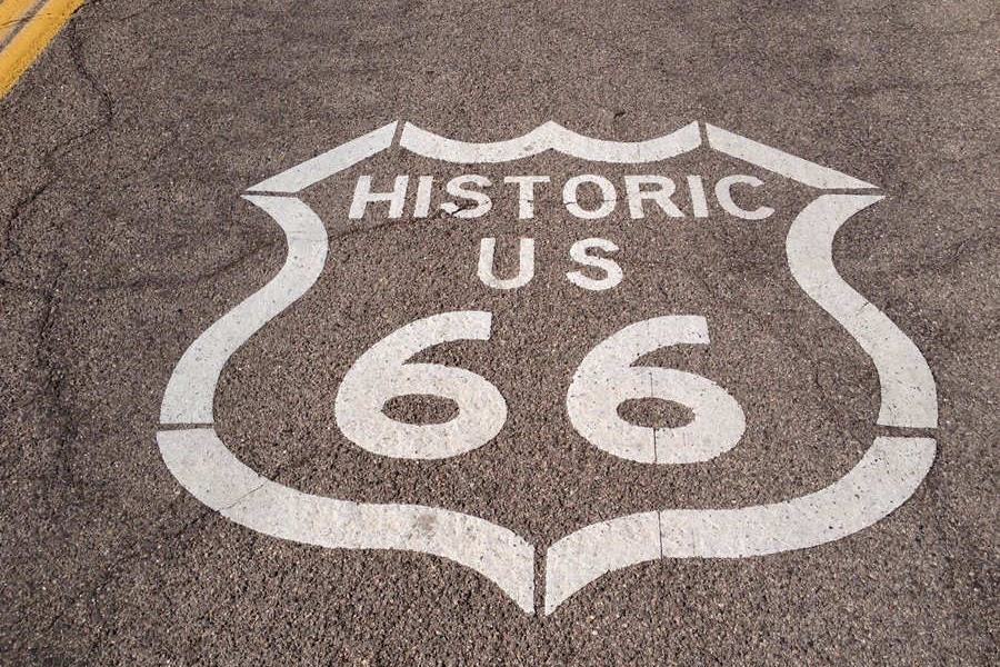
Just after you turn right onto the Byway you will see the Route 66 Shield painted on the road, shown below.
See this map with its location.
Shield on the US 66 roadway close to I-40.
Austin Whittall
Black Mountains
They are a mountain range that was formed some 15 to 20 million years ago when lava flowed thickly over a base of Precambrian granite.
They run with a north-south alignment and measure 75 miles long (121 km) and some 10 mi. wide (16 km). The highest point is Mount Perkins with 5,456 ft. (1.663 m).
Route 66 was built across the Black Mountains instead of following the route adopted by the railroad, which had easier gradients because it followed the National Old Trails highway which in turn was used to move ore out of the mines at Oatman and Goldroad.
The steep climb from east to west began at the foot of the mountains at 2,268 ft. and climbed up to Sitgreaves Pass (3,595 ft) over a distance of 9 miles. West of the pass, the road then dropped into Oatman, falling 915 ft. in a winding course along 4 miles.
Towards the Black Mountains
Not much has changed since the days of Rittenhouse, who mentions a gas station on mile 8 (from Kingman) -gone- an abandoned "Fig Springs Camp" at mile 18 -gone- at the point where the Gold Hill Grade climb begins, the climb to Sitgreaves Pass, which Rittenhouse calls "Gold Hill Grade".
Gold Hill Grade
It was the steepest gradient along the whole of route 66, with hairpin turns and an even steeper grade on the western side. Rittenhouse suggested that the westbound driver "should... keep his car in second gear going down".
On the way up US 66 passed by Cool Springs Camp (mile 23) with some cabins and gasoline.
Cool Springs
A Route 66 icon
20 miles west of Kingman on Route 66. (Map with directions).
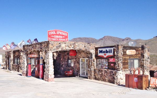
Originally established by Floyd and Ada Spidel in the 1940s. During the golden days of Route 66 it was a stop on the road before facing the tough winding climb across the Black Mountains towards Sitgreaves Pass. There were cabins, food, fresh water and gasoline.
It crumbled into disrepair when traffic fell off in 1952 when Route 66 was realigned through Yucca.
Purchased in 1997 by Ned Leuchtner he restored it to its former appearance and reopened in 2001. Stop at its gift shop and get some great views of Squaw tit mountain behind it.
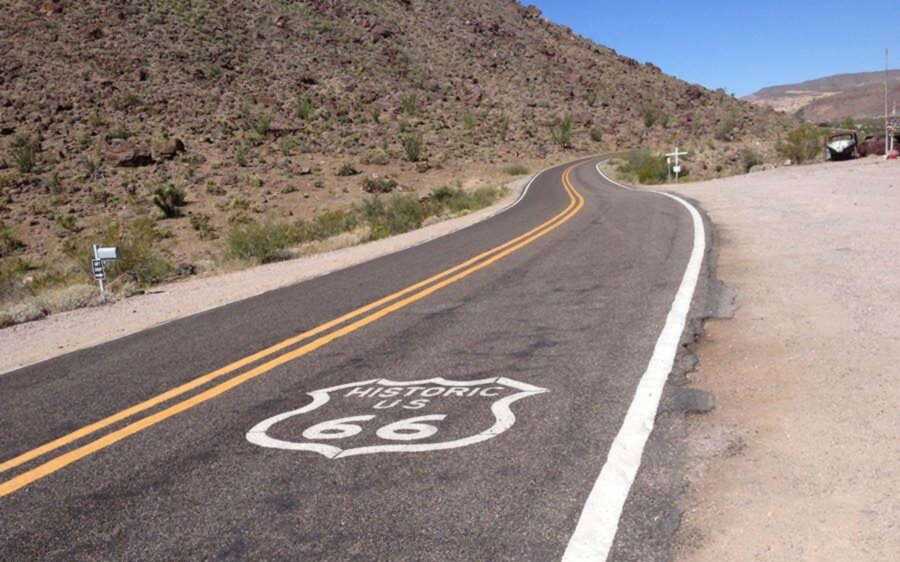
See the US 66 Shield painted on the road in front of the old gas station.
A view of the rebuilt Cool Springs Gas Station
Shield on the roadway in front of the Cold Sprig gas station between Kingman and Oatman:
Austin Whittall
One mile west is "Ed's Camp" which in Rittenhouse's time had fuel and was established on the N.O.T. in 1919 by "Ed". (Street View).
As the road climbs, you will notice some steps cut in the rock, on the left side of the road, in the middle of a curve: "Shaffer Fish Bowl Springs". See the Street View. Park (with care) and go up the steps to the "fish bowl". A spring in the dry mountains.
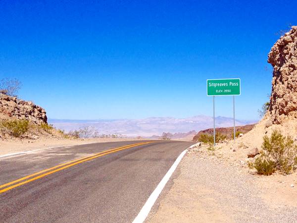
Sitgreaves Pass
During Rittenhouse's time there was another gas station and ice cream parlor at Gold Hill Summit (Sitgreaves Pass) (mile 27). On the summit.
At 3,595 ft (1.096 m) it offers a great view east and west. Park and enjoy the scenery.
Sitgreaves Pass on Route 66
Goldroad

Watch out for Burros sign near Oatman Arizona.
Perla Eichenblat.
Mining Ghost Town
The road winds downwards, and two miles west of the sumit, according to Rittenhouse it had "garage, no cabins, cafe or other facilities here". It was a mining community in those days, with 718 residents.
As an interesting remark, he noted that there was a tow truck that would haul those whose vehicles could not make it up the road, eastbound; they charged $3.50.
Now it is abandoned, with the ruins of some buildings visible among the bushes, it is a real ghost town. Although mining is still going on in Goldroad, it is private property so please don't trespass.
Jose Jerez discoverd gold there in 1900 and dug the first shaft shortly after. He sold it in 1901 for $ 50,000. The mine produced $ 2.3 million by 2007 and closed in 1916. It reopened in 1922 and closed again in 1949. In 1992 the Addwest Minerals reopened it.
Kingman to Oatman Arizona in the Black Mountains, a hairpin bend:
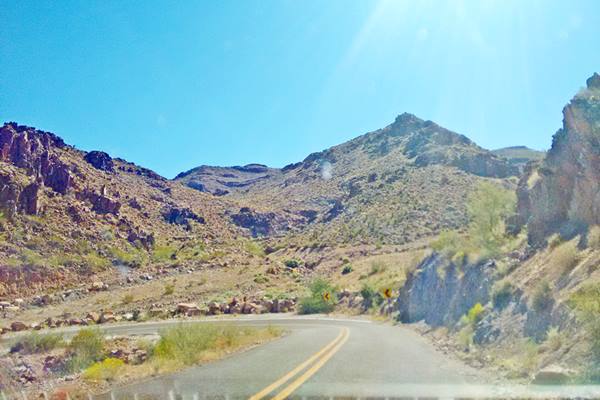
After Goldroad, the road took a winding course westwards. Ahead lies the Negro Head mountain. Then it took a southbound course towards Oatman.
To the left, beyond Oatman is the Elephant's Tooth Mountain.
Oatman
The road descended swiftly into Oatman, which in Rittenhouse's day had "Everett Hotel; two small tourist courts; Bill's garage; limited facilities... and the old Arizona Hotel.", he pointed out that its boom days had now ended as there were many closed stores. He noted the "plank sidewalks, old sidewalk awnings".
What to do and see in Oatman
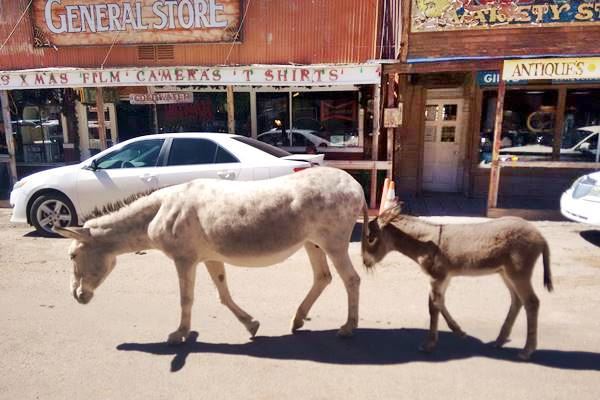
The town is a "wild west gold mining town" with The Historic Route 66 Back Country Byway. Don't miss the Gunfights and Burros in town and The historic Durlin (Oatman) Hotel.
Onwards to Topock
Beyond Oatman the Route drops with a easy gradient into the Colorado River Valley. Rittenhouse pointed out 3 miles west of Oatman a trailer camping spot on the right side of the road, and 2 miles south, "Water faucet on the roadside... for cars that need water on the climb driving east".
Don't miss the impressive peaks to your left, Boundary Cone and Wrigley Peak.
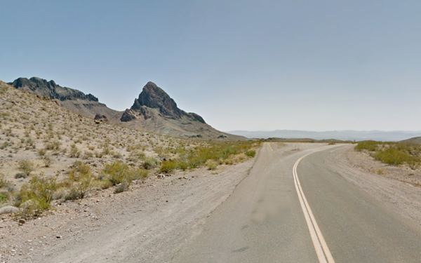
The road on the right side of the picture is the original N.O.T. highway that went to Needles and crossed the Colorado River using a ferry until the Trails Arch Bridge was built in Topock in 1916.
There was, in those days, a burned gas station 2 miles ahead, on the left. He mentions the volcanic rocks in the area and finally, the enticing willows along the Colorado River, when the road reaches Topock.
Topock
Topock , at mile 58 from Kingman, had "Gas; grocery; few cabins; garage for light repairs; limite facilities". Then came the Colorado River bridges and in its midpoint the Arizona California State Line.

Hotels and Motels close to this segment
>> Book your Hotel in Kingman
More Lodging Near Kingman along Route 66
There are plenty of lodging options in the cities and towns along Route 66 east and west of the city; click on the links below to find your accommodation in these towns, listed from east to west:
Eastwards
In Arizona Along Route 66
Westwards
You are so close to Las Vegas and the Grand Canyon!
The bridges across the Colorado River
The bridges in Topock
Five bridges were built to cross the Colorado River south of Needles:
- The First Railroad Bridge, gone, 1883 - 1890
- The Red Rock Railroad Bridge, 1890 - 1947 Railroad Bridge (later 1947-66 U.S. 66 Bridge)
- The Trails Arch Bridge, 1916 - 1947 Road Bridge)
- The New Red Rock Railway Bridge, since 1945)
- The Freeway Bridge, after 1966
First Railroad Bridge
The site for the first bridge was a "Eastbridge", 3 miles south of Needles. There the local workers drove pilons into the soft river bed to support the wooden bridge they would build across the Colorado River. The bridge, completed in August 1883 was washed away by the spring flood season.
A new bridge was built in 1884, and again in 1886, and in 1888. The floods and the unsuitable location for the bridge site (sandy clay soil) led the engineers to relocate the bridge further south in 1890.
Red Rock Railroad Bridge
It replaced the "Eastbridge"; the engineers chose a point further south, beyond the marshes and the mouth of the Sacramento Wash, at a narrow spot in Beal, CA, facing Topock where there was a solid rock foundation for the bridge. There they built a steel cantilever bridge, the Railway Red Rock Brige.
The steel cantilever bridge
The bridge cost over $460,000 which is more than $15 million in 2022 dollars; it was America's longest cantilever bridge.
As trains and their cargo increased in weight the bridge was reinforced in 1901 to carry heavier loads and later, a support pier was added in the middle of the span.
It is the bridge in the middle in the following image:
Looking east from California into Arizona, the three bridges.
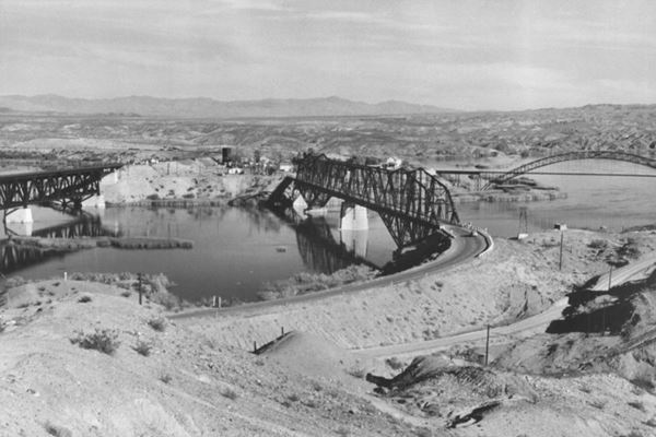
The picture above taken between 1947 and 1969 show, from left to right, the New Red Rock Railroad Bridge, the "old" Red Rock Railroad Bridge, that carried US 66 from 1947 to 1966, with the highway leaving its western tip and curving left (north), and the original Trails Arch bridge (far right) with its access road, the 1926-47 US 66 crossing the image along the bottom. Topock can be seen in the distance, in Arizona.
Trails Arch Bridge
Listed in the National Register of Historic Places in 1988.
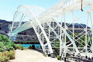
The Topock Bridge, Arizona & California. Source
The cars that drove along the roads of the 1910s, crossed the Colorado River using the Needles Ferry. But a flood razed the ferry in 1914 so the cars crossed the river using the railroad's Red Rock Bridge: planks were laid across the tracks and the cars crossed between trains.
There was a bridge on the "Ocean-to-Ocean" route at Yuma, but the Los Angeles to St. Louis National Old Trails Highway also required a bridge across the Colorado River
In 1914, the states of Arizona and California, the US Bureau of Indian Affairs and San Bernardino County agreed to build a bridge.
The structure is a steel arch bridge with a "cantilever system" where the arch was assembled in two halves on each side of the river and then hoisted into place and linked together with a ball-and-socket central hinge.
At 800 ft. (243 m) in length and with a span of 600 ft. (182 m), it was the longest arch bridge in America until 1928.
The bridge was completed on Feb. 20, 1916 and carried the traffic of the N.O.T. highway. In 1926, U.S. 66 was aligned across it and remained so until 1947 when it was replaced by the Red Rock Bridge which the AT&SF railroad had just stopped using.
Its deck was removed in 1948 and a natural gas pipeline was laid across it; it is still in use.
We marked the course of the 1926-47 Route 66 from Topock AZ to California across this bridge with a pink line in our custom map of Route 66 in AZ.
Viewing the Trails Arch Bridge
From the California side of the river you can get a good view the old Arch Bridge from this vantage point (Map and Directions from Topock AZ), there is a concrete billboard and a parking space. The Billboard says "Welcome, Turn Right Next Exit" with a Route 66 shield.
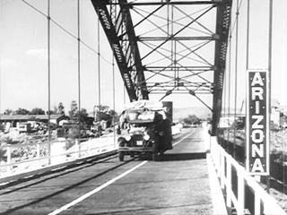
Dust Bowl and the Great Depression, "Grapes of Wrath", US66 and the Colorado River Bridge
The black and white image is a still from themovie "The Grapes of Wrath" showing the Joads crossing the Colorado River along the steel arch bridge in 1940.
The Grapes of Wrath and the Trail
The book by John Steinbeck and the movie it inspired, directed by John Ford (1940), portrayed the tragic story of an Oklahoma family, the Joads, who lost their farm during the Great Depression and migrated to California seeking new opportunities.
In this Pulitzer Prize-winning work, Steinbeck (who later won the Nobel Prize in Literature) depicts their tragic journey (along Route 66). He also coined the phrase "Mother Road", referring to U.S. 66.
>> Learn more on our Grapes of Wrath page.
New Red Rock Railroad Bridge
The heavy military cargoes during World War II led the AT&SF railroad to plan and build a new bridge just north of the original one.
It was completed in February 1945: a high level double-track bridge. This bridge is still in use today.
Route 66 Red Rock Bridge: Carried vehicles after 1947
The Trails Arch Bridge was a very narrow bridge and only one lane crossed it, it also had a sharp 90° turn on the Californian side. It had a low carrying weight (11 tons); as trucks carried heavier loads a new bridge became necessary.
When the railway completed the "new Red Rock Bridge" the "old" bridge was modified to accommodate U.S. 66 trafic in 1947 and continued carrying traffic until it was replaced by the I-40 bridge in 1966. The old steel structure was removed in 1978.
We marked the course of the 1947-66 Route 66 from Topock AZ to California across this bridge with a dark blue line in our custom map of Route 66 in AZ.
These two aerial photographs reflect the changes over the years:
This aerial photograph taken in 1947 shows, from top (north) to bottom (south), the three bridges that crossed the Colorado River at that time. The 1969 aerial photo shows all bridges, including the one carrying I-40.
Route 66 after 1952
Across Sacramento Valley
West of Kingman and to the east of the mountains lies the Sacramento Valley. An intermittent stream (Sacaramento Wash) flows occasionally along its sandy bottom meeting the Colorado River at the Topock marsh area.
The railroad opted for this more-level route to reach California. While Route 66 followed the other course, across the Black Mountains to Oatman.
When the gold mines became exhausted in the late 1940s, the dangerous mountain roadway of Route 66 through Sitgreaves Pass was replaced by a new one, that ran along level ground, through Yucca.
This was the last alignment and was used between 1952 and 1979 between Kingman and Topock. It was safer, had four lanes and hardly any grades.
Topock was Mile post 1 of Route 66 in Arizona.
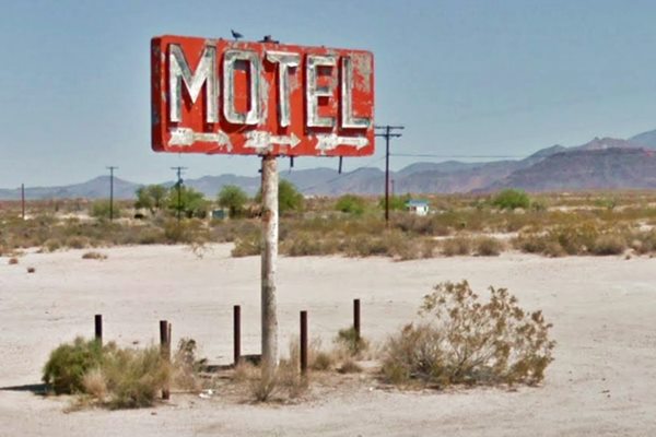
Segment eliminated in 1979
The American Association of State Highway and Transportation (or AASHTO) decided to move the western terminus of Route 66 eastwards.
On June 29, 1979 the AASHTO moved the "end point" from Needles CA eastwards, across most of arizona Arizona, to Sanders, close to its border with New Mexico, to its junction with U.S. 191.
Decertified in California and most of Arizona - 1979
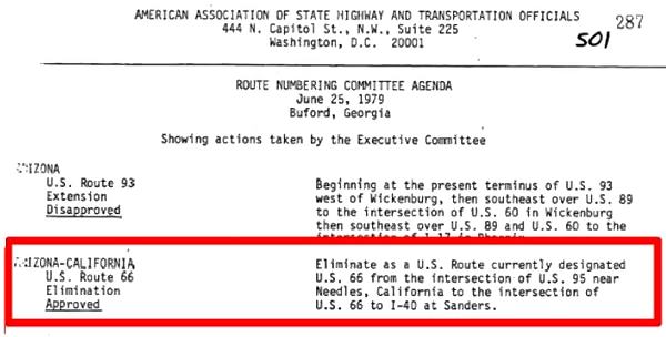
The Western Terminus of Route 66 remained in Sanders until the whole highway was eliminated in 1985.
Cross the Colorado River and drive the Needles to Barstow section in California.
Our itinerary from Kingman to Topock - Arizona ⁄ California state line in Topock ends here, you can carry on westwards into California, see below.
Next Section
Route 66 alignments from Topock to Barstow CA
Previous Section
Route 66 alignments from Williams to Kingman AZ
Visit Lake Havasu City

Lake Havasu City, the lake and London Bridge. Source
This resort town on Lake Havasu has beaches along the lake's scenic shoreline, an active nightlife and the original London bridge.
>> Book your Hotel in Lake Havasu City
Source and Sources

Some sponsored content
> > Book your Hotel in Lake Havasu City.

Credits
Banner image: Hackberry General Store, Hackberry, Arizona by Perla Eichenblat.
Jack DeVere Rittenhouse, (1946). A Guide Book to Highway 66
The Bridges of Topock
Route 66 Maps. Arizona D.O.T.


