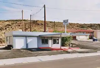
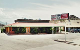
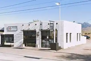
Route 66 in Western Arizona
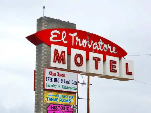
The Classic Trovatore Motel in Kingman
Index to this page
- About Kingman
- Weather
- Hotels
- Map US 66
- Route 66 across Kingman sights &attractions
- Kingman Page 2 (with more tips, tours, and sights)
About Kingman, Arizona
Facts, Trivia and useful information
Elevation 3,333 ft (1.016 m). Population 36,958 (2025).
Time zone: Mountain (MST): UTC minus 7 hours. Summer (DST) no DST⁄ PDT (UTC-7).
Kingman is the county seat of Mohave County, on Route 66 in the northwestern part of Arizona. Its motto is "The Heart of Historic Route 66".
Kingman's History
Human beings have lived in this part of Arizona for over 10,000 years since the Paleoindians hunted in the area. They were the Patayan people who lived along the Colorado River basin. The Havasupai and Hualapai groups of the Patayan were farmers who planted crops of squash, corn, and beans in the watered areas, including what is now Kingman. They still live in the region and along Route 66.
Spain added Arizona to their province of New Mexico, but did not settle it. Missionaries from California explored the area in the 1700s. Arizona passed to Mexico after its independence from Spain in 1821, but it lost it to the U.S. after being defeated in the 1846-48 war.
The government sent Capt. Lorenzo Sitgreaves to explore the region in 1851. He was followed by Lt. Edward "Ned" Fitzgerald Beale, who surveyed a route along the 35th parallel from Fort Smith in Arkansas to California. His route passed through Kingman. He discovered what are now known as Beale Springs (read more on page #2).

Mr. Lewis Kingman in 1885.
During the Hualapai War (1866-1870), an outpost was established at Beal Springs. It became an Indian Reservation after their defeat. The natives were moved out in 1874 and the camp closed.
The Atlantic & Pacific Railroad (later the Atchison Topeka and Santa Fe Railroad) reached the area in the early 1880s. A station was built, and Kingman was founded in 1882. Its post office opened in 1883.
Kingman became the county seat in 1887 (formerly it was located at Fort Mohave), and it grew in importance as a shipping point for the region's mines and ranches.
The National Old Trails Highway (N.O.T.), a rough and primitive highway, reached Kingman in 1914. The N.O.T. guidebook of 1914 reported that Kingman had "Good hotels, Harvey House, camp grounds with shower bath and rest rooms."
Route 66 was created in 1926 and followed the N.O.T. roadbed. The building of Hoover Dam (1931-36) and the World War II airfield contributed to the town's economy. By 1952, mining had dwindled so the Route 66 alignment through Sitgreaves Pass and Oatman was replaced by a new one that ran along level ground, through Yucca.
Interstate 40 bypassed the town in 1979, closing an era.
The Name: Kingman
Named after the railroad surveyor Lewis Kingman (1845 - 1912), who had been dispatched by William Strong, the president of the AT & SF, to survey routes for the railroad across Arizona. He directed the construction from Winslow to Beale Springs, which is where Kingman now stands.
Hotels: Where to Stay in Kingman
Lodging & accommodation in Kingman.
>> Book your Hotel in Kingman
More Lodging Near Kingman along Route 66
There are plenty of lodging options in the cities and towns along Route 66 east and west of Kingman. Click the links below to find your accommodation in these towns, listed from east to west:
Eastwards
In Arizona Along Route 66
Westwards
You are so close to Las Vegas and the Grand Canyon!
>> RV campgrounds in Kingman
Weather in Kingman
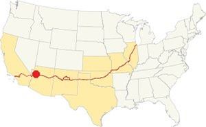
Location of Kingman on Route 66
The area around Kingman has a "cold semi-arid climate". Its altitude gives it much colder winters and cooler summers than those experienced in the neighboring lower-lying desert areas closer to the Colorado River.
Snow occasionally falls in winter with some 3.7 inches (9.4 cm) per year. It rains 36 days every year with 19.3 in. (263 mm). April, May, and June are the driest months, while August is the wettest.
Average temperatures during the year: range from the summer high (Jul) 97.8°F (36.6°C) and summer low 67.2°F (19.6°C) to a winter high (Jan) 55.9°F (13.3°C) and a winter low 31.1°F (-0.5°C).
Tornado risk
Kingman is well to the west of the Rocky Mountains, so there are virtually no tornadoes in the area.
Map of Route 66 through Kingman Arizona
Alignment map in Kingman
>> See our custom Map with US 66 alignment across Kingman.
1926-40s course of Route 66
The first alignment of US 66 out of Kingman (1926-early 1940s) went along 2nd St. southbound and ran to the east of the later alignment, sandwiched between the tracks and the hills. (Pink line in our custom map, also See map here).
1940s to 1952
The highway was realigned in the 1940s (violet line in our custom map), and it was used until the freeway was built in 1979. This roadway ran to the east of I-40 westwards all the way to McConnico (see map of this alignment), where it turned west following the 1926 alignment.
There is a missing section here, 1,000 ft. long -300 m- that is cut by the freeway. We marked it with a black line in our custom map of Route 66 in AZ.
From here, the highway headed west towards Cool Springs and Oatman along current state Hwy 10 (see map of this alignment).
After 1952: Yucca alignment
The highway was aligned in 1952 along what is now I-40 from Kingman to the Colorado River through the neighboring town of Yucca.
Route 66 Alignment near Kingman
With maps and full information on the old roadway.
- Kingman to Topock (next)
- Williams to Kingman (Kingman's)
- Winona to Williams (previous)

Sights and Attractions in Kingman
What to Do, Landmark, and Places to See
- In Kingman: all the Route 66 Classics (This page)
- Tours & Itineraries (Page #2)
- Parks and outdoors (Page #2)
Classic Motels and Service Stations
Historic context, the classic Route 66 in Kingman
Jack DeVere Rittenhouse drove along Route 66 in 1946, collecting information which he included in his book "A Guide Book to Highway 66". Which is
a great reference for learning about US 66 during the post-war period.
Rittenhouse mentions the following accommodations in Kingman:
- Hotels: Beale, Brunswick and Commercial.
- Tourist Courts (the motels of the 1940s): Akron, Arcadia Lodge, Wal-A-Pai, Williams, Kit Carson Motel, Gypsy Garden, Stony Wold, Bungalow, White Rock, Lambert's Gateway Village, Bell's, Stratton's, Kingman, El Trovatore, Challenger, Modern Trailer court. (Those without a link have gone).
Some Kingman Trivia:
Kingman: "get your kicks on Route 66"
"Get Your Kicks on Route Sixty-six" was written in 1946 by Bobby Troup during his US66 trip from Chicago to Los Angeles. Kingman is one of the three Arizona towns mentioned in the song (the others are Flagstaff and Winona).
Read More: Get your Kicks on Route 66, with full details on the song and its context.
Now you go through Saint Looey
Joplin, Missouri,
And Oklahoma City is mighty pretty.
You see Amarillo, Gallup, New Mexico,
Flagstaff, Arizona.
Don't forget Winona,
Kingman, Barstow, San Bernardino.
City tour Kingman from the West
On the western side of Kingman as you approach Kingman from Oatman or Yucca, when you reach Ella's Pl., turn left towards West Beale St., and on the following intersection, turn left, on W Beale St., into it. This is U.S. Hwy. 93, which runs with a NW course towards Las Vegas, Nevada.
U.S. 466 Spur of Route 66
Route 93 overlapped with a spur of Route 66, U.S. 466. It ran from Kingman to Las Vegas, Barstow, Bakersfield and ended on the Pacific Ocean at Morro Bay. It was active until its total decertification in 1971.
> > Read about The six spurs of Route 66
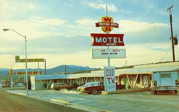
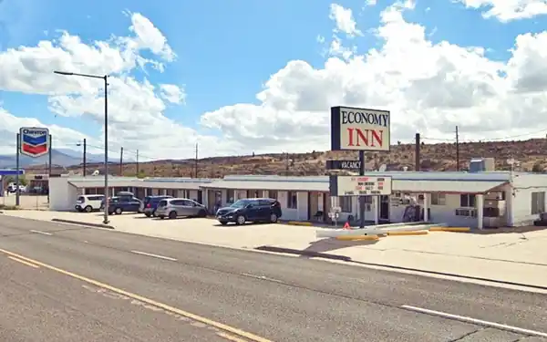
Drive 1 mile west (passing I-40) and, to your left, you will see a motel that used to be the Whiting Bros. Motel in Kingman.
Former Whiting Bros Motel
1250 W Beale St. It was once part of the Whiting Bros. chain of motels and service stations; it is now an Economy Inn. The service station is gone. Below is a Now-and-Then sequence of the motel.
A view in the early 1970s of the Whiting Bros. motel & gas station in Kingman
Whiting Bros. and Route 66
Learn all about the motels and gas stations of Whiting Bros along US 66 in New Mexico and Arizona.
> > Read more: Visit our Whiting Bros. and Route 66 webpage.
Shell Station
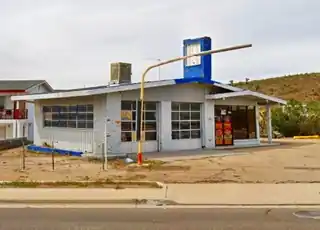
Next door, to the west, is a former Ranch-style Shell gas station. This style was introduced in 1957. It has a low-sloping gable roof with a brick finish and a chimney-like extension rising from the roof where the logo was displayed. Glazed service bays and office. Below is a "Then and Now" set of pictures.
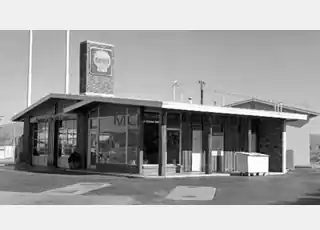
1950s Shell station. Source
Gateway Arch
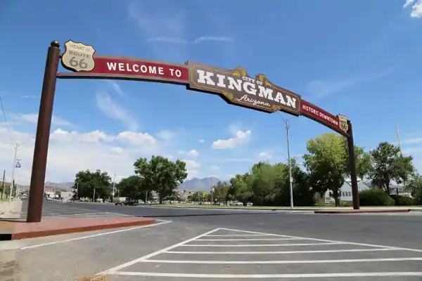
Turn around and head back into Kingman. Ahead is the gateway that marks the entrance into the Historic District.
The 25-foot-tall (7.6 m), 61 feet wide (18.6 m) steel arch spans Beale Street beside the park that is the home to a 90-year-old steam locomotive.
Two US 66 shields on each side remind us that Kingman is "The Heart of Route 66".
The arch marking the historic commercial district in Kingman
The Kingman Comercial Historic District
Listed in the National Register of Historic Places
It covers nine buildings along Andy Devine Ave. on the 300 and 400 blocks in central Kingman.
After passing under the "Gateway Arch", take a right on N. 1st St., park, and visit the steam engine in Locomotive Park and some classic Route66 sights.
Former Texaco Gas Station
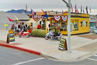
102 E Beale St. On the SW corner of Beale and 1st Streets is a motorcycle accessories shop that used to be a Texaco Gas station.
Notice its classic canopy with the transversal ridges that were part of Texaco's brand identity.
The pumps' island, office, and two-bay garage are well preserved.
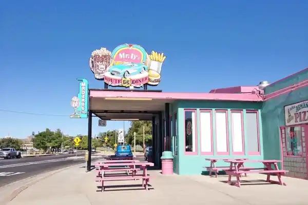
Former Shell Station, now Mr D'Z Route 66 Diner

Shell gas station, 1930s photo, now Mr. Dz. Source
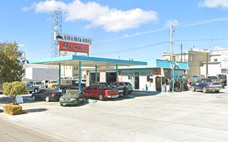
Head south, and on the corner is another classic, a diner at 105 E Andy Devine Ave. NW corner. The diner is pictured at the top of this page was once a Shell gas station.
The vintage 1930s postcard shows the Shell service station with a typical Art Moderne design.
It had a rounded canopy with horizontal lines, curved windows, and crests in the columns and curved streamlined corners. The original canopy has gone, but the curved windows have survived. The building has been repurposed as an iconic Diner, Mr.D'z.
Art Moderne
Art Moderne or Streamline Moderne was popular in the 1930s and evolved from Art Deco. Its main features are: curved shapes with rounded edges, horizontal lines or grooves in walls, flat roofs, smooth wall surfaces (plaster), and pale beige or off-white colors with contrasting dark trims.
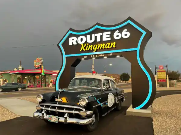
The Route 66 Drive-Thru Shield
Route 66 attraction
Across the road in the parking lot is a modern Route 66 attraction, this giant U.S. Highway 66 shield that can be driven through is a great spot for a photo!. This is a street view of it.
Andy Devine
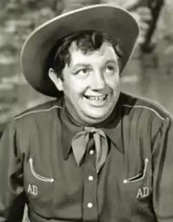
Andy Devine, Source
Route 66 is named Andy Devine Avenue through Kingman. But, who was he?
You have surely seen him in some Western movies. His father opened the Beale Hotel, and he was raised in town.
Andrew Vabre "Andy" Devine (1905 - 1977) was an American character actor and comic cowboy sidekick known for his distinctive, whiny voice and his friendly, plump countenance (see photo).
Turn right to visit the Powerhouse Visitors Center.
Powerhouse Visitors Center
Beside the drive-thru sield, at 120 W. Andy Devine Ave. Open daily 8 AM - 5 PM
It was built in 1906 to generate electricity for the mines in the Black Mountains. It operated until 1938 when the Hoover Dam was inaugurated. In 1997, it reopened as a visitor center and museum. (St. view).
A good place to get advice on what to see and do in Kingman (and the whole of Arizona), as well as maps and guidance. There are Route 66 mementos for sale at the gift shop. Stamp your Route 66 passport here.
The Historic Route 66 Museum is located in the Center.
Historic Route 66 Museum
Admission fee. Read more at the Historic Route 66 Museum website.
Canada Mart Gas Station
Walk 0.2 miles west to visit an adjacent Gas Station.
At 210 W Andy Devine Ave. It has a nice neon sign and a long, triangular-shaped canopy. Gas station, souvenirs, and Native American handicrafts.
Return to your car and continue your tour across the city.
Tour along Route 66 in Kingman
Downtown Kingman "Then and Now"
Begin your tour at the old Powerhouse and head east along Andy Devine Ave. (Historic Route 66). Across 1st, from Mr. D'Z, is the former Dunton Motor's Chevrolet Dealership, established in 1946. The glass showroom was built in 1964.
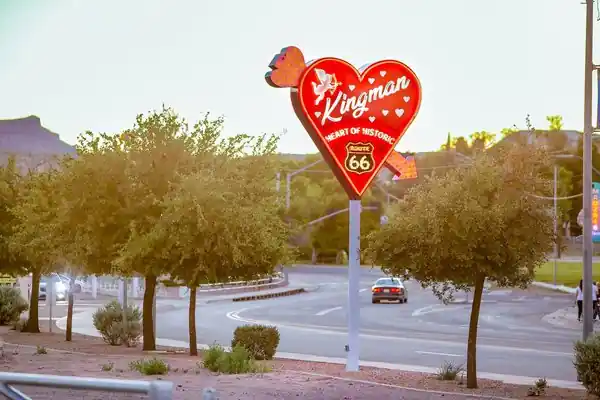
Heart of '66 Sign
To your right, opposite the dealership is the "Kingman, Heart of Historic Route 66" heart-shaped retro-vintage-styled neon sign.
Cox Mobil Gas Station
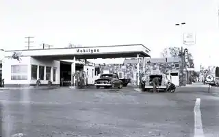
Cox Mobil. Source. Click image to enlarge.
On the corner of 2nd St. (left).
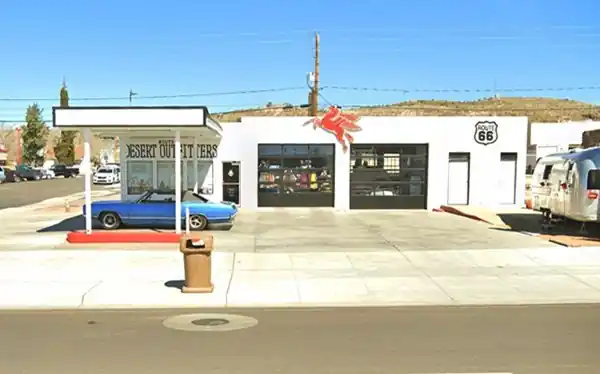
It is a neatly repurposed former Gas Station with a Mobil Pegassus, now a shop, pictured below.
It was owned by Jimmy Cox, who was killed by the Doxol propane railcar explosion in 1973, aged 55.
Cox Mobil nowadays
Desert Drugs Sign
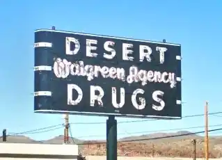
Restored Desert Drugs sign.
On the same block, by the Post Office, is a classic restored Neon Sign (street view), it reads "Desert Drugs - Walgreen Agency". The pharmacy was located across 3rd St. You can see the sign at its original location in the 1940s postcard further down.
Where the Post Office now stands, was Charlie Potter's Union 76 Station c.1949.
On the following block, two landmark hotels predate Route 66.
Below is a vintage postcard of Route 66 in Kingman in the 1940s, showing the central part of Downtown Kingman. The description on the postcard says: "KINGMAN, ARIZONA A modern and friendly city in the extreme western part of Arizona, on U. S. Highways 66 and 466 between the Grand Canyon and Pacific Coast, junction point for Hoover (Boulder) Dam and Las Vegas, Nevada".
A postcard with a view (1940s) of Route 66 in dowtown Kingman
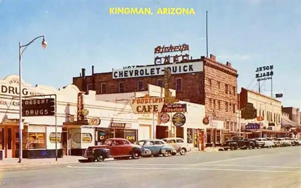
Downtown Kingman nowadays:
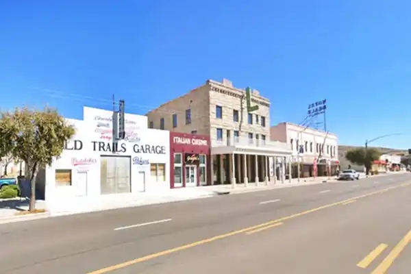
Brunswick Hotel
313 Andy Devine Ave.Built in 1907 to provide another lodging option to those arriving by train. It is in the middle of the block.It is faced in stone and has an inverted "L" shaped green neon sign with the hotel's name on it. See image above.
Beale Hotel
319 Andy Devine Ave. A two-story building on the northern corner, built in 1899 of local stone and brick and refurbished in 1916. It was the first "big" hotel in town.
Old Trails Garage
315 Andy Devine Ave. Don't miss the blue neon sign with white letters on the front of the Old Trails Garage. The garage was built in 1915 on the National Old Trails, the first highway through Kingman.
It has an original blue Packard dealership sign, with white letters "Packard - Ask the man who owns one", ca. 1930, recently restored.
Across the road from the Beale hotel is a gigantic chuckawala lizard statue, 7 feet long.
On the corner of 5th St. is an old Texaco gas station, now a "U-haul" it has its canopy over two concrete pump islands.
Kingman Club
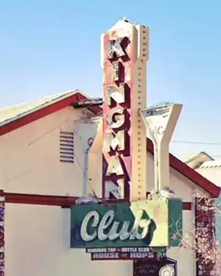
Drive around the block to E. Beale St. The Theater on the corner has a retro-style sign. See the refurbished Kingman Club Neon Sign flanked by two Martini glasses. An original 1950s sign. On the next block, to your right, is the old railway station.
AT&SF Railroad Depot
Back on Andy Devine, to your right between 4th and 5th St. The depot was built in 1907 in a Mission Revival style (St. view).
The Amtrak Southwest Chief route stops at Kingman every day on its service between Los Angeles and Chicago.
Don't miss the Mining Monument (St. view) built in 1904, torn down in the 1940s, and rebuilt in 2016, on the southern tip of the depot.
Britt's Texaco Gas station
Across the street (425 E Andy Devine) on the corner of 5th St. is an old Texaco gas station, now Mesa Motor with a "U-haul". The Kingman 1961 City Directory says it was Britt's Texaco. By 1963 it was Golding's Texaco. Below is a "now and then" set of pictures.
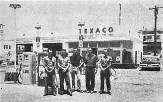
1963 Golding's Texaco. Kingman. Source
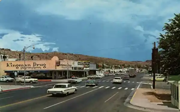
A view looking east along E Andy Devine, from 4th St. The "Kingman Drug" building is still standing. You can see the Texaco sign in the distance.
Water Tanks

Kingman Water Tank:"Welcome to Kingman - Heart of Historic Route 66". A. Whittall
Ahead, to your right are the water tanks (see photo above), with the phrase "Welcome to Kingman - Heart of Historic Route 66" and just ahead, to your left is a historic café.
Casa Linda Café
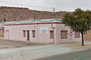
On the corner of 5th was a Chevron Gas station, now it is a vacant lot. Next door, at 511 E Andy Devine Ave. is a building that was a restaurant and café. It dates back to 1933 and, with some minor changes such as the doors, windows, neon sign it has survived. The name is Spanish, and means "Pretty House".

1950s postcard, Casa Linda. Source
Tavern Cafe - McCarthy Motors Ford Dealership

Great sign with a circular hole. A. Whittall
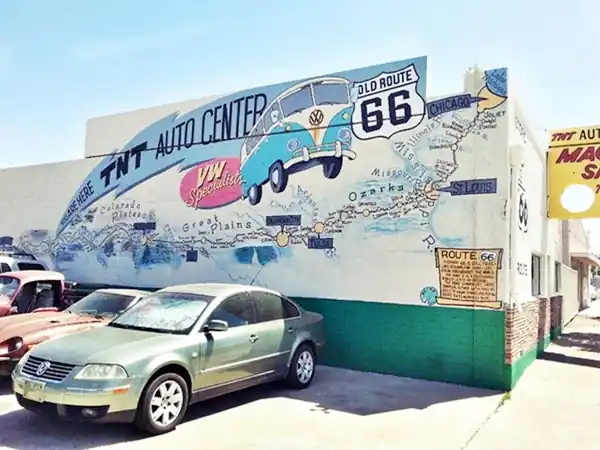
525 E Andy Devine Ave. TNT Auto Repair has a great sign over its entrance with a circular hole through it. This used to be the Tavern Cafe. Originally known as The Lewis Café and Tavern. Here at the bar, several shots were filmed for the 1984 movie Roadhouse 66 starring Wilem Dafoe.
Bob Waldmire Mural-Map
The mural is painted on the southern wall of The Tavern facing McCarthy Motors Ford dealership and was painted by Bob Waldmire (1945-2009). It depicts a map of Route 66 and his white VW bus. He finished it after working on it for two years, in 2006. Read Read Bob Waldmire's bio.
Bob's Shell Station
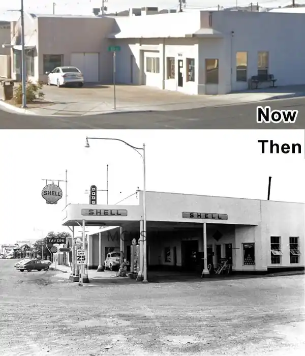
On the next corner (543 E Andy Devine Ave) to your left, is the building that housed Bob's Shell Station, the canopy is gone, but the chamfered corner office and the windows are ths same.
Lockwood Café
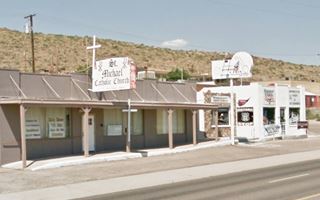
Ahead to your left at 711 E Andy Devine Ave. is a former cafe. Now is is St. Michael Catholic Church. Built in 1937, it had an Indian curio shop next to it (1940), which is presently a motorcycle spare parts shop. See both in the "Then and Now" images below. The original Café neon sign is still hanging from the building.

Postcard Lockwood Cafe. Source
Mobil Service Station
731 E Andy Devine Ave. The remains of a 1951 Mobil gas service station. The office, canopy, garage, and even the sign (with the classic 1960s Mobile logo shield shape still there).
The old Mobil Service Station as it is today:
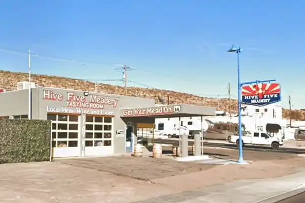
Two blocks to the east, to your left is the Arcadia Court Motel:
Arcadia Court
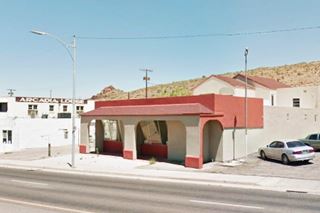
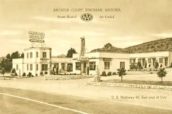
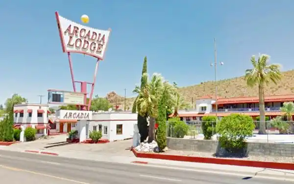
909 E Andy Devine Ave. The Arcadia Court (court was the 1930s name for what we now call a motel), opened in 1938 a few blocks to the north of the downtown part of Kingman. Arcadia is a good name for a motel: it was a utopian ancient land of harmony with nature. It is still operating under a similar name: "Arcadia Lodge" with its great mid-1960s neon sign. Below you can see it in a 1930s postcard
Arcadia Lodge nowadays:
Just ahead are two US 66 icons, a restaurant and a gas station.
Jade Restaurant
909 Andy Devine Ave. The Jade was a Chinese restaurant established by Charlie Lum in 1951 (who was born in Canton, China, in 1912, and moved to Kingman in 1922 with his parents).
He put it next to the Arcadia Motel to ensure a good flow of customers. Although the place has closed, the neon sign is gone, but the building is still standing -but changed, as you can see below.

The Jade in a 1960s postcard. Source
McBrayer's Richfield station
941 E Andy Devine Ave, beside the Jade Restaurant. It is a 1954 service station with a two-bay garage and a flat-roofed canopy over the gas pumps. The 1961 City Directory lists it as owned by Ervin L. McBrayer and managed by Art Searles. Now it is an auto repair shop.
There is a motel (left) on the next block. Route 66 now starts to curve towards the north:
Travelodge
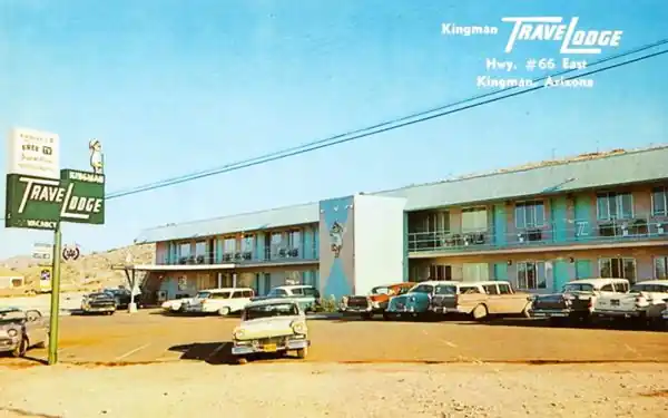
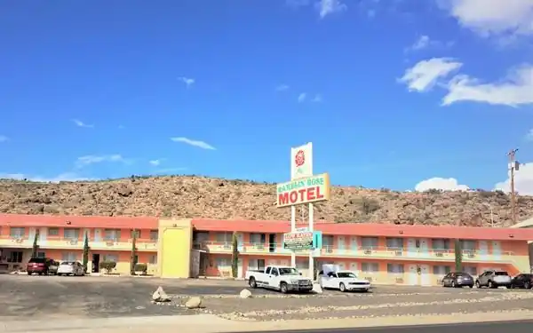
1001 E Andy Devine Ave. The "Ramblin Rose" used to be the "Travelodge motel", a classic US 66 motel that opened in 1958. The 1960s postcard gave a very brief outline of its location: "Kingman TRAVELODGE In Mohave County - Sportsmen's Paradise." As you can see below, it has kept its original look.
An early 1960s postcard of the Travelodge (nowadays the Ramblin Rose)
The Travelodge Motel is now the Ramblin Rose Motel.
Old Alignment on Chadwick Drive
As the road curves to the north, there is a section along what is now Chadwick Dr., that was the alignment of Route 66 until the 1940s, when a cut through the hill straightened the alignment. (Yellow line in our custom map).
On the left, after the northern tip of the "old" road is another motel:
Brandin' Iron Motel
1403 Andy Devine Ave. The back of the postcard says: "BRANDIN' IRON MOTEL Mr. & Mrs. R. A. Bewley, Owners & Operators American Express Credit Cards Member The Diners' Club".
Brandin' Iron Motel in the 1960s
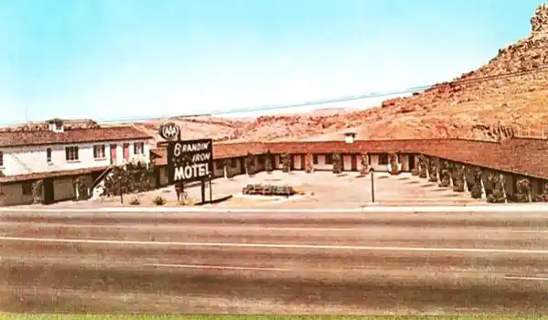
The motel opened in 1953. It had a "U" shaped layout. When Route 66 was widened through Kingman, access to the motel was restricted (you can see that in both images), and it closed in the 1990s. It was remodeled in 2001 and now houses apartments in a "Pueblo"- style stucco wall design.
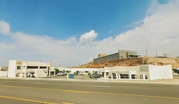
Across the highway, to your right, is a memorable Route 66 icon, the "El Trovatore Motel".
El Trovatore Motel
1440 E. Andy Devine Ave. Built in 1939 by John F. Miller, who owned a hotel in Nevada and bought a ranch in Arizona in 1935 after the completion of the Hoover Dam. The complex initially had 30 units and later, he added another 24.
Trovatore is Italian for "Trobadour" or "bard", "minstrel". It is the name of an opera by Giuseppe Verdi. But "El" is a Spanish word for "the" (in Italian the wourd would be "Il"). So the motel's name combines a Spanish and an Italian word!
Longest Route 66 map in the entire world
Since the old trading post at Meteor City, AZ, has become a ruin, the honor of displaying the World's longest Route 66 map goes to the Trovatore.
The Map is a mural that is 206 feet long (62.8 m) and covers the front of the entire motel. It was painted by local artist Dan Louden.
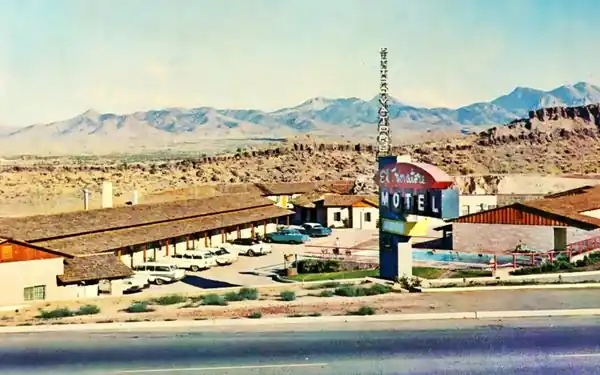
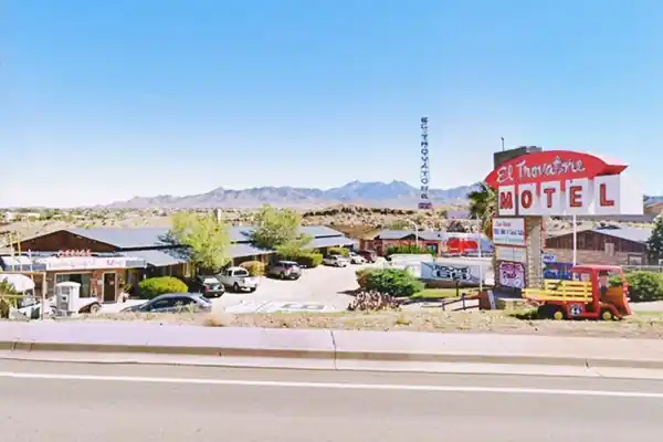
Trovatore Gas Station and former Cafe and Restaurant
Next to El Trovatore, to its right (south side) and passing the service station built in 1968, now an auto-repair shop at 1420 E Andy Devine Ave., is the classic Trovatore Café "On the Top of Town". It later became Coco's restaurant "Designed for family dining".

Vintage postscard Trovatore Cafe
Source. Click image to enlarge
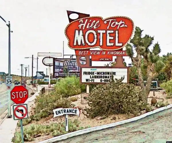
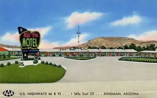
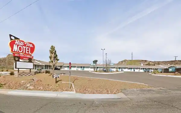
Hill Top Motel
Fantastic Neon Sign
Keep northbound, and 750 feet ahead, on the left is another motel at 1901 E Andy Devine Ave.
Established in 1953 and remodeled in 1959, it is still open and taking care of travelers along Route 66 and operating under the same name Hill Top Motel.
The 1940s postcard below reads "The New U.S. Highways 66 and 93... 1 Mile East of KINGMAN, ARIZONA Telephone Blue 534... Individual controlled Panel Ray Heat... York Refrigeration... The Most Scenic View in Kingman... Ceramic Tiled Baths, with Tub and Shower Combination... T.V. in all rooms. George and Eleanor Allen, Owners & Operators". Below is the motel back in the 1940s
Below is its current appearance; the building seems very similar, and the neon sign is identical (red instead of black and with some other words on the lower part), the trees have grown and the lawn is not so green, but it is the same classic motel. It is pictured at the top of this page.
Another Mobil Station
Across the street at 1918 E Andy Devine is a neat shop, formerly a Mobil station which dates back to 1939 (the year World War II began). The two-bay garage and office are clearly visible.
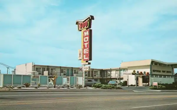
Imperial "400" Motel ❌
The postcard below shows the Mobil sign facing the now-gone "400 Motel" where the Walgreens now stands. You can see the still extant Siesta Motel neon sign behind the Mobile station's canopy (click the image to enlarge it).
Imperial '400' Motels and Route 66
Learn all about these Space Age motels along U.S. 66.
> > Read more: Visit our Imperial "400" Motels on Route 66 webpage.

Postcard, Mobil in Kingman. Source
Click image to enlarge
Postcard c.1963 of the Imperial "400" motel
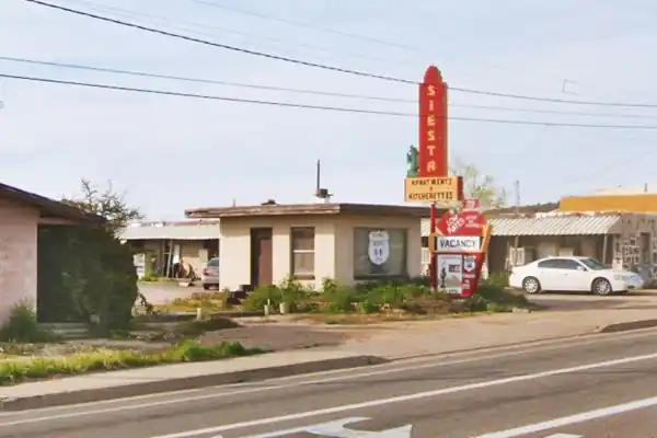
Siesta Motel
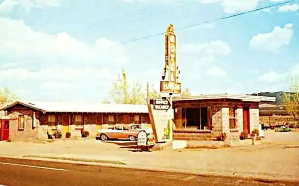
Next to the old Mobil, to your right is the "Siesta Motel" at 1926 E. Andy Devine Ave. What a great name for a motel! "Siesta", the traditional Hispanic afternoon nap.
The motel opened in 1929, barely three years after the creation of Route 66. The building is still there, though nowadays it is an apartment complex. Below is a 1950s postcard of it.
A view of the Siesta Motel nowadays.
Keep northbound and look to your left after crossing N. Stockton Hill Rd., at 1967 E Andy Devine is a "space age" motel:
Orchard, also Astro and Space Age Inn
The motel opened in 1964 as the Astro Motel as part of a chain that spanned California, Utah, Arizona and Kansas.
The word "Astro" comes from Greek, and means star, celestial body, something from space.
Later, it changed its name to "Friendship Inn Space Age Motel." Now it is the Orchard Inn. It has the "avant-garde" Googie style that distinguished the Astro chain motels.
Astro Motels and Route 66
Learn all about these Space Age motels along U.S. 66.
> > Read more: Visit our Astro Motels on Route 66 webpage.

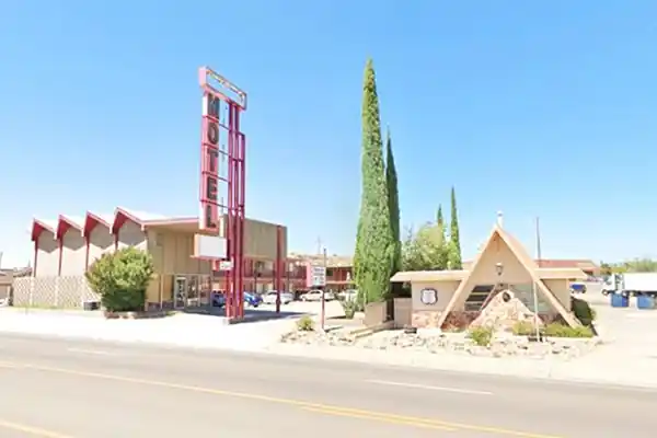
Village Inn Pizza
Next to the "Astro" is the Village Inn Pizza - Motel Restaurant (the "A" shaped building) from 1972 (or 1969 depending on the source), now named Vanny Inn.
Bell Motel ❌
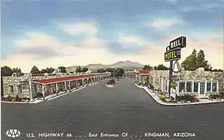
Bell Motel c.1950
Across the road, on the eastbound lane of Route 66 (right) was the now-razed Bell Motel, which later was the Desert Lodge. It was built in 1945 and was mentioned by Rittenhouse in his 1946 guidebook to Route 66.
See its 2015 View while it was still standing, and its 2025 View, razed. The image shows it in a 1950s postcard.
Hill Crest Motel
Adjacent to the vacant lot (north), you can still see the Hill Crest Motel at 2018 E Andy Devine Ave. This motel dates back to 1935; it was upgraded in 1950, and again in 1985, and it is still standing here on Route 66.
On the back of the postcard pictured below, you can read: "US. Highways 66 & 93. East Entrance of..Kingman, Arizona. Back of card: Hillcrest Motel U.S. Highways 66 & 93. East Entrance of KINGMAN, ARIZONA Telephone. Green 251... Air Conditioned & Air Cooled… Ceramic Tiled Baths, with Tubs & Showers... Wall to Wall Carpeting… Fireproof. Restaurants Nearby". Below is a 1940s postcard of this motel.
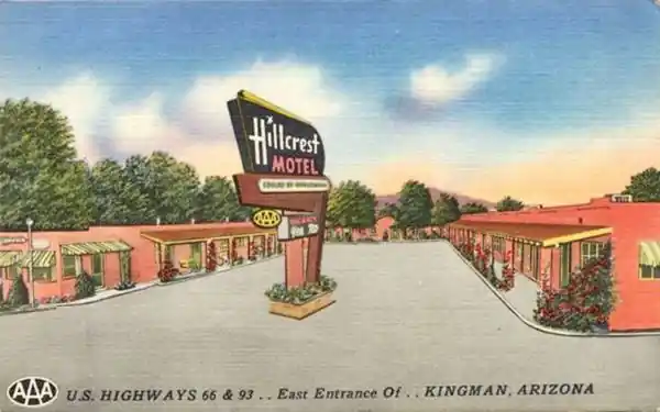
The building (with fewer trees) has survived relatively intact, and a diner occupies its office. A 2025 view of the former motel is shown below.
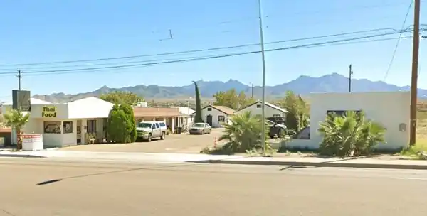
Former Denny's

Former Denny's Diner. A. Whittall
At 2011 E Andy Devine Ave. To your left, on the north side of US 66, is a former Diner.
The current "Rutherford's Family Diner" which we photographed in 2016, was from 1993 until 2009 the "Silver Spoon Family Restaurant". But before that, it was a Denny's Diner with a classic "Boomerang Roof" (St. view). This was a Space-Age design from the early 1960s by Armet & Davis. There are several of them along Route 66; we list some below.
- Barstow Denny's Diner
- Denny’s Diner in Needles CA
- Gallup NM Denny's
- Denny’s Tucumcari Diner
- Albuquerque's Whole Hog Cafe
Kingman Motel, Tideway Cafe and Flying-A station

Old fading Motel Neon Sign. A. Whittall
The large vacant lot between Route 66, Johnson Ave., Kingman, and Main Avenues at one time was the Kingman Motel.
Don't miss the old Motel's Neon Sign behind the former Denny's restaurant -you can see it in the photo of the former Denny's and in this other photo.
The motel had its office on the corner of Johnson Ave and E Andy Devine and was "C-shaped" a single story, gable roofed complex. You can see it in this aerial photo from 1965.
Its postcard says: "U.S. 66, East End, Kingman Arizona... A Modern, 21-unit Motel. Electric Heated. Air-Cooled. Quiet. Cafe & Service Station on Premises."
The place was razed between 1997 and 2005.
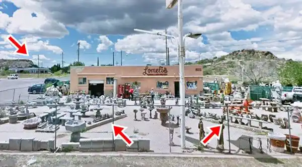
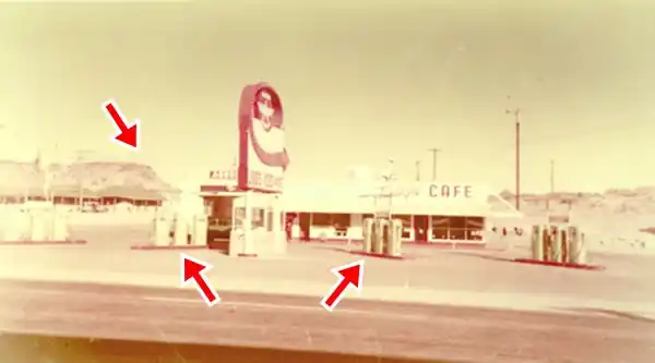
On the northern side of the property was a Flying-A gas station owned by Al Bell. It included the Tideway Cafe run by Bell and Harry Tindle. There is a shop that sells pottery and birdbaths on the premises now, but you can still see the former gas station building and the surviving angled pump islands (red arrows in the image). The same rock bluff can be seen on the left of both images (red arrow), and the northern wing of the motel can be seen beneath it in the 1960s photograph.
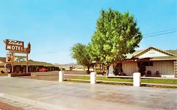
West of this point begins a long stretch of urban road without any significant Route 66 motels until you approach I-40. Here you can see the former "Ranchito Motel", on your left at Airfield Ave.
Ranchito Motel
2803 E Andy Devine Ave. This motel, built in 1940 and refurbished in 1955, is now the High Desert Inn, relatively untouched by time.

Neon signs: Lo's and ABC
On Tucker St. to your left is one of America’s "Coolest Neon Signs", Lo’s Chinese American Food restaurant's sign.

Wine-glass shaped Sign, La Catrina Source. click for St. view
La Catrina
Back on Route 66 to your right, on the eastbound lanes, is a wine-glass-shaped sign of a Chinese restaurant, which later became an Indian food restaurant and now is Catrina, offering Mexican food.
Former King’s Inn Motel
Ahead, to your right, on the south side of the road, is what once was the King's Inn Motel, at 2930 East Andy Devine Ave. King's Inn Motel boasted on its postcard that it was a member of Best Western Motels and "Kingman's newest. 53 Luxurious Rooms with Free Sauna - Room Coffee - TV. - Phones... Excellent Rated... Lowell & Dorothy Dale, Owners-Managers."
Still standing as the Best Western Plus King's Inn and Suites, a four-star hotel. With the same "L" shaped layout on the southern wing.
It's "Heated Pool" with "pointed" corners is still there, as you can see in the Then-and-Now photos below.

1960a postcard King’s Inn Motel. Source

A view of the King's Inn today.
Former Pony Soldier Motel
Across the road, to your left, stands the former Pony Soldier Motel at 2939 E Andy Devine Ave. This hotel is now the Route 66 Motel. It opened in 1963. It was owned by "Mr. and Mrs. Tom White." Now it is the Joshua Tree apartments.
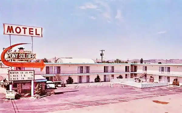
It looks unchanged, except for the name on the original sign.
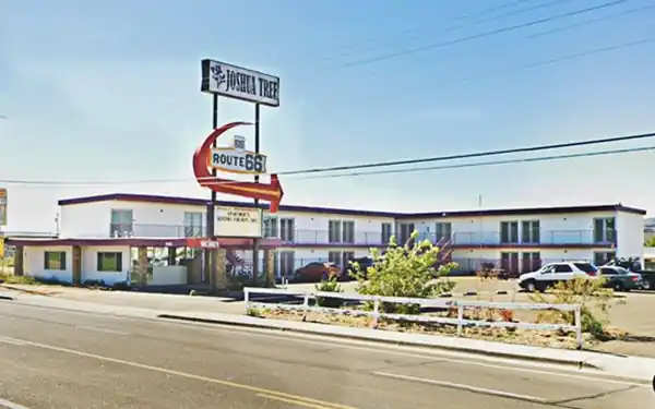
Lido Motel
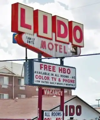
Lido Motel Neon Sign. A. Whittall
Ahead, at 3133 E Andy Devine Ave. is the Lido Motel.
The motel was built in 1952, when Route 66 was realigned through Yucca, bypassing Oatman. It was remodeled in 1965.
In 1969, a Shell Service Station was built on its northern side in a ranch-style design, with a wide, gently sloping roof and a vertical stone column resembling a chimney that carried the Shell sign. The filling station building is still there.
See this St. view of the Lido sign and the former Shell.
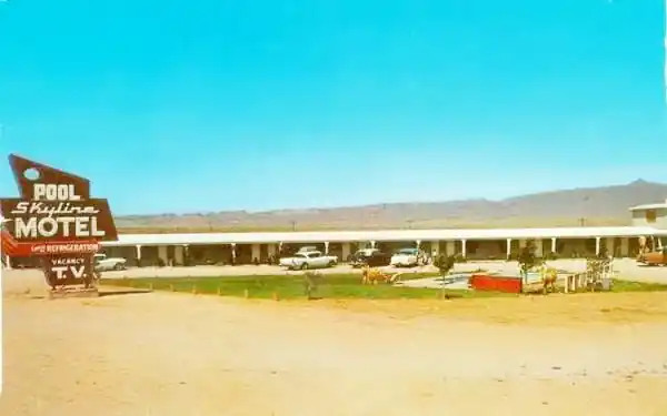
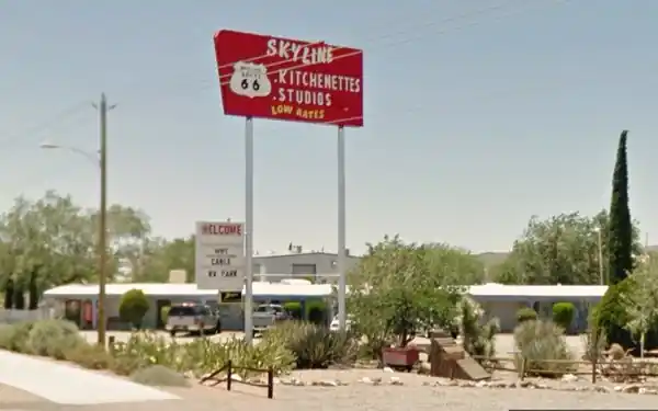
Skyline Motel
Pass under the Interstate, northbound along Route 66, and 1.2 miles North of I-40 is the last motel of this itinerary.
At 3801 E Andy Devine Ave. This motel with an "L-shaped" layout opened in 1955 and was successively remodeled in 1960 and 1973. Now it is a place that rents apartments. The original sign with a typical Route 66 shape has also gone. Below is an early 1960s or late 1950s postcard:
Continue your Road Trip along Route 66:
This marks the end of your city tour along Route 66 in Kingman. On our Kingman Page #2 we describe more local attractions, outdoors, parks, and tours. The next towns westwards, along your road trip are Yucca if you choose to drive along I-40 or Oatman, along the 1926-52 US 66 alignment.
Other Attractions and Tours in Kingman (on Page #2)
Keep on discovering and exploring Kingman and its attractions.
- Chloride, a mining ghost town
- Santa Claus, Arizona
- Grand Canyon Skywalk.
- Camp Beale Springs
- Hualapai Mountain Park
- White Cliffs Wagon Road
- Colorado River & Laughlin Nevada (Little Las Vegas)
More about these attractions on the Next Page
The rest of Kingman's attractions: Kingman Page 2
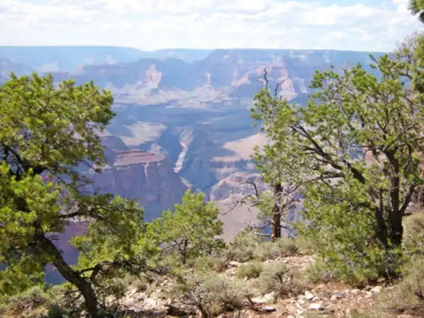
Visit the Grand Canyon
Tip: consider visiting the Grand Canyon on your Road Trip. You can drive Route 66 to Williams, AZ, and from there to the Grand Canyon.
Or you can make it an adventure: Take the Train to visit the Grand Canyon. There are daily "Williams Flyer" services between Williams and the Grand Canyon, plus other services (like the winter Polar Express), which use the restored Santa Fe Railway Station from downtown Williams. You can even sleep over at the hotel in the railway depot:
Grand Canyon National Park
World Heritage site of UNESCO
Side Trip to Lake Havasu City

Lake Havasu City, the lake, and the London Bridge. Source
The resort town of Lake Havasu City on Lake Havasu has beaches along the lake's scenic shoreline, an active nightlife, and the original London Bridge.
The adjacent state park is open 24 hs, and there is an entrance fee. It is located on a reservoir on the Colorado River. You can hike and enjoy the riverside.
Visit the scenic shoreline with beautiful beaches, nature trails, boat ramps, and many convenient campsites.
Learn more about the outdoor sites in the Havasu State Park official website.
Credits
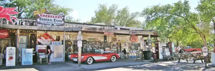
Banner image: Hackberry General Store, Hackberry, Arizona by Perla Eichenblat
Jack DeVere Rittenhouse, (1946). A Guide Book to Highway 66.

