Route 66 Road Trip in Yucca:
Index to this page

About Yucca, Arizona
Trivia, facts, and useful information
Elevation: 1,084 ft. (332 m). Population: 50 (2025).
Time zone: Mountain (MST): UTC minus 7 hours. Summer (DST) no DST⁄ PDT (UTC-7).
Yucca is a community located on Interstate 40, Mohave County, Arizona, between Kingman and Topock.
The name Yucca
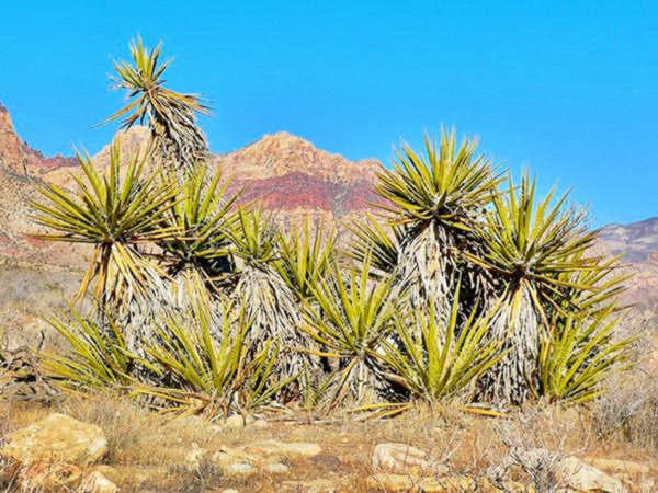
It was named after the Mojave yucca or Spanish dagger, Yuca mohaviensis or Yuca schidigera, because many grew in the area.
This is a native plant that lives in the deserts of southwestern USA. It is a tree that can reach a height of 15 ft (5 m), it has sharp bayonet-like leaves, and white flowers.
Yucca's History
Arizona has been inhabited for more than 10,000 years. The historic Native American people lived close to water sources, like the Patayan people along the Colorado River.
The Patayan groups,Havasupai and Hualapai people grew squash, corn and beans using irrigation.
After the conquest of Mexico, Spain claimed the territory of Arizona as part of their New Mexico province, but they didn't settle there.
In 1821 Mexico won its independence from Spain and incorporated this territory, but lost in after the 1846-48 war with the U.S.
In 1850s, the U.S. commissioned Capt. Lorenzo Sitgreaves and Lt. Edward "Ned" Fitzgerald Beale to explore and survey the territory.
The Atlantic & Pacific Railroad, later renamed as the Atchison Topeka and Santa Fe Railroad, arrived in the early 1880s, establishing a station named Yucca.
The post office opened in 1905. The Railroad linked it to the north with Kingman (with the sations of Athos, Kaster, Drake, Hancock, and McConnico), to the west, were the stations of Haviland, Franconia, Powel and Topock, followed by the Colorado River and California.
The railroad followed the relatively flat ground of the Sacramento Valley lying between the Black Mountains to the west and the Hualapai Mountains to the east.
A book published in 1915 says that it had a population of 138 at that time, and that "The railway company sank a well 1,004 feet deep at Yucca some years ago which yields a supply of excellent water rising within 104 feet of the surface."
See this old map from 1915, with the railroad and Yucca.
As the automobile became more popular in the early 1900s, the National Old Trails Highway (N.O.T.) was built aligned along the railroad. It reached the area around 1914. This was known as the "Valley cut-off" highway, and is recorded as such on contemporary postcards.
A second N.O.T. highway took a more steep and winding rout through the gold-mining area of Oatman, further north.
When US highway 66 was created in 1926 it followed the N.O.T. highway west of Topock and east of McConnico, but bypassed the section that included Yucca. The route followed the steep and winding alignment across the Black Mountains through Oatman.
During World War II, the U.S. Army built a training airfield in Yucca that was later purchased by Ford Motor Co. as a proving ground.
The mines became exhausted in the late 1940s, and the Route 66 alignment through Sitgreaves Pass and Oatman was replaced by a new one, that ran along level ground, through Yucca.
US 66 brought travelers and tourists to town, and many cafes, motels and gas stations sprung up.
When interstate 40 was built, it followed this alignment, running together with US 66 until the former was decertified in the 1980s.
As it cut through the town, the local business dwindled, with tourists preferring to stop at neighboring Kingman or Needles.

Hotels and Motels in Yucca
Lodging & accommodation in Yucca; sponsored content. Find a room in town, or in neighboring Kingman AZ or Needles California, just a few miles away:
> > Book your hotel in Yucca
More Accommodation near Yucca along Route 66
There are plenty of lodging options in the cities and towns along Route 66 east and west of this town; click on the links below to find your accommodation in these towns, listed from east to west:
Eastwards
In Arizona Along Route 66
Westwards
You are so close to Las Vegas and the Grand Canyon!
>> Check out the RV campground in neighboring Topock
Yucca's Weather
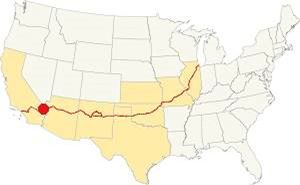
Location of Yucca on Route 66
Yucca has a hot desert climate. Summers are very hot, and winters are cool.
The average lows in January are 30 to 45°F (-1.1 to 7.2°C). The July the highs can exceed 110°F (43°C).
Hardly any snow falls in winter. Summer is the rainy season, but rain is scarce not more than 4 in. or 10 cm in the rainy months.
This is not a tornado area. Read more about: the risk of Tornadoes on Route66.
Map of US 66 in Yucca
Visit our Kingman to Topock page for the description of this alignment. Below is the color coded interactive map:
>> Custom map of Route 66 in Yucca

Thumbnail of the 1971 Arizona highway map. Credits
Click on thumbnail map to enlarge
When Route 66 was established in 1926 it ran further north, from Kingman to Oatman across the Black Mountains and then south to Topock.
Across Sacramento Valley
West of Kingman and to the east of the mountains lies the Sacramento Valley. An intermittent stream (Sacaramento Wash) flows occasionally along its sandy bottom meeting the Colorado River at the Topock marsh area.
The railroad back in the 1880s opted for this more-level route to reach California.
In 1952, Route 66 was realigned, bypassing Oatman and avoiding the dangerous winding course across the mountains. Instead it ran along level ground close to the railroad, to Kingman through Yucca (see map).
Interstate 40 advancing eastwards from California crossed the Colorado River in 1966 and replaced U.S. 66 in this area. T While Route 66 followed the other course, across the Black Mountains to Oatman.
See this Map of Route 66 through Yucca.
This was the last alignment and was used between 1952 and 1979 between Kingman and Topock. It was safer, had four lanes and hardly any grades.
The American Association of State Highway and Transportation (or AASHTO) decided to move the western terminus of Route 66 eastwards.
On June 29, 1979 the AASHTO moved the "end point" from Needles CA eastwards, across most of arizona Arizona, to Sanders, close to its border with New Mexico, to its junction with U.S. 191.
Getting to Yucca
To the north lies Kingman (25 mi.), and to the west is Topock (25 mi), and crossing the Colorado River, in California, Needles (39 mi).
The Route 66 alignment in Yucca
Visit our pages with old maps and plenty of maps and information about US 66's alignments:
- Topock to Barstow (Next)
- Kingman to Topock (Yucca's)
- Williams to Kingman AZ (Previous)
Route 66 landmarks & attractions
Sights in Yucca
This is a short tour through Yucca from east to west (or north to south). Coming from Kingman, leave the freeway at Exit 26 and take the Frontage Rd. towards the south.
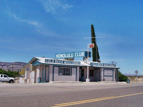
The Honolulu Club
South 6th St. and Frontage Rd. The Honolulu Club opened in Oatman, on the original Route 66 alignment.
It was a bar, dancing spot, garage and gas station. Below is a 1933 photograph of the Honolulu Club on Route 66 in Oatman
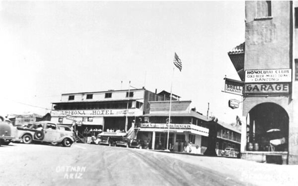
When the highway was realigned to the south, through Yucca, in the early 1950s, the club relocated in Yucca. The building with its signs is still standing, but it is permanently closed. Below is a photo from 2007, when it was still open:
Water Tank
Just ahead, to your left, is a water tank with the words "YUCCA EST. 1883" written on it.
Site of the Desert Star Motel (gone)
Between 4th Ave and 3rd Ave, to your right is the site of the former Desert Star Motel. Only the foundations survive. It was torn down a few years ago.
It was an eight-room motel built in the 1950s. You can see photos showing what it looked like, and how it decayed in our Our Facebook Post on the Desert Star Motel.

Desert Star motel postcard Credits.

Desert Star motel before it was razed in 2014. Credits. Click for street view
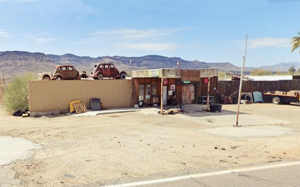
Old Gas Station
On the southwestern side of town, just passing W 12435 St. are the remains of an abandonded gast station.
The pump island can be seen, under the box-shaped canopy, a relic from long gone times.
Just ahead, turn left along Cal-Ari Dr. cross the interstate and turn right (south) towards the geodesic sphere along Alamo Rd.
Area 66
12716 Alamo Rd. Area 66 has a history dating back to the 1970s. It claims to be the "only geodesic sphere elevated off the ground by a single pole in the world."
Inside the 40 foot diameteer sphere is a museum dedicated to UFOs (such as the 1953 Kingman UFO) and a gift shop.
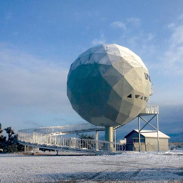
See this Street View of the sphere and signage on the frontage Rd.
It has been called "Dinosphere" (actually it was a "dine sphere"), "Arizona Death Star", "Golf Ball House", and now "Area 66", a pun towards New Mexico's Area 51.
The sphere was built as a night club that was part of a scam real-estate project, the "Lake Havasu Estates".
The land was sold to gullible investors as part of Lake Havasu City (40 miles to the south, by a lakeside), but the 10,000 acres of desert in Yucca only had cactus.
A New York Times article published in 1972, mentions the sphere as follows "a big gold geodesic "dine sphere" that has never opened for dining."
Retrace your steps heading north along Alamo Rd. and continue as it becomes the Frontage Rd.
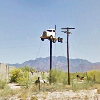
Truck on a Pole
To your right, at 12366 Frontage Rd.
You can't help seeing a slender pole roughly 25 ft. high (7.5 m) with a white colored Kenworth semi truck mounted on its tip.
This is all that remains of a once busy truck stop that the desert has slowly claimed.
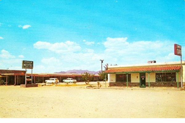
Continue northwards. Just ahead are the vacant remains of the abandoned Joshua Motel and its Café.
Ruins of a Joshua Motel & Café
The café was part of the motel, it has a Spanish tiled roof facing the road, the word "Cafe" written on the southern wall is barely visible.
As you can see in the 1950s postcard below, the café is unchanged. The neon sign lost its neon, and the building received a brick parapet as a decoration.
On the left side of the image (north) is the now abandoned motel.
See this Street View of the now empty motel.
Ahead, are the signs of the Whiting Bros. gas station and motel. The buildings have been razed.
Whiting Bros. Motel and Gas Station.
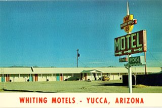
Whiting Bros motel postcard, Yucca AZ. Credits
Only the signs of the motel and gas station remain, on the eastern side of the highway. The motel and gas station were torn down years ago, and the signs are gradually decaying in the desert air.
Whiting Bros. History
Four Whiting brothers (Arthur, Earnest, Eddie and Ralph) founded the company in 1926 and saw it grow to over 100 filling stations.
They also owned motels and truck stops. Many of these motels were located along Route 66 where you can still see the remains of them.
Whiting Bros. and Route 66
> > Read more: Visit our Whiting Bros. and Route 66 webpage.
Learn all about the motels and gas stations of Whiting Bros along US 66 in New Mexico and Arizona.
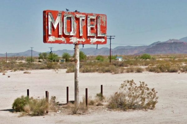
The "pool" and the crest with the company's logo have vanished.
To the south of the motel was the gas station. Only the concrete pump islands and the two signs survive.
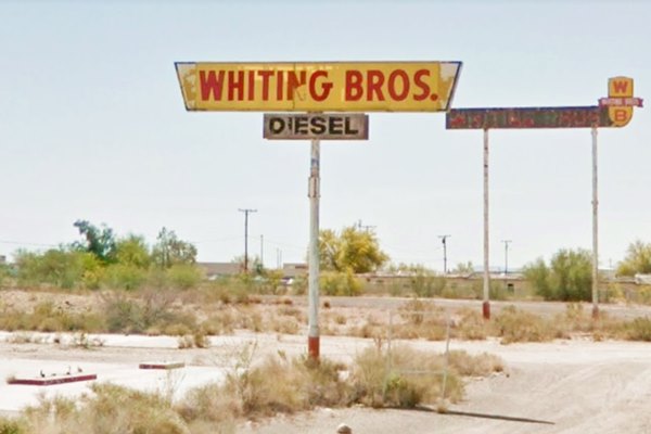
Street view of all three signs.
Continue your Journey
This leg of your Route 66 road trip ends here, you can return to the freeway at the exchange just ahead and continue your journey along Route 66 west towards Topock, or east to take the old course of US66 through Oatman.
Side Trip to Las Vegas
Famous Las Vegas in Nevada is a 2 hour - 130 mile drive to the northwest, see this map with directions.
If you visit Las Vegas
Some tours and sightseeing
Sponsored
Natural Attractions
Some sponsored content
Lake Havasu City

Lake Havasu City, the lake and London Bridge. Source
The resort town of Lake Havasu City on Lake Havasu has beaches along the lake's scenic shoreline, an active nightlife and the original London bridge (you can take a Tour to visit it)
The adjacent state park is open 24 hs, and there is an entrance fee. It is located on a reservoir on the Colorado River. You can hike and enjoy the riverside.
Visit the scenic shoreline with beautiful beaches, nature trails, boat ramps, and many convenient campsites.
>> Book your Hotel in Lake Havasu City
Learn more about the outdoor sites in the Havasu State Park official website.
>> Book your Hotel in Yucca AZ


Credits
Banner image: Hackberry General Store, Hackberry, Arizona by Perla Eichenblat


