Touring Springfield along Buypass 66
Sights and Attractions in Springfield (Part 2)
- Western Springfield & Bypass 66 - read on below
- Sights along City 66 in Springfield (Page 1)
Historic context, the classic Bypass 66 in Springfield
Rittenhouse in his 1946 "guidebook to U.S. Highway 66" described the Bypass 66, built in 1936 as a quick alternative for those who were heading "Straight through in a hurry" because it "avoid[ed] city traffic".
It remained as a part of US 66 until 1956, when the highway was aligned together with I-44 further north.
Rittenhouse also mentions a "a small community" just on the western part of Springfield, we describe it further down.
Tour Route 66 landmarks in Springfield (Page 2)
Along Bypass 66
We will tour the city from east to west, starting at N. Glenstone Av and Kearney (where City 66 turns to the left). Head straight, westwards.
The Rancho Motel ❌
Gone - torn down in 2024.
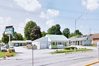
1720 E Kearney St. to your left was The Rancho Motel. It dated back to 1955. Previously it was an Allied Service Travel Court. The office has changed over the years, but the units remained as they were. The sign is all that remains, it was torn down in 2024.

1950s postcard of The Rancho Motel Springfield MO. Source
Rancho Court (formerly Trail's End Motel) ❌
Gone - torn down in October 2025.
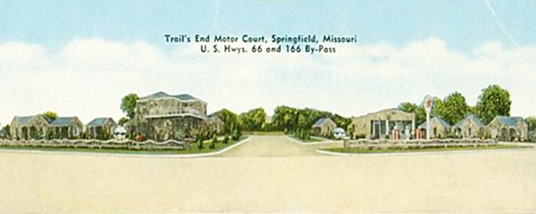
To your left, at 1534 E Kearney St. It was built in 1949 as the "Trail's End Motel", later it became the Rancho Court Motel. It had twelve cottage-style units with kitchenettes with a semi-circular layout. The stone and brick cabins were set out on the eastern and the on the west side of N. Delaware Ave. The office was to the east, a two-story building, and the gas station (now gone) was on the western property. Below you can see the office (left), gas station (right) and the cabins behind them, the street lies between them. It was razed in 2025.
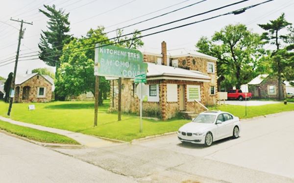
Below is the old motel as it stood before demolition in October 2025: "Rancho Court" apartments, showing the office, and cabins to the left and right of the image, plus the old faded neon sign.
D-X Filling Station
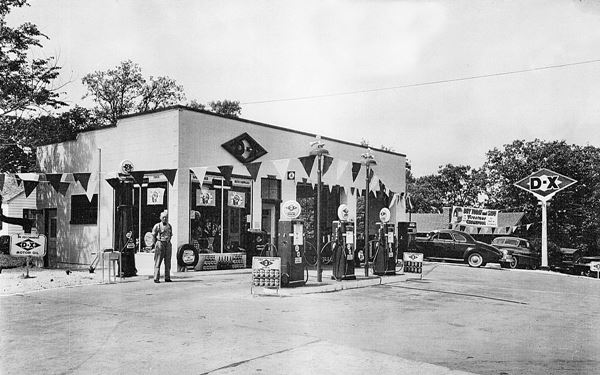
This is a 1940s oblong box style gas staton. It is set on the SW corner of Broadway at 1001 W Kearney St. The building is in good shape. It never had a canopy, it has kept its two original service bays, and a third one has been added. You can make out the outline of the pumps island on the concrete driveway.

Rex Smith Gas Station & Cabins
Head west, all of the motels that lined the highway here were torn down to make space for modern buildings. At West Bypass (U.S. 160), take a left. Head south. To your right, on the SW corner is the classic Rex Smith Gas Station.
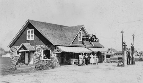
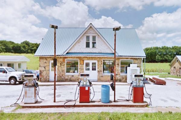
2321 NW Bypass, Springfield. Thise side-gabled gas station sold Flying A brand gas. It was built by Otto Young in 1933 in a Craftsman bungalow style on what would become the new bypass alignment of U.S. 66 north of Springfield.
It had a restaurant and two cabins behind the gas station, north and south of it. Each stone cabin had two units.

Danny's Service Station
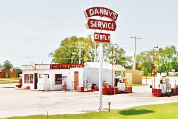
Drive south for 0.9 miles. To your right on the NW corner of NW Bypass and EE Rd. is another service station. It has a great sign and is an icebox-sytle building, perhaps from the 1930s.
Continue south along U.S. 160 for another mile. You will reach the junction with "City 66" that comes from the east along W. Chestnut Expressway. Here both Bypass 66 and City 66 meet and end. From this point westwards the Main U.S. 66 headed out of Springfield along what is now MO-266. Turn right and follow it into "Western Springfield".
Towards West Springfield
More Route 66 sights!
After you turn onto MO-266 (former US 66), to your left, on the SW ide of the highway is a classic motel.
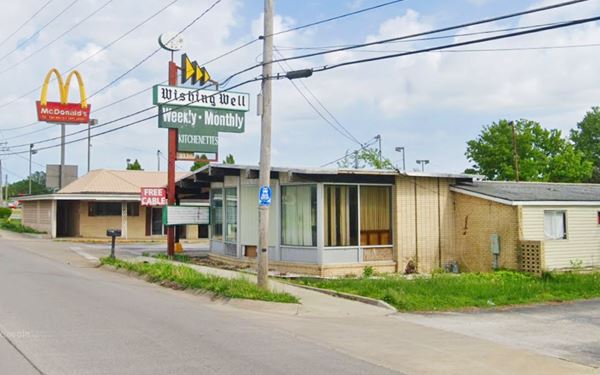
Wishing Well Motor Inn ❌
Gone - torn down.
Now a vacant lot at 3550 W Chestnut Expy. Built in 1947 to lure in the eastbound travelers.
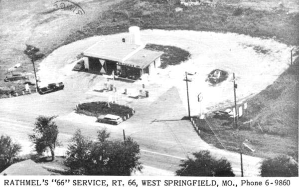
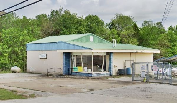
Rathmel's frame Phillips 66
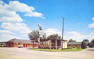
To your right, at 4230 W Chestnut. This propane gas business has a former "Rock Frame" style Phillips 66 gas station. This design dates back to the 1950s when the company incorporated canted (slanted) plate glass windows and rocks were used to face the the office's walls
Below is a postcard from the early 1960s, looking south.
Alli's Family Restaurant
Just ahead, to your left, at 4525 W Chestnut Expy. is this old 1950s restaurant. Formerly the Seven Gables Restaurant and Truck Stop.
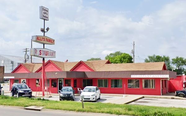
Route 66 continued with a westerly course which now is intersected by I-44 half a mile west of Alli's. Continue west along MO-266 and you reach Elwood.
West of Springfield, towards Halltown
Rittenhouse's 1946 book describes the western outskirts of Springfield: " 6 mi Andy's Court. Next gas station at 8 mi... 9 mi. A small community
here, with a custom grinding mill (Left), gas station, grocery and general store."
Some of these landmarks are still standing next to Route 66.
On the western side of I-44 former US-66 (now MO-266) was moved to the north and then south again to make way for the access ramps of the Interstate. This cut it off from the original alignment. The original roadbed segment became Trail View Rd. by the Deer Lake Golf Course (See our custom map)
Gas station and Andy's Court Site
On the western tip of the realignment, at 5957 W State Highway 266, Springfield. MO-266 was the now gone Andy's court (See map), but next to it, on its eastern side is an old gas station. You can see both of them in this aerial photo from 1959, on the upper side of the image.
Later it was "Homer's Body Shop", with a two-bay garage and an oblong box building.
Rainey's Wrecker Service
Head west to the "next gas station..." mentioned by Rittenhouse: Rainey's Tow service. Bert and Ina Rainey opened this site in 1945 as a gas station with a wrecker. They lived on the premises (the two story building). A concrete block garage whith 6-service bays was added later. There is a former D-X gas sign standing by the pump islands.
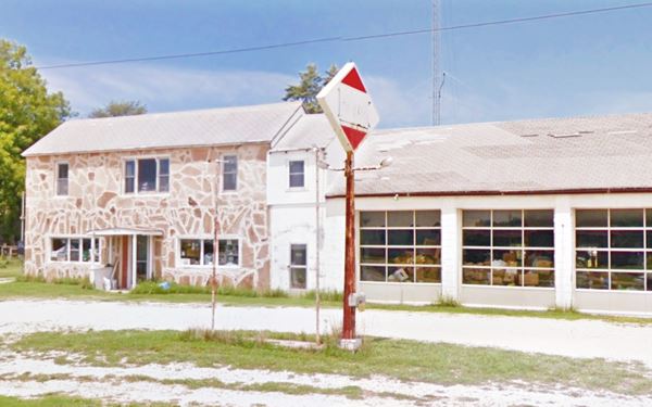
Just 0.3 miles ahead is the "Small community" mentioned by Rittenhouse:
Ronnie's Phillips 66
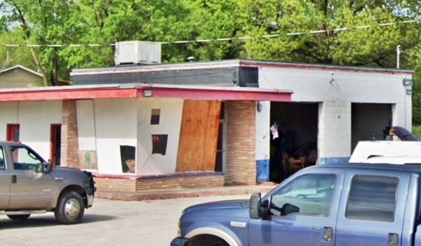
To your right. As you can see in the image below, this is another rock frame 1950s Phillips 66 station, it has the slanted office windows (now replaced with fiber board) and the rock faced walls. It is a garage (Ronnie's diesel).
Barnes General Store and Main Street Feed
Greene County Historic Site
To your left (South side of US 66). In 1935 John Barnes purchased some land here and opened his general store. It grew into a successful business so he added individual buildings to his property. To the west was the feed mill, and the general store, it also had a barber shop, produce store, and a Conoco gas station to the east.
Below are two pictures sowing his "Barnes City" in the late 1930s.
Notice the Conoco station with its sign, to the left.
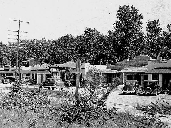
Western wing of Barnes "City".
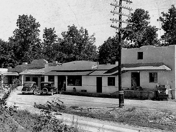
Below is a view of the western wing nowadays, which is known as "Main Street Feed". You will see that the building beneath the grain elevators is the one on the right side of the 1930s image above, and the other two buildings left of it, appear in both "Then and Now" images.
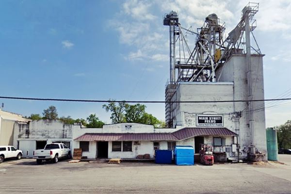
John passed away in 1940 and his family kept on running the business until they sold the business in 1972 to Perryman. The eastern part of the complex had been modernized. The place closed for good in 2016.
O'Dell Gas Station and Café
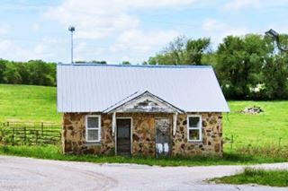
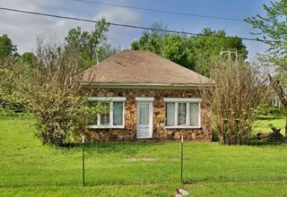
Drive west. The 1993 Missouri Survey of Route 66 mentions "O'Dell gas station, cafe and residence 8911 HWy. 266"; it included a photograph that helped us locate the site, which is still standing.
It is a stone-faced hip-roof building on the north side (right) of U.S. 66 at its intersection with Farm Rd. 85 N.
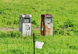
Two gas pumps in a field
Ahead is the last sight in Western Springfield: two gas pumps in a field!
On the south side of the highway (left) as you enter the curve before reaching County Rd. T.
Your City Tour of Springfield ends here. Head west towards Plano to continue your Route 66 road trip.
Other Interesting Sights in Springfield
Kickapoo Indian Village
Historic Marker
NE corner of E. Madison and South Ave. (Map with marker's location).
See it on the south wall of the apartment building. The text says: "Kickapoo Indian Village. From approximately 1812 to 1832 a Kickapoo Indian Village occupied the site bounded on the north by Madison, west by Campbell, south by Grand and east by Jefferson. 100 wigwams clustered around a spring formerly situated 250 feet southwest of this point. The Indians are believed to have planted on this site the first orchard of the Indian peach. Springfield University Club. 1925."
Pythian Castle

Pythian Castle, Springfield. Source
Listed in the National Register of Historic Places
1451 E. Pythian Street (Map).
It was built in 1913 by the Knights of Pythias -a fraternal organization. Later owned by the U.S. Army.
Said to be a POW camp during WW II.

More Springfield Attractions on the Previous Page
In the Previous Page (Page #1) we describe Springfield downtown and City Route 66 attractions, weather, maps and an overview of the city's history.
Sponsored Content
>> Book your Hotel in Joplin


Credits
Banner image: Hackberry General Store, Hackberry, Arizona by Perla Eichenblat
Jack DeVere Rittenhouse, (1946). A Guide Book to Highway 66.
Architectural - Historic Survey of Route 66 in Missouri, Maura Johnson. 1993.

