A Ghost town on Missouri's Route 66
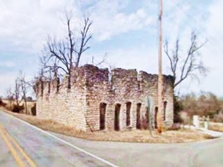
Abandoned General Store -not a mortuary- in Plano, Missouri, Route 66
Index to this page

TheRoute-66.com is reader-supported. When you buy through links on our site, we may earn an affiliate commission at no additional cost to you.
About Plano Missouri
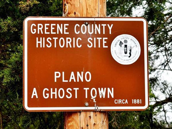
Historic Site: Ghost Town
Facts, Trivia and useful information
Elevation: 1,226 ft (374 m). Population n⁄ (2010).
Time zone: Central (CST): UTC minus 6 hours. Summer (DST) CDT (UTC-5).
Plano a ghost town on Old Route 66 in western Greene County, in southwestern Missouri.
History of Plano
Learn more about the history of this area in our Springfield Missouri page.
The county was established in 1833 and named after American Revolutionary War General Nathanael Greene.
The community's post office opened in 1895 but closed in 1903. The village never grew beyond a few scattered homes.
Fairbanks and Tuck in 1914 mention Plano as one of the "Other towns and trading points in the county" with no additional information.
The name: Plano
Probably named after Plano, in northern Texas (settled in 1851), which it traded with. The word is Spanish and means "flat" and was suggested because it was thought to mean "plain" as the area where the town was built.
The town offered gasoline to U.S. 66 travellers until it was bypassed by I-44 in the early 1960s, which linked Paris Springs with Springfield to the south, along what used to be US-166. The town became a Ghost Town.
Getting to Plano
You can reach Plano along historic Route 66 and Interstate I-44 that links it with Tulsa and Oklahoma City in the west and with Springfield and St. Louis in the east. U.S. Route 71 (overlapping I-49) links it with Fort Smith, Arkansas and Kansas City.

Where to Lodge in Plano, Missouri
You will find accommodation very close to Plano in neighboring Springfield.
> > Book your hotel in Springfield
More Hotels close to Plano on Route 66
There are several hotels in the area close to this town. Alternatively you can also find your accommodation along Route 66 in the neighboring towns and cities in Missouri. We list them below (from east to west):
On Route 66's Main alignment in MO
Eastwards
Westwards
- Hotels in Kansas
- Baxter Springs KS
- Galena KS
- Riverton KS
- Hotels in Oklahoma
- Miami OK
>> Check out the RV campgrounds in nearby Springfield
Weather in Plano
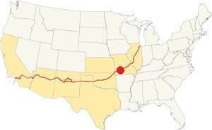
Location of Plano on Route 66
Plano has very defined seasons. It is on the northern limit of America's humid subtropical climate. This gives the region very humid weather in late summer.
The average summer (Jul) temperatures are: high 89°F (31.6°C), low 68° (19.8°C). The winter (Jan) avereage highs are 43°F (6.1°C) and the lows are below freezing, at 22°F (-5.3°C).
Roughly 45.6 in. (1.160 mm) of rain fall each year, and 17 in. of snow (43 cm) fall each winter. It is close to Springfield, the American city with the most variable.
Tornado risk
Plano is located inside the "Tornado Alley" and Greene County has an average of 9 tornado strikes per year.
Tornado Risk: read more about Tornado Risk along Route 66.
Map of Route 66 in Plano MO
Route 66 Alignment in Plano: 1926-60
Route 66 went through Plano from 1926 until 1960 when it was realigned along I-44 all the way from Springfield to Halltown.
After crossing the town, all alignments meet at US 160 and W Chestnut Expressway, and head west, leaving Springfield behind.
The original alignment followed what is now MO-266. Before reaching Plano there were two Bloody Bridges, that were realigned in 1972.
See this Map 1926-60 US66 Springfield to Halltown, through Plano.
The alignment near Plano
Visit our pages, with old maps and plenty of information about US 66's alignments.
- Route 66 in Kansas (next)
- Springfield to Joplin (Plano's)
- Rolla to Springfield (previous)
Route 66 Sights in Plano
A Few old homes along US 66
Historic context, the classic Route 66 in Plano
The 1946 book "A Guide Book to Highway 66" written by Jack DeVere Rittenhouse does not mention Plano. Maybe by then its only service station had folded and only some homes stood near the highway. But, mentions two spots nearby, from east to west they are:
Gas station and cabins... Camp Ross Court, with a cafe and gas station on the bank of Pickerel Creek Rittenhouse (1946)
Thinking about visitingt Branson?
Some tours and sightseeing
Sponsored
Ghost Town of Plano its sights
A Greene County Historic Site
We will start the "city tour" on the eastern side of Plano, coming from Springfield along MO-266 (Route 66) and head west towards Plano and Halltown beyond. As you approach Just after you cross County Road T, to your right, at 9323 MO-266 is the Historic Modern Cabins motel.
Modern Cabins

Modern Cabins neon sign, Plano MO. Credits
A Greene County Historic Site
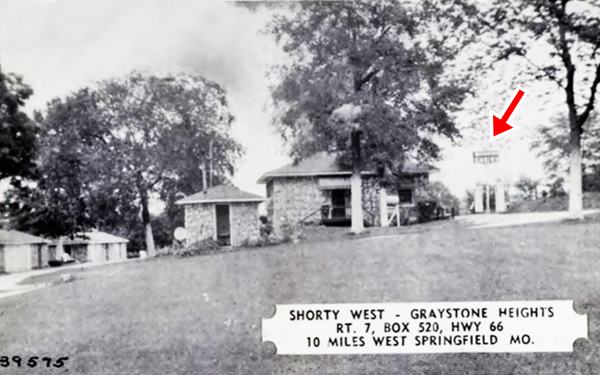
This was a Cabins complex, which were the first type of motels: individual cabins and a parking area. It was built in 1935 by Margaret and Ben Brewer who named them "Graystone Heights Modern Cabin"s which eventually had eight cabins, a café and a Conoco brand gas station.
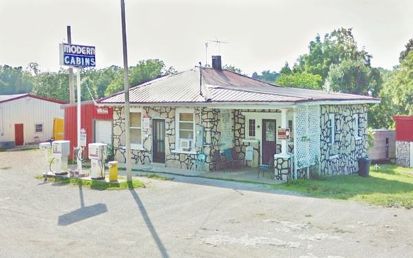
The place has been restored and now sports a refurbished "Modern Cabins" neon sign and vintage 1960s-70s Conoco gas pumps. Now it is the R & S Floral Factory Warehouse.
The motel went out of business when I-44 bypassed old Route 66 in this area.
The image below shows the cabins in the 1930s, notice the neon sign (red arrow) that is still standing two gas pumps flank the sign. The building next to it is the gas station. The picture looks east and Route 66 is on the far right side of the photograph.
Below is the same building and neon sign as they appear nowadays.
Modern Cabins gas station nowadays. Plano, Missouri, Route 66
Yeakley Chapel
A Greene County Historic Site
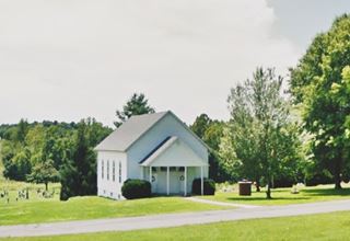
Head west for 1.7 mi. at S. Farm Rd. 65, to your left, on the SW corner, is the historic church next to the cemetery.
According to the 1883 History of Greene County, John Yeakley, settled here in March 1840, he came from Tennessee. He worked to organize the Methodist church in Plano in 1865, and among its first members were John and Eliza Yeakley, Martha and J. N. Jones, Susan and B. Johnson, and J. C. Richardson. The chapel was built in in 1870 and it cost $2,000 of those days (a small fortune) it was a wood frame structure 37 feet wide and 50 feet long. Rev. S. Reece dedicated it that same year. The chapel burned on January 29, 1883, and was rebuilt.
Plano's Bloody Bridges
Head west. The original Route 66 followed what is now MO-266, towards Plano. Before reaching the ghost town there were two "Bloody Bridges" both had curves as you approached them making them dangerous.
The eastern bridge crossed Sac River, and the western one crossed Pickering Creek. To improve safety, the road was straightened out in 1972, it was no longer US66 at that time.
You can see the original Route 66 alignment in this map of the missing roadbed in pale blue.
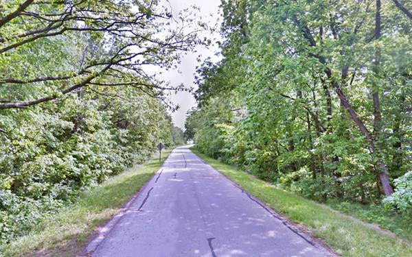
Below is a view of the original highway close to Pickering Creek, along what is now West Farm Rd. 140, this was the 1926-61 Route 66.
Camp Rose and H Dude Ranch

Camp Rose Auto Court postcard. Credits
The alignment has a dead end by Pickering Creek. Here in the 1960s was the "H Dude Ranch" owned by Sam Holman. Before that it had been the "Camp Rose" Auto Court. The place is now private property, but the original L-shaped motel can be seen in the satellite view of the old motel site.
It was owned by Allan Rose, who opened it in 1939. It had ten rooms and a Spanish Mission design.
Drive back to MO-266 and drive 1.3 mi. west into Plano. To your right, on the SE corner of Route 66 and S. Farm Rd. 45 is the old Tydol filling station.
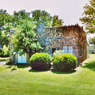
Former Tydol Gas Station
The sandstone building on the southeastern corner of the junction was once a grocery store and Tydol service station. Now it is a private home. It has a roughly hewn rock facade with a parapet with a jagged edge.

Tydol gasoline logo
Tidewater Oil Company began as the Tide Water Oil Co. in New York City in 1887 and was well known for its "Flying-A" and "Tydol" brands which it began selling in the 1920s.
Plano General Store
Diagonally opposite the Tydol station, to your righ, on the northwestern corner of the junction.
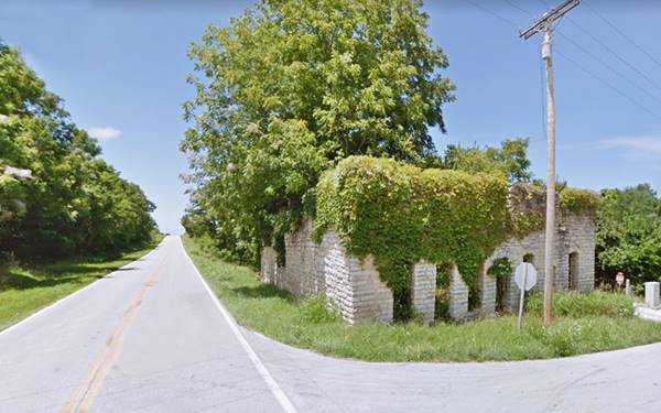
This two story sandstone building overgrown with ivy is said to be the ruins of a casket factory or a mortuary. But, that is a myth; the place was actually a General Store.
The building dates back to 1902 and is the store owned by Alfred Jackson.
The Springfield-Greene County Library District, information on Greene County, Missouri tells us that John Samuel Corum Jackson (1845-1916) moved to Missouri from his native Tennessee and had nine children two of which lived in Plano, Quintilla "Quinn" Kelly Jackson Taylor (1877-1926) who married a farmer and Alfred Jackson (1878-1950) who was a merchant at Plano in the early 1900s.
The mortuary was located on the other side of the road in a now gone wooden building.
This is where your Plano city tour ends. Continue your Route 66 road trip westwards in Halltown.

Some sponsored content
> > Book your Hotel in Lebanon

Credits
Banner image: Hackberry General Store, Hackberry, Arizona by Perla Eichenblat
Jonathan Fairbanks and Clyde Edwin Tuck Past and Present of Greene County, Missouri ca. 1914
History of Greene County, Missouri, 1883, R.I. Holcombe
Jack DeVere Rittenhouse, (1946). A Guide Book to Highway 66
Architectural - Historic Survey of Route 66 in Missouri and Detailed Survey, Maura Johnson. 1993


