Route 66 Winona to Williams Arizona
The course of Route 66 between Winona and Williams
Part 1. The Alignment of Old Route 66 from Winona to Flagstaff
US 66 in Winona
The National Old Trails Highway built in the early 1910s was originally planned through Phoenix, but the local authorities managed to have it routed from Needles through Flagstaff instead. This led to it continuing on to Winslow and linking it with the Ozark Trail in Romeroville, New Mexico.
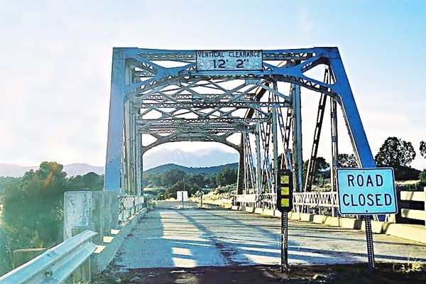
The National Old Trails highway was improved in 1922 with Federal funds and became the Flagstaff - Winona highway. The now historic Walnut Creek Bridge was built at that time.

Elden Junction satellite view. Click image to enlarge
In 1926 when U.S. 66 was created, the Winona to Flagstaff highway with its bridge became part of Route 66. And remained so until the highway was realigned in 1947. At that time the old road became what is now AZ-394.
Winona to Flagstaff 1926 - 1947 road
Leave Winona and head north. The road has a northwestern course parallel to the Rio de Flag River, curving around Turkey hill and then, after crossing the river it merged with US 89.
Map with directions from Winona to US89.
At the junction with US 89, it took a now abandoned course which ended next to the Conoco Service Station on US 89 1⁄4 mi. south of the modern junction. This is shown in the following map and in the image (click it to enlarge).
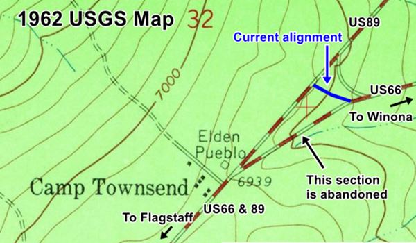
From here it headed towards the southwest and then west, into Flagstaff (Map of this alignment.
1947 - 1968 alignment
From Winona the road was realigned west towards Flagstaff with a shorter course. Now it is covered by the I-40 westbound roadbed from Exit 211 at Winona until Exit 204 (the eastbound lanes were added in 1960). Here you can still drive the 1947 to 1968 road: leave I-40 at Exit 204 and follow the road (Historic Route 66) which meets the 1926 alignment further east at E. Route 66 Ave - jct. US 80 and US 180 in Flagstaff, see this map with directions.
Later alignment
After 1968 Route 66 was realigned again, west of Exit 204, all the way to Exit 191 as a four-lane divided highway using the course that later became I-40.
Part 2. Route 66 through Flagstaff
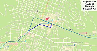
The color key for the map of US 66 through Flagstaff is the following:
Pale Blue (1) East of Flagstaff: it is the Driveable 1926 to 1947 Route 66 alignment. (2)Downtown the 1934-1968 alignment. (3) West of Mikes Pike St. it is the 1926 to 1968 alignment.
So there were two alignments through the town. Both differ in the downtown alignments -shown in the image. Below are the maps with directions.
> > 1926 - 1934 US 66 alignment in downtown Flagstaff
> > 1934 - 1968 US 66 alignment in Flagstaff
They both met on the south side of the city and headed west, and you can still drive it till it meets I-40 at Exit 191. (1926-1968 alignment west of Flagstaff).
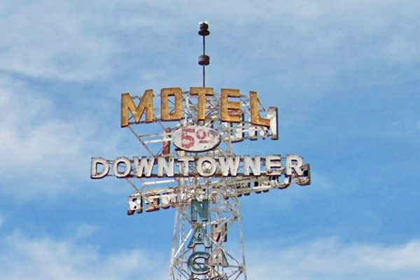
Hotels and Motels along this segment
Lodging & accommodation between Williams and Kingman, sponsored content. Find a room in neighboring on this leg of your Route 66 road trip.
There is lodging on Route 66 very close to Winona.
>> Book your Hotel in Flagstaff
Close to the Historic Route 66 bridge, you can rent a 4-bedroom home on airbnb.
Lodging Near Winona along Route 66
More Accommodation near Winona on Route 66
There are plenty of lodging options in the cities and towns along Route 66 east and west of Winona; click on the links below to find your accommodation in these towns, listed from east to west:
Eastwards
In Arizona Along Route 66
Westwards
You are so close to Las Vegas and the Grand Canyon!
>> There are several RV campgrounds in Williams
Part 3. West of Flagstaff at I-40 Exit 191
Below we will describe Route 66 westwards through Bellemont and Parks all the way to Williams.
Westwards from Exit 191, the original US 66 roadbed lies under the I-40 which was built over it in 1979. You have to drive to Bellemont, to Exit 185, to be able to access the older alignments.
Route 66 in Bellemont
From the N.O.T. days and later, when U.S. 66 was created and until 1931, Route 66 ran north of what is now the freeway, along Brannigan Rd. into Bellemont. We refer to our custom map in Bellemont for the color scheme:
this is marked with a pale violet line. The alignment went westwards, and is now cut by I-40, crossed the village of Bellemont and at this point (See map) took a SE-NW course into Brannigan Park.
Then in 1931 it was realigned along what is now W Route 66 -which can still be driven- and into Bellemont along two now erased segments (orange in our map). The embankment can still be seen on the south side of the modern Route 66 (see image). It too ran with a SE-NW course,
a bit to the the west of the original alignment. This can be driven along Brannigan Rd. towards Parks.
With WWII a straighter highway was necessary so it was aligned along a course that bypassed Brannigan Park (Map through Bellemont.)
Now it has a dead end at its eastern tip and western tip, both cut by I-40, but you access it roughly in its midpoint at Exit 185, heading to the south of I-40.
The famous Pine Breeze Inn is located on the eastern part of this segment.
There are three separate sections of Route 66 between the villages of Bellemont and Parks and they are listed in the National Register of Historic Places. We describe them below.

Part 4. The three historic sections from Bellemont to Parks
Leave I-40 at Exit 185 and head north along the Frontage Rd. it soon heads north towards Brannigan Park in the Kaibab National Forest.
This is the map of the 6.2 mile segment, that you can drive all the way into Parks: Map of the Brannigan Road segment.
1. The older 1926 to 1931 alignment at Brannigan Park
As the route followed by the railroad and modern I-40 from Bellemont to Parks crossed abrupt and rugged terrain with some steep climbs, this alignment that had been used by the 1917 National Old Trails alignment, was abandoned around 1920-21 in favor of a longer but less difficult one that curved to the north around Fortynine Hill (7,850 ft).
Route 66 in 1926 was aligned along this earlier 1920-21 roadbed. You can still see parts of the original road winding next to US 66. At Brannigan Park, a large and well-watered meadow set in the middle of the pine tree forest, the original 1926-31 US 66 took a different alignment, now obliterated by nature.
It west, and finally to the southwest, beyond the later Route 66 alignment built in 1931, meeting it close to Parks. You can see it marked with a blue line in our custom map.
There is only one part can be driven today (See map). It finally swung to the north of the later alignments and it can be still seen close to the General Store at Parks.
2. 1931-1941 Brannigan Park Road
Built in 1931-32, it was a 24 foot-wide road, and it was paved by 1934. Now it is partly paved.
This was also the highest point of the whole Route 66, at 7,405 feet above seal level, it was not easy for the early drivers to climb Brannigan Park pass on Fortynine Hill.
3. Historic abandoned Section East of Parks
Listed in the National Register of Historic Places
This section, just east of the Parks General Store was part the road built in 1921, incorporated into US 66 in 1926, and improved by paving and widening it in 1931. (Shown in this map). Now it is a trail that can be walked. Along it are the remains of a springhouse where tourists would camp and get fresh water.
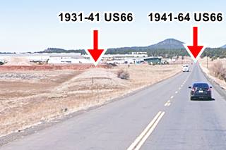
It has a asphalt paving and concrete culverts one of which has a brass plate stamped "1931". Below you can see the old alignment meet the later 1941 one (red arrow is the 1931 roadbed).
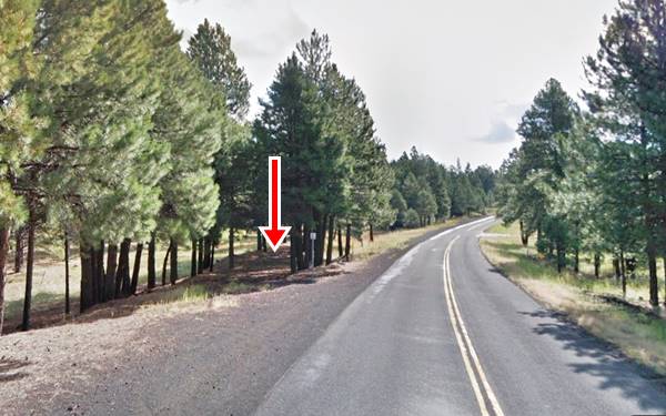
The original road alignment continued west, passing behind the iconic Parks General Store, on its northern side, and heading westwards from there to the north of the modern highway 66. This is a very short segment, and we describe it below:
1941 to 1963 Route 66 Bellemont to Parks
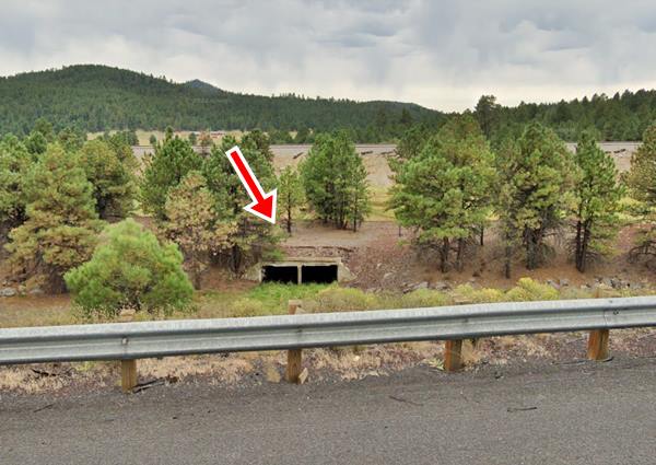
The Brannigan Park segment was replaced by a straighter and shorter roadway running more or less where I-40 is now located. You can see the old roadbed in several places. We marked the original road in our custom map with a purple line at the rest areas west of Bellemont, then it is overlaid by the freeway and again appears (orange line) to enter Parks east of the current Exit 178, where a short segment can still be driven (see this map into Parks 1941-63 Route 66). This is the map of the extant 1941-1963 road into Parks.
Culvert of the 1941-63 Route 66 on the south side of I-44 east of Parks
Historic abandoned Section West of Parks
Listed in the National Register of Historic Places
It is a 0.35 mile section of road built in 1921 as the National Old Trails road and incorporated into Route 66's alignment in 1926. It is a narrow road with a "paved" surface formed by tarred gravel. And it can still be seen and walked along as it lies just a few feet north of modern Old Route 66. (Satellite view.)
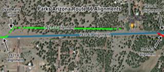
Dead Man's Curve
The western tip of this segment ended in a sharp curve which the local newspaper called the "Dead Man's Curve" after the accidents it caused. You can see it in this 1959 aerial photo.
The 1931 realignment improved the road and straightened its alignment west of Parks.
See the map (click on it to enlarge it), its color code is the following:
Green: 1921-1931 alignment. This is the original ection and the deadly curve.
Pale Blue: 1931-1963 alignment to the south of the older one
Red: 1941-1963 alignment which left the historic eastern section abandoned (1941 realignment map).
Part 5. Westwards from Parks to Williams
1926-31 US 66 Westwards towards Williams
The N.O.T and 1926-31 US66 alignment then turned to the SW and met current I-40 at the N. Spitz Spring Rd. overpass. (Green line in our interactive custom map); it can't be driven along this segment. It crosses the freeway several times and can only be driven along this segment towards Beacon hill.
It then followed the orange line in our custom map, and Deer Farm Rd. that can still be driven. Heading southwest (now cut by I-40), it continued west (map) into Williams along Mountain Man Trail and after a gap (marked with a red line in our custom map), followed Rodeo Rd., Edison and N. Grand Canyon Rd. into downtown Williams (map).
The 1932 Route 66
See this map of driveable US66 west from Parks all the way to I-40's Exit 171; it is 5.5 miles long.
This follows the 1931 alignment of Route 66. It was improved in 1939 and 1941 to make its grades less steep, new culverts and guard rails were added too.
At the exit the freeway cuts the old alignment (see it in our custom map of missing segments, marked with black line.
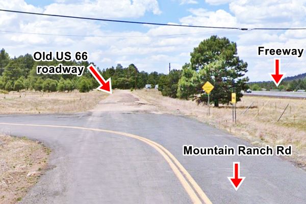
After exit 171, the roadbed is now under the eatbound lanes of the Interstate completed in 1964, but there are three places were the original alignment can still be driven along:
1. On the south side of I-40 at Exit 171: for about 0.4 miles as can be seen in this Map of this section
Then, as shown in the image below, the old roadway is a dead end, cracking and full of potholes (pink line in our map).
Below is a "Then and Now" set of pictures taken 7 miles east of Williams:
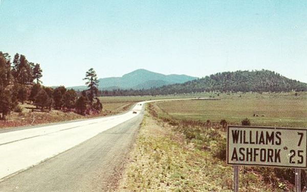

2. When you reach Williams, the original road forked to the south and you can still see the old roadbed. green line in our custom map.
The road continues into the town of Williams, a through it; there still is eastbound and a westbound streets carrying US 66 through the town, see the map of Route 66 into Williams.
The interstate I-40 began construction in 1964 and finished in 1979, replacing the older alignements, and in 1984 it finally bypassed Williams.
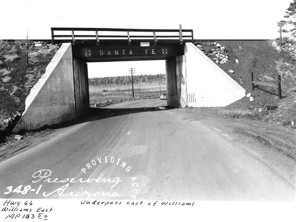
3. Old underpass, the original highway crossed the railroad with a grade crossing. In the 1930s it was upgraded and an underpass was built. Now, the 1950s Route 66 eliminated the old underpass with its sharp curves and crosses the tracks with an overpass. We marked the old road (the paving and underpass are still there) with a yellow line in our map.

Williams the last town to be bypassed along Route 66
Williams was the last town to have its section of Route 66 bypassed, due to lawsuits that kept the last section of Interstate 40 in Arizona from being built around the town. After settlements called for the state to build three Williams exits, the suits were dropped and I-40 was completed.[6] On October 13, 1984, Interstate 40 was opened around the town and newspapers the next day reported the essential end of US 66. The following year, Route 66 was decommissioned.
Continue your journey
Our itinerary from Winona to Williams Arizona ends here, you can carry on westwards into Kingman AZ, see below:
Next Section
Route 66 alignments from Williams to Kingman AZ
Previous Section
Route 66 alignments from Winslow to Winona AZ
Some sponsored content
>> Book your Hotel in Flagstaff

Credits
Banner image: Hackberry General Store, Hackberry, Arizona by Perla Eichenblat.
Jack DeVere Rittenhouse, (1946). A Guide Book to Highway 66
Route 66 Maps. Arizona D.O.T.


