Route 66 in Romeroville NM
Index to this page
About Romeroville, New Mexico
Facts, Trivia and useful information
Elevation: Elevation: 6, 287 ft (1, 918 m). Population: n⁄a (2025).
Time zone: Mountain (MST): UTC minus 7 hours. Summer (DST) MDT (UTC-6).
Romeroville is a small community located on the junction of US-84 with US-85 & I-25. At one time Route 66 following the formar Ozark Trail met the Santa Fe Trail at this point and headed west into Santa Fe.
History
People have lived in this part of New Mexico for at least 10, 000 years, the Pecos River was a main route linking the Sangre de Cristo Mountains in the north with the plains and the Llano Estacado in the southeast.
Old cutting, at Puerta del Sur Pass, west of Romeroville.
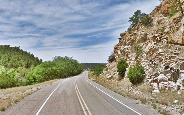
This part of New Mexico was not actively settled during the Spanish Colonial period (1598-1821), it was too far from the capital at Santa Fe across the Sangre de Cristo Mountains and its location on the foothills next to the Great Plains exposed it to the raids of the Comanches and Apaches. However, it was a strategic trade route linking New Mexico with the east and the Mississippi, and the Santa Fe Trail passed right through the area.
Some time after Mexico won its independence from Spain in 1821 these meadows on the eastern foothills of the Rocky Mountains attracted Spanish-Mexican settlers in the 1830s. They founded Las Vegas a few miles west of where Romeroville is now located. But Mexico lost the territory to the U.S. after its defeat during the Mexican-American War (1846-48). The Mormon Batallion led by General Kearny passed through Las Vegas and Romeroville in 1846 crossing a mountain pass north of the village that now bears his name.
The name: Romeroville
The town was named after Trinidad Romero (1835-1918), a businessman of Hispanic origin, from Santa Fe, who owned a freight company that worked the Santa Fe Trail. He set up his offices at a ranch just south of Las Vegas in the 1880s. He was also a representative in the Territorial house of representatives and congressman (1877-79).
The U.S. Army quickly neutralized the Apache attacks and pacified the area, trade grew along the "Santa Fe Trail". One trader, Don Trinidad Romero chose this point to set up his headquarters on the Santa Fe Trail, it was the beginning of Romeroville.
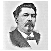
Trinidad Romero. Source
The establishment built by Don Romero coincided with the arrival of the railroad. The depot was named after him (without the "ville" part). It was a humble place described in a 1915 USGS report of the area as "Romero (ro-may'ro) 6,287 ft. 791 mi. from Kansas city. A siding.."
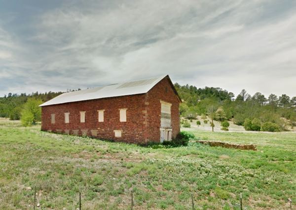
Romero built a two-story adobe mansion (pictured below); it later became a hospital and finally a "dude ranch;" it burned to the ground in 1932, the barn close to it has survived.
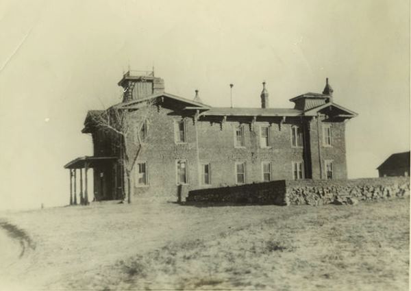
Romeroville was built at a strategic location just west of Las Vegas: it was the point where the railway took a southwards course at the junction of the trail leading along Gallinas Stream to Santa Rosa and the Santa Fe Trail to Santa Fe.
Just to the west of Romeroville is Romeroville Canyon, a gorge in the mesa that links Las Vegas westwards with Bernal, now used by I-25 and US-85, it was the original route of the "Santa Fe Trail" and later, the alignment chosen for Route 66 in 1926.
The railroad towards Santa Fe from Romeroville headed south (parallel what is now US 84), through two stops: Ojita mi. 779; the Spanish word (O-hee'ta) means little spring, from "ojo de agua" or "water-eye") and Sulzbacher before turning west into Bernal.
Romeroville was chosen as the western terminus of the Ozark Trail due to its location on the Santa Fe Trail. Later, in 1926, Route 66 was aligned along the Ozark Trail through Romeroville.
After 1937, Route 66 was realigned along a shorter course from Santa Rosa to Albuquerque through Moriarty and the road through Romeroville from the south became US 84, and the one that passed through it from east to west, US 85.

Where to Stay near Romeroville
There are plenty of accommodation options and lodging along Route 66 close to Romeroville:
> > Book your room nearby in Santa Fe or Las Vegas NM
More Lodging Near Romeroville along Route 66
Below you will find a list of some of the towns along Route 66 in New Mexico. Click on any of the links to find your hotel, motel or accommodation in these towns (listed from east to west):
On Route 66's Main alignment
The Santa Fe Route 66 segment
Eastwards
Westwards
>> There are RV campgrounds near Romeroville in Las Vegas NM
The weather in Romeroville
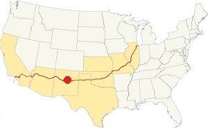
Location of Romeroville on Route 66
Summers are warm and winters quite cold. The area is dry.
The average summer high (Jul) is 83°F (28.3°C) and the low average is 52°F (11.1°C). In winter (Jan) the average low and high are: 22°F (-5.5°C) and 46°F (7.8°C) respectively.
Rainfall is higher during the period between May and Nov. (13 in.-330 mm). The average rainfall is 16.5 in. per year (419 mm).
There are 272 sunny days and 62 precipitation days per year in this sunny and dry town. Snowfall is around 27 in. per year, and falls between Nov. and March.
Tornado risk
Romeroville is located in an area with virtually no tornado risk: San Miguel county only has two (2) Tornado watches per year and mostly in the eastern fringe of the county.
Tornado Risk: read more about Tornado Risk along Route66.
Map of Route 66 in Romeroville, NM
Visit our The Santa Fe Loop (1926-37) alignment page for a detailed description of Route 66 in this area. Below is the color coded interactive map:
>> Custom map of Route 66 in town
The original Route 66 was aligned through Santa Fe in 1926 along three previous highways, the "Ozark Trail", the "Santa Fe Trail" and the "National Old Trails".

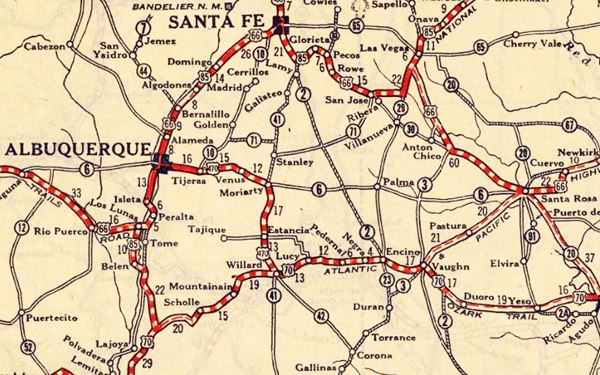
1925 Road map, Central NM
Click on image to enlarge.
Source
The thumbnail map above from 1925 (click on it to see the full sized map) shows the roads that existed one year before Route 66 was created.
Notice "Romero" on the center-right side of the map.
Those marked "22" (National Old Trails Rd., coming from Los Angeles) and "32" (New Santa Fe Rd.) with white letters in a black box, went from Gallup to Albuquerque and through Santa Fe.
The only paved sections (full black line) were between Albuquerque and Bernalillo, and Albuquerque and Tijeras. The highway from Bernalillo to Santa Fe, and beyond Isleta was "improved" (dashed line), the rest were either graded or dirt roads.
The Santa Fe Loop (1926-1937)
This was the first alignment of Route 66, from Santa Rosa to Albuquerque via Pecos (and Romeroville) to Santa Fe.
We describe this segment in our Santa Fe Loop page, a dedicated webpage, with the full alignment, from Santa Rosa, through Dillia, Pecos, Santa Fe, Santo Domingo, and Bernalillo all the way to Albuquerque.
This original highway also continued beyond Albuquerque to Isleta, Peralta and Mesita.
Romeroville does not appear in this map, only neighboring Las Vegas
1937 Realignment of Route 66
A political dispute between New Mexico Governor A. T. Hannett and local politicians led to the realignment of Route 66 in 1937.
Hannett blamed the local party bosses when he lost his 1927 bid to re-election. He decided to punish them, and their backers (the business men in Santa Fe) so he quickly had state highway #6 built, in 1927, to link Moriarty with Albuquerque. This highway bypassed the capital city, and was 90 miles shorter for those driving from the east to Albuquerque.
In 1937, the Federal roadbuilders decided to realign Route 66 using Hannett's road, and paved it. It was a straighter highway, and only had a short mountain segment across the Sandia Mountains between Sedillo, Tijeras and Carnuel.
Route 66 Alignment near Romeroville
With maps and full information of the alignments of Rte. 66.
- Albuquerque to Lupton (next)
- Santa Rosa to Albuquerque 1937-85 (parallel)
- Tucumcari to Santa Rosa (previous)
The Santa Fe Loop (1926-1937)
Our Santa Fe Loop page describes the complete 1926 to 1937 alignment of Route 66 from Santa Rosa to Albuquerque through Pecos, Santa Fe and Bernalillo.
Romeroville: its Attractions
Landmarks, Route 66 sights
Where the Ozark Trail meets the Old Santa Fe Trail
Romeoville is a small community at the junction of the Ozark Trail and the Santa Fe Trail on the 1926 to 1937 alignment of Route 66 between Santa Rosa and Santa Fe. The village is tiny, and is enclosed by I-25 & US 85 on the north and US 84 on the south. The railway crosses through it, following I-25.
The railway and US 85 ⁄ I-40 follow the "Santa Fe Trail" with an east to west alignment.
The Santa Fe Trail
Santa Fe was linked to Mexico City to the south by the "Camino Real de Tierra Adentro", a Royal Highway built by the Spanish Crown. But another important trail was opened in the 1792 across the Great Plains to trade with the French Louisiana settlements on the Missouri River (now St. Joseph and Independence MO).
Wagon trains used it to move goods from the east into New Mexico, and later, pioneers trekked along it to settle the west.
Upon reaching New Mexico it split into two forks to reach Santa Fe, one of them went through Las Vegas, Romeroville and Pecos. They all cross Kearny Pass, a historic point just east of the village.
Kearny Pass or Kearny Gap
The foothills of the Rocky Mountains at Las Vegas and Romeroville form a ridge called "El Crestón" or Crest. There were two passes across it, the "Puerto del Norte" and the "Puerto del Sur" (an incorrect rendering of "Puerta" that means "door"). Kearny's forces used the Puerta del Sur, now named after him. The railway also used it to cross the crest. Nowadays US 85 followed the railroad cutting. Modern I-40 cut right through the hill at this point too.
A tower built in stone stood over the Pass, it was known as the "Torreón", it was built to guard against the Indian raids.
The meeting point of the Ozark Trail and the Santa Fe Trail
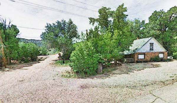
The image below shows the point where the 1926 alignment of Route 66 (nowadays it is Camino Romeroville) met the old 1926 alignment of US 85 that linked (overlapping Route 66 west of this point), Santa Fe with Las Vegas NM.
It was also the point where the Ozark Trail met the Santa Fe Trail.
Current view of the junction of "The Santa Fe Trail" and the Old 1926 Route 66 in Romeroville
The Ozark Trail Monument Site

The obelisk at Romeroville, NM: an Ozark Trail marker now gone. ca. 1920. Source
The Ozark Trail Association was the brain-child of William Hope "Coin" Harvey (1851-1936), an entrepreneur, teacher and active promoter of tourism. He foresaw the importance of the automobile in America and established the Ozark Trail in 1913 to promote good roads, road signs and maps.
The Ozark Trail soon grew to span Missouri, Oklahoma, Texas and eastern New Mexico. When Route 66 was created, it was aligned along the Ozark Trail from NM to MO.
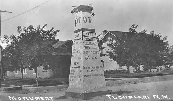
As there were no Federal highways at that time, monuments shaped like pyramids or obelisks were erected at key locations and the mileage to major cities were painted on the markers.
There were many of them, bur few survive, surviving monuments include one on the original US 66 in Oklahoma (Between Stroud and Davenport).
There was another one in Tucumcari NM, pictured below.
One was erected here, in Romeroville, the western terminus of the Ozark Trail. It was removed long ago.
It was a 50 foot obelisk that was located at the junction of the Santa Fe Trail and the Ozark Trail. That is, modern US 85 which was the Santa Fe Trail from Santa Fe to Las Vegas, and current US 84, which linked Las Vegas to Santa Rosa NM, and would later become the 1926-1937 alignment of Route 66.
Romero's barn
Located less than a mile east of the crossroads (map with directions).
The stone barn built on Romero's estate has survived on the eastern side of the villag; it stood quite close to the mansion. Pictured below. It dates back to around 1876.
Arroyo La Manga creek bridge on the original Route 66
From the crossroads head left, and go west along the old U.S. 85, it is a short driveable segment that ends in a dead end after 1.3 mi. (map with directions).
The original roadway was disrupted by the construction of U.S. 84 and its improvements in the 1940s and by the freeway's four lane aligment. The old road can be seen here, with a bridge.
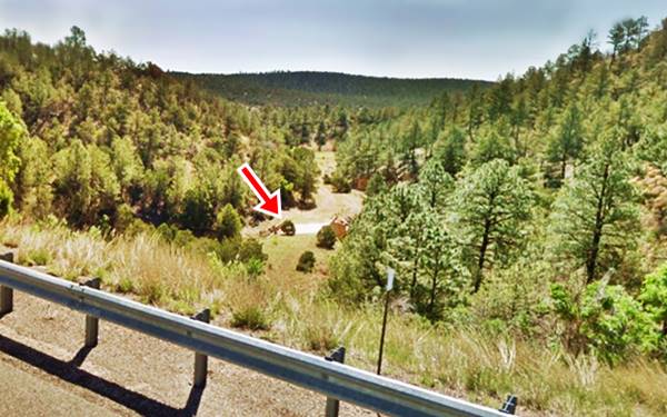
On the left side of the freeway, one mile to the SW of its Exit 339 beyond the KOA Campground, 500 feet west of where the current road ends is the original concrete bridge built in 1926 to carry US 66. Closed to traffic, surrounded by forested hills it marks the old roadbed. Pictured below.
End of this leg of your Road Trip
Here on the western side of Romeroville is the end of this leg of your journey. Continue your road trip by heading north and visiting the next stop: Las Vegas.

Sponsored Content

>> Book your Hotel in Albuquerque

Credits
Banner image: Hackberry General Store, Hackberry, California by Perla Eichenblat

