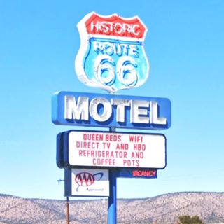
Ash Fork Arizona's Route 66
Index to this page
About Ash Fork, Arizona
Facts, Trivia and useful information
Elevation 5,160 ft (1.573 m). Population 483 (2025).
Time zone: Mountain (MST): UTC minus 7 hours. Summer (DST) no DST⁄ PDT (UTC-7).
Ash Fork is a small town in northwestern Arizona, in Yavapai County. Route 66 runs right through it.
This part of Arizona has been inhabited for at least ten thousand years. To the west were the Sinagua natives who farmed close to what is now Flagstaff. To the east lived the Patayan people, near the Colorado River. The Havasupai and the Hualapai people later lived along the Grand Canyon area.
Although Arizona was part of the Spanish Colonial Empire, the region was never settled by them. Francisco Vélez Escalante, a Spanish missionary explored the area in 1775. Mexico received the territory when it won its independence (1821) from Spain and later ceded it to the U.S. after its defeat in the 1846-48 war.
The Name: Ash Fork
In some early 1900 maps, postcards and even in the 1951 Shell Road Map, it appears as "Ashfork" (one word).
The town was named after the place where the three forks of Ash Creek met. And the creek got its name from the ash trees (genus Fraxinus) growing there.
In Norse Mythology, the first man, Askr, was formed from an ash.
In 1857, the U.S. government sent Lt. Edward "Ned" Fitzgerald Beale on a mission to survey and open a wagon trail from Fort Smith in Arkansas, to California. His route passed a few miles north of Ash Fork and can still be visited: it is the Beale Wagon Road, it was the main route used by settlers moving into California until the railway was built.
The Navajo in eastern Arizona and western New Mexico were subdued by the late 1870s and settlers moved into the area. Trade sprung up between Williams and the copper mines at Jerome, and Ash Creek was on the main road of the freight carts.
the Atlantic & Pacific Railroad (later the Atchison Topeka and Santa Fe Railroad) reached Ash Fork in 1883 and that same year the United Verde Copper Col. was formed in Jerome.
The railroad siding, with the post office was located at the point where the three forks of Ash Creek met and thus it was named "Ash Fork".
After the town burned down in 1893 it was relocated to the south of the tracks. The Branch railway to Prescott and Phoenix met the main line at Ash Fork.
The town never fulfilled its ambitions to become a winter resort.
The National Old Trails (N.O.T.) highway was built across Arizona in the 1910-20s and it became the basis for Route 66 in 1926. The highway was aligned through the town and a road maintenance camp was built at its western tip.
Ash Fork had no water until a well was drilled in 1975; prior to that the water was hauled in daily by train. The old steam engines needed water to operate and it was stored in steel and stone dams built in the mountains in 1898 and 1911 (learn more about historic steel dam below).
The relocation of the railroad 10 miles to the north of town in 1960 led to a loss of population, and the 1977 fire wiped away many of the downtown buildings. It was followed by the 1987 fire that burned the business district along Route 66. Many icons of the classic Route 66 days have been lost, but there is still plenty to see.
Route 66 in the town was bypassed by I-40 in 1970.

Accommodation: Where to Stay in Ash Fork
Find your room in the motels in Ash Fork (sponsored content):
>> Book your room in Ash Fork
More Accommodation near Ash Fork on Route 66
There are plenty of lodging options in the cities and towns along Route 66 east and west of this town; click on the links below to find your accommodation in these towns, listed from east to west:
Eastwards
In Arizona Along Route 66
Westwards
You are so close to Las Vegas and the Grand Canyon!
There is an RV campground in Ash Fork
The Weather in Ash Fork
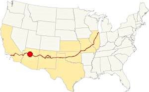
Location of Ash Fork AZ on Route 66
Thanks to its altitude, summer in Ash Fork is relatively cool. The climate is Mediterranean.
The average high in summer (Jul) is 83.3°F (28.5°C); the average summer low is 55.1°F (12.8°C). The average high (Jan) during winter is around 46.5°F (8.1°C) and the average low is chillly 23.3°F (-4.8°C).
Rainfall is around 22.1 inches per year (562 mm). There are around 70 rainy days each year. Snowfall is 68 inches (173 cm) starting late in October and ending in late April. On average there are 19 snowy days per year.
Tornado risk
The region located west of the Rocky Mountains has virtually no tornado events. Tornado Risk: read more about Tornado Risk along Route66.
Map of Route 66 in Ash Fork, AZ
Map with the alignment of Route 66 through Ash Fork
Visit our Williams to Kingman page for the description of this alignment. Below is the color coded interactive map:
>> Custom map of Route 66 in Ash Fork

Thumbnail of the 1910 N.O.T. map at Ash Fork. Source
Click on thumbnail map to enlarge
This is the westbound US 66 alignment map and this is the eastbound US 66 alignment map across Ash Fork.
The first dependable road for cars in this part of Arizona was the "National Old Trails" Highway, it was built from California eastward in the early 1910s, click on the thumbnail map to see its alignment through Ash Fork. The map indicates with symbols next to the town that it had meals-lodgings, gasoline-oil, garage-repairs. As the usage of automobiles grew, the National Old Trails highway had to be improved, as improved in the early 1920s with Federal funds and in 1926 it was included in the alignment of the brand new U.S. Highway 66.
Ash Fork Hill
Rittenhouse described the road between Williams and Ash Fork in his 1946 guidebook as being 19 miles long, "but in this distance you drop 1,700 feet down winding grades which are tricky on winter nights when the road is icy. Inquire about road conditions before starting, if driving at night". Which sounded rather challenging. Below is a "Then and Now" view of the same spot showing the remains of the old roadway (red arrow):
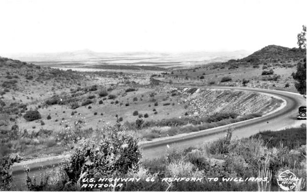
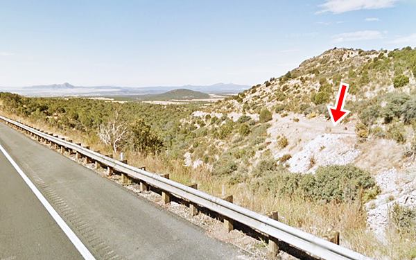
Picacho Butte (Picacho is a "solitary peak" in Spanish) can be seen in the distance (left) in both images. It is a circular volcanic dome roughly 9 million years old, 7,171 ft high (2,186 m).
The modern freeway cuts through the hills and avoids the narrow winding cliff-hanging course of the old roadway.
Ash Fork alignment
Until 1950 Route 66 crossed the town as a two lane road (along Lewis Ave.) and from 1950 to 1979 Lewis Ave. carried the westbound traffic while Park Ave. took the eastbound flow.
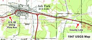
Our custom map of "old & missing segments" shows the now gone segment from Monte Carlo Truck service in the east into Ash Fork with an violet line and the original pre-1950 western exit along Pine Ave. with a pink line.
The Shell roadmap below spells the town's name as "Ashfork" -one word and not two:

Thumbnail of the 1951 Shell Roadmap. Source
Click on thumbnail map to enlarge
Route 66 Alignment near Ash Fork
With maps and full information of the old roadway.
- Kingman to Topock (next)
- Williams to Kingman (Ash Fork's)
- Winona to Williams (previous)

Sights and Attractions in Ash Fork
What to Do, Places to See
Historic context, the classic Route 66 in Ash Fork Arizona
The best description of "classic" Route 66 can be found in Jack DeVere Rittenhouse's book ("A Guide Book to Highway 66") published in 1946. It has plenty of information on what the road had to offer travellers and listed motels, filling stations and attractions along Route 66. He describes the town as follows:
ASH FORK... hotels: Escalante, Arizona, and White House; courts: Hi-Line, Copper State, McCoy's; Theroux garage; cafes; all facilities... Sandstone is also quarried near here. Rittenhouse (1946)
Road Trip through Ash Fork
Driving westwards from Willliams as described in our Williams to Kingman page, leave the freeway at Exit 149. On the north side at North Monte Carlo Road is the old truck stop and cafe site.
Monte Carlo Cafe
1932 - 1952 Route 66 east of Ash Fork
Rittenhouse drove down the original 1932 to 1952 alignment (map of the old US66 alignment), it has a cracked roadbed and is used by hikers. You can also reach it further east at Welch Rd (Exit 151).
He mentioned a "Gas Station and Store" two miles east of Ash Fork, Monte Carlo's. There was a Cafe. Later it partly relocated to the four-lane highway built in the 1952, but the buildings close to the new highway were razed when Exit 149 was built (see it in this 1958 aerial photo).
The old café building is still standing next to the 1932-52 road segment. The current business on the premises since 1993 is the family run Monte Carlo Truck Service.
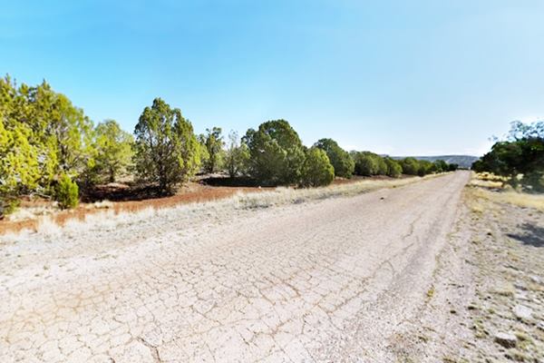
This original highway west of Monte Carlo is now buried beneath the freeway. The current frontage roads were added later. West of this point, to your left, on the south side of the freeway, along County Line Rd. you will see the remains and ruins of a café and two motels. See this map with directions to visit them.
County Line motels
Rittenhouse mentioned back in 1946 "another gas station" one mile west of montecarlo, probably the old County Line Cafe.
County Line Cafe

2001 view County Line Cafe. Source
Click on thumbnail to enlarge
Just west of the Yavapai - Coconino County line, all that remains are the foundations and some crumbling walls. The neon sign is slowly falling apart. Below are some images of the place over the years.
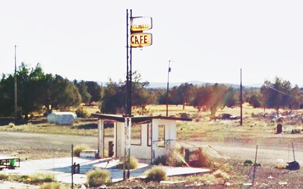
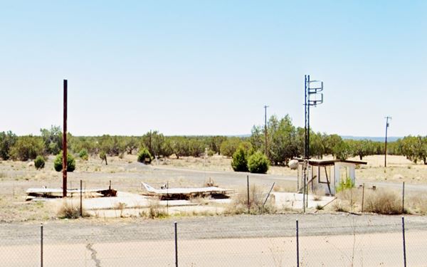
Martin's Motel and County Line Cafe
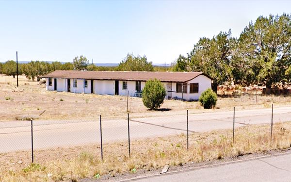
Next to the old café is a long narrow gable roof building, the remains of Martin's Motel. Vacant, neon sign gone, but still standing.
An "old" postcard of the Martin's Motel
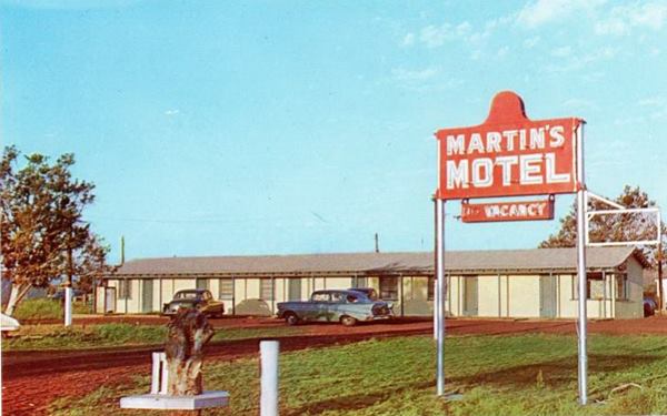
The Martin's Motel as it looks today
Sleepy Hollow motel site (Gone)
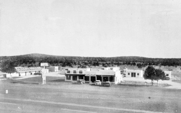
To the right (west) of Martin's was the Sleepy Hollow motel, its postcard says it was "Two miles east of Asfhork, Ariz. on U.S. Highway 66... Modern. Private boths. Panel Ray heat... Quiet and clean. Reasonable rates..." It had separate buildings, each with two units and a central office. A gable roof building ran parallel to Martin's motel. Nothing remains. A sandstone sales business is located on the lot (Street view in 2022).
Ahead are the remains of a gas station, maybe Frosty Spot, that the 1980 phone directory placed on "E Hwy 66 Ash Fork". You can see it in this 1973 aerial photo, but nothing remains (Street view), only some rubble and foundations among the shrubs and grass.
Return to the freeway and head west. Take exit 146 into Ash Fork, ahead, just after crossing the bridge over Ash Fork Wash, to your right is the marker:
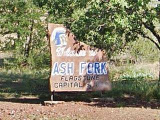
Flagstone Capital marker
There are more than 50 quarries in the area mining Coconino sandstone. This stone formed from the sand dunes of a desert that covered what is now western U.S.A. some 260 million years ago.
Flagstone is a variety of sandstone used for paving patios, walkways, and building facades. The word comes from Old Norse (flaga) and means slab or chip.
The Arizona House of Representatives officially named it the "Flagstone Capital of the World" in 2001.
Hume Mobil station
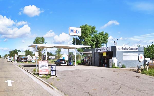
Drive west along Lewis Ave into Ash Fork. Ahead, to your right is the Mobil station dating back to the mid 1950s, owned by Roy Hume it is a box-shaped building with two service bays and a detached double butterfly canopy.
Copper State Motel
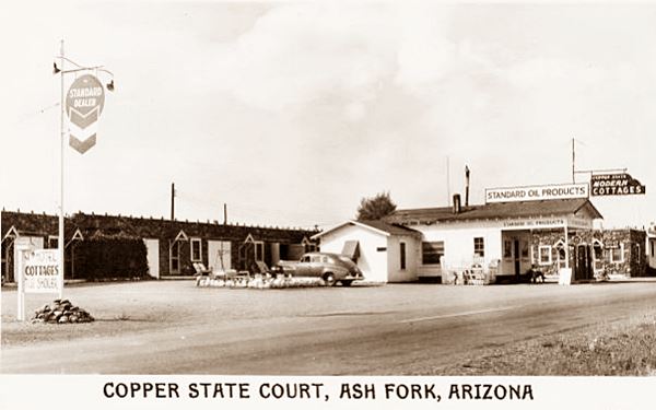
Opposite the gas station 101 Lewis Ave. Zelma and Ezell Nelson opened it in 1934 as the "Copper State Modern Cottages", which later switched to "Copper State Court". Originally there were twelve cottages with thick stone walls and garages. They ran the place till 1975, when they sold it. The old Standard service station that stood in the central part of the court became the office.
In those days, Arizona could well be called "The Copper State," producing (in 1966) 51.4% of all copper mined in the U.S.
There have been some minor changes: the Standard Oil pumps have gone, but the old building is still there, with the former canopy now built up as an office. The flagstone rooms seem the same as they did back in the 1940s. Below is a "Then and Now" view of the motel:
An "old" postcard of the Copper State Motel
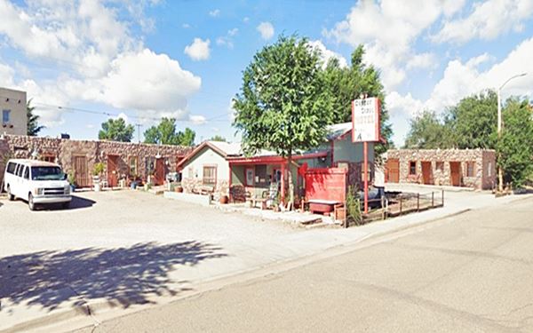
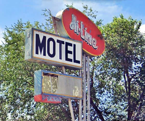
The Hi-Line Motel
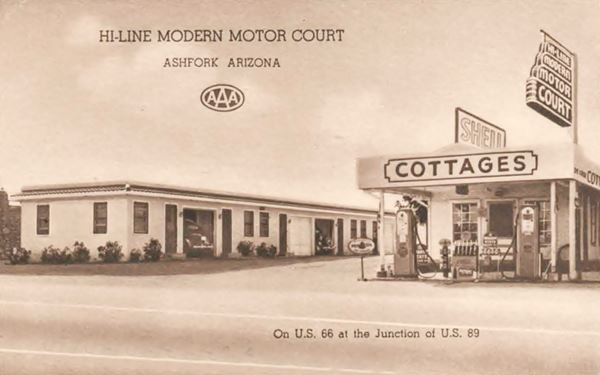
To the right of the Copper State, at 127 E Lewis Ave. is another classic motel, the The Hi-Line Modern Auto Court that also had a Shell filling station. Alton McAbee opened it in 1935. It became the Hi Line motel in the 1950s. It called itself "Your Home Away From Home." The sepia colored postcard tells us it had "New, strictly modern cottages... Tiled showers and closed attached garages... Mr. and Mrs. J. R. Edwards, managing owners."
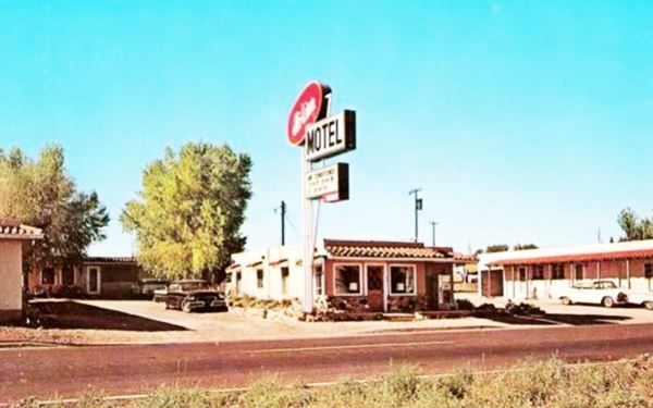
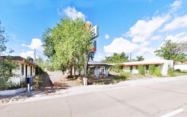
Another postcard, from the 1960s. Notice the change in the neon sign:
Theroux Garage

Theroux garage 1950s advertisement. Source
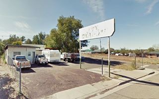
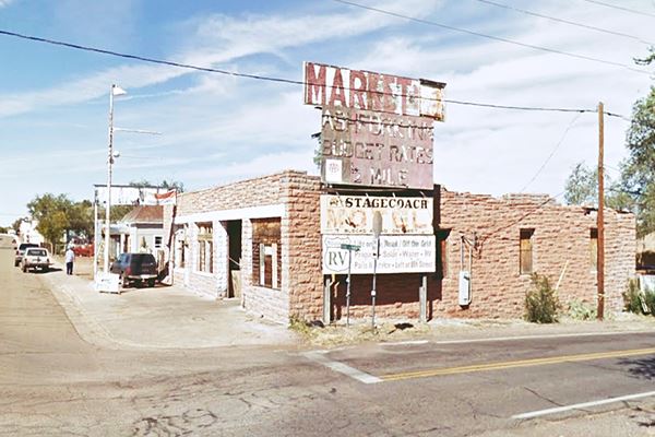
On the next corner, to your right is the garage mentioned by Rittenhouse in 1946. It opened in 1933 and it has a faded billboard on the corner peeling away under the sun says "MARKET - Ashfork Inn Budget Rates 1⁄2 Mile - Stagecoach Motel - Route 66 RV Life on the Road - Off the Grid... Left at 8th Street." Another sign by the office says "Yavapai Traing Post", the place is vacant and boarded up.
It also sold Mobil gas. The pump islands are still there.
Original 1930s flagstone sidewalks
The town's flagstone sidewalks were laid down by the Works Projects Administration (WPA) between 1936 and 1939 to provide work to unemployed local labor during the Great Depression. There is a small historic marker on the corner remembering this even, right by the Baptist Church facing Theroux (street view); keep your eyes open, there are more of these markers along Lewis.
Zettler's Market
The 1980 phone directory mentions Jake's Shell at 202 E Lewis, but nowadays there is a small shed on the northwest corner of Lewis and 2nd St. Next to it at 242 Lewis Ave., is Zettler's Market (street view).
It opened in 1930, as a bakery ran by Marie and Homer Zettler. After WWII, their oldest son Vernon and his wife Marge turned it into a market and ran it until they retired in 1983.
Union 76 station

Union 76 and Texaco in 2022 (street view).
Click image to enlarge
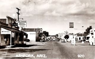
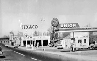
At 268 Lewis Ave. this former Union 76 station is now a garage and repair shop (Patriot auto and truck repair). This Type 140 service station appeared in 1953.It was a steel building completely shop-fabricated for field assembly. It had a sweeping trapezoidal box canopy with a space age Googie design. Originally, as you can see in the 1940s picture below, it had a more classic design, with a sturdy canopy and box columns. Below are two views (1940s, and 50s of the same corner, compare with the 2022 view above). Notice how the buildings on the south side (left) have vanished, razed by the fires of 1977 and 87:
Bar and Brothel
At the corner of 3rd St., look northwards along it, just a few yards away, on the western (left) side of the road is a green woodframe building (47210 N Third St).
Built in 1903 it predates Route 66 and is a relic of the wild West days, a former brothel and bar (Street view).
DeSoto's Salon (former Teague Texaco)
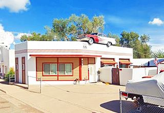
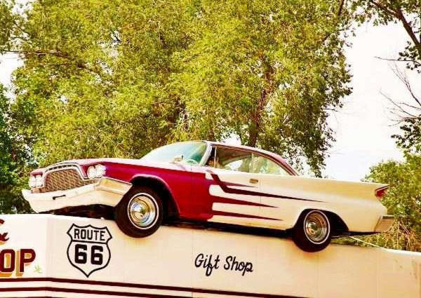
At 314 W Lewis Ave. Next to the old bar and brothel, on the northwest corner of Lewis and and 3rd St. is an old Texaco Station that was modernized in 1957 and now sports a Chrysler DeSoto Adventurer 1960 model car on its roof, and it is driven by Elvis!
It was restored in 2001 and turned into a Beauty Parlor and Barber Shop (now closed). The service station had an angled corner office, similar to Texaco's Teague Type B stations.
>> Learn all about the Teague-style Texaco service stations along Route 66
The DeSoto on the rooftop:
The Yavapai theater was located on the SW corner of Lewis and 3rd St., facing the Texaco, the post office stood next to it until it moved in 1960 to its present location on Park Ave.
Ash Fork Hollywood trivia "Crow Bar"
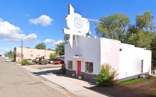
To the left of the Texaco is an old cafe with a whitewashed neon sign pictured below. It dates back to 1925 and was the Green Door Bar and was part of the 1992 movie Universal Soldier. Several scenes were shot in Ash Fork. A fictional motel (Lucky's motel court) was built and blown up during the filming. The "Crow Bar" (Green Door Bar) can be seen in the thumbnail image from the movie, its neon sign was great!.

Crow Bar scene still (Universal Soldier - 1992)
On the SW corner of Lewis and 4th at 401 Lewis is another historic sidewalk marker next to the 1922 Drug Store that survived the fires.
Arizona Cafe
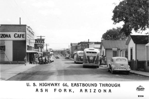
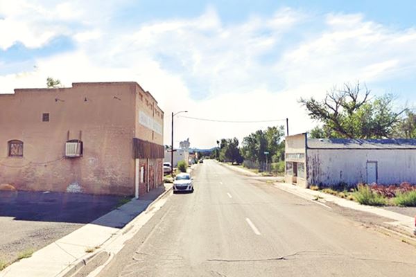
Facing it is the two story masonry building that was the Arizona Cafe and later te Northern Ariz. Commercial Co.; now it is the Emmanuel Trinity Methodist Church). Below is a Then and Now set of images, the cafe is on the left:
An "old" postcard looking east along Lewis Ave. in the 1940s
The same spot on Main Street, Ash Fork, nowadays
More buildings along Route 66

1930s view at Lewis and 5th. Source
Click image to enlarge
There was a Standard Oil station next to the Arizona cafe (now a vacant lot on the western side of the property); you can see its sign on the left side of the thumbnail image -click on it for full size photo. Across the street was White House Hotel (white building with verandah), greatly altered since its Route 66 days (389 W Lewis Ave.), the Arizona Hotel and 66 Café were torn down. Same view nowadays.
Escalante Memorial
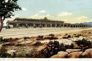
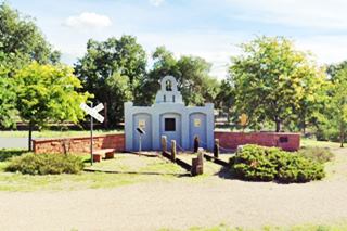
To your right is a small monument and marker that has a plaque recording the history of the town. The Escalante hotel, mentioned by Rittenhouse in 1946 was built as a railroad hotel and was part of the Harvey House hotels and restaurants. It closed in 1951 and was torn down in 1960 you can see the remains of its foundations just west of the monument (map).
Fernow's Texaco
Ahead, after the water tower, to your left is another former Texaco; the 1980 phone directory lists it as "Fernow's Texaco 8 and Park Ave". It is a 1970s stone building with a detached canopy and shingle mansard roof. The old sign towers over the property. The station had access from both east and westbound traffic.
Original Route 66 1926-50s
Turn left at 8th st. and follow it as it becomes Pine Ave. This was the original Route 66 until the 1950s. Drive along it for 0.3 miles (map with directions) to visit the Museum:
Ash Fork Maintenance Camp #1
Listed in the National Register of Historic Places
At 901 West Old Route 66. This was the road and highway maintenance camp that dates back to 1922 when the National Old Trails highway was built. It later took over the upkeep of Route 66.
Now it houses the Ash Fork Route 66 Museum & Tourist Center. The old warehouse s still standing. You can see historic Route 66 and Ash Fork photos and artifacts incuding a scale model of the old Escalante hotel.

Maintenance Camp in 1934. Source

Maintenance Camp nowadays. Source
Old Route 66 ends just ahead in a dead end. It was cut off by the newer alignment built in the 1950s, that extended Lewis Ave. westwards, and later by the Freeway. Retrace your steps back to Park Ave. and drive east to visit the remaining landmarks along the eastbound branch of U.S. Hwy 66 in Ash Fork.
Eastwards along Park Ave in Ash Fork
Eastbound US 66
Former McCoy's - Stage Coach Motel
At 823 W. Park Ave. to your right, between 8th and 7th Streets, it was built around 1939, and you can clearly make out the layout of the premises, a single story gable-roofed building with an L-shaped layout. The office and cafe on the corner and a parking area in between.
Richfield Station
On the south east corner of 6th at 487 W Park is a small paved parking area with an angled building in the back and a sign facing the traffic. This was a Richfield gas station that opened in 1954.
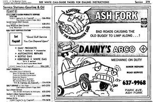
Danny's Arco
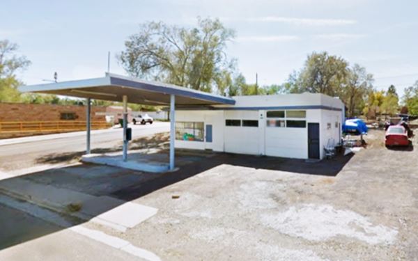
Ahead, on the corner of 5th St., on the right is the1950s Arco station with an oblong box shape, flat canopy and two service bays. The pump islands are empty.
A 1950s Arco filling station in Ash Fork
Oasis Lounge
Ahead, to your left at 346 W Park is the Oasis Lounge, a box-shaped stone faced tavern with a great vertical neon sign (Street view). And as you reach the end of Park Ave, to your right is an old abandoned truck stop, "Ted's" but it dates back to the 1980s.
West side of Ash Fork
Take a left and return along Lewis Ave to the fork at 8th Street. Continue straight along W Park Ave. To your left you will spot a motel, the former Nomad:
Nomad Motel
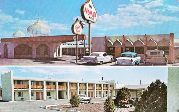
The postcard below, postmarked in 1964 tells us the following: "On U.S. Hwy 66 West Side of Ashfork Ariz. 26 modern refrigerated rooms, electric hear, free TV - telephone service in rooms, Coffee shop...." It was one of three, the other two were in Needles and Seligman (see Nomad Motel).
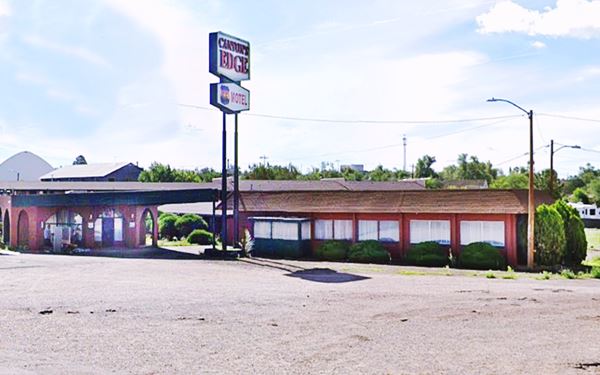
It is still open after operating under different names over the years (as "Ash Fork Inn" and now "Canyon's Edge").
>>You can Book a Room in this motel.
The motels had a distinctive Arabian decor, perhaps inspired in the Bedouin people, whose name means "desert nomad" in Arabic:
Now: without the Arabian touch!
Shamrock Station
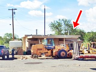
Next to the hotel, hidden behind flagstones and heavy machinery is another landmark, the Shamrock Station that dates back at least to 1958 (you can see it in this aerial photo taken in 1958 - right side of the image). It is fairly intact but hidden in plain sight. This aerial photograph shows another gas station (left side of the image), a Whiting Bros. station. The local phone directory tells us it was the station #94, West of Ash Fork.
You can also see it in the image below, opposite the Whiting Bros. station (above the motel, on the left side of the image).
Whiting Bros. station (Gone)
The 1990s image below shows the "Nomad", at that time Ash Fork Inn, on the lower left side of Route 66, the Sinclair above it (middle left), Picacho Bute in the distance and on the west side of the highway the old Whiting Bros Station
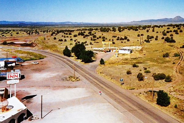
The place was torn down and a flagstone business is located on the property (StoneWorld Inc.), this is its Street view
Read more about Whiting Bros. & Route 66
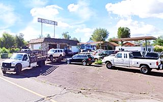
Ahead the original road curved west and is now overlaid by the freeway. On the south side of I-40 is a truck stop and a trading post mentioned in the 1980s phone directory: "Murphy's Chevron Station W of Ash Fork" and "Murphy's Towing Service 513 8 St. Ash Fork" now it also includes "Six Shooter Molly Trading Post". The 1950s phone directory mentions Ted Cowan's Chevron station on "Hiway 66" on the west side of Ash Fork, but we haven't been able to find it.
Continue your Road Trip
This marks the end of this leg of your Route 66 road trip, head west along Historic Route 66 and visit the next town on your journey: Seligman
Outdoors, National and State Parks
There are plenty of outdoor spots where you can enjoy nature close to Ash Fork, ride your mountain bike or hike.
Cathedral Caves
10 mi. south of the town along US 89. It was badly looted in the past and is now conserved by a NGO and closed to all except genuine speleologists. Read more at their website.
Beal Wagon Road
Russell's Tank
About 15 miles (24 km) north of Ash Fork is the historic "Beale Wagon Road", the first federally funded U.S. highway.
You can reach it via FR 142 and head to Russel's Tank where there is parking and an Interpretative Site.
Russel’s Tank provided cool fresh water and was a stop used by the pioneers heading west along Beale Road. You can picnic there. Map with directions from Ash Fork to Russel's Tank.

Russell's Tank c.1863

Bainbridge steel dam. Source
Ash Fork Bainbridge Steel Dam
Listed in the National Register of Historic Places
Designed and patented by Francis Bainbridge; it was the first large steel dam in the world. Built in 1898 it still holds water.
It has 24 3 ⁄ 8 inch-thick (9.5 mm) steel plates with a curved shape that give it structural strength. Its main steel section is 46 ft high and 184 ft long.
When it fills up, the dam spills over the steel crest. The lake contains over 36 million gallons of water.
Bike Tour
Check our this resource Historic Route 66 Mountain Bike Tour at the fs.usda.gov website.
The Grand Canyon Skywalk
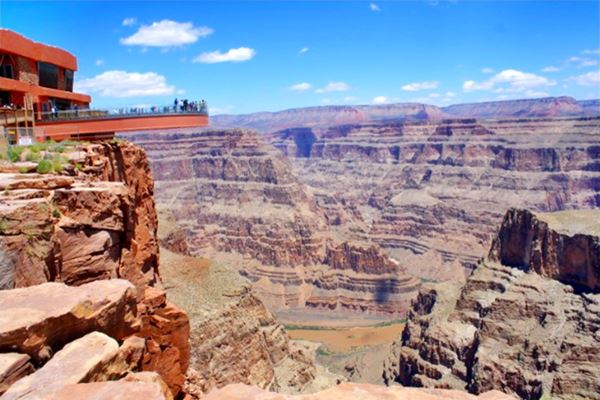
Opened in 2007 it is within the Hualapai Tribal land. It is a transparent horseshoe-shaped bridge that curves out and above the Grand Canyon 4,770 ft (1.450 m) above the Colorado River.
The best way to reach it is taking a tour as the roads are not in top conditions.
Read more at the Skywalk website.
Grand Canyon Skywalk
Some sponsored content
Lake Havasu City

Lake Havasu City, the lake and London Bridge. Source
The resort town of Lake Havasu City on Lake Havasu has beaches along the lake's scenic shoreline, an active nightlife and the original London bridge (you can take a Tour to visit it)
The adjacent state park is open 24 hs, and there is an entrance fee. It is located on a reservoir on the Colorado River. You can hike and enjoy the riverside.
Visit the scenic shoreline with beautiful beaches, nature trails, boat ramps, and many convenient campsites.
>> Book your Hotel in Lake Havasu City
Learn more about the outdoor sites in the Havasu State Park official website.
>> Book your Hotel in Ash Fork AZ


Credits
Banner image: Hackberry General Store, Hackberry, Arizona by Perla Eichenblat
Jack DeVere Rittenhouse, (1946). A Guide Book to Highway 66.


