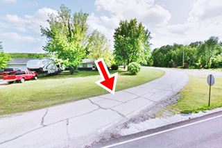
Mining Ghost Town
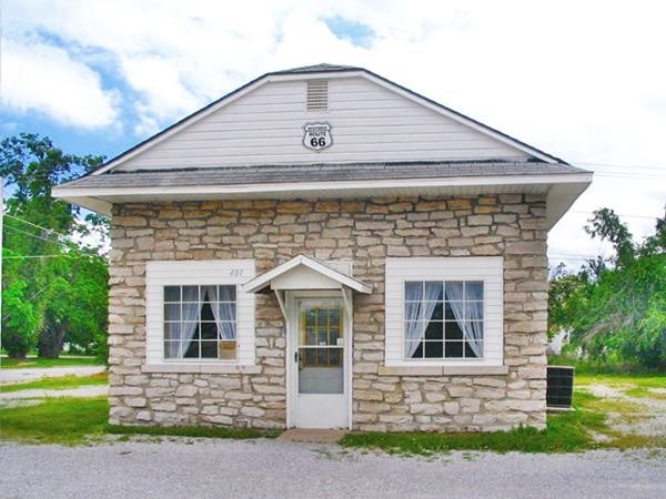
Old Rock Gas station in Carterville, Route 66
Index to this page
About Carterville Missouri
Facts, Trivia and useful information
Elevation: 984 ft (300 m). Population 1,891 (2010).
Time zone: Central (CST): UTC minus 6 hours. Summer (DST) CDT (UTC-5).
Carterville, is a small town located on Route 66 half way between Carthage and Webb City in Jasper County (Webb City and Carterville were known in the early 1900s as the Twin Cities), southwest Missouri very close to Kansas and Oklahoma.
Carterville's history
The western part of Missouri was peopled some 10,000 years ago. Around 700 BC, the Osage people reached the area, escaping from the warlike Iroquois, who forced them out of their homeland in the Ohio and Mississippi rivers.
French, coming from Canada explored the region (1682) and named it Louisiana after their King, Louis XIV. After passing to Spain from 1763 to 1800, Napoleon recovered it and sold it to the U.S. government in 1803. It was organized as the Missouri Territroy in 1812 and attained statehood in 1821.
The Osage, who had stood firm against the white settlers and other natives, signed a series of treaties in 1808, 1818 and 1825 reliquishing their land in exchange for new territory in a Reservation in Oklahoma.
In 1841 Jasper county was established and the town of Carthage became county seat the following year. At that time James Carter settled in Jasper in a farm.
During the American Civil War (early 1860s) Carthage was evacuated and razed in two different battles, it was then that Carter's son, James Gilbert Leroy Carter settled in his farm at Center Creek, 2 mi. north of what is now Carterville.
He sold 80 acres of land to W. A. Daugherty, T. Davey, C. Allen, and W. McMillan who formed the Carterville Mining and Smelting Co. in 1876.
The company set aside 30 acres for a town and the rest was sold to miners. The post office that opened that same year was named "Carterville".
The name: Carterville
Carter suggested the town be called Daughertyville after its W.A. Daugherty, who bought his land to found the town. But Daugherty declined because he believed it would be distorted into "Dirtyville", so he named it "Carterville" after Carter.
Carter is a surname derived from an occupation: he who transports goods by cart or wagon: "Carter".
This was at the time when lead and zinc had been found in neighboring Webb City (1873). Carterville also became a mining community and grew considerably, even bigger than Webb City.
The population was served by a trolley or treetcar linked it with the major cities in the area after 1893.
Lead and zinc mining boomed until the end of World War I in 1918 when richer mines in Oklahoma replaced those in Missouri. The town spiralled into decline.
Route 66 was aligned through Carterville in 1926, at that time it was already paved from the KS border to Carthage. Cars soon displaced the streetcar which was replaced by buses though it eventually closed in 1939.
Route 66 was bypassed by I-44 which opened in 1958 from Oklahoma City to Joplin and then headed east along US-166, south of Carterville, towards Springfield however Route 66 survived in Missouri until its decertification in 1978.

Where to Lodge in Carterville Missouri
Find your hotel room close to Carterville in neighboring Joplin or Carthage
> > Book your hotel in Carthage or Joplin
More Accommodation close to Carterville along Route 66
There are several hotels in the area close to this town. Alternatively you can also find your accommodation along Route 66 in the neighboring towns and cities in Missouri. We list them below (from east to west):
On Route 66's Main alignment in MO
Eastwards
Westwards
- Hotels in Kansas
- Baxter Springs KS
- Galena KS
- Riverton KS
- Hotels in Oklahoma
- Miami OK
>> Check out the RV campground in Joplin
Carterville’s Weather
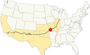
Location of Carterville on Route 66
The climate in Carterville is subtropical and wet; it has cool and dry winters and rainy summers (most rain falls from April to July, with frequent thunderstorms).
Averages rainfall is around 46.5 in per year (1.180 mm) and during winter some 11.9 in. of snow (30 cm) falls.
The winter (Jan) average high is 44.9°F (7.2°C). The average low is below freezing, with 25.0°F (-3.9deg;C). During summer (Jul) the average high is 90.6°F (32.6°C) with an average low of 69.° (21.1°).
Tornado risk
Carterville is located within the infamous "Tornado Alley" and Japer County has an average of 6 tornado strikes per year.
Tornado Risk: read more about Tornado Risk along Route66.
Map of Route 66 in Carterville
U.S. 66 alignments
1926 to 1958
All alignments between 1926 and 1958 crossed "downtown" Carterville along the alignment shown in this map.
In 1958 Missouri DOT map and the 1963 the USGS map of the area show that US 66 was realigned along what is now I-49 BL. Route 66 continued going through Carterville as BR 66 along Main St. (map of BR 66).

1956 Roadmap western Missouri. Source
Click for large size map
1958-78 Route 66 in Carterville and Webb City
In 1958 US 66 was realigned with US 71 along what is now I-49 BL, from Madison St. in Webb City, on the southern and western side of the town, and Carterville. See this 1958-78 alignment Webb City and Carterville.
The thumbnail shows a Shell Highway roadmap (click it to enlarge) published in 1956; you can follow Route 66 from Springfield to Joplin (on the left) through Carterville (it apperars as "Carterv." on the map).
After 1978 the Mother Road eastern terminus was moved from Chicago to Scotland, west of Joplin.
Route 66 Alignment near Carterville
Visit our pages, with old maps and plenty of information about US 66's alignments.
- Route 66 in Kansas (next)
- Springfield to Joplin (Carterville's)
- Rolla to Springfield (previous)
Route 66 Sights in Carterville
Carterville and its Route 66 attractions
Historic context: Classic Route 66
In 1946, Jack DeVere Rittenhouse rode along Route 66 and wrote his "A Guide Book to Highway 66" which gives us plenty of information about Route 66 during its heyday. Rittenhouse mentioned Carterville in his book.
garage; stores; no cabins or hotel... this former opulent mining center is now almost a ghost town, with its boarded-up stores, empty buildings, and general air of desolation Rittenhouse (1946)
He added that the collapse began when the lead and zinc mines closed after World War I in 1918. The town still has that "ghost town" air, with stark vacant red-brick buildings lining its Main Street.
We will begin our tour on the eastern side of Carterville, coming from Carthage on the western side of I-49BL.
The highway meanders as a narrow concrete strip between woods and a pleasant countryside.
Route 66 in the woods
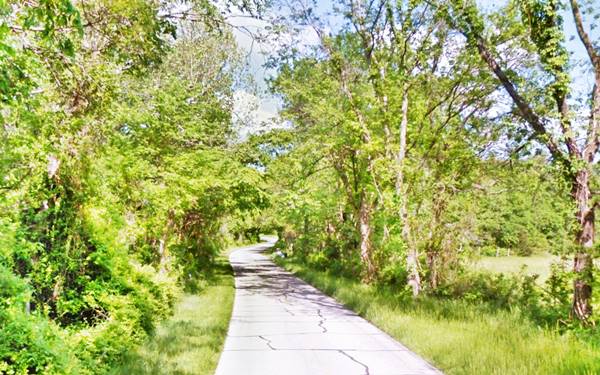
Three miles west of the freeway, Route 66 turns in a wide curve towards the south (left) onto North Pine St. and heads into Carterville.
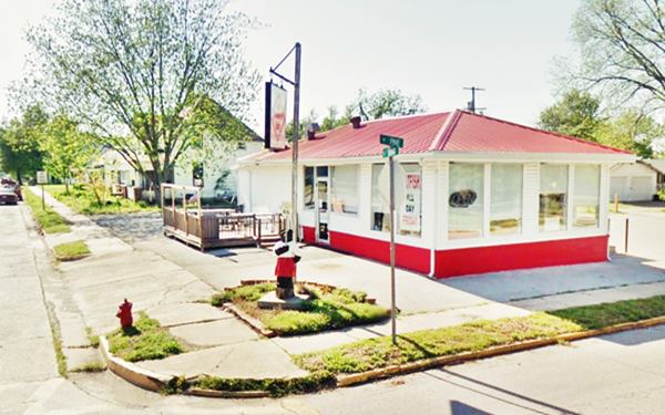
After 1.3 miles the highway reaches Main Street and turns right. Here, on the NW corner is a classic landmark from the 1930s.
Carterville Dairy Creme
At 328 E. Main St. Originally it was a gas station, built in the early 1930s on the very strategic junction on the eastern side of town.
Later it became a "Dairy Queen" Ice Cream Shop and the 1993 Architectural ⁄ Historic Survey of Route 66 in Missouri reports it is a "Dairy Creme".
It has since become the "Famos Grill Italian Smokehouse" Established in 2020.
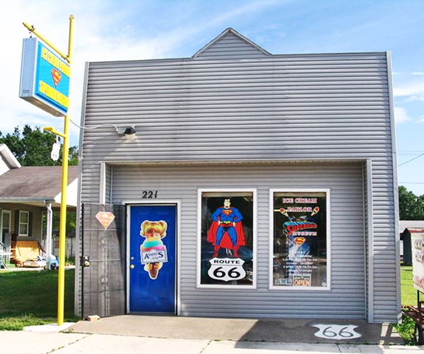
Head west along Main Street and just ahead, to your left, is the world famous "Superman museum".
SuperTAM on 66: Superman Museum & ice cream parlor
At 221 W Main St. Larry Tamminen opened the small museum in 2006 and named it "Superman on 66". However, he to rename it to avoid copyright infringement. He chose his surname's first three letters -TAM, and the place became "SuperTAM".
It is also an ice cream parlor. Over 2,600 Superman items are on exhibit at the museum, from posters to figurines, vintage toys, books, newspaper clippings and more.
Chris and Andrea Briley purchased it from Tamminen and took over in 2021. It is an ice cream parlor so don't miss the "Kryptonite Delight" or the "Superman" flavor which is colored red, blue and yellow (obviously).
SuperTAM "superman" museum and ice cream parlor
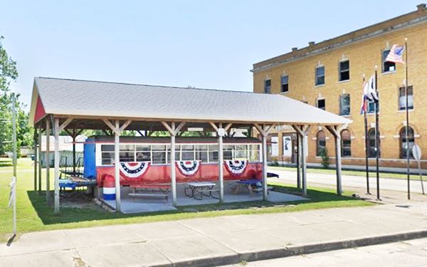
Streetcar
Next door, under a roof, is a former streetcar painted red and white, bears the number 66. It is a K-84 car, one of the most modern ones used on the electric streetcar network that linked 100,000 residents in the Tri-State area (Kansas, Oklahoma and Missouri) from 1893 to 1938.
The postcard from the early 1900s, further down, shows a streetcar and the two parallel sets of tracks running along Main Street.
Streetcar on Route 66, Carterville
Head west, and on the next corner, to your right is a classic three-story red-brick building.
Weeks Hardware Co. building
326 W. Main St., on the NW corner of N. Fountain St. The building's facade tells us it was built in 1900 (street view).
Weeks established his hardware company in the 1890s, and supplied hardware, spares and equipment to the local mines. It proclaimed itself as "The largest supply house in southwestern Missouri."
The three-story building has red-brick facade and a corner tower which at one time sported a pyramid hip roof on it (as you can see further down in the 1920s photo of the Old Rock service station); now it is boarded and vacant.
After the death, in 1915, of Amos Cass who was a partner in the company, mining fell into a depression (1918) and the hardware store closed.
It was partly repurposed and it accommodated a "drive-in" hotel, that allowed guests to use the freight elevator to park their cars on the second floor. This hotel coincided with the creation of Route 66 in 1926.
Later it was owned by cabinet manufacturer Morton Booth Co. You can see it in the "Then and Now" images below, looking east along Main Street, on the left side of the images.
Carterville in a early 1900s postcard looking east along Main St. by the Weeks Hardware Co. building
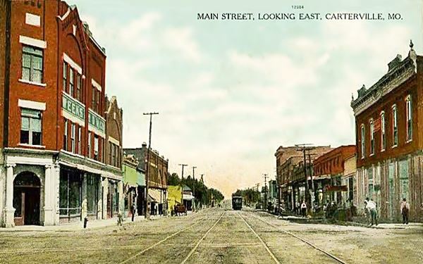
The streetcar no longer runs, the road is now paved, and many buildings have gone. But basically the Weeks Building is still the same.
Carterville today, the same spot as the one shown in the postcard above.
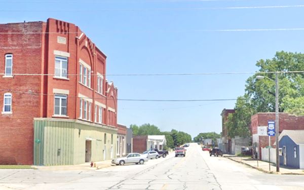
Diagonally across Route 66, on the SW corner of S. Fountain and Main is a classic Route 66 service station:
Old Rock Filling Station
At 401 W. Main St. In the image below we the Sinclair service station being built in the 1920s-30s. Behind it is the Weeks Hardware Co. building which then had its pyramid hip roof on the corner tower. The image is captioned "C. P. Elkins standing in front of the Sinclair Station during its construction."
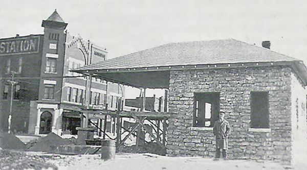
The photo shows that, the service station's roof continued forward, and became the canopy over the pumps as was the style of those early Sinclair stations.
Later, as you can see in the following image during the 1950s it sold Hudson brand gasoline and had three pumps in front of the building with no canopy over it. The original canopy area had been closed in to enlarge the office.
You can actually see this modification if you look at the building carefully, the former canopy is enclosed by walls with stones that have a different tone of white.
Nowadays it is a visitor center (pictured at the top of this page).
Selling Hudson branded gasoline c.1950s
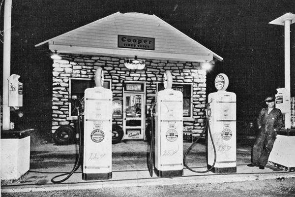
Hudson Gasoline
Mary Hudson (1912-1999) founded Hudson Oil in 1933 when she bought her first gas station in Kansas City. She became a Forbes listed millinoaire as she grew it to an empire with 300 stations across 35 states and lost it all during the oil crisis in the early 1980s, filing for bankruptcy in 1984.
Comets on Route 66 Park
The park is located on the north side of Main Street, facing the Rock gas station.
The Comets were the local high school's team, but when Carterville School District merged into Webb City's in 1968, the Comets ceased to exist and Webb City's Cardinals took their place.
The park is a spot where you can relax, stop for a picnic and enjoy the pavilion.
Main Street Garage
Facing Rock station, on the NW corner of Main and Fountain you can see the remains (concrete parking area, foundations of office, and gas pumps) of the Main Street Station and Garage, also known as P & T Auto Sales.
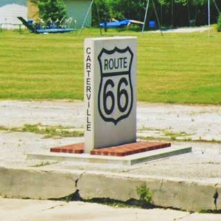
Marker
There is a stone marker on that spot, with Route 66 shields and the town's name on it. Just a few feet to the left is the park's steel arch gateway.
Ahead istop at the Used car lot:
Bulger's Used Car Lot
520 W Main St.
The Bulger's have been selling used cars since the late 1940s, and here are many classic trucks and cars. Do stop for a photo.
It has a "Cars movie" look to it. Just ahead, Route 66 curves in a wide "S" and heads towards Webb City where you can continue your Route 66 roadtrip.
Your city tour of Carterville ends here.

Some sponsored content
> > Book your Hotel in Lebanon

Credits
Banner image: Hackberry General Store, Hackberry, Arizona by Perla Eichenblat
Architectural - Historic Survey of Route 66 in Missouri, Maura Johnson. 1993.
Franck Hicks (2021), Preserved Traction
Jack DeVere Rittenhouse, (1946). A Guide Book to Highway 66


