Small Hamlet on Missouri's Route 66
Index to this page
About Plew Missouri
Facts, Trivia and useful information
Elevation: 1,161 ft (354 m). Population n⁄a (2010).
Time zone: Central (CST): UTC minus 6 hours. Summer (DST) CDT (UTC-5).
Plew is a small scattered community located along Old Route 66 in Lawrence County, in southwestern Missouri.
History of Plew
Learn more about the history of this region in our Carthage Missouri page.
The name: Plew
Plew is apparently named after its first settler ca. 1830s. Plew is a northern Enlgand deformation of Plow which in turn is a nickname and sign-name derived from old Norse plóg-r (plough).
The county created in 1845 was named after James Lawrence a seaman from the English-American War of 1812.
The unincorporated community in a rural farming area and had a post office from 1893 to 1904. Nowadays it is a scattering of houses.
Route 66 was aligned through the area in 1926 and travel along the U.S. 66 gave some boost to the local economies during the Depression in the 1930s. But this disappeared after the town and Route 66 were bypassed by I-44, which had opened in 1958 between Joplin and Oklahoma City, and then went east along what used to be US-166, south of Plew towards Springfield.

Where to Lodge in Plew, Missouri
Lodging close to Plew, the closest town with accommodation is Carthage
> > Book your hotel in neighboring Carthage
More Lodging near Plew along Route 66
Find more Motels and Hotels close to Plew along Route 66.
There are several hotels in the area close to this town. Alternatively you can also find your accommodation along Route 66 in the neighboring towns and cities in Missouri. We list them below (from east to west):
On Route 66's Main alignment in MO
Eastwards
Westwards
- Hotels in Kansas
- Baxter Springs KS
- Galena KS
- Riverton KS
- Hotels in Oklahoma
- Miami OK
>> Check out the RV campgrounds in nearby Carthage
Weather in Plew
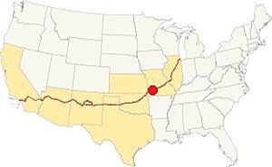
Location of Plew. on Route 66
Plew has a humid and subtropical climate. Winters are cold and dry. Summers are wet, and the rainy season lasts from April to July. Expect thunderstorms.
Yearly average rainfall is around 46.5 in (1.180 mm), and during winter 11.9 in. of snow (30 cm) falls in Plew.
The winter (Jan) average high is 44.9°F (7.2°C) and the average low falls below freezing: 25.0°F (-3.9deg;C). The summer (Jul) average high is 90.6°F (32.6°C) and the average low is 69.° (21.1°).
Tornado risk
Plew is located within the "Tornado Alley"; Lawrence County has around 8 tornado strikes per year.
Tornado Risk: read more about Tornado Risk along Route 66.
Map of Route 66 in Plew
Driving westwards from Paris Springs and Spencer, Route 66 has a clear east-to-west alignment for over 30 miles. It goes through small villages and hamlets, including Plew. See this map of this section.
Route 66 Alignment near Plew
Visit our pages, with old maps and plenty of information about US 66's alignments.
- Route 66 in Kansas (next)
- Springfield to Joplin (Plew's)
- Rolla to Springfield (previous)
Route 66 Sights in Plew
Landmarks and Places to See
Plew is a small tiny scattering of houses, not even a village.
Historic context, the classic Route 66 in Plew
In his 1946 book "A Guide Book to Highway 66" Jack DeVere Rittenhouse gives us a clear picture of Route 66 was like during that time, yet he does not mention Plew, only the two camps, or resorts with cabins built of logs and stone that had service stations and cafes. And some gas stations, we will see what is left of them below.
Tour the route 66 landmarks in Plew
Gas stations, gone
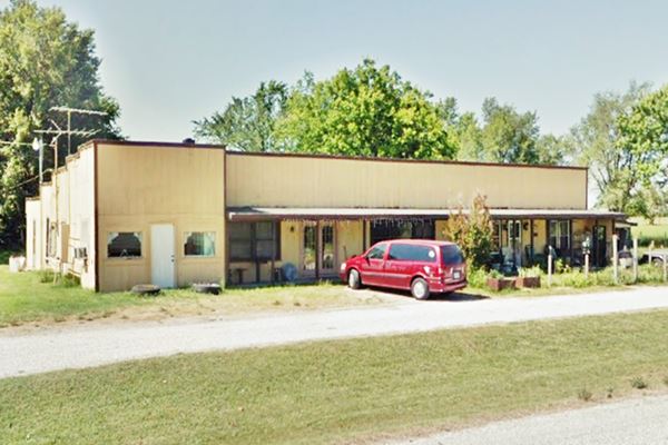
We will tour Plew from east to west, coming from Resuce and heading towards Avilla. Rittenhouse mentions "... More gas stations" 3 miles west of Rescue. This places them at the intersection of Lawrence 1010 and Route 66. There was a building on the south side of the highway, but it has been torn down to make space for "Trimline Barns". The building is shown below before it was razed.
Old gas station, now gone, on the south side of Route 66 in Plew Missouri
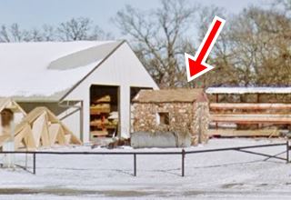
Facing it, to your right, on the north side of the highway, are the ruins of another station (pictured below, marked with red arrow).
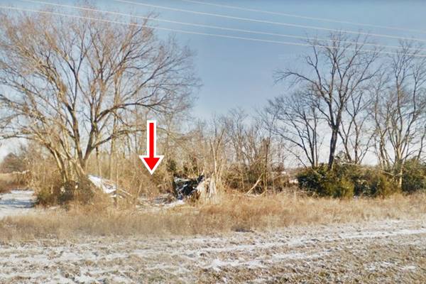
This point is where "Plew" is located, as you can see, it isn't a village or town, just some homes and farms. Nothing else.
Biblical billboards
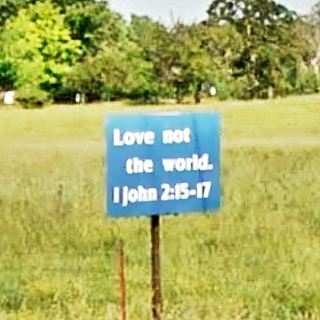
As you drive west, you will notice billboards with a strong Biblical content on both sides of the highway. This one is white sign with bold black words (street view) that quotes Romans 14:11 on one side and Matthew 11:29 on the other.
Ahead, to your right, is another long sequence of signs in a Burma Shave sequence urging repentance. It has different texts, for those heading west and east.
Below is one of these sequences, each line is a billboard, and together they all convey the message:
"Are you a servant to hatred?"
(street view)
"Cuss words, anger, lust, immodest dress"
(street view)
"Immoral acts, gambling, smoking, drinking, lying"
(street view)
"No man can serve two masters. Matthew 6:24"
(street view)
"Serve Satan here - burn with Satan hereafter"
(street view)
"Lake of fire! Torment forever! Repent NOW!"
(street view)
Log City Camp
Continue westwards where Rittenhouse places another two tourist complexes, he describes them as follows:
LOG CITY. Like STONE CITY... is a popular resort with cabins frequented by vacationists for week-ends or longer. Buildings are of stone and logs. Gas stations, store and cafes Rittenhouse (1946)
Log City comes first, 4 miles west of Rescue, at County Ln 6 and Route 66, to your left, on the south side of the highway.
Established in 1926, by Carl Stansbury. By 1938 it had a service station a cafe, diner, liquor store, and fourteen cabins with bathtubs. After I-44 bypassed Route 66 in the late 1960s, they had less visitors and eventually closed.
More recently the former service station was reformed and converted into an auto body shop.
The postcard reads "cottage at Log City camp by highway 66."
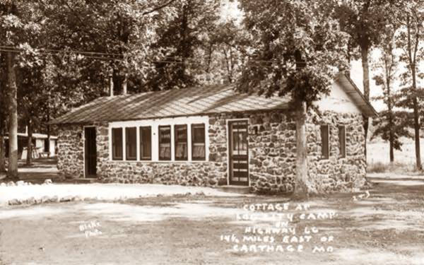
Current view of a cabin in former Log City, the same building, the windows at each tip have been blocked, but the other four are still there.
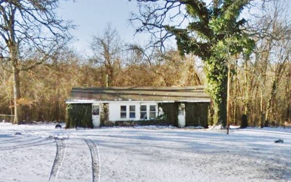
But the main service station has gone, it has been replaced by a modern building, below is a "Then and Now" sequence.

Log City vintage postcard Plew MO; Source
Forest Park Camp - Gone
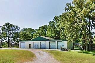
This competitor of Log City, opened in 1928, right across the highway from Log City Camp. It had ten rock cabins, café and restaurant. It too declined and now no trace remains, a large warehouse occupies the premises.
According to Rittenhouse, one mile further west was "Stone City" (5 miles west of Rescue), but nothing remains of them; the image shows the last cabin, torn down in 2018.
Your "City Tour" of Plew ends here. Head west and continue your road trip by visiting neighboring Avilla.

Some sponsored content
> > Book your Hotel in Lebanon

Credits
Banner image: Hackberry General Store, Hackberry, Arizona by Perla Eichenblat
Jack DeVere Rittenhouse, (1946). A Guide Book to Highway 66
Architectural - Historic Survey of Route 66 in Missouri, Maura Johnson. 1993.
Route 66 in Missouri, NPS. 2008


