Home of "The Blue Whale"
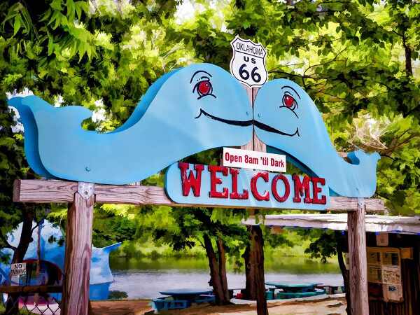
Entrance to the Park "kissing blue whales"
Index to this page
- About Catoosa
- Weather
- Hotels near Catoosa
- Map of US 66 through the town
- What to see and do in Catoosa
About Catoosa, Oklahoma
Facts, Trivia and useful information
Elevation: 623 ft. (190 m). Population: 7,151 (2010).
Time zone: Central (CST): UTC minus 6 hours. Summer (DST) CDT (UTC-5).
A small town, in the Metro area of Tulsa, spanning Wagoner and Rogers Counties in northeastern Oklahoma. Its motto is: "It Just Feels Good".
The Big Blue Whale, Catoosa
Catoosa's History
Learn more about the region's history in our Claremore, History webpage
During the late 1700s, French fur traders explored the Arkansas River and reached a river that they named Verdigris (from the French words for "green" and "gray"). At that time, this area was part of the French Louisiana.
After the US purchase of Louisiana in 1803, it remained a remote area and was designated as Indian Territory, for the relocation of Native Americans, removed from their tribal lands in the East. The Cherokee Nation was assigned this territory and they settled it.
Fort Spunky (1860s)
A fortified farmhouse on the south side of Route 66, next to Spunky Creek, was used in the mid 1860s by the Union forces. It was a mail and stage coach station on the Star Mail route through this area before the arrival of the railroad.
Spunky
Someone who is courageous and determined. A good name for a Fort!
After the American Civil War, a post office was erected there, and its first postmaster was Will Rogers' uncle, John Gunther Schrimsher (1835 - 1905).
Some ruins are still visible: the framework and the stone chimney of the original building remain.
The Name Catoosa
Catoosa is named after the "Old Catoos", a rounded hill just west of the town (read more below). It is a deformation of the Cherokee expression "Gi-tu-zi" which means "Here live the People of the Light", a native clan that lived on the hill.
There is a historic marker (street view) located half a mile north of the town, at the entrance to the Big Blue Whale Park by the flag pole, it reads: "Old Mail Route - About 1/2 mile SW is the site of Fort Spunky, a relay station on The Old Star Mail between St. Louis and California. After the war between the states, Catoosa was founded as the post with John Gunter Schrimsher (1835-1905) an uncle of Will Rogers as post-master. Erected as a public service by Mr. and Mrs. Carl R. Mathews - Will Rogers Memorial Highway"
A small rural community grew along the stage coach route. And the rails of the St. Louis - San Francisco Railway reached Catoosa in 1882. And it became a point for shipping cattle to St. Louis. William Halsell established a Ranch at Bird Creek and in 1883 a post office opened at Catoosa.
Farming, coal mining boosted growth, and in 1926, Route 66 was aligned through the town and re-aligned in 1936 to its current location (now it is Oklahoma highway 66). In 1957 Interstate I-44 opened, and bypassed the town.

Where to Stay; Accommodation
There are several hotels in Catoosa so you can lodge here:
> > Book your Motel or Hotel in Catoosa
More Lodging Near Catoosa
There are several hotels in the area close to this town. Alternatively you can also find your accommodation along Route 66 in the neighboring towns and cities. We list them below (listed from east to west):
On Route 66's Main alignment
Eastwards
Westwards
>> There are several RV campgrounds in the Tulsa - Claremore - Catoosa area.
Catoosa’s Weather

Location of Catoosa on Route 66
The average high temperature in January is 48°F and the low is 27.5°F (8.9 and -2.5°C). In July the average high and low temperatures are 93.1 and 71.3°F (33.9 and 21.8°C).
Rainfall is 41 inches per year (1.041 mm) with most rain falling during May, June and Sept. There are 93 rainy days a year.
Snow: 9.6 in. (24.3 cm) per year, between Nov. and March, the record: 29.6 inches in on e year.
Tornados
Tornado Risk: Catoosa lies within the "Tornado Alley in Oklahoma and experiences some 10 Tornado watches every year.
Read more about: the risk of Tornadoes on Route66.
Map of Route 66 in Catoosa, Oklahoma

1954 US66 map in Catoosa Oklahoma
Map with the alignment of Route 66 through Catoosa
The original alignment in 1926 and until 1942 followed this alignment (map). Then it was realigned along the eastern side of the town (map), and after 1957, it was made straighter (map).
The image inset shows a USGS map with Route 66 published in 1954 (before I-44 was built).
Route 66 Alignment near Catoosa
Visit our pages with old maps and plenty of information of the old US 66 roadway.
- Tulsa to Chandler (next)
- Vinita to Tulsa (Catoosa's)
- KS-OK state line to Vinita (previous)
Route 66 landmarks & attractions
Sights in Catoosa
- City Tour. Read on below
- State Parks
Catoosa's Attractions
Jack DeVere Rittenhouse described Catoosa in his "Guide Book to Highway 66", published in 1946 after he drove the Mother Road from Chicago to Los Angeles.
The hamlet of CATOOSA... lies about one-half mile west of US66 here. Jack DeVere Rittenhouse, 1946
We will start our City Tour of Catoosa on its eastern side, after crossing the Verdigris River bridge, pictured below (we describe them in our Verdigris webpage).
The image shows (upper right side) some spans of the 1936 bridge.
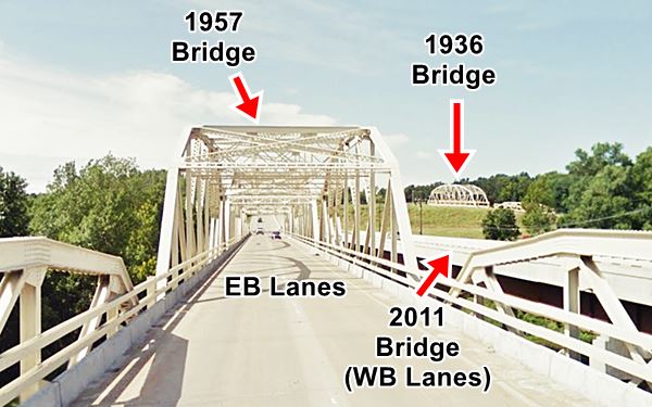
Molly's Landing and the 1936 bridge
After crossing the river, turn right along N Old Hwy 66. This is the original 1926-36 Route 66 that crossed the river north of this spot along a bridge built in 1925, replaced by a wider one in 1936 on the current Route 66-OK-66 alignment.
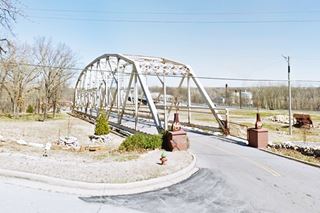
To your right is the entrance to a local restaurant, and its entrance is highlighted by two spans removed from the 1936 bridge when it was dismantled and replaced by a new one in 2011.
Head west along OK-66 to visit the famous "Blue Whale."
The Blue Whale of Catoosa
To your right, at 2680 OK-66, Catoosa. Their motto was "Makin' waves in Catoosa, Oklahoma since 1972"
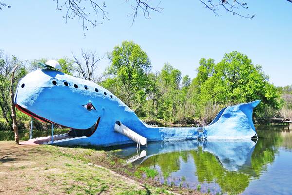
The Blue Whale was built by Hugh S. Davis. And is the most famous landmark along Route 66 in Catoosa. His property had a pond where, after his retirement in the late 1960s, he decided to build a "fish". The fish became a whale and it was a big one too.

The Blue Whale under construction, 1970, Source

The Blue Whale inner view, Source
With the help of a friend, Harold Thomas, he made an iron framework for the body, 80 ft. long and 20 ft. tall and covered it with cement. The making of the whale took 2 years, and was completed in July 1972. People would come and swim in the pond and slide off the whale's tail.
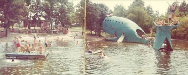
The Blue Whale closed in 1988 and Davis passed away in 1990. It is now owned by Dee Dee (Davis) Belt and her husband. And was refurbished in 1997 by the Catoosa Chamber of Commerce.
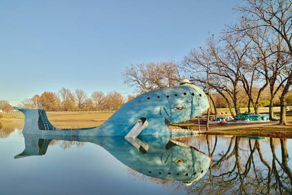
The Park's brochure included some "Facts"; the whale required plenty of material. Below are some of them
- 2,650 ft. sucker rod
- 126 bags of concrete mix
- 2,454 linear ft. wood
- 100 hours of welding and 2,920 hours of labor
- 15 tons of sand
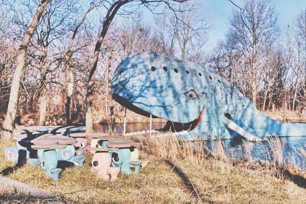
The following picture shows the spot in 1995, notice the pink and blue whale-shaped seats and tables on the shore.
Blue Whale Trivia
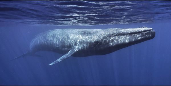
The blue whale is the largest animal that has lived on earth, a male can measure 95 ft. long (29 m) and weigh 330,000 lb (150 MT). They live up to 90 years. A calf weighs as much as an adult African elefant! Hunted almost to extinction, only 10 to 25,000 remain in the oceans.
There have been other "Blue Whales", much smaller ones, built in resin and fiberglass across the US in the 1960s and they appeared in postcards: Oakland CA, Rapid City SD, and Canton OH are some of them.
Across Route 66, to your left is the old Trading Post.
Arrowood Trading Post
2700 E0570 Rd. (Old Route 66) that runs on the store's eastern side.
Arrowood is a Cherokee surname, and this is a genuine indian trading post. It was opened by Chief Wolfe Robe Hunt, who operated it with his wife, Glenal.
They originally had a store in Tulsa, which they opened in 1936, and made a living selling Native American crafts. They opened a second shop in Catoosa (Catoosa Trading Post) and added pottery and jewelry to the Osage beadwork.
The store faced the "old" 1920s alignment of Route 66 as you can see in the following image that looks towards the NW from Old Route 66 (same view nowadays).

Catoosa Arrowood Store
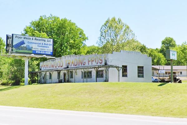
Trading posts were popular in the 1940s and 50s, as they offered "exotic" Indian curios and Western handicrafts to city-dwelling tourists.
When the Interstate opened in late 1950s, the Chief closed his Tulsa store and focused on the Catoosa one, which was closer to the Turner Turnpike. He took his brother-in-law, Hugh Davis as a partner (Davis built the Blue Whale across the road) and expanded the store to include a cafe and a service station. They named it "Catoosa Indian Trading Post".
Chief Wolfe Robe Hunt bought out his partner but, after his death, the store closed. It was reopened in 1990 by Dave and Pam Jennings renamed as the "Arrowood Trading Post". It closed in the late 1990s. Now it is a car repair shop.
Drive along Ford St. into the downtown area, no Route 66 lanmdarks have survived the ravages of time and "progress" but there is a museum as you turn left, facing the Police station.
Catoosa's Historical Museum
At 207 S. Cherokee (the old Route 66 alignment before it became a four-lane highway). It has a replica of an old train depot with exhibits of Catoosa's past. Vist the caboose outside of the museum (street view).
Continue along the original 1926 alignment. When you reach E Pine St. on the south side of town, take a right to visit the other museum.
The D.W. Correll Museum
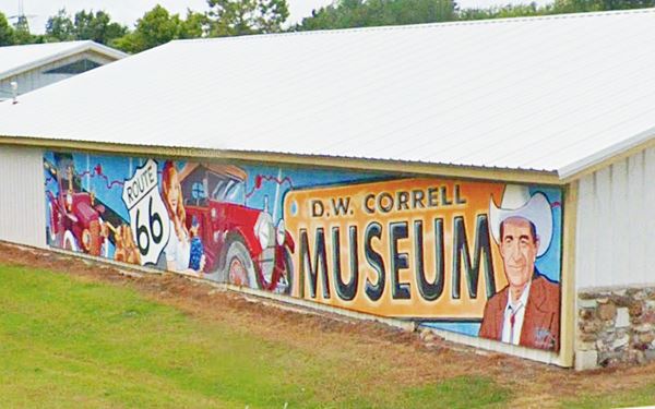
To your left at 19934 East Pine Street. It has a display of rocks, gems, and sea shells; vintage whiskey bottles and antique cars from the early 1900s, an 1898 steam engine car and also an antique toy car collection.
The 72-foot wide mural pictured below, by Lance Hunter, is painted on the main building.
Ahead, 0.3 mi. west, to your left is Duck Cemetery.
Blue Duck or Bluford Duck, (1858 - 1895)
An Old West, Cherokee Indian outlaw. He was condemned to death in 1886 for the murder of a farmer named Samuel Wyrick. After appeal he was given life in prison but pardoned in 1895 by President Cleveland. He died shortly after, of tuberculosis.
Visit his tomb: Section D, Grave 4, Dick Duck Cemetery.
Retrace your steps to Route 66, turn right and continue towards Tulsa. Ahead is an original 1939 bridge on US 66, just south of E Pine St. shown below. A 2-span Concrete slab fridge.

Lookout Mountain
You can see it to your right, to the west (map). Rittenhouse mentioned it as "Lookout Mountain", it "lies off US66 a short distance... low, rounded... hardly more than a hill. Formerly an Indian vantage point"; this is the "mountain" that gave the town its name.
You can see the indian lookout. In the maps it figures as "Indian Hills" and their highest point is 870 ft (Route 66's altitude is 635 ft), so it makes a good lookout over the relatively flat surroundings. See its street view. Now it is inside the Links of the Cherokee Hills Golf Club, the north west at the intersection of Route 66 and N 193rd E Ave.
The Indians had built a stone cairn on its summit probably as a trail marker. Now a Casino operates next to it.
The Hard Rock Casino
Operated by the Cherokee Nation, is a resort with two hotels, restaurants and a golf course.
It is the venue of the annual Cherokee Art Market and the International Cherokee Film Festival.
This marks the end of your Catoosa City Tour along Route 66. You can head west and visit the next town on the Mother Road: Tulsa.

Natural Attractions
Outdoors & State Parks
Redbud Valley Nature Preserve
North 161st East Avenue, 3.8 miles north of I-44 (Exit #237 is 161st East Ave.) See this map with directions.
Managed by Nature conservancy and Oxley Nature Center, it preserves plants and animals unique to this area. Ideal for hiking and watching birds and animals. Restrooms, picnic tables and drinking water are available. Admission is Free.
Some sponsored content
>> Book your Hotel in Tulsa

Credits
Banner image: Hackberry General Store, Hackberry, Arizona by Perla Eichenblat
Jack DeVere Rittenhouse, (1946). A Guide Book to Highway 66.
Phil and Pete Payette, Oklahoma, American Forts.
BlueWhaleRoute66.com the official website.


