
Index to this page
Route 66 from Vinita To Tulsa OK
Oklahoma Route 66 Itinerary and maps
Each leg of Route 66 described below has an interactive map and many image maps so you can follow the alignments of the highway along the way:
- KS-OK state line to Vinita - map of this segment
- Vinita to Tulsa - Map of this segment
- Tulsa to Chandler - Map of this segment
- Chandler to Yukon - Map of this segment
- Yukon to Clinton - Map of this segment
- Clinton to Texola - Map of this segment
Texas, next leg
Kansas, previous leg
Historic Route 66 Vinita to Tulsa
Background on Historic Route 66

1948 Shell Roadmap northeast Oklahoma
Click on map to enlarge
Source
The thumbnail map (click it to enlarge) is a Shell Highway map published in 1948; you can follow U.S. Highway 66 from Galena KS (upper right) to Claremore OK (lower left), Vinita, the starting point of this leg of Route 66 is in the middle.
Below is a map that predates Route 66 by two years.
It was published in 1924 and it shows the car-worthy roads or "Auto Trails" that existed before the US Highway system was created in 1926.
Vinita is in the middle of the map, along highway "50", meaning the "Ozark Trails", it would become Route 66 in 1926; you can follow it from Vinita to Tulsa OK (on the lower right left corner).


From Vinita to Tulsa
Vinita, starting point of this leg
We will start on the eastern side of Vinita after crossing I-44, and head west. The original 1926 alignment and successive ones used this alignment. It was paved in Portland cement in 1933 all the way to the Rogers County line west of Vinita.
See this map with US 66 alignment in Vinita

On the south side of Vinita there is a remaining segment of the 1926 alignment, bypassed when US66 was paved in 1933. Here Wilson St. takes a curve towards the west, and to your left (map with directions) is the first alignment of US 66.
>> green line in our custom map is the 1926 US66 in Vinita.
The Oklahoma DOT map of Vinita says that the Wilson St - Euclid St. are the "probable historic alignment (unverified)" they also point out a "Concrete Foundation" on the curve. The USGS map published in 1913, well before Route 66 was created, shows how Euclid St. (running east to west - left to right) meets Scraper St - S 4400Rd (running north to south - top to bottom). We marked the point with a red circle. You can also see Wilson St. with a NE-SW angled course from the upper right to the lower left.
You can see a black dot at the intersection; this is the "concrete foundation" mentioned by OK DOT. It was probably a gas station or the remains of "De Luxe Courts" with modern cabins and a gas station located 0.5 mi. south of the town.
Sharp curves like this one were dangerous and that is why the 1930s US 66 was moved to its present alignment, with a long soft curve.

1913 USGS map of Vinita

Concrete Foundations by Route 66 Vinita. Click for St. View
West of this point the highway has an east-to-west course that was upgraded to four-lanes in the 1960s (it also carried US 60 and US 69). But after US 60 forks to the NW, Route 66 becomes a 2-lane highway once again and curves with a SW direction into White Oak.
>> pale blue line in our custom map is US66 from Vinita to White Oak
White Oak

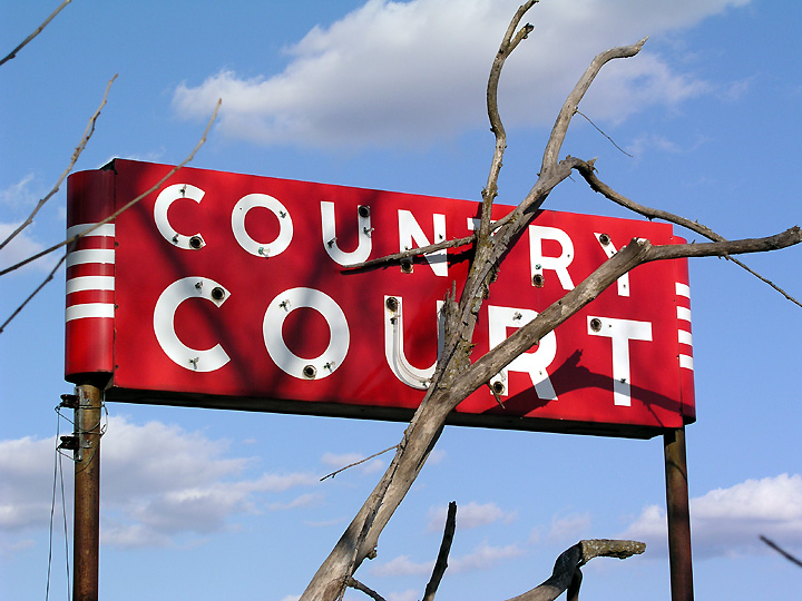
Neon Sign Country Court between White Oak and Chelsea, Source
Route 66 was paved here in 1933 and followed the 1926 alignment. The highway through White Oak is a two-lane roadway, and the four-lane alignment (paved in the 1960s) begins again west of the Rogers county line.
Chelsea
Craig County is followed by Rogers Co. and the segment west of the county line had been paved in 1931. And improved to a 4-lane alignment in the 1960s; the westbound lanes are the original roadway.
Head west towards Chelsea.
>> yellow line in our custom map is the 1926-60 White Oak to Chelsea alignment.
There are three alignments across Chelsea/p>
- 1926-29 alignment (red line in custom map). Just before you reach Pryor Creek, take a left, and head south along S 2460 Road, it soon reaches Pryor Creek, and crosses the "Historic Bridge" (more on it below), then it went along E 1st, took a left onto Cherry St. (now it has a zig-zag here as Cherry is cut off from E 1st.) and then right along E 6th to Walnut St (now OK-66), where it turned left to leave town.
- 1929-32 alignment (blue line in custom map). The road kept along E 1st St to Walnut, and turned south.
- After 1932 (pale blue line in custom map). It follows what is now OK-66 curving southwards along Chelsea's "Main" Street, Walnut Avenue.
>> red, blue and pale blue line in our custom map are the Chelsea alignments.
Historic Pryor Creek Bridge - Chelsea
Listed in the National Register of Historic Places
At S 2460 Rd. (E 1st St.) and Pryor Creek. This bridge is 1⁄4 mile east of the town and it was built in 1926 to carry Route 66 across the stream.
Historic Pryor Creek Bridge, Chelsea, Oklahoma

It has one single span, a modified Pratt Through Truss bridge (a bridge that has beams bracing it above the roadway). It is 123 ft. long and 19 feet wide.
Bushyhead
Route 66 heads towards Bushyhead, along the westbound lanes of the 1960s four-lane US highway 66, now Oklahoma Hwy. 66. It runs with a NW-SW course.

>> violet line in our custom map is the Chelsea-Bushyhead to Foyil 1926-60 US66.
Foyil
The road reaches Foyil, where there are three alignments.
Restored Texaco gas station on US66 in Foyil


Map of US 66 in Foyil. Click image to enlarge
The thumbnail map (click on it for a large sized map) shows these different alignments of Route 66 through Foyil. The red arrows on the top, show Foyil's 1926 to 1962 US66. Then it goes through the town, and meets the later four-lane alignment built in 1962 on the south side of Foyil.
East and west of Foyil, the original alignment is now under the 1962 westbound lanes. The 1962 4-lane road bypassed the town along its western flank.
The curved section in the map marked with a blue arrow is, according to the Oklahoma Dept. of Transportation, possibly the original 1926-31 alignment in Foyil. The red arrows along the curve mark the section originally paved in 1931 with Portland cement, south of the town.
1931 Alignment in Foyil

Original US66 from 1931, Foyil. Click for St. View
This 0.7 mile-long stretch of Route 66 begins at E 3rd St. and ends next to its intersection with the four-lane Route 66 built in 1962 (pale blue line in custom map). (red line in custom map)
It is a narrow two lane road, paved with Portland concrete. Until then, the 1926-32 highway had a dirt surface (orange line in custom map). Route 66 curved through Foyil, and you can still see its SW tip, where it is cut off by the eastbound lanes of the later US66 alignment.
>> orange, red and pale blue lines in our custom map show 1926-31, 1932-62 and post-1962 alignments in Foyil
Through Sequoyah
The highway continues west, following the westbound lanes of modern OK-66, passing through Sequoyah and reaching Claremore. This alignment was the original 1926 one, paved in 1931 from Chelesea to Claremore.
>> pale blue line in our custom map is 1926-60s US66 Foyil to Claremore.
Route 66 from Claremore to Tulsa
> > Book your hotel in Claremore
Claremore alignments
The thumbnail below shows a Shell Highway map (click on it for full size map) that dates back to 1948. Claremore is on the upper right corner, and Tulsa on the lower left.
There are two alignments in town:
1926- 58 alignment. Route 66 was a dirt road when it was created in 1926. It entered the town along J. M. Davis parallel to the railroad and remained there until 1958.
>> pink line in our custom map is the 1926-58 US66 in Claremore.
After 1958. In July of 1958 US66 was moved one block to the east, along what is now Lynn Riggs Blvd. a wide avenue that linked to the four lane aligment.
>> yellow line in our custom map is the Clarmore US66 after 1958.

1948 Shell Roadmap Claremore-Tulsa
Click on map to enlarge
Source

Old roadbed 1926-58, Claremore. Click for Street view
Above you can see the southern tip of the original 1926-58 alignment in the grass (red arrow), to the east (blue arrow) is the new 1958 roadbed.
West of Claremore, the highway was paved in 1930 for 4.2 miles, and met the next segment to Verdigris, which had been paved in Portland cement in 1926. The whole alignment between Claremore and Tulsa County line was upgraded to 4-lanes in 1957. Route 66 follows the westbound ones.
Verdigris
New Bridge (not classic Route 66 period)
The modern Verdigris River (violet marker in custom map) didn't exist until the 1960s. It is man-made, part of the McClellan - Kerr Arkansas River Navigation System (MKARNS), an inland waterway system linking the Tulsa port of Catoosa with the Mississippi River.
This modern waterway was built between 1963 and 1971, and after it was built a new bridge was built to carry Route 66 across it. It was renamed Verdigris River and the former course of Verdigris River was renamed "Bird Creek". This "creek" was the original channel of Verdigris River until the 1971.
Therefore the bridge spanning "modern" Verdigris River is not part of the original Historic Route 66 alignment through Rogers County.
This aerial photograph from 1967 shows the spot when there was no river there.
>> violet marker in our custom map is the "modern" Verdigris River created in 1971.
1925 Verdigris River (Bird Creek) Bridge on Route 66 (gone)
Back in 1925, the "modern" Verdigris River (actually a channel on a waterway) didn't exist; the narrow Verdigris River's meandering course through Oklahoma between Claremore and Catoosa had only one bridge across it, a steel truss one, built that same year (Map showing where the 1925 bridge was located). When Route 66 was created the following year, its alignment was laid across that bridge.
1926-36 road segment
On the eastern side of the river, the roadbed can be seen running from NE to SW across the premises of Semi Pro's Inc. the roadway is gone, and so is the bridge (yellow line in custom map).
On the western side of the river (red line in custom map) there is a part of the old road that can be still be driven (0.3 mi long).
>> yellow line in our custom map is the missing 1926-36 segment. Red: driveable segment. Yellow marker: bridge site.
However the bridge proved to be a bit too narrow (18 ft.) so a new alignment for Route 66 was built just south of it in 1936 (more on this bridge further down). The new roadbed had a wider and therefore safer bridge (24 ft).
The three (1936, 1957 and 2011) Verdigris - Bird Creek Bridges

Old 1936 bridge at "Molly's Landing", Catoosa. Click for Street view
1936 bridge
Now gone, though you can see sections of the bridge on the western bank of the river (Catoosa), to your right on the north side of the highway. Now they are part of the entrance to "Molly's Landing" restaurant; see picture.
It was 24 feet wide, and built by M.E. Gillioz, of Monett Missouri, a large contractor during the early 1900s. The steel bridge had six spans ranging from 100 to 210 feet long. (three of them were Through K-truss, and the ends were Camelback Pony Trusses; two on the east, one on the west.
1957 bridge
In 1957 Route 66 was widened to four lanes and a second bridge was built, on the south side of the 1936 bridge carrying the eastbound lanes, it was a bit wider (28 ft) than the 1936 bridge, that carried the westbound lanes. The second bridge was also built by Gillioz, and has the same spans as the older bridge.
The 1936 bridge was reconditioned and rededicated in 1957 and a monument was erected at the southeastern tip of the bridges. They were named as the H. Tom Night Jr. Bridge. Night had been a Claremore City attorney, a State Highway Commissioner and a State Senator.
The 1936 bridge was replaced in 2011 for safety reasons, but some of its spans have been preserved.
>> red marker in our custom map is the 1936 bridge site.
Below is a view of all three bridges, looking west along the eastbound (EB) lanes. To the right is the 2011 bridge carrying the westbound (WB) lanes.

Visit the 1936 Bridge spans
After crossing the river, to our right is the original 1926 alignment that can be driven; and if you turn right onto North Old Hwy 66 just ahead, to your right is the entrance of a "Molly's Landing" where you will see some of the old spans and the dedication monument.
1926-57 segment
Until the four lane alignment was built, US 66 continued along the "Old Hwy 66" into Catoosa. It went by the eastern side of Arrowood Trading Post.
>> violet line in our custom map is the old 1926-57 US66 east of Catoosa.
Across Catoosa

1954 US66 map in Catoosa Oklahoma
1926-42: Through the town
Along Ford and S Cherokee St, crossing the downtown district with a sharp curve at the junction of both streets.
>> purple line in our custom map is the 1926-42 Catoosa alignment
After 1942: East side of town
It was realigned as a straighter two-lane highway along what is now OK-66, this is the highway that Rittenhouse drove in 1946.
>> green line in our custom map is the 1942-57 Catoosa US66.
West of Catoosa until 1957
Both Catoosa alignments met at Muskogee St. and until 1959 followed the alignment shown in teal in our custom map, towards Tulsa the alignment has a bridge built in 1939 just south of E Pine St. shown below.
1957 alignment in Catoosa
It is the modern OK-66, from the Verdigris River bridge all the way to I-44's Exit 241. The famous Blue Whale is on this alignment.
The Big Blue Whale, Catoosa

>> red line in our custom map is the 1959 Route 66 south of Catoosa
US 66 alignment into Tulsa
Route 66 reached eastern Tulsa from Catoosa from 1926 to 1959 using 193rd St. southwards, then a right onto 11th St., westwards all the hway to Mingo Rd.
>> teal line in our custom map is the 1926-59 US66 into Tulsa.
At Mingo Road if followed two alignments into Tulsa:
Original 1926-32 alignment. Along Mingo norhtwards, then took a left along Admiral Place. A left onto Lewis and a right along 2nd, into the town. Then: Detroit, 7th, Cheyenne and 11th Street, to Maybelle and then across the 11th St. Bridge. On the western side of the River it followed Southwest Blvd. (in those days Quanah Ave.)
>> violet line in our custom map is the 1926-32 US 66 across Tulsa.
1932 to 1959. It was realigned west of Mingo Road along 11th St. into downtown. Meeting the previous alignment there.
>> yellow line in our custom map is the 1932-59 US 66 across Tulsa.
1926-59 Arkansas River Bridge. The highway went along 11th St. and turned south across the historic bridge. The western part of this alignment is now cut by Exit 4C of I-244 and the historic bridge can't be driven. A new alignment carries Route 66 across the Arkansas River using W 12th st. But this wasn't the historic alignment.
>> green line in our custom map is 1926-59 original US66 Arkansas River segment.
After 1959. With the Interstate I-44 there were more changes: I-44 became the Route 66 and 11th St. was Bus. 66 until deleted in 1973.

End of this leg of your Road Trip
This is the end of the itinerary, on the eastern bank of the Arkansas river in Tulsa.
Continue your road trip
Next Section
Route 66's alignments from Tulsa to Chandler
Previous Section
US 66 alignments from KS-OK state line to Vinita

Some sponsored content
>> Book your Hotel in Tulsa
Credits
Banner image: Hackberry General Store, Hackberry, California by Perla Eichenblat
Jack DeVere Rittenhouse, (1946). A Guide Book to Highway 66
Route 66 Maps. Oklahoma D.O.T.