Index to this page
Route 66 from Vinita To Tulsa OK
Oklahoma Route 66 Itinerary and maps
Each leg of Route 66 described below has an interactive map and many image maps so you can follow the alignments of the highway along the way:
- KS-OK state line to Vinita - map of this segment
- Vinita to Tulsa - Map of this segment
- Tulsa to Chandler - Map of this segment
- Chandler to Yukon - Map of this segment
- Yukon to Clinton - Map of this segment
- Clinton to Texola - Map of this segment
Texas, next leg
Kansas, previous leg
Historic Route 66 Tulsa to Chandler
Background on Historic Route 66
When US Highway 66 was created in 1926 it was aligned along the previous highways. The map below shows these first highways, called "AutoTrails". They were paved and unpaved roads that could be driven relatively safely by cars. This map was published in 1924, only two years before Route 66 was created.
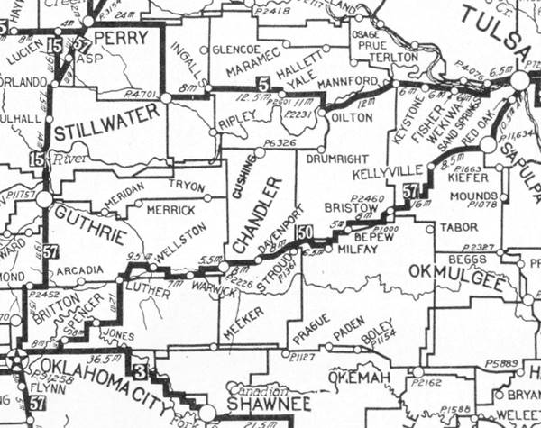
Chandler is in the middle, and Tulsa on the upper right side, on a secondary highway. The main road from Luther bypassed Arcadia and Edmond. The highway marked as "50" (in a black square) meaning the "Ozark Trails" would mostly become Route 66. You can follow it from Tulsa, through Chandler and westwards to Oklahoma City.
Route 66 itineraries from Tulsa to Chandler
Starting point: Tulsa
We will begin our itinerary on the western side of Tulsa and head west.
>> navy blue line in our custom map is the bridge and gap at the Arkansas River.
The old historic bridge that carried Route 66 is still there, but closed to vehicles. The exchange at I-244's Exit 4C removed the curve where the 11th St. alignment curved towards the bridge.
Westwards from the bridge there have been three alignments over the years:
1926 to 1951
US 66 turned sharply south along Quanah Ave., current Southwest Blvd. which curved with a SW course becoming Sapulpa Rd.
It went through Red Fork (at W 41st St.) and curved along Southwest Blvd. and Frankoma Rd. through Oakhurst all the way to Sapulpa. It can be driven.
>> pale blue line in our custom map is the 1925-51 Tulsa-Sapulpa alignment.
1951-59
From 48th St. the highway forked and ran next to the Turner Turnpike along what is now OK-66 (New Sapulpa Rd.) that was a 4-lane roadway. It met the older alignment in Sapulpa.
>> red line in our custom map is the 1951-59 Tulsa to Sapulpa US66
1959 onwards
US 66 shifted its course to I-44 in Tulsa metro area.
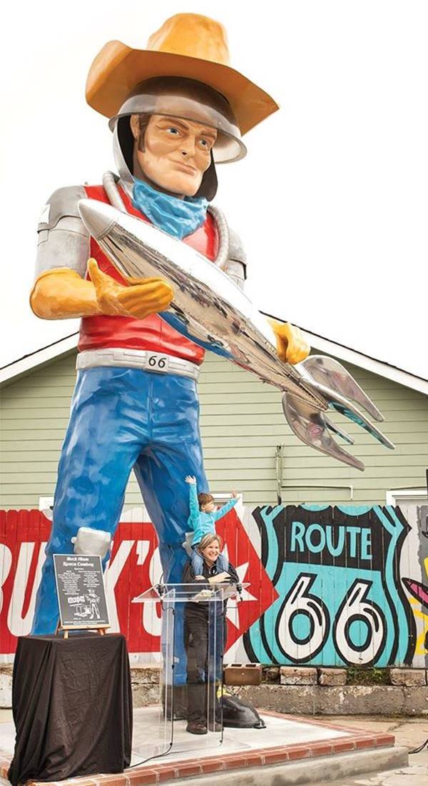
Oakhurst
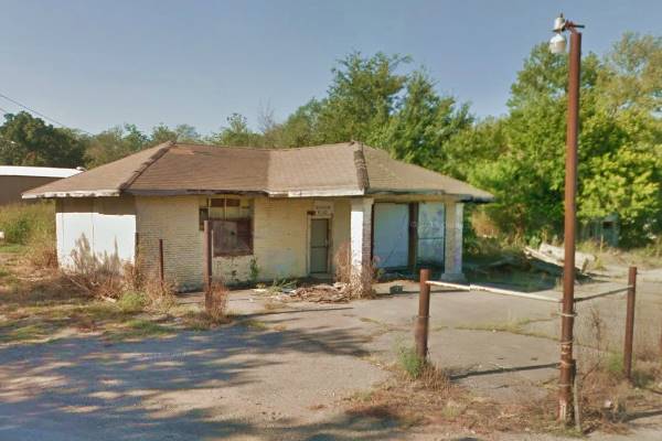
This community is located on the 1926-51 Route 66, just 4 miles southwest of Tulsa, this stretch of higway was known as "Sapulpa Road". The image below is Turney's & Casey's was a filling station, garage, diner, and cafe. Now vacant.
Route 66 in Sapulpa
Drive west and you will reach Sapulpa and cross it with a sharp turn westwards in downtown.
>> violet line in our custom map is Sapulpa's 1926-84 US66
Historic Old Alignment of Route 66 west of Sapulpa
West Sapulpa Segment (1924-1952)
Route 66 continues westwards towards Kellyville.
This segment is 3.3 miles long and was originally part of the unpaved Ozark Trails built in 1915. In 1921 it became State Highway No. 7 as part of a project to link Sapulpa and Bristow with a modern highway. The roadbed had two lanes and a width of 18 ft., and was paved in 1924-25 with Portland Concrete. It even has a 2-mile section with a concrete retaining wall and guardrail.
In 1926 it was incorporated into Route 66 and is in use until this day as OK-66 (Historic Route 66), although its original concrete has been overlaid with later asphalt paving.
This segment includes the historic Bridge #18 at Rock Creek.
Bridge #18 at Rock Creek (Sapulpa)
Listed in the National Register of Historic Places
The old Route 66 (1926-52) alignment crossed Rock Creek using this bridge. It is one of the remaining steel-truss bridges that carried Route 66 in Oklahoma. This particular bridge is a Parker through truss bridge and, as an unusual feature, it has a brick decking (it is paved with red bricks).
> Read more about Brick paved sections of Route 66.
Historic Rock Creek Bridge, Route 66, Sapulpa
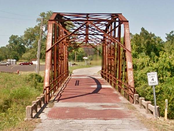
It is 120 ft. long and 18 ft. wide. Its steel truss has a compound truss and a polygonal top cord which allow its long span.
It was built in 1924, just two years before Route 66 was created, and was originally part of the old Ozark Trail, which was incorporated into Route 66 when the U.S. highway system was laid down.
It remained part of Route 66 until the road was realigned in 1952. It still carries traffic as Historic Route 66.
>> yellow line in our custom map is the 1926-52 US66 west of Sapulpa
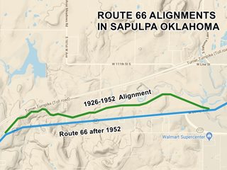
A straighter and wider alignment for Route 66 was built further south which replaced this section in 1952 and remained in use until 1984.
>> green line in our custom map is the 1952-70 US 66 west of Sapulpa
Route 66 in Sapulpa
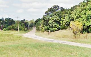
The road meanders through the countryside, among trees, blending in with it, instead of cutting across it in straight lines. It is a good example of the days when the trip was as important as the destination. (see image below).
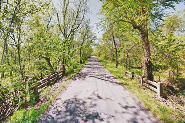
Old Route 66 in Kellyville
At the end of the historic Sapulpa segment the highway takes a NE-SW course into Kellyville
>> pale blue line in our custom map is the 1926 and later alignments from Sapulpa to Kellyville and westwards
Here it was first paved in concrete in 1926, and it was realigned later (we don't know the date but probably in 1938). You can still see two of the old 1926 segments of Route 66 in Kellyville: The first is on the north side of OK-66, east of the town, just west of Maple Dr. to your right on the north side of modern OK-66 is a curved paved segment. Another segment lies further west, to your left. It begins on the south side of OK-66, it is Oak Street, curving towards the railroad starting at Allen St. it includes a remaining ghost segment west of Buffalo Ave. where the old Portland concrete roadway is visible.
>> teal lines in our custom map show the 1926-38 segments in Kellyville
A third original paving section can be seen west of Kelyville, on the south side of the modern US-66 where Polecat Creek approaches the highway, it is hidden among the trees, it can be seen on its western tip (see image, red arrows). It crosses the road in a long S (it is marked with the blue line in custom map). You can also see it in this 1956 aerial photograph.
>> blue line in our custom map is the Polecat Creek segment (1926-38)
Continue west, and cross the interstate; there is a gap in the original alignment here at the overpass.
>> black line in our custom map is the gap at I-44-
The Historic "Original" segments of Route 66 into Bristow
Drive along the original Route 66
We will describe below, in deetail the three sections from east to west, driving from Kellyville to Bristow and then west of Bristow towards Depew.
First Historic Section 1926-1938 US66
Driving west from Kellyville along OK-66 and 0.6 miles after crossing I-44, on the right side of OK-66 is the "Old Highway 66", take it. This is the beginning of the first section of the original winding 1926 to 1938 alignment of Route 66.
>> red line in our custom map is the 1926-38 US 66 east of Bristow
It has two curving segments north and south of current OK-66. It was paved with Portland concrete in 1926. In those days, the concrete was poured in fifty foot sections, 10 inches thick. Over the years the original concrete has been paved over with asphalt.
Shortened & Replaced in 1938
This section was replaced by the later alignment, both shorter and straighter, built in 1938 and used until US 66 was decomissioned in 1985.
>> orange line in our custom map is 1938-84 US 66 east of Bristow
Second historic Section: 1926 - 65
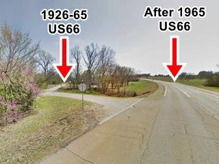
Head west along OK-66 and after 0.8 miles, OK-66 curves southwards along the later (1965) alignment of Route 66.
The original alignment continues straight along E 0770 Rd (the 1926 to 1965 Route 66), see map.
>> yellow line in our custom map is the 1926-65 US 66, gap at its eastern tip marked in Violet
This segment had been paved with Portland concrete in 1924, two years before Route 66 was created. The fact that it was paved was a reason to align the new US 66 highway along it
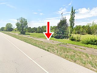
At the junction with OK-48, it turns sharply south (left). Here, to your right, you can still see the a section of the original soft curved roadbed of old US66. Follow the old 1926-65 segment southwards and just before reaching OK-66 again head right along S353W Rd., it crosses OK-66 and heads south (see image) and yellow line in custom map.
Follow this alignment until you reach the 1935 Warren pony truss bridge across Sand Creek, cross it. Ahead it meets the later alignment (now OK-66).
1965 realignment east of Bristow
The highway adopted a shorter course avoiding the right angle curve at OK-48 as shown in our custom map:
>> pink line in our custom map is the 1965-85 US66 east of Bristow
Bristow
From here the highway crosses the freeway into Bristow.
>> brown line in our custom map is 1926-85 US 66 into Bristow
Just ahead, the original pre-1965 highway had another alignment (you can see it in this 1956 aerial photograph), it ran with a curve to the east. The modern OK-66 is the 1965-85 alignment.
>> green line in our custom map is 1926-65 US66 into Bristow
Route 66 from 1926 to 1985 crossed Bristow from north to south along Main Street (brown line in our custom map) forking on 4th St.
>> brown line in our custom map is 1926-85 US 66 along Main St.

One of the old bridges on the 1926-28 US66 wests of credits
1926-28 Roadbed
Followed Main southwards, crossed the railroad and ran along its south side, then crossed the Deep Fork River and the Little Deep Fork (the original 1913 bridge is still there, read more below).
>> violet line in our custom map is the 1926-28 driveable US66
>> black line in our custom map is the closed 1926-28 segment, notice the red markers at the old bridge sites.
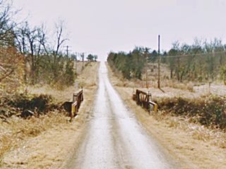
The gap at the western side is a "missing section" in private property, with two now abandoned concrete bridges (see the location maps of bridge 1 and bridge 2, shown in picture).
After 1928 until 1985
US 66 turned west along 4th St and south on Roland keeping on the north side of the railroad
The bridge over Catfish Creek was replaced in 1940 and when it was replaced for a second time in 1995, the bridge and road alignment were moved a few feet further south.
>> pale blue line in our custom map is the 1928-85 driveable segment west of Bristow
>> pink line in our custom map is the Catfish Creek gap.
Bridge on Little Deep Fork Creek (1926-28 alignment)

Little Deep Fork Creek Bridge. Credits
Two miles west of Bristow on the 1926-28 alignment see map, is the beadstead Warren pony truss, with a wood plank deck. It gets its name because the steel end posts are vertical and they extend down, deep into the river banks like the legs of a bed, furthermore, the two sides of the bridge resemble the head and foot of a bed.
The bridge was built in 1913 as part of the road system planned and improved by the Ozark Trail Association, a private organization that promoted better highways.
Depew
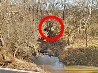
Route 66 now runs west towards Depew. The first US66 alignment from Bristow to Depew of from 1926 to 1928 was unpaved, and it had a slightly different alignment to straighter one built in 1928 (red line in custom map) it had two right-angle turns and a now eliminated segment where it crossed the Little Deep Fork Creek using a steel bridge. The concrete abutements can still be seen (red circle in image). In 1928 the road was moved to its current location and the bridge was also moved. It was replaced in 1973.
>> green line in our custom map is the 1926-28 US 66 east of Depew.
>> gray line in our custom map shows the closed Deep Fork Creek alignment (1926-28) and bridge.
>> red line in our custom map shows the 1928-84 US 66 east of Depew.
The alignment continues into Depew (burgundy colored line) where the business district had been paved by the city in 1925, so Route 66 was aligned along it in 1926, going through the center of the town: south down Flynn Ave. then right along Main St. and again, another right along Ladd. Ave. back to current OK-66.
In 1928 it was moved to the north side of the town to avoid the U-shaped alignment and the two grade crossings of the railroad. You can see the second roadbed south of the current OK-66 (realigned and widened in 1984), between Flynn and Ladd: this is the original 1928 paved segment of road, now cutoff from the highway both alignments are pictured above, see marker in our custom map.
>> burgundy line in our custom map is 1926-28 US66 in Depew.
West of Depew
Westwards, all the way to 545th W Ave, the current OK-66 is the roadway built in 1984 to replace the ones we describe below. The original 1926 to 1984 alignment ran north of the current roadway see its alignment in the map below:
>> pale green line in our custom map is 1926-84 US 66 West of Depew.
Just ahead the 1926-28 and the 1928-84 alignments split so we will describe them separately.
1926-28 Route 66
It went straight, west and then turned 90° south at the cemeteries and followed the alignment shown in our custom map:
>> teal line in our custom map is the 1926-28 US66 alignment
Most of it can't be driven the roadway is gone. At its western tip, it meets the later 1928-84 alignment (honey colored line) and runs on the eastern side of the current OK-66.
1928-84 Route 66
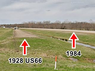
It follows the southern fork, and can be driven in some sections with gaps between them, it runs on the north side of current OK-66 (built in 1984). It is pictured below, looking west, you can see the original roadbed on the right, and the newer (1984) one to the left.
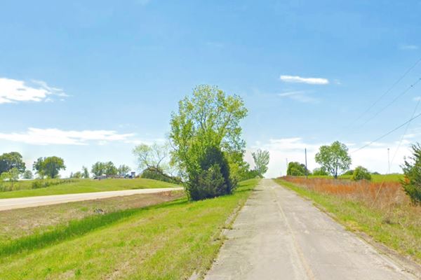
>> honey color line in our custom map is the 1928-84 US 66 west of Depew.
West of the point where the 1926 and 1928 alignments meet, OK-66 it follows the alignment shown in the following map, and used it from 1926 to 84 towards Stroud. The eastern part (red line) can be driven in some parts, the old road is visible in others. The western section (green line) can't be driven.
>> red and green lines in our custom map is the 1926-84 US 66 into Stroud.
Stroud
Ahead there is a fork in the alignments into Stroud.
Course of US 66 on the East side of Stroud
1926-1930 Route 66
>> red line in our custom map is 1926-30 US 66 E of Stroud
This segment was never paved It is now cut by I-44, but it can be driven. As you head west after I-44 you will cross an original concrete bridge built in 1930, spanning Lilly Creek. It has concrete spans 30 ft. long. It is shown below.
Old Route 66: Lilly Creek Bridge, Stroud
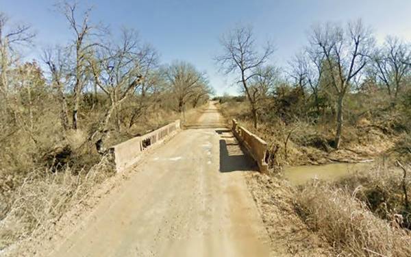
And then, after turning south, you will cross another bridge, a steel pony truss bridge (pictured below) that was built across Salt Creek in 1921.
1930-1960 Alignment
The highway was paved with Portland concrete, shortened and realigned in 1930. It runs on the north side of modern OK-66, and forks from the earlier alignment at the curve, taking a NE-SW course. This 1930-1960 Route 66 follows a course parallel to the later one built in 1960, when it was upgraded.
It can be seen from the current highway, but then it moves away, through private property. You can follow this Rte. 66 alignment in our custmo map. Above is a view of the old highway to the right, and the later post-1960 road to the left (red arrow).
In 1960 it was realigned along what is now OK-66 highway as shown with a pale blue line in the map:
>> burgundy line in our custom map is 1930-1960 US 66 E of Stroud;
>> pale blue line: 1960-85 US66 alignment
Stroud Downtown and Westwards
Both alignments meet on the eastern side of the city and run through Stroud with an east to west direction for one mile. At 8th St, they separate once again.
>> blue line in our custom map is 1926-85 US66 alignment in downtown Stroud.
1926-30 alignment
It is known as the "Ozark Trail Section of Route 66" and was build in 1915. This section predates Route 66.
The private organization, the Ozark Trail Association petitioned the Lincoln County commissioner to create and designate a county road system belonging to the "Frisco-Ozark Trail system". The roadbed was built between 1915 and 1917 and was incorporated into the Ozark Trail highway network.
The network was a collection of dirt or gravel roads linking the towns in Lincoln county. Later, when Route 66 was created in 1926 it used these roads in its initial alignment.
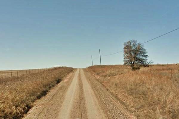
The old road however remains in use until this day as a "improved" dirt road, that is, one that is ocassionally graded and surfaced with some gravel.
Ozark Trail Route 66, Stroud
Ozark Trail Monument
The Ozark Trails Monument is a concrete obelisk that is 21 feet tall, with a base that is 48 inches square and 46 inches tall.It is quite unique and rare. It marked the intersection of Ozark Trail roads.
There was one, now gone in Romeroville, New Mexico, on what would become the 1926 US 66 alignment. It was the western terminus of the Ozark Trail. Another obelisk stood in Tucumcari on Route 66.
This map marks the site of the obelisk.
It is one of only two of these monuments surviving in Oklahoma (the second is in Langston). On the apex of the obelisk you can see some square recesses that once held electric light fixtures that lit it up from above. It was recently whitewashed by the Oklahoma Route 66 Association as you can see in the image below.

Original whitewashed O.T. obelisk, old US66 Stroud. Source
Obelisk Replica in Stroud
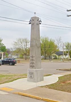
On Route 66 on the SW corner with 2nd Ave you can see a replica of the obelisk pictured above (street view), it was inaugurated in 2020, it has a bronze plaque that reads: "This obelisk is an exact replica of the original Ozark Trail Marker now located between Stroud and Davenport. The Ozark Trail was a precursor for Route 66 and existed from 1915 to 1926. The first markers were telephone poles painted green and white. These were replaced with obelisks painted white with green directional lettering of cities with the mileage to point travelers along their way. Twenty-one of these markers were constructed while only two remain in Oklahoma, one in Stroud and the other in Langston. The marker stands 21' tall, is 48" square at the base and is 6' below ground. It contains 12 yards of concrete and weighs around 48,600 pounds. The original marker was located at the intersection of Highway 66 and Highway 99. After becoming a traffic hazard with the increase of vehicles, it was relocated to its current location 3 miles West (N3540 Road) and 1.3 miles South (E890 Road) of Stroud."
>> red line in our custom map is 1926-30 US 66 west of Stroud
>> yellow line in our custom map is 1930-85 US 66 west of Stroud
1930 Alignment
Davenport
When US 66 was paved in 1930 from the Creek County Line to Chandler with Portland Concrete, it was shortened and shifted to a new roadbed, leaving the Ozark Trail segment.
Both 1930 and 1926 alignments met and continued west into Davenport. The 1.6 miles through Davenport were paved in 1931 with asphalt and in 1933 rebuilt in Portland concrete. Until 1993 there was a viaduct south of Davenport, which carried Route 66 over the old tracks of the Santa Fe railway. The tracks and viaduct are now gone.
Final leg of your road trip into Chandler
The higway continues west, all the way to Chandler following the alignment shown in the map below:
>> pale blue line in our custom map is the 1926-85 into Chandler.
Original 1950s neon sign Route 66 Bowl in Chandler
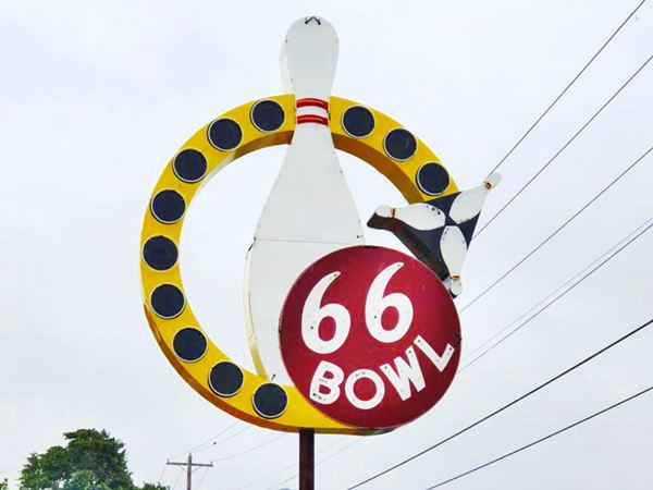
This is the end of the itinerary, on the eastern side of Chandler.
Continue your road trip
Next Section
Route 66's alignments from Chandler to Yukon
Previous Section
US 66 alignments from Vinita to Tulsa

Some sponsored content
>> >> Book your Hotel in Tulsa

Credits
Banner image: Hackberry General Store, Hackberry, California by Perla Eichenblat
Jack DeVere Rittenhouse, (1946). A Guide Book to Highway 66
Route 66 Maps. Oklahoma D.O.T.


