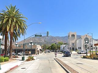
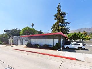
Route 66 in Monrovia CA
Index to this page
About Monrovia California
Facts, Trivia and useful information
Elevation: 571 ft (174 m). Population 36,937 (2025).
Time zone: Pacific (MST): UTC minus 8 hours. Summer (DST) PDT (UTC-7).
Monrovia is a city located Route 66 in Los Angeles County in southern California on the San Gabriel Mountains' foothills; it is part of the Los Angeles metropolitan area. Two Route 66 alignments cross the city: the original 1926 one, and the realignment of 1934.
The history of Monrovia
The foothills of the San Gabriel Mountains have been inhabited during the last ten thousand years, since the end of the last Ice Age. Hunter gatherers lived in the coastal areas and in the mountains and river valleys. When the Spanish reached the area in the 1600s, they encountered a Native American group, the "Tongva". The Spaniards named them after the nearby mission (San Gabriel Arcangel) established in 1771: Gabrieleños or Gabrielinos.
The Mission's land was nationalized by the Mexican government in the 1830s (Mexico had become independent from Spain in 1821). The land was then granted to local residents who established vast ranches on it.
The land that would become Monrovia forms part of two Ranchos created in 1841 when Governor Juan Alvarado issued land grants to Andrés Duarte, who set up the Rancho Azusa de Duarte (read more about Duarte) and Hugo Reid, a Scotsman naturalized Mexican created the Rancho Santa Anita.
After Mexico lost all its territory north of the Rio Grande to the US during 1846-48 war, the land grants were reviewed by the U.S. government. Eventually Duarte's ranch was split and sold off to cancel debts, and one of those subdivisions (240 acres) was bought by William Newton Monroe in 1883 for $30,000. It became Monroe Ranch.
The name: Monrovia
William Newton Monroe (1841-1935) was a school teacher, American Civil War Lieutenant and railroad engineer for the Southern Pacific Railroad from Omaha to Los Angeles.
Monrovia is a Latinized form of his surname. The town's main street, Myrtle Ave. is named after is oldest daughter. Monroe as a surname (also written as Munro), found in Scotland. It comes the Scots Gaelic words "bun" that means "mouth of" and "roe," meaning "river": "from the mouth of the river."
Several of Monroe's friends also bought land in the area and they founded a town, named after him in 1886, the land was sold by the Monrovia Land and Water Company.
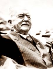
Mr. William Monroe. Source
The Santa Fe railroad extended its line through Monrovia in 1887, linking its main line in San Bernardino across the San Gabriel Valley and into Los Angeles. That same year the town was incorporated and the High School was built. It was a liquor-free town.
In 1903 the Pacific Electric streetcar-tram linked it to Los Angeles and it became a suburb of the great city.
The USGS geological survey along the Santa Fe railroad mentions Monrovia in 1915 as follows "Monrovia station is in the southern part of Monrovia, an old settlement lying against the foot of the mountains. West of Monrovia the railway swerves to the northwest for 2 miles and then goes west through the small towns of Arcadia, Santa Anita, and Lamanda Park into Pasadena."
At that time the town was also linked by road with the other cities in the area; the use of cars had grown in the early 1910s, and the National Old Trails (N.O.T.) Association was formed to promote the building of a decent highway between New York and Los Angeles; it passed through downtown Monrovia along Foothill Blvd.
In 1926, US highway 66 (Route 66) was created and aligned along the N.O.T. highway through San Gabriel Valley. In 1934 it was realigned south of the town, to eliminate several sharp 90° turns between Duarte and Pasadena. It remained in use until the freeways slowly drained traffic from it in the 1960s.

Accommodation in Monrovia
You can find your lodging in town.
> > Book your Hotel in Monrovia
More Lodging close to Monrovia along Route 66
Below you will find a list some of the towns along U.S. Hwy 66 east and west of Monrovia; click on any of the links to find your hotel in these towns.
>> Check out the RV campground near Monrovia, in Pomona
The Weather in Monrovia
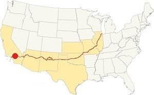
Location of Monrovia on Route 66
Monrovia has a Warm Summer Mediterranean climate. Rather dry and hot in summer but cool in winter (which is the rainy season). The average monthly temperatures does not exceed 71.6 °F (22°C).
Monrovia has some 290 sunny days each year and during fall (autumn) strong dry winds blow from the desert (Santa Ana winds) drying out the area and increasing the risk of wildfires in the foothills.
The summer average high is 89.4°F (31.9°C) and the average low is 61.1°F (16.2°C). During winter the average high is (Jan) 67.8°F (19.9°C) and the average low is 44.3°F (6.8°C) in winter, the peaks of the San Gabriel Mountains receive snow, and may occasionally falls in Monrovia.
Rainfall averages 21.1 in. per year (536 mm), with the period May to October being the driest one with an average of 0.5 to 2.8 in. per month (12 - 71 mm). There are some 43.5 rainy days per year
Tornado risk
Monrovia is very close to the Pacific Ocean very far from the Rocky Mountains (western limit for tornadoes) so there is no risk of tornadoes in town.
Tornado Risk: read more about Tornado Risk along Route66.
Map of Route 66 in Monrovia
>> Custom map of Route 66 through Monrovia.
National Old Trails Highway (N.O.T.) in Monrovia
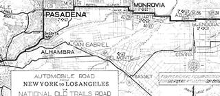
1912 N.O.T. Road map
Click on image to enlarge.
Credits
As mentioned further up, by the early 1910s automobiles were becoming popular, but the highways were not suitable for cars. Across the nation organizations were created to promote better roads. This led to the creation of the National Old Trails (N.O.T.) Association that lobbied for a highway between Los Angeles and New York. It ran close to the Santa Fe railway across California and Arizona.
The map shows its alignment into Monrovia, along what now is Huntington Dr., then north along Highland Ave, and west along modern Royal Oaks Dr. (violet line in our custom map), then north along Shamrock Ave., then west along what now is Colorado Ave, but in those days was Orange Ave. At Myrtle Ave it turned north again, and then west along Foothill Ave. across Monrovia and all the way to eastern Pasadena.
Route 66 Map
In 1926 Route 66 was aligned along the National Old Trails roadway. From east to west, the red line from Azusa to Duarte marks the 1926-74 alignment of Route 66 along Huntington Dr. and, as mentioned above, the violet line shows the alignment until the early 1930s.
The map below shows the highwas in the Los Angeles region in 1927. You can follow Route 66 from Victorville in the east, to San Bernardino and west to Pasadena and Los Angeles. Monrovia is on the lower left side.

1927 Road map, SW CA
Click on image to enlarge.
Credits
The black and white 1930 thumbnail map above also shows the alignment of Route 66 from Victorville to Los Angeles notice Monrovia and the detail with the alignment into Pasadena.
The map below, from 1928 shows Route 66 running from Duarte, across Monrovia, Arcadia, south of Sierra Madre, and into Pasadena. At that time the highway ran along Foothill Blvd. north of the later alignment that ran further south along Huntington and Colorado that was built in 1933. Until then it ran along the course marked with a green line in our custom map.

1956 Shell Roadmap, SW CA
Click on image to enlarge.
Credits
In 1932 Huntington Dr. was built and paved between Duarte and Arcadia along the southern side of Monrovia into Arcadia and Route 66 was aligned along it in 1934. As marked with a red line in our map. West of Arcadia it ran along Colorado Pl and Colorado St. both were built at for this purpose between Arcadia and eastern Pasadena.
The map above shows the same area in 1956; a freeway now links Victorville with Cajon and San Bernardino with Los Angeles. In the 1950s, the freeway system in LA would start to divert traffic away from Route 66. In 1964 the western terminus of Route 66 was formally moved from Santa Monica to Needles CA; however, only the highways up to Pasadena were decertified, the remaining ones remained signed as Route 66 until I-40 was completed between Barstow and Needles in the early 1970s.
Route 66 Alignment near Monrovia
With maps and full information on the Mother Road.
- Pasadena to Santa Monica (Next)
- Barstow to Pasadena (Monrovia's)
- Topock to Barstow (Previous)

Sights and Attractions in Monrovia
Historic Context
The 1939 "Guide to the Golden State" written by the WPA described the Monrovia section of Route 66 as follows:
MONROVIA, 34.3 m. (560 alt., 10,090 pop.), was laid out in 1886 by W. N. Monroe, when lots today worth many thousands of dollars were sold for $100. Monrovia is surrounded by orange, lemon, and avocado groves and other orchards. Poultry raising and small gardening are important in the vicinity. The town is noted for a wide variety of trees and shrubs; in the northern part of town, is a papaya plantation. WPA (1939)
In 1946, after World War II, Jack DeVere Rittenhouse drove along Route 66 collecting information for his "A Guide Book to Highway 66". In it, Monrovia is merely one among the many towns in San Gabriel Valley. He wrote: "More towns you pass through include... AZUSA, 343 mi., DUARTE, 347 mi.; MONROVIA, 350 mi., ...."
Enjoy Route 66!
During its heyday, in 1947, the Monrovia-Arcadia area boasted 25 new motor lodges and motels, and at the U.S. Highway 66 Association convention in Oklahoma City, Walter Muller, the owner of the Westerner Hotel told his colleagues about the premium service offered by these motels, such as in-room phone service and "beautiful crystal swimming pools".
All except three of these classic motels in Monrovia have been lost to development; malls and large parking areas next to Route 66 have eliminated them. In our drive westwards from Duarte we will mention these lost landmarks as we pass by the spots where they once stood.
The map shows the eastern side of Monrovia along Huntington Dr., click on it to enlarge it. Notice the motels, cafes and service stations.
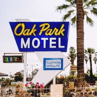
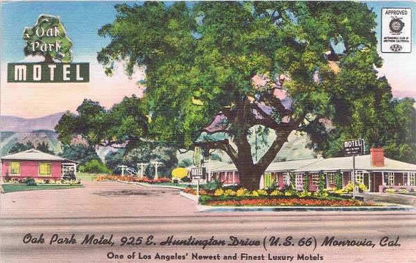
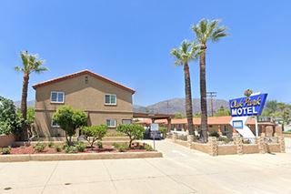
Oak Park Motel
Leaving Duarte, the highway running along Huntington Drive curves nortwards in a wide "S". Here in eastern Monrovia on the city limit with Duarte, at 925 E Huntington Drive is this classic 1950s motel. It is the first motel on the right in the map above.
Its postcard from 1956 reads: "Where you can relax and have fun in our beautiful new heated swimming pool. Play shuffleboard, corquet, and horseshoes in a truly restort atmosphere. Television. Apartment suites available. 10 minutes to Pasadena." Its great googie-styled early 1960s neon sign is a must-see stop.
It is still operating under the same name. You can Book a Room in the Oak Park Motel.
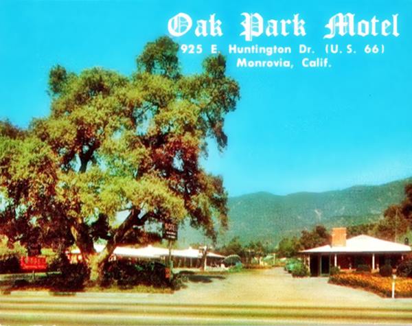
Below are a set of "Then and Now" views of the motel. The large oak seen in the postcard above has gone and the palm trees give it a "Californian" look. It should be noted that the expedition led by Portola in 1769 from San Diego through Los Angeles all the way to San Francisco and back, recorded the presence of large oaks in this region (in Spanish, "encino" = oaks), in fact a L.A. suburb is named "Encino".
The Oak Park in a vintage postcard which describes it as "one of Los Angeles' newest and finest luxury motels"
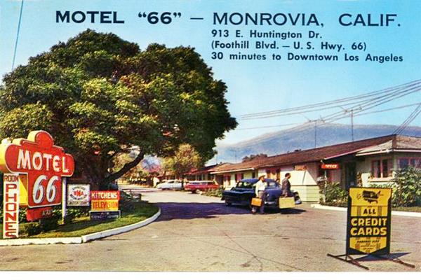
Motel "66" ❌
Next door, at 913 E Huntington, now an auto repair shop stands on the property. This motel had "28 hotel-type stucco cottages with garages - 8 with kitchenettes. Completely modern... at foot of mountains, in orange groves..."1
K.C. Jones Drive-In❌
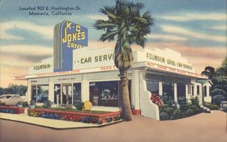
K.C. Jones Drive In. 1950s, US66 Monrovia. Source
Click image to enlarge
Across Huntington Dr., on the SE corner with Mountain Ave. at 902 E Huntington, the 1940 map shows a Cafe. This business began as Dale W. Abbott's "Abbott's Diner" and later (early 1950s) became KC Jones Drive-In. They were among the early Kentucky Fried Chicken franchises in the days before KFC had dedicated branded stores.
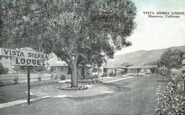
Vista Sierra Lodge ❌
There was a Motel with 11 units on the NW corner with Mountain Ave (see map above) at 845 E Huntington; By 1964 it has been torn down and a gas station built there. Now a Tommy's Hamburger restaurant stands on the property.
Pictured below, it was the Vista Sierra Lodge (the name is supposed to mean "View of the Hills" in Spanish, but it an anglicized version of the correct words "Vista de la Sierra". It was listed in the 1941 Automobile and Trailer Travel Magazine as follows: "✶✶ VISTA SIERRA MOTEL - 845 E. Huntington Dr. U. S. 66. 5A , 2hf , $ 2.50- $ 3.50", just look at those prices! The current 2024 equivalent is $ 99 - $ 139. 2
As you cross Mountain curves softly to the north in a wide "S". The land on the south side of the road up to the flood ditch is actually part of Duarte, as the city limits of Monrovia ran along the line linking E Huntington and Cypress Ave; this border is marked with a thick dashed black line in the 1940s land use map. We will describe the sites in this area as if they were part of Monrovia, but they aren't; they are in Duarte.
To your left is the site of the former Monrovia Airport.
Monrovia Airport ❌
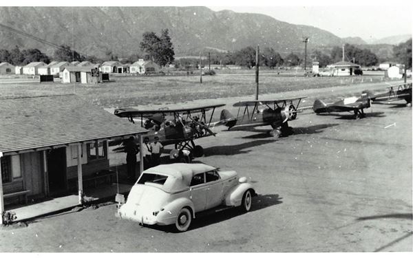
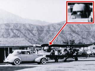
Also known as Foothill Flying Field, Monrovia airport was active between 1928 and 1952. It was located south of Huntington Dr between Shamrock Ave to the west, Mountain Ave to the east, and Duarte Rd. on the south. Its northern tip is marked in purple in the 1940s land use map. After 1953 it was sold, subdivided and built up. Now I-210 cuts across it. It had a single, 2,700-foot long unpaved runway and the hangars, airplane repair shop and offices were located on the SE corner of Shamrock and Route 66. It is pictured below c.1940, notice Route 66 running left to right, the Monrovia Motor Lodge to the left on the north side of the highway, and the Airdrome restaurant with a pagoda-style single story building to the right above the third plane. The car seems to be a four-door convertible Buick c.1939.
My Old Kentucky Home Restaurant ❌
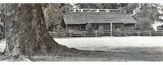
My Old Kentucky Home 1940s, US66 Monrovia. Source
Click image to enlarge
Named for the famous ballad written in 1852. Established in 1929 by Mr. and Mrs. R. R. White, it served diners and banquets and its cocktail lounge was called the "Moonshine Room", it looked like a log cabin and was famous for its fried chicken.
It stood on the south side of the highway, to your left, where Cypress Ave forks from Huntington Dr. Located at 802 E Huntington.
Airdrome Restaurant ❌
Next to the restaurant, at 742 E Huntington Dr. was a spot catering to those driving along the highway, it was located closer to the roadway, at the northeastern tip of the local airport. In the land use map it appears as a Cafe, but actually it was more than that; it was founded by Patrick James McDonald in 1937.
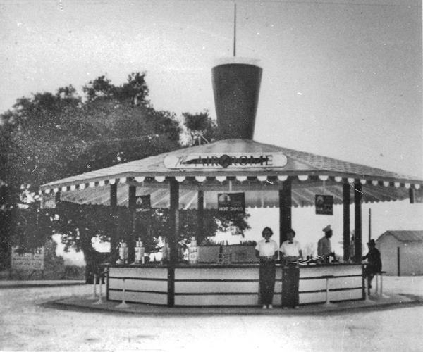
His sons, the McDonald brothers, Richard and Maurice helped their father run the business that included a fruit stand across the street at 721 E Huntington and the Wigwam in Arcadia. However in 1940 the brothers decided to relocate to San Bernardino, so they cut the building in half and moved it there (Read more about the 1st McDonald's in the World in San Bernardino).
The move meant a change in the name for "Airdrome" to "McDonald's Barbecue Restaurant." Later in 1948 the dumped the carhops, eliminated the drive-in, and cutlery and dishes, they dropped the elaborate dishes and focused on quick service, standard hamburgers with fires and shakes in a family-friendly restaurant. McDonald's was born.
Giant Orange (McDonald's Orange Juice Stand) ❌
McDonald's Giant Orange stand, US66 Monrovia. Source
Click image to enlarge
It was close to their "Giant Orange" stand at 721 E. Huntington. Both sold food for travelers on Route 66. Richard McDonald wrote about both stands as follows:
I also built an other orange juice stand directly across the street from the airport. As you know, there is a lot of traffic on that highway and wanted to try to get the people going in each direction. The second stand was in the shape of a huge orange and many hundreds of people stopped each week to take a photo of the huge orange. I wish they also had stopped to buy some orange juice and oranges. When we moved to San Bernardino in 1940, we moved the original stand. The moving company actually cut the building in half and towed it to San Bernardino. We sold the large orange stand and it was also moved. In regard to the Wigwam building, we did have our father run that one until he passed away. This was also strictly orange juice and oranges which we purchased from packing houses in Glendora. If you ever learn what ever happened to the large orange stand, please let me know.... Richard J. McDonald (1996)
This orange stand looked a lot like the famous Route 66 Giant Orange in Fontana.
New Salem Motor Court ❌
Opposite McDonald's on the north side of the highway, to your right, at 745 E Huntington was another motel, with 12 units, that can be seen in this 1952 aerial photo. It was torn down in the late 1960s, now there is a parking lot here, the Taco Bell marks the spot. It is pictured below.
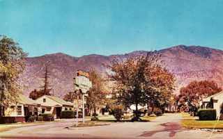
New Salem Motel c.1950, US66 Monrovia. Source
Click image to enlarge
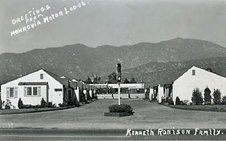
Monrovia Motor Lodge c.1950, US66 Monrovia. Source
Click image to enlarge
Monrovia Motor Lodge ❌
The 12 unit Monrovia Motor Lodge was located at 715 E. Huntington Dr, where the Yoshinoya Japanese restaurant now stands, you can see it in 1952 aerial photo. Click on the image above to enlarge and see more (the large version has two views of it).
The Alignments of Route 66 Split: Shamrock and Huntington
There was P. L. Davis Texaco Service station on the corner beside the motel, at Shamrock and Huntington Dr.
Here the alignment split. The early 1930s one ran north along Shamrock meeting the earlier 1926-30s one a few blocks north and then continued into downtown Monrovia. The 1933-74 alignment continued straight along Huntington Drive.
There was Kirk's Signal service station here (see image) in the 1930s and much later in the early 1970s a US Gas station opposite, on the SE one. On the western side of the intersection, the 1948 city directory mentions Bunn Bros gas sta at 624 Huntington and Sunset Oil St at 621 Huntington.
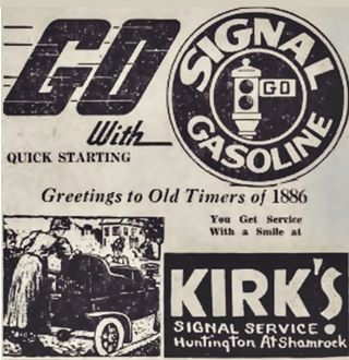
Kirks Signal gasoline ad, Monrovia. Source
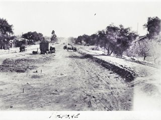
1933 huntington drive under construction. Monrovia. Source
Click image to enlarge
Huntington Drive (1934-74 Route 66)
Huntington Dr. was a major road that ran from Los Angeles with a norteastern direction towards Pasadena. There was a two-lane roadway on each side of a central median that was occupied by the tracks of the Pacific Electric streetcar system. The company was owned by Henry Edwards Huntington (1850 - 1927), which gave its name to the throughfare. It was paved gradually, with the lanes on the south side of the tracks paved by the mid 1920s, followed by those on the north in the 1930s.
East of Holly Ave in Arcadia, the current alignment of Huntington along the western side of the golf courses didn't exist in 1928. Instead, the paved link ran along Campus Dr to S Santa Anita Ave. East of this point, it was a dirt road. In 1933 it was widened and paved (see picture). Route 66 was realigned along it into Arcadia along the south side of Monrovia.
Denny's Coffee Shop ❌
The local Denny's with its characteristic roof was located on the SW corner of Huntington and Shamrock Ave. at 624 East Huntington. The postcard (click to enlarge) tells us "Breakfast Luncehon Dinner Free Parking Air Conditioned For Your Comfort..."Highway" 66 Open 24 Hours Your Host - George Reis Jr."
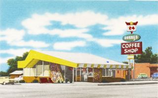
Denny's 1960s postcard US66. Monrovia. Source. Click to enlarge
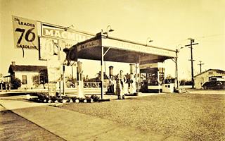
Jerry's Union 76 c.1930s Monrovia. Source. Click to enlarge
Jerry's Union 76 ❌
Just west of Denny's on the SW corner of Sherman with Huntington (536 E. Huntington); in those days Sherman intersected Huntington. The station was opened in 1929 by Mr. Yanosky. The 1948 city directory names it as Taylors Serv[ice station].
There are no surviving Route 66 buildings along Huntington in Monrovia. We mention those that have been torn down in the following section, and will drive through the town following the Original 1926-33 alignment of Route 66 described further down.
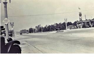
Myrtle and Huntington, 1934, Monrovia. Source. Click to enlarge
In the early 1930s, at the intersection of Huntington Drive and Myrtle Ave., the town's "Main Street", was Moran's Richfield Station on the NW corner; the 1934 phone directory listed it as "Moran F D Service station b 1023 S Myrtle." There was a Shell Station #298 on the SE corner. The image above was taken from the Shell in 1934 looks west at the junction; Moran's is on the upper right side. This is the same view nowadays.
El Patio Motel ❌
Located at 135 W Huntington Dr, on the first block west of Myrtle; its Managing Owners in the early 1950s were Mr. and Mrs. Frank Reiland. It was a "truly modern, nicely furnished motel with tile showers. Radios. Some kitchenettes.... El Patio is Spanish for "The Courtyard."
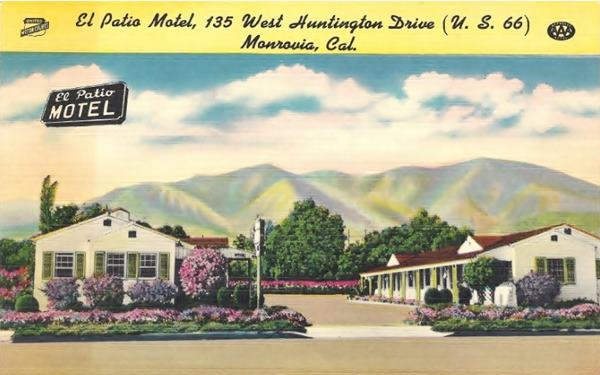
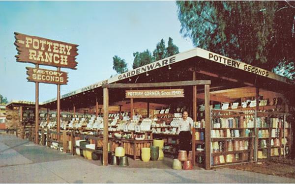
The Pottery Ranch ❌
The shop was located on the SE corner with S Magnolia Ave, at 248 W Huntington Dr. and it managed to survive until the late 2000. See this 2007 St. view while it was still standing. Its postcard says "The Pottery Ranch specializes in buying selected factory and seconds and close-outs in dinnerware, ceramic giftware, gardenware, and glassware. This offers saving of up to 50%... Pottery corner since 1940."
McDonald's Striked "M" Sign
At 480 W Huntington Dr. As mentioned earlier, Patrick McDonald opened his first food stand near the old Monrovia Airport and his sons moved to San Bernardino where they concevied the Fast Food business model.
In 1952 the two brothers decided to give their buildings a striking design and hired Stanley Clark Meston who included two stylized yellow parabolic arches, one on each side of the building. The "golden arches" were born.
They were used in the new restaurants opened between May 1953 and the 1960s, when the arches were eliminated from buildings. They created a new logo in 1962. It had a yellow "M" formed by two overlapping golden arches with a slanting line across it, it was supposed to look lika a McDonald's store viewed from the side, with its arches and the slanting restaurant's roof. The arches cross over each other at the bottom. This design was removed in later logos where the two arches meet in a single point.
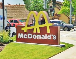
As you can see in the image, this McDonald's in Monrovia has the "old logo" that was stylized into the "Striked M" seen in this restaurant. Until 2017 the logo on the building was a striked M, now it is a modern yellow on blue one.
Pacific and Ken-Jean Motels ❌
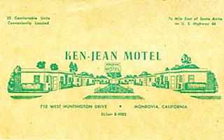
Ken-Jean Motel 1930s Monrovia. Source. Click to enlarge
At 721 W Huntington was the Pacific Motel with 14 rooms, it appeared in the 1961 Leahy's Motel Guide. On the north side of the highway between Monterrey Ave and I-210. It survived until the early 1970s.
Opposite was the Ken-Jean Motel at 710 W Huntington. Both motels can be seen in this 1954 aerial picture, it was torn down in 1978 to make space for the Courtyard hotel that now stands on the property.
Mon Arc Motel ❌
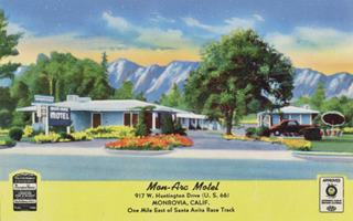
Mon Arc Motel, Monrovia. Source. Click to enlarge
West of Foothill Freeway, at 917 W Huntington, it had 12 units, a "New... insulated and air-conditioned, ultra modern, fireproof motel... radios, garages..." You can see it in this 1954 aerial photo. The place was razed when the freeway was built to make space for the ramps at Exit 33.
Wagon Wheel Lodge ❌
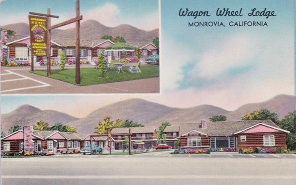
On the next corner, 5th Street that marks the western limit of Monrovia. At 926 S Fifth Ave. it was just half a block north of Route 66. Its postcard tells us it was: "Southern Calif. newest Deluxe Motor Hotel. Deluxe Kitchens, Completely Furnished, (Ranch House Apts.) Fireplaces, homey surroundings."
It was converted into apartments in the 1980's and later became the Extended Stay America - Los Angeles - Monrovia.
This marks the end of Huntington Dr in Monrovia and the list of Rotue 66 landmarks that have been lost to progress. The next section follows Route 66's original alignment across the town along Shamrock and Foothill.
Original 1926-33 alignment of Route 66
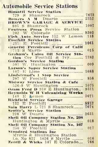
Monrovia Service Stations in 1934 phone directory. Source
Sights and Landmarks along the Original Route 66 in Monrovia
Turn right along Shamrock Ave from Huntington Drive and head north. The highway crossed a grade crossing across the Southern Pacific railroad spur on Almond St (tracks have since been removed), and ahead, to the left is the Immaculate Conception church just north of Royal Oaks (formerly Foothill Blvd. that in the past carried US 66 across Duarte into Monrovia.
The church was built on land donated by the Bradbury family, and dedicated in 1906. It was expanded in 1955.
Opposite the church on both corners with East Walnut Avenue there were two classic gas stations:
Brown's Garage and Service Station
Historic landmark

1934 phone directory ad of Brown's garage. Source
To you left, at 805 S Shamrock Ave on its SW corner with E Walnut.
Filed for Historic Landmark in Monrovia, it is an L-shaped building that faces Shamrock. It began as a fruit stand and home back in the early 1920s. The service station was added in 1926, just when Route 66 was created and aligned in front of it. In 1942 its gasoline pump island was demolished and the building became a small industry making military equipment during World War II. In 1945 it was purchased by oil well equipment-maker Halliburton. The northern part of the building is the same as you can see in the "Then and Now" set of pictures.
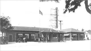
Biasotti's Flying A Service Station
Across Walnut, on the NW corner was the second service station at 729 Walnut.
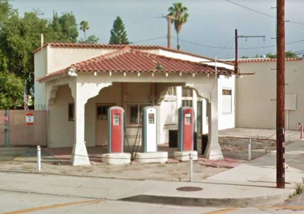
It is one of two remaining antique Flying A Service Stations in Los Angeles County. Its service area faces the corner and has three vintage pumps under a canopy held up by two frontal columns. It was built in Mission Revival Style and has a stucco facade. The canopy has a hipped roof covered with Spanish tiles.
It dates back to the 1920s and was built here to cater to the traffic along the original 1926 alignment of Route 66 into Monrovia.
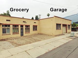
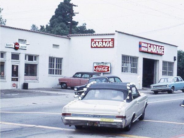
Biasotti's and Henson"Maria" Frances Ficone Biasotti (1877-1971), she ran the business after her husband Giacomo "James" Biasotti (b. 1868) died in 1934. It was a service station on the corner, and the market, "Biasotti's Groceries" on the door at 729 facing Shamrock. Next to it was the service station listed in the 1934 phone directory as Harry L. Sain's service station. Maybe it had curbisde pumps (?) that later became a garage operated by Howard Henson. Henson had previously owned a gas station on Myrtle Ave between Walnut and Olive in the 1940s, but sold it to move here. Below is a picture showing both buildings in the 1960s. Compare it with the current view.
Gas station nowadays (in 2024 it is being restored, pumps have gone)
Keep northbound and turn left when you reach Foothill Blvd. its original name was White Oak Avenue.
Street Names in Monrovia
The town's streets were named for flowers, trees and women's names. Very few have changed over the years since the town was founded in 1886: Banana Ave. became Hillcrest Boulevard; White Oak is now Foothill Charlotte became Canyon; Falling Leaf became Huntington Drive, and Orange Avenue became Colorado Boulevard.
Harding Court
Historic landmark
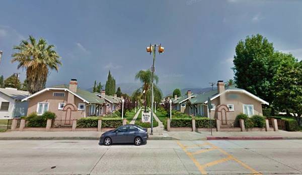
Drive westwards along E Foothill Blvd for 0.2 miles. AT 401 E Foothill, to your right is an example of a 1920s "Bungalow Court"; it was advertised in the 1934 phone directory under the Bungalow Courts listing. It was designed and built by Sherman McQueen in 1920. The complex has fifteen three-bedroom bungalows that open onto a central garden. It was named after the then elected-President Warren Harding.
It was restored in 2002 and sold as private apartments.
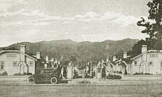
Harding Court in Monrovia
Westwards, as you approach Myrtle Ave, the town's main street there are no more surviving landmarks, but the telephone directory from 1934 mentions a few: the Foothill Service Station (231 E Foothill), Graham's Union Oil Service Station on Foothill and Ivy, later moved westwards to the corner with Stedman.
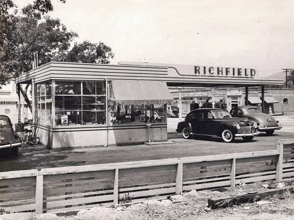
Then came Beischel's Richfield Service Station (132 E Foothill) on the SE corner with Encinitas. Lawrence Beischel opened it here in 1923 and Bud Miller ran the Ford brand repair shop on the back of the gas station. It was upgraded many times over the course of the years. Across, on the SW corner was a Signal Service Station in the 1940s.
Myrtle and Foothill
At South Myrtle Ave. to your right is the First Presbyterian church on the NE corner, by the way, Myrtle was named after Monroe's oldest daughter.
There was Chuck Calver's Chevron Service Station (pictured below) service station on the SW corner, and Klein's Pharmacy in the 1930s, later Jewell Pharmacy on the NE one (this building is still there). Below is a view of this intersection in 1949, the other image is the current view at the same spot.
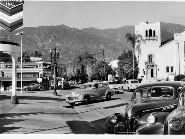
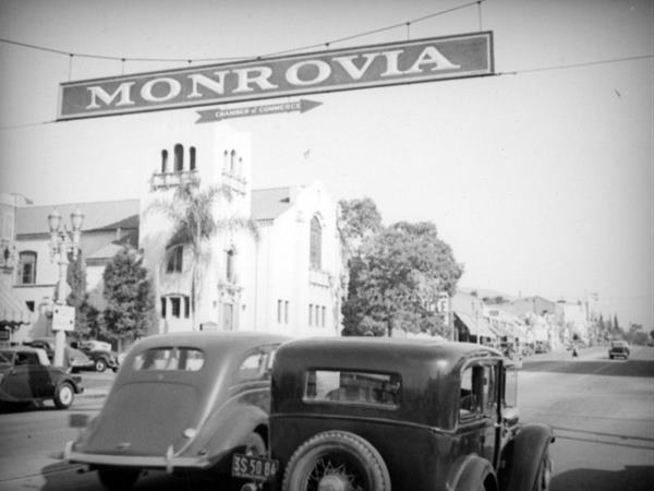
The picture above looks east along Foothill at Myrtle; it was taken by Herman J. Schultheis around 1937, notice the arrow pointing south into Myrtle, the Mission Revival style First Presbyterian Church and the shops lining the street. This is the same view nowadays.
Not visible in either image, was the Ruechel Garage (104 E Foothill) on the SE corner at Myrtle Ave. The garage was established by Ben Ruechel in the early 1910s, and continued by Fred after Ben's death in 1914. It was modified over the years, and torn down in the 1970s.
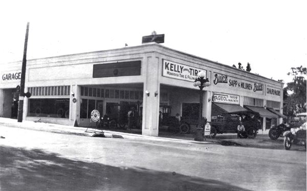
The building was known as the "Anson Building" after is constructor, Charles H. Anson. It was shared by the Buick dealers Sapp & Mildred, Stanlet Noore's Tire business and Fred Ruechel's garage.
The Leven Oaks
Just south of the intersection, to your left, at 120 S Myrtle Ave. Is a classic hotel built in 1911 at a cost of $40,000 to provide decent lodging to visitors. It has a "U" shaped layout with a central plaza between the north and south wings. Its postcard says "a family and tourist hotel, homelike atmosphere, excellent food, comfortable rooms, beautiful grounds."
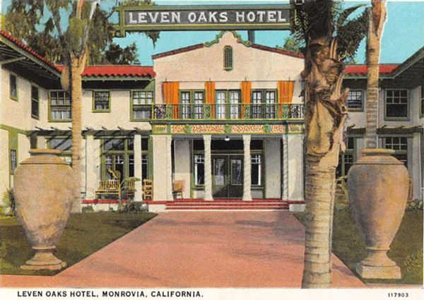
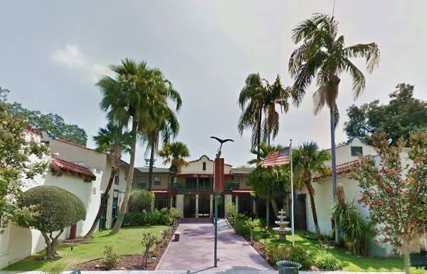
It was named after eleven oaks that stood on the property, some of which were left untouched, and some of which survive to this day. It was designed by the Eagers in a Swiss style.
In 1984, its owner, Lisa Magno, turned it into an assisted living facility for seniors, and nowadays it houses 36 residents.
Westwards along Foothill
Graham's Union 76
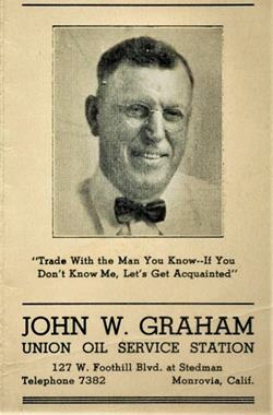
John W. Graham's Union station ad c.1930s. Source
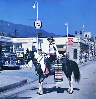
Graham's Union station c.1940s. Source
Drive west along Foothill and on the next block, on the NW corner with Steadman Pl, at 127 W Foothill is the second location of Graham's service station owned by John Webster Graham (1882-1958) . The building has survived though greatly modified but you can still see the old Streamline Moderne style canopy over the concrete gas pumps island, the small office and, to the left, the one-door repair shop.
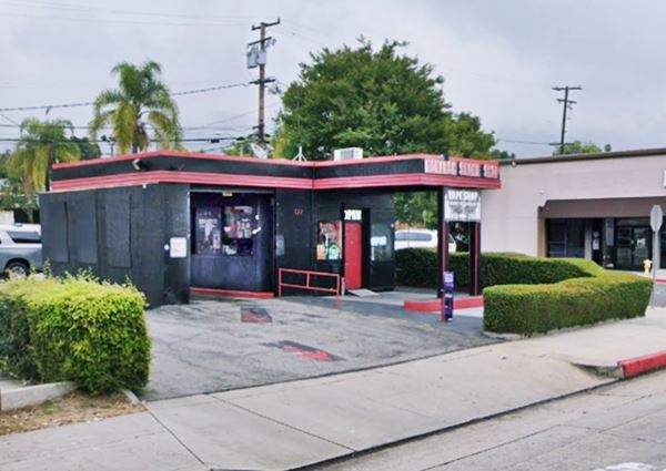
The 1934 telephone directory mentions Lindstrands's 1 Stop Service at 207 W Foothill with Shell Oil Service Station #167 across the street at 250 W Foothill on the SE corner with Magnolia Ave.
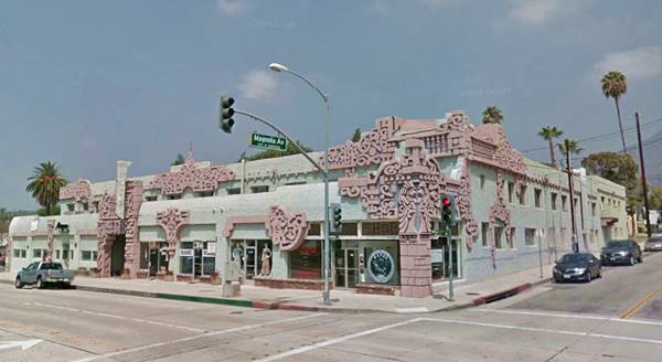
Aztec Hotel
Listed on the National Register of Historic Places
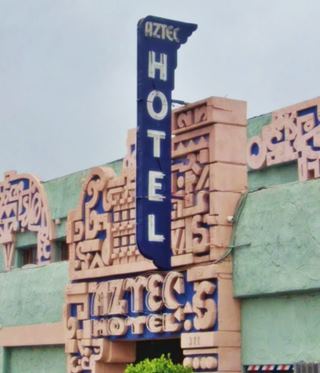
At 311 West Foothill Blvd., kitty-corner from the Shell was this classic hotel that is still standing and almost one hundred years old.
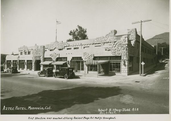
The picture above was taken in 1924-25 taken by the building's architect, Robert B. Stacy-Judd (1884-1975); he captioned it: "First structure ever erected utilizing Ancient Maya Art Motifs throughout."
The 44-room Aztec Hotel opened in 1925 (one year before the creation of Route 66) and was built in "Mayan style" though it was named "Aztec" because Stacy-Judd believed that the general public was more familiar with the Aztecs than the Mayans.
The reliefs and murals can be seen both outside and in the interior of the building. It prompted a short Mayan style boom which lasted a few years.
The 1930s realignment of Route 66 to Huntington Drive bypassed it. But it kept operating for many years. It was restored in 2000.
Aztec Hotel in Monrovia nowadays
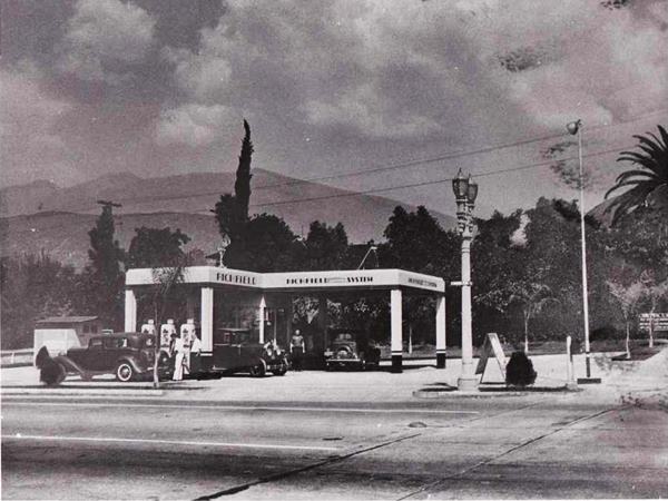
Bob Scott's Richfield Service Station
Two blocks west, on the NW corner with N Alta Vista is a former service station. Built in the 1920s with two separate canopies one facing each street, it was modernized over the years and after the 1960s, repurposed. The building is still there.
This alignment continues westwards along Foothill across northern Arcadia, Santa Anita, southern Sierra Madre and in eastern Pasadena meets the later one along Huntington Drive, Colorado Pl and Colorado Blvd that runs further south.
Continue your Road Trip
This marks the end of your trip across the city of Monrovia, head west to continue your Route 66 road trip in neighboring Arcadia.

Sponsored Content
>> Book your Hotel in San Bernardino

Credits
Banner image: Hackberry General Store, Hackberry, Arizona by Perla Eichenblat
A Guide to the Golden State; Federal Writers' Project of the Works Progress Administration, Hastings House, New York, 1939.
Jack DeVere Rittenhouse, (1946). A Guide Book to Highway 66.


