Route 66 in Arcadia CA
Index to this page
About Arcadia California
Facts, Trivia and useful information
Elevation: 482 ft (147 m). Population 54,997 (2025).
Time zone: Pacific (MST): UTC minus 8 hours. Summer (DST) PDT (UTC-7).
Arcadia is a city located Route 66 in Los Angeles County in southern California, on the San Gabriel Mountains' foothills; it is part of the Los Angeles metropolitan area.
Arcadia and Route 66
There are two towns named Arcadia on Route 66, the other is the Arcadia in Oklahoma, site of the famous Historic Round Barn.
The history of Arcadia
The foothills of the San Gabriel Mountains have been inhabited for over 10,000 years, and at the time of Spanish discovery in the 1600s, the Europeans encountered a hunter - gatherer Native Americansociety, the "Tongva". The Spaniards named them after the mountain range, river, and valley in this area, San Gabriel. They were known as Gabrieleños or Gabrielinos.
A Mission was established nearby in 1771 (San Gabriel Arcángel) and it owned a vast swath of land in the San Gabriel valley. Not long after Mexico's independence from Spain in 1821, the land was taken from the church and nationalized. Then it was granted to Mexican citizens. At that time California and what is now the Southwestern U.S. was Mexican territory.
Hugo Reid, a Scotsman who had become a naturalized Mexican and married a local Tongva, Victoria Bartolomea Comicrabit, received a land grant in 1841 from Governor Juan Alvarado. Reid named it after one of his wife's relatives (Anita Cota) as "Rancho Santa Anita", Anita is a Spanish pet form of Ana, which in turn derives from the Hebrew name Anne, meaning "favor, grace".
After the Mexican American war (1846-48), Mexico had to ceded California (Nevada, Arizona, New Mexico, Utah and Colorado) to the US, and it became a state in 1850. But by then Reid had already sold his land to his neighbor, Henry Dalton.
The ranch had other owners over the years and was finally bought by Elias Jackson "Lucky" Baldwin (1828-1909) in 1875. Baldwin had come to California during the Gold Rush and made a fortune, hence his nickname. He built his mansion on the 8,000 acre tract, that became the Queen Anne Cottage that is preserved in the Arboretum.
When the Los Angeles and San Gabriel Valley Railroad built its line through the area (linking up with the Santa Fe Railroad in 1887), Baldwin sold part of his land and created a town named Arcadia, which was platted in 1888.
The name: Arcadia
It was named after the Greek region of Arcadia in the mountains of central Peloponnesus. Its name derives from Arkas, the son of Greek god Zeus and Callisto, Arkas was the founder and first king of Arcadia.
The region served as inspiration for pastoral poems, the first of wich dates back to the Renaissance with Jacopo Sannazaro's Arcadia published in 1504 in Italy, and a similar one in English by Philip Sidney's "The Countess of Pembroke's Arcadia" (1580). It is a synonym for harmony with nature, pastoral peace and unspoiled land.
Baldwin built the Oakwood Hotel next to the railway station and it sold liquor, convenient because neighboring Pasadena and Monrovia were "dry" towns. Arcadia incorporated in 1903 and the Pacific Electric streetcar system linked it to Los Angeles.
By 1910, the use of cars had grown greatly and the National Old Trails (N.O.T.) Association was formed to promote a road between New York and Los Angeles; it passed through Arcadia, 0.7 miles north of its City Hall. A second paved road system linked it with Los Angeles: Santa Anita Ave, Campus Dr., and Huntington Dr.
In 1926, U.S. Highway 66 (Route 66) was created and aligned along the N.O.T. highway through San Gabriel Valley. In 1935 it was moved south, along Huntington Drive from Monrovia into Arcadia, and then west along Colorado Pl. and Colorado St. into Pasadena.
The freeways of Los Angeles and the Interstate highways marked the end of Route 66 in Arcadia, as traffic chose to drive along them.

Accommodation in Arcadia
You can find your lodging in town.
> > Book your Hotel in Arcadia
More Lodging close to Arcadia along Route 66
Below you will find a list some of the towns along U.S. Hwy 66 east and west of Arcadia; click on any of the links to find your hotel in these towns.
>> Check out the RV campground near Arcadia, in Pomona
The Weather in Arcadia
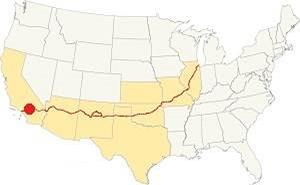
Location of Arcadia on Route 66
The climate in Arcadia is of the "Warm Summer Mediterranean" type. It is dry and hot in summer but cool in winter, which is also the rainy season. The average monthly temperature does not exceed 71.6 °F (22°C).
Arcadia has around 290 sunny days each year, and during fall (autumn) the strong dry "Santa Ana" winds blow from the desert drying out the area and increasing the risk of wildfires in the foothills.
The summer average high is 89.4°F (31.9°C) and the average low is 61.1°F (16.2°C). During winter the average high is (Jan) 67.8°F (19.9°C) and the average low is 44.3°F (6.8°C).
In winter, the peaks of the San Gabriel Mountains receive snow, and may occasionally falls in the higher districts of Arcadia.
Rainfall averages 21.1 in. per year (536 mm), with the period May to October being the driest one with an average of 0.5 to 2.8 in. per month (12 - 71 mm). There are some 43.5 rainy days per year
Tornado risk
Arcadia is very close to the Pacific Ocean very far from the Rocky Mountains (western limit for tornadoes) so there is no risk of tornadoes in town.
Tornado Risk: read more about Tornado Risk along Route66.
Map of Route 66 in Arcadia
>> Custom map of Route 66 through Arcadia.
National Old Trails Highway (N.O.T.) in Arcadia
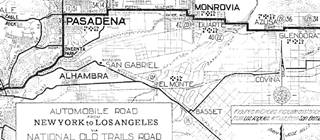
1912 N.O.T. Road map
Click on image to enlarge.
Credits
As mentioned further up, by the early 1910s automobiles were becoming popular, but the highways were mostly dirt trails with ruts and potholes that were unsuitable for cars. Across the nation organizations were created to promote better roads. This led to the creation of the National Old Trails (N.O.T.) Association that lobbied for a highway between Los Angeles and New York.
The N.O.T. map (click to enlarge) shows its alignment across this area, it can be seen on Foothill Avenue between Monrovia and Pasadena. Downtown Arcadia would be located where the "N" of Pasadena is.
Route 66 Map
In 1926 Route 66 was aligned along the National Old Trails roadway and the green line marks the 1926-34 alignment of Route 66 along Foothill Ave in Arcadia.
The following map shows the highway in the Los Angeles region in 1927. You can follow Route 66 from Victorville in the east, to San Bernardino and west to Pasadena and Los Angeles. Pasadena and Monrovia are on the lower left side; Arcadia lies between them but isn't shown in this map.

1927 Road map, SW CA
Click on image to enlarge.
Credits
The black and white 1930 thumbnail map above also shows the alignment of Route 66 from Victorville to Los Angeles notice Monrovia and the detail with the alignment into Pasadena.
The other map published in 1928 shows Route 66 running from Duarte, across Monrovia, Arcadia, south of Sierra Madre, and into Pasadena. It shows it running along Foothill Blvd. and Colorado into Pasadena.
In 1933 Route 66 was realigned along Huntington Dr., Colorado Pl., and Colorado St., and it is marked with a red line in our custom map.

1956 Shell Roadmap, SW CA
Click on image to enlarge.
Credits
The map above shows the same area in 1956; a freeway now links Victorville with Cajon and San Bernardino with Los Angeles. Arcadia appears in it. In 1964 the western terminus of Route 66 was formally moved from Santa Monica to Needles CA; however, only the highways up to Pasadena were decertified, the remaining ones remained signed as Route 66 until I-40 was completed between Barstow and Needles in the early 1970s.
Route 66 Alignment across Arcadia
With maps and full information on the Mother Road.
- Pasadena to Santa Monica (Next)
- Barstow to Pasadena (Arcadia's)
- Topock to Barstow (Previous)

Sights and Attractions in Arcadia, California
Historic Context
The 1939 "Guide to the Golden State" written by the WPA described the Monrovia section of Route 66 as follows:
ARCADIA, 35.9 m. (479 alt., 5,216 pop.), is largely peopled by Los Angeles commuters. Poultry and rabbit raising is carried on here. The LYON PONY EXPRESS MUSEUM, (L) 36.4 m. (8-6; adm. children 10$), where the highway widens triangularly to meet converging Huntington Drive, houses the privately owned exhibit of W. Parker Lyon, former mayor of Fresno, California. The frame buildings achieve a deliberately ramshackle effect, purportedly resembling a ghost city, with a "pioneer" attendant guarding the entrance. Inside is an 1849 bullet-scarred bar, an old gold scale, a vigilante bell, several stagecoaches, and a collection of Indian mementos and curios of the 1840's and 1850's but little to justify the name "Pony Express."
At 36.4 m. is a junction with Huntington Drive. Left here to the main entrance (R) of SANTA ANITA RACE TRACK, 0.5 m. (racing 1:30 p.m. (weekdays, except Mon., during 2-month (winter season beginning about New Year's Day; adm. $1.10, parking 25$), named for the "Lucky" Baldwin rancho, which it adjoins (R). It is the $1,000,000 home of midwinter racing events that include a $100,000 handicap. Blue buildings with white roofs spread along one side of the 1-mile oval track, backed by the lofty peaks of the San Gabriel Range. The grandstand seats 30,000; the stables can hold 1,500 horses. During the racing season the 500-acre scene is one of excitement and holiday bustle, thronged with notables, among them Hollywood celebrities. The season's wagers amount to more than $25,000,000. WPA (1939)
Shortly after World War II, Jack DeVere Rittenhouse drove along Route 66 in 1946 gathering information for his memorable book: "A Guide Book to Highway 66". He mentioned that there were many towns: "... DUARTE, 347 mi.; MONROVIA, 350 mi., and ARCADIA, 352 mi. Just west of Arcadia you pass the PONY EXPRESS MUSEUM (L), containing a historic collection of stagecoaches and old western relics. Famous SANTA ANITA RACETRACK is just beyond.".
Jack Kerouac and Arcadia
Jack Kerouac (1922-1969) wrote the classic novel "On the Road" explores the essence of "Americanness" in a way which was controversial when the book was written in 1951 and when it first published in 1957, with its view on the freewheeling notion of the post-WWII beat youth, road travel, and freedom.
Kerouac visited L.A. in 1947 trying to sell a screenplay to Columbia Pictures, but instead fell in love with Bea Franco. In "On the Road", Keouac tells us that he was short of cash when he stopped here, adding:
Before the daily room rent was due again we packed up and took off on a red car to Arcadia, California, where Santa Anita is located under snowcapped mountains... We went into a motel court and bought a comfortable suite for about four dollars -shower, bath towels, wall radio and all. We held each other tight and talked. I loved this girl in that season we had together, and it was far from finished Jack Kerouac (1957)
Which motel did he stay at? No one knows.
Route 66 Road Trip Leg in Arcadia
During its heyday, in 1947, the Monrovia-Arcadia region boasted 25 new motor lodges and motels and at the US Highway 66 Association convention in Oklahoma City, Walter Muller, the owner of Arcadia's Westerner Hotel told his colleagues about the premium service offered by these motels, such as in-room phone service and "beautiful crystal swimming pools."
Almost all of these classic Route 66 motels in Arcadia have now gone, lost to development: like Eaton's Santa Anita Hotel, the Westerner Hotel, or the Huntington Motel, just to mention a few. We will mark these lots landmarks with a red cross (❌).
Below we describe both alignments of Route 66 across the city:
- Original 1926-33 Route 66
- Later 1934-74 Route 66
Route 66 1926-33 Alignment along Foothill Blvd.
This is parallel to the later alignment but 3⁄4 of a mile north of Huntington Dr. it carried traffic and it has some sights along it; we describe them below, driving westward from Monrovia.
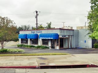
On the eastern city limits, at 5th Ave., at 424 E Foothill, on the corner with 5th Ave, the 1963 City Directory mentions W C Thomas' Mobil Service ❌ and the building is still there, recently a cleaners shop; see its picture.
The 1963 city directory mentions the following restaurants along East Foothill on the 300s block: HENRY'S GRILL (Henry Hackel), 342 E Foothill Blvd, and BURGER LANE Inc. (Dan Crawford), 309 E Foothill, between 5th and Northview Avenues. Both gone.
Arcadia Wigwam ❌
The Orange Inn pictured below in a photo taken on June 3, 1927 featured a 10-foot tall orange-shaped fruit juice stand. It also was a restaurant.
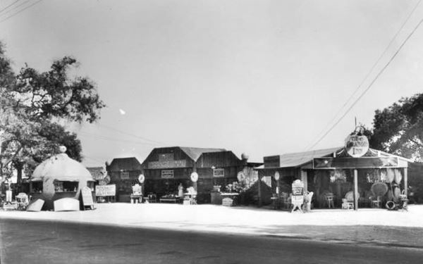
Later it changed its name (and appearance) becoming the Slemon's Orange Wigwam with a conical thatched building that in the 1930 City Directory appears as belonging to James B. Slemlons at 141 E Foothill. The postcard below reads: "THE WIGWAM "The Slemons Tribe" - The most bewautiful fruit funiture and basket store in America... The home of the famous "Wigwam Orange Juice" Foothill Boulevard Arcadia California."
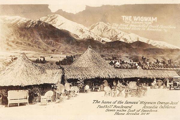
It was named Wigwam because it was located on Wigwam Avenue and Foothill Blvd. as you can see in this map roughly where the modern McDonald's is located.
The McDonald's Wigwam ❌
The Wigwam was a roadside stand that stood in Aracadia near 2nd & Foothill, at the current 'Wigwam' street.
The Patrick McDonald and his two sons, the McDonald brothers, Richard and Maurice owned the Airdrome restaurant and an orange juice stand in neighboring Monrovia. They later moved their drive in to San Bernardino and transformed into the the 1st McDonald's in the World. However, they kept the "wigwam" open and it was managed by Patrick until his death. Richard McDonald wrote about both stands as follows:
I also built an other orange juice stand directly across the street from the airport. As you know, there is a lot of traffic on that highway and wanted to try to get the people going in each direction. The second stand was in the shape of a huge orange and many hundreds of people stopped each week to take a photo of the huge orange. I wish they also had stopped to buy some orange juice and oranges. When we moved to San Bernardino in 1940, we moved the original stand. The moving company actually cut the building in half and towed it to San Bernardino. We sold the large orange stand and it was also moved. In regard to the Wigwam building, we did have our father run that one until he passed away. This was also strictly orange juice and oranges which we purchased from packing houses in Glendora. If you ever learn what ever happened to the large orange stand, please let me know.... Richard J. McDonald (1996)
Casa Janara
Continue east, and to your right, on the NE corner at 200 East Foothill, is a restaurant that was "6 blocks North of Highway 66" (when Route 66 ran along Huntington Dr.); it served Mexican Food and was "Open Every Day."
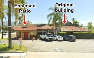
Still open as a restaurant, now it is "Don Ricardo's Bar and Grill." The hip roof building to the left in the vintage postcard below, with its stone chimney is still there, the open air verandah with tables on the left has been enclosed.
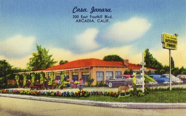
Westwards none of the businesses mentioned in the City Directory have survived. We list them as a reference of the lost landmarks:
- 100 E Foothill King & Son Chevron
- 66 E Foothill Stuehrmanns Service
- 56 E Foothill Henry Celmer's Coffee Shop
- 25 E Foothill Hathaway's Shell
- 4 E Foothill Eddie Mefford's Texaco Service
- 4 W Foothill Baker's Union Service
- 5 W Foothill Anderson Richfield
Westwards the original highway crossed open countryside and there are no surviving buildings.
The 1934 to 1974 Alignment of Route 66 across Arcadia
Driving westwards from Monrovia starting at Arcadia's eastern city limits at 5th St. and Huntington, where Santa Anita Wash crosses Route 66 you will enter Arcadia.
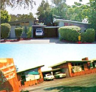
Half a block north of Huntington along Fifth St., at 111 N 5th Ave was the now defunct Arcadia Oaks Motel ❌ it appears in the 1963 City Directory and in the 1961 Greater Los Angeles Directory it appears in the aerial photos from 1952 to 2000 with eight cottages around a central office.
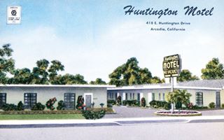
The Huntington Motel, Arcadia. Source. Click image to enlarge
Along Huntington Drive, just ahead, to your left where the two story block building on the corner now stands, the 1963 City Guide mentions the Huntington Motel ❌ operated by Noella Boucher at 418 E Huntington it had 10 cottages (click picture to enlarge).
Round Up Motel ❌
Adjacent to the Huntington Motel, at 412 E Huntington, was the Round Up Motel. Its 1957 postcard below tells us it offered "Real Western Hospitatlity." Loren and Carol Jimerson owned it, and it had 20 units with "full-tile showers. Wall-to-wall carpets... Television and radios... Garages." It was torn down in the mid 1980s.
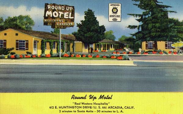
The Derby Motel ❌
Also to the left, next to where BJ's restaurant is now located, was the Derby, a classic Route 66 Motel. Torn down in the mid 1980s. You can see it in this 1954 aerial photograph.
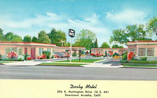
Derby Motel Arcadia Rte 66. 1950s. Source
Click image to enlarge
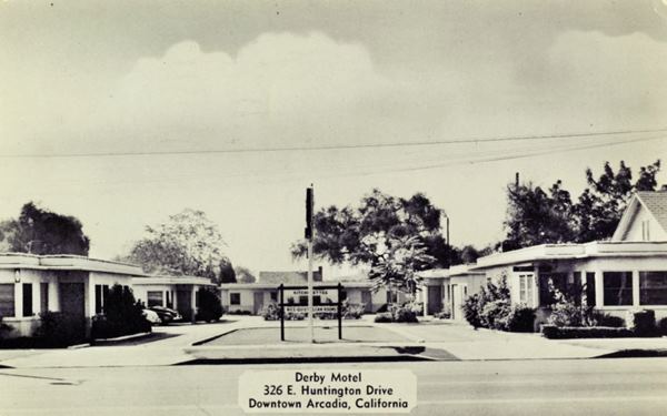
The 1950s color postcard (click to enlarge) tells us it had 16 units and that Ray and Helen Gault were the Managing Owners. Its black and white 1953 postcard below places it at 326 E Huntington "1⁄2 mile east of Santa Anita Race Track. Clean rooms, kitchenettes and suites. Considerate terms. First Class Restauraant Almost Opposite." This upscale restaurant is still there, it is also named "The Derby".
The Derby and horse racing
Edward Smith-Stanley, Twelfth Earl of Derby (1752-1834) like most English aristocrats of his time was interested in horse racing, gamgling and hunting, so it was natural that the Earl of Derbty establish one of the most famous horse races in the world, the Epsom Derby. It has been run every year since 1780.
This English derby is pronounced: DARH-bee. When the American Kentucky race was established in 1875 the same name was employed, but it was pronounced DER-bee.
Finally, the derby hat was also named for the earl; it is a hard felt hat with a narrow brim and a rounded crown. It was used by Chaplin, Stan Laurel, Oliver Hardy and Curly Howard, Churchill and even Greta Garbo and Bette Davis. It is also called bowler aftern the Bowler Bros. hatters who produced it.
In 1963, at 301 E Huntington there was a Royal Union Service Station ❌.
The Derby Restaurant
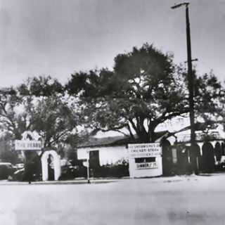
The Derby restaurant c.1940. Source
Hudson M. Proctor founded a tavern (Proctor's Tavern) in Arcadia in 1922; the 1930 phone directory has the following entry under Restaurants: "Proctor H M 12 Foothill blvd Arcadia," he relocated to this spot at 233 E Huntington in 1931. Shortly after, in 1934 horse racing was legalized in California and in 1934 the Santa Anita racetrack opened just down the road.
George Monroe Woolf (1910 - 1946) was a thoroughbred race horse jockey who became a legendary figure for his victories riding Seabiscuit in 1938. Horse racing was very popular at that time and had national radio and newspaper coverage. Woolf died in a racing accident and was inducted into the National Museum of Racing and Hall of Fame, Canada's Sports Hall of Fame, and the Canadian Horse Racing Hall of Fame.
Woolf had partnered with Bill Peterson and purchased the Derby in 1938. The place was deocarated with horse-ridign memorabilia, and has been preserved throughout the decades.
There are two bronze statues, one of George Woolf and the other of Seabiscuit at the Santa Anita racetrack.
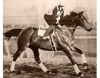
Woolf riding Seabiscuit. Source
Click image to enlarge
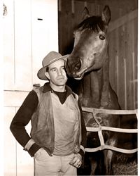
Woolf and Seabiscuit. Source
Click image to enlarge
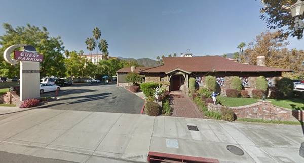
Notice how the neon sign evolved from a steed's head in the 1930s to a hat nowadays, both related to the Derby.
Bob's Beef Burgers ❌
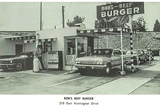
Bob's in the early 1960s, Arcadia. Source. Click to enlarge
The 1963 city directory mentions Bob's Beef Burgers here at 218 E Huntington on the eastern side of the railroad overpass. Now a Starbucks stands on the site. See the current St. view the same railroad embankment can be seen in the images.
Originally this was a site of the In-N-Out Burgers. Carl Allen Bob was in a partnership with Harry and Esther Snyder, the founders of the hamburger chain back in 1948, but he didn't want to expand the drive-in so they split. Carl kept this site and two others while the Snyder's opened their shops in other locations. Only after Bob's closed for good and was torn down in 1989 did they open an In-N-Out in Arcadia.
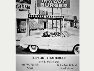
In-N-Out in the 1950s, Arcadia. Source. Click to enlarge
Harry and Ethel Snyder grew the chain they founded in 1948, and now, run by the family's third generation it has expanded into Arizona, Utah, Nevada, and Texas. As a curious fact, In-N-Out prints Bible quotes in small sized fonts on their packaging, like "Proverbs 3:5", "John 3:16", or "Proverbs 24:16"
On the next block there were several restaurands and gas stations, all of them lost (❌):
- 166 E Huntington Cats Pajamas Restaurant
- 159 E Huntington King's Flying A Service
- 131½ E Huntington Mr O's (restaurant)
- 113 E Huntington Little Sweden (restaurant)
- 104 E Huntington Standard Stations Inc
- 103 E Huntington Todd's Donut Shop
Downtown: First Ave. and Huntington Dr.
Just ahead is the downtown area, the image below taken in the 1920s or 30s looks north along First Avenue at its intersection with Huntington Drive and it compares it with the current view at that same spot.
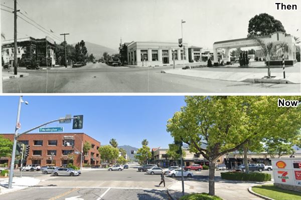
The Old City Hall is the ivy covered building on the top left (NW) corner. It was a two-story colonial-style building dedicated in 1918 and torn down in 1950. It was designed by Xavier Lourdou, and its entrance with a portico supported by four columns, faced First Ave.
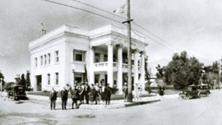
Arcadia CA, "Old" City Hall, 1926. Source
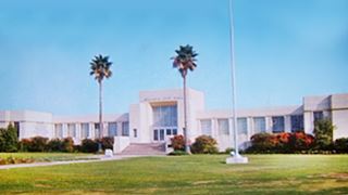
Arcadia CA, "New" City Hall, 1950s. Source
In 1948 a new city hall was built at 240 W Huntington on a large 13.5 acre plot of land, where a civic center was built, partly funded by a five-cent tax levied on the entrance ticket to the Santa Anita racetrack.
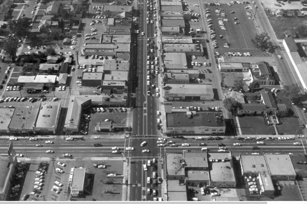
A Thrifty Drug Co. was built on the site of the old City Hall in 1950. Torn down later. The image above was taken in 1955 and looks westwards from 1st Ave. and Huntington. The Thrifty can be seen on the upper right corner of the crossroads.
Arcadia Drive-In Market ❌
On the SW corner, opposite the Thrifty (see the image above, upper left corner) was one of the country’s first drive-in market centers that included a service station, it opened in 1929 and was also known as the "Market Basket". It had different stores in an L-shaped layout around a central drive area. These included dry cleaners, meat market, grocery store, bakery, fresh vegetables market and a Cafe. It was torn down and the Home Savings and Loan (now Chase Bank) was built on the property in 1960, at 60 E. Huntington Drive.
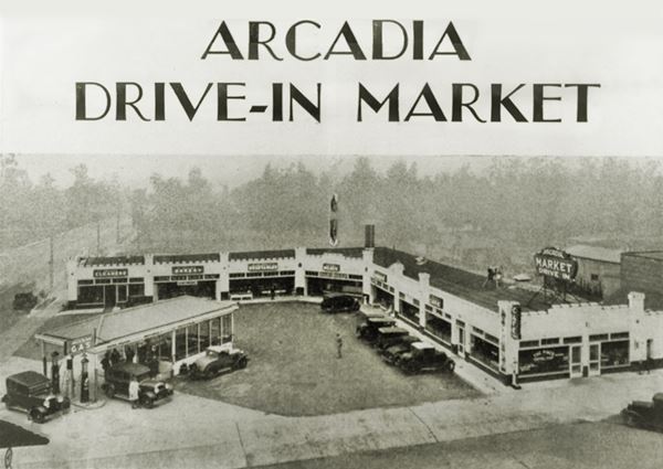
Drive-In markets offered the advantage of easy access (by car), many different types of foods in one venue, no need for delivery, and the convenience of one-stop shopping, and this one included a service station.
Just south, at 31 S 1st Ave was the J & N Coffee Shop, and along the block west of First Avenue, there six restaurants and a service station listed in the 1963 city directory:
- 59 E Huntington Pelleginos' Fina Italian Food
- 48 E Huntington Lindy's
- 31 E Huntington Leo's Malt-Burger Shop
- 29 E Huntington Spencer's Hofbrau
- 16 E Huntington Moon Palace
- 14 E Huntington Hickory Burger
- 6 E Huntington Royal Union Service
The former Arcadia News Journal Art Deco Building
Historic marker
This building is one of the few surviving classics in Arcadia. It is located in the middle of the block, on its northern side at 51 E Huntington Drive.
The Arcadia News Journal Building was built around 1932 in Art Deco style. Notice the square panels on the upper part of the facade. These were sculptured by J. J. Mora. The building is now a Funeral Parlor.
Art Deco Style
The Art Deco style also known as "moderne style" flourished between both World Wars (1914 - 1940). And became the predominant artistic style of the 1930s.
It influenced everything, from jewelry to book bindings to furniture, advertising and, of course, architecture.
Its name comes from the "L'Exposition Internationale des Arts Décoratifs et Industriels Modernes" held in Paris in 1925, where artists tried to blend our industrialized world with fine arts.
It was a symbol of wealth, luxury, and elegance that adopted symmetry, rich colors, and bold rectilinear geometric shapes to exalt the technological progress of the early twentieth century. It shunned the curves and asymetrical art of the styles that preceded it.
It also included animals, stylized foliage, chevrons, zigzags, and other geometrica motifs as ornaments on Art Deco style buildings.
The former Arcadia News Journal Art Deco Building
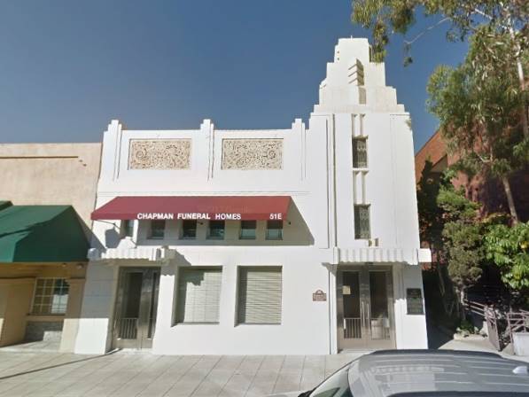
You can see the builduing on the left side of the following image, that looks east along Huntington towards 1st Avenue, taken on November 7, 1937.
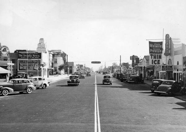
The image above also shows the Arcadia Theater ❌, on the right side of the street; it was playing "One Mile from Heaven" with Claire Trevor and Sally Blane, and "Thin Ice" a romantic comedy movie starring Tyrone Power and figure skater Sonja Henie.
On the left side, there is a Gilmore Oil Co. gas station selling their Red Lion gasoline brand. The company was acquired in the 1940s by the Socony-Vacuum Oil Company amd eventually became Mobil Oil, it can be seen in as a Mobil station (click for late 1940s image of this spot).1
Notice the Old City Hall (left) beyond the the Art Deco Arcadia News Journal building, and the price of the "Old Guide Whiskey" distilled by the Three G Destillery Corp. in Burbank CA, priced at 59¢ the pint.
At the western tip of the block , to your right, with the windmill on its roof is Denny's restaurant.
Denny's Windmill Restaurant
At 7 E Huntington Dr. Open 24 ⁄7, it is located on the NW corner of Santa Anita Av. and Huntington Drive. In the late 1950s the Shopping Bag food market stood here, but it was replaced by the current building in 1967; it is a mid-century Googie style building designed by architects Harold Bissner and Harold Zook for the former Van de Kamp's restaurant and bakery.
Van de Kamp's Holland Dutch Bakeries was founded in 1915 in Los Angeles and its stores had windmills atop their restaurants. The company went broke in 1990 and the brand is now owned by Pinnacle Foods Group.
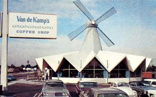
Van de Kamp's, Monterey Park, 1968 Source. Click to enlarge
Googie Architecture
Pronounced "gu:gi", it was a form of modern building design inspired in the Atomic and Space ages. It used bold geometric shapes, vast glass surfaces and symbolic motion designs (like atoms, boomerangs, wing shapes, arrows, and disks) that conveyed a sense of futurism and modernity.
It appeared in California in the late 1940s and was popular until the late 1960s. Cafes, motels, and service stations sported these ultra-modern designs. Denny's is a good example of googie architecture.
The building has 16 sides to it, to give it an almost circular shape, and also features a folded plate roof with 16 crests on it, and large plate glass windows under it; even the original windmill sits on top of it. In 1987, the City Council adopted Ordinance No. 1858 that amended the sign regulations, and also included a provision that prohibited the windmill from turning.
Denny's bought the property with an unmoving windmill and proposed to remove the the blades and the support tower. However, a campaign was launched by a local group to preserve the landmark. Denny's changed its plans and restored it in 2013, and in June 2016 the Ordinance was repealed and the windmill began spinning again. But the blades fell off in 2017 and had to be repaired.
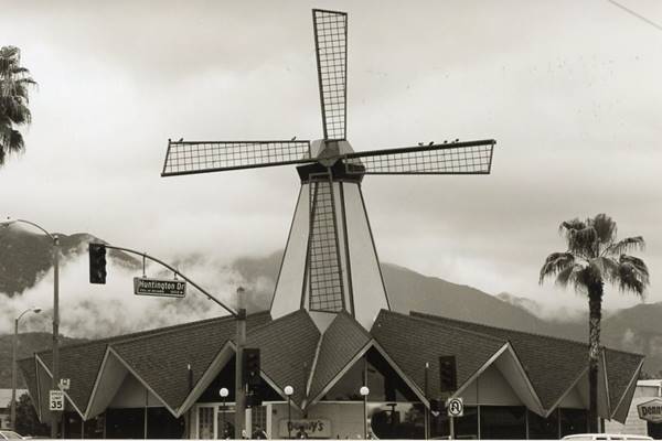
Current view of Denny's with its windmill, Route 66, Arcadia
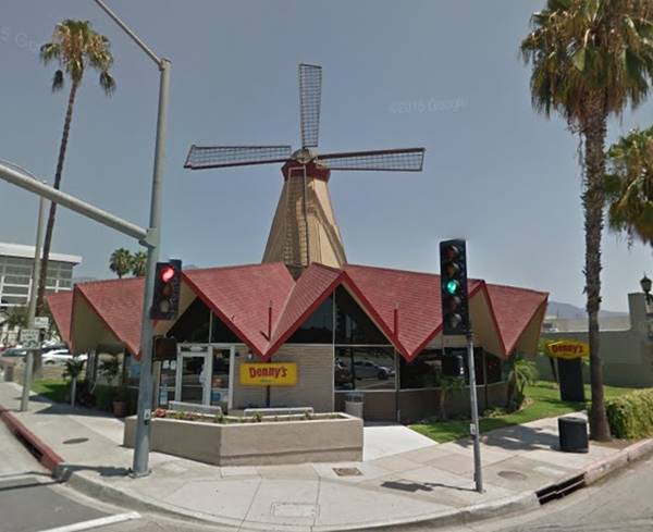
Van de Kamp and Route 66 Trivia
There is another one of these buildings on Route 66, the Pancake house, in Houck, Arizona. It was built in 1967 as a Van de Kamp's restaurant, but went bust, and it lacks also the windmill.
Westwards along W Huntington
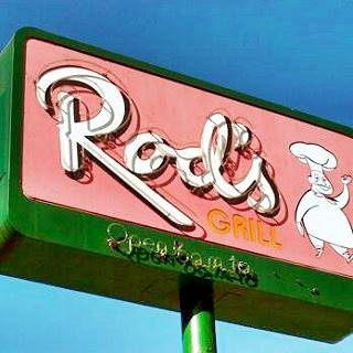
On the south side of the street is Arcadia Park, the 1963 directory lists several businesses along the north side of the street west of Santa Anita Ave. Only Rod's Grill has survived.
- 5 W Huntington Santa Anita Service
- 19 W Huntington George's Real Pit B-B-Q
- 41 W Huntington Rod's
- 79 W Huntington Casamano Chevron
- 101 W Huntington Santa Anita Motor Inn
- 111 W Huntington Hartfield's Union Service
- 125 W Huntington Henry's Santa Anitan Drive In Restaurant
- 130 W Huntington Flamingo-Ramada Hotel & Ramada Arcadia Restaurant
Rod's Grill
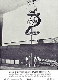
Rod's Cafe, 1950s ad. Source
At 41 W Huntington was (on Morlan Pl. and Huntington
This place has been serving meals since 1957. It serves breakfast all day (6 AM -9 PM) plus lunch and dinner. Its neon sign is a classic, but its original one back in the late 1950s was even better as you can see in the image, that says "As one of the most popular spots in Arcadia, Rods serves the best in teen-age snacks while catering to the adults of the city as wel Rod's."
This is the current view at the same spot shown in the 1950s image.
It is temporarily closed. It has an interior decoration that is purely 1960s.
There were four restaurants, this was the No. 4; the others were these: #1, 1124 W Valley Blvd. Alhambra CA; #2 190 S Atlantic Blvd., East Los Angeles, CA; and #3, 525 Garfield Ave, Montobello, CA.
Roxie Motor Court ❌
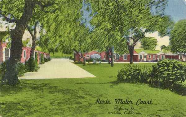
Roxie Motor Court, 1940s, Arcadia Route 66. Source
Click image to enlarge
At 55 W Huntington, across Morlan Pl from Rods. It was operated by Ed and Sue Hall, later by Connaghan and Henderson, and finaly by Mr. and Mrs. Ralph Antrim; it offered "Family Units, Bridal Suite, Monterey-style furnishings, lovely gardens and lawns." It isn't mentioned in the 1963 City Directory, so it had closed by then
Santa Anita Motor Inn ❌
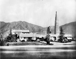
Santa Anita Motor Inn, 1941 Arcadia Route 66. Source
Click image to enlarge
Located on the NW corner of Santa Anita St., at 101 W Huntington Drive. It opened in 1938 and was owned by Mr. and Mrs. Ben F. Petre. It wwas built in Streamiline Moderne style with 15 units. Torn down in 1974; this is the same view as the postcard, nowadays.
Carpenter's Santa Anitan Drive In ❌
See this aerial photo taken in 1954, with Harfield's Union gas station on the corner of Huntington and San Rafael Rd., followed by Carpenter's and opposite, the Pony Express Museum. We describe them below.
At 125 W Huntington the 1963 phone directory mentions Henry's Santa Anitan Drive In Restaurant, but, before it, this was the site of Carpenter's a restaurant owned by Charles Carpenter that opened in 1939. It worked with the "Chicken in the Rough" franchise.
Later it became part of Henry's Drive-In Restaurant chain but he kept the name. The chain included spots in Glendale (1947), Henry's Famous Rite Spot in Pasadena (1953) and another Henry's Drive In in Alhambra. They also featured the "Chicken in the Rough" on their menus, named so because Henry's had once been part of the Oklahoma-based Chicken in the Rough chain. This chain was created in 1936 by Beverly and Rubye Osborne and grew nationwide with 250 restaurants. It's logo was a rooster with tartan trousers, a golf stick in its left foot, a bag of golf clubs on its shoulder, and a golf ball hidden in the grass ("rough" in golfer terminology). In 1963 it is called the "Santa Anitan Drive In".
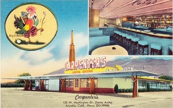
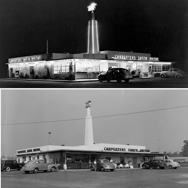
To your left on the south side of the street you will see the Le Meridién Hotel. Here was the site of the Pony Express Museum, and later on, at the same spot, the Flamingo Motel; both gone.
Pony Express Museum ❌
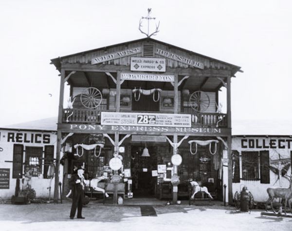
At 130 W. Huntington Drive. William Parker Lyon, who made a fortune with his furniture store, began a collection of Western relics that he displayed at his museum of Californian Antiquities in Pasadena. In 1935 he moved it to Arcadia naming it the "Pony Express Museum". The Pacific Electric tramway had a station named after it and 100,000 visitors came every year to visit it; the admission charge was 25 cents for adults, and 10 cents for children.
It displayed all sorts of weird and wacky things from stage coaches, to cannons, the longest shotguns, rifles, Indian scalps, and fire engines.
Lyon died in 1949, and the museum closed in 1955. William Harrah purchased it and moved it to his casino in Reno. After his death in 1978, the collection was auctioned.
The picture below, taken in 1939, is captioned as follows: "Exterior view of W. Parker Lyon's Pony Express Museum in Arcadia, where 28 rooms exhibited gold rush and old West relics and curios."
Former Flamingo Motel ❌
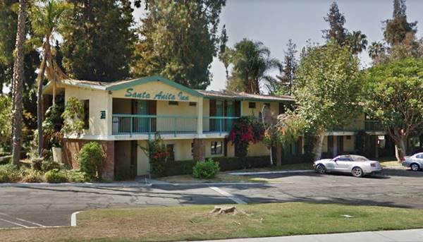
The Flamingo Hotel was part of Ramada Inn chain opened on the site the old musuem in 1956. The postcard shown below describes it as "A beautiful Motor Hotel with complete hotel service, including Swimming Pool, Room Telephones, Television, Excellent Cafe, Cocktail Lounge, Children's Playground..." It closed in 1984, and became the Santa Anita Inn in 1988 but it was torn down in 2018 to make space for the Le Meridién hotel that opened in 2021.
The Flamingo Motel in a 1950s postcard
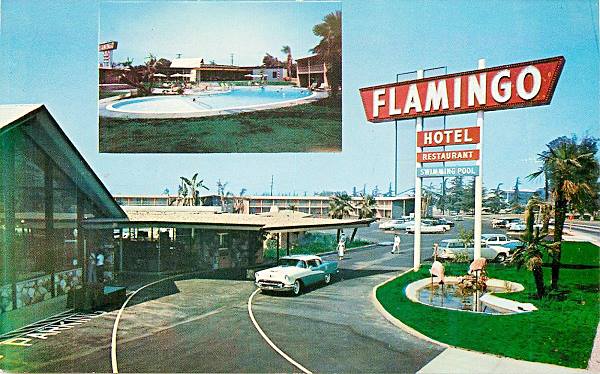
The image shows it before it was torn down (as the Santa Anita Motel); the office and main building have lost their 50's look, the classic sign has gone, but the room buildings, a two story complex behind it, and the swimming pool remained the same.
Fork in the Road
Santa Anita Park Race Track
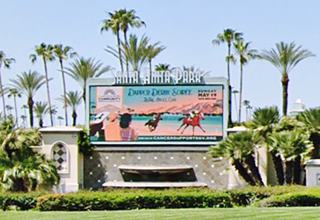
Here there is a fork in the road, Route 66 curves and turns right, with a SE-NW course along Colorado Pl. Huntington Drive curves with a NE-SW course to the left. There is a billboard announcing the coming events at Santa Anita Park racetrack (pictured above). The racetrack can be seen in the "Y" of the fork in the two images below, that look west above the fork, one taken in 1937, the other in 1958.
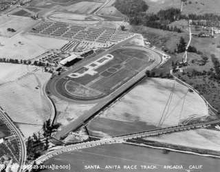
Santa Anita racetrack 1937 aerial view. Source
Click image to enlarge
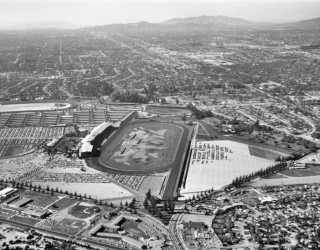
Santa Anita racetrack 1958 aerial view. Source
Click image to enlarge
Located at 285 W Huntington Dr, the racetrack is the second one in Arcadia; Elias J. "Lucky" Baldwin erected the first one in 1907 in his Rancho Santa Anita. The state of California oulawed betting on horses in 1909 so the track closed.
The land was later used by the Army and in 1933 it transferred the land back to Los Angeles County. The area became the Arcadia County Park and, in 1934 once the ban on racing was removed, the Santa Anita Race Track opened there.
Hal Roach, a movie producer and studio owner partnered with Dr. Charles H. Strub, Dentist, and they opened Santa Anita Park. It was built in Streamline Moderne style by famed Los Angeles architect Gorden B Kaufmann.
Woolf and Seabiscuit bronze statues
Don't miss the life-size bronze 1941 Seabiscuit Statue that stands in "Seabiscuit Court" (map marking the spot).
Seabiscuit (1933 - 1947) was a champion Thoroughbred racehorse, that was very popular during the years of the Great Depression, so much so that the Three Stoogies filmed "Even as IOU" in 1942 in which they end up with a retired race horse named "Seabasket", a word play on Seabiscuit.
The satue dedicated to George Woolf and is just 90 feet (27 m) from Seabiscuit's (Woolf statue location map). Woolfe died at the age of 35, after falling from his horse during a race here at Santa Anita and suffering a concussin. It is possible that he blacked out and fell due to his Type 1 diabetes.
World War II Internment of Japanese Americans
California Historical Landmark #934
In 1942 the racetrack became the Santa Anita Assembly Center for Japanese American U.S. citizens. A forced relocation center for Americans of Japanese ancestry. It was one of 18 such places in the country, and served as a temporary detention center holdingover 18,000 persons there, in primitive barracks and converted horse stables. These citizens were processed from March to Oct. 1942 here, and then sent inland to permanent interment camps like the one on old Route 66 in Santa Fe New Mexico. There was another Route 66 internment camp for Japanese Americans at Leupp Corner AZ.
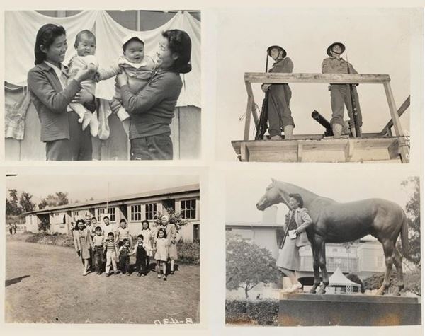
The image above shows Japanese Americans in detention in Santa Anita, including the armed Military Police sentries that guarded them. One picture shows Mrs. Lily Okura poses with statue of Seabiscuit.
These were American Citizens, including women and children, who were jailed without trial unllike Italian or German Americans (whose home countries were at war with the US). Over 120,000 persons suffered this unfair treatment.
President Ronald Reagan in 1988 officially apologized on behalf of the U.S. government, and a payment of $20,000 was approved for surviving detainees. The Civil Liberties Act that authorized this recognized that the internment had been the product of "race prejudice, war hysteria, and a failure of political leadership." 2
Prisoner of War Camp
After the Japanese Americans were moved out, the place then became a P.O.W. camp known as "Camp Santa Anita." It held thousands of German soldiers captured in North Africa during the campaign there in 1942-43. There was another POW Camp in McLean Texas on Route 66.
After WW II, the races began again in 1945. Santa Anita has become one the top horse racing facilities iin the US, Home of the Breeder's Cup and the Santa Anita Handicap. Racing takes place in October and late December through April, before the summer heat sets in.
Along Colorado Place Route66
Until 1931, Route 66 ran north of Arcadia, along Foothill Blvd between Monrovia and Pasadena. But it was realigned along Huntington (after it was linked with Monrovia east of Arcadia) and Colorado (westwards into Pasadena). The city planted deodar cedars along Huntington and Colorado Boulevard as part of a beautification project. Arcadia wanted to attract attention from the thousands of visitors that would come to Los Angeles during the 1932 Olympic Games.
The Westerner ❌
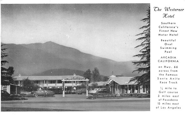
At 161 Colorado Place, with the Westerner Restaurant next to it at 181 Colorado Pl. It was built around 1948 and had 50 rooms, set around a central courtyard, with a ranch-like portico. Its 1950s postcard says "Southern California's Finest New Motor Hotel Beautiful Oval Swimming Pool on Hwy 66 across from the Famous Santa Anita Race Track 1⁄4 mile to Golf Course..." It was torn down 2007 and a modern medical center stands on the property.
Frontier Motel
Next to it, at 275 Colorado Place was the 12 room motel, it appears in the City Directory (1963) and was built with a bold Space Age design with slanting roofs and large glazed walls.
The old Frontier Motel is now closed but its buildings have survived the ravages of time as it has been restored and is now known as "The Village", an apartment complex. The composite image combines an old postcard3 from the 1950s with its current view.
The Frontier Drive-In ❌
The Frontier Drive-In, 1940s, Arcadia Route 66. Source
Click image to enlarge
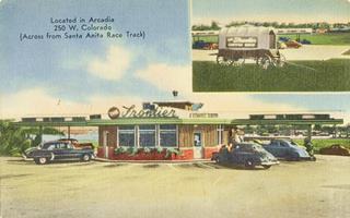
At 250 W Colorado its also had a location at 4731 E Live Oak. It was built in 1953, and its postcard says "Foutain Service - Dinners & Food Platters Cirb Service for your Convenience." It had closed by 1963, as it doesn't appear in the city directory, and torn down by 1972.
Both motel and drive-in can be seen in this aerial photo taken in 1954.
Continue West along Colorado Pl.; it becomes Colorado St. just ahead and then curves and takes an east west curve here because it met the AT & Santa Fe railroad tracks and ran along their southern side. Much later, in the late 1960s, the freeway I-210 was built with its lanes on both sides of the railroad.
The area on the south side of the highway was the site of Baldwin's Ranch, and the Santa Anita railway depot was located at Baldwin Ave. and the AT & SF tracks. Take a left along N. Baldwin Ave. to visit the Arboretum on the ranch site (Map with directions - only 0.5 mi.)
Los Angeles County Arboretum and Botanic Garden
At 301 North Baldwin Ave. You don't need to love plants to visit the Arboretum established in 1947 on the original Rncho Santa Anita grounds. It has several attractions.
Peafowl
These birds, whose males are known as peacocks, have extravagant brightly covered feathers on their tails with "eye-spots" on them. They were introduced by Baldwin to control the snakes and snails on his farm. But now they are wild. They appear on the Arcadia city seal.
Films and Series Location
Fantasy Island with Queen Anne cottage
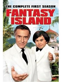
Tarzan movies were filmed here and some TV shows too, among them was Fantasy Island which aired between 1978 and 1984.
The house with the bell tower that the little person, Tatoo, rang is actually the Arboretum's Queen Ann Cottage (Map showing where it is).
It was here that Tatoo rang and cried out "De plane! De plane!" See the video that also shows the cottage. The arrival of the guests by plane was shot in the lagoon behind the house.
Queen Anne Cottage
Listed on the National Register of Historic Places
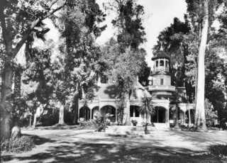
Lucky Baldwin's Queen Anne cottage. Source
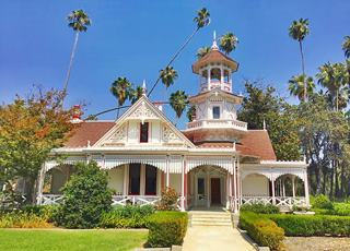
Queen Anne cottage nowadays. Source
The Baldwin Cottage, also known as the Queen Anne Cottage was built in 1886 by "Lucky" Baldwin. It is believed to be a wedding gift for his fourth wife, Lillie Bennett, who was sixteen when she married Baldwin. Her father, Albert was an architect, and he designed the building.
Baldwin didn't live here, he used it as a guest house; instead he resided in the adobe house built by previous owner, Hugo Reid.
The lake beside the cottage is natural, fed by springs.
There are of course 127 acres of gardens, the 1840 "Reid" adobe home, and the original railway station built in 1890, the "Santa Anita Depot" relocated here when the I-210 Foothill Freeway was built in 1970.
Head back to Colorado St. and head west to cover the last segment in western Arcadia
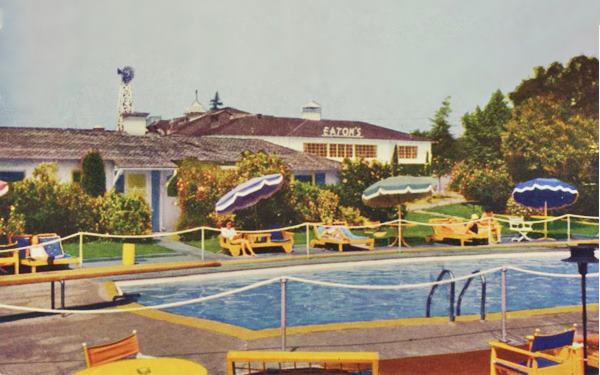
Eaton's Santa Anita Hotel and Restaurant ❌
The restaurant opened in 1939 with a spectacular building. The hotel opened in 1941 and was listed in the 1963 city directory at 1130 Colorado; the restaurant is next door, at 1150 Colorado. The hotel had 58 rooms, a swimming pool and bungalows. Charles Eaton and his wife owned it. The restaurant had a sit-down dining area and also a drive-in. Below is a view of the restaurant from the air taken on March 7, 1940, before the hotel was built; notice the "spire - steeple" on its right tip, that has an eight-sided layout.
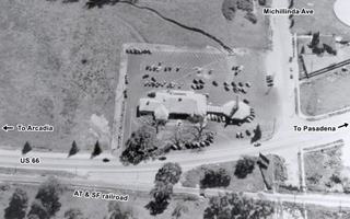
Eaton's Santa Anita Drive In, 1940, Arcadia CA. Source
Click image to enlarge
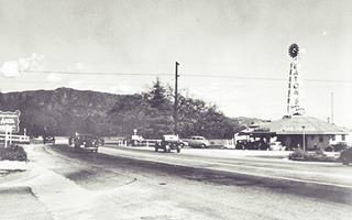
Eaton's Santa Anita Drive In, c1940, Arcadia CA. Source
Click image to enlarge
The image above shows the drive-in seen from the street, looking towards the east. This is the same view nowadays.
The motel was built on the eastern side of the property, below are two vintage pictures of it before it was torn down in the 1970s. The color postcard reads: "Attractive comfortable accommodations in air-conditioned bungalows, dining room, coffee shop and lounge. Swimming pool, badminton and riding facilities for fun and relaxation."
Western Arcadia - Pasadena - Sierra Madre
At Michillinda Avenue the highway curves slightly to the SW to realign further south and meet Colorado Blvd that was extended eastwards to this point in the 1931 realignment. Here the highway heads west again as it enters East Pasadena, an unincorporated community in Los Angeles County in a 0.6 mile-long stretch and then enters Pasadena the next town along the alignment.
However, Rittenhouse in his classic 1946 Guidebook to Highway 66 mentions, and places Sierra Madre between Arcadia and Pasadena despite the fact that Sierra Madre city limits are 0.6 miles north of Colorado Blvd. Below is a map from his book showing Sierra Madre; 2 miles west of Arcadia and six east of Pasadena:
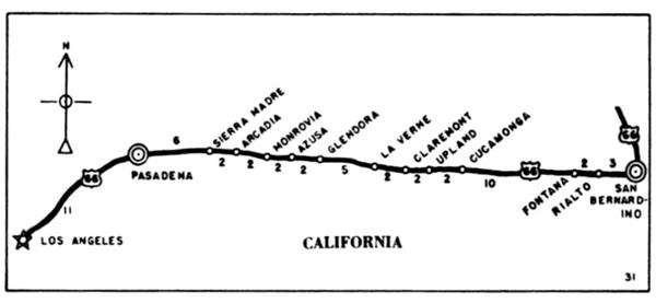
It is natural that Rittenhouse mention Sierra Madre because this area was open country in 1946 west of the fork back by the racetrack all the way to Rosemead Ave in Pasadena, the only town here was Sierra Madre just north of the highway.
Continue your Road Trip
This marks the end of your trip across Arcadia, head west to continue your Route 66 road trip in neighboring Sierra Madre.

Sponsored Content
>> Book your Hotel in Santa Monica

Credits
Banner image: Hackberry General Store, Hackberry, Arizona by Perla Eichenblat
A Guide to the Golden State; Federal Writers' Project of the Works Progress Administration, Hastings House, New York, 1939.
Jack DeVere Rittenhouse, (1946). A Guide Book to Highway 66.


