Route 66 in San Bernardino CA
Index to this page
About San Bernardino California
Facts, Trivia and useful information
Elevation 1,053 ft (321 m). Population 224,820 (2025).
Time zone: Pacific (MST): UTC minus 8 hours. Summer (DST) PDT (UTC-7).
San Bernardino is a city located on Route 66 and Alternate 66 aligbments. It is the county seat of San Bernardino County in southern California.

The History of the city of San Bernardino, California
This part of California has been inhabited for more than ten thousand years. During the recent historic period after Spanish settlement in the Seventeenth Century, the natives were named "Serrano" which is the Spanish word for "Hill people"; there were several groups, and near Big Bear Lake lived the Yuhaviatam (Pine People).
The Spaniards had explored California in 1602 from their base in Mexico which they had conquered in 1520. They founded Los Angeles in 1769 and from there they slowly moved inland, setting up the Mission San Gabriel Arcángel (1771). Later, in 1810 they reached San Bernardino where a mission established in 1819 and a Ranch in 1842.
Mojave Trail or Mojave Road
The Mojave Trail was an ancient route used by the natives, running across the Cajon Pass that is just north of San Bernardino; a gap between the San Bernardino and San Gabriel Mountains. The trail went all the way to the Colorado River along the Mojave River. It was a major native trade route.
Mexicans in California used it to trade with their colony in New Mexico (Santa Fe and Albuquerque) in the late 1700s. In 1826, Jedediah Smith was the first American to enter California from Utah using this route.
In 1772 Pedro Farges (1730-1794), a Spanish officer marched from San Diego California to Monterey and San Francisco along an inland route, and became the first European to cross San Bernardino and enter Cajon Pass. Father Garces in 1776 used the same route on his way to visit the Hopi people in Arizona, from Devore, through Sawpit Canyon to the Mojave River in the north.
In 1821 Mexico became independent from Spain and California was incorporated to its territory. However, the U.S. defeated Mexico in the 1846-48 War and it was forced to cede California, Texas, Colorado, New Mexico and Arizona.
In the mid 1800s, the Mormons expanded west and settled along the "Mormon Corridor," buying the San Bernardino ranch in 1851 and founding the town of San Bernardino, that was incorporated in 1857. It grew as an important trading hub on the crossroads of several trails into Southwestern USA.
The name, San Bernardino
The city was named after an Italian missionary, a Franciscan, Saint Bernardino of Siena (1380 - 1444), the "Apostle of Italy". Bernardino is a pet form of Bernardo which is of Germanic origin and means "Bear - hard" or "strong as a bear."
Railroads
In 1883, the California Southern Railroad (CSR) linked it with San Diego in the south, and headed through Cajon Pass to Barstow in the north. There it connected in 1885 with the main line of Atlantic & Pacific Railroad (A&P) all the way eastwards across Arizona, New Mexico and Kansas.
A&P would later be absorbed by the Atchison Topeka & Santa Fe Railroad and the CSR line gave it the right of way into Los Angeles in 1887 through San Gabriel Valley.
The local natives opposed intrusion into their territory and the state militia waged a campaign against them in 1866 killing most of them. The remaining natives were sent in 1891 to the Santos Manuel tribal reservation.
National Old Trails Highway (N.O.T.) in San Bernardino
Towns sprung up beside the railway stations and dirt trails linked them to farms and to teach other. By the mid 1900s, the use of the automobile had grown considerably and better roads were necessary. This led to the creation of the National Old Trails (N.O.T.) Association, an organization that was set of building a decent road from Los Angeles to New York.
Their transcontinental highway ran beside the AT & Santa Fe railroad tracks from Los Angeles, through San Bernardino, across Cajon Pass, and via Barstow to Needles, and into Arizona.
In the San Bernardino Area, the Automobile Club of Southern California (ACSC) in its 1915 map shows the N.O.T. heading westwards from Devore at the foot of Cajon Pass, through Verdmont Sta., 2 miles away, crossing the tracks there and heading along Cajon Ave. Road for 5 mi. until turning south into San Bernardino along Mt. Vernon Ave. and then, a sharp right to head west along San Bernardino Ave. towards Rialto. San Bernardino offered "Meals - lodgings. Gasoline - oil. Garage Repairs."
That same year the road from San Bernardino to Barstow via Cajon Pass became California’s highway LRN 31; it was the first section of the route to be brought under state jurisdiction.
Over the next few years, the road had been widened so that by 1920 it was generally 16 ft. wide. It had been paved with macadam since 1916. By 1924 there was a gas station at Devore but the road remained the same as in 1912 except that S. Bernardino Ave. was now known as Foothill Boulevard (Fourth St.)
Route 66
Route 66 was created as a U.S. highway in 1926 and it incorporated most of the N.O.T. roadbed west of Las Vegas in New Mexico. The road was widened further to 20 ft with 5 ft. shoulders, eliminating curves (1932 - 34) from San Bernardino to Victorville.
In 1934 a secondary route along Kendall Drive from Verdemont ran on the eastern side of the Santa Fe Railroad and went into town along N E St. this was the "City 66" mentioned by Jack Rittenhouse in 1946 (see below), while the original alignment was the "Alternate 66" that ran on the western side of town and avoided crossing downtown San Bernardino.
The 1939 book "A Guide to the Golden State" by the WPA described the town and its access route as follows:
US 66 broad and palm-lined, turns R., dividing the business district (L) of SAN BERNARDINO, (1,073 alt., 37,486 pop.), seat of San Bernardino County. The name San Bernardino was given by a party of missionaries, soldiers, and Indians from the San Gabriel Mission under Padre Francisco Dumetz, who entered the valley on May 20, 1810, the feast day of San Bernardino of Siena. In 1851, Capt. Jefferson Hunt arrived in the valley with a party of 500 Mormons from Salt Lake, who bought Rancho San Bernardino for $77,000 in 1852, and laid out a city along the broad, spacious lines of Salt Lake City. The Mormons remained dominant here until 1857, when Brigham Young, anxious to center his flock in Utah, issued a recall. San Bernardino is today a railroad and fruit-packing center... WPA (1939)
The guide mentions that "West of San Bernardino US 66 runs along the base of the Sierra Madre Mountains through the heart of a picture post card landscape orange groves overlooked by snowcapped peaks. The tile-roofed stucco towns among the orchards along the way are starting points for roads and trails into the forested mountains."
A 1940 map shows E St. as California State Hwy 18. To the south of town were U.S. Highways 70 and 90 running down Colton Ave parallel to U.S. Highway 66 into Pomona, and north was another highway along Highland Ave. all the way to Upland (paved).
After World War II, traffic along Route 66 grew and peaked in 1960: over 1.1 million travelers passed through San Bernardino. Interstate I-15 was built northwards, through Cajon Pass to Victorville and Barstow in 1958 and later, southwards, across the Pass into San Bernardino in 1971-72.
Faster flowing traffic meant that overnight stops in San Bernardino fell, hurting the Route 66 motels and as it bypassed the commercial district, where many shops closed.
San Bernardino Trivia
- The English band Christie wrote a hit single in 1970 called "San Bernadino" it reached the top-ten in sevderal countries. The band said they'd never visited the city.
- On November 19, 1954 singer and actor Sammy Davis, Jr. crashed at the fork of Cajon Boulevard and Kendall Drive returning to Los Angeles from Las Vegas. He lost his left eye in the accident. He performed a benefit show for the new community hospital in 1958 with many famous Hollywood stars including Judy Garland.
- The Route 66 Rendezvous is the largest car show in the US, and is held yearly in San Bernardino. Visit their website for more details.
The Arrowhead
California Historical Landmark - geological monument
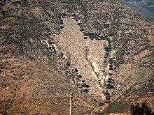
The Arrowhead is a natural feature and gives its name to neighboring Lake Arrowhead. It appears on San Bernardino county seal.
It is a rock formation of light colored quartz on a mountainside that faces San Bernardino. It is shaped like an arrowhead and measures 1,375 ft (419 m) by 449 ft (137 m).
The local natives' legend says that an arrow shot from heaven burned the shape into the mountain showing a spot where they could be healed, and there is a spring here. A Hotel and spa were built next to it. The water was bottled and sent to Los Angeles under the Arrowhead brand. One scientific study by Norman Meek suggest that it was man-made, altering the scar of a landlide to an arrowhead shape and used to promote the spa. 1

Accommodation in San Bernardino
You can find your room in San Bernardino by following the link below.
> > Book your Hotel in San Bernardino
More Lodging Close to San Bernardino along Route 66
Find more lodging & accommodation close to San Bernardino; there are plenty of lodging options in the cities and towns along Route 66; click on the links below to find your accommodation in these towns (shown from east to west):
Have you slept in a wigwam lately? Book a Room in the Wigwam Motel in San Bernardino
>> Check out RV campground here, in San Bernardino
The Weather in San Bernardino
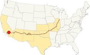
Location of San Bernardino on Route 66
San Bernardino has a hot-summer Mediterranean climate: mild winters and dry - hot summers. You may experience frost and low morning temperatures during winter, including occasional snow flurries.
During winter, the average high is (Jan) 68.4°F (20.2°C) and the average low is 42.1°F (5.6°C). In sumer the average high is (Jul) 96.2°F (35.7°C) and the average low is 58.5°F (14.7°C)
About 16 inches (406 mm) of rain fall yearly. Snow falls heavily at Arrowhead Springs as it lies in hight (3,000 ft. - 910 m) ground. Rainfall is least during May to September, with less than 0.25 in. falling monthly (6.4 mm). The town has 38 days with precipitation yearly.
Tornado risk
San Bernardino is located well to the west of the Rocky Mountains, so there is no risk of tornadoes in this part of California.
Tornado Risk: read more about Tornado Risk along Route66.
Map of Route 66 in San Bernardino
Read about the Barstow to Pasadena alignment in our dedicated webpage. Below is an interactive map of this section:
Map of this segment in San Bernardino.
From the N.O.T. Highway to U.S. 66
The following map was published in 1927, one year after the U.S. Highway system was created. It shows the area of Southwestern California close Los Angeles. You can see Route 66 running from Victorville through Cajon and into San Bernardino and then westwards towards Los Angeles.

1927 Road map, SW CA
Click on image to enlarge.
Credits

1956 Shell Roadmap, SW CA
Click on image to enlarge.
Credits
The map above shows the same area in 1956; a freeway now links Victorville with Cajon and San Bernardino with Los Angeles.

Detail 1930 roadmap
Click on image to enlarge.
Full map
The thumbnail map shows the alignment of Route 66 from Victorville to Los Angeles, it enters San Bernardino along Mt. Vernon and then leaves along 4th St. More on this below where we describe the City or Main 66 and the Alternate 66 alignments.
Route 66 Alignment near San Bernardino
With maps and full information on the Mother Road.
- Pasadena to Santa Monica (Next)
- Barstow to Pasadena (San Bernardino's)
- Topock to Barstow (Previous)

Sights and Attractions in San Bernardino, California
Historic context, the classic Route 66 in San Bernardino
Jack DeVere Rittenhouse drove along Route 66 in 1946, collecting information which he included in his book "A Guide Book to Highway 66," a great reference for learning about US 66 during the post-war period. Rittenhouse mentions San Bernardino as follows, after Blue Cut in Cajon Pass:
US 66 continues downgrade, past the gas station and store at DEVORE ..., and reaches a fork [8 miles south] where City 66 runs (L) to San Bernardino, and Alternate 66 goes (R) to Los Angeles... Rittenhouse (1946)
The distance of 8 miles south of Devore given by Rittenhouse places this fork at the spot where Highland Avenue crosses Route 66 and North Mt. Vernon Ave. heads south. But Highland Ave. never carried Route 66. Furthermore, the maps of those years show that US 66 heads south along N Mt. Vernon Ave for another 2 miles and there turns sharply right, towards Los Angeles along 4th St.
Rittenhouse then states that as his guidebook was "written for the traveler to Los Angeles, it is assumed that you will take the right (alternate) fork through the edge of San Bernardino. At the center of a small business district US 66 turns right and heads almost straight west toward Los Angeles, about 53 miles distant. From this point on, the traveler is practically "in" Los Angeles. Tourist camps of the best type, fine cafes, and other roadside facilities are found all along the way, so no further detailed description is necessary". Perhaps he wrote the wrong mileage in his book.
He adds that there are 12 towns between San Bernardino and Pasadena and that "Many of them are so close together as to be practically indistinguishable from each other".
The Two Route 66 alternatives into San Bernardino
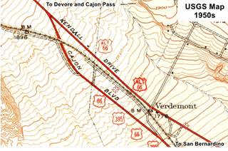
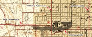
There were, according to the USGS maps, two Route 66 alignments into San Bernardino: the "Main" U.S. 66 along Cajon Blvd. and Mt. Vernon Ave. and Alternate 66 further east, along Kendall Dr. and E St and into downtown San Bernardino.
- Main 66. It shared it with U.S. 395 and U.S. 91. We marked its course with pale blue line in our custom map. At 4th street it turned west (the orange line in our map). Later it moved to 5th St. in the 1950s, red line. By 1969 when Route 66 was aligned along what now is I-215 (it was I-15 at that time), Route 66 entered San Bernardino along the freeway (San Bernardino-Barstow Freeway) and left it at Exit 43, onto 5th St. (yellow line).
- Alternate 66. It entered San Bernardino along the course marked with a dark blue line in our map, along Kendall Dr. and E St. Then its original alignment westwards was along W 4th and W 3rd Streets along the south side of San Bernardino Depot. Then north along N Mt Vernon Ave as shown with a violet line in our custom map. However it moved to 5th St. in the 1950s (light blue line).
Alternate US 66
Alt 66 appeared as from 1941, by 1954 it was named BR 66, iand after 1958 and until 1969, Bus 66-.
Although in use for some time, in 1959 the American Association of State Highway and Transportation Officials (AASHTO) came up with the formal "Alternate" designation.
It was to be used to designate a highway that branches off from the main one, passing through certain cities and then links up with the main route again.
If the Main and alternative routes followed a similar course, the better built or shorter highway would be the one marked as "Main", while the other would become the "Alternate" one.
There are only six places along Route 66 where an Alternate 66 alignment existed; from East to West they were the following one just west of Chicago, Carthage MO, the one in Joplin MO, Oklahoma City, this one in San Bernardino, and the one leading into Los Angeles CA.
Get your Kicks in San Bernardino
At the same time that Rittenhouse wrote his guidebook, Bobby Troup created his emblematic song, "Route Sixty-six," that immortalized Route 66 in the minds of several generations as an iconic Road Trip, a journey where the traveler can get his kicks, enjoying the moment and the freedom of riding the Mother Road.
>> Read More: Get your Kicks on Route 66, full details on the song and its context.
San Bernardino is one of the three Californian towns mentioned in the song (along with LA and Barstow), and it appears in the following stanza:
Now you go through Saint Looey
Joplin, Missouri,
And Oklahoma City is mighty pretty.
You see Amarillo, Gallup, New Mexico,
Flagstaff, Arizona.
Don't forget Winona,San Bernardino. Bobby Troup (1946)
Devore
Driving westwards from the Cajon Pass, the previous stop in your Route 66 road trip along Cajon Blvd., the original alignment is cut at the junction of I-15 and I-215. A modern underpass was built in 2018 to bypass the gap and reach Devore on the SE side of this massive interchange at I-15's Exit 123.
This unincorporated community was known as El Cajon de Muscupiabe in the 1850s, and became Devore around 1904. It was named after John A. Devore, a directing manager at Kenwood Corporation, a company that manufactured clothes, and in particular railroad uniforms. Devore was sent to California to promote the company with the railroads there. He acquired land here and developed farms and orchards. The Santa Fe Railroad built Devore Station here. Devore is a French surname of unknown meaning.
Drive 0.3 miles after passing beneath the freeway and take Cajon Ct. to your left; this is the original Route 66 alignment here in Devore.
Screaming Sally's
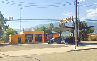
At the northern tip of this dead-end street, at 18169 Cajon Blvd. is Screaming Sally's Saloon, formerly Screaming Chicken Saloon. They style themselves as an "iconic biker bar on Route 66 we carry over 20 tap beers with your favorite selections and the best Bloody Mary and Micheladas in town take a ride to listen to some amazing Rock and Roll and weekend Summers are our best." The venue is a former gas station with a butterfly canopy and an office with a canted roof and two service bays. Enco - Humble gas stations had this type of slanting roof.
Next door, at 18291 Cajon Blvd. is Papa Tony's Diner that opened in 1967 and closed in 2020. Now it is Jerry's Cafe.
Shell? 1960s gas station
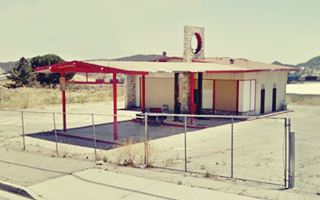
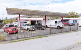
And finally, adjacent to the Cafe is a garage specializing in trucks, a former 1960s gas station built in a ranch-style with a chimney-like pylon that was used by Shell from 1940 to 1970 and Texaco from 1960 to 1970. It has gently sloping gabled roof and canopy. It has a stone pylon that extends vertically over the office and service bays and was used to display back-lite company logo (red arrow), gable canopy covers two sets of pump islands. The aerial photo of the area shows it was already here in 1966 (with Screaming Sally's). It is pictured above.
the 1956-57 phone directory mentions Child Alvin Texaco, RA Cade Texaco and Odoms Shell stations in Devore, perhaps some of them were these gas stations. It also mentions two cafés: Leo's and Van's.
Alt 66 and US 66 split ways
Continue along Cajon Drive and after 1.3 miles, there is a fork. The 1956-57 telephone directory places Leckal's Motel here, maybe the building on the eastern side of the fork with a vintage whitewashed neon sign at 19216 Cajon Blvd (street view).
Spot Cafe and Robert Everrett's Gas Station (gone)
The local telephone directory had Robert Everrett's A Service here at the fork with the Spot Cafe as part of the complex (map marking where it stood). The postcard of the cafe (below) mentions it was located originally on Loomis' Chevron Service and that it offered "Complete meals. Have your car serviced while you eat."
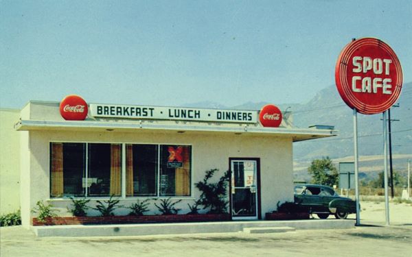
At the fork, Kendall Dr. carrying Alt 66 continues straight (we describe this alignment further down), while US 66 curves right to an underpass beneath the railroad tracks and heads to the SW into San Bernardino. 21⁄2 miles ahead was Verdemont with a railway depot.
This was open countryside during the golden days of the Mother Road. The 1956-57 telephone directory listed the "Shady Auto Court, Alva M. Roberts Owner, Verdemont" here. After another 3.5 mile, at the modern overpass at State St. in Muscoy is the site where a classic diner once stood, and two motels.
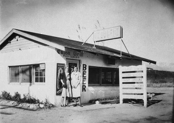
Cajon Grill (gone)
The restaurant pictured below figures in the 1956-57 telephone directory at 3530 Cajon Blvd. but the lot is now vacant.
Cajon Motel and Trailer Park
The Cajon Motel, decrepit and in ruins.
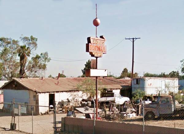
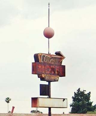
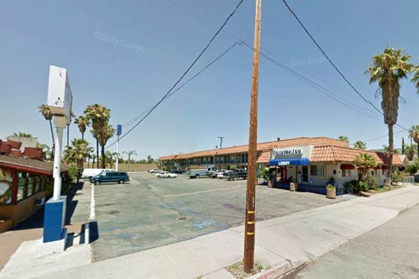
Crossing N.State St. at 3436 Cajon Blvd. to your right is the Cajon Motel, long single story building with a gable roof. The place is a shambles, in ruins, but it has an interesting and very old, faded and rusty motel sign with a ball on its top; the Cajon Motel. It appeared in the 1956-57 phone directory. Its days are numbered so see it while it is still there.
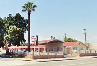
Palms Motel
Next door, at 3424 Cajon Blvd, just beside it, to the south also on your right is another classic; the Palms Motel. Weary drivers stopped here, before heading into Los Angeles or even entering San Bernardino. They were the first places to stop at, right after Devore, at the end of the tiring Cajon Pass.
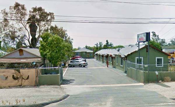
Continue along Route 66. At W Highland Avenue it turned south. Here there is a viaduct carrying Highland, but in the 1940s there was a grade crossing here. It was a busy intersection, with a motel and a service station. Further south, Mt. Vernon which carried US 66 had many motels, most of them now gone.
Route 66 motels on Mt. Vernon
Lido Motel
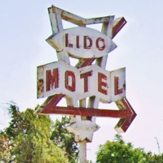
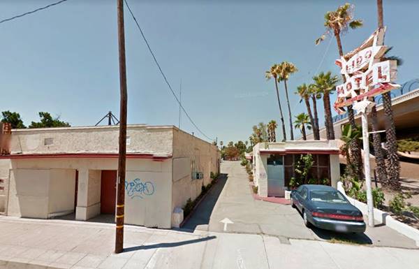
To your left, at 2180 N Mt. Vernon, the first motel along Mt. Vernon was the Lido Motel. At one time it was Andy's motel. Its's classic neon sign is great.
Andy's Motel pstcard read: "I. Culbertson, Manager. The first modern Motel entering San Bernardino from East on Highway 66. Air Cooled - Heated. Your Home Away From Home." It appeared in the 1956-57 phone directory under this name, so Lido is more recent, perhaps from the 1960s.
The Lido Motel in the past was the Andy's Motel, 1940s vintage postcard
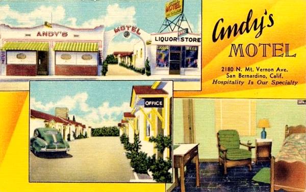
The arch is gone, but the building on the left is still there, the gables over the units doorways are also there. It needs some upkeep. The original "Lido" is a beach resort near Venice, Italy; the word in Italian, means "shore" or "bank".
Mount Vernon Motel
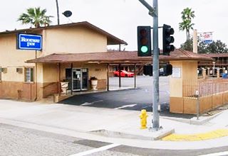
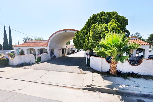
Adjacent to the Lido, at 2140 N Mt. Vernon Ave. is the former Mount Vernon Motel. Now it is a 26 unit apartment complex.
The 1940s postcard below proclaims it is "San Bernardino's Finest. 40 modern, air-cooled units with circulating ice water... Kitchenettes. Coffee Shop in Connection. Gateway to So. Cal. Mountain Resorts."
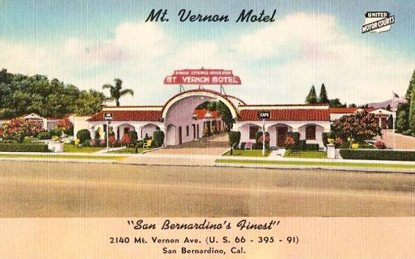
It hasn't changed much, now there is a wall in the front part by the sidewalk and the trees have grown. Below is its current appearance.
Motel Dream Inn (former Sharlene Motel)
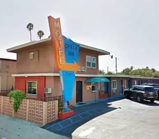
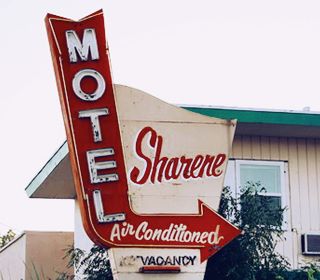
On the next block, to your right (2036 N Mt. Vernon Ave.) In the 1956-57 telephone directory it appears as the Sharene Motel, and remained under that name at least until 2009. It is still open and catering to Route 66 travelers.
The original vintage neon sign has been restored and painted orange and blue. It is worth a photo.
Valley Motel
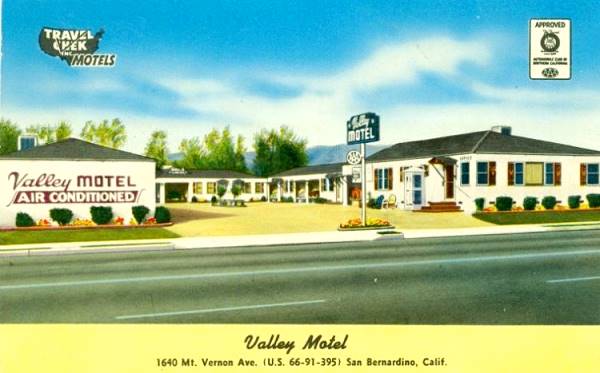
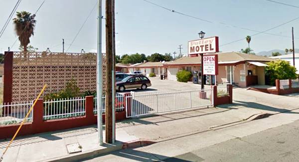
Head south, there are many vacant lots. Ahead, at 1640 N Mt. Vernon Ave. to your right is another classic motel. The Valley Motel is still operating under the same name (it appears in the 1956-57 phone directory!) There have been some minor changes in its outer apparance, like the decorated bricks used on the left building.
Its postcard says: "An air-conditioned motel with wall-to-wall carpets and full-tire showers. Panelray vened heat. Beauty-rest and Foam rubber mattresses. Radios. Closed Garages." (Radios!, what a different world from ours with Free WiFi!). Below is a "Then and Now" view, notice the same hip-roof.
Holiday Inn
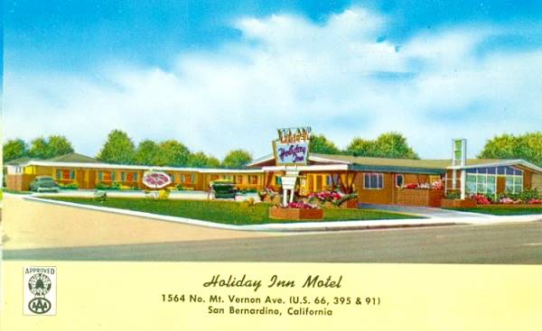
On the next block, at 1564 N Mt. Vernon Ave, it offered "Radio and TV in every unit" back in the 1950s. It is still operating under the same name. Its gabled canopy has been greatly modified, as it is now raised higher and turned around.
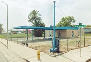
Tom and Jerry's Station
Across the street, on the SW corner at 1548 N Mt Vernon is Tom and Jerry's Service Station, it appears under that name in the 1956-57 Telephone Directory it had a long flat canopy and two pump islands. Now it has been restored and sells fountains, pottery and garden decorations. Pictured above.
Oasis Motel
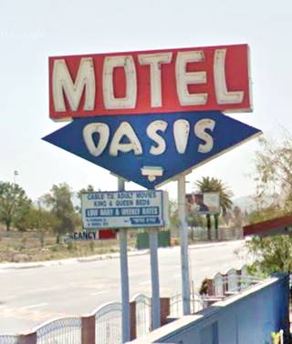
On the next corner, at 1488 N Mt Vernon Ave., to your right. It is still operating as a motel, its neon sign lacks the "character in a turban" that used to crown it in the 1950s. In the 60s, it was an "interracial" motel, in a time when race was a serious issue, it was ran by Ms. Virginia Arness, former wife of James Arness, actor of a famous TV series; Gunsmoke (1955-75). They divorced in 1963 and Virgina died of a drug overdose in 1977.
In her own words in a 1967 article in the magazine Ebony, "I was drawn to this community because it was mixed racially... It is the contrast or blend that creates the beauty." 1
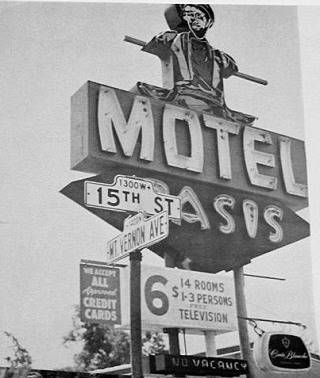
The Oasis Motel sign in 1967. Source
Mitla Cafe
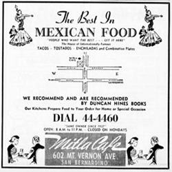
1956 Phone Book advertisement Mitla Cafe. Click image to enlarge
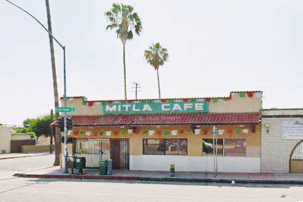
At 602 N Mt. Vernon, to your right. This family-owned restaurant has been serving delicious Mexican food since 1937. Lucia Rodriguez, who passed away at the age of 87 in 1981, and her husband, Vicente Montaño opened a lunch counter in Western San Bernardino in 1927 after migrating from Tepatitlan, Jalisco. They moved to Mt. Vernon Ave in 1940 with their Mitla restaurant, and shortly after, Vicente passed away. Lucia had to work hard to run the business. With the help of her second husband Salvador, the place became well known. Lucia was a founding member of the Mexican Chamber of Commerce of San Bernardino.
Californian Civil Rights leader Cesar Chavez was a regular at Mitla and Glen Bell, the founder of Taco Bell learned about the crunchy hard-shell, deep fried taco used at Mitla (tacos dorados, Spanish for "Crispy tacos") and availed himself of their recipe "adapted" it when he shifted from cooking hamburgers to preparing Mexican food. Glen started off in 1948 with a hot dog stand "Bell's Drive-In" here in San Bernardino, and added hamburgers at a second location. In 1951 he started selling crispy tacos at "Taco-Tia." It grew into several sites that he sold, and opened another chain, "El Tacos". In 1962 he sold El Tacos to his associate and opened the first Taco Bell in Downey, California, now a chain with over 7,400 restaurants in the U.S. and 1,100 more across 30 countries around the world. 2
Crossroads on Route 66 and Alt 66
Ahead, the original Route 66 turned west (right) along 5th Street that one mile west continued towards Los Angeles as Foothill Boulevard. This area is now cutoff, and part of a container yard. Here it met ALT 66 that curved around the south side of San Bernardino's railway depot. By the early 1950s, both Alternate and Main 66 were realigned along 5th Street. Click on the thumbnail map to enlarge it and view these alignments.
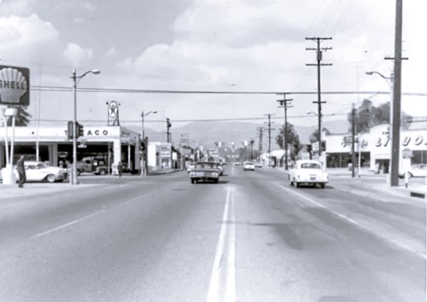
The picture above looks north along Mt. Vernon Ave. you can see the San Bernardino Mountains in the distance, Eddy's Shell Service to the left is now a pawn shop, Dan Carpenter's Texaco to the left is an Arco station and to the right was Mickel's Drive Inn Liquour Store. This is the current view at that same spot.
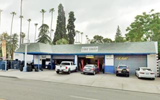
Further west, at 1632 W 5th St. was the Tulsa-Wichita-Abilene Oil and Gas Co station, listed in the 1956-57 telephone directory, the building is still standing and is a tire shop, with the old canopy and pump islands as you can see in this St. view.
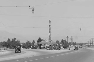
1938, fork of 4th & 5th St on US 66 in San Bernardino. Source. Click image to enlarge
Ahead the highway curves, crossing a modern flood canal for Lytle Creek, and meeting 4th Street that here extends west into Foothill Blvd. At the "Y" fork was Bud's Richfield Service station, pictured in 1938 (click on it to enlarge it), further east along 4th St you can spot a Texaco station. On the north side of 5th there was a small gas station and a diner. All gone. Notice the Richfield "beacon" tower; we explained it when describing the one in Barstow CA. There is a U.S. Hwy 66 shield by the CHPS motorcycle on the right side of the gas station.
Turn around and visit the Alternate 66 alignment, described in the following section.
Alternate 66 alignment through San Bernardino
ALT 66 along the eastern side of town
To follow the Alternate alignment turn around and head east along 5th St., and north along E St. (See map with directions) this is ALT 66 alignment of Route 66 through San Bernardino,
Little remains of the motels and gas stations along 5th Street, San Bernardino has torn down most of its landmarks. At H St, just after crossing I-215, you can take a 2 mile round trip to visit the historic depot (map with directions.)
Santa Fe Railway Station and Depot
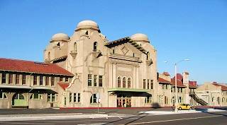
San Bernardino, historic railway station. Source
Listed in the National Register of Historic Places
At 1170 W 3rd St. The first wooden depot built in 1886 burned down in 1916 so a new one built in Mission Revival Style; it opened in 1918 and served as the Atchison, Topeka and Santa Fe Railway as a Passenger and Freight Depot. It has domes, towers and tiled roofs. It was also the site of the Harvey House restaurant until 1950. Then After passenger operations ceased, the station closed. It has been restored and currently serves one Amtrak and two Metrolink lines.
Return to 5th Street. North along H Street are some motels from the days that I-215 carried Route 66.
Old Wilshire Service Station ❌
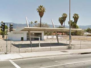
On the NE corner of H and 5th was a classic service station (790 W 5th St.) torn down in 2017 (). It had a very odd canopy, streamlined and held up with two slanting steel poles that pierced it. Two steel cables held it up like a modernistic sculpture. This was the style used by Wilshire gasoline, later part of Gulf. Built in the 1960s. Now lost for good.
San Bernardino, CA: Imperial 400 motel ❌
The motel, now Gone, was one block east of the Wilshire station, and located at 755 W 5th St.
Its can be seen in the postcard below. See its Street View in 2007, one year before it was razed.
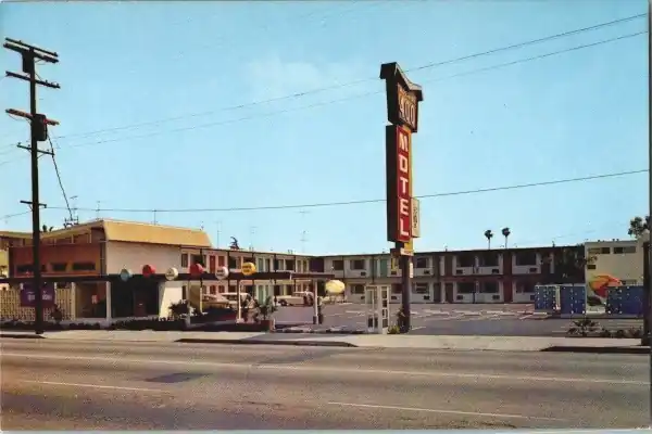
Imperial '400' Motels and Route 66
Learn all about these Space Age motels along U.S. 66.
> > Read more: Visit our Imperial "400" Motels on Route 66 webpage.
Sands Motel
Still standing at 606 N H St. The 1950s postcard below described it as follows: "Sands Motel, Mr. B's Coffee Shop and the swimming pool... The Sands Motel, newest and finest, adjacent to US 395, 66 & 99. 54 air conditioned rooms - Free TV - Room phones - Heated swimming pool - Walking distance to downtown - Credit Cards honored." The place is still operating as a motel. The roof style has changed quite a bit.
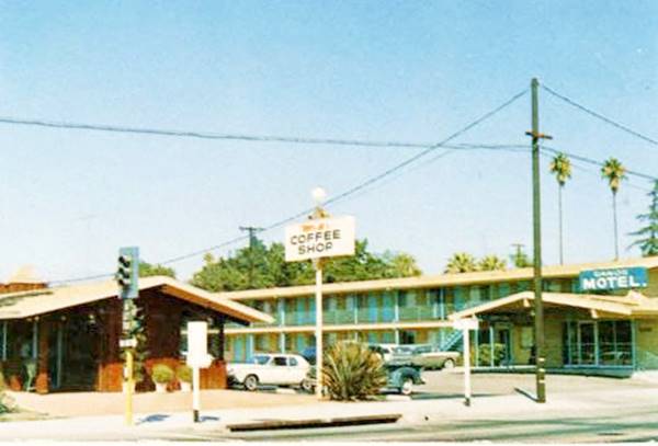
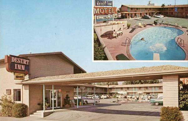
Desert Inn
Head back to 5th St. and go east. At 607 W 5th St is the former Desert Inn, operating as a motel since the 1960s. According to its postcard below, posted in 1962, it offered "Large, airy, sound proof rooms. Private phones. Free T.V... Heated Pool. Complimentary Coffee.." You can see its current appearance too, the long gabled canopy is still there, but the classic neon sign has gone.
Astro Motel
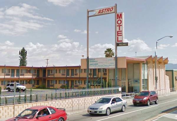
When you reach E Street, ALT 66 ran northwards (left), but take a south turn (right) to visit a Classic Space Age Motel just 3 blocks away on the corner of E St. with Rialto Ave. at 111 South E St.
The motel opened in 1964 as the Astro Motel and was part of a chain that spanned California, Utah, Arizona and Kansas. It has an "avant garde" style shared with all the Astro chain motels. They promised "Space Age Luxury...Down to Earth Prices." The sawtooth roof and the flat slab canopy was part used in all motels.
Astro Motels and Route 66
Learn all about these Space Age motels along U.S. 66.
> > Read more: Visit our Astro Motels on Route 66 webpage.
Turn around and head back to 5th St. continuing northwards along E Street; like Mt. Vernon Ave, there are many empty lots, and hardly any classic Route 66 spots remain.
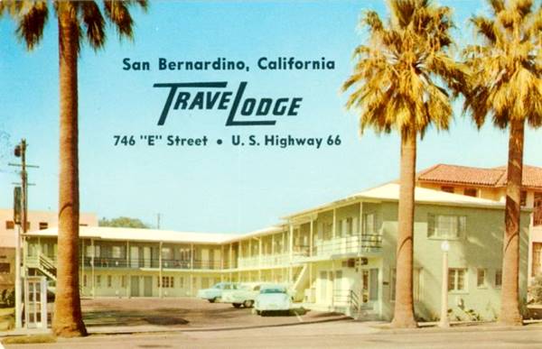
Travelodge Motel (gone)
It stood beside the Church of Christ, Scientist at 746 N E St. and went under during the Covid-19 pandemic. It was torn down shortly after. Below is a 1950s Postcard, and you can see it in 2020 shortly before it was torn down.
William's Mobil
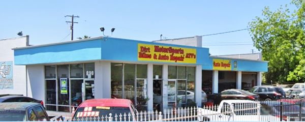
At 9th street there is a surviving gas station, formerly Russell William's Mobile Service at 898 N E St. it has a corner office, and four service bays, now it is an garage and repair shop. By 1968 it had become a Humble gas station. Pictured below.
Across 9th, on its NE corner was the now-gone Cecil Beard's Shell Station, with two lines of gas pumps but no canopy.
Ken Lin Motel, now Motel 7
At 1363 North E Street to your right is the former Ken Lin is still open as a motel and now is the Motel 7 amd the old neon sign has changed but is stil very attractive, topped with a star. The slab-like portico over the entrance has gone, but the building is just as it used to be.
The 1960s postcard says "Mr. and Mrs. J. W. Posey. Mgrs... Swimming Pools, T.V., Phone & Refrigerated Air Conditioning in every room."
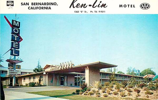
Ahead, opposite the motel is a Classic Burger spot:
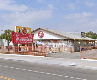
Historic McDonald's Museum
Route 66 Roadside Attraction
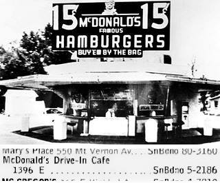
1940 McDonald's first site and 1956 phone book entry.
At 1398 N E St. to your left. This was the site of the first restaurant opened by the McDonald brothers, it was where they worked out the formula that led to their successful McDonald's hamburger chain. The original building was torn down in the early 1970s.
Ray Kroc, a milkshake machine salesman, visited them in 1954 to find out why they needed som many machines. He realized they had a great business and he partnered with them. In 1961 he bought them out and gre McDonalds' into a global franchise.
Dick and Mac McDonald opened their "McDonald's Barbecue Restaurant" here in 1940. They sold cheesburgers, pork sandwiches, ribs and other dishes. The McDonald brothers sold 15 cent hamburgers using a "Speedee Service System" and they became a hit. In 1948 they refocused their business into a simple, efficient and fast restaurant specializing in burgers, milkshakes and sodas. McDonald's was born.
Below are both brothers standing in front of their restaurant in 1948, while it was being remodeled.
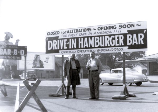
The place is now a museum, with free admission. It was owned by the late founder of the Juan Pollo fast food chain Albert Okura (1951-2023) an entrepreneur and also a philanthropist keen on preserving and restoring Route 66. After saving the Original McDonald's stand in 1998 he planned to restore Roy's cafe, service and motel in Amboy CA.
Further west, in Upland is another "vintage" McDonald's, with the classic Golden Arches design.
More old Gas stations
Drive north to see two service stations that appear in the 1956-57 phone directory. At 1799 N E St. is the F H Dennis gas station pictured below, now it is a tire shop.
Further north, at 3308 E St. was H&B Harris and Bauersfeld Associated Service, that is still standing by Alt 66 (pictured above). See their advertisement below.
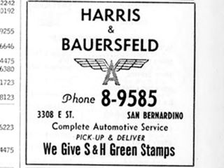
H&B service station advertisement in the 1956-57 directory
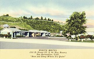
White Motel 1950s. Source. Click to enlarge
White Motel (gone)
At 3701 D St. "U.S.- 66 Bus. Route...fully modern, 12-unit insulated motel with private showers... Radios... Quiet surroundings; No train or traffic noises" It was located at the curve where Kendall Dr becomes E Street, and was accessible from both D and E streets. The lot is vacant (St. view.)
Turn around and head back to the junction of 4th, 5th, and Foothill Boulevard, and head west to visit three classic motels.
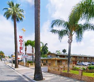
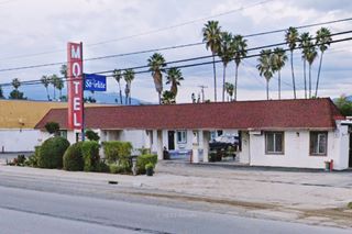
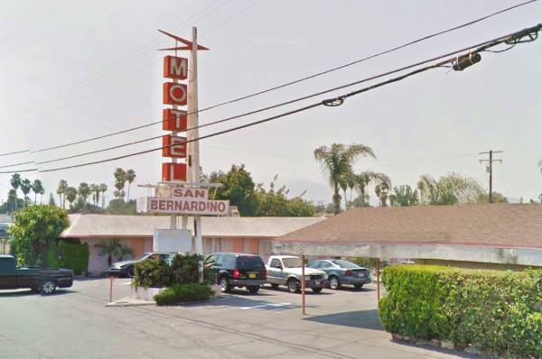
San Bernardino Motel
To your right at 2528 Foothill Blvd. The motel is still in operation, on the north side of the road. The vintage postcard below mentions that all rooms were air-cooled and "each with private baths and garage... 'The Last Word in Comfort'."
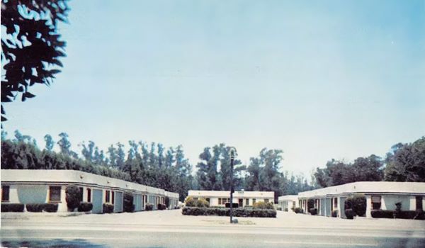
The motel has added a classic neon sign and retained the original U-shaped layout around a central courtyard.
Starlite Motel
Just ahead, at 2606 E Foothill Blvd. With a 1950s layout around a central court and a red and white sign. It appears in the 1959 aerial photograph of the area, but not in the one taken in 1948.
Then comes the famous Wigwam Motel.
Wigwam Motel Village #7
Listed in the National Register of Historic Places
Wigwam, Tepee and Hogan
A wigwam is a native shelter made from a pole structure covered with bark. It is usually used as a synonym for tipi or teepee, but they are not the same.
A teepee is a conical tent used by the natives of the Great Plains. It is made with animal hides set upon wooden poles. They have smoke flaps a the tip of the cone. The word "tipi" means "dwelling" in Lakota language (Thípi) and the word "wigwam" derives from the Algonquian "wikewam", with the same meaning.
The local natives did not use wigwams. But for tourists driving along the Mother Road, a wigwam is indeed a synonym of an Indian dwelling.
At 2728 East Foothill Boulevard, San Bernardino.
>>You can Book your Room in the Wigwam Motel
The old Wigwam Motel is a classic sight on Route 66 and is still open and lodging guests.
Is it in San Bernardino?
The California Wigwam Motel was built within the city limits of San Bernardino in 1949. The motel would later acquire a Rialto postal address, but it was born in San Bernardino and still is in San Bernardino.
The Wigwam Motel in San Bernardino
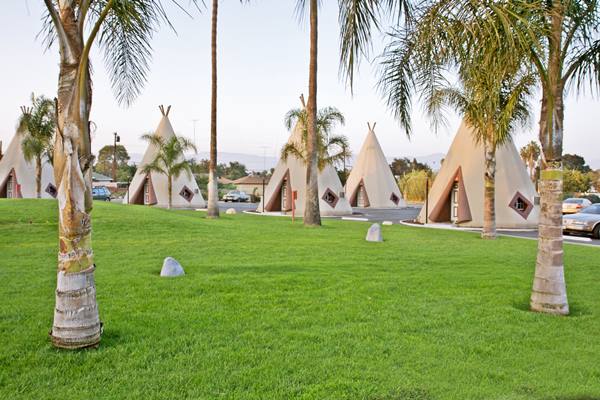
History of the Wigwam Motel
The first "Wigwam Village" was built in Cave City Kentucky in 1938 by Frank Redford. He patented the idea. Chester E. Lewis liked the idea and licensed the right to use it, paying Redford a royalty fee. Lewis built several Wigwam Villages over the next 20 years. But the seventh (and last) village that was finished in San Bernardino in 1949 (hence its name "Village #7") was built by the creator of the concept, Frank Redford himself.
Redford sold his properties back in Kentucky in 1944 and headed west, where he started to build the #7 in 1947.
It originally had 11 wigwam cabins in a field-like park. With the increase in traffic along US 66 he added eight more wigwams in a second concentric semicircle. They were built in concrete and are 32 ft. tall (9.76 m), and their diameter at floor level is 20 ft. (6.1 m). This makes them a bit narrower and less taller than those at the Holbrook village (28 ft x 21 ft size).
Frank planned a third set of units and even built the foundations for one of them (you can see it), but he never built them.
After Frank's death, and decades of decline, it reopened in 2002 and has been restored formidably. Only two other "Wigwam Villages" survive the #2 in Cave City, Kentucky and #6 in Holbrook, Arizona, the latter is on Route 66.
So, Have You Slept in a Wigwam Lately?, here you can find out what its like. This is the end of your journey across San Bernardino.
Continue your Road Trip
This leg of your journey ends here; continue your "Route 66 Road Trip" by heading west towards the next town along the highway: Rialto.

Sponsored Content
>> Book your Hotel in San Bernardino

Credits
Banner image: Hackberry General Store, Hackberry, Arizona by Perla Eichenblat
A Guide to the Golden State, by the Federal Writers' Project of the Works Progress Administration, Hastings House, New York, 1939.
Jack DeVere Rittenhouse, (1946). A Guide Book to Highway 66.


