The highest points along U.S. 66
Elevation Profile of Route 66
What is an Elevation Profile?
The elevation profile or topographic profile, is a two-dimensional cross sectional view of the landscape that your path crosses. It shows the altitude of your route.
It is fun to know the elevation profile of your journey along route 66, know how high you will be riding along the Mother Road.
This is a state-by-state list and the states are listed from East to West, Chicago to Santa Monica.
Click on the links to visit the state and find its Parks that are close to Route 66.

Illinois
California ¦ Arizona ¦ New Mexico ¦ Texas ¦ Oklahoma ¦ Kansas ¦ Missouri ¦ Illinois
Chicago
Chicago is the eastern terminus of Route 66, and it is located on the western shore of Lake Michigan at a relatively low altitude.
Chicago is of 594 ft (181 m) above sea level.
> > Learn more: Where does Route 66 start? and where does it end?
Eastern "Begin" point of Route 66, Chicago Illinois
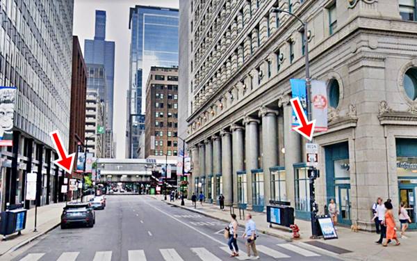
Close up of the Route 66 "Begin" sign, in Chicago, Illinois

In the background in the image above, you can see the black windows of the "Sears Tower" at 233 South Wacker Drive. It is now named "Willis Tower". It is a 110-story building that stands 1,450 feet high (442 m); nowadays it is the second tallest building in the US and the Western Hemisphere after the New World Trade Center building in NYC.
Illinois Route 66 elevation profile

US 66 elevation profile across Illinois
From Chicago, westwards, the highway runs across flat terrain, the prairies of Illinois, heading downwards towards the Mississippi River valley, where at East St. Louis, Illinois, it reaches a low of 417 ft (127 m).
What is now Illinois was bulldozed by the glaciers during the Ice Ages, and Route 66 crosses the highest elevations of the central part of the state, on the south side of Bloomington, with 860 ft (262 m).
The terrain here is a ridged plain formed by moraines, accumulations of dirt and rocks pushed along by the glaciers as they advanced. This spot is known as the Bloomington Moraine.
Missouri
California ¦ Arizona ¦ New Mexico ¦ Texas ¦ Oklahoma ¦ Kansas ¦ Missouri ¦ Illinois
Missouri's elevation profile

US 66 elevation profile across Missouri
The Mississippi River Valley is the lowest point of Route 66 in Missouri with around 420 feet (128 m).
As it heads west it enters the Ozarks, and climbs as it winds its way across the hills.
The Ozarks are a plateau, a highland region that covers 47,000 sq. miles (120.000 km2). Route 66 runs across two of its geologic units, the Salem Plateau and the Springfield Plateau.
In Marshfield at 1,493 ft (455 m) Route 66 reaches the highest elevation east of the Rocky Mountains!
Then it graduall drops towards the southwest, and reaches 900 feet as it enters Kansas, west of Joplin.
Hooker Hill Cut
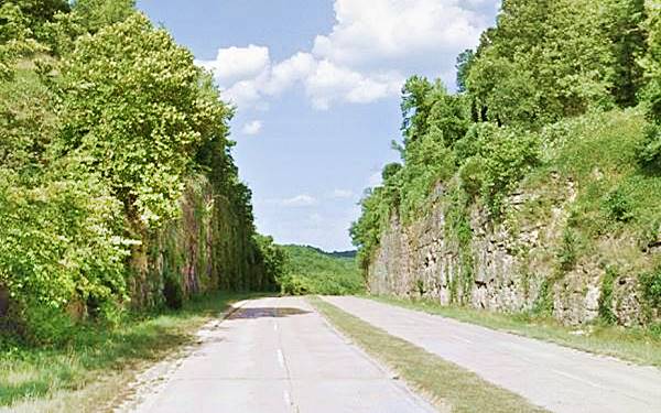
There is an impressive 93-foot-deep cut across Hooker Hill built in the early 1940s (see Hooker Cut) in the Ozarks between Rolla and Waynesville (See this Map with location).
Old Postcard of Hooker Cut, on four-lane U.S. Highway 66 in Hooker, Missouri
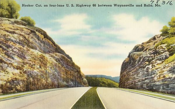
Hooker Cut nowadays in Hooker, Missouri
Kansas
California ¦ Arizona ¦ New Mexico ¦ Texas ¦ Oklahoma ¦ Kansas ¦ Missouri ¦ Illinois

US 66 elevation profile across Kansas
Elevation: Kansas Is Flatter Than a Pancake
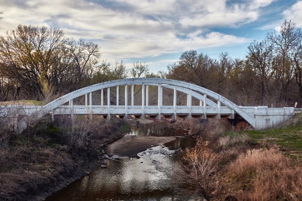
The short 13 mile-long stretch of Route 66 in Kansas is very flat. It runs between Galena and Baxter Springs.
There is roughly a 100 feet height difference between both towns. The hisoric "Rainbow" bridge spans Bush Creek along the way (pictured below).
Oklahoma
California ¦ Arizona ¦ New Mexico ¦ Texas ¦ Oklahoma ¦ Kansas ¦ Missouri ¦ Illinois
Oklahoma US66 elevation profile

US 66 elevation profile across Oklahoma
In Oklahoma the highway leaves the southwestern tip of the Ozarks and enters the region known as the "Prairie Plains", it descends from 845 ft. (258 m) on the Kansas state line near Quapaw, to its lowest point in Oklahoma, on the Verdigris River, with 581 ft. (177 m) near Catoosa.
Don't miss the "Blue Whale" of Catoosa"
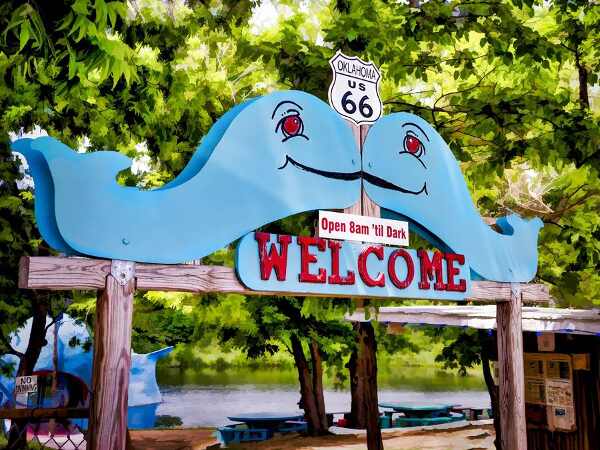
It then climbs gradually, across the Arkansas River, central Oklahoma, with some hills in the "Red Bed Plains", the "Gypsum Hills" and the "High Plains" on the border with Texas. Here it reaches the highest spot on Route 66 in Oklahoma, on the western side of Elk City with 2,169 ft (662 m), then it drops slightly ending at Texola with 2,119 ft (646 m), on the Texas state line.

Texas
California ¦ Arizona ¦ New Mexico ¦ Texas ¦ Oklahoma ¦ Kansas ¦ Missouri ¦ Illinois
Heights along Route 66 in Texas

US 66 elevation profile across Texas
Route 66 has a gradual climb across the "High Plains" region of the Texas Panhandle between the Oklahoma state line (with 2,169 ft - 662 m) and Glenrio on the New Mexico state line.
It reaches a height of 3,832 ft (1.169 m) in Glenrio after crossing a high spot with an altitude of 4,150 ft near the ghost town of Boise, where it meets a range of hills that peak at 4,261 ft (1.300 m).
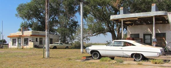
A view of vintage cars, a Route 66 diner, and gas station in Glenrio
New Mexico
Route 66's elevation in New Mexico

US 66 elevation profile across New Mexico
Route 66 climbs its way across New Mexico. Here it crosses not only the Rocky Mountains, but also the Sandia Mountains.
It reaches 6,830 ft (2.083 m) just east of Clines Corners, dips as it goes through Moriarty and then climbs into the Sandia Mountains.
Sandia Mountains
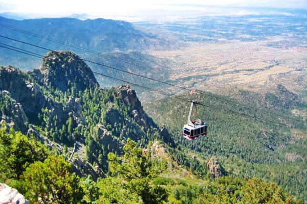
The Sandia Mountain range lies east of Albuquerque on the eastern flank of the Rio Grande Valley. They are not part of the Rocky Mountains that end just north of them near Santa Fe.
The Sandia mountains are covered with pine forests and their highest point is Sandia Crest with 10,678 ft (3.255 m).
Sedillo highest point east of the Rocky Mountains
After Moriarty, Route 66 reaches the village of Sedillo, in Sedillo Canyon at the foot of Sedillo Hill, near the highest point of Route 66 east of the Continental Divide.
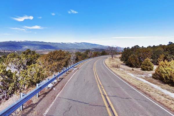
The original 1937 alignment leaves I-40 at its Exit 181 and follows Sedillo Hill Road (NM-306); it then climbs to the highest point of Route 66 east of the Continental Divide in the Rockies: Sedillo Hill.
Highest Point of Route 66 east of the Continental Divide
Exactly at Kimberly lane and NM-306 (Sedillo Hill Road). Exact Spot (street view).
Altitude: 7,102 feet (2.166 m)
The old 1937 alignment of Route 66 curved around Woodland Hills and reached the highest altitude east of the Continental Divide.
View along the Sedillo Hill Road, US66 in the Sandia Mountains in New Mexico
Route 66 then descends along the western slope of the Sandia Mountains through Tijearas and Carnuel where the winding highway once had a deadly curve.
Dead Man's Curve in Carnuel
The deadly curve like a large closed "S" was -and still is- located on the eastern side of town, where Tijeras Canyon widens and the highway winds out of it. Now the freeway cuts straight across it, but Route 66 hugged the terrain and followed its contour. See this map showing Dead Man's curve (in Orange).
Route 66 reaches a "low spot" at the Rio Grande river in downtown Albuquerque.
Trivia: Altitude of Albuquerque
Albuquerque is one of the highest major cities in the United States, ranging from 4,900 feet (1.490 m) in the Valley to over 6,700 feet (1.950 m) in the Sandia Mountain foothills.
Volcanos on Route 66
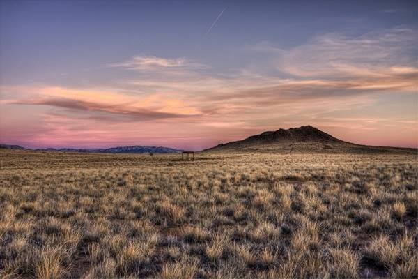
On the western bank of the Rio Grande, some 8 mi. northwest of Albuquerque is the Petroglyph National Monument, a volcanic range that formed 150,000 years ago
when the crust rifted apart and allowed magma to rise through it along a 5 mi. (8 km) fissure like a curtain of fire.
The Rio Grande Valley is actually a "rift", where the Earth's crust is thinner allowing lava to flow upwards, the valley to sink, and the lateral areas to rise, like the Sandia Mountains to the east.
Nine Mile Hill
Jack Rittenhouse in his "A guidebook to US Highway 66" written in 1946, described the western side of Albuquerque, after crossing the Rio Grande.
... Almost at the edge of town, you begin to climb the long, steep grades out of the Rio Grande valley, and onto the plateau Rittenhouse (1946)
It was the famous and dreaded Nine Mile Hill from the river banks all the way to the Rio Puerco River. Cars would overheat in summer along the long grade.
The highway heads west across the broken volcanic terrain in Mesa, Laguna, San Fidel and Grants, climbing into the Rockies where it reaches its highest elevation.
High Point: Continental Divide
It marks the watershed between the Atlantic Ocean and Pacific Ocean basins. It is located at the village of Continental Divide in New Mexico.
Campbell Pass Second Highest Point on Route 66
Here at Continental Divide is Campbell Pass, with an elevation of 7,270 ft. (2.216 m).
It is crossed by the Interstate 40, old Route 66 and the BNSF Railway.
It is not a sharp valley between towering peaks, instead it is a wide and easily accessible pass between low altitude mountains.
Official Continental Divide Marker
Landmark Official Marker
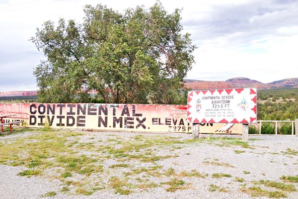
The back of the marker shows a map with some local attractions. The front of the marker reads:
Continental Divide
Elevation 7,245 ft.
Rainfall divides at this point. To the west it drains into the Pacific Ocean, to the east, into the Atlantic.
This is its Street View.
It is one of two markers at the pass, the other is on the south side of the freeway.
Ahead is the Top of the World gift shop (to your right), and another marker sign with a mural painted on a wall behind it.
The "Divide Sign" Route 66, Continental Divide New Mexico
Colorado Plateau
This area is part of the Colorado Plateau a highland in the Four Corners region (Utah, Arizona, Colorado and New Mexico) that covers an area of 130,000 sq. mi. (336,700 km2).
It extends beyond the southern Rocky Mountains. Continental divide is located on the southeastern side of the plateau. Route 66 runs across it all the way to the San Francisco Volcanic Field in Flagstaff AZ.
Arizona
California ¦ Arizona ¦ New Mexico ¦ Texas ¦ Oklahoma ¦ Kansas ¦ Missouri ¦ Illinois

US 66 elevation profile across Arizona
Route 66 enters Arizona in Lupton at a height of 6,185 ft (1.886 m) and runs across the Colorado Plateau till it reaches the foothills of the large volcanic field of San Francisco, in Winona. Rittenhouse wrote about the highway here.
WINONA. (Alt. 6,005 ft)... US 66 now begins to climb more steeply, although there are no difficult grades between here and Flagstaff. Jack DeVere Rittenhouse (1946)
San Francisco Volcanic Field
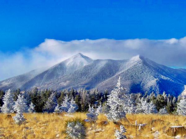
The hills and mountains that surround Flagstaff and extend towards the Grand Canyon are geologically young as they formed during the last 6 million years. They are now extinct volcanoes forming the San Francisco Volcanic Field that covers about 1,800 square miles (4.660 km2).
A hotspot below the Earth's mantle heated the magma which caused vast eruptions. As the American tectonic plate moved west, the volcanos spread eastwards.
This created the highest mountain in Arizona (San Francisco Mountain) alt. 12,633 feet (3.853 m) and also the youngest volcano in Arizona, Sunset Crater which erupted some 900 years ago. Though quiet now, there will be more eruptions in the Volcanic Field, but when they will take place is not known.
Flagstaff, Arizona
Route 66 reaches Flagstaff, the city has an elevation of 6,910 ft (2.106 m) and also has an average yearly snowfall of 100.3 inches (254.76 cm) making it one of the snowiest incorporated cities in all of the United States.
West of Flagstaff is the Highest points on Route 66.
Highest Points of Route 66
Just west of Flagstaff (Exit 190) on what is now I-40, is the Arizona Divide with an altitude of 7,335 ft. (2.237m).
This is the highest point of of Route 66 after its 1942 realignment.
Now I-40 runs across this point (see this map showing where it is. It replaced an even higher spot, further west.
Brannigan Park Pass - Highest point of the whole highway
Segment Listed in the National Register of Historic Places
Ahead, just west of Bellemont is the 1926 to 1942 Alignment of Route 66. It is a 6.2 mile segment called Brannigan Road, that you can drive all the way into the town of Parks (Map of the Brannigan Road segment).
This was also the highest point of the whole Route 66, at 7,405 feet above sea level (2.259 m).
It was not easy for the early drivers to climb Brannigan Park pass on Fortynine Hill, steep and high altitude made life difficult back in the 1930s.
Route 66 continues west, leaves the forested San Francisco area. Near Ash Fork was a dreaded hill.
Ash Fork Hill
Though US 66 is mostly buried under I-40, in some parts it surfaces to the south of the Interstate and you can still spot the old road's remains (like this concrete culvert in the forest on the south side of I-40).
Ash Fork Hill was a difficult section as the old road had a 1,700 foot incline -one of the steepest along the whole of Route 66. The original dirt road was replaced in 1932 by a new one that more or less followed the earlier one. As traffic increased during World War II, a new and less steeper alignment was built in 1950. I-40 was built on top of it. The old road was abandoned and although most of it is closed to the public, it can be walked along; it is part of the Kaibab National Forest.
The road continues west, and after passing through Kingman, reaches another mountain range.
West of Kingman, Arizona is the highest point of US 66 in Arizona: Sitgreaves Pass
Sitgreaves Pass
The Black Mountains
The Black Mountains are a mountain range that was formed some 15 to 20 million years ago when lava flowed thickly over a base of Precambrian granite.
This range has a north-south alignment and is 75 miles long (121 km) and about 10 mi. wide (16 km). Its highest point is Mount Perkins with 5,456 ft. (1.663 m). It runs parallel to the Colorado River, on its eastern side.
Route 66 was built across the Black Mountains instead of following the corridor chosen by the railroad, which circles the mountains on the range's eastern and southern flanks folowing easier gradients. However, Route 66 was realigned along this easier path through Yucca in the early 1950s.
The 1926-1953 Route 66 across the Black Mountains
US 66 was built along the National Old Trails highway which in turn was used to move ore out of the mines at Oatman and Goldroad in the Black Mountains.
The higway crosses Sitgreaves Pass, at 3,595 ft (1.096 m), the pass offers a great view east and west. Park and enjoy the scenery.
Sigreaves Pass on Route 66
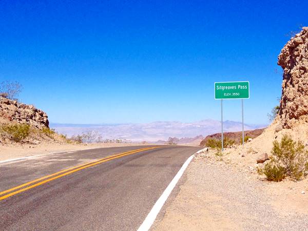
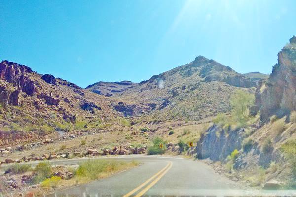
West of the pass, the road then drops into Oatman, falling 915 ft. in a winding course with sharp curves as you can see in the following image.
Kingman to Oatman Arizona in the Black Mountains, hairpin bend:
U.S. 66 then heads downhill all the way to the Colorado River at Topock, where it reaches the lowest point in Arizona, and the lowest elevation of the whole highway west of the Mississippi River in St. Louis.
Here in Topock the altitude is 499 ft (152 m). Route 66 crosses the river and enters California.

California

US 66 elevation profile across California
Just west of Needles the highway circled north around the Sacramento Mountains and the Piute Mountains (3,300 ft - 1.000 m), through Goffs, Essex, and Danby. Then it circled widely on the south side of the Clipper Mountains and at "Summit", just east of Chambless it crosed the southern part of the Marble Mountains by the Summit cafe at 1,273 ft (388 m). This map marks the spot.
Cajon Pass
After crossing the Mojave Desert and turning south following the Mojave River towards the ancestral Cajon Pass, a gap between the San Bernardino and San Gabriel Mountains used by the Native American people for thousands of years. Father Garces, a Spanish missionary used the trail through Cajon Pass during his mission to the Hopi Indians in Arizona in 1776. Jedediah Smith was the first American to use it westwards, from Utah in 1826.
Cajon Pass is the place where Route 66 leaves the Mojave Desert and reaches Los Angeles. Here the highway reaches 4,300 ft (1.311 m).
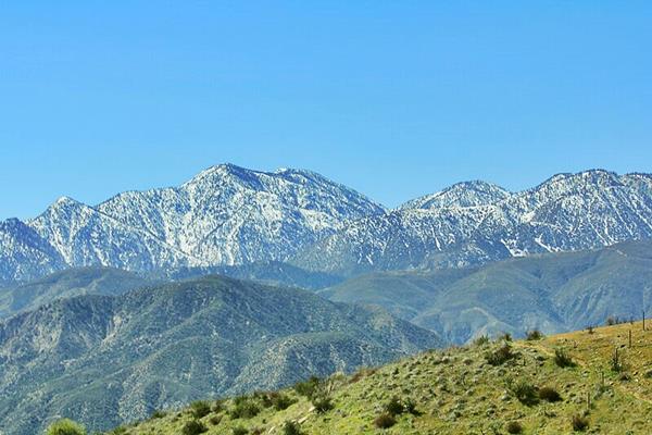
View of the San Gabriel Mountains seen from Cajon Pass
Source
San Gabriel Mountains
Driving westwards towards Los Angeles, the San Gabriel mountains are to the right, on the west side of the highway.
The mountain range is located to the north of Los Angeles and has a east - west orientation. It's highest peak is Mount San Antonio (Mt. Baldy) at 10,064 ft (3.068 m).
The Mountains' dimensions are 69 mi (111 km) long and 23 mi (37 km) wide. The range is made up of Precambian to Mezosoic rocks that were uplifted as fault blocks during the Cenozoic (5 - 15 M. years ago).
San Bernardino Mountains
On the eastern side (left) of the highway, these mountains are located to the north and northeast of San Bernardino. Their highest peak is San Gorgonio Mountain at 11,489 feet (3.502 m).
They were uplifted some 11 M. years ago by the San Andreas Fault and are still rising. Snow accumulates on the peaks during winter as well as rainfall which feeds rivers that flow into the surrounding desert.
The Mountains' dimensions are Length: 60 mi (97 km) long and 41 mi (66 km) wide.
The San Andreas Fault
Route 66 crosses San Andreas Fault at Cajon Pass.
The fault runs for 800 miles (1.300 km) across California with a NW - SE course. It marks the tectonic boundary where the Pacific and North American tectonic plates meet.
The plates have a horizontal movement, sliding against each other (right-lateral-strike-slip), where the western part of California moves north and the eastern part wit the rest of North America, moves south. The slip is about 0.9 in per year (4.5 cm).
The plates jam in some sections and tension builds up until the rock fails deep in the Earth's crust, causing the plates to jump into position again and releasing all the pent up energy as an earthquake.
Discovered by Prof. Andrew Lawson in 1895, it was named after the San Andreas Valley. It runs from San Francisco to the Baja California area.
Route 66 now runs westwards towards the Pacific Ocean to its Western Terminus, the "End of the Road".
Lowest Point of Route 66
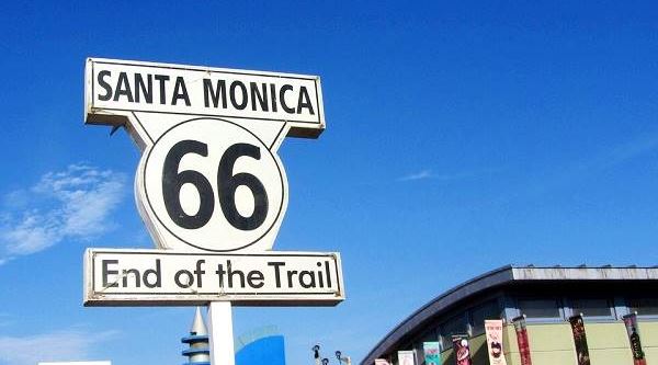
At Santa Monica, California, US66 meets the Pacific Ocean at sea level. This is its lowest point of the whole Route 66, almost at sea level.
The "End of the Trail" sign on Santa Monica Pier
This is the end of our detailed description of the altitude and elevation profile of Route 66. Enjoy our website there is plenty of information to help you plan your road trip.

Some sponsored content
> > Book your Hotel in Winslow Arizona

Credits
Banner image: Hackberry General Store, Hackberry, Arizona by Perla Eichenblat
Jack DeVere Rittenhouse, (1946). A Guide Book to Highway 66

